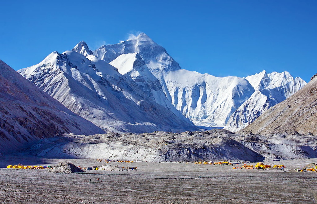
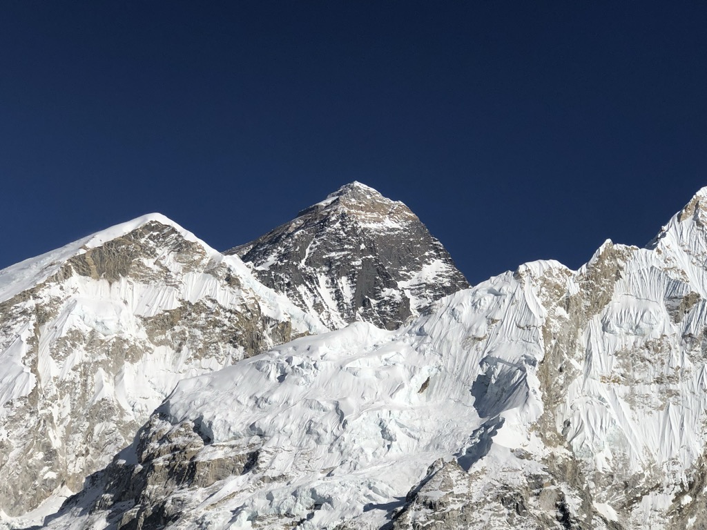
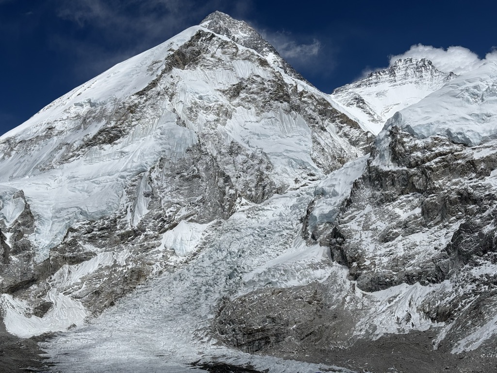
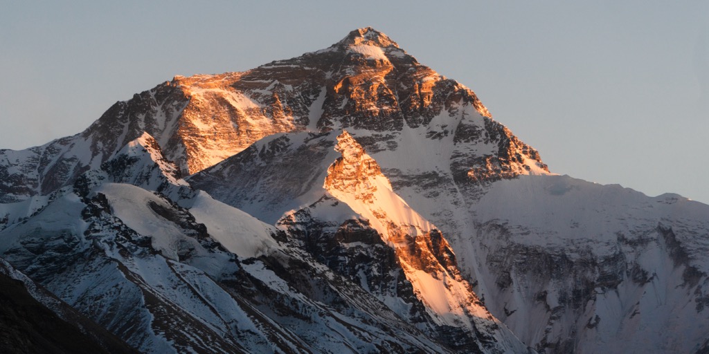
Mount Everest is Earth's highest mountain above sea level, located in the Mahalangur Himal sub-range of the Himalayas. The China–Nepal border runs across its summit point. Its elevation (snow height) of 8,848.86 m (29,031 ft 8+1⁄2 in) was most recently established in 2020 by the Chinese and Nepali authorities.
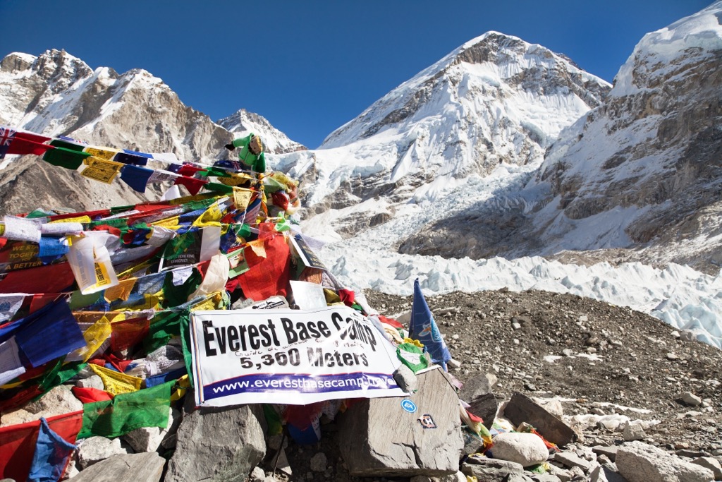
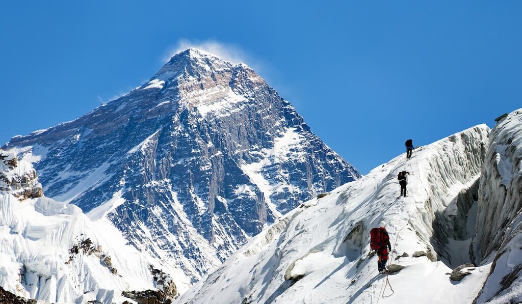
Mount Everest attracts many climbers, including highly experienced mountaineers. There are two main climbing routes, one approaching the summit from the southeast in Nepal (known as the "standard route") and the other from the north in Tibet. While not posing substantial technical climbing challenges on the standard route, Everest presents dangers such as altitude sickness, weather, and wind, as well as hazards from avalanches and the Khumbu Icefall. As of May 2024, 340 people have died on Everest. Over 200 bodies remain on the mountain and have not been removed due to the dangerous conditions.
Climbers typically ascend only part of Mount Everest's elevation, as the mountain's full elevation is measured from the geoid, which approximates sea level. The closest sea to Mount Everest's summit is the Bay of Bengal, almost 700 km (430 mi) away. So to approximate a climb of the entire height of Mount Everest, one would need to start from this coastline, a feat accomplished by Tim Macartney-Snape's team in 1990.
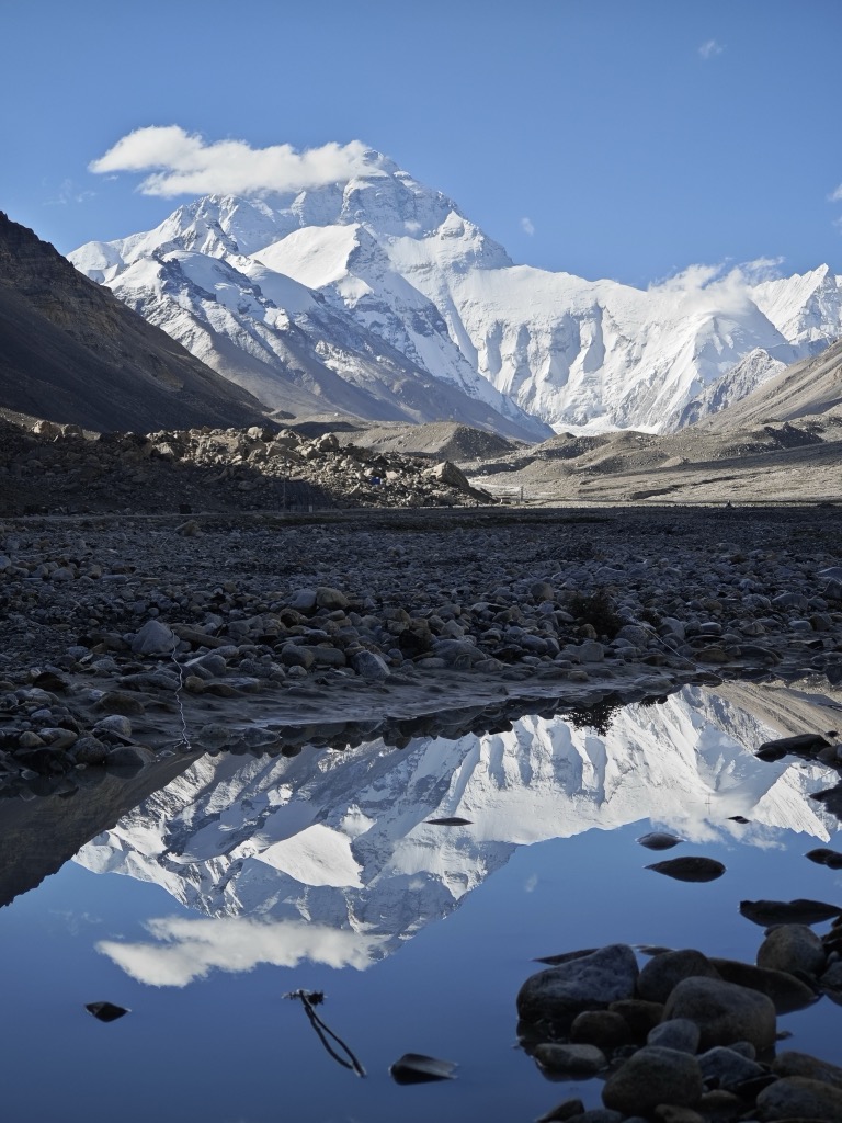
Climbers usually begin their ascent from base camps above 5,000 m (16,404 ft). The amount of elevation climbed from below these camps varies. On the Tibetan side, most climbers drive directly to the North Base Camp. On the Nepalese side, climbers generally fly into Kathmandu, then Lukla, and trek to the South Base Camp, making the climb from Lukla to the summit about 6,000 m (19,685 ft) in elevation gain.
The first recorded efforts to reach Everest's summit were made by British mountaineers. As Nepal did not allow foreigners to enter the country at the time, the British made several attempts on the north ridge route from the Tibetan side. After the first reconnaissance expedition by the British in 1921 reached 7,000 m (22,970 ft) on the North Col, the 1922 expedition pushed the north ridge route up to 8,320 m (27,300 ft), marking the first time a human had climbed above 8,000 m (26,247 ft). The 1924 expedition resulted in one of the greatest mysteries on Everest to this day: George Mallory and Andrew Irvine made a final summit attempt on 8 June but never returned, sparking debate as to whether they were the first to reach the top. Tenzing Norgay and Edmund Hillary made the first documented ascent of Everest in 1953, using the southeast ridge route. Norgay had reached 8,595 m (28,199 ft) the previous year as a member of the 1952 Swiss expedition. The Chinese mountaineering team of Wang Fuzhou, Gonpo, and Qu Yinhua made the first reported ascent of the peak from the north ridge on 25 May 1960.
There's a difficult alpine trail (T6) leading to the summit.
By elevation Mount Everest is
# 1 out of 127 in Qomolangma National Nature Preserve # 1 out of 936 in Tibet # 1 out of 866 in Nepal # 1 out of 12241 in China # 1 out of 64 in Tingri County # 1 out of 83 in Sagarmatha National Park # 1 out of 212 in Eastern Development Region # 1 out of 99 in Solukhumbu # 1 out of 3458 in the Himalayas
By prominence Mount Everest is
# 1 out of 127 in Qomolangma National Nature Preserve # 1 out of 936 in Tibet # 1 out of 866 in Nepal # 1 out of 12241 in China # 1 out of 64 in Tingri County # 1 out of 83 in Sagarmatha National Park # 1 out of 212 in Eastern Development Region # 1 out of 99 in Solukhumbu # 1 out of 3458 in the Himalayas
We use GPS information embedded into the photo when it is available.
3D mountains overlay
Adjust mountain panorama to perfectly match your photos because recorded by camera photo position might be imprecise.
Move tool
Rotate tool
Zoom
More customization
Choose which peak labels should make into the final photo and what photo title should be.
Next
Photo Location
Satellitte
Flat map
Relief map
Latitude
Longitude
Altitude
OR
Latitude
°'''
Longitude
°'''
Apply
Register Peak
Peak Name
Latitude
Longitude
Altitude
Register
Teleport
PeakVisor
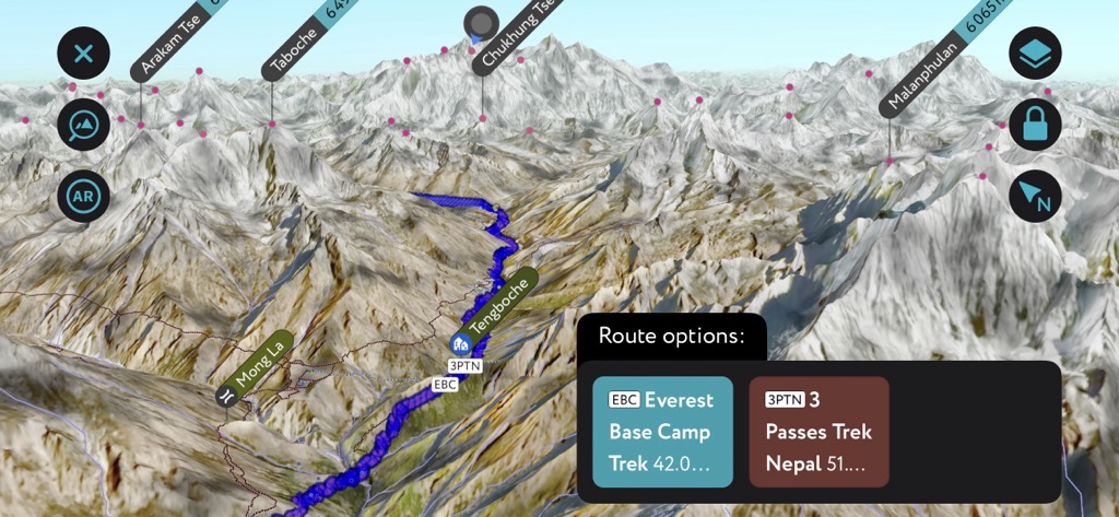
This 3D model of Sagarmatha National Park in Nepal was made using the PeakVisor app topographic data. The mobile app features higher precision models worldwide, more topographic details, and works offline. Download PeakVisor maps today.
Download OBJ model
PeakVisor
The download should start shortly. If you find it useful please consider supporting the PeakVisor app.
PeakVisor for iOS and Android
Be a superhero of outdoor navigation with state-of-the-art 3D maps and mountain identification in the palm of your hand!