Get PeakVisor App
Sign In
Search by GPS coordinates
- Latitude
- ° ' ''
- Longitude
- ° ' ''
- Units of Length

Yes
Cancel
❤ Wishlist ×
Choose
Delete
Founded in 1976, the Sagarmatha National Park is Nepal's most famous nature reserve in the Himalaya. Just 3 years after its foundation it was designated a UNESCO World Heritage Site. There are at least 40 named mountains in the park including the highest and the most prominent mountain in the world Mount Everest also known as Sagarmatha in Nepali (सगर् sagar meaning "sky" and माथा māthā meaning "head") and Chomolungma in Tibetian language (meaning "Goddess Mother of the Earth"). The mountain is so important that it can also be seen on Nepal’s flag, which in itself is not a regular rectangular banner, but the only non-quadrilateral flag constituted of two pennons and thus having a shape of a mountain. For other mountains featured on national flags, check out our article.
Home to many glacial valleys, rugged terrain, and 90 majestic peaks, including the world's highest Mount Everest, the Sagarmatha National Park is the very essence of the finest trekking. Winding through the national park's scenic valleys the iconic Everest Base Camp trek might be crowded in high season but it is a must-do anyway. Elevations in the park range from 2,845m (9,334 ft) at Monjo (park's southern entrance) to the top of Mount Everest at 8,848m (29,029 ft). Other notable peaks include the world's fourth highest Lhotse and sixth highest Cho Oyu, one of the world's most beautiful peaks Ama Dablam (literally Mother's Necklace) and Pumori.
PeakVisor 3D Map of Sagarmatha National Park and Everest Base Camp trek. Try zooming in, rotating the model as well as clicking (and tapping) on the peaks.
Regardless of how well your trek might be organized, PeakVisor detailed 3D maps and peaks identification tools are especially handy in such a scenic place. We are undauntedly committed to adapting the app to the trekkers’ needs in this region. Even though internet connection in the mountains might leave much to be desired, you still can have it quite often along the trek. Still, it is highly advisable to download all the maps in advance, also a power bank or two will make your life much easier. Take some print maps for a backup, Nepa Maps are arguably the most popular choice.
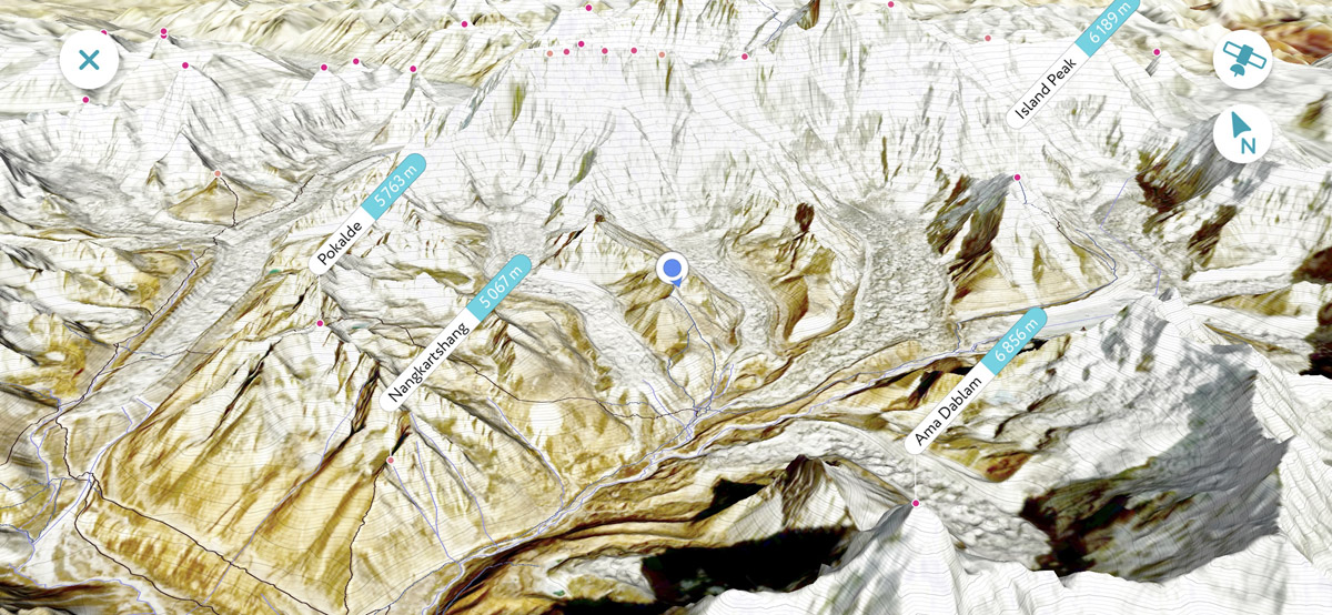
The most important things to consider for the Sagarmatha National Park adventure and almost any other endeavour in Nepal are the altitude sickness essentials, a TIMS card and a national park ticket (which can be obtained either in Katmandu’s Department of National Parks and Wildlife Conservation at NTB building, Bhrikuti Mandap or on the way to Everest base camp in Manjo village at Sagarmatha national park office), last but not least, a first-aid kit. Oftentimes comfortable earplugs are highly recommended.
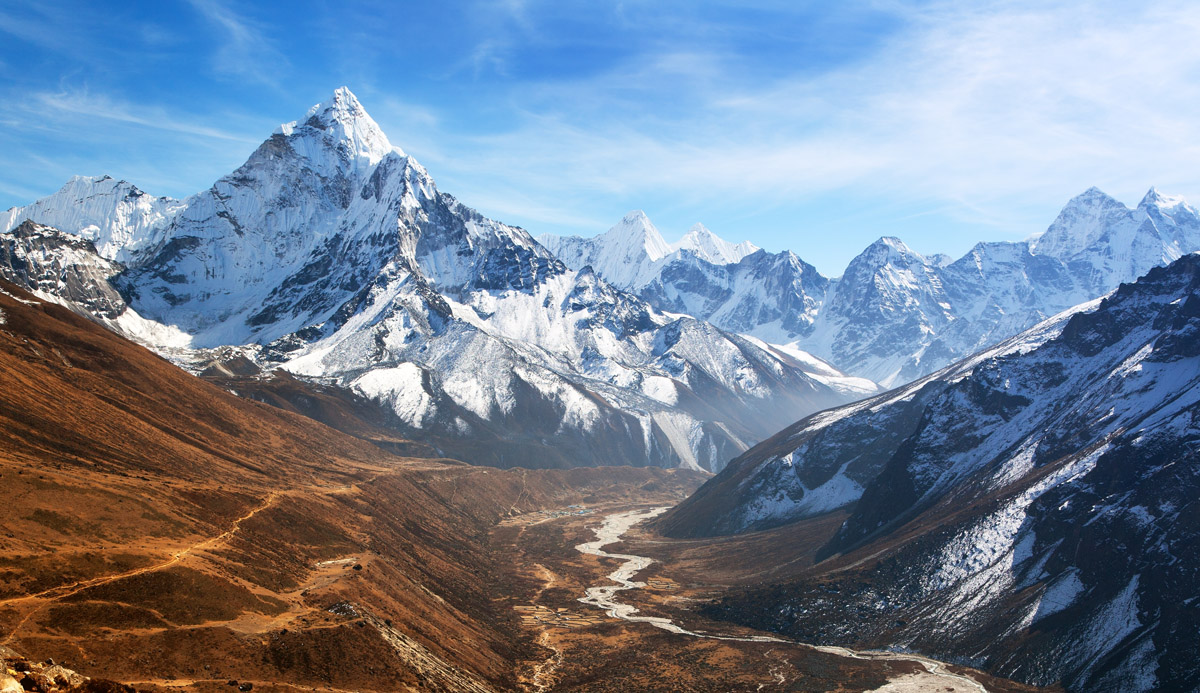
The Khumbu Valley is the backbone of Sagarmatha National Park
The most popular months for trekking in Sagarmatha National Park are March to May and October-November. The monsoon season starts in June and ends in September significantly increasing the chances of rain but if your vacation time isn't flexible then it is totally worth the effort to trek off-season. In fact, some trekkers tend to prefer this period as there are fewer crowds on the way.
All trekkers are required to obtain a TIMS card. TIMS stands for the Trekking Information Management System and is being administered by the the Trekking Agencies Association of Nepal (TAAN) and the Nepal Tourism Board (NTB). You can get yours at the Nepal Tourism Board office in Kathmandu. The price for an individual trekker is less than $20 (a green card), and twice less for those travelling in an organized group (a blue card).
Treks entering the Sagarmatha National Park (and any other national park in Nepal) require paying a national park fee. It can be paid at the entrance (right after the village of Monjo) or in advance at the same building where you get your TIMS card. The price tag for foreigners is 3,390 NRs per person per entry (approx. 35 USD)
As for any other trek with a huge elevation difference it is advised to dress in layers. Taking into account duration and long distances of the trek, make sure you wear sturdy sensible boots, preferably well-worn before your Everest endeavours. Having blisters or sore feet on the first day at Lukla because of new footwear can hardly complement your trekking experience. If you plan visiting high altitude passes or there's a chance of snowfall, which is almost always the case, add microspike crampons to your gear. Finally, don't forget trekking poles, a hat, sunglasses, and plenty of sunscreen.
Almost all trekking adventures in Nepal start with a flight to Kathmandu, the country's capital. On average, a two-way adult ticket costs 600-800 euros from large European and American hubs. After a long flight it might be a good idea to acclimatize and spend a relaxing day or two in the city and visit its sights, including Durbar Square, a UNESCO World Heritage Site right in the center historical center.
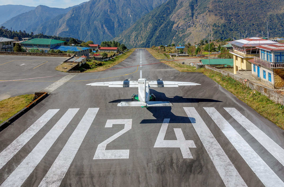
Excursions to the national park, including the Everest Base Camp trek start at Lukla where a small high-altitude airport is located. Due to lateral winds and seemingly precarious tarmac, it is considered to be one of the most dangerous airports. But worry not, it has a very high safety record despite those chilling videos.
Here's a detailed intro to the Lukla airport.
There are plenty of accomodation options of various comfort and budget levels along the trek. Still, do not expect to see 5-star hotels on the way, the higher in the mountains, the more egalitarian your walk will be with everybody sleeping in almost the same Spartan conditions. To be fair, sleeping headquarters are sprinkled throughout the park at a maximum distance of a couple of hours. On average, the level of comfort is lower than in the Alps, but hey, that's the top of the world! There are camping areas as well.
Altitude sickness is the biggest threat to consider during any treks in the Sagarmatha National Park. The rule is to limit daily elevation gain by 300 metres (1,000ft). In case of an increased elevation gain an extra rest day is required, so that the body can have extra time to acclimatize. Use that time for short side trips.
Most of the trails are relatively narrow and shared with porters and yaks oftentimes carrying heavy loads. In order not to be knocked down the slope and pass them safely move to the high side of the trail and wait.
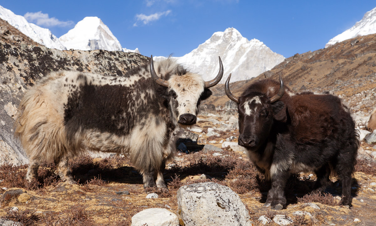
Yaks in the Sagarmatha National Park
There are many exposed sections with steep drop-offs in the park. Also, the staggering views of the world's finest peaks tend to distract trekkers from the trail, especially those who seek for better or more exotic pics. Don't fall into this trap and keep your eyes on the trek. Make a stop in order to enjoy scenic beauty and make spectacular photos.
With the current hype over the coronavirus outbursts in China, we cannot but mention some basics regarding health precautions.
There are actually no specific health requirements apart from common sense practices that you follow every day: wash your hands before every meal and follow regular hygiene procedures.
In general, you should consult your doctor for up-to-date information regarding your personal vaccinations if any of them are due, high altitude medication and medications for any reasonably foreseeable illnesses whilst traveling in Nepal. Be aware that some drugs, including anti-malarials, have side effects at altitude. Please discuss this carefully with your doctor.
Common things to remember when trekking:
It is always a pleasure to understand the meaning of peak names, especially in a place like this. Here are the most popular words you can encounter in Nepal:
Tse त्से means peak. You can see it in Lhotse, Cholatse, Khumbutse.
Ri रि means hill, but in the case of the Himalaya, you may consider it as "not exceptionally high mountain", e.g. Pumori, Gokyo Ri.
Himal हिमाल is a mountain range. For example, Mount Everest is part of the Mahalangur Himal.
Danda is a mountain ridge.
Tsho is a lake.
La ला is a pass, a saddle, for example, Cho La and Kongma La.
About 3,500 ethnic Sherpa people reside in the villages of the Park. The Sherpas occupied the Khumbu Valley about 600 years ago and have inherited a rich and distinctive culture. Their traditional economy is based on farming, herding and trading with Tibet. Since 1950, the alpine expeditions and trekking tourism have strongly increased revenue flows for the Sherpas. However, the presence of about 20 000 tourists per year has caused pollution and waste disposal problems.
This is arguably the most famed long trek in the world which is on the wish list of every outdoor enthusiast. It doesn't require any particular skills and almost any determined hiker can pull it off. But that doesn't mean that the adventure is to be taken lightly. There are still quite a lot of hazards one needs to account for. Limiting your altitude gain is one of the most important precautions.
Day 1 - Day 3
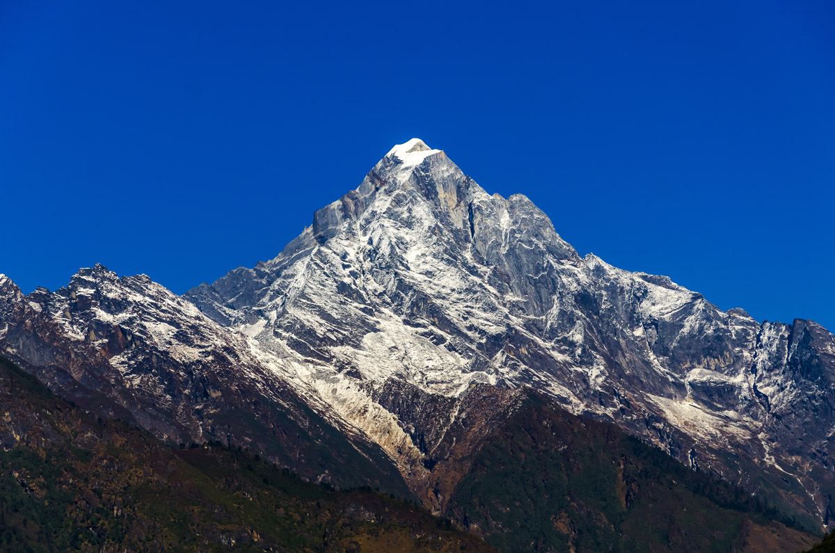
The very first section of Everest Base Camp is the north-bound traverse from Lukla airport to the Sagarmatha National Park entrance. With weather permitting immediately upon arrival to Lukla, you can spot a prominent peak called Nupla. That's a landmark for the first two days on your way to the Sherpa's capital Namche Bazar. Keep your TIMS card ready to present at the police checkpoint at the exit from Lukla.
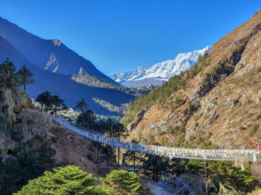
The trail winds up the narrow valley with several suspension bridges over the Dudh Koshi River along the way. Phakding and Monjo are the most popular villages in this part of the trek. There aren't many peak sights until you finally reach Namche Bazar, but there are two worthy viewpoints not to be missed: Kusum Kangru viewpoint before the trail reaches Ghat and Kongde Ri viewpoint right after the village of Phakding.
The entrance to the Sagarmatha National Park is slightly behind the village of Monjo. There at the checkpoint you'll need to present your TIMS card and the national park ticket.
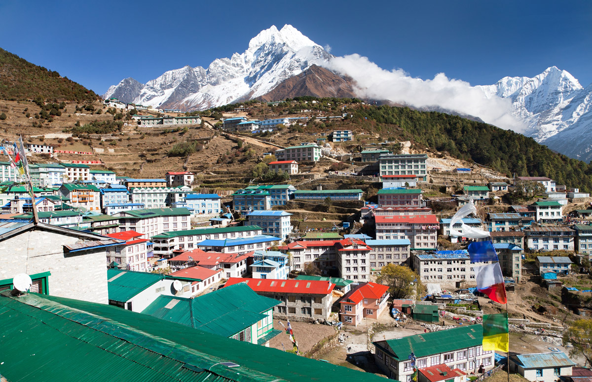
Nestled in a spectacular amphitheater at the foot of the sacred Khumbi Yul Lha (the name means something like "God of Khumbu") Sherpa’s capital Namche Bazar is the largest village in the Sagarmatha National Park. Having reached almost 3,500m above sea level this is the place where you most likely to have the first altitude acclimatization rest day. One of the options for the rest day is the panoramic loop above Namche Bazar through Syangboche - Khunde - Khumjung. The highlight of the day and maybe of the whole trek will be Hillary Memorial Chortens (stupas). The viewpoint offers unparalleled views of such majestic peaks as Ama Dablam, Thamserku, and Kongde Ri.
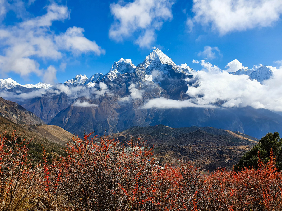
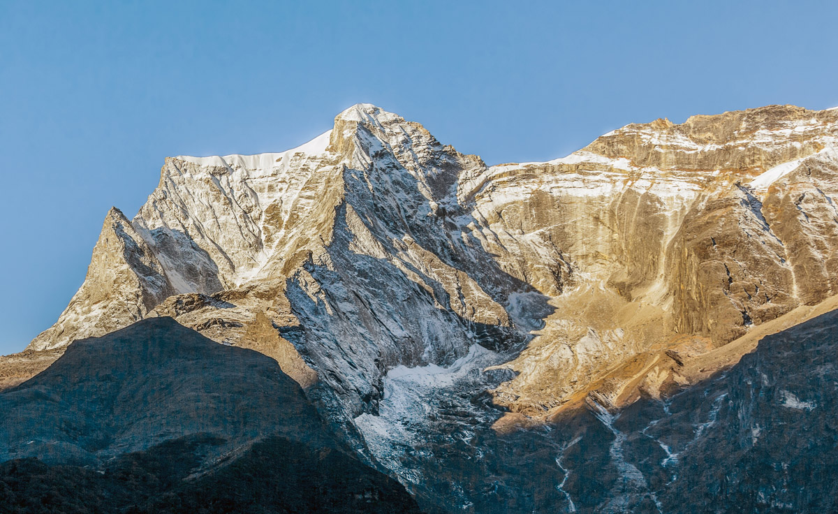
The westernmost valley in the national park is also the least visited and offers solitude to the trekkers even at the peak of the trekking season. Check the Three Passes trek below for more details as it goes through that valley. Also a day hike to the secluded village of Thame is another acclimatisation day opportunity.
Day 4 - Day 7
With majestic Ama Dablam to the right and the world's top Everest and Lhotse getting closer every step, this part of the trek is one of the most spectacular sections of all the Himalayan treks. The trek passes by the famous and one of the most scenic high-altitude monasteries in the village of Tengboche.
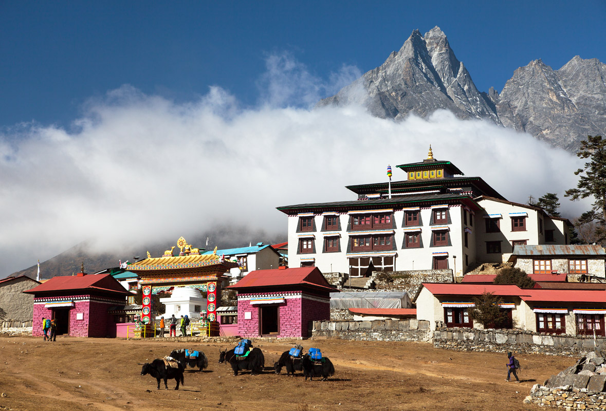
After a photo session in Tengboche, we suggest proceeding to Pangboche which is at the same altitude but boasts more opportunities for side-trips during the acclimatisation day. Stay at Ama Dablam base camp and visit the viewpoints beneath the majestic Taboche. Both trails feature a huge elevation gain but at least you can do some scouting and challenge the heights on your way back when your body is well adapted to thin air.
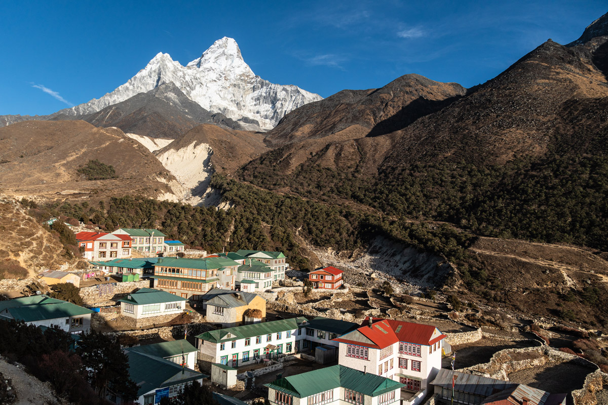
At the altitude of 3,985m the village of Pangboche boasts of the oldest monastery in the Khumbu region and spectacular views of Ama Dablam. Shortly after the village the trail climbs above the treeline bringing a dramatic change to the surrounding landscape, including the weather changes, it becomes noticeably colder and more windy.
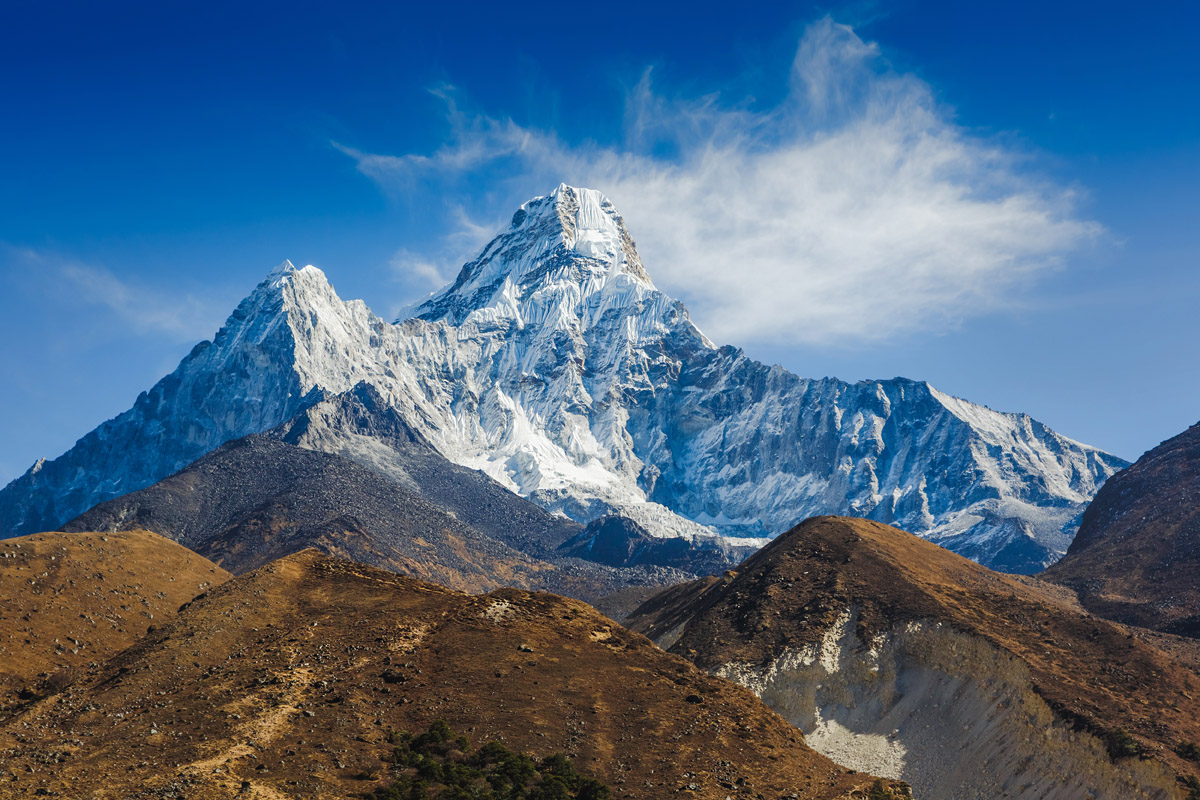
The next destination is the village of Pheriche situated at 4,371m above sea level, or a slightly higher Dingboche at 4,450m. Pheriche is home to the emergency health center dealing with altitude sickness, they even offer free lectures on this topic every day. Located a bit higher, Dingboche offers better panoramic views, especially those of Taboche, Cholatse, and Ama Dablam. From the village you can also see Lhotse and Island Peak in the distance.
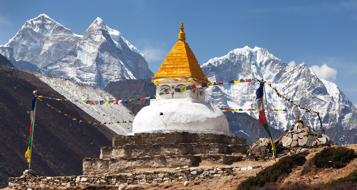
Dingboche stupa with prominent Kangtega and Thamserku peaks in the background.
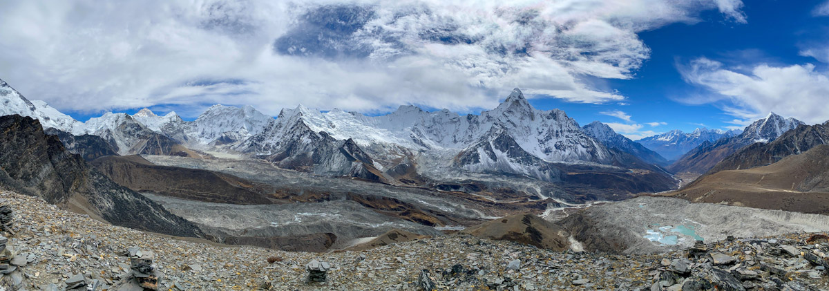
Dingboche, as well as Pheriche, is a perfect place for another acclimatisation day. Luckily, there are plenty of day hikes around. Nangkartshang is one of the most scenic viewpoints above 5,000m. Those who have an extra day can opt for a side trip to the village of Chhukung and from there to the summit of Chukhung Ri for an otherworldly 360-degree panorama over sparkling glaciers, azure-blue lakes, and looming stone giants.
Day 8 - Day 11
This is the culminating part of the trek. All three traverses are short (less than 3 hours) but due to the elevation gain you have to stop for a night before lunch time.
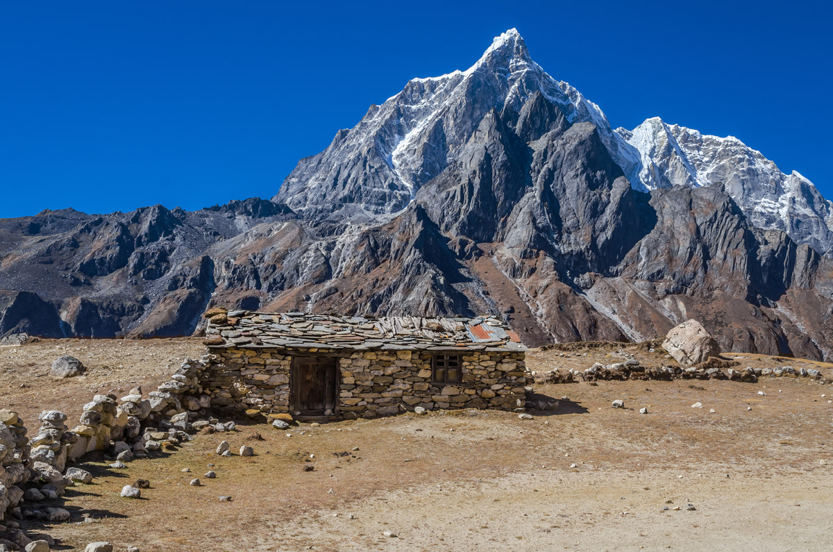
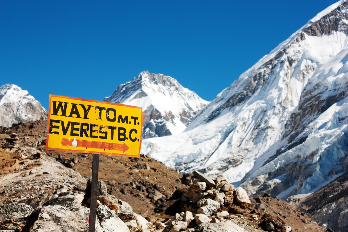
The village of Lobuche brings one of the finest peaks into the view. Pumori, meaning "the Mountain Daughter", was named by George Mallory. "Pumo" means young girl or daughter. A small black hill in front of Pumori is called Kala Patthar (literally, Black Rock) which is the top point for most of Everest Base Camp treks from which trekkers enjoy unobstructed Everest views. Contrary to common belief, Everest isn't much visible from the base camp itself, but due to recent avalanches and movements of the glacier Mt. Everest can be spotted at least partially from the Everest Base Camp.
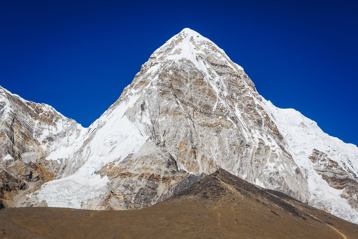
At an altitude of 5,164m Gorak Shep is the highest accomodation along the Everest Base Camp trek. This abandoned village is not inhabited by the locals, but trekkers can stay overnight and enjoy satellite high-speed internet access among other basics. Gorak Shep is also the name of the nearby frozen lakebed covered with sand, which makes an eerie impression of total devastation.
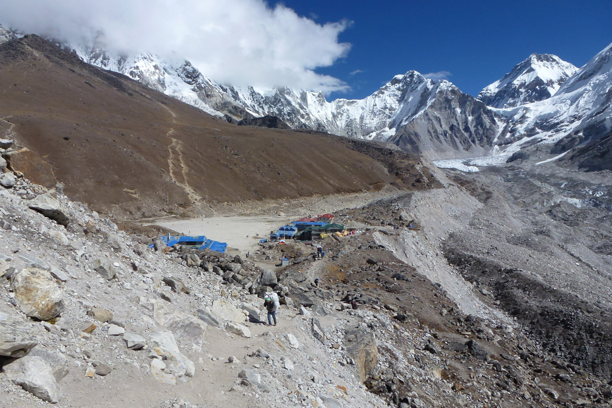
You can spot other notable peaks from Gorak Shep. Merely 6 km away is Khumbutse (6,665 metres (21,867 ft)) and 8 km away is Lingtren (6,749 metres (22,142 ft)) with the adjacent Lingtrennup which is now more commonly called Xi Lingchain (6355 metres (20850 ft). They form the international border between Nepal and the Tibet Autonomous Region of China. You can also observe Changtse Peak, but it is already in Tibet China. This peak has questionable altitude: 7,543 metres is from modern Chinese mapping. Some authorities give 7,583 metres, according to PeakVisor measurements based on satellite maps, it is 7,555 metres (24,787 ft).
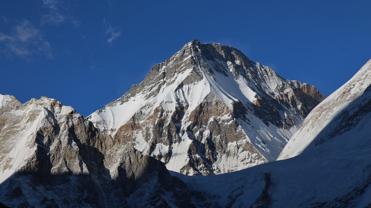
It is highly advisable to embark on the Kala Patthar ascent early in the morning. Ideally, you meet the sunrise at the top while enjoying unrivaled panorama.
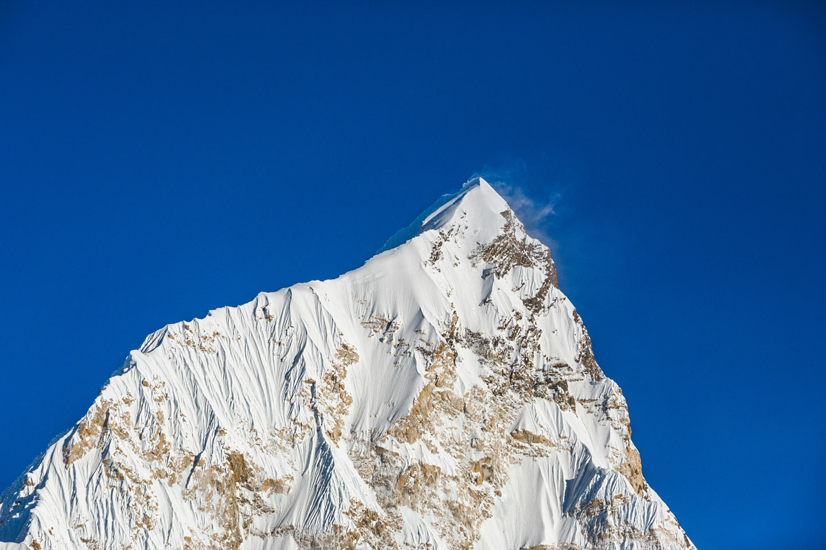
The return trek usually follows the same trail with stops at Dingboche, Tengboche, and Namche Bazar. Those adventurous enough can take side trips to Cholatse Lake at the foot of Cholatse and Arakam Tse, and many others depending on the time available.
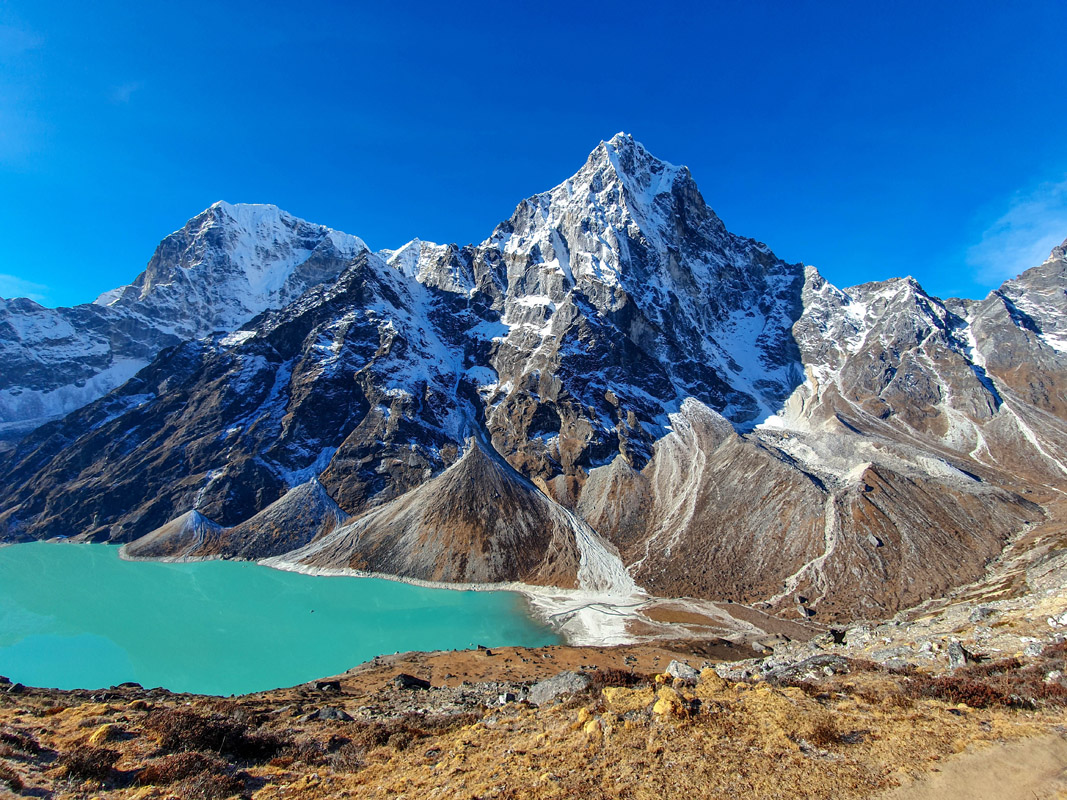
Cholatse Lake
A shorter and significantly less crowded alternative to the Everest Base Camp trek is Gokyo. It offers even more authentic adventure to five sacred lakes and the Ngozumpa Glacier, the longest in the Himalayas. Also, the trek culminates at the summit of Gokyo Ri with jaw-dropping 360-degree panorama. Some trekkers combine this trek with EBC to form a scenic loop through Cho La pass.
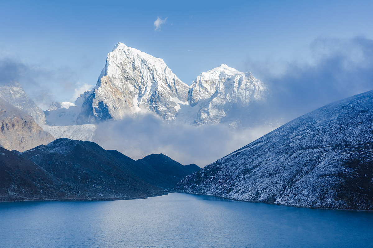
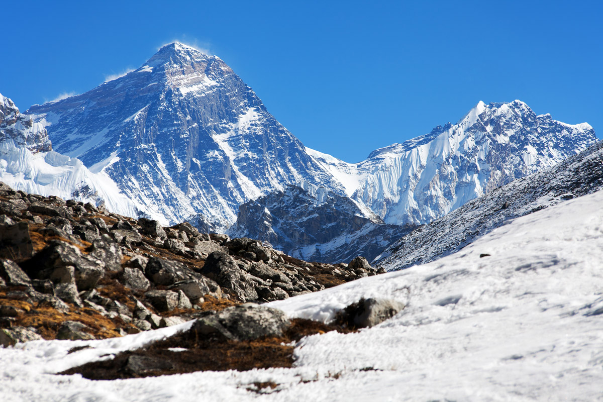
Everest view from Gokyo Ri
Apart from scaling Gokyo Ri, the trek could be extended to the farthest Fifth Lake for a spectacular viewpoint of Ngozumpa Glacier, world's sixth highest Cho Oyu, and lined up pyramids of Cholo, Kangchung, Nirekha peaks to the east.
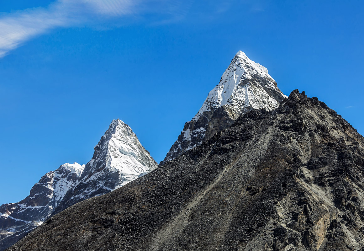
The longest and the hardest of all the treks is Three Passes which crosses all the major valleys via three high-altitude passes in the Sagarmatha National Park.
The whole park area is an endless viewpoint but there are several that stand out. Most likely you don't want to miss any of them during your trek in the Sagarmatha National Park.
To the west of Namche Bazar, Sunder Peak rises 5,300m into the sky to offer unbeatable panorama.
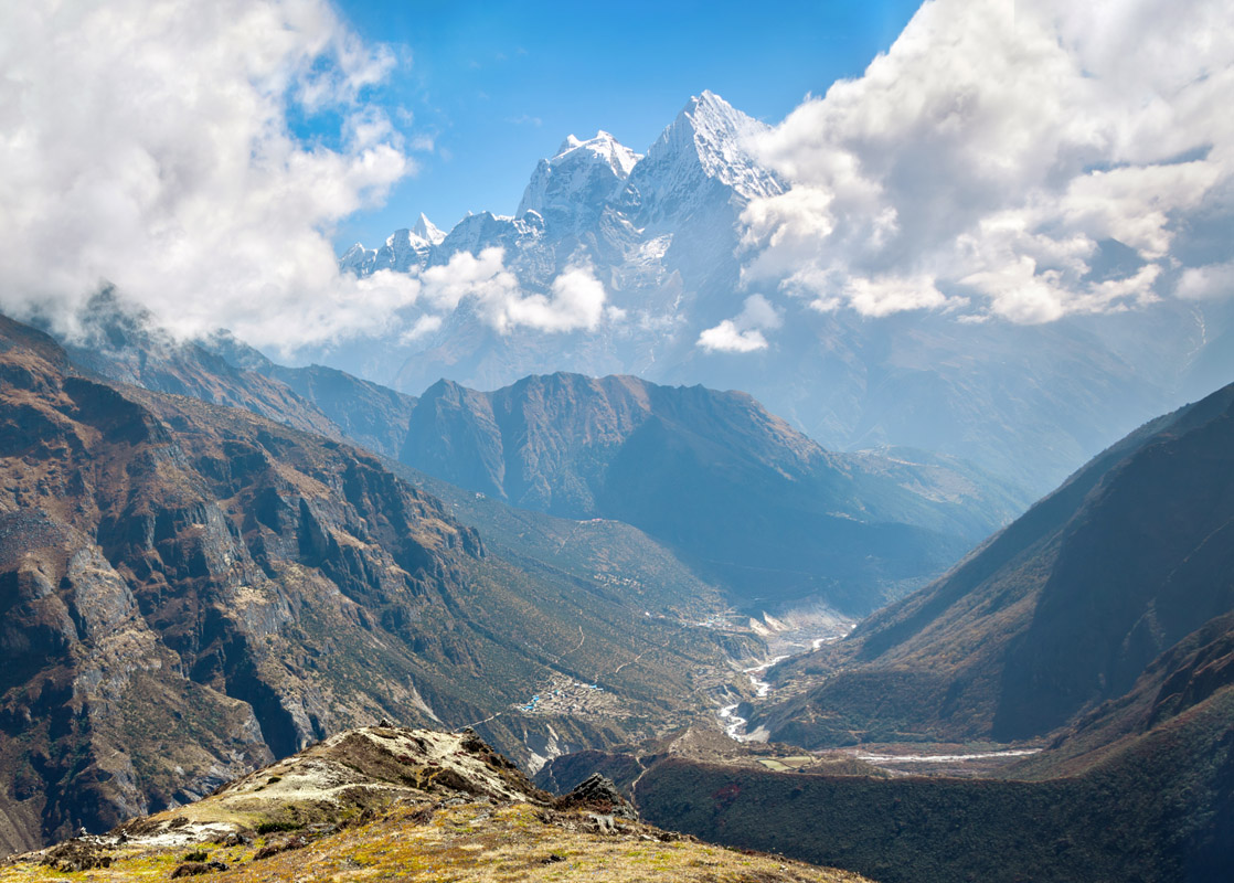
Descending from Sunder Peak.
A must-do viewpoint above Namche Bazar. Go 20 minutes up the hill behind Kunde Monastery. The name might sound non-Nepalese and this is truly so. This is where three chortens pay tribute to the Everest summiteer and his wife and daughter, both of whom died in a plane crash while working on aid projects in the region.
Nangkartshang is a 45-minute walk up from Dingboche. This former meditation retreat is located in a broad and beautiful valley. Should you wish to see Cholatse, Taboche, and Ama Dablam, go uphill for another 30 minutes and enjoy the views featuring lake Chola-tsho as well.
Chukkung Ri (commonly spelled as Chukhung Ri or Chhukung Ri) is not much frequented by trekkers as you cannot see Everest from there but the trade-off is you can take in fantastic views of Imja Tse (Island Peak), Ama Dablam, Makalu, and Nuptse. This rocky peak is similar to Kala Patthar above the village of Chhukung. Being used as an acclimatisation trip on the way to Imja Tse, Everest Base Camp and Kala Patthar, Chukkung Ri might turn out to be a lung-bursting and strenuous 4-hour walk. There is not particular technical expertise needed, just make sure you have enough steam to cover the trail.
There are quite opposable records as to whether you need a special permit to visit this mountain, or a fee. Some travel sites that officially a fee is required (because this peak was confused with Kyajo Ri 6,151m, which is the actually the peak that was supposed to be listed, but apparently someone goofed on the website). Realistically, nobody cares. According to the National Park, you don't need a special permit for Chukkung Ri, in fact from their office and for a few rupees you can purchase a certificate for climbing it.
How to get there. Starting from the village, it takes around 2 hours to climb to the saddle on very well defined trails with cairns marking almost the entire way. Once you are on the saddle, turn left on a good and easy trail to the lower summit. For the main summit, turn right and traverse the ridge of loose scree and broken rocks. The trail is sometimes not obvious and quite steep. Expect 45mins to 1 hour from the saddle. It takes 2 hours to go down from the main summit. Bring at least 2 litres of water for the climb as the streams might be frozen.
The Gokyo Ri Trek in Nepal was once considered to be the best place for getting a view in the Everest ranges. Gokyo Ri (5,483m) is the perfect alternative to Everest Base Camp Trek. Other than the four highest mountains namely Lhotse, Cho Oyu, Everest, and Makalu, there are many other mountains which are visible from Gokyo Ri on a clear day. This trek offers great views over Gokyo Ri glacier and Gokyo Lakes which are freshwater lakes at the highest elevation from 4700-5000m in which the water flows from various glaciers and streams.
Tell us about your Everest adventures, we’ll be thrilled to learn more about this fantastic location.
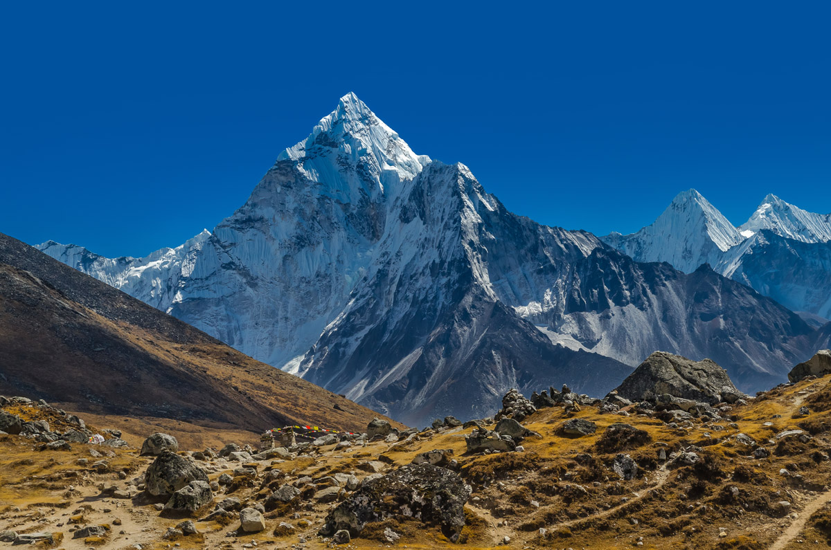
Explore Sagarmatha National Park with the PeakVisor 3D Map and identify its summits.


ultra
8000ers
china-ultras
nepal-ultras
ultra
8000ers
china-ultras
nepal-ultras
ultra
8000ers
china-ultras
nepal-ultras
ultra
8000ers
china-ultras
nepal-ultras
