
Scan the QR code and open PeakVisor on your phone
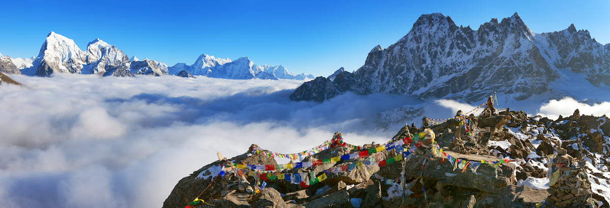
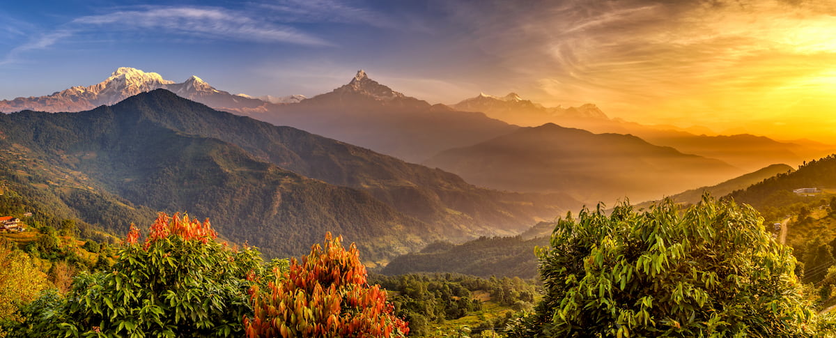
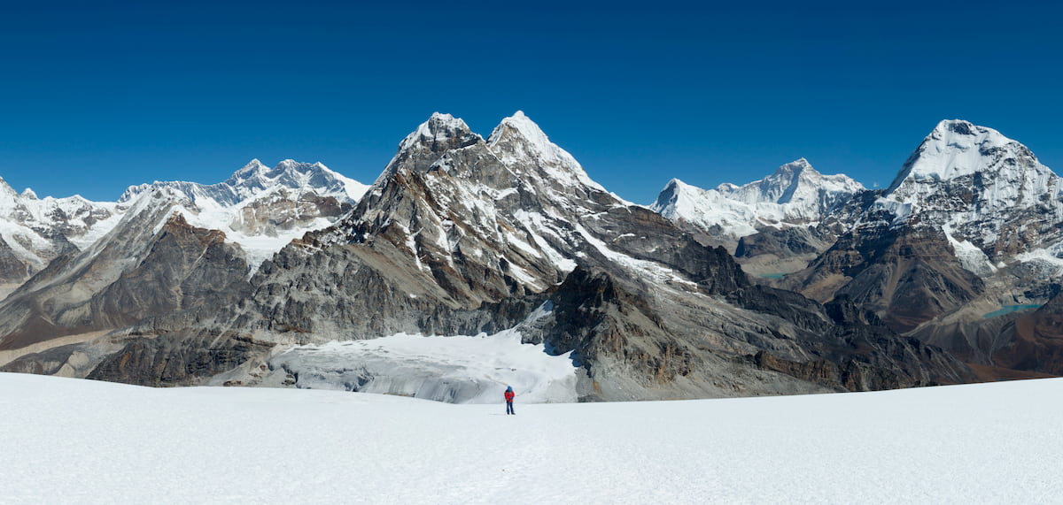
Boasting jagged summits, massive glaciers, stunning mountain vistas, and the highest peak on Earth, the Himalayas are the loftiest mountain range in the world. Covering a vast swath of south-central Asia, the Himalayas contain 3,411 named peaks, the highest and most prominent of which is the mighty Mount Everest (Sagarmāthā/Chomolungma/珠穆朗玛) at 8,848m (29,032ft).
Forming a massive barrier between the Indian subcontinent to the south and the Tibetan Plateau to the north, the Himalayas (technically the Himalaya) is a major mountain range in India, Nepal, Pakistan, Tibet (China), and Bhutan.
The range itself covers a span of some 2,4000km (1,500mi), stretching from Nanga Parbat in Pakistan to the west all the way to Namcha Barwa in Tibet to the east. Due to its prominence, the range is home to the headwaters of the watersheds of many of south-central Asia’s major rivers, including the Indus, Brahmaputra, Ganges, and Irrawaddy.
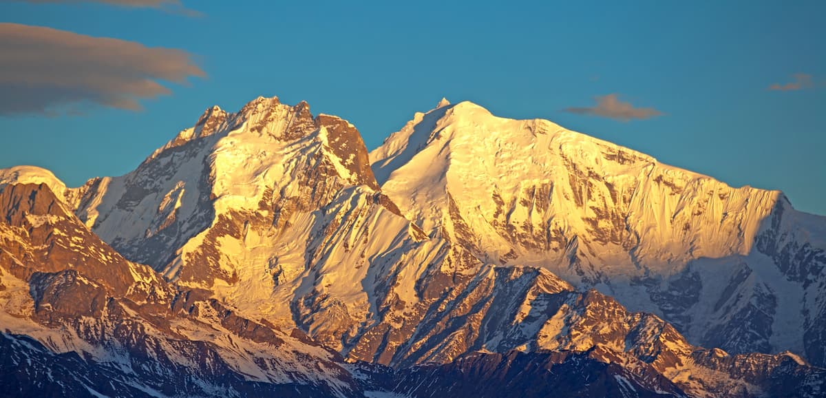
Moreover, the Himalayas include more than 50 peaks that crest the 7,000m (22,300ft) mark, as well as ten of the world’s fourteen 8,000-meter peaks, such as Mount Everest, Kangchenjunga (कंचनजंघा), Lhotse (ल्होत्से/ལྷོ་རྩེ), Makalu (馬卡魯峰/मकालु हिमाल), Cho Oyu (ཇོ་བོ་དབུ་ཡ/卓奥友峰), Dhaulagiri I (धौलागिरी), Nanga Parbat (نانگا پربت), Shishapangma (希夏邦马峰), Annapurna I (अन्नपूर्ण), and Manaslu (मनास्लु).
That being said, while many of the peaks in the Himalayas are ultra prominent, the region is also surrounded by other mountain ranges and high points to the west, north, east, and southeast.
In particular, the Himalayas are bordered by the Karakoram in Pakistan, the Baluchistan Mountains in Iran, Afghanistan, and Pakistan, as well as the Hindu Kush in Afghanistan, Pakistan, and Tajikistan to the west. Meanwhile, the Hengduan Mountains in northern India and mainland China are located to the east.
Additionally, the range is located to the northeast of the Naga Hills in India and Myanmar and to the south of the Tibet Plateau in Tibet and the Pamir Mountains of Tajikistan, Tibet, Afghanistan, and Kyrgyzstan.
Due to the sheer size of the Himalayas, it’s easiest to categorize the range by country.
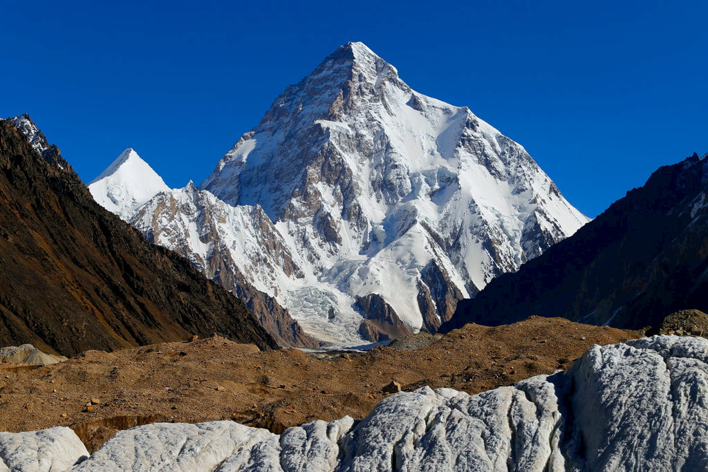
Home to the easternmost extent of the Himalayas, Pakistan includes just a small section of this lofty range. In fact, while Pakistan is, indeed, a highly mountainous country, many of the country’s highest peaks are actually part of the neighboring Karakoram, which is home to notable summits, like K2 (کے ٹو), Gasherbrum I (گاشر برم/加舒尔布鲁木I峰, and Broad Peak (بروڈ پیک).
That being said, within the small part of Pakistan, there are some very tall peaks, such as Nanga Parbat. Moreover, Pakistan’s Himalayas contain a handful of protected areas, including Deosai National Park.
Encompassing both the central part of the Himalayas and some of the easternmost part of the range, India is home to some of the most stunning parts of the world’s highest mountain system.
The range traverses parts of a number of different Indian states and territories (some are disputed), including Himachal Pradesh, Uttarakhand, Arunachal Pradesh, Meghalaya, Manipur, Mizoram, Nagaland, Tripura, Sikkim, Assam, Jammu and Kashmir, West Bengal, and Ladakh.
Moreover, India is home to a handful of different Himalyan sub-ranges, such as:
The country also boasts an assortment of great national parks and wildlife sanctuaries in its Himalayan regions, including:
One of the world’s most mountainous countries, almost all of Nepal is dominated by the Himalaya and its foothills, with the exception of the low-lying Terai Region to the south. Parts of all but six of the world’s fourteen 8,000m peaks are located in Nepal or on its borders.
Moreover, the country is home to a number of major Himalayan sub-ranges, such as:
As far as hiking and trekking areas go, Nepal is no stranger to beautiful national parks and conservation areas. Some of the most popular Himalayan parks in the country include:
The Tibet Autonomous Region (TAR) in China contains much of the northernmost and easternmost parts of the Himalayas. While much of Tibet is dominated by the Tibetan Plateau, the southernmost part contains a number of Himalayan sub-ranges, including:
Moreover, Tibet is home to quite a few popular trekking areas for those who manage to acquire a permit. The region also contains a few designated parks, such as the Qomolangma National Nature Preserve, and it is believed that there are plans for the designation of more national parks and nature reserves in Tibet in the coming years.
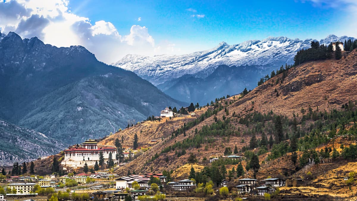
The Kingdom of Bhutan is a small landlocked country that contains 29 named mountains - all of which are part of the Himalayas. Additionally, Bhutan has a number of protected regions, including Jigme Dorji National Park and Sakteng Wildlife Sanctuary.
Despite its small size, Bhutan does contain 3 ultra-prominent peaks - Gangkhar Puensum (གངས་དཀར་སྤུན་གསུམ་), Jomolhari (ཇོ་མོ་ལྷ་རི/绰莫拉日峰), and Tongshanjiabu (同山加布峰) - as well as a small Himalyan sub-range known as the Black Mountains.
That being said, it’s important to note that mountain climbing is forbidden in Bhutan on peaks over 6,000m (19,685ft) for spiritual reasons.
As a result, Bhutan’s highest peak Gangkhar Puensum is likely the highest unclimbed mountain in the world, though this is difficult to validate due to the sheer number of unnamed peaks with less than 100m (330ft) of prominence around the world.
Although the Himalaya are currently the highest mountains on Earth, they weren’t always as lofty as they are today. Indeed, the range is among the youngest on Earth and it’s quite likely that many of the world’s other major ranges, such as the Appalachians in the United States and Canada, were once higher than the Himalaya.
The geologic history of the Himalaya dates back many hundreds of millions of years when Gondwana split apart during a major rifting event during the Norian. After the Indian plate separated from Australia and Antarctica in the Early Cretaceous, the space between the Indian plate and the Asian plate formed a small ocean called the South Indian Ocean.
Not long after, during the Late Cretaceous, the Indian plate started drifting northward at a relatively rapid speed leading to a collision with the Asian plate and the start of a major mountain building event that continues to this day.
Indeed, the Himalaya are still growing as the Indian plate continues to move northward into the Tibetan Plateau. While the exact rate of the Indian plate’s movement isn’t wholly clear, it is believed to be moving at a speed of at least 67mm per year and, as a result, the Himalaya are rising at a rate of about 5mm per year.
Perhaps the most exciting change in elevation caused by the Himalayas’ tectonic activity was the official increase in height of Mount Everest. In fact, on December 8, 2020, Chinese and Nepalese authorities announced that a new survey reassessed the height of the mountain to be precisely 8848.86m (29,031.69ft), raising it by about 61cm (2ft) from a previous measurement.
This increase in height is believed to be partially due to the major 2015 earthquake in Nepal, which registered as a 7.8 on the moment magnitude scale. The earthquake also triggered a massive avalanche on Mount Everest, killing at least 19 people, and another avalanche in the Langtang, killing at least 200 people.
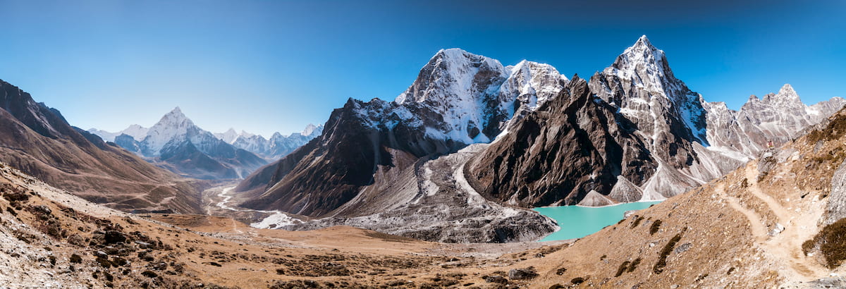
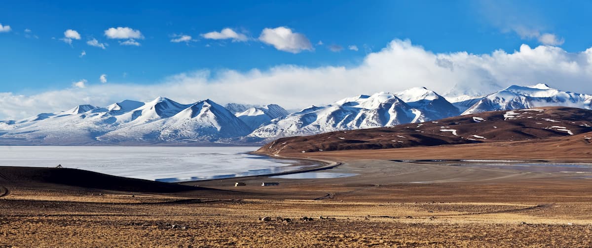
Furthermore, the Himalaya owe much of their present shape to the glaciers that dominate the landscape. Within the Himalaya, there are a number of major valley glaciers, as well as glaciers on almost all of the range’s highest mountains.
In a mountain range as large as the Himalayas, a substantial amount of biodiversity is to be expected. Indeed, the range contains a number of different ecoregions as well as an assortment of different endemic flora and fauna. However, the specific species and ecosystems that you’ll encounter depends greatly on your geographic location and elevation.
The lowest elevations in the region around the Indo-Gangetic plain are home to lowland forests that are a mix of scrub and deciduous trees, as well as some small stands of mixed coniferous forests.
Meanwhile, the Lesser Himalaya between about 2,000m and 3,000m (6,600 to 9,800ft) are home to mixed temperate forests, including the eastern Himalayan broadleaf forests and the western Himalayan broadleaf forests ecoregions.
Just above these broadleaf and mixed forests, between about 3,000m and 4,000m (9,800 to 13,100ft), the landscape transitions into temperate coniferous forests. This includes ecoregions such as the western and eastern Himalayan subalpine conifer forests, and the northeastern Himalayan subalpine conifer forests. Some of the most common tree species at these elevations include rhododendrons, Himalayan hemlock, west Himalayan spruce, and east Himalayan fir.
Above 4,000m (13,100ft), the land is dominated by sprawling alpine meadows that eventually give way to true alpine regions that contain little else besides rock, snow, and ice.
Wildlife throughout the low and the mid elevations of the Himalaya is truly exceptional, with a number of endemic species calling the region home. Some of the most notable animals in the range include the Himalayan tahr, the Himalayan horal, the Himalayan musk deer, the bharal, the Asian black bear, the red panda, the golden langur, and the Kashmir gray langur.
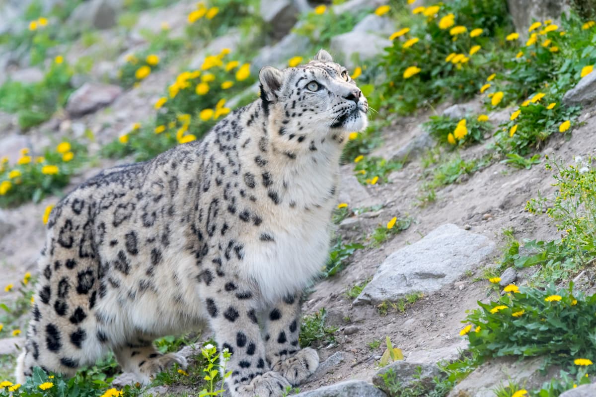
Perhaps the most elusive animal to prowl the Himalaya is the beautiful snow leopard. The snow leopard lives throughout the mountains of central Asia, including within the Himalaya, the Tibetan Plateau, and in various high-elevation regions of China, Mongolia, and Russia. However, it lives between 3,000 and 4,500m (9,800 and 14,800ft) and it is particularly difficult to catch a glimpse of these magnificent animals.
Due to the range’s proximity to some of the world’s largest rivers, it comes as no surprise that the region in and around the Himalaya has been continuously inhabited for thousands of years. The region is very ethnically, culturally, and religiously diverse, with Hinduism, Tibetan Buddhism, Islam, Sikhism, and Jainism being the major religions in the area.
As far as mountain climbing in the Himalayas goes, interest in the region’s mountains from people of European descent began around the time of the Great Trigonometric Survey, which was conducted in India by the UK in the 19th century. Survey work was slow going in the range due to the ruggedness of the terrain and the need to haul theodolites into high elevation locales.
Moreover, the status of Nepal as a closed kingdom until the mid 20th century made travel in the highest elevation parts of the range exceptionally difficult or off-limits. In fact, by the mid-1800s, it was widely believed that Kangchenjunga was the tallest peak on Earth, partially because the British surveyors weren’t able to access Nepal.
By the 1840s, however, British Surveyor General of India, Andrew Waugh sited a peak - then called Peak b - from the eastern Himalayas which appeared to be exceptionally large. After he and his team made a number of measurements of the peak from nearly 200km (124mi) away, Waugh believed that Peak b was actually the tallest in the world.
In the English language world, the peak was called Peak XV and it was estimated to be around 8,839.8m (29,002ft) tall - a surprisingly close estimate based on survey distances. Waugh eventually called the peak Mount Everest, naming it after Sir George Everest, who was his predecessor as the Surveyor General of India.
From that point forward, expeditions in the region became a fairly popular pastime for well-to-do British surveyors and adventurers. During the late 19th and early 20th centuries, citizens of western European countries (mostly Britain) launched a number of expeditions in and around the Himalaya, some of which were sponsored by the Royal Geographical Society.
By the turn of the century, some of the range’s highest peaks saw their first organized climbing attempts, though many ended without a successful summit and many well-known climbers, such as Albert Mummery, died along the way.
Perhaps the best-known early Himalayan climbing expeditions of the early 20th century were the 1921, 1922, and 1924 British expeditions to Mount Everest. Although the first expedition was primarily for reconnaissance of the peak, the second and third expeditions saw 2 serious attempts on the mountain’s summit.
On the 1924 British Mount Everest Expedition, George Mallory (who had been on all 3 expeditions) and his climbing partner, Andrew “Sandy” Irvine, disappeared somewhere near the upper slopes of the mountain, never to be seen again until Mallory’s body was discovered on the mountain by climber Conrad Anker in 1999. Whether or not the duo made it to the summit of Everest is still a point of contention.
Interestingly, the first-ever summit of an 8,000 meter peak in the Himalaya was not of Mount Everest but of Annapurna I. The 10th highest peak on Earth, Annapurna I was not actually the original objective of the 1950 French Annapurna Expedition (they had hoped to climb Dhaulagiri I instead), but the trip became an infamous part of climbing lore after Maurice Herzog and Louis Lachenal narrowly eluded disaster on the summit.
Moreover, the 1950 ascent of Annapurna was the first time that an 8,000 meter peak had been summited on its first attempt.
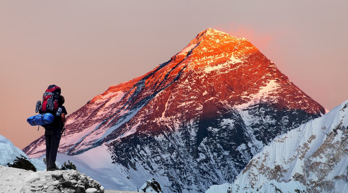
Three years later, after decades of attempts, Tenzing Norgay and Sir Edmund Hillary also made the first ascent of Mount Everest on the 1953 British Mount Everest Expedition.
Throughout the Golden Age of British Mountaineering in the mid-20th century, all 14 of the world’s 8,000 meter peaks saw their first ascent, with the final peak, Shishapangma, being summited in 1964.
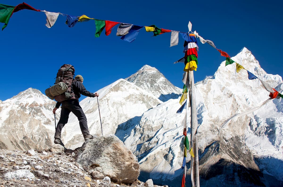
Since then, the Himalayas’ tallest peaks have become incredibly popular among mountain climbers, thousands of whom flock to the region each year for a chance to climb in this stunning range.
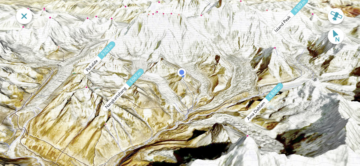
As one might imagine, the lofty slopes of Mount Everest see much of the region’s climber traffic, though other peaks, such as Cho Oyu, Ama Dablam, and Baruntse, remain popular among both guided groups and independent climbing parties.
Moreover, the Himalayas have become increasingly popular among trekkers in the last few decades. While treks to the region’s many high-elevation basecamps remain popular, other options, including circuit hikes are fan-favorites among tourists, particularly in Nepal.
Regardless of where you go in the Himalaya, stunning mountain views and a landscape like no other are sure to impress.
With thousands of peaks to check out, there’s no shortage of adventure in the Himalayas. If you’re looking to plan a trip to the region, here are some of the most popular trekking areas to consider:
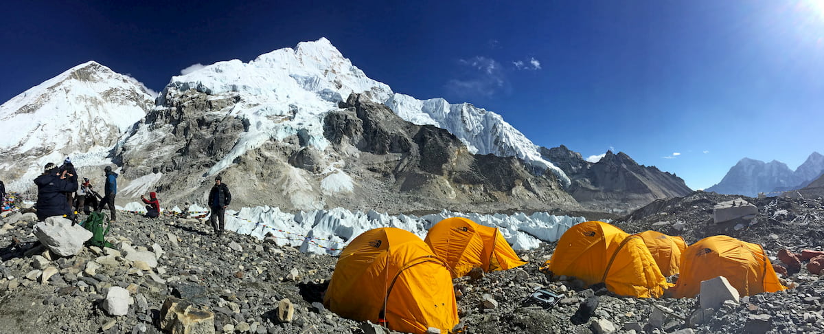
The region in and around Mount Everest within the Solukhumbu District is one of the most popular trekking destinations in Nepal for international travelers. Although the area is accessible by a multi-day road journey, most visitors to the region start with a flight from Kathmandu to the Tenzing-Hillary Airport at Lukla.
From there, many visitors set out on treks toward Everest Base Camp, though there are plenty of other treks to consider if you’re looking to get off the beaten path. Treks to Gokyo Lakes, the Three Passes, Mera Peak, and the Arun Valley are all excellent choices. Or, if you’re interested in experiencing the region’s beautiful culture, a trip to Namche Bazaar can’t be beat.
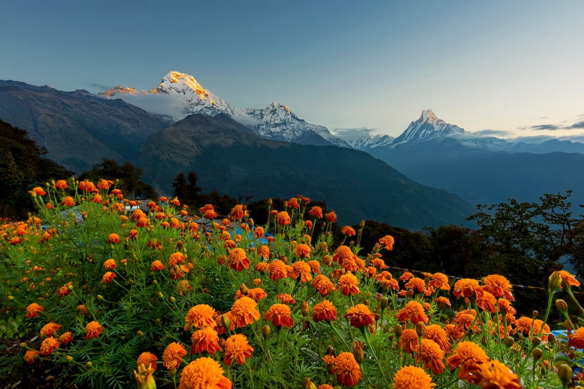
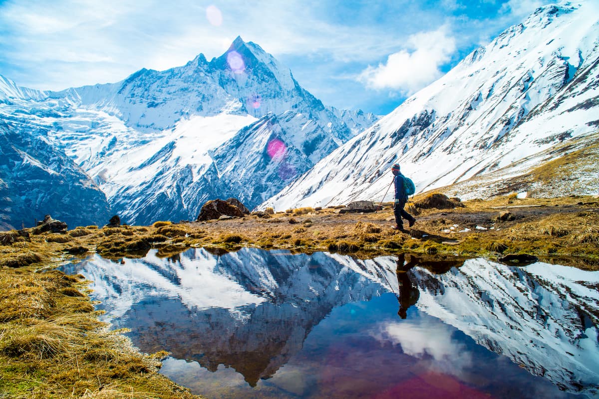
Leading the Mount Everest Region in terms of popularity among international travelers, the Annapurna region is a sure bet for enthusiastic trekkers. Most visitors launch their trip in the Annapurna region by flying from Kathmandu to Pokhara and then catching a bumpy jeep ride into the foothills.
Some of the most popular treks in the Annapurna region include hikes to Annapurna Base Camp and the Annapurna Sanctuary, as well as the longer Annapurna Circuit trek.
Alternatively, many visitors opt for a shorter trek to Poon Hill from Ghorepani, which offers views of the Annapurna Massif, Dhaulagiri, and even Mount Everest on a particularly sunny day. If you’re planning on trekking to Poon Hill, make sure to get up early on your summit day so you can catch the sunrise from the top. You’ll be glad you made the effort.
Located on the far eastern end of Nepal, straddling India’s Sikkim region, the Kanchenjunga area is a solid trekking location if you’re looking to escape the crowds.
Getting to the region is a bit more involved than the Annapurna or Mount Everest regions, but it is possible to fly to Bagdogra and arrange for a private jeep transfer toward the start of many of the area’s popular treks.
In addition to the Kanchenjunga Base Camp Trek, other great hiking options in the area include the Goecha La trek, the Varsey Trek, the Dzongri Trek, and the Sandakphu, though many of these treks require camping rather than staying in tea houses.
Despite being the highest mountain range in the world, well over 50 million people live in and around the Himalayas, including thousands of people who live in villages that are above 3,400m (11,150ft). If you’re planning a trip into the Himalayas, here are some of the best places to start your journey:
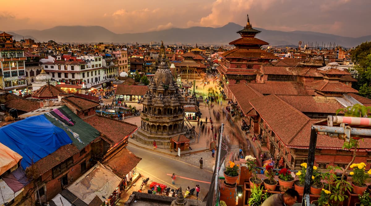
The capital and most populous city in Nepal, Kathmandu is home to about 1 million residents. Kathmandu is located in the west-central part of the country and it serves as an excellent starting point for any trip into Nepal.
Within Kathmandu, there are plenty of amazing cultural and historical sites to check out, including the city’s many world heritage sites. The city also has Nepal’s largest airport, which includes international and domestic terminals that offer great connections to the country’s most popular trekking areas.
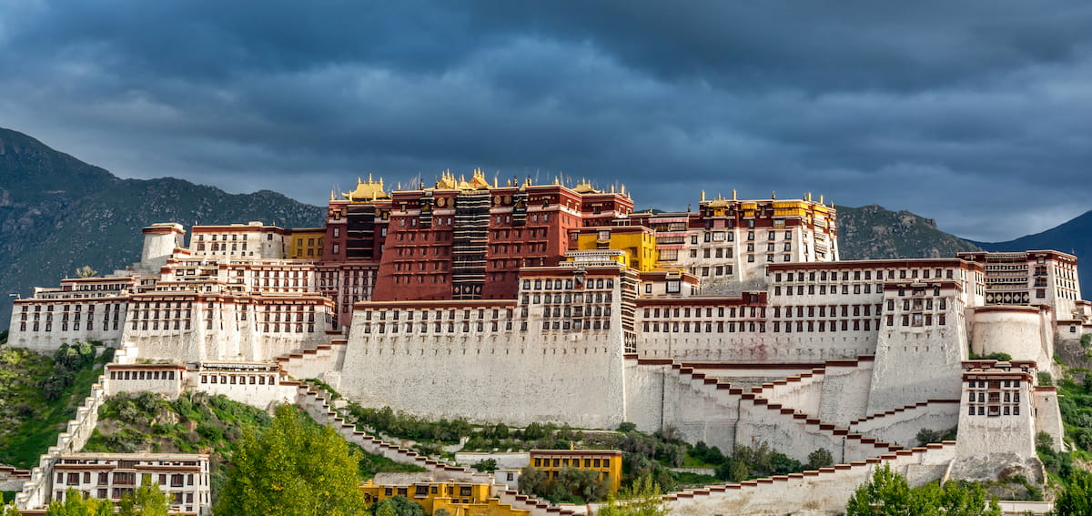
Lhasa is the administrative center of the Tibet Autonomous Region and its most populous city. It is connected by the Qinghai-Tibet Railway, the Qinghai-tibet Highway, and the Lhasa Gonggar Airport to other parts of China as well as occasional international flights to Kathmandu.
Most trekkers in Tibet start in Lhasa, though it’s important to point out that getting a visa for the region is essential to avoid any issues at the border. Visas can be difficult to acquire for foreigners, though many local guide services can help you through the process.
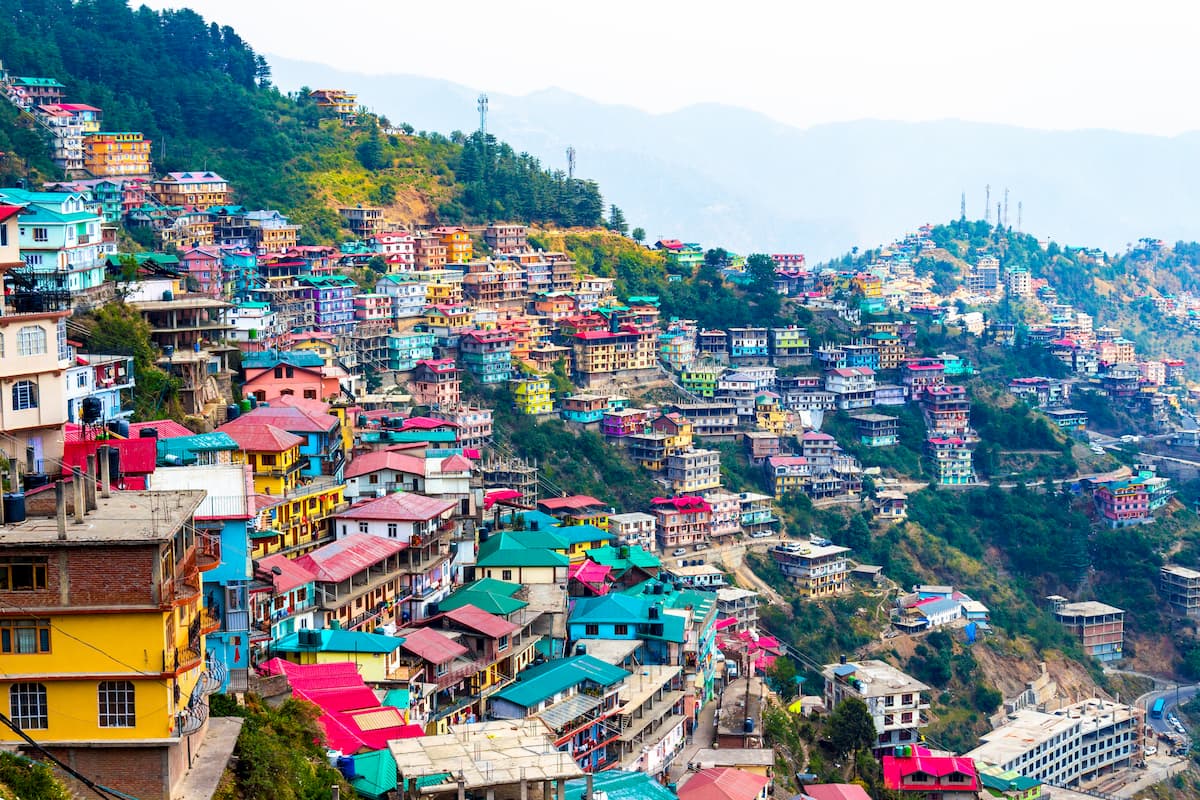
The capital of Himachal Pradesh, Shimla is home to about 169,000 people who live in the foothills of the Himalaya. Shimla contains some truly remarkable cultural and historical sites , which makes it a hub for tourism in the region. It is accessible by road, train, and air, so it’s a great place to visit if you’re interested in visiting India’s section of the Himalaya.
Thimphu is the capital and biggest city in Bhutan with about 114,000 residents. Interestingly, Thimphu does not have its own airport, so most visitors to the area fly into Paro Airport about 54 km (34mi) away.
That being said, the vast majority of tourists to Bhutan require a visa and must book their visit in advance using a registered Bhutanese tour operator (or their international partner). Tour operators generally take care of visas for you, but pre-planning is essential.
Considering that India is probably the main country to get to the Himalayas, especially if you take itineraries by land, I will pay more attention to it by listing not just one, but several cities, towns and resorts at once starting from the main one, Shimla.
The town is built on the famous Seven Hills of Shimla, of which the Jakhu Hill is the highest (2,454 m / 8,051 ft). It is the capital of Himachal Pradesh and home to about 169,000 people. Shimla also contains some truly remarkable cultural and historical sites such as, for example, Kali Bari Temple, dedicated to Shyamala Mata, an incarnation of goddess Kali, which makes it a hub for tourism in the region. Another reason is that it is very accessible by road, train (Kalka-Shimla Railway route), and air. So it is a great place in India’s section of the Himalayas.
However, given the length of the Indian Himalayan Region into 13 states, I asked Ivan Kuznetsov, an outdoor writer from the Dolomites, Italy, and Karelia, Finland, to do an overview of the other cities, towns, and resorts. He spent a month in the region in 2016, when he studied Buddhist philosophy at a local institute and hiked in the mountains:
"All in all, except for Shimla, I can identify the same number of major cities and resorts in the six states that can be seen as tourist hubs in other parts of the region. Moving from the west to the east, these would be Leh in Ladakh; Dharamshala, McLeod Ganj, and Manali in the same Himachal Pradesh; Rishikesh in Uttarakhand; Gorakhpur in Uttar Pradesh; Darjeeling in Sikkim; and Guwahati in Assam. Next, I will tell you briefly about one main feature of each to help you choose one of them:
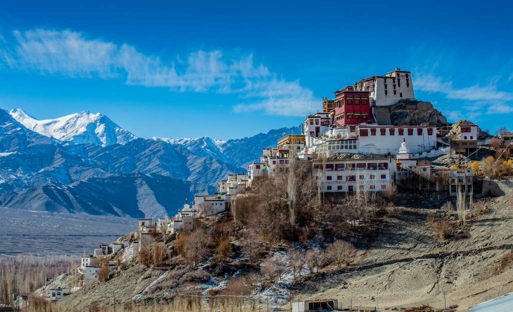
Leh is quite a small town by Indian standards, with a population of over 30,000, but a metropolitan community in the high mountainous state of Ladakh, characterized by cosmic scenery. The city is best known for the Leh-Manali Highway of a total length of 428 km (266 mi) with an average altitude of more than 4,000 m (13,000 ft), which is considered a cult among motorcyclists as one of the best routes not only in India but also in the world on this form of transport. The main attraction of the city itself is Leh Palace, where the kings of the former Kingdom of Ladakh used to sit, built in the traditional Tibetan style.
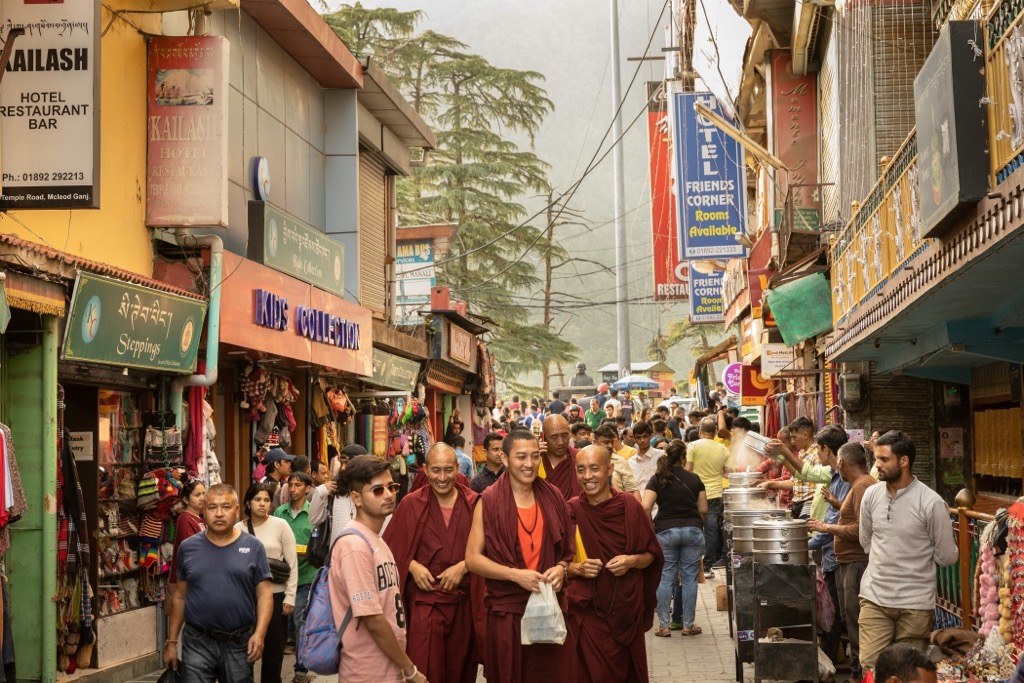
Dharamshala is probably the second most important city in the state of Himachal Pradesh after Shimla. The city is not so much famous for itself (in my opinion, it’s big, noisy, and dirty), but for its two suburbs: McLeod Ganj and Sidhpur, home to the largest Tibetan community outside of Tibet. For this reason, it is sometimes called "Little Lhasa". The main attraction of McLeod Ganj is the Tsuglagkhang Complex also known as Dalai Lama Temple, which is the seat of Tenzin Gyatso, the current 14th Dalai Lama. Read more about it in the Tibet Autonomous Region guide.
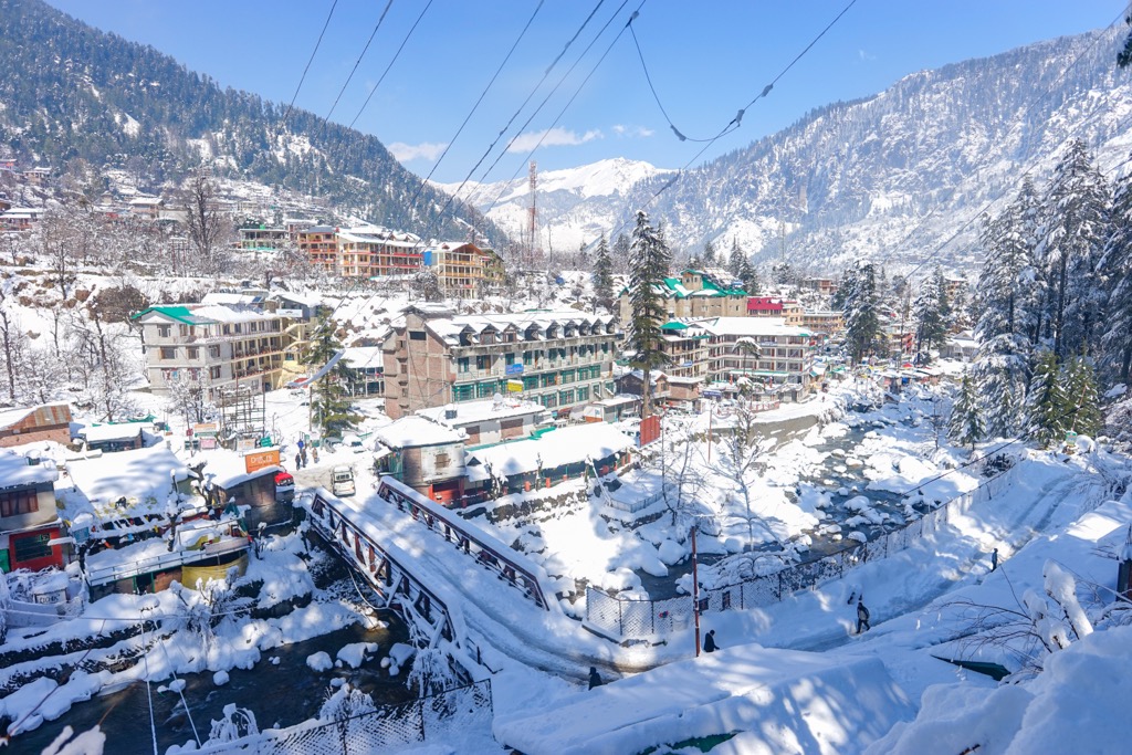
Manali is the last of a series of the largest and most popular towns and resorts in the state of Himachal Pradesh and the starting point of the aforementioned Leh-Manali Highway. With a population of only over 8,000 people, the town can be described as quiet. It has a large number of individual attractions, but all travelers get first to Mall Road, the main street in Manali where all the stores, restaurants, hotels, and various services are concentrated. In addition, the town is considered a center for outdoor activities as opposed to Shimla, a resort town. Manali is home to hiking, paragliding, and many other active sports.
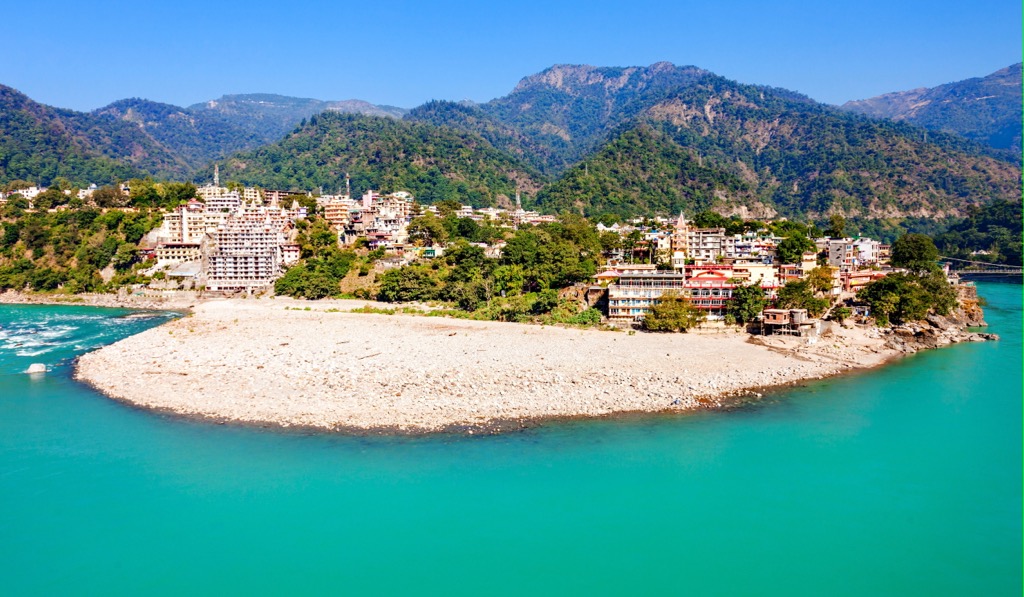
Rishikesh is the most famous city in the state of Uttarakhand south of the Himalayas, situated on the sacred Indian Ganges River. The city is known primarily as a center of Hinduism with a large number of ashrams. Just one fact: It was here that the Beatles made their journey to India between February and April 1968 to take part in a Transcendental Meditation (TM) training course at the ashram of Maharishi Mahesh Yogi, an Indian yoga guru, who created this system. You can say that Rishikesh is a kind of Goa in the north of India, where all lovers of this country as well as those who are just going to discover it tend to go. Rishikesh is also a great intermediate point on the way to Manali, Shimla, and Dharamshala.
Gorakhpur is a big city in the neighboring state of Uttar Pradesh, which is the main staging post on the way from India to Nepal by land, thanks to its closest location to Kathmandu. However, to get from one to the other you have to travel more than 24 hours by bus through the bad mountain serpentines of Nepal, which I personally did not dare to do on my trip to India. Gorakhpur itself is usually reached by train from Delhi and other cities. It also takes time and a lot of energy, due to the fact that Indian trains — well, you know all about them.
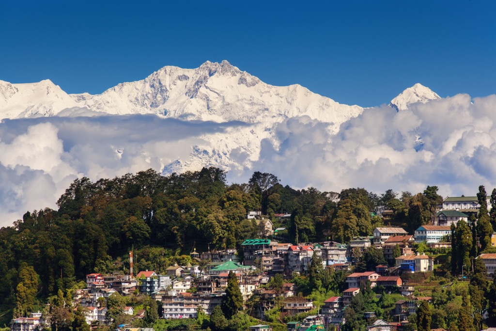
Darjeeling is the main center of tourism in the eastern part of the Indian Himalayan Region in the state of Sikkim. First of all the city and the whole state is of pure geographical interest because it is sandwiched between Nepal and Bhutan — the other two major Himalayan states. Darjeeling is famous for being one of the main summer residences of British politicians, administrators, and military officers during the British Raj, which was the rule of the British Crown on the Indian subcontinent between 1858 and 1947. The city is known also for its connection to the mainland by the scenic railroad of the same name, the Darjeeling Himalayan Railway, running through the mountains, which was declared a UNESCO World Heritage site in 1999. Two more railway lines were later added to it, so the site is known as Mountain Railways of India today.
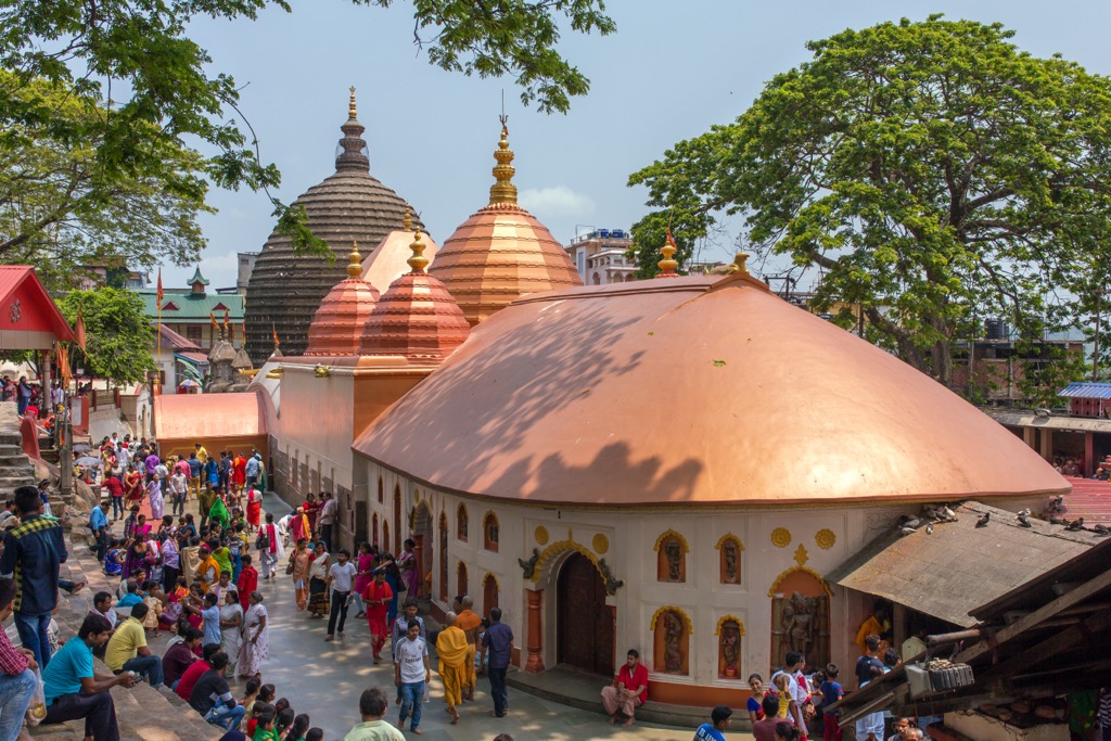
Guwahati is the biggest city in the northeastern part of Indian Himalayas in the Assam state in the valley of the mighty Brahmaputra River. If you look at the map, you can call it the main river of the Himalayas: It runs horizontally almost all through the whole Tibet Plateau west to east until it takes a sharp turn to the south in India and Bangladesh, which is about half the river length of the 2,906 km (1,806 mi), making it the 15th longest in the world. The height of the river is just as impressive — 5,210 m (17,090 ft). The main cultural and architectural attractions of Guwahati are the various sacred Hindu temples: Kamakhya Temple, Navagraha Temple, Umananda Temple, and others.


ultra
8000ers
china-ultras
nepal-ultras
ultra
8000ers
india-ultras
nepal-ultras
ultra
8000ers
china-ultras
nepal-ultras
ultra
8000ers
china-ultras
nepal-ultras
ultra
8000ers
china-ultras
nepal-ultras
ultra
8000ers
india-ultras
nepal-ultras


