Scan the QR code and open PeakVisor on your phone
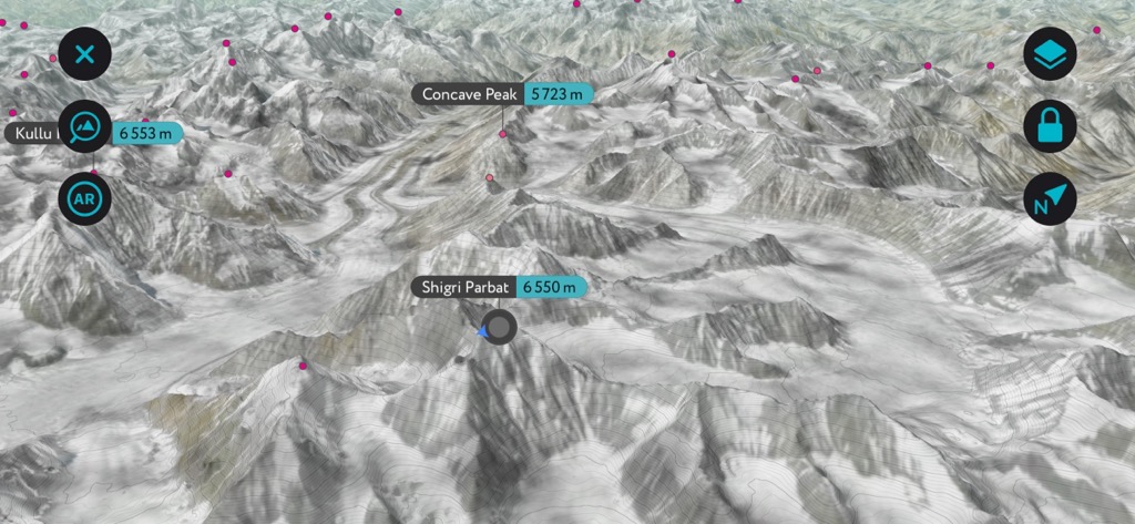
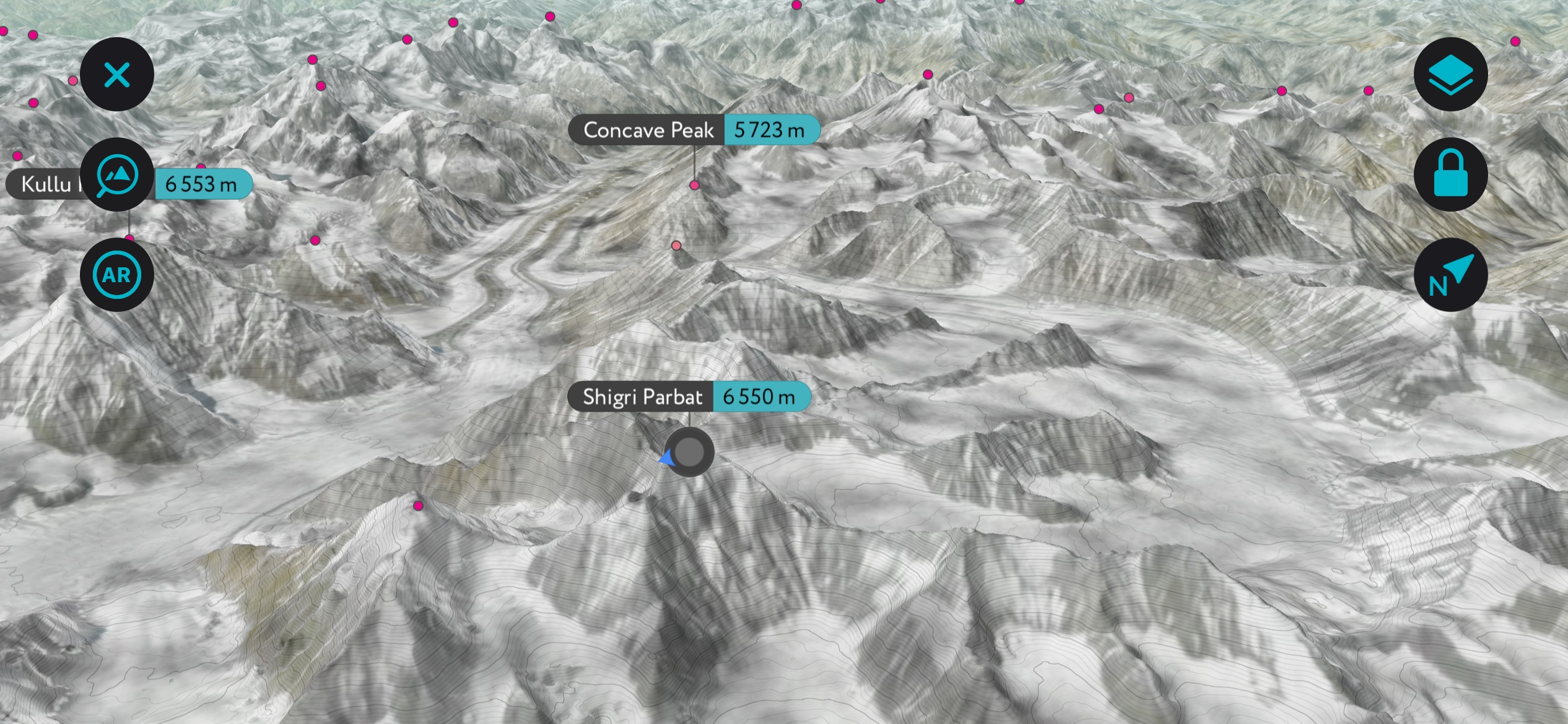
Pin Valley National Park (675 sq. km / 261 sq. mi) is one of five national parks in the northern Indian state of Himachal Pradesh and the only one in Lahaul & Spiti district (Lahaul Valley and Spiti Valley, once two separate districts, were combined in 1960). The landscape of Pin Valley National Park is primarily a high-elevation desert. Although the park contains only eight named summits, they are monumental. Shigri Parbat (6,550 m / 21,490 ft) is the highest, while Dibibokri Parvat (6,507 m / 21,348 ft) is the most prominent.
Situated on the leeward side of the central Himalayan belt (sparing it from Indian Ocean monsoons), Pin Valley lies west of the bordering Khirganga National Park, Inderkilla National Park, and Great Himalayan National Park.
Established in 1987, Pin Valley National Park is a “cold desert,” and along with the nearby Kibber Wildlife Sanctuary, it is part of the Cold Desert Biosphere Reserve, which spans 7,770 square kilometers [2,972 sq. mi] across the Indian Himalaya. A cold desert biome is an arid region that receives scant amounts of annual precipitation and is typically at higher elevations and latitudes. When precipitation does occur, it is mainly in the form of snow or fog instead of rain. Other examples of cold desert regions include the Gobi Desert in China and Mongolia and the Great Basin in the United States.
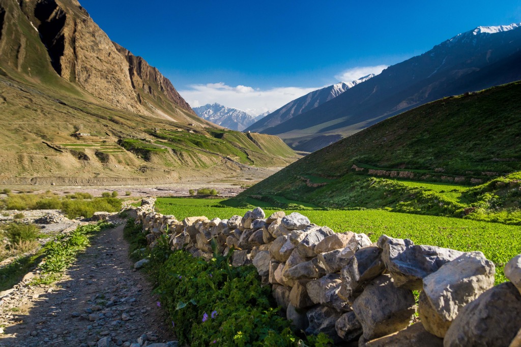
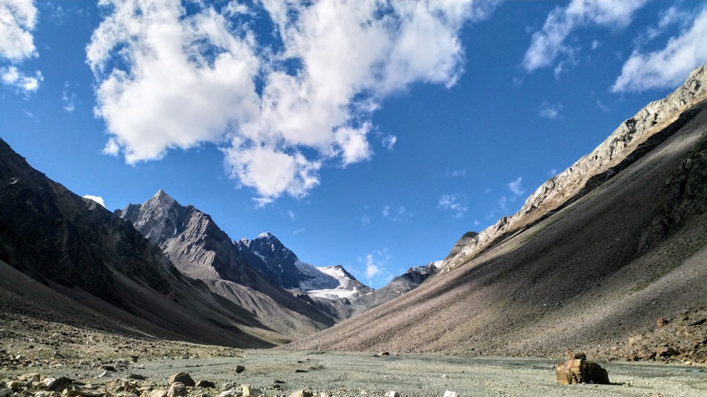
Like Khirganga and much of Himachal Pradesh, Pin Valley is extraordinarily rugged and characterized by immense topographic relief with sparse, low-lying vegetation. At its lowest elevation, Pin Valley is still 3,500 meters (11,480 ft) above sea level.
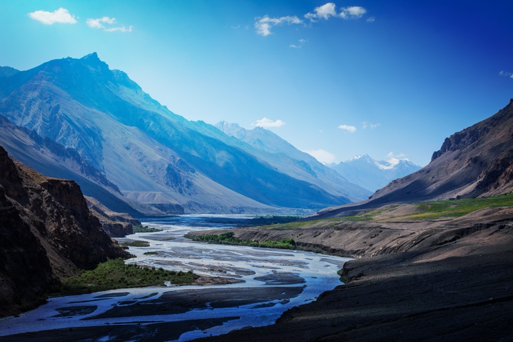
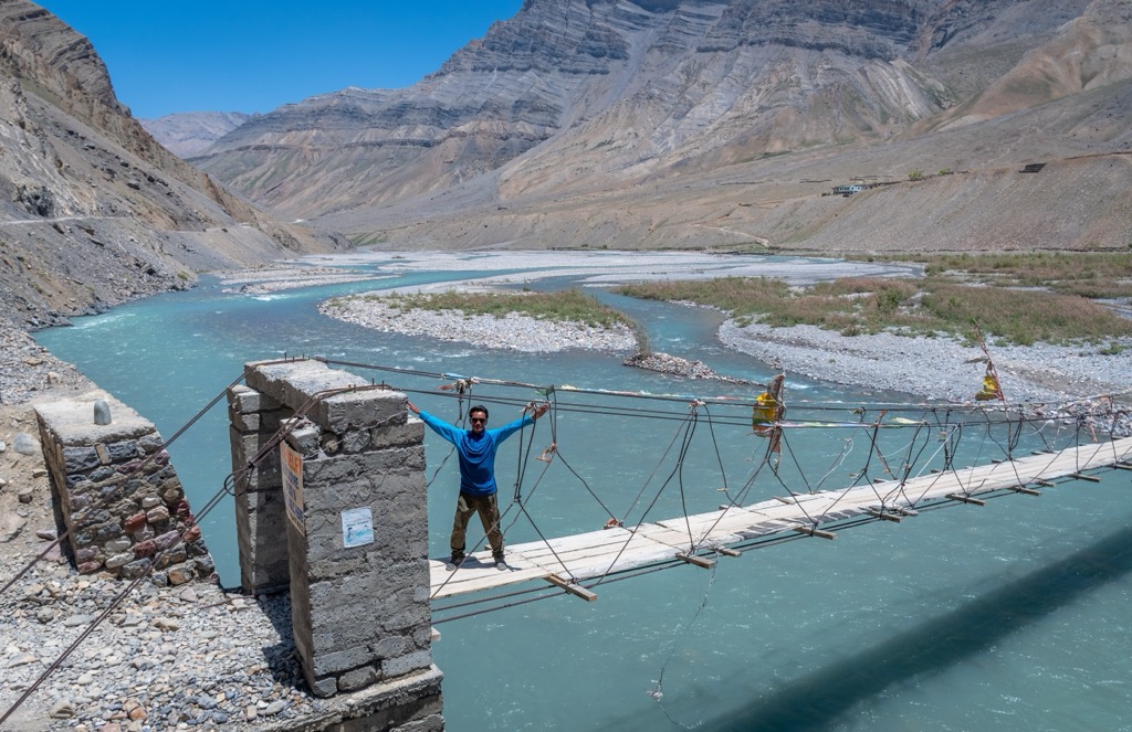
In addition to the sprawling alpine deserts, meadows, and high peaks, Pin Valley National Park is home to the confluence of the Spiti River and one of its main tributaries, the Pin. The Spiti, at 225 kilometers (140 mi) long, is the lifeblood of the eponymous valley, dividing the Lahaul & Spiti district. The Kunzum Pass (4,551 m / 14,931 ft) connects the two regions. Nearly all of Spiti's settlements lie along the banks of the Spiti River.
The Spiti River stems from the glaciers around Kunzum and Chandratal Wildlife Sanctuary, running southeast, and has a total catchment of over 6,300 square kilometers (2,430 sq. mi). Due to its position on the leeward side of the Himalayas, the Spiti does not benefit from the summer monsoons that bring rain to most of India. Instead, it is entirely glacier-fed, presenting an increasing risk to the communities and wildlife that rely on its water as human-catalyzed climate change continues to shrink glacial coverage.
The climate of Pin Valley National Park is typically cold and arid, owing to its high elevation and desert-like conditions. Winters are severe, with snowfall often leading to road closures and isolating the valley, blanketing the landscape in a pristine layer of white. Winter spans from late October to March, with average temperatures ranging from -20 °C to -5 °C (- 4°F to 23°F).
Summers, though short (June to September), bring a brief period of milder weather, which is crucial for the survival of the valley’s unique flora and fauna. Average temperature ranges from 5°C to 15°C (41°F to 59°F). Snow melts, and the valleys are briefly ensconced in vivid greenery. The shoulder months are subject to fluctuating temperatures, ranging from 0°C to 10°C (32°F to 50°F). The climate in these periods is unpredictable, with the possibility of either sudden snowfall or warmer days.
As of 2022, proposals are underway to combine Pin Valley with Khirganga and Great Himalayan, forming one megapark that will become India's third-largest, with a total area of over 3,120 square kilometers (1,205 sq. mi).
Like all of Himachal Pradesh, the story of Pin Valley National Park's geology begins with the formation of the Himalayas, one of Earth's most significant geological events. This mighty range, the world’s highest, was formed due to the collision of the Indian Plate and the Eurasian Plate, which began around 50 million years ago and continues today. This monumental tectonic activity led to the uplift of the Himalayan range, the Tibetan Plateau, and the mountains of Pin Valley.
The region's rock formations are predominantly sedimentary and metamorphic, dating back to the Precambrian and early Paleozoic eras. These rocks were once part of the Tethys Sea, an extensive ocean that existed between the Gondwana and Laurasia land masses before the Himalayan uplift.
As the sea receded and the land rose, these rocks were exposed, folded, and uplifted. The Spiti Valley and adjoining Pin Valley are particularly famous for rich fossil beds, which contain marine fossils and evidence of the Tethys Sea's ancient life forms, including ammonites and trilobites.
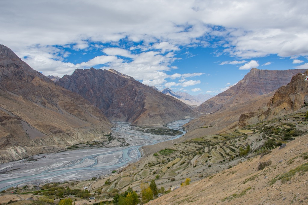
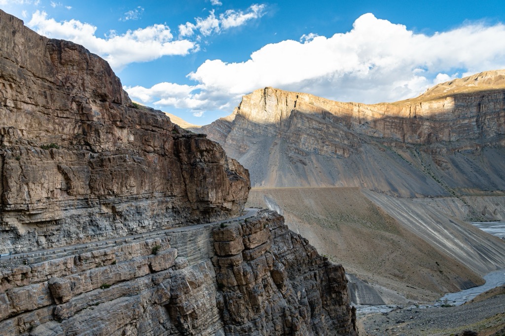
Pin Valley showcases a variety of geological features. The rugged terrain, characterized by steep slopes and deep gorges, is sculpted by the Pin River, a tributary of the Spiti. The river cuts through the valley, revealing layers of rock strata and creating dramatic landscapes. The valley's high-altitude cold desert conditions contribute to its unique geomorphology, characterized by stark mountain faces, rock spires, and scree slopes.
The valley's high relief and steep gradients have led to the formation of many sheer cliffs, resulting from tectonic uplift and differential erosion, a process by which softer rocks erode faster than harder ones, leading to dramatic vertical drops.
Due to the sparse vegetation, the rocks in the park are directly exposed to the strong winds prevalent at high altitudes. Over time, these winds, carrying sand and small particles, erode down the rock surfaces. This process, known as aeolian erosion, results in fascinating rock formations, such as pinnacles, hoodoos, and natural arches, each sculpted into intricate shapes by the wind.
The park's landscape is a result of glacial activity. Glacial moraines—accumulations of dirt and rocks left in the path of moving glaciers—lie throughout the park. The extreme temperature fluctuations, especially the freeze-thaw cycles, also contribute to frost weathering. Water seeps into cracks during warmer periods and freezes during colder periods, expanding and gradually breaking the rock apart. This process leads to the formation of angular rock fragments and scree slopes, distinctive features in high mountain environments like Pin Valley.
The sporadic but intense rainfall in the region also forms alluvial fans and cones at the mouths of gorges. As water rushes down the steep slopes during heavy rains, it carries sediment and debris, depositing these materials at the valley floor and creating fan-shaped or conical deposits.
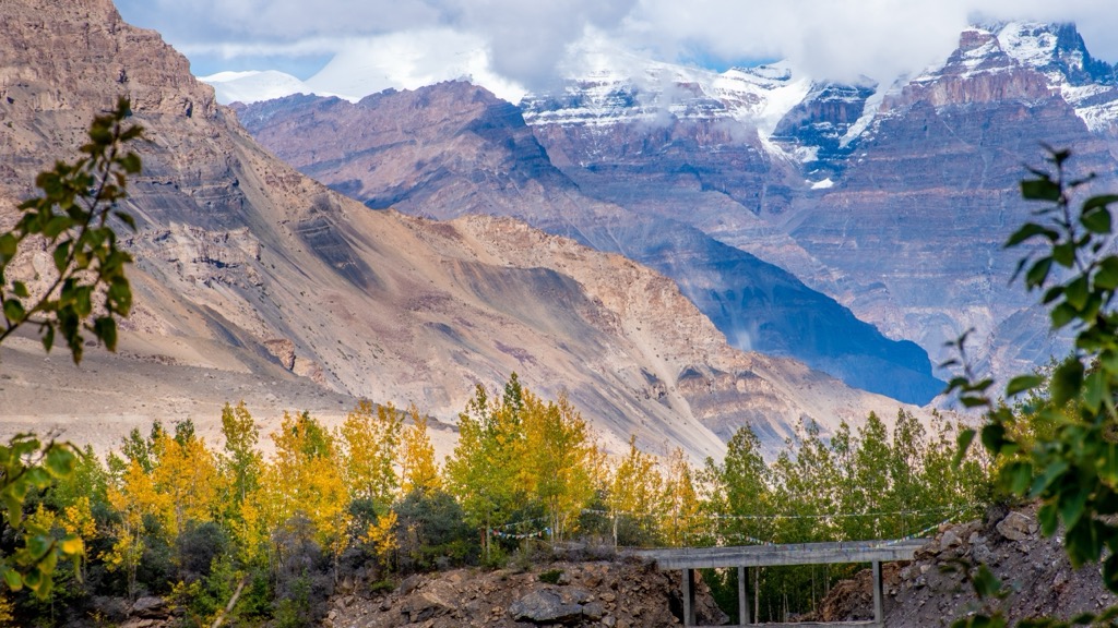
The flora in Pin Valley National Park is minimal and sparse, at least in comparison to nearby parks like Khirganga and Great Himalayan, which benefit from India’s seasonal monsoons and are much less arid.
As a result, the plant life that does exist here is characterized by its adaptability to extreme weather, low oxygen levels, and poor soil conditions. Species tend to be stunted, hardy, and able to survive with minimal water. Still, there are over 400 documented plant species within the park's boundaries. Alpine grasses and small shrubs dominate the landscape, particularly in areas not covered by snow for parts of the year.
During the brief summer, when the temperature rises and the snow melts, the valley transforms with greenery and wildflowers blooms. This seasonal burst of life is crucial for the local wildlife, providing food and habitat.
Junipers are one of the most noticeable trees in the area. These hardy conifers can withstand harsh, dry conditions and are often found on rocky slopes. They are both ecologically and culturally significant and are often used by locals in traditional medicines and rituals. Various species of willow are also found along the banks of streams and rivers in the park. These trees are well adapted to the moist conditions near water bodies and play an essential role in erosion prevention.
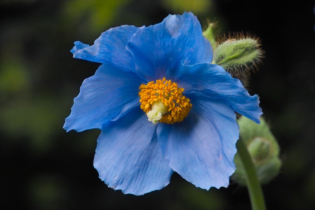
Other notable species of flora include sea buckthorn (Hippophae rhamnoides), known for its bright orange berries and highly valued for its nutritional and medicinal properties. The Himalayan Blue Poppy (Meconopsis) is a striking blue flower and is a rare and delightful sight. It blooms in the summer months in the park’s alpine meadows. If you’ve ever seen Batman Begins, this is the flower Bruce Wayne takes to the League of Shadows.
Another trademark species is the edelweiss (Leontopodium). This famous mountain flower, often associated with the Alps, also grows in the higher regions of the Himalayas and Pin Valley. It’s known for its distinctive white, star-shaped flowers.
The Pin Valley area is also known for various medicinal plants, which have been used in traditional medicine for centuries. These include Ephedra gerardiana, Dactylorhiza hatagirea (Himalayan marsh orchid), and Aconitum heterophyllum.
Like the flora, the fauna of Pin Valley National Park is characterized by species that have evolved to survive in an environment with limited oxygen, extreme cold, and scarce food resources.
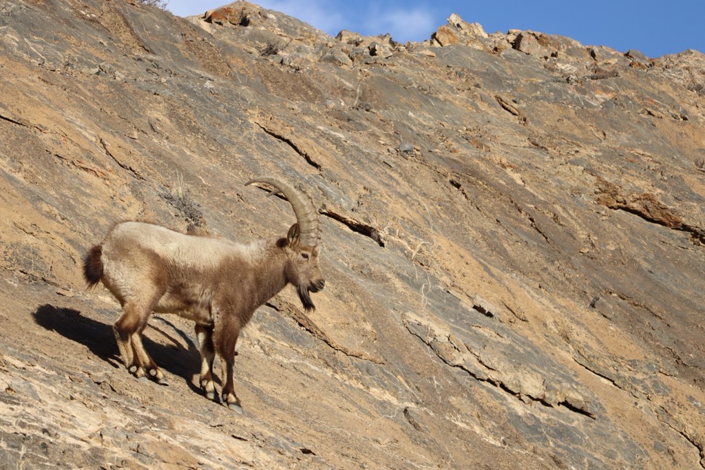
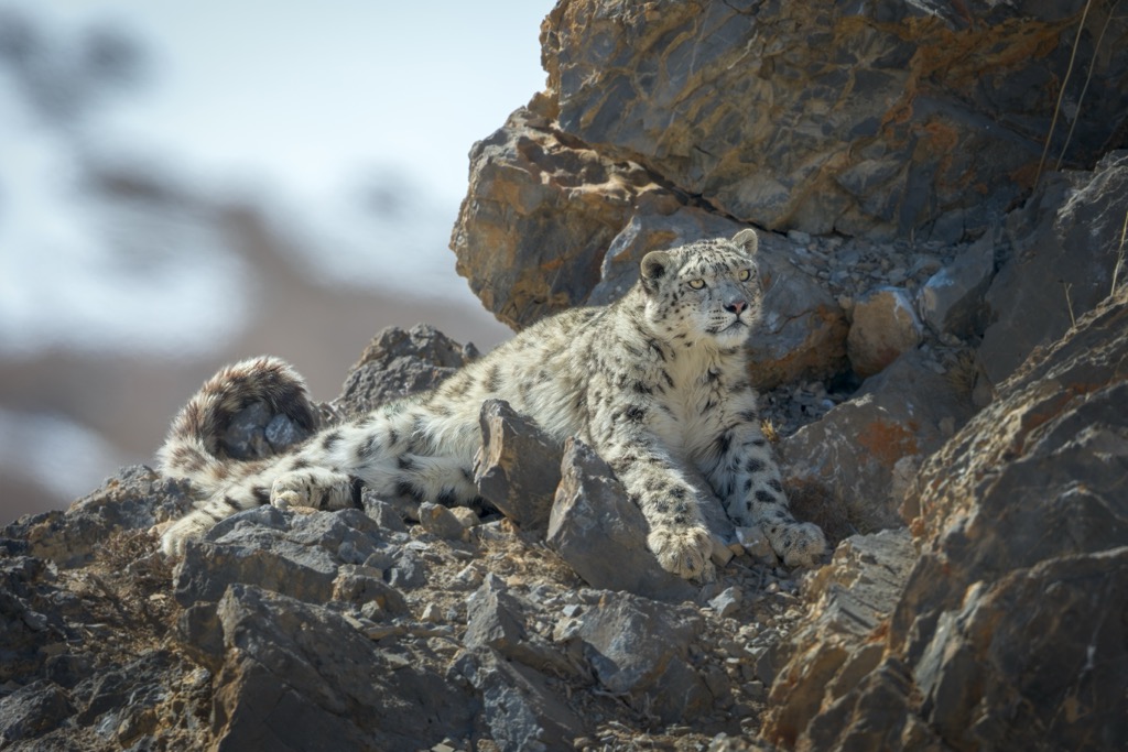
Elusive snow leopards (Panthera uncia) are rare and endangered big cats well-adapted to the cold, rugged terrain of the Himalayas. Their thick fur and wide, fur-covered feet make them well-suited for the snowy landscape. Siberian ibex (Capra sibirica) are large and sturdy mountain goats commonly seen on the park’s steep, rocky slopes; they are known for their impressive curved horns and agility in navigating the treacherous terrain.
The Himalayan marmot (Marmota himalayana) is another common sight. These large ground squirrels are often seen sunbathing on rocks during the day. Marmots are social animals living in colonies, and their loud whistles can be heard as a warning signal when predators are nearby.
Other notable fauna include:
Avian life includes:
The history of human habitation in the Pin Valley goes back several thousand years. However, the harsh and remote nature of the region meant that, like many other regions in Himachal Pradesh, it was one of the last places in the Indian subcontinent to be settled. Early inhabitants were nomadic, moving with the seasons and the availability of resources. Over time, these nomadic groups settled into small, isolated communities, adapting their lifestyles to the extreme conditions of the high-altitude desert.
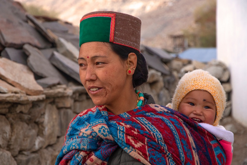
The region is particularly unique in India in that its culture and history have been profoundly influenced by its proximity to Tibet. The Pin Valley has served as a bridge between India and Tibet, with the exchange of cultural and commercial practices. The inhabitants traded staples like salt, wool, and semi-precious stones; this proximity also resulted in the influx of Buddhism, which came to the region around the 8th century and significantly shaped the valley’s socio-cultural fabric. It is one of the few regions in India where Buddhism is the predominant religion.
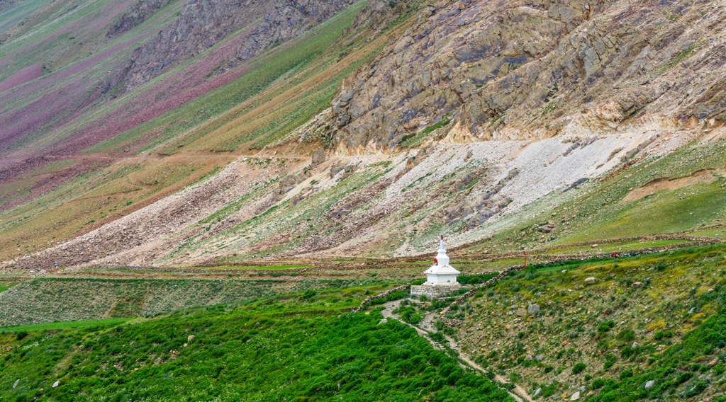
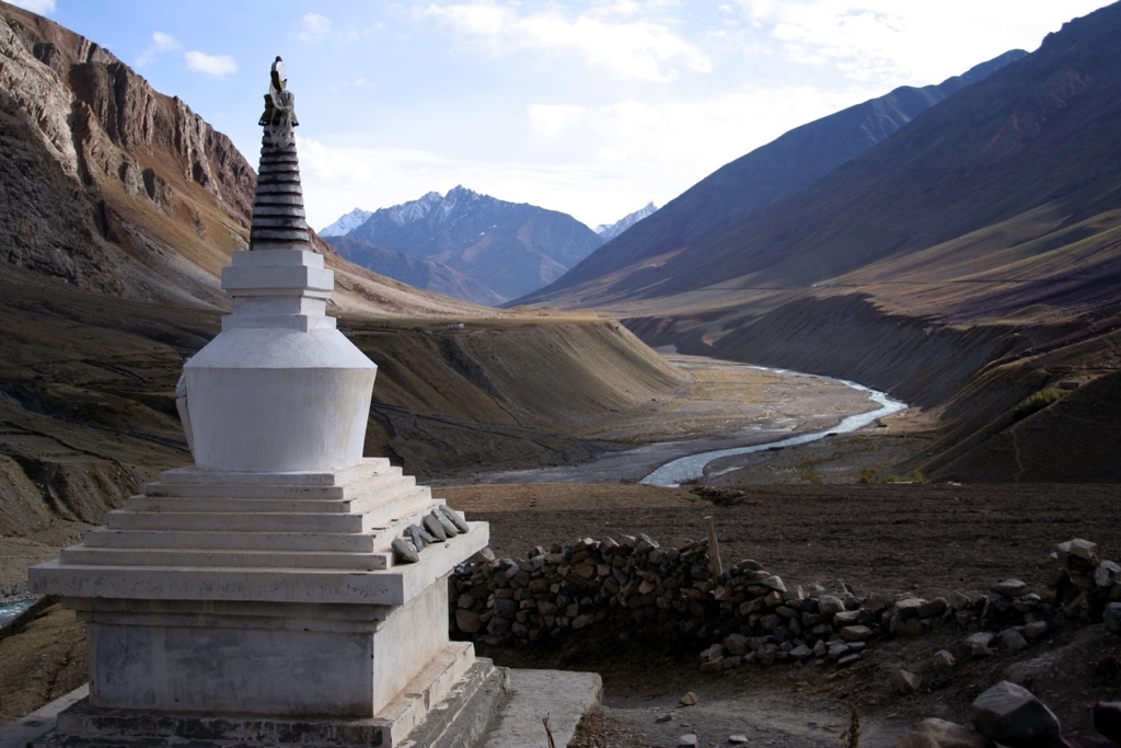
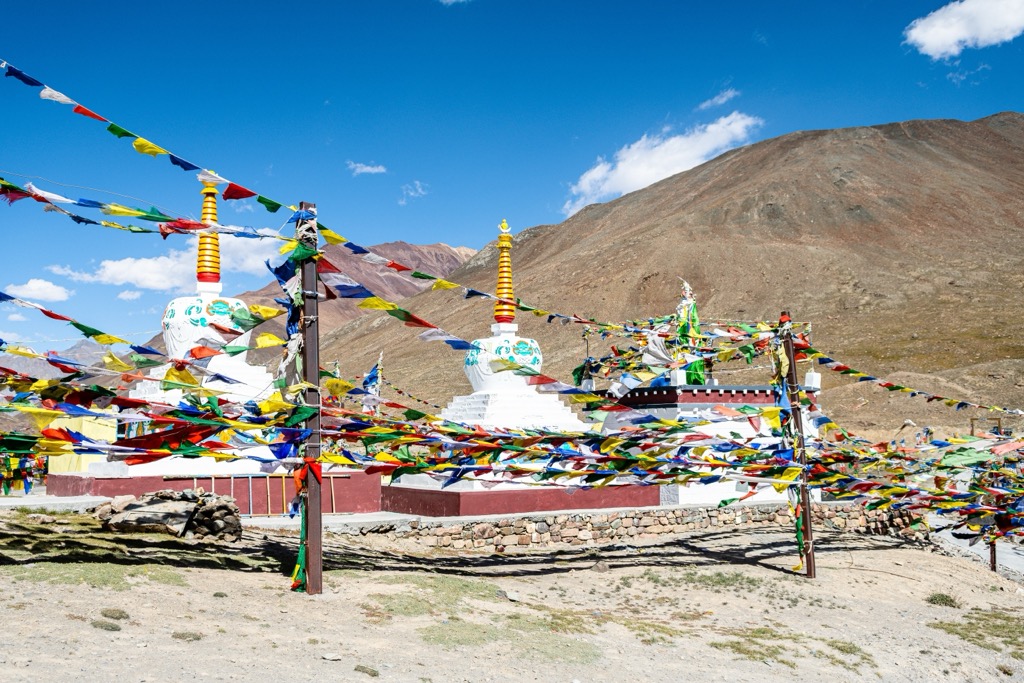
Spirituality has always been a significant aspect of life in Pin Valley. The valley is dotted with gompas (Buddhist monasteries) and chortens (stupas), which are central to the spiritual and cultural lives of the people. These religious sites are not only places of worship but also serve as community centers and preserve the valley's rich oral history and traditions.
Despite the challenging conditions, agriculture has been a cornerstone of human habitation for thousands of years. The communities have developed unique agricultural practices to cope with the cold desert climate. They rely on subsistence farming, cultivating hardy crops such as barley, peas, and potatoes. Animal husbandry is also integral, with yaks, goats, and sheep essential for wool, meat, and milk. The wool from these animals is used to make clothing and rugs, which is crucial for survival in cold temperatures.
Tibetan Buddhism was the primary influence in the region until the 17th century when Pin Valley came under the indirect influence of the Mughal Empire. However, the harsh terrain and remote location meant this influence was mostly limited to trade routes. By the early 19th century, the Sikh Empire under Maharaja Ranjit Singh had annexed the region. Nevertheless, few changes occurred due to the region’s remoteness.
With the latter advent of British rule in India, the region came under British administration. Like the Mughals and Sikhs before them, the British influence in the remote Pin Valley was minimal. The area remained isolated, with local communities continuing their traditional lifestyle. After independence (1947), the region was incorporated into the state of Himachal Pradesh. Pin Valley National Park was established in 1987.
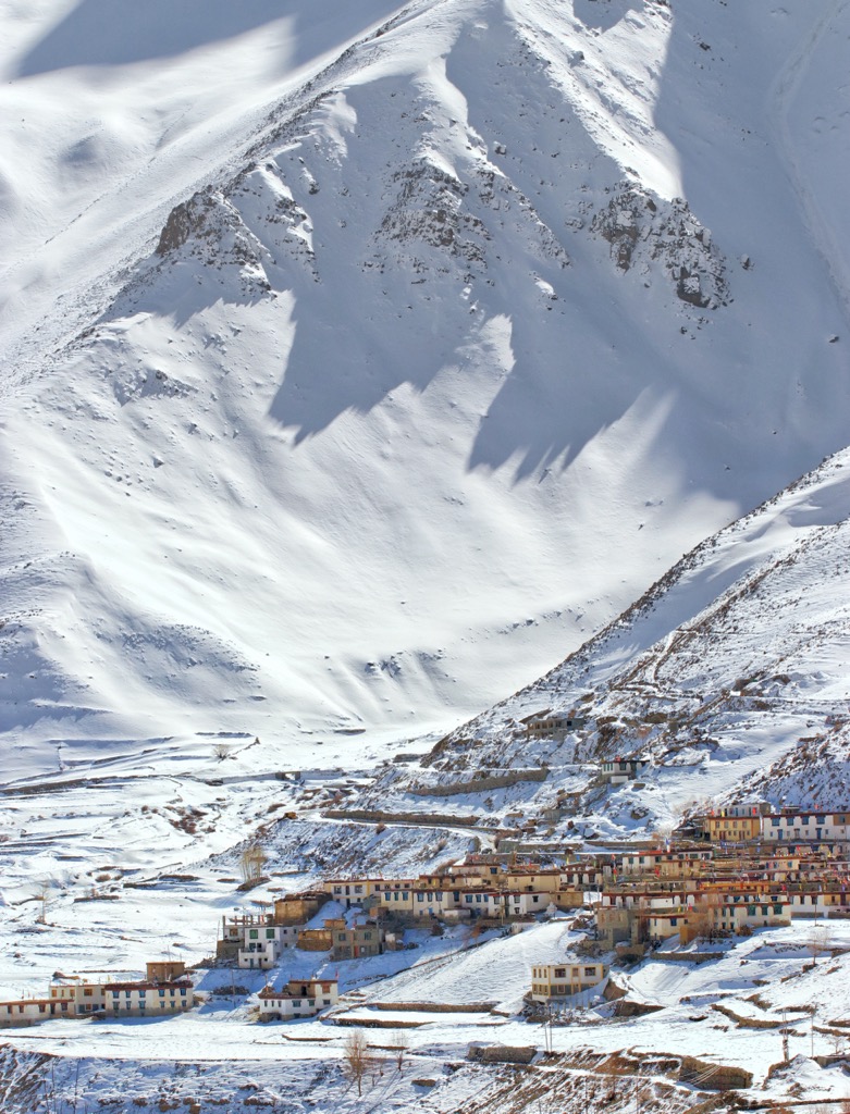
While Pin Valley National Park has no permanent residents, there are around 17 villages on the park's borders, with a population totaling only 1,600. With a population of 31,000 and a density of merely 2.3 people per square kilometer (5.9 / sq. mi), today Lahaul & Spiti is the least densely populated district in India.
Over half a dozen seasonal settlements inside the park, known as dogharies, are inhabited only during the warm summer months. Like elsewhere in Lahaul and Spiti, the residents are predominantly Buddhist.
In recent decades, tourism has become an increasingly important part of the economy in Pin Valley. The unique landscape, rich wildlife, and cultural heritage attract tourists from around the world. Cultural festivals and traditions play a vital role in tourism and the community life of Pin Valley. Festivals like Losar (Tibetan New Year) and Saka Dawa (the birth of Buddha) are celebrated enthusiastically, showcasing traditional music, dance, and cuisine. The influx of humanity has brought economic benefits but also challenges in balancing conservation and cultural preservation with development.
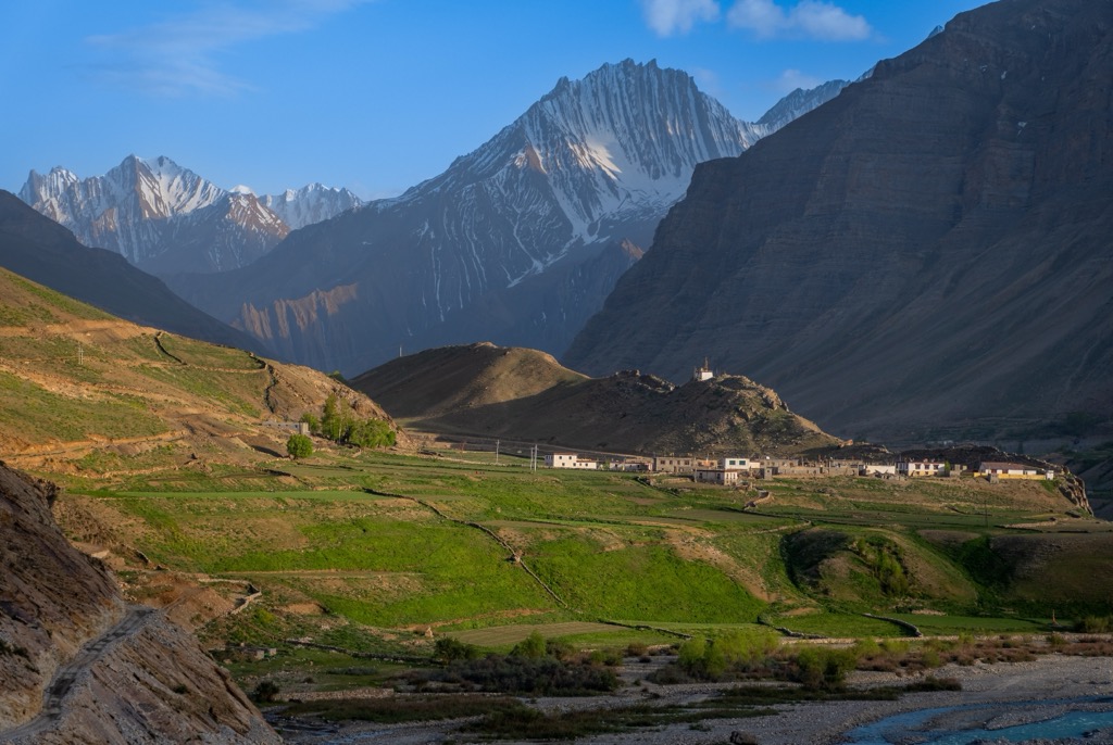
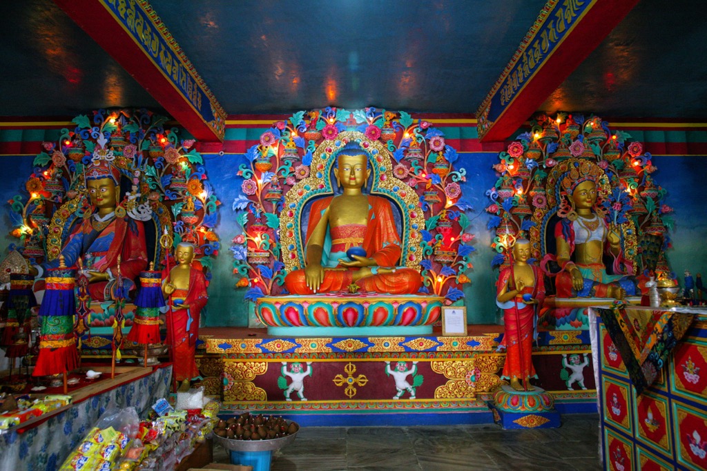
No visit to Pin Valley is complete without a stop at the ancient Kungri gompa (Tibetan Buddhist monastery), built around 1330 AD. The cham and buchen dances—performed by this gompa's lamas—are famous in the valley. The former (cham) is typically performed to bring merit, a form of meditation and offering to the gods, while the latter (buchen) drives out evil spirits.
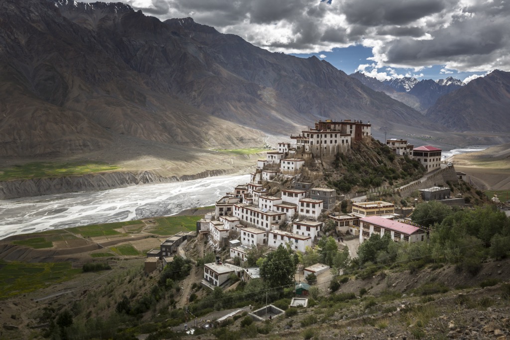
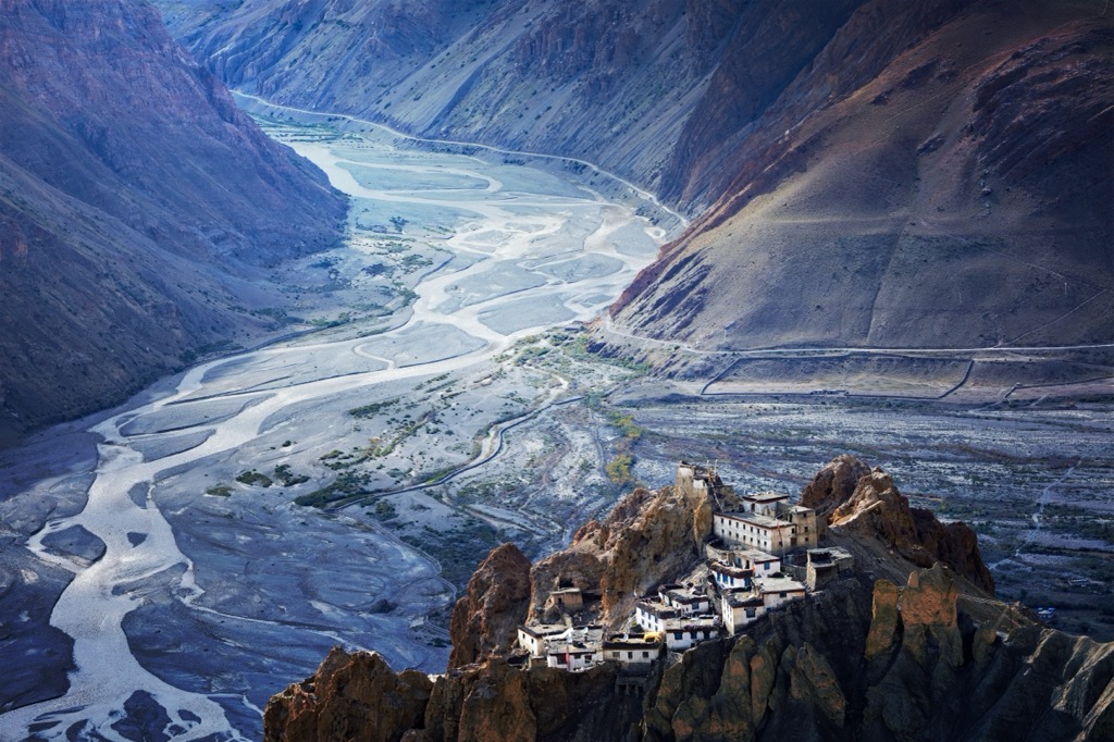
Travelers can reach the Kungri by car but can also trek around four to five hours up the Pin River (recommended) from the Spiti confluence at Samling. This town is 10 minutes south by car from Pin Valley National Park’s main entrance. En route to Samling, be sure to stop at the frozen waterfall at Lingti on the north banks of the Spiti River. Just a few kilometers southeast, there is another striking monastery at Dhankar, perched on the banks of the cliffs above the town.
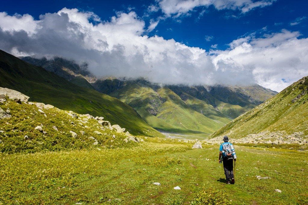
Also described in our Khirganga National Park page, this lengthy one-way trek takes intrepid hikers from Spiti to the Parvati Valley over the Pin Parvati pass at 5,306 meters (17,408 ft), or can be completed in reverse, from Parvati to Spiti. Exact distances vary depending on the start and end point. Still, most travelers take at least six days to complete the trek in one direction with time for sightseeing, covering around 80 kilometers (50 mi) with 4,200 meters (14,000 ft) of elevation gain.
The Pin Bhaba Pass, like the Pin Parvati, takes hikers up to a high-altitude pass and over into the lush Bhaba Valley from the cold, arid deserts of Spiti and the Pin Valley. Most full-trek itineraries are seven to nine days, though the trekking itself takes about four or five days, with a total on-foot distance of 51 kilometers (31.6 mi).
You’ll reach around 4,865 m (15,961 ft) at the Bhaba Pass. This trek is shorter and entails less elevation gain than the Parvati, and many outfitters run trips from Spiti, Kullu, and even Shimla.
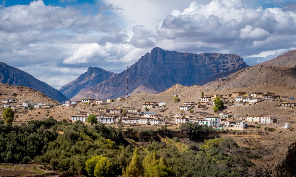
Kaza (Kuzu) is the vibrant capital and largest town in Spiti. Although rich in cultural heritage and natural beauty, Kaza is still a tranquil settlement, home to only 3,200 people. Kaza is perched at about 3,800 meters (12,467 ft); the surrounding mountainscape features a stunning amalgamation of barren peaks, crystal-clear rivers, and expansive skies.
The town serves as a crucial hub for travelers and adventurers exploring the Spiti Valley, offering a base for excursions to various monasteries like Key, Tabo, and Dhankar, as well as access to Pin Valley National Park. The market, with its array of shops and eateries, buzzes with a mix of local residents and tourists, offering everything from daily necessities to traditional handicrafts and Tibetan souvenirs.
Despite its remote location, Kaza is known for hospitality and modern facilities, including guesthouses, cafes, and internet connectivity, all blended with traditional Spiti architecture. The town is also a center for cultural immersion, with annual Buddhist festivals and rituals reflecting the deep spiritual ethos of the region.
In years past, Kaza was the only semi-developed settlement in the region, but with increasing tourism in Spiti, the small towns like Mud (Mudh), on the border of Pin Valley and the banks of the Pin River, are also beginning to offer a number of homestays and guesthouses. Mud (pop. 210) has no established restaurants, so it’s best to dine at your homestay or guesthouse. Mud is a typical base for treks in the park and the last village on the Spiti side of the Pin Parvati and Pin Bhaba treks.
Mud became famous among geologists in the 1860s because of a vast array of visible strata called the Muth Formation, stretching over 300 meters (965 ft) high. The weather-resistant layer consists of white quartz arenite, contains a variety of ripple marks and burrows, and dates to around 420 million years ago.
Situated along the banks of the southern-flowing Beas River, Kullu (pop. 18,500) is the largest town in the Kullu district, which borders Lahaul & Spiti to the west. It is around 223 kilometers (138 mi) from Kaza by car, and although it’s far, it’s the closest town with an airport, which operates daily flights from New Delhi and Chandigarh. Buses also travel to Kullu from the south. To reach Pin Valley, head north from Kullu to Manali, continue north via the Atlal Tunnel, and then east to the pass at Kunzum La (4,551 m / 14,931 ft). The total trip to Kaza takes six to seven hours by private car.
The area around Kullu is renowned for beautiful temples—both Buddhist and Hindu—and vibrant festivals, like the Kullu Dussehra, a week-long celebration every autumn consisting of traditional foods, music, and dancing. Kullu also serves as a starting point for many treks and has whitewater paddling, rock climbing, and mountain biking opportunities. (I recently ranked this area among the best luxury climbing destinations for Climbing magazine.)
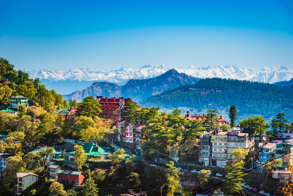
Traveling north from Himachal Pradesh’s capital, Shimla (pop. 171,000), is the only way to reach Pin Valley National Park in the winter, as the passes from Manali are closed. One would travel from Shimla to Tapri by bus, then Tapri to Kaza, from which point it is around 10 kilometers (6.2 mi) to Pin Valley National Park.
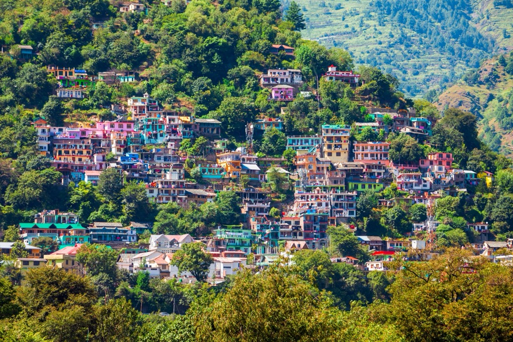
Shimla has been a popular tourist destination since the British colonial era and is renowned for its colonial architecture, lush greenery, and pleasant climate. At an elevation of approximately 2,200 meters (7,200 ft), it offers a respite from the boiling plains of North India, especially during summer.
The city's history as the summer capital of British India is evident in its Victorian-style architecture, particularly the historic Christ Church, the Ridge, and the Mall Road, Shimla's main street. The latter is a bustling thoroughfare, lined with shops, cafes, and colonial buildings, and a hub of activity for both locals and tourists. Shimla is also known for the Kalka-Shimla Railway, a narrow-gauge railway offering panoramic views of the nearby hills and valleys.