
Scan the QR code and open PeakVisor on your phone
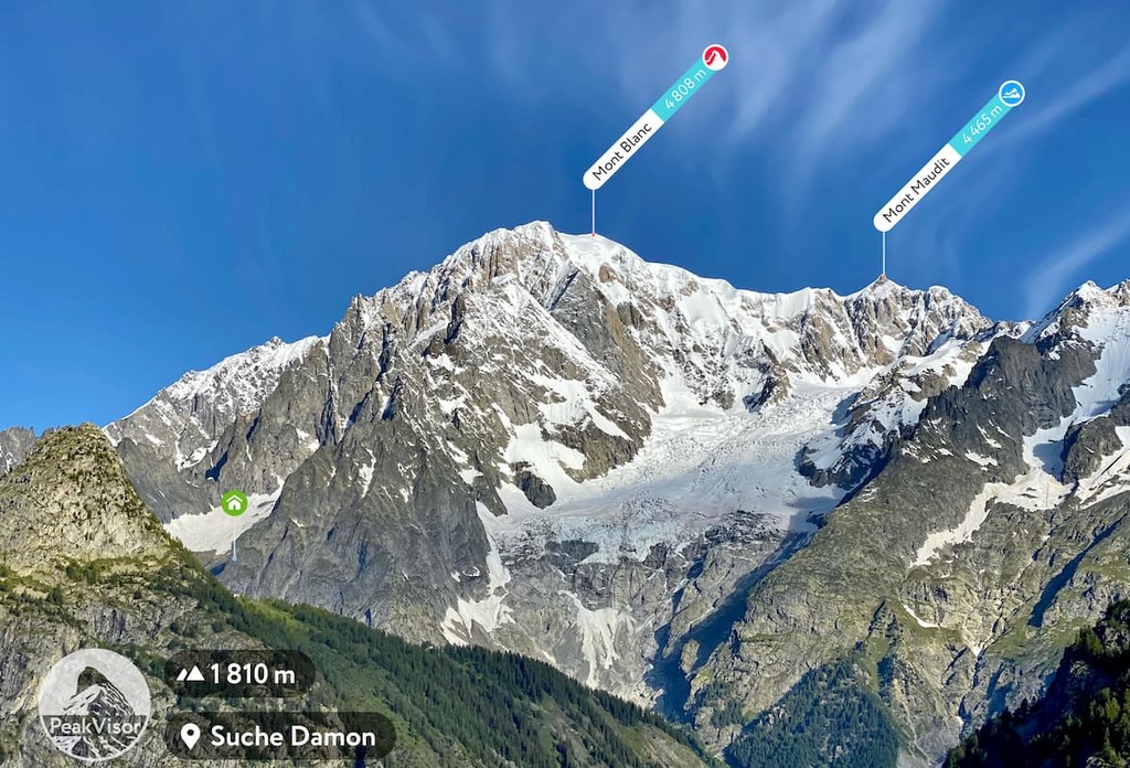
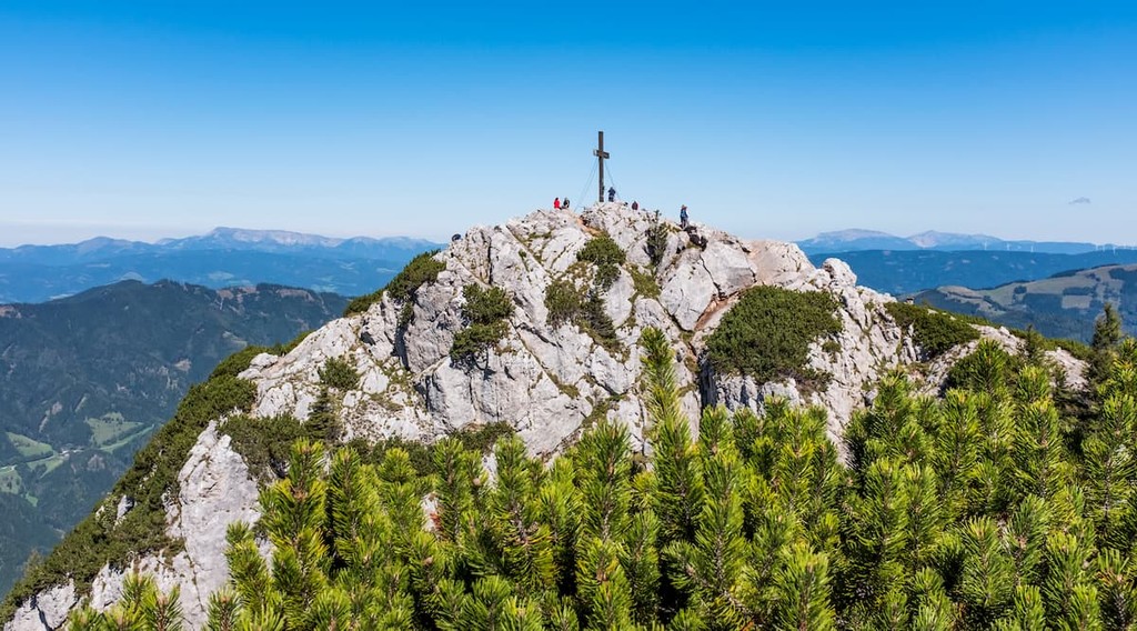
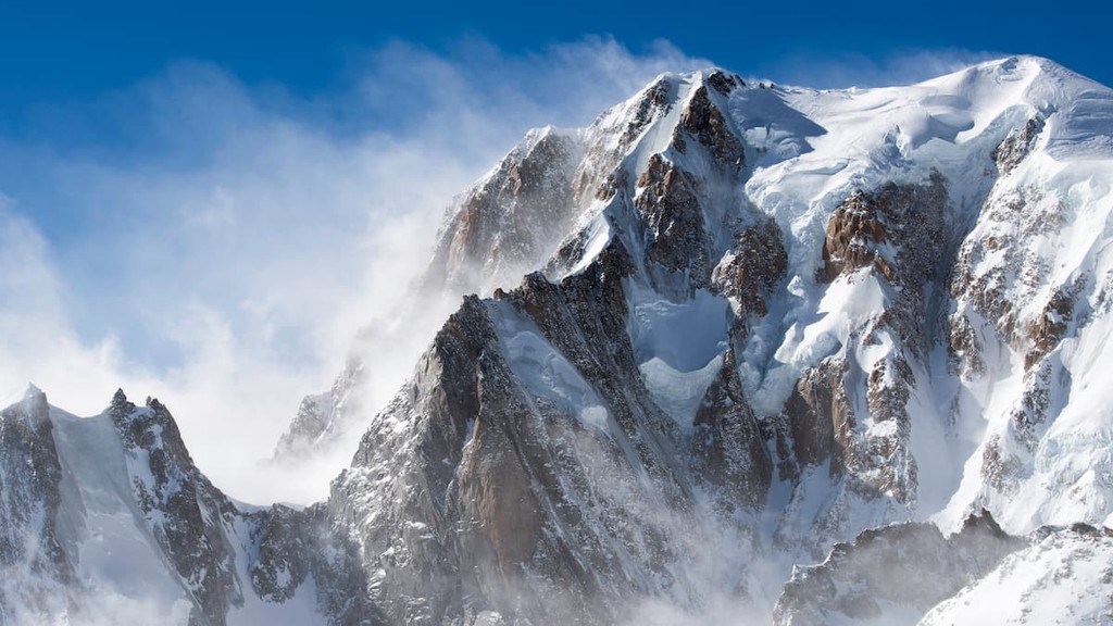
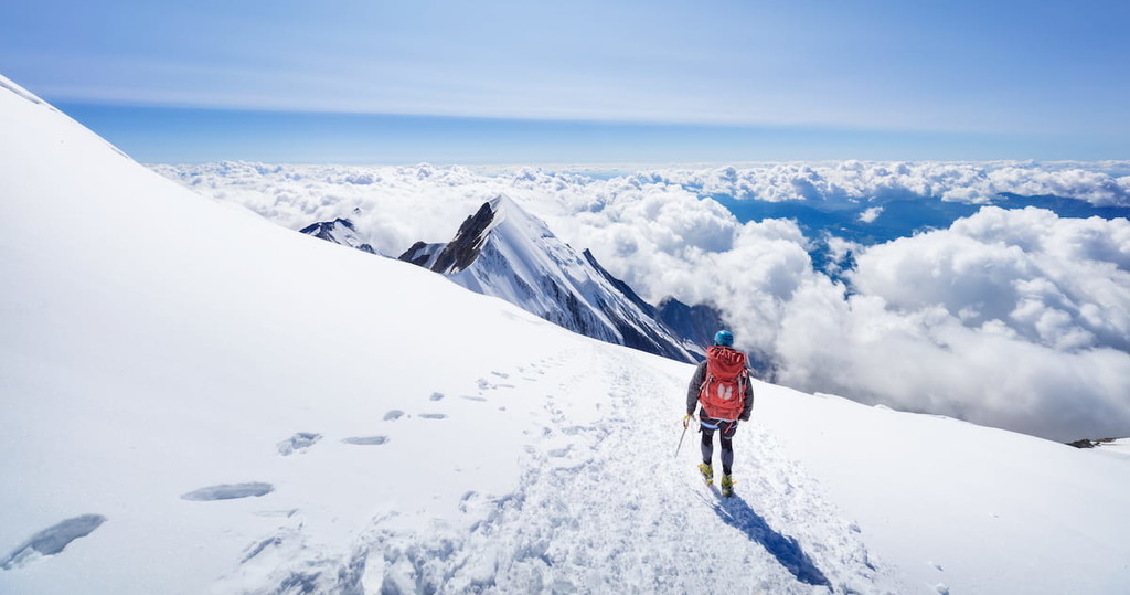
The loftiest mountain range wholly contained in Europe, the Alps are a major collection of rugged peaks that stretch for some 1,200 kilometres (750 miles) across 8 countries. As a whole, the Alps contain 60,614 named mountains, the highest and most prominent of which is Mont Blanc (Monte Bianco) at 4,808m/15,774ft on the border of France and Italy.
Covering a wide swath of south-central Europe, the Alps (Alpi/Alpes/Alpen/Alpe) are one of the world’s major mountain ranges.
The range forms a crescent shape across 8 countries, collectively known as the Alpine States. In particular, the Alps are located within France, Monaco, Germany, Italy, Liechtenstein, Slovenia, Switzerland, and Austria, though the majority of the range is located within Austria, France, Italy, and Switzerland. There are also some who argue that the Kőszeg Mountains of Hungary are part of the Alps, but this is not widely accepted.
While the technical delimitation of the Alps is the subject of much debate, it’s generally accepted that the Alps are a range that stretches from France in the west to Slovenia to the east.
Moreover, although the Alps are the most extensive and loftiest single system of mountains in south-central Europe, they are surrounded by other ranges on all sides.
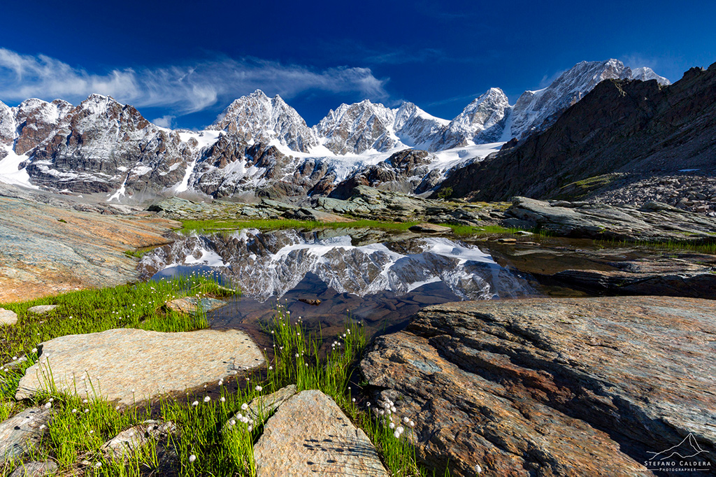
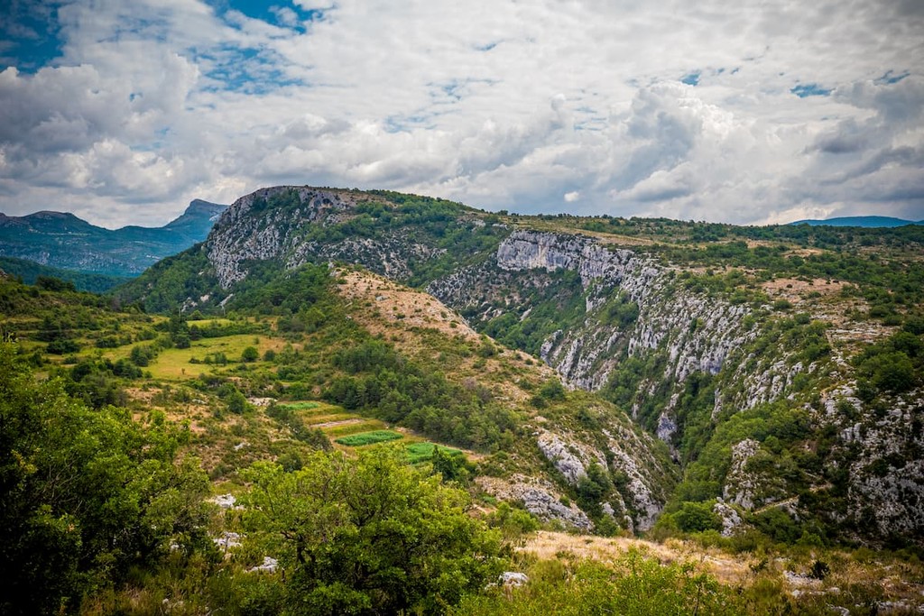
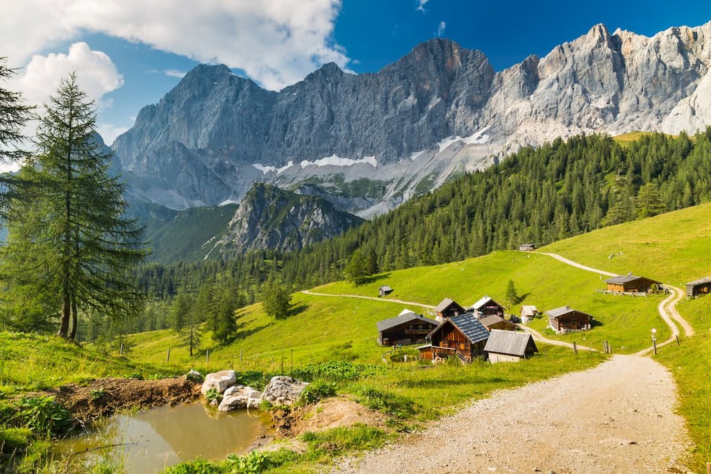
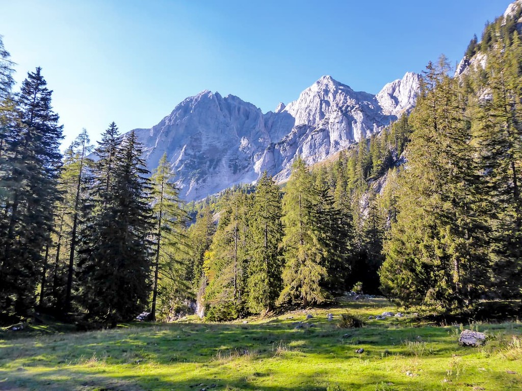
Dolomites, Italy
The Alps are located to the east of the Massif Central in France and to the east of the Jura Mountains of both France and Switzerland. Meanwhile they are situated to the south of the Black Forest in Germany and the Bohemian Ranges of Germany, Czech Republic, Poland, and Austria.
Additionally, the range is located to the west of the Carpathian Mountains of Slovakia, Hungary, Ukraine, Romania, and Serbia, as well as to the west of the Dinaric Alps (not part of the Alps proper) of Slovenia, Bosnia and Herzegovina, Albania, Kosovo, Serbia, and Croatia. Finally, the range is to the north of the Apennines, which covers much of the Italian Peninsula.
Within the Alps, there are 36 sections, as defined by the SOIUSA system (Suddivisione Orografica Internazionale Unificata del Sistema Alpino).
Also called the ISMSA (International Standardized Mountain Subdivision of the Alps), the SOIUSA is an informal system that separates the European Alps into 2 main parts (East and West), 5 sectors (Southwestern, Northwestern, Central, Northeastern, and Southeastern), and 36 sections, as defined below.
The westernmost part of the Alps, the Dauphiné Prealps (Préalpes du Dauphiné) are located in France’s Auvergne-Rhône-Alpes and Provence-Alpes-Côte d'Azur regions. Within the range, there are 2,352 named mountains, the highest and most prominent of which is Grande Tête de l’Obiou.
Known for their abundance of winter sports opportunities during the colder months of the year, the Dauphine Prealps are also popular during the summer. Some of the more popular activities in the region include hiking, cycling, hang gliding, and taking scenic cable car tours to the tops of some of the Dauphine Prealps’ stunning peaks.
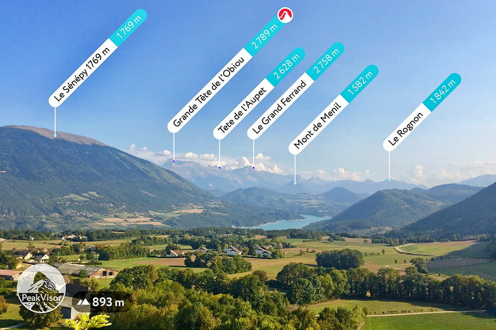
The range is home to a handful of parks, including Parc naturel régional du Vercors and the Réserve naturelle des Hauts Plateaux du Vercors. Major peaks in the range include Mont Aiguille, Grande Tête de l’Obiou, Pic de Bure, Grand Veymont, and Tête de la Cluse.
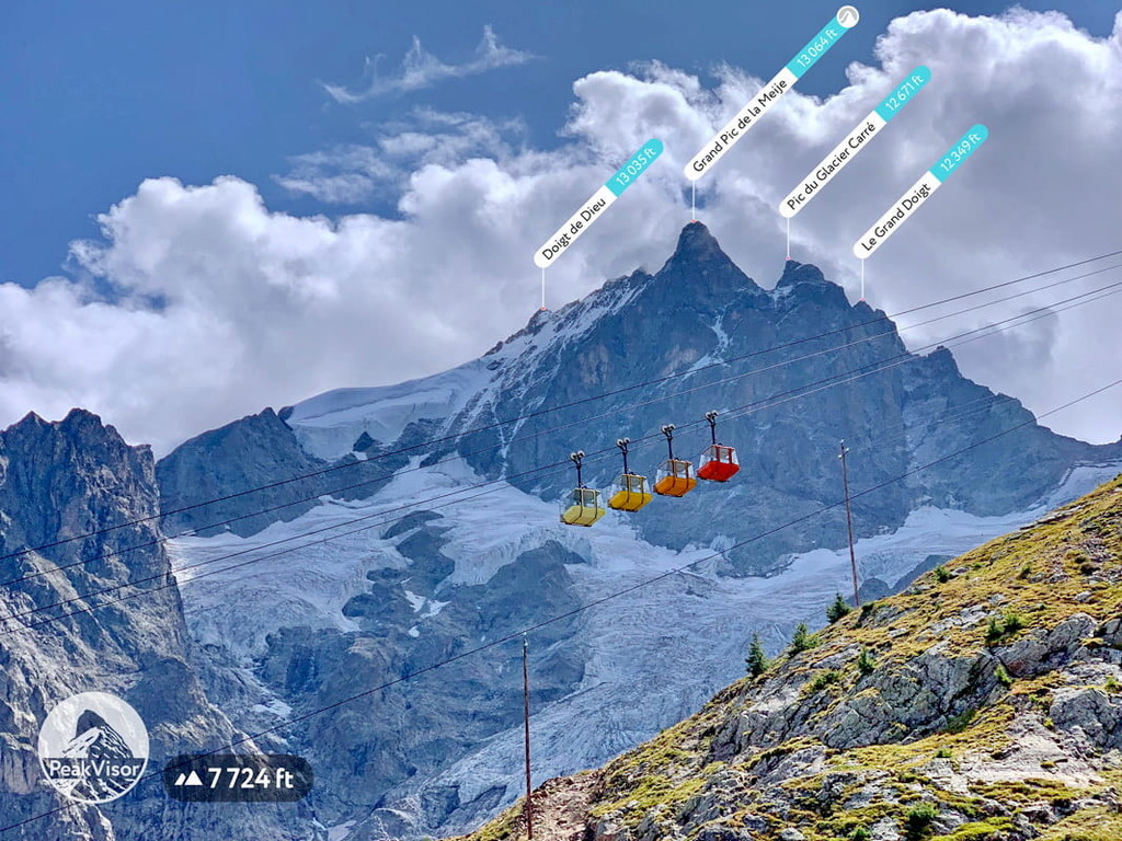
Located to the east of the Dauphiné Prealps, the Dauphiné Alps (Alpes du Dauphiné) are a collection of peaks in southeastern France’s Auvergne-Rhône-Alpes and Provence-Alpes-Côte d’Azur regions. The range is home to 1,614 named peaks, the highest and most prominent of which is Barre des Écrins.
Boasting dozens of peaks over 3,000m (9,800ft), the Dauphiné Alps are an excellent place for high-elevation adventures. There are many ski resorts found throughout the range as well as plenty of gondolas that provide easy access to the higher slopes. Moreover, the range is located along the Tour de France Route as its many passes pose quite a challenge for cyclists.
Perhaps the most popular hiking area located in the Dauphiné Alps is Parc national des Écrins, which offers a great assortment of trails to enjoy, such as the GR54.
Major peaks in the Dauphiné Alps include Barre des Écrins, Dôme de Neige des Écrins, Grand Pic de la Meije, L’Ailefroide, and Mont Pelvoux.
The southwesternmost of the Alps subranges, the Provence Alps and Prealps are located in France’s Provence-Alpes-Côte d’Azur region. There are 1,830 named mountains in the range, the highest of which is Tête de l’Estrop and the most prominent of which is Mont Ventoux.
Within this region, there are plenty of excellent parks to check out, each of which offer fantastic hiking areas. Some of the best parks include Parc naturel régional du Queyras, Parc national des Écrins, Parc national du Mercantour, and Parc Naturel Regional du Verdon.
While the Provence Alps and Prealps are not the highest of the Alps, they are known for their unique landscapes. Many of the region’s major peaks, such as Tête de l’Estrop, Mont Ventoux, Grande Séolane, and Mourre de Chanier offer excellent views and stunning hiking scenery.
Situated in southeastern France’s Auvergne-Rhône-Alpes region and Switzerland’s Valais canton, the Savoy Prealps contain a small subrange known as the Chartreuse Mountains and other peaks to the east and southeast of Geneva. The range contains 1,272 named mountains, the highest and most prominent of which is Haute Cime.
Like many of the other nearby Alps subranges, the Savoy Prealps are popular amongst skiers. However, the subrange also contains a great collection of parks, which make for great hiking destinations. Some of the most popular parks include:
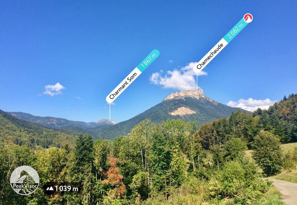
Major peaks in the Savoy Prealps include Chamechaude, Charmant Som, Dent de Crolles, Mont de Grange, La Pointe Blanche, Haute Cime, Tour Sallière, Arcalod, and Pointe Percée, and La Tournette.
Covering parts of Provence-Alpes-Côte d'Azur in France, Piedmont and Liguria in Italy, and Monaco, the Maritime Alps are a small subrange of the Alps located along the Mediterranean Coast. The range contains 1,682 named mountains, the highest of which is Cima Sud Argentera, and the most prominent of which is Cima Nord Argentera.
Known for their stunning scenery and drastic relief over the Mediterranean below, the Maritime Alps are home to many small villages which are perched on the range’s many cliffs. There are also quite a few via ferrata routes in the Maritime Alps, as well as a handful of parks, such as Parc national du Mercantour in France and Parco naturale delle Alpi Marittime in Italy.
Major peaks in the range include Cima Nord Argentera, Mont Pelat, Tête de Siguret, Cime du Gelas, and Sommet de la Frema.
A truly coastal Alps subrange, the Ligurian Alps are located in Italy’s Liguria and Piedmont Regions. They contain 1,272 named mountains, the highest of which is Punta Marguareis, and the most prominent of which is Monte Armetta.
Due to the proximity of the Mediterranean, the Ligurian Alps tend to have quite a lot of prominence over the water below. The range offers spectacular vistas of the surrounding region. There are dozens of alpine refuges within the range, which are fantastic places to stay if you’re on a longer hiking adventure.

Within the Ligurian alps there are many ski areas, as well as a handful of parks, such as Parco naturale del Marguareis, Parco regionale di Bric Tana, and Parco naturale regionale delle Alpi Liguri.
Major peaks in the range include Punta Marguareis, Monte Mongioie, Cima delle Saline, Monte Armetta, and Cime de Marta.
Straddling the border between France and Italy, the Cottian Alps (Alpes Cottiennes/Alpi Cozie) are one of the most popular hiking destinations in the region. They contain 1,900 named mountains, the highest and most prominent of which is Monviso.
The range is home to thousands of kilometers of ski slopes, hundreds of ski lifts, and hundreds of kilometers of hiking trails. There are also quite a few protected areas that offer excellent backcountry adventure opportunities, such as:
Major peaks in the Cottian Alps include Monviso, Aiguille de Scolette, Aiguille de Chambeyron, Pic de Rochebrune, and Punta Caprera.
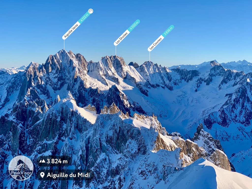
Encompassing parts of Switzerland’s Valais Canton, France’s Auvergne-Rhône-Alpes region, and Italy’s Aosta Valley and Piedmont Regions, the Graian Alps (Alpes grées/Alpi Graie) are some of the most rugged parts of the Western Alps. The range contains 2,227 named mountains, the highest and most prominent of which is the mighty Mont Blanc (Monte Bianco) at 4,808m (15,774ft).
Home to countless hiking areas, alpine refuges, and opportunities for adventure, the centerpiece of the Graian Alps is easily the combined Parc national de la Vanoise and Parco nazionale del Gran Paradiso regions.
The range is also known for its population of Alpine ibex and other wildlife. Hiking in the range is popular at the lower elevations, while technical climbing skills are a must for anyone looking to tackle the Graian Alps’ highest peaks.
Major mountains in the range include Mont Blanc (Monte Bianco), Pic Eccles, Mont Maudit, Gran Paradiso, La Grande Casse, and Mont Pourri.
Encompassing part of the Italian Piedmont and the Swiss Canton of Valais, the Pennine Alps (Alpes valaisannes/Walliser Alpen/Alpi Pennine/Valais Alps) are the second highest subrange of the Alps. Within the range, there are 2001 named mountains, the highest and most prominent of which is the Dufourspitze on Monte Rosa.
The range has a whole network of hiking trails, cable cars, and cog railways which offer unparalleled access to its upper slopes. Parks in the Pennine Alps include:
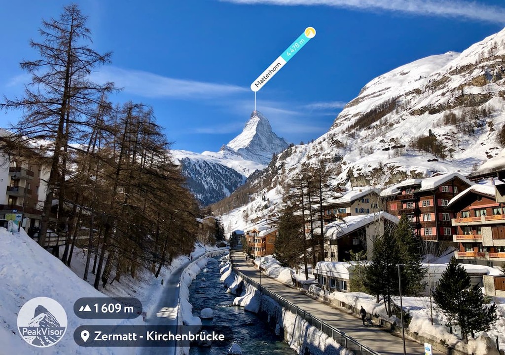
Moreover, the Pennine Alps are home to some of the Alps’ most recognizable peaks. Major peaks in the Pennine alps include Monte Rosa, the Matterhorn, the Weisshorn, Weissmies, the Dom, Grand Combin, Grandes Jorasses, and Dente Blanche.
Stretching across a wide section of Switzerland, the Bernese Alps (Berner Alpen/Alpes bernoises) are full of glaciated peaks and stunning alpine scenery, as well as some of the country’s most notable peaks. There are 1,127 named mountains in the range, the highest and most prominent of which is the Finsteraarhorn.
As with much of the Swiss Alps, the Bernese Alps contain hundreds of kilometers of hiking trails, cable cars, and cog railways which allow access to the slopes of the tallest peaks for experienced climbers. Parks in the range include Pfyn-Finges Nature Park.
Thanks to the range’s lofty elevation, it contains many of Switzerland's most iconic peaks. This includes Finsteraarhorn, Jungfrau, Eiger, Mönch, Schreckhorn, and Aletschhorn.
The northern part of Switzerland’s Alps, the Swiss Prealps are the foothills to the Bernese Alps. They cover parts of Switzerland from Lake Geneva through Lichtenstein to the Austrian border and they include 1,878 named mountains, the highest of which is Schilthorn and the most prominent of which is Säntis.
Thanks to the Swiss Prealps’ proximity to Bern, they are a very popular hiking destination. They also offer great views of the Eiger, Mönch, and Jungfrau from most of their tallest peaks. Popular parks in the range include:
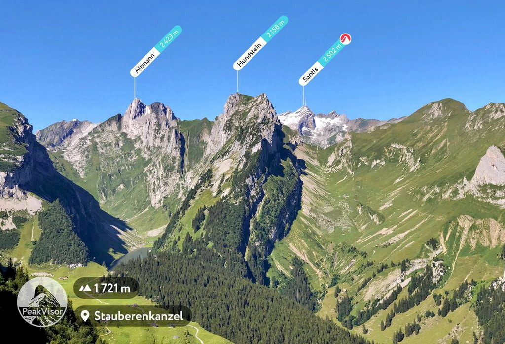
Major peaks in the Swiss Prealps include Schilthorn, Schwarzhorn, Gamsberg, Brienzer Rothorn, Rigi, and La Tarent.
Found in western Switzerland, the Glarus Alps (Glarner Alpen) are a collection of 809 named mountains, the highest and most prominent of which is Tödi. The range is mostly contained within the canton of Glarus and it is home to a UNESCO World Heritage Site.
Within the range, there are a number of glaciated peaks and stunning alpine lakes. There are also some fantastic cultural sites, including the towns of Chur and Sargans. Chur is often considered to be the oldest town in Switzerland while Sargans is best known for its beautiful castle.
Major peaks in the Glarus Alps include Tödi, Bifertenstock, Bächistock, Piz Giuv, and Oberalpstock.
Encompassing much of south-central Switzerland and north-central Italy, the Lepontine Alps (Lepontinische Alpen/Alpes lépontines/Alpi Lepontine) are located in Valais, Ticino, Uri, and Graubünden cantons and the Piedmont and Lombardy regions of Italy. They contain 1,737 named mountains, the highest of which is Monte Leone, and the most prominent of which is Monte Togano.
Although the Lepontinealps aren’t as lofty as some of their neighbors, they are home to some fantastic natural landscapes. There are also some popular parks, such as Parco Nazionale della Val Grande and some great cable cars.
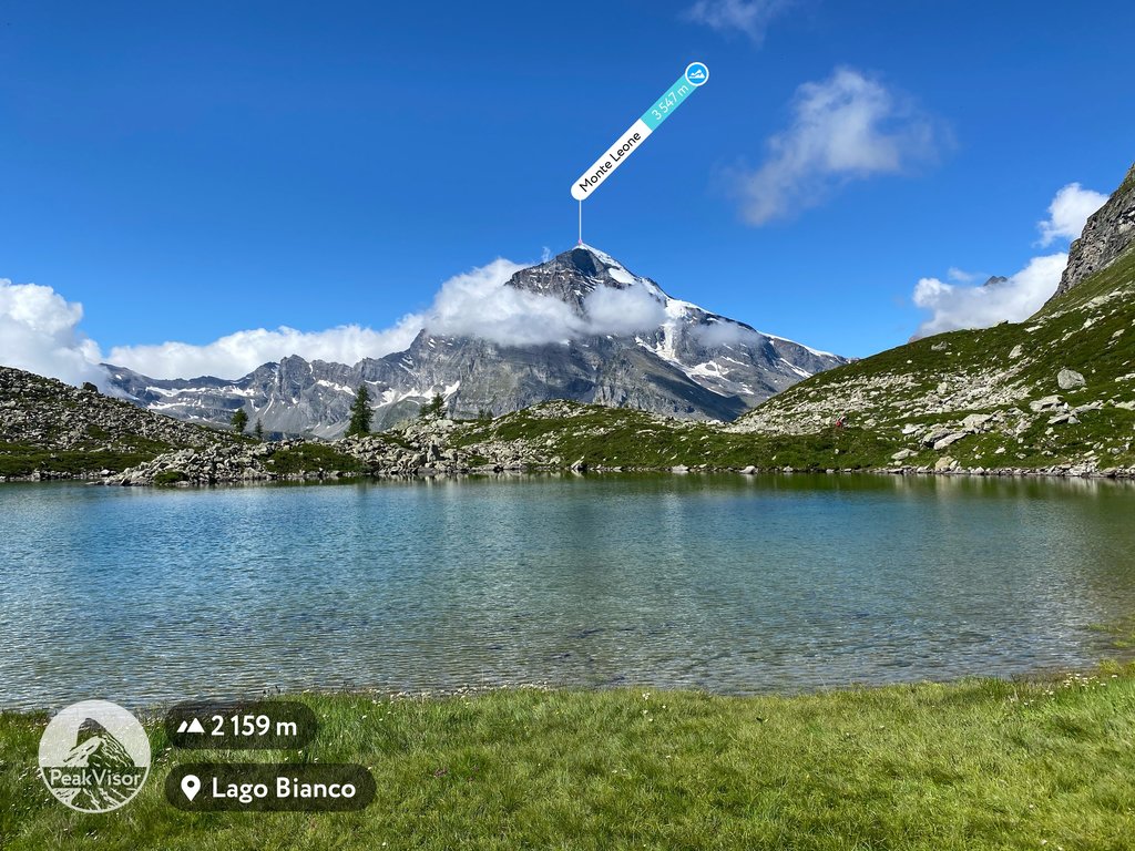
Major peaks include Monte Leone, Rheinwaldhorn, Güferhorn, Monte Togano, Monte Limidario, and Blinnenhorn.
A very small subrange of the Alps, the Lugano Prealps (Prealpi Lombarde Occidentali) are located in North-West Italy and southern Switzerland, near the city of Milan. They contain 426 named mountains, the highest of which is Pizzo di Gino, and the most prominent of which is Monte Tamarao.
Despite being quite small compared to other parts of the Alps, Monte Tamaro actually just barely misses the cut-off to be classified as an “Ultra” by only 93 m (305ft)! The range is also home to a great collection of trails and huts as well as Parco Regionale Campo dei Fiori.
Major peaks include Pizzo di Gino, Camoghe, Monte Tamaro, Monte San Primo, Monte di Tremezzo, and Monte Generoso.
Covering much of North-CentralItaly, the Bergamasque Alps and Prealps (Alpi e Prealpi Bergamasche) are a particularly rugged and rocky collection of peaks. There are 984 named mountains in the range, the highest and most prominent of which is Pizzo Coca.
The range is famous for its great mix of flora and fauna, which are easy to visit using the area’s network of mountain huts. There are also plenty of rivers and waterfalls throughout the range, which make for a nice hiking destination.
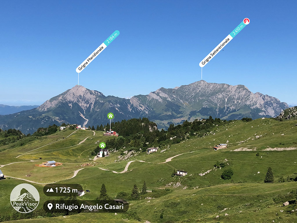
Major peaks in the range include Pizzo di Coca, Punta di Scais, Grigna Settentrionale, Pizzo Formico, and Monte Torrezzo.
One of the largest subranges of the Alps, the Western Rhaetian Alps (Alpi Retiche occidentali/Westliche Rätische Alpen) is a collection of 2,800 mountains that marks the delineation between the Western and Easter part of the range. The highest and most prominent mountain in the range is Piz Bernina.
This range covers parts of Switzerland, Italy, Austria, and all of Liechtenstein. It is home to the most dense concentration of glaciers in the Eastern Alps with well over 150 named glaciers. Moreover, there are a number of parks here, including:
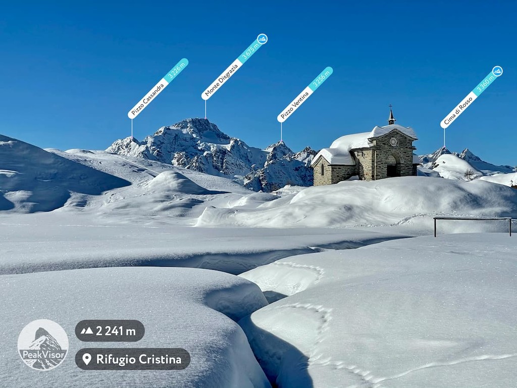
Major peaks include Piz Bernina, Piz Zupò, Piz Roseg, Piz Palü, Cima de Piazzi, and Monte Disgrazia.
Located just to the east of the Western Rhaetian Alps, the Eastern Rhaetian Alps (Östliche Rätische Alpen/Alpi Retiche orientali) are home to 1,946 named mountains, the highest and most prominent of which is the Wildspitze.
The Eastern Rhaetian Alps are firmly located in the Eastern Alps within Austria and northern Italy to the south of Innsbruck. They contain a number of parks, though the most notable are likely Naturpark Texelgruppe and Naturpark Ötztal, which are contiguous along the Italian/Austrian border.
Major peaks in the range include Wildspitze, Palla Bianca, Hintere Schwärze, Zuckerhütl, Glanderspitze, and Rietzer Grießkogel.
The southernmost part of the Rhaetian Alps, the Southern Rhaetian Alps (Südliche Rätische Alpen/Alpi Retiche meridionali) are found in North-East Italy to the northeast of Milan. They contain 1,143 named mountains, the highest and most prominent of which is Ortler.
Famous for their population of bears, the Southern Rhaetian Alps are also partially protected as a UNESCO World Heritage Site. They are also the location of the famous Giro d’Italia cycling event, though they are among the most remote of the Alps subranges. Also located within the range are both Stelvio National Park and Adamello-Brenta Nature Park.
Major peaks include Ortler, Gran Zebrù, Monte Cevedale, Cima Presanella, Cima Tosa, and Monte Adamello.
Located across the northwestern border of Austria and southern Germany, the aptly named North Tyrol Limestone Alps (Nordtiroler Kalkalpen) are a collection of jagged limestone peaks. The range contains 1,913 named mountains, the highest of which is Parseierspitze and the most prominent of which is Zugspitze.
While the range itself isn’t particularly lofty, it does cover a wide swath of land across Austria’s Tyrol state. It also includes a handful of parks and protected areas such as Schachen und Reintal and Karwendel und Karwendelvorgebirge.
Major peaks in the range include Parseierspitze, Zugspitze, Bikkarspitze, and Ellmauer Halt.
Covering much of the German state of Bavaria and the Austrain states of Tyrol and Vorarlberg, the Bavarian Alps (Bayerische Alpen) are a rugged collection of glacially-carved peaks. The range contains 2,182 named mountains, the highest of which is Mädelegabel, and the most prominent of which is Daniel.
Although Bavaria is a state of Germany, the Bavarian Alps refer just to the mountains in the southern part of the region. It is known for having large cirques, U-shaped valleys, and stunning lakes for hikers to enjoy. Some of the many parks in the range include:
Major peaks include Mädelegabel, Daniel, Hohes Licht, Großer Krottenkopf, Urbeleskarspitze Ostgipfel, Kreuzspitz, and Krottenkopf.
A small Alps subrange, the Brescia and Garda Prealps (Prealpi Bresciane e Gardesane) are located in North-East Italy to the east of Milan. The range contains 862 named mountains, the highest of which is Monte Cadria, and the most prominent of which is Monte Baldo - Cima Valdritta.
Throughout the range, there is an abundance of of hiking trails, including treks to some of the region’s alpine lakes. There’s also a long distance trail called Sentiero della Pace that stretches through a nearby town, so it’s the perfect day hiking destination.
Major peaks include Monte Cadria, Punta Setteventi, Monte Baldo - Cima Valdritta, Monte Bondone (Monte Cornetto), Monte Caplone, and Monte Misone.
The Venetian Prealps (Prealpi Venete) are located in North-East Italy to the north of Venice, forming the foothills of the Alps as they rise up from the Po Plain below. The range contains 1,082 named mountains, the highest of which is Col Nudo and the most prominent of which is Cima Dodici.
Although the range is fairly small, it is quite prominent due to the low-lying nature of the land to the south.In fact, many of the peaks in the range have a prominence of more than 1,000m (3,280ft). Parks in the range include Foresta dei Folignani and Foresta regionale del Prescudin.
Major peaks include Col Nudo, Cima Dodici, Col Visentin, Cima Carega, Monte Grappa, and Cima Palon.
Boasting stunning alpine terrain and staggering cliffs, the Dolomites (Dolomiti) are one of the most famous Alps subranges. Located in North-East Italy, the range contains 2,094 named mountains, the highest and most prominent of which is Marmolada.
Thanks to their beautiful scenery and plethora of climbing opportunities, the Dolomites have long been popular among mountaineers. Parks are abundant in the range and they include Parco Naturale Puez-Odle and Fanes-Sennes-Braise Nature Park.
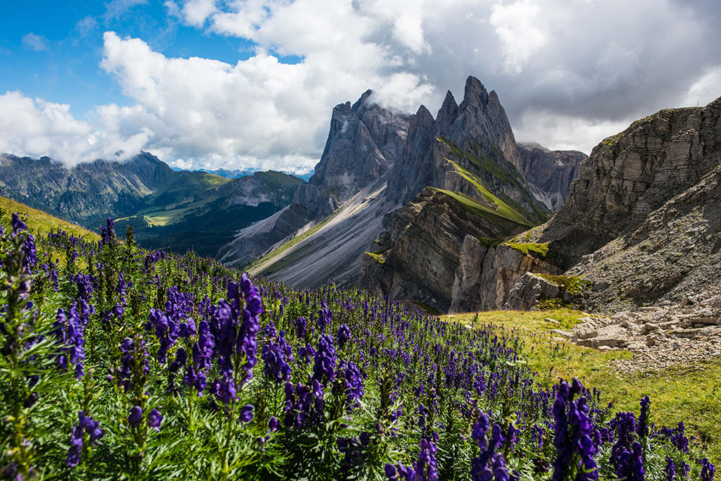
Major peaks include Marmolada, Antelao, Tofana di Mezzo, Tofana di Rozes, and Monte Cristallo.
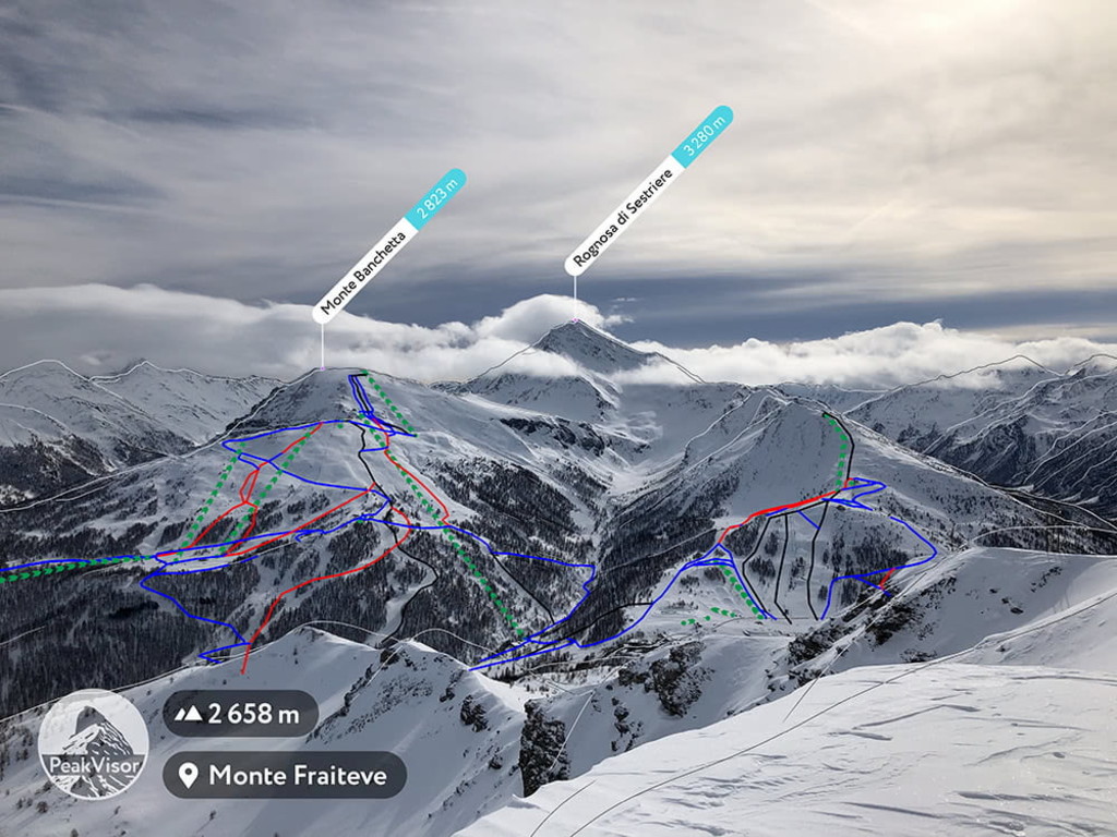
The Western Tauren Alps (Westliche Tauernalpen/Alpi dei Tauri occidentali) are one of the largest subranges of the Alps. Within the range, there are 3,307 named mountains, the highest and most prominent of which is Großglockner.
Known for their many high passes, the Western Tauern Alps boast fantastic hiking opportunities. There are trails that lead to a number of mountain huts and some great destinations within High Tauern National Park.
Major peaks include Großglockner, Großvenediger, Großes Wiesbachhorn, and Hochfeiler.
A tiny subrange in north-western Austria, the Tyrol Schistose Alps (Tiroler Schieferalpen) contain just 689 named mountains, the highest of which is Lizumer Reckner, and the most prominent of which is Kreuzjoch.
The range itself is quite small, though it is located just to the east of Innsbruck, so it is very visible from the road. Major peaks include Lizumer Reckner, Kreuzjoch, Geißstein, and Hohe Salve.
Located mostly in the state of Salzburg, the Northern Salzburg Alps (Salzburger Nordalpen) are a small, yet rugged collection of peaks. There are 1,054 named peaks in the range, the highest and most prominent of which is Hochköning.
Featuring much of the watershed of the mighty Danube River, the Northern Salzburg Alps are a highly rocky subrange. They also contain the lake Köningssee in Bavaria, which is located in Nationalpark Berchtesgaden - a popular hiking area.
Major peaks in the range include Hochköning, Binhorn, Raucheck, Nackter Hund, and Berchtesgadener Hochthron.
Located along the tri-border region between Italy, Slovenia, and Austria, the Carnic and Gailtal Alps contain a relatively large collection of mid-elevation peaks. Home to over 1,900 named mountains, the range’s high point is Monte Coglians/Hohe Warte and its most prominent peak is Cima dei Preti.
The Carnic and Gailtal Alps include part of the Parco naturale regionale delle Dolomiti Friulane and the Riserva naturale regionale della Val Alba. They also contain some particularly high passes at around 2,800m (9,200ft) and were the site of a number of major conflicts during World War I.
Major peaks include Monte Coglians/Hohe Warte, Cima dei Preti, Creta della Cinevate, Terza Grande, and Latschur.
The northern reaches of the Alps, the Salzkammergut and Upper Austria Alps are a major watershed of the Danube River in northern Austria. Within the range there are 2,290 named mountains, the highest and most prominent of which is Hoher Dachstein.
Home to a number of ultra prominent peaks, the range also happens to contain quite a few major lakes. The biggest park in the range is easily Nationalpark Kalkalpen, which contains one of the largest remaining forests in central Europe.
Major peaks include Hoher Dachstein, Großer Priel, Grimming, Großer Höllkogel, and Gamsfeld.
Covering a wide swath of central Austria, the Lower Tauern (Nizke Ture/Niedere Tauern) is a small area in the Eastern Alps. It contains 1,660 named mountains, the highest of which is Hochgolling, and the most prominent of which is Hochreichart.
The range has been a popular tourist destination for well over 100 years, having been popular among members of the Austrian Alpine Club in the 1860s. It also contains a number of alpine huts as well as the Biosphärenpark Salzburger Lungau und Kärntner Nockberge.
Major peaks include Hochgolling, Hochreichart, Preber, Hochwildstelle, and Kasereck.
Situated along the Austrian/Slovene border, the Carinthian Styrian Alps (Alpi di Stiria and Carinzia/Steirisch-Kärntnerische Alpen/Gurk-und Lavanttaler Alpen) and the Carinthian Slovenian Alps (Koroško-Slovenske Alpe/Kärntnerisch-Slowenische Alpen) are a collection of about 2,000 peaks. Between the two subranges, the highest and most prominent peak is Grintovec.
Combined, the two ranges are quite prominent, particularly when approached from the south. This is especially true in Slovenia, where the Carinthian Slovenian Alps are particularly lofty when compared to the lower-elevation areas around the city of Ljubljana. A large portion of the northern part of the subranges is also contained within Biosphärenpark Salzburger Lungau und Kärntner Nockberge in Austria.
Forming the foothills of the Alps in North-East Italy and northern Slovenia, the Julian Alps and Prealps (Julijske Alpe v širšem smislu/Alpi e Prealpi Giulie), as well as the Slovene Prealps (Slovenske Predalpe) are among the shortest of the Alps subranges. Between the two ranges, the highest and most prominent peak is the ultra-prominent Triglav in Slovenia.
The two ranges do have a number of parks, however, such as Triglav National Park and Parco naturale regionale delle Prealpi Giulie. Moreover, the majority of the two ranges’ highest peaks are situated within the Julian Alps proper, which contains a handful of peaks above 2,000m (6,500ft).
Major peaks include Triglav, Jôf di Montasio, Škrlatica, Kanin, and Matajur.
The southeasternmost part of the Alps, the Styrian Prealps (Steirisches Randgebirge/Štajersko Robno hribovje) are a relatively low-lying range in southeastern Austria. The range contains 1,377 named mountains, the highest and most prominent of which is Ameringkogel.
Known for its rocky outcroppings, the Styrian Prealps aren’t particularly high, though they are fairly prominent above the city of Graz below. Technically speaking, a small portion of the range crosses into Hungary, though this is just a few minor summits.
Major high points in the range includeAmeringkogel, Großer Speikkogel, Stuhleck, Hochlantsch, and Rennfeld.
Featuring some of the highest peaks of the Eastern Alps, the Northern Styrian Alps (Steirische Nordalpen) are located in eastern Austria to the southwest of Vienna. The range contains 1,891 named mountains, the highest and most prominent of which is Hochtor.
While they’re not as tall as their western neighbors, the Northern Styrian Alps offer a lot of hiking opportunities for the intrepid visitor. They contain the Nationalpark Gesäuse, which is known for its dramatic landscapes across the Enns Valley below.
Major peaks include Hochtor, Hochschwab, Totenköpfl, Großer Pyhrgas, and Großer Buchstein.
Last but not least, the Northern Lower Austria Alps are the northernmost and easternmost extent of the mighty Alps. Containing 2,009 named mountains, the highest of which is Hochstadl, and the most prominent of which is Hochkogel, the Northern Lower Austria Alps border the western part of the city of Vienna.
Although their hilly, more than particularly mountainous, the Northern Lower Austria Alps are the perfect day trip location from Vienna or Bratislava. They also contain the Wienerwald (Vienna Woods), which is a very popular recreation area.
Major peaks include Hochkogel, Hochstadl, Ötscher, Taubenstein, Dürrenstein, and Stumpfmauer.
Although the Alps is divided into a number of subranges based on geographic location and with their own unique geologic structures, the range as a whole shares a similar geologic history.
The range formed during a major mountain building event known as the Alpine orogeny, which took place in the Late Mesozoic and Cenozoic. During this mountain building event, the African, Indian, and Cimmerian plates to the south collided with the Eurasian plate to the north, causing the uplifting of a large swath of land.
In fact, this orogeny led to the formation of a slew of different mountain ranges in a region known as the Alpide Belt. The Alpide Belt includes some of the world's other major ranges, such as the Himalaya, the Hindu Kush, the Karakoram, the Caucasus, the Carpathians, and the Pyrenees.
The range’s geologic history is defined by widespread faulting and thrusting. Much of the range’s rocks have experienced high grade metamorphism, though there are also some substantial outcroppings of sedimentary rocks and igneous intrusions in the Alps.
Moreover, the Alps have historically been an important source of minerals and metals for people living in south-central Europe of the millenia. Commonly mined resources in the range include amethyst, quartz, cinnabar, iron ore, gold, and copper.
In addition to the Alpine orogeny, the other major geologic process that has defined the Alps is the region’s long history of glaciation. The range has long been covered by glaciers (many of which still exist to this day) that have shaped and carved the mountains to their present shape.
With the exception of the highest elevation sections of the range, which are mostly alpine meadows that give way to bare rock and icy slopes, the Alps are included within the Alps Conifer and Mixed Forest ecoregion, which stretches across much of the range.
Interestingly, this ecoregion is actually a transitional zone between the much more temperate ecoregions to the north and the Mediterranean climate to the south. Here, there are many different plant communities (depending on aspect and elevation) and there are thousands of species of plants that can be found in the range.
For the most part, the lowest slopes of the Alps are dominated by deciduous broadleaf forests of oak while the mid elevations up to the timberline boast montane forests of silver fir, mountain pine, Norway spruce, European larch, Scots pine, and arolla pine.
When it comes to wildlife, the Alps don’t disappoint. The range is home to tens of thousands of animal species, some of which are found nowhere else on Earth.
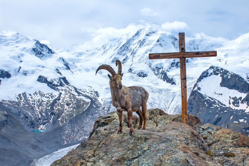
Perhaps the most notable mammal of the Alps is the Alpine ibex, which is known to climb up to around 3,000m (9,800ft). Other animals in the range include chamois, Eurasian lynx, Eurasian wolf, red deer, roe deer, wild boar, and the Eurasian brown bear.
The area in and around the Alps has long been home to humans and the region has been inhabited for tens of thousands of years.
There is extensive archaeological evidence of Neanderthal inhabitation of the Alps dating back to about 40,000 BCE, though it’s believed that anatomically modern humans didn’t come to the range until about 30,000 years ago.
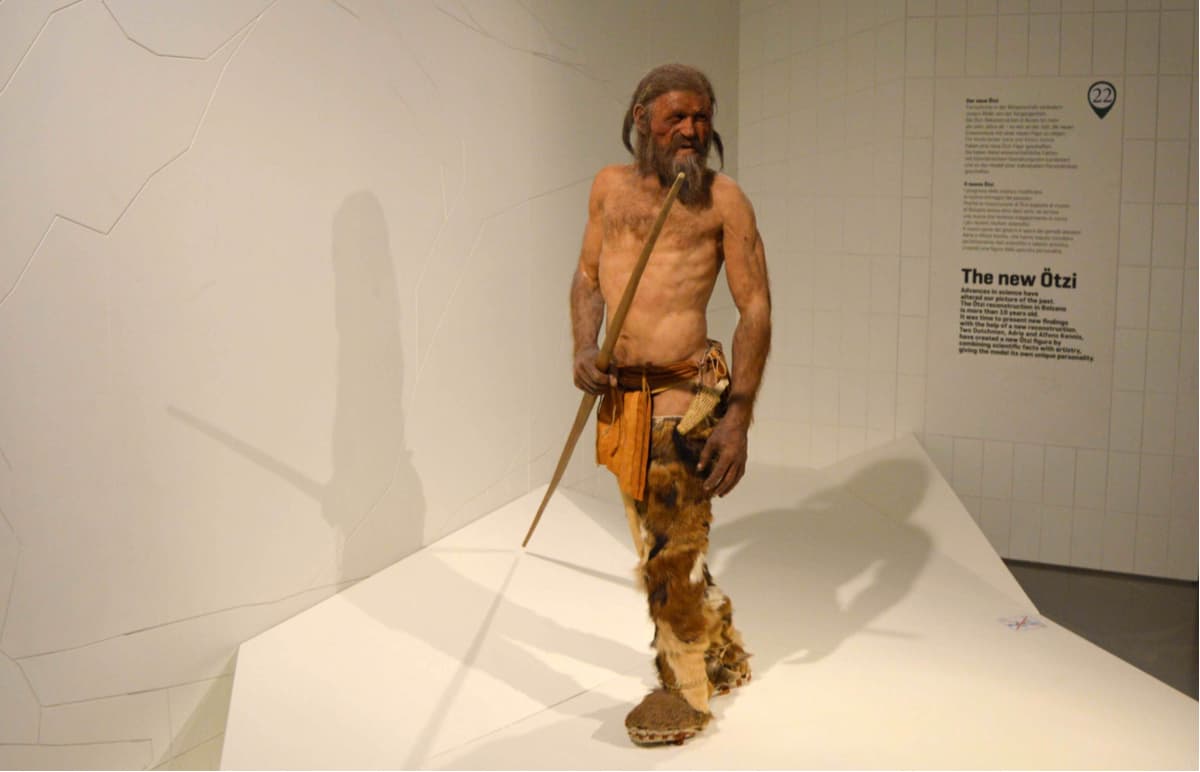
The Bronze Age saw an influx of different groups including the Unfield and Terramare cultures. Perhaps the most notable remains from this time period in the range is that of Ötzi the Iceman, a well-preserved mummy who was believed to have lived during the 3200s BCE.
During the Greco-Roman period, a number of different groups were known to have lived in and around the Alps, such as the Gauls, Ligurians, venetii, Raetians, and Leopontii.
Roman Emperor Augustus undertook an extensive conquest of many of the Alpine tribes, thus cementing the range’s importance to the Roman Empire. Hannibal of Carthage was also known to have crossed the Alps in 218 BCE during the Second Punic Wars with elephants in tow.
During the early middle Ages, the Alps were settled by a number of different groups, including the Slavs to the east, and the Franks to the west. The High Middle Ages saw a large growth in the population of the region and significant expansion in agrarian society, which led to more concerted efforts to settle the region.
In particular, the Alps were a popular place to graze livestock, such as sheep, though these were later replaced by cattle as the dominant livestock in the region.
Around this time, there were also frequent struggles for control of the Alps between neighboring groups, particularly in the Western Alps, which saw frequent conflict over the Savoy region. Meanwhile, the history of the eastern Alps during this time was focused on the goings on of the House of Hapsburg and their control of the region.
By the 18th and 19th centuries, the modern geopolitical boundaries of the Alps started to more closely resemble their modern forms. Moreover, around this time, partially thanks to the Romantic era at the end of the 18th century, people became increasingly more interested in mountains themselves.
For example, Mont Blanc saw its first ascent in 1786 at the hands of Jaques Balmat and Michel Paccard, is often considered to be the birth of modern mountaineering.
Furthermore, the so-called “Golden Age of Alpinism” got its start in the Alps with Alfred Willis’s claimed first ascent of the Wetterhorn in Switzerland in 1854. From the mid 1850s to the mid 1860s, many of the Alps’ major peaks, such as Monte Rosa, Aiguille du Midi, Mönch, Eiger, Wildstrubel, Nadelhorn, and Mont Pourri, got their first ascents.
The Golden Age of Alpinism ended not long after it started after Edward Whymper’s ill-fated first ascent of the Matterhorn in 1865, where 4 of the climbing party perished on the descent.
During the late 1800s and early 1900s, the Alps became a popular tourist destination for well-to-do Europeans, particularly from the United Kingdom. The range was a must-visit on any Grand Tour, cementing the range’s popularity as a tourist destination.
This time period also saw the birth of the mountain guide profession in the Alps, which continues to be a major part of the region’s culture to this day. While the profession was not formally organized until the birth of the International Federation of Mountain Guides (IFMGA/UIAGM/IVBV), which has now grown to include dozens of member organizations around the world.
During the early 20th century, the next major objective of many of the region’s most prominent mountaineers was the Great North Face of the Alps. The Great North Faces, which are found on the Matterhorn, Petit Dru, Grandes Jorasses, Eiger, Piz Badile, and Cima Grande di Lavaredo, represent some of the most difficult and most notable climbs in the range. Although each face saw its first ascent in the 1930s, Gaston Rébuffat was the first to climb all of them not long after.
These days, the Alps remain an incredibly popular hiking, climbing, biking, skiing, and vacationing destination. Whether you’re looking to enjoy lift-accessed skiing, high-altitude mountaineering, or some exceptional views, there’s something for everyone in the Alps.
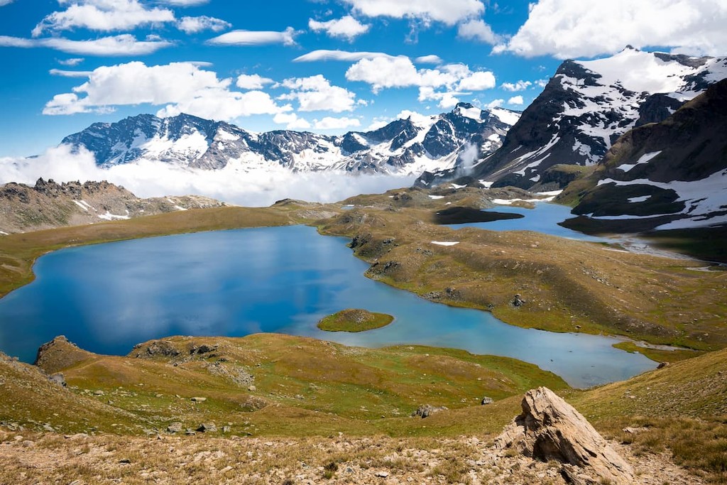
The Alps are one of Europe’s premier mountain ranges, so there’s no shortage of adventure to be had in the range. Here are some of the best places to check out during your visit:
Forming a contiguous area that stretches across Italy and France, Parco nazionale del Gran Paradiso and Parc national de la Vanoise are somes of the best hiking areas in the Alps. The two parks encompass over 1,250 sq. km (482.6 sq. mi) and are an excellent place to see wildlife.
In fact, the two parks are particularly great places to see alpine ibex and alpine chamois. There are also plenty of trekking opportunities in the parks and a seemingly unlimited amount of climbing routes to choose from.
Located in south-western Austria, Nationalpark Hohe Tauern econmpasses much of the Hohe Tauern of the Western Tauern Alps. The park covers about 100km (60mi) of the crest of the mountain chain, making it the largest of Austria’s national parks.
Throughout the park, visitors can enjoy stunning waterfalls, amazing hiking, and beautiful mountain views. There are also a number of major glaciers in the park, as well as plenty of lush alpine meadows that boast amazing wildflowers in the summer months.

Located in southeastern Switzerland, the aptly-named Swiss National Park includes some of the most rugged sections of the Western Rhaetian Alps. The park is part of a UNESCO Biosphere Reserve and it was one of Europe’s first national parks.
Within the park, there are over 100km (60mi) of hiking trails with 21 different routes. Each route provides a different adventure experience and there are trails of varying difficulties for hikers of all abilities.
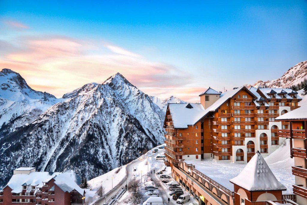
Looking for a place to stay in the Alps? The range is home to a fantastic mix of cities and villages for you to choose from. Here are some of the best places to check out:
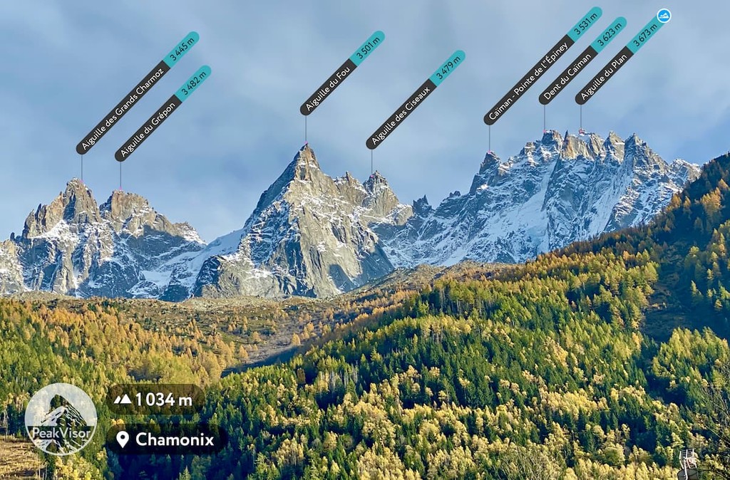
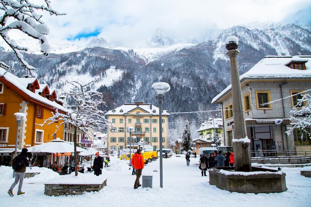
Located in southeastern France, the town of Chamonix is one of the country's most popular ski destinations. With a population of around 9,000 people it is famous for its proximity to high peaks such as Mont Blanc and the Aiguille du Midi. From the town, which is filled with great shops, restaurants, and hotels, one can take a cable car to the top of the Aiguille du Midi for some spectacular views.
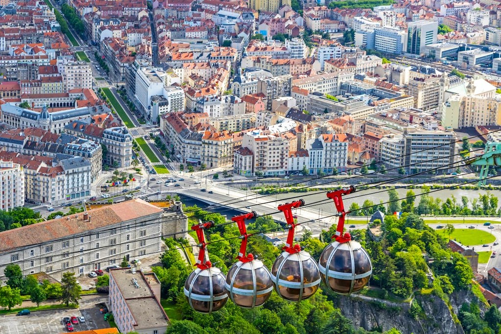
One of the largest cities in the Alps, Grenoble is situated in southeastern France and is home to about 160,000 residents. Although the city has a very diverse economy, it is also a popular starting point for ventures into the French Alps. Grenoble’s cable cars are particularly popular as they offer panoramic vistas of the region.
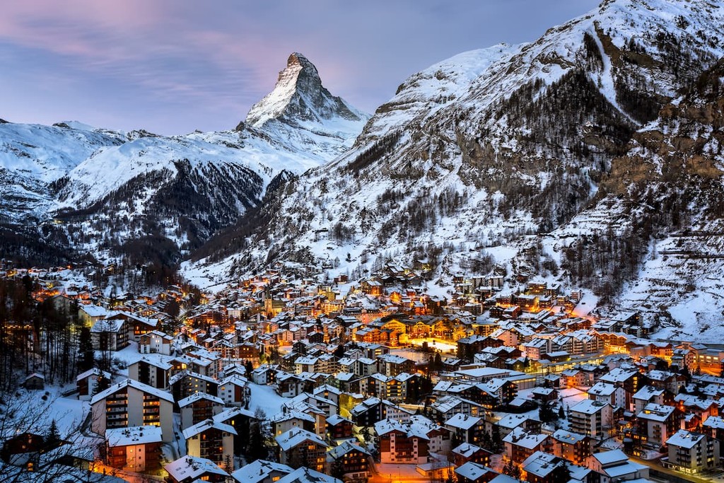
The municipality of Zermatt is located in the canton of Valais in southern Switzerland. A famous skiing and mountaineering destination, Zermatt is home to about 6,000 residents, though the population surges during the winter months with tourists and seasonal workers. The town has a number of ski resorts as well as amazing views of the Matterhorn.
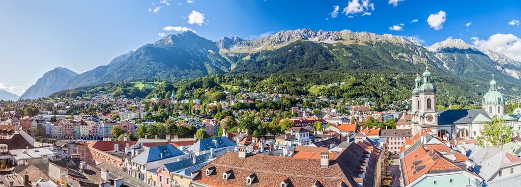
Situated in western Austria, Innsbruck is the capital of Tyrol and the country’s fifth-largest city. Its location makes it a prime destination for skiing and mountaineering and there are several ski resorts in the vicinity. The city has also hosted the Winter Olympics twice and it is a major tourist destination.
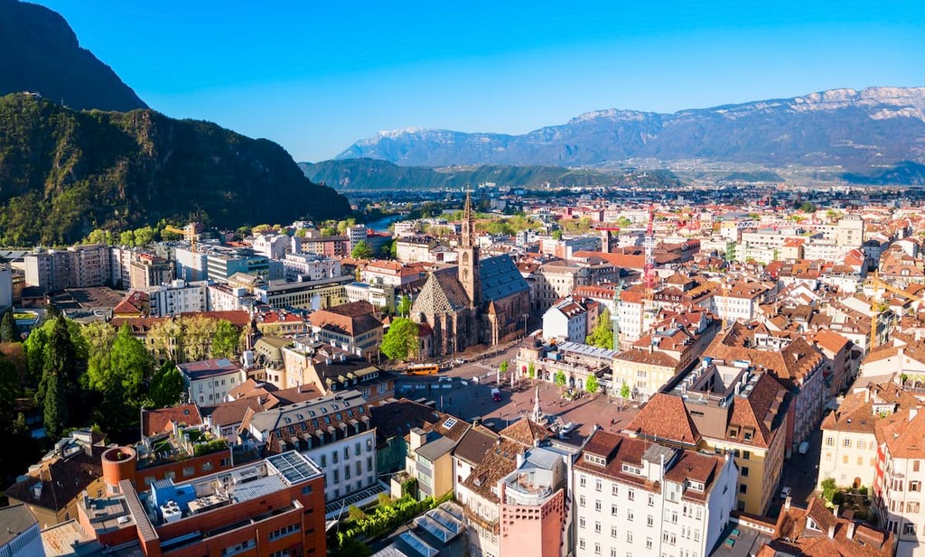
Bolzano is a city in North-East Italy with a population of over 100,000 residents, which makes it the largest community in the region. Thanks to its proximity to the Dolomites, it is a popular starting point for ventures into the range. It is also home to the Messner Mountain Museum Firmian, which is dedicated to showcasing artifacts and exhibitions about mountaineering history.
Located in the Bavarian Alps, Oberstdorf is one of the highest towns in all of Germany. With about 10,000 residents, the town is at the foothills of Nebelhorn and Fellhorn, the former of which can be accessed via a cable car. It is a particularly popular hiking and skiing destination in the Bavarian Alps.


top10
ultra
glacier
europe-4500ers
alps-4000ers
italy-ultras
france-ultras
top10
ultra
glacier
europe-4500ers
alps-4000ers
italy-ultras
switzerland-ultras
top10
ultra
glacier
europe-4500ers
alps-4000ers
italy-ultras
france-ultras
top10
ultra
glacier
alps-4000ers
switzerland-ultras
top50
ultra
glacier
alps-4000ers
italy-ultras
switzerland-ultras
top10
ultra
glacier
europe-4500ers
alps-4000ers
italy-ultras
switzerland-ultras


