Scan the QR code and open PeakVisor on your phone
With the Alps to the south and expansive plains to the north, Germany provides a perfect snapshot of Central Europe's varied landscapes. There are 38564 named summits in Germany. The highest and the most prominent mountain is Zugspitze (2,962 m/9,717 ft).
Germany is a country located in Central Europe. The seventh-largest country in Europe, Germany covers an area of approximately 357,022 sq. km (137,847 sq. mi). Approximately 8,350 sq. km (3,224 sq. mi) of the country is water, which equates to roughly 1.27 percent of Germany's total area.
Germany shares borders with nine countries: Belgium, France, and Luxembourg to the west, the Netherlands to the northwest, Denmark to the north, the Czech Republic and Poland to the east, Austria to the southeast, and Switzerland to the southwest.
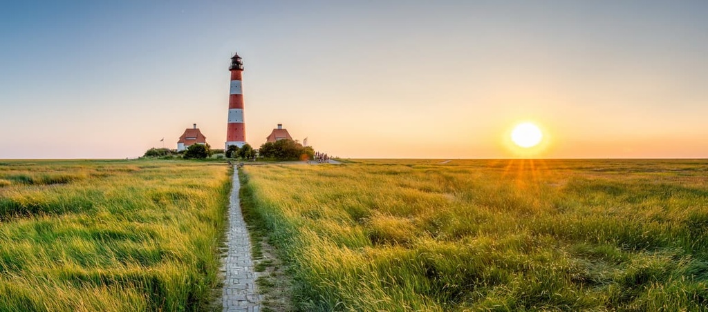
As a result, Germany is entirely landlocked apart from its relatively small northern coastline. Germany borders the North Sea to the northwest and the Baltic Sea to the northeast. The Jutland peninsula of Denmark separates the two oceans and borders Germany to the north.
Several major rivers flow through Germany. The Danube, the second-longest river in Europe, springs from Germany and flows for 2,850 km (1,770 mi) through 9 countries before emptying into the Black Sea.
The Rhine is the longest river in Germany. It begins in the Swiss canton of Grisons (Graubünden) and flows north for 865 km (537 mi) through eastern Germany.
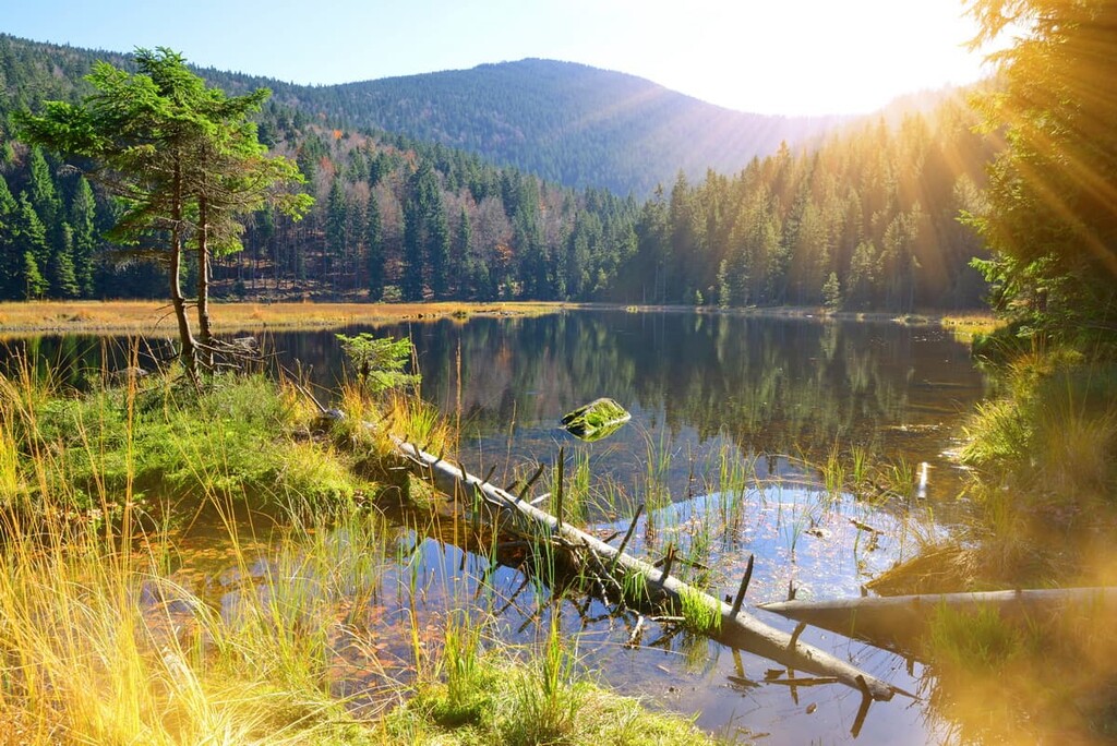
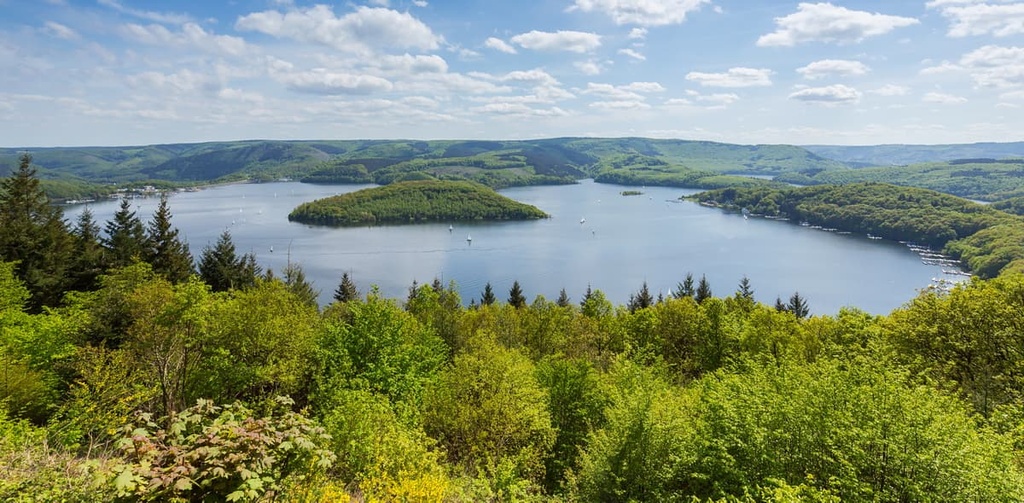
There are estimated to be between 15,000 and 30,000 lakes in Germany. The largest lake located entirely in the country is Lake Müritz, which covers 117 sq. km (45 sq. mi) across the northern state of Mecklenburg-Vorpommern.
Lake Constance in southern Germany, which covers an area of 536 sq km (207 sq mi), is slightly larger, but sections of the lake are located across the Swiss and Austrian borders.
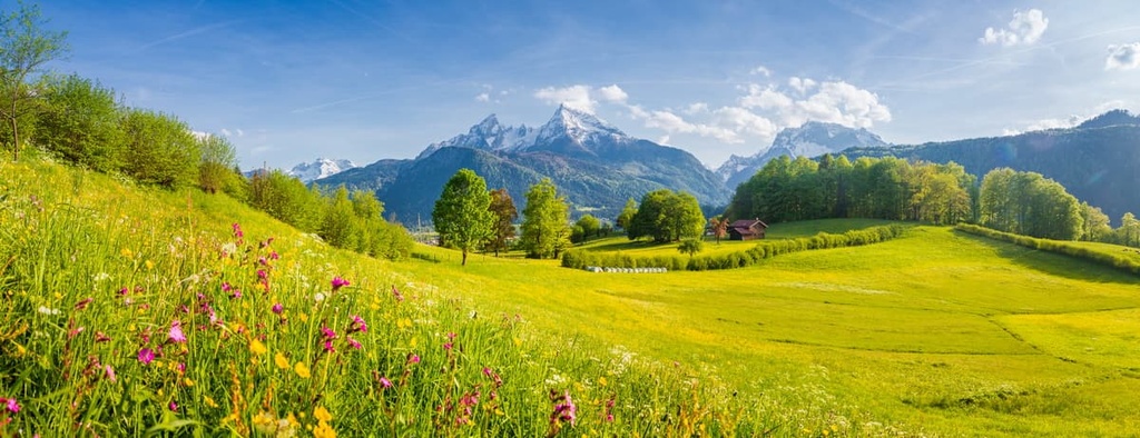
Due to its location at the heart of the continent, Germany boasts many of Europe's main topographical features. Geographically, Germany can be split into three key regions: the Central Uplands, the North German Plains, and the Alps.
The most northerly natural region of Germany, the North German Plains is the country’s flattest area. It consists of low moorlands, bogs, marshes, and lakes. The North German Plains form a part of the North European Plain, which stretches from Belgium to Poland.
The southern boundary of the North German Plains is generally considered to be the Lower Saxon Hills. Several important rivers run through the North German Plains, including the Rhine, Elbe, Ems, and Weser.
The Central Uplands, which run from east to west across Germany, are varied. Generally, the Central Uplands are split into three regions: a collection of plateaus and massifs that extend from Bohemia to the Rhenish Uplands, a section of lowlands to the south, and a northern fringe of secondary rock.
The Central Uplands feature several of Germany's most famous mountain ranges, including the Black Forest, the Bavarian Forest, and the Ore Mountains.

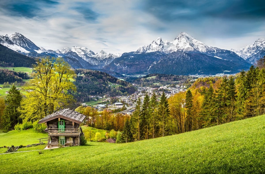
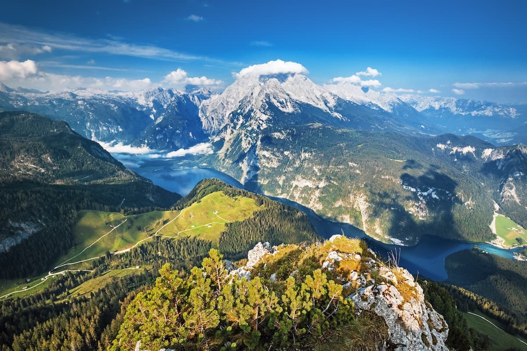
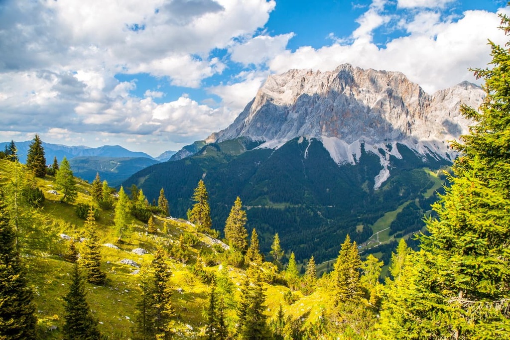
The smallest natural region of Germany, the Bavarian Alps extend from Austria into Germany. The German Alps can be split into three areas: the Allgäuer Alps to the west and the Berchtesgadener Alps to the east, with Wetterstein Alps, which feature Germany's highest mountain, Zugspitze (2,962 m/9,717 ft), in the center.
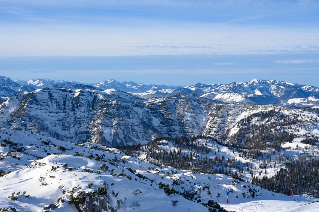
The Alps is Germany’s most mountainous region, with many peaks topping out at over 2,500 m (8,202 ft) in elevation. Most of these tall peaks are located near or along the Austrian border. The Alpine Foreland is situated to the north of the German Alps, and it consists of a large triangular plateau and foothills.
Germany consists of 16 federated states:
Of these states, the largest is Bavaria in southern Germany. Bavaria covers an area of approximately 70,550 sq. km (27,239 sq. mi), which makes it roughly the same size as Ireland. The second-largest state is Lower Saxony, which encompasses an area of roughly 47,709 sq. km (18,420 sq. mi).
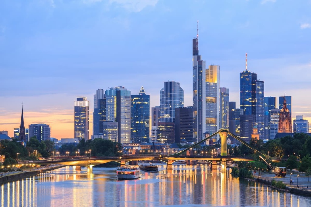
Germany is home to some of the most influential cities in Europe. Berlin, the capital of Germany, is the fifth-largest city on the continent and the largest city in the European Union (EU). Hamburg, Germany's second city, is one of the most important ports in Europe. Other notable settlements include Munich (München), Cologne (Köln), and Frankfurt am Main.
The geological basement of Germany is quite varied. It features some of the oldest rock formations on the planet in the country’s north/northeast and some of the youngest rocks to the south.
The northern areas of Germany primarily date back to the Precambrian, the oldest geological unit of Earth's history. Contrastingly, the southern areas date back to the Cenozoic era, which began 66 million years ago and continues to the present day.
The northern section of Germany, known as the North German Plains, forms part of the Central European Depression. It formed during the Pleistocene era between 2.85 million to 11,700 years ago. This era is commonly referred to as the Pleistocene or Quaternary glaciation.
The area is composed of a layer of sedimentary rock several thousand meters thick. The landscape was created by glacial advances by Scandinavian ice sheets. Glacial erosion coupled with a lack of impact by orogenies contributed to the region's flatness.
The Central Uplands, the South German Scarplands, and the North Rhine Plain form part of the Central European Blocks. Unlike in the North German Plains, the effects of the Alpine Orogeny were strong across the Central European Blocks. Meanwhile, the impact of Pleistocene glaciation was minor in this region.
There are several distinct geological areas within the Central European Blocks. Some areas feature Paleozoic basement outcrops, while others are capped with rock from the Mesozoic or Cenozoic eras. One notable feature of the Central Uplands is the north-western edge of the Bohemian Massif, which forms the largest adjoined outcrop of basement rock in Central Europe.
The German Alps, along with the rest of the Alps, were formed by the Alpine Orogeny during the Paleozoic Era approximately 300 million years ago. The Alps' sedimentary rocks were formed when the area lay under the ancient Tethys Sea. Dead sea creatures and sediment were deposited on the seafloor and then compressed to make sedimentary rocks.
The area's rocks were thrust into mountains by the collision of the African and Eurasian tectonic plates at the beginning of the Late Cretaceous. The most common rock type found in the German Alps is limestone.
Germany has a varied landscape and is, therefore, home to a range of flora and fauna.
There are five recognized ecoregions in Germany: Atlantic mixed forests, Baltic mixed forests, Central European mixed forests, Western European broadleaf forests, and Alps conifer and mixed forests. Just over half of Germany's landmass is dedicated to agriculture. Approximately 30% of the country is forested.
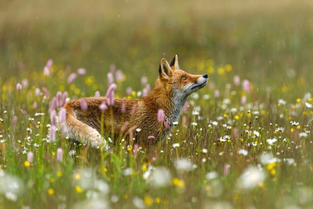
There are approximately 48,000 documented animal species in Germany, of which insects account for roughly 33,000 species. About 35 percent of these animal species are endangered, mainly as a result of the destruction of natural habitats for agricultural purposes.
Several large terrestrial mammal species inhabit Germany. Among the largest species are chamois, European badgers, wild boars, Alpine ibex, and European wildcats. Notable small mammals include red squirrels, beavers, hedgehogs, voles, and rabbits.
There are roughly 531 bird species in Germany, 216 of which are considered rare or were accidentally introduced to the country. Common bird species include European bee-eaters, northern fulmars, meadow pipits, and Eurasian nuthatches. Notable birds of prey include tawny owls, Bonelli's eagles, and ospreys.
Of the thousands of insect species in Germany, a large percentage is in decline. For example, the number of flying insects in Germany has decreased by 75 percent over the past 30 years. Notable insect species include Queen of Spain fritillaries, spotted longhorn beetles, and beautiful demoiselle damselflies.
Germany's rivers, lakes, and coastlines are home to over 270 fish species. The most common freshwater species is carp. Other notable species include bass, pike, and crappie.
You'll find 21 amphibian and 14 lizard species native to Germany. The most famous species is the fire salamander, which is known for its distinct yellow spots and high toxicity.
As mentioned, roughly 30 percent of Germany is forested. High up on mountain slopes, the most common tree species in the country include spruces and firs, while larch and white pine are most common in sandy areas. Deciduous trees such as oaks and beeches constitute around 30 percent of the trees in all German forests.
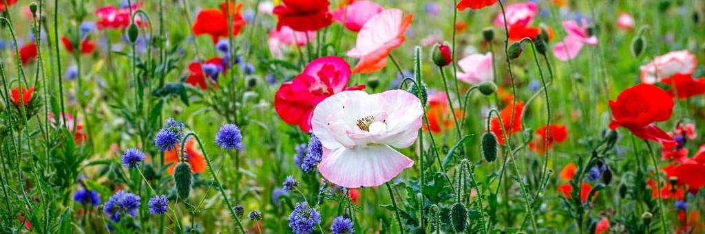
There are approximately 10,300 plant species in the country. The blue cornflower is considered a national symbol of Germany. Other notable and common plant species include European spindles, German chamomile, and common bugloss.
Approximately 14,400 varieties of mushrooms grow across Germany. Common types include porcinis, chanterelles, chestnuts, and red caps.
Germany has a long and complicated history, having changed boundaries, names, and beliefs many times over the past few thousand years. The earliest examples of ancient humans found in Germany date back approximately 600,000 years.
Through the Northern European Bronze Age up until the fifth century, Germany was predominantly inhabited by the Germanic people and tribes. Celtic tribes settled the southern areas of modern Germany; however, they were slowly Germanized over time.
The first recorded evidence supporting this distribution was during Julius Caesar's Gallic Wars around 50 BCE. During the Gallic Wars, Roman troops were involved in skirmishes with Germanic tribes along the Rhine. The majority of early Germanic settlers lived in wood houses, practiced mixed agriculture, and didn't use currency for trading.
Despite a heavily fortified Roman frontier, Germanic tribes and Romans traded and traveled freely. That said, there were often border skirmishes and occasionally larger-scale conflicts, especially resulting from large migrations by Germanic tribes during the third century.
The Germanic people played an important role in the collapse of the Western Roman Empire. Around 375 CE, during what's known as the Migration Period, the Huns invaded Europe from the east, pushing Germanic tribes across the Roman frontier.
Despite the collapse of the Hun Empire around 453 CE, the strain caused by the Hun invasion eventually weakened the Roman Empire enough that many territories were either abandoned or claimed independence. The Western Roman Empire collapsed in 476 CE after the last Roman Emperor, Romulus Augustulus, was deposed by Italian barbarian King Odoacer and a contingent of Germans.
Following the collapse of the Roman Empire, Germany was divided. Large parts of modern Germany were ruled by the Franks under the Merovingian dynasty. Under Frankish King Clovis, Germany was first converted to Christianity.
In the ninth century, the Carolingian dynasty took control of the Germanic Franks. Their power culminated in Charlemagne becoming the Emperor of Romans in the West. During his reign, Charlemagne helped conquer other areas of modern Germany, including Bavaria and Saxony.
The emergence of modern Germany began following the death of Charlemagne's son, Louis the Pious. Under the Treaty of Verdun in 843, the Carolingian kingdom was split between his three surviving sons, leading to the formation of a rough outline of medieval Germany and France.
The division led to the establishment of the Holy Roman Empire to the east. During the tenth and eleventh centuries, the Ottonian rulers unified several German duchies. The Hohenstaufen emperors in the twelfth and thirteenth centuries encouraged settlement in the southern and eastern territories.
Germany underwent significant cultural changes and turmoil in the fifteenth, sixteenth, and seventeenth centuries, due partly to religion. The development of movable-type printing and a translation of the Bible by Martin Luther helped standardize the German language.
The development of Lutheranism and the Reformation stoked religious turmoil, leading to one of the bloodiest conflicts in European history, the Thirty Years' War. The 1555 Peace of Augsburg signified the end of the turmoil, with future Holy Roman Emperors able to choose between Lutheranism and Roman Catholicism as the state religion.
By the nineteenth century, following the Napoleonic Wars and the fall of Napoleon, the Congress of Vienna redrew the borders of Europe, loosely uniting 39 states into the German Confederation.
In 1866, Otto von Bismarck was appointed Minister President of Prussia. Tensions about the formation of the German Confederation led to the Austro-Prussian War. After defeating the French in the Franco-Prussian War in 1871, Otto von Bismarck and the German princes formed the first German Empire. Bismarck was the first chancellor, and the King of Prussia became Kaiser.
In 1918, at the end of the First World War, the German Revolution saw Germany shift from a constitutional monarchy to a federal republic. The result was the formation of the Weimar Republic. The 1919 Treaty of Versailles, which accepted defeat following the First World War, was seen as embarrassing by many Germans. This perceived humiliation helped Adolf Hitler gain political prominence.
The Great Depression in 1929 led to unemployment levels of over 30 percent in Germany. The economic and political fallout helped the Nazi party win a special election in 1933. Removal of civil rights, rearmament, and the annexation of surrounding territories, including Austria, culminated in the outbreak of the Second World War in 1939.
During the Second World War, the Holocaust led to the persecution of minorities in Germany, resulting in the murder of approximately 6 million Jewish people and millions of other racial minorities, political prisoners, people with disabilities, and members of the LGBTQ+ community. Nazi Germany was defeated following the victory of Soviet forces at the Battle of Berlin in 1945.
After World War II, Germany was split in half, with the Soviet Union controlling East Germany and the UK, USA, and France controlling West Germany. In 1989, the Berlin Wall separating the two states was torn down, leading to the reunification of Germany.
Since reunification, Germany has been one of the most important countries in the EU. Currently, Germany is the second-most populous country in Europe (after Russia) and has the continent’s largest economy.
Germany is home to approximately 200,000 km (124,274 mi) of hiking trails, 16 national parks, and 98 nature parks. Roughly 25 percent of Germany's area is national parks and nature parks.
The 16 national parks in Germany are:
Whenever hiking in remote areas of Germany, ensure you bring the appropriate equipment, map out your route, and notify somebody of your itinerary. Pay attention to the alpine trail markers, and don't undertake a difficult hike in bad weather or without the necessary experience.
Read on to find out about some of the main hiking areas in Germany.
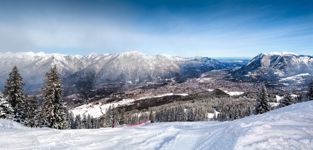
The Wetterstein Alps, or Wetterstein (Wettersteingebirge), is a compact mountain range located in Bavaria on the Austrian border. Wetterstein attracts hikers from around the world looking for challenging alpine treks. Zugspitze (2,962 m/9,717 ft), the highest mountain in Germany, sits on the border between Bavaria and the Austrian state of Tyrol.
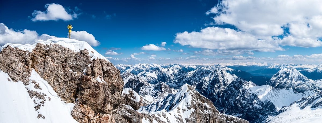
Due to the Wetterstein's cable cars, nearby towns, and scenery, the range is popular with hikers year-round. Munich (München), Germany's third-largest city, is located just 90 km (56 mi) from Wetterstein. The famous alpine ski resort of Garmisch-Partenkirchen sits in the shadow of Zugspitze. It's possible to get a cable car to the summit of Zugspitze.
Due to Zugspitze's popularity, there are several ways to climb the mountain. One of the most popular is the Höllental route. This difficult out-and-back trail starts from Hammersbach and takes hikers through the Höllental, or Hell's Valley, a stunning narrow gorge complete with waterfalls.
The trail then leads to the Höllentalangerhütte (1,387 m/4,550 ft) and then past the Höllentalferner glacier. To reach the summit of Zugspitze, you'll need to climb a via ferrata (klettersteig), which is a type of a protected climbing path. The Höllental route is 20 km (12.5 mi) long with an elevation gain of 2,330 m (7,644 ft).
Another popular mountain in Wetterstein is Alpspitze (2,628 m/8,622 ft). With its pyramidal north face, Alpspitze is considered by many to be the most attractive of the Wetterstein mountains and was the symbol of Garmisch-Partenkirchen for many years.
The primary method of reaching the summit of Alpspitze is on via ferratas. The most popular way to reach the summit cross is by climbing the Alpspitz Ferrata, a well-developed and relatively straightforward via ferrata.
Meanwhile, the easiest way to reach the via ferrata is by getting the Alpspitzbahn cable car to Osterfelderkopf (2,218 m/7,277 ft). The round trip to the summit of Alpspitze is 4.3 km (2.5 mi) with an elevation gain of 594 m (1,948 ft).
Founded in 1970, Bavarian Forest National Park (Nationalpark Bayerischer Wald) is the oldest national park in Germany. The park encompasses 242 sq km (93.5 sq mi) of the Eastern Bavarian Forest in the Free State of Bavaria along the German border with the Czech Republic.
Coupled with the Czech Republic's Bohemian Forest, the Bavarian Forest forms part of the largest contiguous area of forest in Central Europe. The park has an extensive signposted trail system which is approximately 350 km (217 mi) long.
One of the most popular trails in Bavarian Forest National Park is the Rachelrundweg looped trail. The trail leads to the highest peak in the park, Großer Rachel (1,453 m/4767 ft), affording hikers views of Rachelsee Lake to the southwest, some 400 m (1,312 ft) below the summit. This trail is 11.4 km (7.1 miles) long with an elevation gain of 571 m (1,873 ft).
Another popular trail in Bavarian Forest National Park is the Lusen Rundweg, which leads to the summit of Lusen (1,373 m/4,504 ft), the park's sixth highest mountain. The trail is popular year-round as it provides panoramic views of the surrounding forests. This looped trail is roughly 13.5 km (8.4 miles) long with an elevation gain of 573 m (1,879 ft).
Berchtesgaden National Park (Nationalpark Berchtesgaden) is the only national park located in the German Alps. The park covers an area of 210 sq. km (81 sq. mi) across the Berchtesgaden Alps in Bavaria along the Austrian border.

The park is renowned for its challenging hikes and sublime alpine scenery. The park contains some of the highest mountains in Germany, including the Watzmann (2,713 m/8,900 ft), which is the country's third-highest massif. Whether you're planning a strenuous mountain trek or a lakeside stroll, there are few more beautiful national parks in Germany than Berchtesgaden National Park.
One of the most popular hikes in Berchtesgaden National Park is the Wimbachbrücke zum Watzmannhaus. This difficult hiking trail leads from the Hammerstiel parking lot to Watzmannhaus, an alpine resort perched on the edge of rugged cliffs 1,980 m (6,496 ft) above sea level.
The walk is well-signposted and follows a gravel path. The trail leads to the summit of Watzmanngugel (1,800 m/5,905 ft) and then onto Watzmannhaus.
If you book in advance, you can spend the night at Watzmannhaus before scaling one of Watzmann's main peaks: Hocheck (2,651 m/8,697 ft), Südspitze (2,712 m/8,897 ft), and the third-highest summit in Germany, Mittelspitze (2,713 m/8,900 ft). This out-and-back trail is 13.7 km (8.5 mi) in length with an elevation gain of 1,329 m (4,360 ft).
The Grünstein Loop is another highly-popular hiking trail in Berchtesgaden National Park. This moderate route leads from the Hammerstiel parking lot to the summit of Grünstein (1,304 m/4,278 ft). Despite being significantly lower than the Watzmann, Grünstein affords similar panoramas of Königsee, the cleanest lake in Germany. This looped trail is 10.1 km (6.3 mi) in length with an elevation gain of 719 m (2,358 ft).
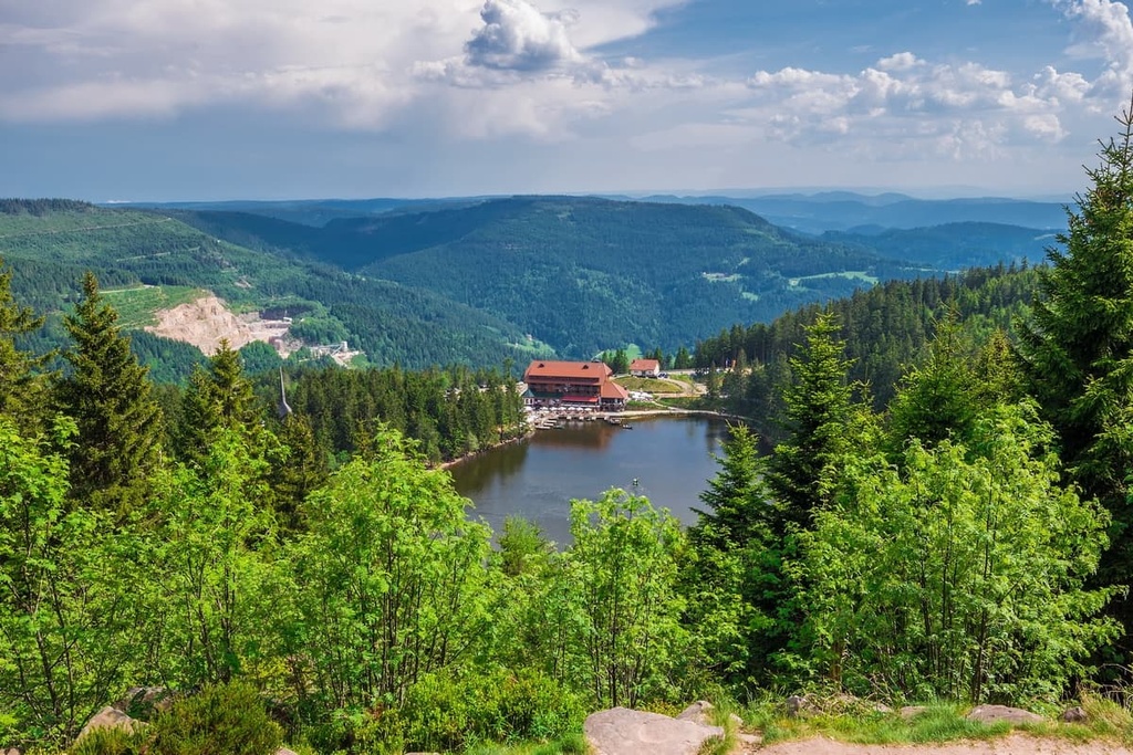
Located in southwest Germany in Baden-Württemberg is the Black Forest National Park (Nationalpark Schwarzwald). The park encompasses approximately 101 sq km (39 sq mi) of land across the Northern Black Forest, a forested mountain range that's one of Germany's most famous natural features. The highest summit in the park is Dreifürstenstein (1,155 m/3,789 ft).
One of the highlights from the Black Forest National Park is the Badener Höhe loop. This challenging circular trail leads to the summit of Badener Höhe (1,004 m/3,293 ft), the most prominent mountain in the park.
From the village of Herrenwies, the trail leads steeply uphill to the top of Badener Höhe, where visitors can climb a 30-meter-tall observation tower for some of the best views of the Northern Black Forest region. The walk up Badener Höhe is approximately 6 km (4 mi) in length with an elevation gain of roughly 250 m (820 ft).
If you're looking for a less difficult mountain hike in the Black Forest National Park, consider the Schliffkopf trail. This there-and-back route leads from the Schliffkopf car park gently uphill through scenic pastures to the summit of Schliffkopf (1,055 m/3,461 ft).
On clear days, you'll be treated to vistas of the Black Forest mountain range and the Rhine Plains. Atop the mountain is the Schliffkopfhütte if you're looking for somewhere to stay. The hike is approximately 5 km (3 mi) in length with an elevation gain of around 250 m (820 ft)
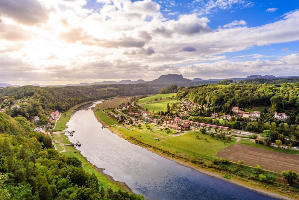
Saxon Switzerland National Park (Nationalpark Sächsische Schweiz) is located in Saxony in east-central Germany. It covers an area of 93.5 sq km (36.1 sq mi) along the Czech Republic border and adjoins the Bohemian Switzerland National Park.
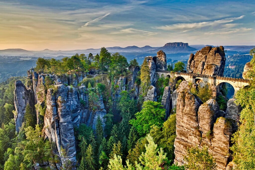
Saxon Switzerland National Park is home to arguably the most dramatic landscape in Germany. The park is home to the Elbe Sandstone Mountains, which contains otherworldly monolithic sandstone structures carved over millions of years by erosion.
One of the most significant rivers in Central Europe, the Elbe, runs through the park's southern section. The tallest and most prominent mountain in the park is Silberblick (558 m/1,831 ft). The park is also a hotspot for rock climbers, with around 700 scalable summits.
Hikers looking to discover the best of Saxon Switzerland National Park's rock formations should check out the Falkenstein, Schrammsteine und Großer Winterberg trail.
This looped trail leads past the rock formations at Falkenstein (378 m/1,240 ft), Großer Winterberg (556 m/1,824 ft), and Schrammsteine (402 m/1,318 ft). Highlights include knife-like limestone pillars, deep ravines, and vast gorges. The trail is 20 km (12.4 mi) in length with an elevation gain of 748 m (2,454 ft).
One of Germany's most iconic lookouts is accessible along the Bastei, Amselsee, and Hohnstein loop. This circular trail runs from Wehlen through the north of the park.
The trail climbs steeply uphill to the Bastei Bridge (Basteibrücke), a stone bridge built 193 m (633 ft) above the River Elbe through the jagged Bastei rock formation. After enjoying some of the finest views of the Elbe Sandstone Mountains, you'll continue onto Amelsee reservoir and then the Polenz Valley. The trail is 24 km (15 miles) in length with an elevation gain of 1,010 m (3,313 ft).
Located in North Rhine-Westphalia along the German border with Belgium is Eifel National Park (Nationalpark Eifel). The park covers approximately 110 sq km (41.25 sq mi) of rolling hills, beech forests, and glistening lakes. The park forms part of the largest cross-border High Fens–Eifel Nature Park.
The park was established to protect the many endangered species in the region, including Eurasian eagle owls, European wild cats, and black storks. There are roughly 1,800 endangered animal and plant species in Eifel National Park.
There are approximately 240 km (150 mi) of trails in Eifel National Park. The highest summit in Eifel National Park is Sonntagshügel (671 m/2,201 ft).
One of the most popular trails in Eifel National Park is the Rursee Loop. This looped trail leads around Rursee Lake (also known as Rurstausee) and crosses three dams, including the 480 m long Rurtalsperre Schwammenauel, which is one of the longest dams in Germany. High up in the hills, you'll be treated to panoramic views of Eifel's landscape. This looped trail is 25.7 km (16 mi) long with an elevation gain of 677 m (2,221 ft).
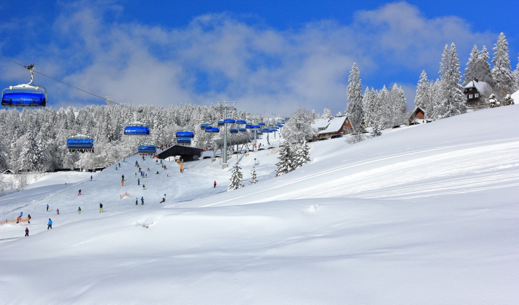
For skiing and snowboarding enthusiasts, there are more than 650 ski resorts in Germany. However, most of them are very small resorts with a total length of slopes up to a kilometer (mile), rarely several kilometers (miles). They are located throughout the country, but the greatest number of areas for skiing in the German Alps is in the southern part of the state in the Bavarian Alps, which also brought together the largest of them. On the administrative map, the country’s most ski region is Bavaria. There are some resorts in Baden-Württemberg, North Rhine-Westphalia, and Saxony, too.
The largest ski resort in Germany is Steinplatte in Bavaria, which is partly located in Tyrol, Austria, with more than 40 km (25 mi) of slopes and more than 10 ski lifts in total.
Other major areas for skiing in Germany with more than 15 km (9 mi) of slopes and more than 5 ski lifts each include the following in descending order of size:
The only two large ski resorts outside the German Alps are Fichtelberg–Oberwiesenthal with more than 15 km (9 mi) of slopes and more than 5 ski lifts and Arber with more than 10 km (6 mi) of slopes and more than 5 ski lifts. They are located in Saxony on the eastern borders of the country with Poland.
The main ski resort near Munich, the capital of Bavaria, is Brauneck with more than 30 km (19 mi) of slopes and more than 15 ski lifts. The nearest resorts to the other major cities in Germany are the same as listed above, so Germans travel to the Bavarian Alps for skiing from Berlin, Hamburg, and so on. On the high-speed train, it takes about half a day.
Check the Germany ski resorts map in the World Mountain Lifts section of the site. It includes information about open ski lifts / slopes in Germany in real-time with opening dates and hours. There are also year-round cable cars, funiculars, cog railways, aerial tramways, and all other types of mountain lifts.
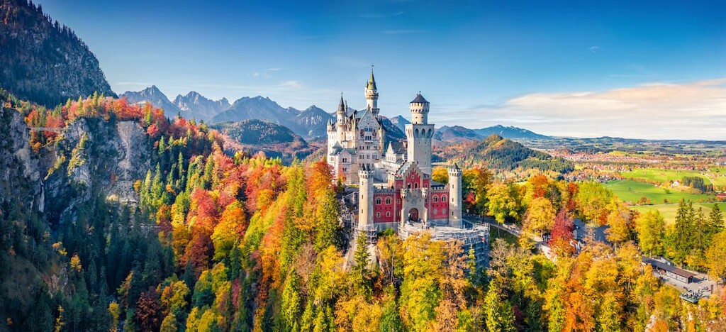
Germany is home to dozens of fascinating cities and settlements, each rich in it’s own culture and history. Read on to find out about the major cities in Germany.
Berlin is the capital of Germany and the largest city in the EU. One of Germany's most culturally and historically significant cities, Berlin is home to world-class attractions like Brandenburg Gate, the Reichstag, and Museum Island. During your visit, ensure you take a stroll along the Berlin Wall and sample some iconic currywurst.
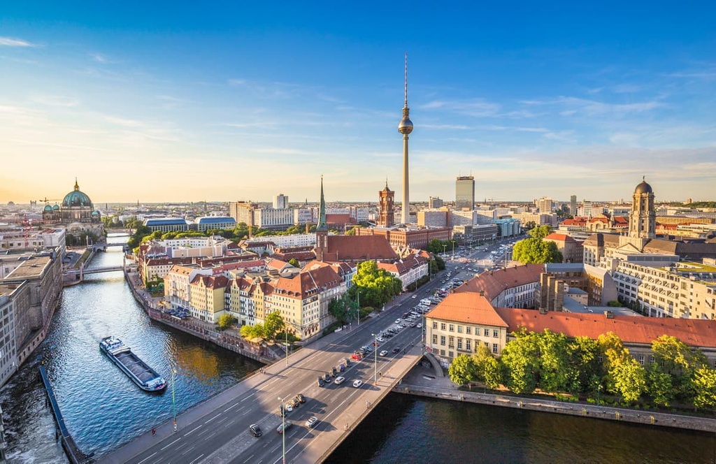
There are several wetland nature parks surrounding Berlin worth visiting, like Westhavelland Nature Park and the Dahme-Heideseen Nature Park. The nearest national parks are Harz National Park and Saxon Switzerland National Park, which are both about 250 km (155 mi) away. Popular hotels in Berlin include Hotel NH Collection Berlin Mitte am Checkpoint Charlie, the Park Inn by Radisson, and the Leonardo Royal Hotel.
As Germany's second largest city, Hamburg is well worth visiting. Perched on the River Elbe, this historic port city is home to some of the finest architecture in Europe, including the Elbphilharmonie Hamburg and the Chilehaus. During your stay, ensure you take a tour of the port of Hamburg, including the Speicherstadt UNESCO World Heritage Site.
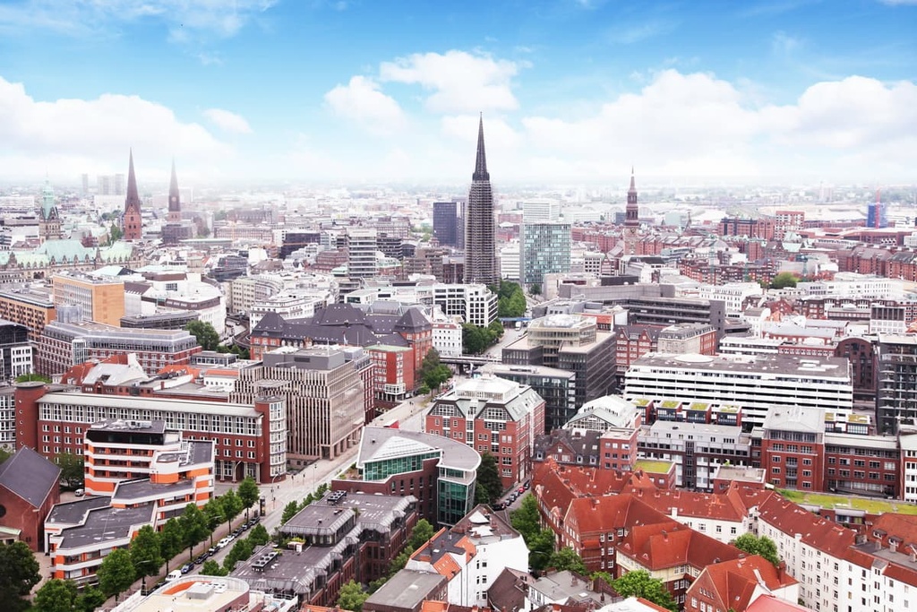
Hamburg is the best place to stay if you're heading to Germany's North Sea coastline to explore Neuwerk in the Hamburg Wadden Sea National Park. Popular Hotels in Hamburg include Hotel NH Hamburg Mitte, Hotel Hafen, and the Novum Style Hotel.
Munich (München) is the capital of the Free State of Bavaria. Munich is known for its easy-going culture and historical attractions like the Munich Residenz and Nymphenburg Palace. If you're a big fan of beer, Munich is the best city to experience Oktoberfest thanks to its numerous famous beer halls.
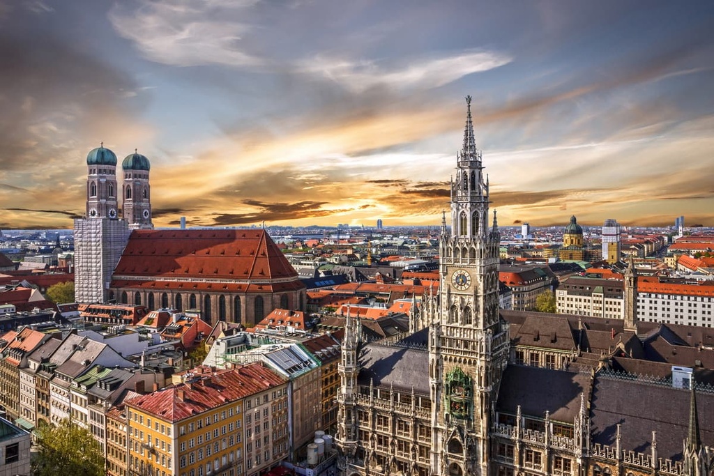
Situated north of the Bavarian Alps, Munich is the ideal base from which to explore Berchtesgaden National Park, which is located 150 km (93 mi) south of the city. Bavarian Forest National Park is also just 195 km (121 mi) to the west of Munich. Popular hotels in Munich include Hotel NH München City Süd, the Leonardo Hotel, and the Steigenberger Hotel.
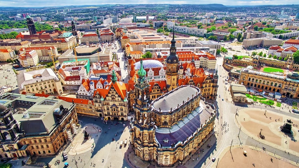
Dresden is the capital of Saxony and the state's second-largest city after Leipzig. Dresden is perhaps most famous for the firebombing that took place during the Second World War that destroyed most of the city. In the aftermath, many of Dresden's most famous buildings had to be reconstructed, including the Frauenkirche and the Zwinger.
Dresden is the best place to stay if you're looking to visit Saxon Switzerland National Park, which is less than 50 km (31 mi) away. Popular hotels in Dresden include the Park Inn by Radisson, the NH Hotel Dresden Neustadt, and the Hilton Dresden.
Cologne (Köln) is the capital of North Rhine-Westphalia and is one of the oldest cities in Germany. Resting on the Rhine, Cologne is located just north of Bonn, the former capital of West Germany. Cologne is perhaps most famous for its 12 Romanesque churches. The highlight of these churches is Cologne Cathedral, which is the third-highest church in the world and Germany's most-visited landmark.
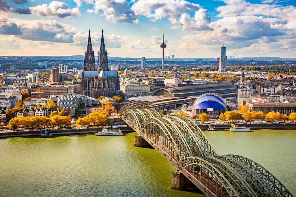
Cologne is the city to stay in if you're visiting Eifel National Park, which is less than 70 km (43 mi) away. Popular hotels in Cologne include the Leonardo Hotel, the Mercure Hotel, and the Steigenberger Hotel Köln.
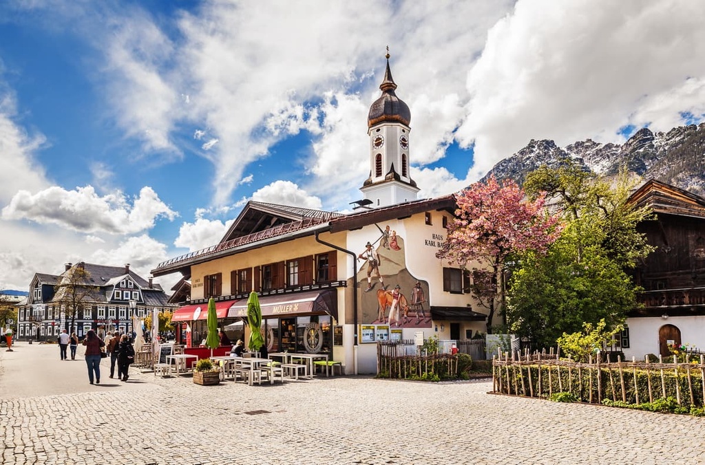
Sat in the shadow of the mighty Wetterstein is Garmisch-Partenkirchen. At an elevation of 708 m (2,323 ft), Garmisch-Partenkirchen is the ideal place to stay if you're looking to go hiking or skiing on Germany's highest mountains, including Zugspitze (2,962 m/9,717 ft).
Garmisch-Partenkirchen has plenty of winter sports pedigree. The town is famous for hosting the 1936 Winter Olympic Games, the first Winter Olympics to include alpine skiing. It has also hosted many other major winter sports events over the years. Popular hotels in Garmisch-Partenkirchen include aja Garmisch-Partenkirchen, Riessersee Hotel, and Dorint Sporthotel.