
Scan the QR code and open PeakVisor on your phone
Discover the oldest and largest adjoined deciduous forest in Germany at Hainich National Park. There are 27 named hills in Nationalpark Hainich. Große Laite (491 m/1,611 ft) is the highest point. The most prominent hill is Heidelberg (459 m/1,506 ft).
Hainich National Park (Nationalpark Hainich) is the only national park located in the Free State of Thuringia in Germany. Hainich National Park encompasses an area of 75 sq km (29 sq mi), making it Germany's second smallest national park after Jasmund National Park (Nationalpark Jasmund).
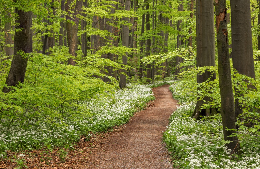
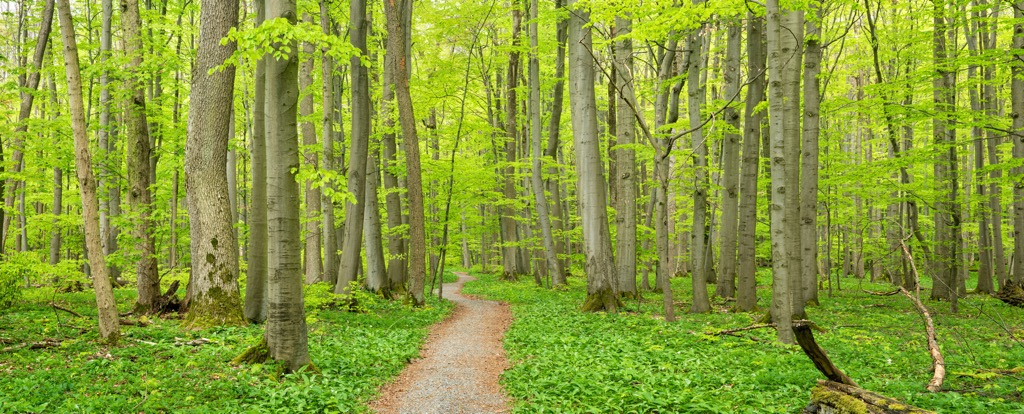
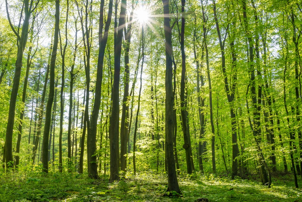
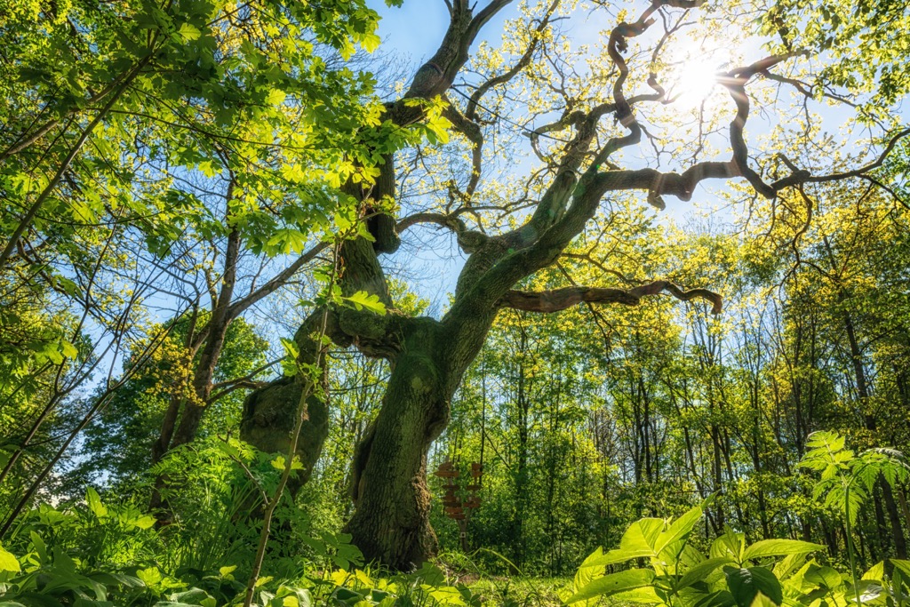
The main feature of Hainich National Park is its ancient beech forests. The park's forests have been designated as an "Ancient and Primeval Beech Forests of the Carpathians and Other Regions of Europe World Heritage Site," as they provide a unique insight into how forests have developed since the Last Glacial Period.
Hainich National Park is located in the western half of Thuringia, just east of the Werra River. It forms a part of the larger Eichsfeld-Hainich-Werratal Nature Park (Naturpark Eichsfeld-Hainich-Werratal).
The park is part of Hainich, a forested series of hills that covers an area of 160 sq km (61.8 sq mi). Hainich is notable for being Germany's largest adjoining deciduous forest. The southern half of Hainich, known as the Kindel, falls within the boundaries of Hainich National Park.
Hainich is bounded by the towns of Mühlhausen to the north, Eisenach to the south, and Bad Langensalza to the east. Erfurt, the capital of Thuringia, is located roughly 50 km (31 mi) to the southeast of Hainich National Park.
Hainich National Park sits on the eastern edge of the Thuringian Basin and is underlain by the Muschelkalk Group. The Muschelkalk Group is a shell-bearing limestone that can be found across Central and Western Europe.
In places, the Muschelkalk Group can be over 100 m (328 ft) thick. It formed during the Middle Triassic period, approximately 240 to 230 million years in the middle of the Germanic Trias Supergroup rock strata.
There are also a few other rock formations that crop up across Hainich in small patches. These formations include Buntsandstein sandstone, Zechstein sedimentary rocks, and Keuper dolomite, shale, and claystone.
The eastern slopes of the Thuringian Basin are relatively flat with little prominence. The western edge of Hainich is much steeper after being carved by local rivers into valleys. The landscape of Hainich today has been shaped by erosion and loess deposits.
The hills of Hainich are gently undulating and don't exceed 500 m (1,640 ft) in elevation. The highest summit in Hainich National Park is Große Laite (491 m/1,611 ft). Other significant hills include Heidelberg (459 m/1,506 ft), Eichenberg (443 m/1,453 ft), and Neuenstein (463 m/1 519 ft).
With 90 percent of Hainich's forests unused by humans, Hainich National Park is the perfect place for nature to flourish undisturbed. Read on to learn about Hainich National Park's wildlife.
There are approximately 10,000 species of animal, plant, and fungus present within Hainich National Park. While walking around in the undergrowth, hikers may come across deer, wild boar, and badgers.
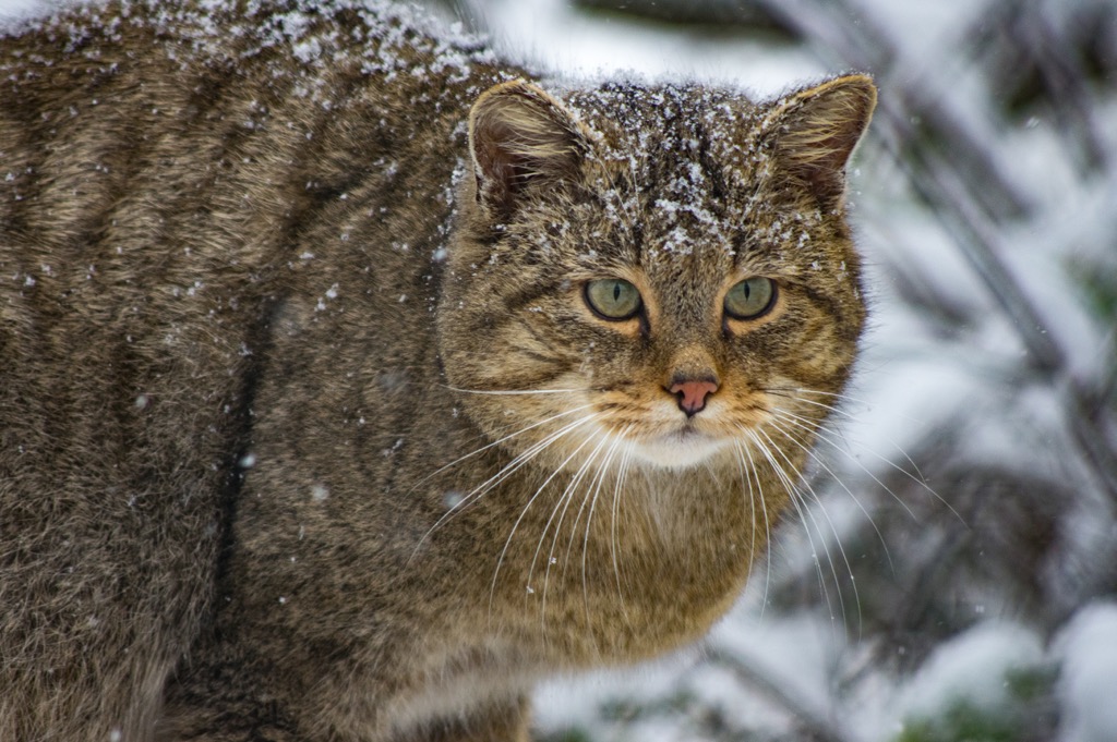
Raccoons also live within the park after being brought to Germany from North America in the early twentieth century. Some of the more elusive mammals inhabiting Hainich National Park include dormice and pine martens. The most elusive of all is the European wildcat — there are thought to be around 40 individuals in the park.
Innumerous bird species inhabit every corner of the park, including all seven species of woodpecker found within Thuringia. In the beech forests live chaffinches, wallcreepers, golden orioles, and wood warblers. Circling above the trees are several larger bird species, such as buzzards, common ravens, and red kites.
In the few open areas of Hainich National Park, birds such as red-backed shrikes, great gray shrikes, and meadow pipits nest in bushes and hedges. Hikers may even occasionally spot a rare quail.
Around 80 percent of all species within Hainich are insects. There are also around 220 spider species that spin their webs in these forests. Wood beetles are among the best-studied creatures in Hainich National Park. Over 500 wood beetle species are in the park, including 115 jungle relics.
Around 13 species of amphibians inhabit Hainich National park despite a lack of water. These species include crested newts, tree frogs, and yellow-bellied toads.
While beech trees might dominate the forests of Hainich, 30 other deciduous tree species are also present, including ashes, hornbeams, sycamores, and checker trees. There are also over 900 fern species growing within the park.
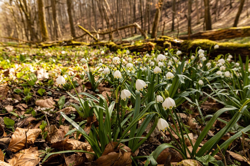
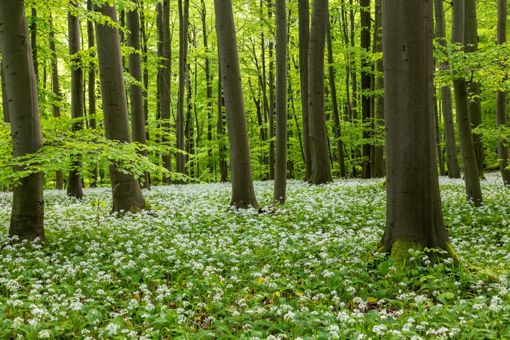
Many early bloomers can be found in the nutrient-rich soil areas of Hainich's forest, including wild garlic, forest violets, martagon lilies, and march cups.
Twenty-six species of orchids have been identified in Hainich National Park. These species include lady orchids, military orchids, and three-toothed orchids.
Hainich National Park is home to a lot of deadwood, which allows fungi to thrive. Over 1,600 species of fungi have been identified in the park, including bearded tooth fungus and tinder fungus.
There are approximately 40 abandoned villages in and around Hainich. Some of these settlements, such as Graurode or Gravenode, date back 1,000 years to the tenth century.
However, many of these settlements were already abandoned by the fourteenth century. Many of these settlements were abandoned due to the plague epidemics, infertile soil, and a lack of fresh water.
Since 1935, the southern half of Hainich has been a restricted military area, initially used by the Wehrmacht, the Nazi armed forces during World War II. After the Nazis were defeated in World War II, the Soviet Union took over control of Hainich and further expanded the military area.
It wasn't until 1991 that part of Hainich was accessible to the public. Since then, the region has been slowly transforming from a military area into a national park and protected forest.
Some of the densest areas of Hainich were inaccessible even to the military, meaning parts of the park have been developing independently of humans for nearly a century. This lack of activity provides a unique look at a native ancient forest undisturbed by humans for decades.
Hainich National Park was established on December 31, 1997, making the park's birthday New Year's Eve. The park's headquarters are located in Bad Langensalza.
Hainich National Park is the ideal destination for a walk in the woods, with 20 looped trails and 120 km (75 mi) of walking trails to explore.
Before setting off on a hike, ensure you map out your route and inform others of your intended itinerary. Bring plenty of food and water, and appropriate hiking gear. Visit the Hainich National Park Center in Schoenstedt for more information on trails and the local area.
Read on to learn about some of the best hikes in Hainich National Park.
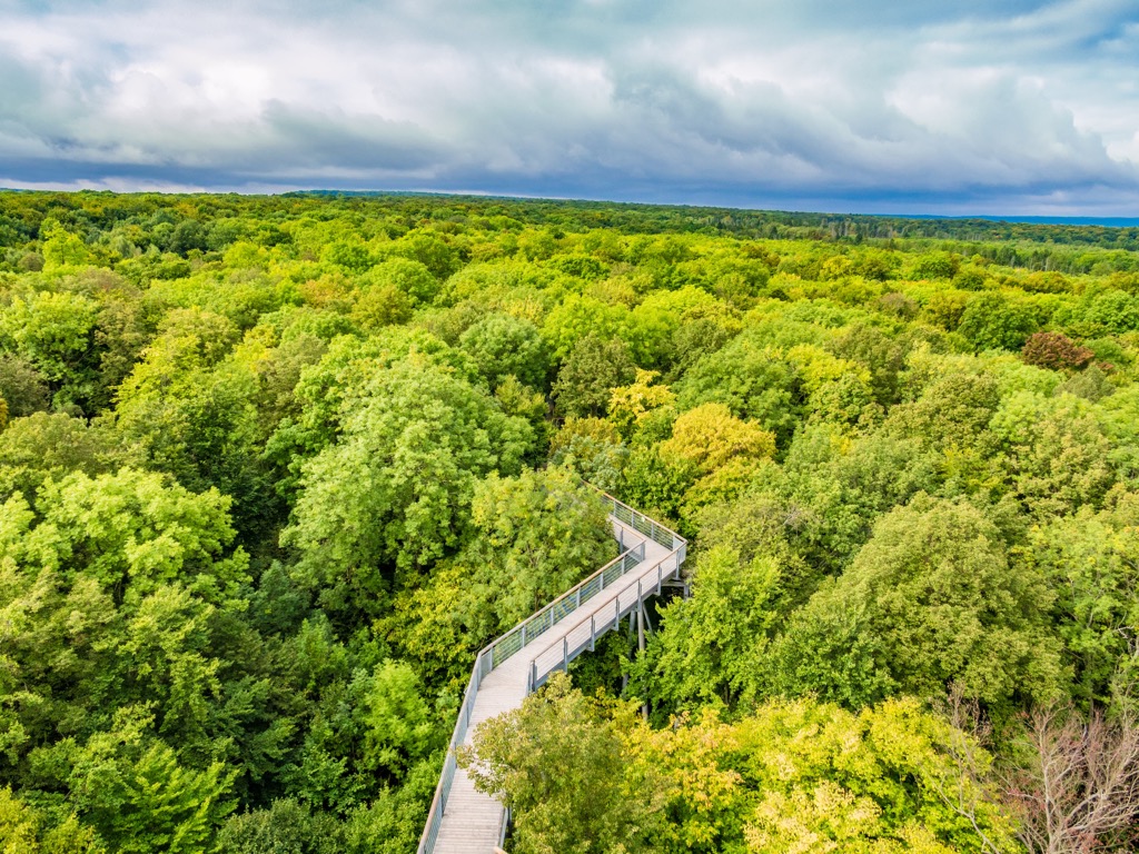
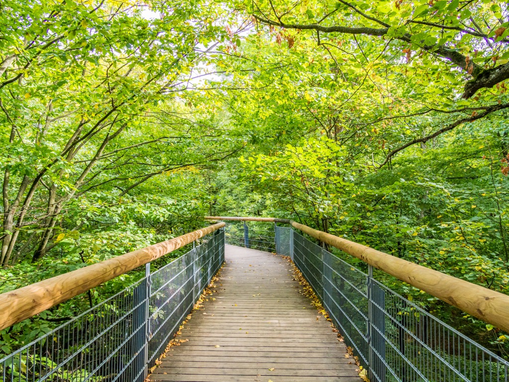
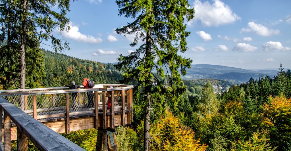
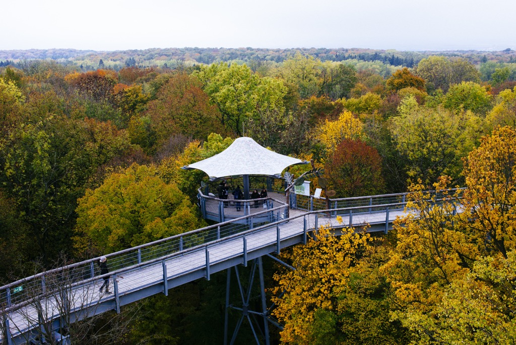
The Treetop Path (Baumkronenpfad) is one of the main attractions in Hainich National Park. This 540 m (1,771 ft) long walkway takes visitors above the beech trees to a 44 m (144 ft) tall observation tower, which provides some of the best views of Hainich and the Thuringian Basin.
Note that the Baumkronenpfad may be closed in the winter due to storms and poor weather, so plan ahead. The Baumkronenpfad is open from 10:00 a.m. to 7:00 p.m.
The World Heritage Trail (Welterbepfad) is one of four trails in Hainich National Park created by WWF Germany. The trail aims to showcase the best of Hainich's ancient beech forests. The trail also leads over Große Laite (491 m/1,611 ft), the highest hill in Hainich National Park.
The Welterbepfad is 9.5 km (6 mi) in length and is marked with a UNESCO symbol. You can pick up this trail from the Craulaer Kreuz hiking car park (Wanderparkplatz Craulaer Kreuz).
Large sections of this path lead through the bottom of a long valley. There's also a 100-step staircase to climb, which passes lots of deadwood teeming with life.
The Steinbergweg takes in some of the best of Hainich National Park's landscape. The path circles the Steinberg (344 m/1,128 ft), a hill from which this trail takes its name.
You can pick up this trail by parking at the Treetop Walkway car park (Parkplatz Baumwipfelpfad). The Steinbergweg is 10 km (6.2 mi) in length and is marked with an ammonite symbol.
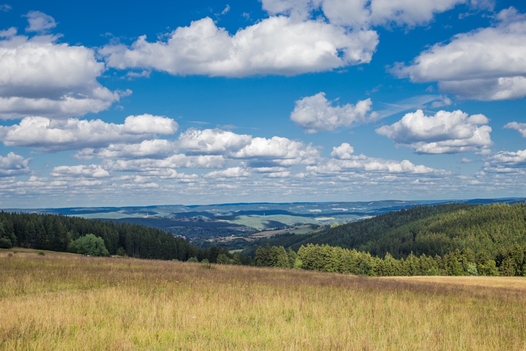
Along this trail, you'll walk past fields filled with sheep, dense beech forests, and a doline. Upon reaching the edge of the forest, you'll be treated to stunning views across the Thuringian Basin towards Großer Inselsberg (916 m/3,007 ft).
Discover some of the oldest forests in Hainich National Park along the Saugrabenweg. You can pick this trail up from the Am Zollgarten car park (Parkplatz Am Zollgarten). The trail is 10.7 km (6.6 mi) in length and is marked with a wild boar symbol.
The Saugrabenweg leads hikers through the UNESCO World Heritage Area and the Brunstal, which is known for being carpeted in march cups in the spring. You'll also pass Graurode, 1 of 40 abandoned villages in and around Hainich National Park.
Towards the end of the Saugrabenweg, you can enjoy a homemade cake and a drink at the Brotzeit Fuchsfarm snack bar. It's recommended hikers wear a good pair of hiking boots on the Saugrabenweg, as the path gets muddy.
A short, popular path worth hiking in Hainich National Park is the Eichenbergweg. You'll have the opportunity to explore some of the mixed deciduous forests on Eichenberg (443 m/1,453 ft) and discover a few interesting landmarks.
The Eichenbergweg is 3.5 km (2.1 mi) in length and is marked with an acorn symbol. As well as getting to see Hainich's hornbeams and copper beeches, you'll also pass the remnants of a medieval refuge castle, where a few of the original walls still stand.
Just down the path from the medieval castle refuge is one of the thickest trees in the park, a 5.45 m (17.8 ft) thick 800-year-old oak.
The Rennsteig is an ancient courier path that was first described in 1448 as the "Rynneweg." It runs for 31 km (19 mi) from north to south across Thuringia from Eigenrieden to Hörselberg-Hainich. Approximately 8.5 km (5.2 mi) of the trail traverses the length of Hainich National Park.
The Rennsteig enters Hainich National from the north near Reckenbühl. Along the way, you'll pass over Neuenstein (463 m/1 519 ft), before passing Betteiche and Ihlefeld, a legendary twisted tree and natural historical monument.
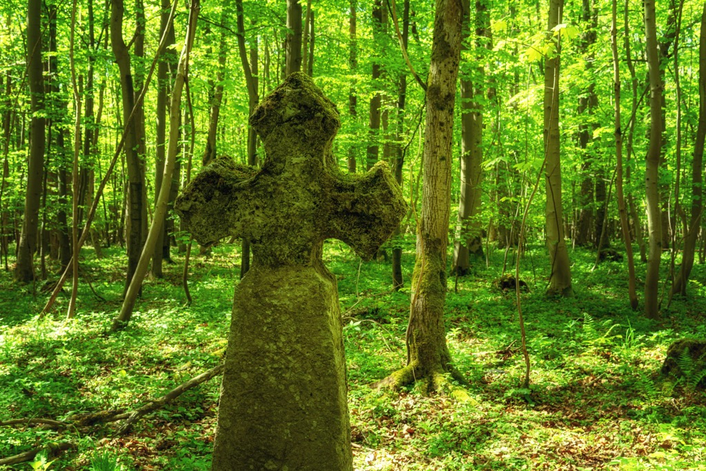
Other monuments along the trail include the fifteenth-century Ihlefeld Cross (Ihlefelder Kreuz) and the Iron Hand (Eiserne Hand), a sixteenth-century ironwork sculpture. The Rennstieg exits Hainich National Park just before reaching Alter Berg (519 m/1 703 ft), the highest summit in the Hainich hill chain.
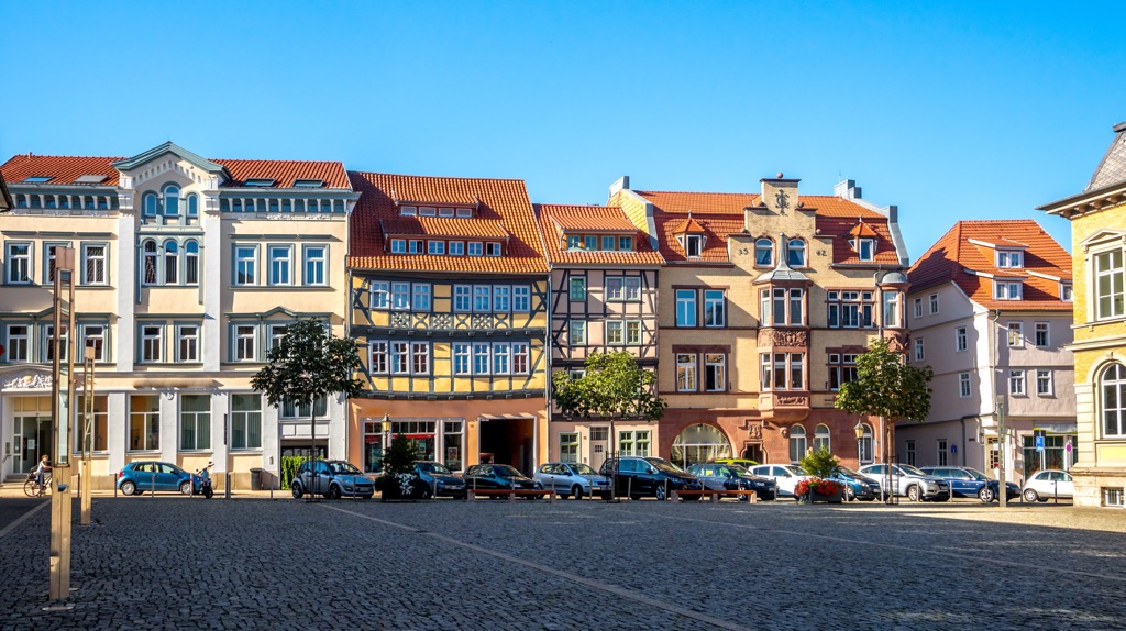
Surrounded by charming German towns complete with traditional half-timbered houses, Hainich National Park isn't short idyllic spots to spend the night. Read on to find out about the main towns and cities near Hainich National Park.
Erfurt is the capital of Thuringia and the largest settlement in the state. Erfurt is popular with tourists thanks to its beautifully preserved city center, which is considered one of the finest of its kind in Germany. It was also once home to Martin Luther, one of the key figures of the Protestant Reformation.
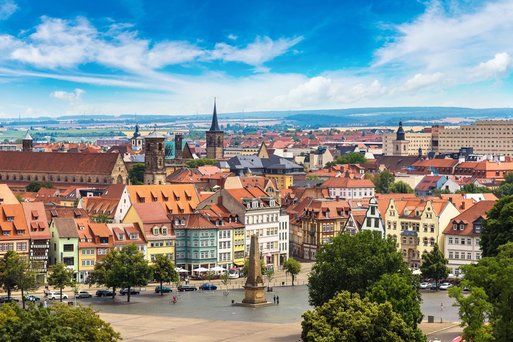
During your stay in Erfurt, don't miss out on touring its best medieval attractions, like Merchants' Bridge (Krämerbrücke), Erfurt Cathedral (Erfurter Dom), and Petersberg Citadel (Zitadelle Petersberg).
Erfurt is approximately a 55 km (34 mi) drive from Hainich National Park, making the park easy to reach on a day trip. Popular hotels in Erfurt include Dorint Hotel am Dom, Hotel Krämerbrücke, and Hotel Am Kaisersaal.
The spa town of Bad Langensalza is home to the headquarters of Hainich National Park. With its ornate public gardens and well-preserved medieval old town, Bad Langensalza is a popular tourist destination. The town sits along the German Timber-Frame Road tourist route and boasts many medieval half-timbered houses.
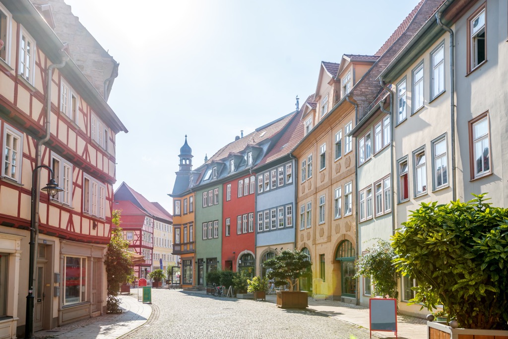
Local attractions in Bad Langensalza include the Japanese Garden (Japanischer Garten) and the Friederik thermal baths (Friederiken Therme). Bad Langensalza is the perfect base for exploring Hainich National Park, which is located just 11 km (7 mi) away.
Popular hotels in Bad Langensalza include Sante Royale Hotel, Gasthaus Zur Weintraube, and Alpha Hotel Hermann von Salza.
Eisenach is a large town situated near the Thuringia/Hessen border. Eisenach is one of the region’s most historic towns. In the twelfth and thirteenth centuries, Eisenach was the capital of Thuringia and was the birthplace of German composer Johann Sebastian Bach.
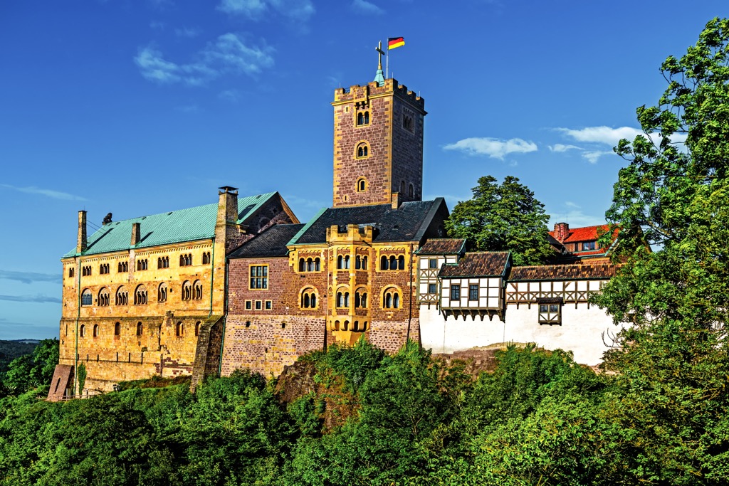
If you're planning to stay in Eisenach, ensure you take a tour of Wartburg Castle. Perched on a 410 meters (1,350 ft) high cliff, Wartburg Castle was built in the eleventh century and is a UNESCO World Heritage Site. You should also consider visiting the Bach House, the world's largest Johann Sebastian Bach museum.
Eisenach is located 11 km (7 mi) from Hainich National Park, making it a favorite destination for hikers. Popular hotels in Eisenach include Vienna House, Hotel Kaiserhof, and Berghotel.
On the northern edge of Hainich is the town of Mühlhausen. Mühlhausen was considered one of the most important settlements in central Germany during the Middle Ages and was once a self-ruling republic of the Holy Roman Empire.
The town is nicknamed "muhlhousia turrita," meaning Mühlhausen with its towers. Mühlhausen was given this nickname as you can't avoid seeing the church spires in the town center, including the thirteenth-century Divi-Blasii Kirche and the 86 m (282 ft) tall St Mary's Church (Marienkirche).
Hainich National Park is just 13 km (8 mi) from Mühlhausen, making exploring the local ancient beech forests easy. Popular hotels in Mühlhausen include Brauhaus Zum Löwen, Hotel Stadt Mühlhausen, and Hotel Mühlhäuser Hof.


