Get PeakVisor App
Sign In
Search by GPS coordinates
- Latitude
- ° ' ''
- Longitude
- ° ' ''
- Units of Length

Yes
Cancel
❤ Wishlist ×
Choose
Delete
The Wetterstein is a mountain chain belonging to the North Tyrol Limestone Alps, on the border of Tyrol, Austria, and Bavaria, Germany. Of the 183 mountains in the range, many of which draw avid alpinists and climbers, Zugspitze is the highest and has the greatest topographic prominence. The looming peak measures 2,962 m (9,718 ft) with a prominence of 1,745 m (5,725 ft). Germany’s tallest peak houses two of the country’s last remaining glaciers as well as the top stations of no less than three cable cars.
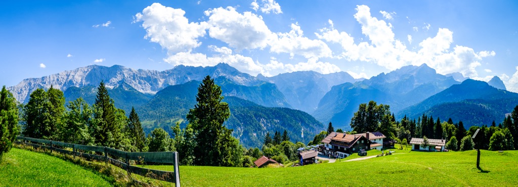
The Wetterstein Mountains span the border between Tyrol, Austria, and Bavaria, Germany. The range is easily accessed from Garmisch-Partenkirchen, Mittenwald, Seefeld in Tirol, and Ehrwald. These are all popular tourist towns, offering an array of alpine climbing, via ferratas, skiing, and hiking trails.
The range is neighbored by the Ammergau Alps to the west and north, the Bavarian Pre-Alps to the northeast, the Karwendel to the east, and the Mieming Range to the south. The Loisach River flows to the north and west, while the Kankerbach stream, Kranzbach stream, and Isar River flow to the northeast and east.
Wetterstein contains Germany’s tallest peak. At 2,962 m (9,718 ft), Zugspitze towers over the surrounding landscape and houses two of the last glaciers in Germany. It’s a popular spot, so don’t expect to be alone on the trails and slopes. Those looking for quieter sections should check out Waxenstein and the eastern Wetterstein ridges.
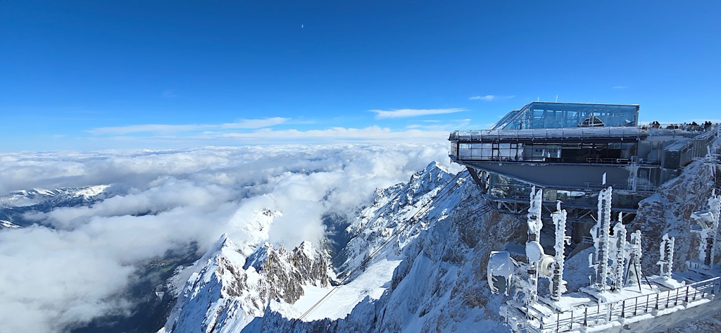
The Wetterstein Mountains are a subrange of the North Tyrol Limestone Alps and, by extension, the much larger European Alps. Rocks in the mountains formed over 200 million years ago from deposits in the ancient ocean Tethys. Shells, mud, and sand accumulated on the bottom of the ocean floor. During the early Cretaceous, around 140 million years ago, the African plate drifted north, pushing and folding deposits on the ocean floor over each other.
The Alps uplifted during the Alpine Orogeny, a mountain-building event that occurred as the African and Eurasian plates collided. This collision has been ongoing since Cretaceous times. Most mountain building occurred between 65 and 2.5 million years ago, although the mountains continue to uplift. However, the uplift rate no longer outpaces erosion, and the Alps are not considered a growing range.
Mountains in the range are primarily composed of compact limestone and are part of the Wetterstein formation.
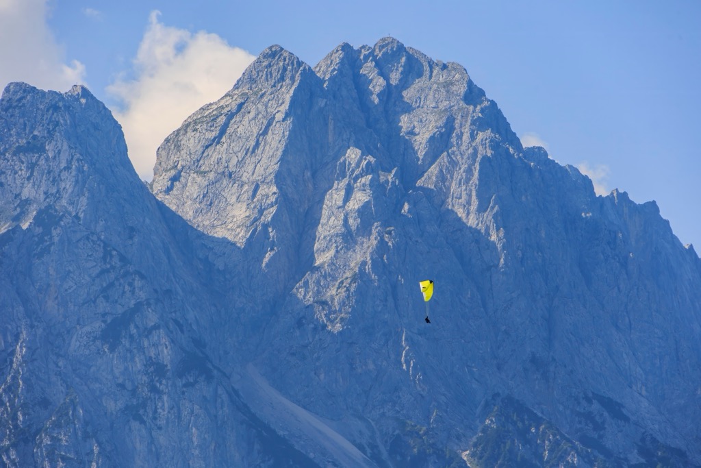
Nestled into the Wetterstein Mountains is Wettersteinwald, a forest reserve protected in 1978 by Bavaria. The Wettersteinwald contains trees representative of forests across the range – Swiss pine, spruce, and mountain pine. The range is home to several orchid species. Some, such as the Orchis ustulata or burnt orchid, are currently listed as critically endangered by the IUCN.
Outside the forest reserve, local farmers use sections for high summer pasture. Besides sheep and cattle, chamois, marmots, marten, and deer live in the mountains. If you visit in the fall, you may hear deer bugling during their mating season.
The Wetterstein Mountains are also a prime birding location. Notable species include the white-back and three-toed woodpecker, the citril finch, several grouse species, alpine chough, and golden eagles.
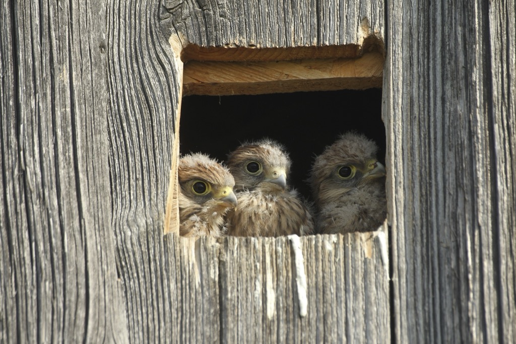
The Wetterstein Mountains have a complex human history. Early people in the area, the Germanic Baiuvarii, were the predecessors of modern-day Bavarians and Austrians. During the Middle Ages, leadership passed between various counts and bishops until Tyrol ultimately fell under Habsburg rule in 1363.
During the Napoleonic Wars in the early 1800s, Bavaria took control of the region, though it was returned to Austria after the Congress of Vienna in 1814.
In 1820, Lieutenant Josef Naus from the Royal Bavarian Army and mountain guide Johann Georg Tauschl were the first to summit Zugspitze. The Royal Bavarian Topographic Bureau commissioned the trip to capture an accurate understanding of the border between Germany and Austria.
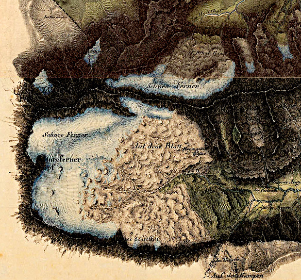
The Schüsselkarspitze, one of the top climbing destinations in the range, was first climbed by Heinrich Moser and Oscar Schuster in 1894. The peak contains several famous routes that mark early achievements in extreme climbing.
The mountain railway, Baerische Zugspitzbahn, arrived in 1930 after decades of discussion. Its construction aligned with the Passion Play performed in Oberammergau that year.
The Wetterstein Mountains have evolved into a recreational paradise, with a high concentration of ski resorts, hiking trails, and numerous other activities. Farming still has a significant place in the valleys, though the economy is now driven by tourism.
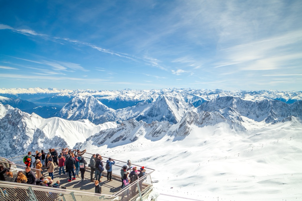
Wetterstein is a mecca for alpinists and climbers. The range offers scenic trails with steep elevation gain, numerous climbs and via ferratas, and quick access from the holiday villages of Garmisch-Partenkirchen in Bavaria and Ehrwald in Tyrol.
A handful of huts pepper the slopes and provide convenient stop-overs for multiple-day trips at higher elevations. Ski resorts such as Zugspitze and Garmisch are home to some of the best skiing in Germany.
Various cable cars and gondolas enable quick access to the mountains. Tiroler Zugspitzbahn rises from Ehrwald to the western summit of Zugspitze. The Ehrwalder Almbahn gondola services the Ehrwalder Alm ski and hiking area year-round. The Zugspitze cable car spins from the German side, as does the cogwheel train from Garmisch-Partenkirchen to Zugspitzplatt by way of Granaui and Eibsee.
The area around Oberreintal Hut and the southern side of Schüsselkarspitze and Scharnitzspitze are known for alpine climbing. You’ll find all level routes on limestone slabs.
The south side over Gaistal is quieter than the north side. The Zugspitze Via Ferrata, the Schneefernerkopf Route, and the Alpspitz Ferrata are just a few of the fixed rope routes in the range.
As far as long trails go, three sections of the Via Alpina (running from Trieste to Monaco) traverse the Wetterstein. The Limestone Alps Trail, or North Alpine long-distance hiking trail 01, travels between Gregenz and Lake Neusiedl, cutting across the rocky Wetterstein.
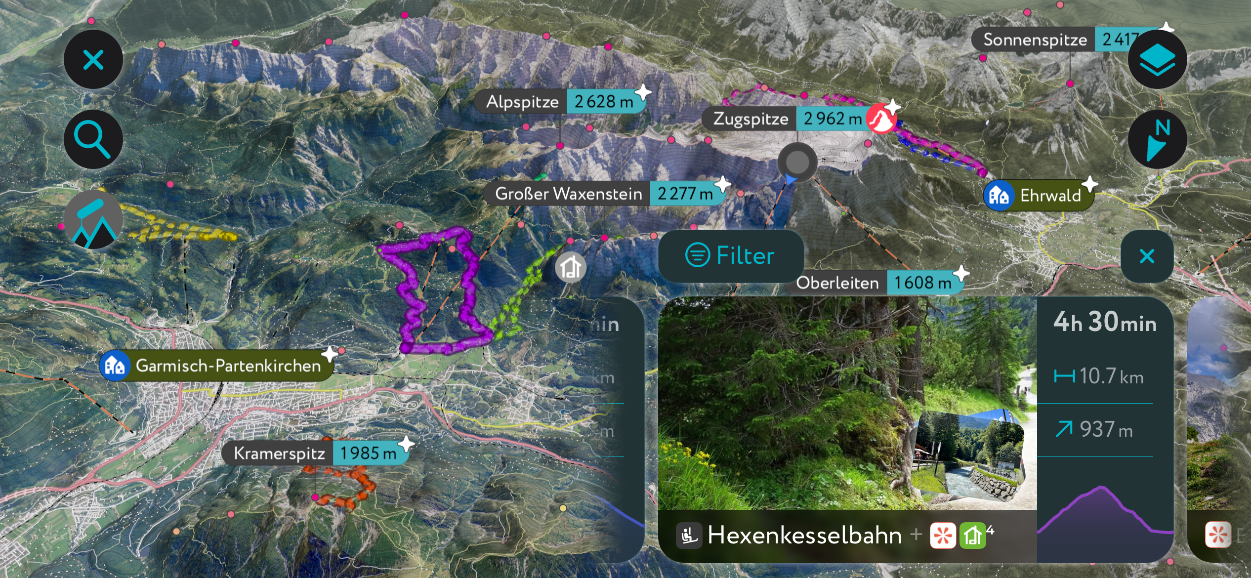
Need fresh ideas for your next outdoor adventure? The PeakVisor App provides the latest regional maps and information, helping you get the lowdown on your local area.
Download the PeakVisor App for up-to-date weather reports in any destination across the Alps, including snow depths. Plus, we've been hard at work adding the details of hundreds of mountain huts, with information on opening hours, overnight accommodation, and dining options.
From the German side, five routes reach the summit of Zugspitze. The Reintal Route from Garmisch-Partenkirchen is long, although the least technical, and offers a gradual and scenic descent with huts along the way offering food, drinks, and a place to stay. The Höllental Route is the most direct and popular route. Originating in the town of Hammersbach, the trail cuts through the Höllental Gorge. It requires scrambling, climbing, and some steep sections.
The Jubiläumsgrat Ridge route starts on the summit of Alpspitze and follows an exposed ridge to Zugspitze. The challenging terrain and steep drop-offs make this the most complex and technical option, best for those with proper equipment and advanced mountaineering skills. The Stopselzieher Route departs from Grainau and is a challenging, less-frequented trail with a rocky and steep ascent.
The final route from the German side is the Höllentalferner Route, often done as a winter ski tour. Leaving from the Höllental Hut, it crosses the Höllentalferner Glacier and requires mountaineering skills and proper equipment, including ice axes, crampons, and basic glacier protection.
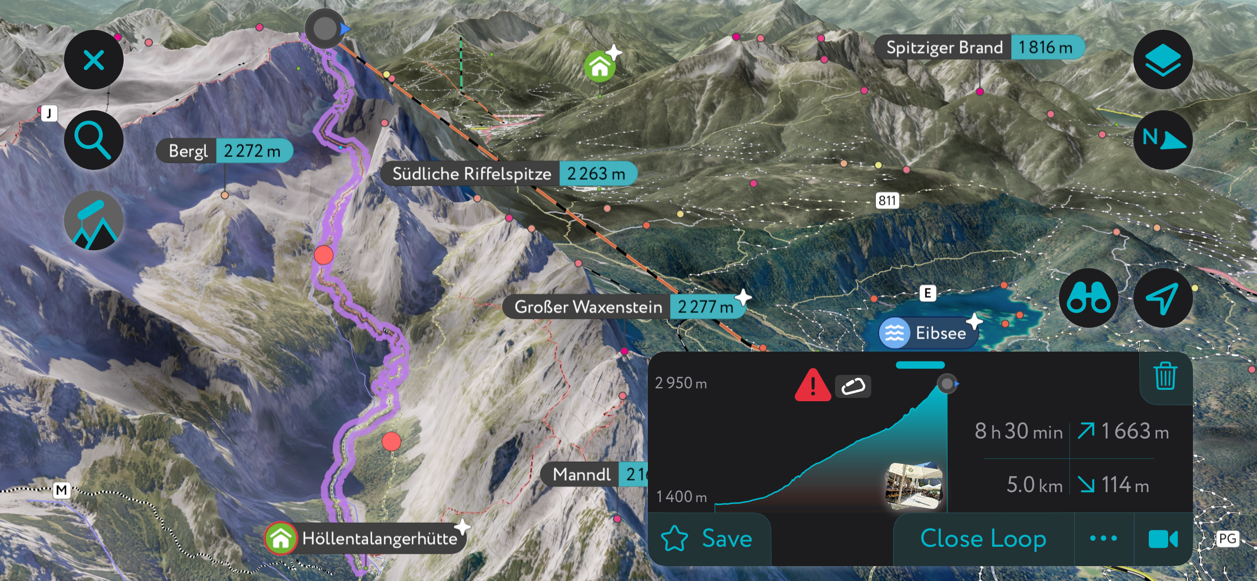
Of course, it’s also possible to reach the top from the Austrian side and via cable car. The vast majority of people who claim the summit of Zugspitze got there via one of three cable cars and not on the power of their own two feet.
The Garmisch-Partenkirchen is one of Germany’s most famous ski resorts and hosts World Cup competitions and other major events each year. The resort encompasses three mountains – the Hausberg, Kreuzeck, and Alpspitze.
Gentle slopes on the Hausberg are perfect for beginners and children, while challenging runs include the Kandahar slope, with one section of 43-degree steepness. Freeriders should check out the Osterfelderkopf, the Hochalm, the Längefelderbahn, and the Bernadien lift. In total, there are 18 lifts with access to 43 km (27 mi) of routes.
Schüsselkarspitze is one of the best climbing spots in the Wetterstein, with numerous famous climbs running along the south and southeast faces. Routes feature cracks, overhangs, and smooth slabs, ranging from fully bolted sports climbs to trad climbing. Pitons and bolts for belay stances on the popular routes make the multi-pitch routes even more efficient.
The West Ridge, rated at UIAA Grade III+, is a quintessential climb. Another well-known route is the South Face “Fiechtl/Herzog,” which was first climbed in 1913 and is historically significant from the early days of technical climbing. On the southeast face, the “Peters/Haringer” is a popular mixed sport and trad climb. While fitted with bolted belays and a few bolts per pitch, it still requires a rack of nuts and cams to sew it up.
The towns of Garmisch-Partenkirchen in Bavaria and Ehrwald in Tyrol are great spots to base yourself and access the Wetterstein mountains and Zugspitze. To the east lies Mittenwald, a historic town with excellent access to the mountains and only 65 km (40 mi) from Munich. Once in the mountains, you can stay at numerous mountain huts, maximizing your time at elevation.
Garmisch-Partenkirchen, population 27,500, is located on the German side of Zugspitze. It is not only a mecca for winter sports but also an ideal spot to base yourself and explore Bavaria's mountains, lakes, and historic towns. The town and surrounding slopes offer 60 km (37 mi) of pistes and serve as an international winter sports venue, including for the Olympics. The Partnach Gorge, Leutasch Gorge, and Höllental Gorge are also great day trips.
Outside of snow season, hiking trails wind through the valleys, along the slopes, and into nearby gorges. The Neuschwanstein Castle, which is said to have inspired Walt Disney, is now a museum and offers tours. Book in advance to ensure the tours are not sold out. Additionally, the Werdenfels Museum dives into the town’s history and culture.
Ehrwald, located at the base of Zugspitze on the Austrian side, gets an honorable mention. Like Garmisch, winter offers prime downhill skiing, snowboarding, and country skiing, while warmer months allow visitors to take advantage of the hiking trails and via ferratas.
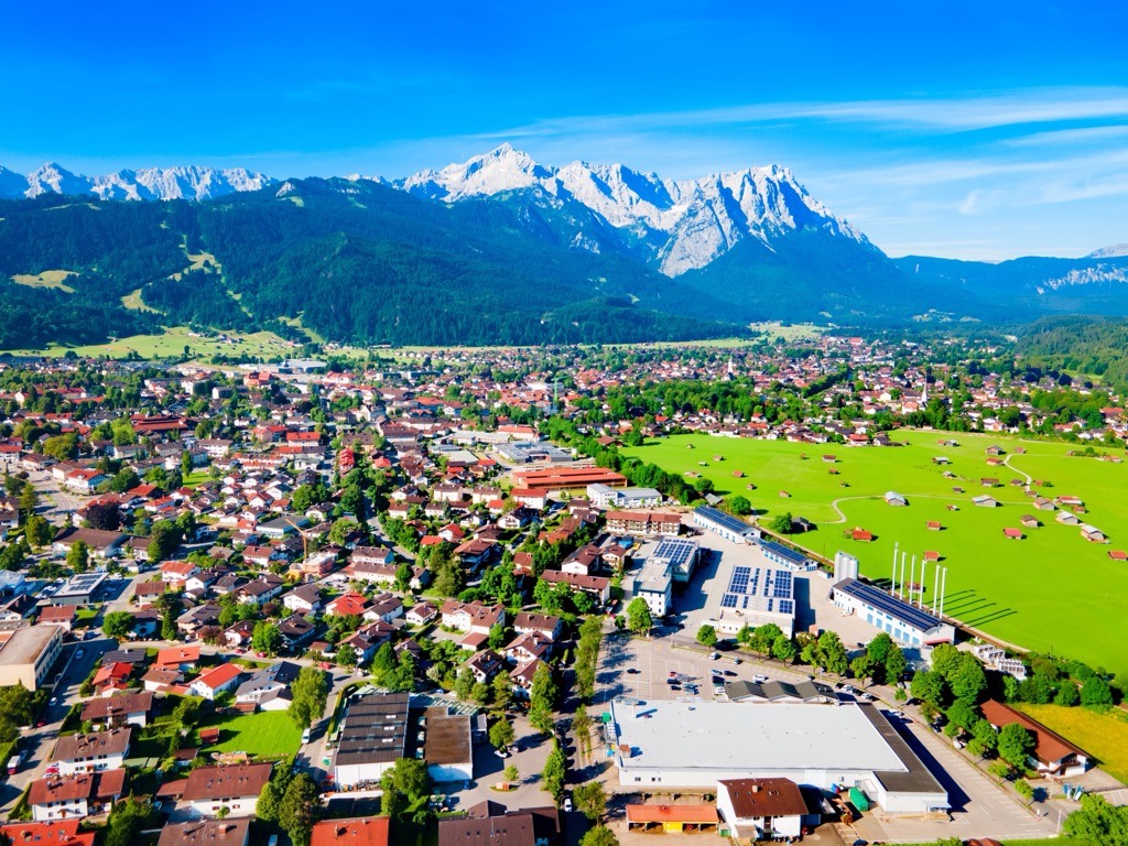
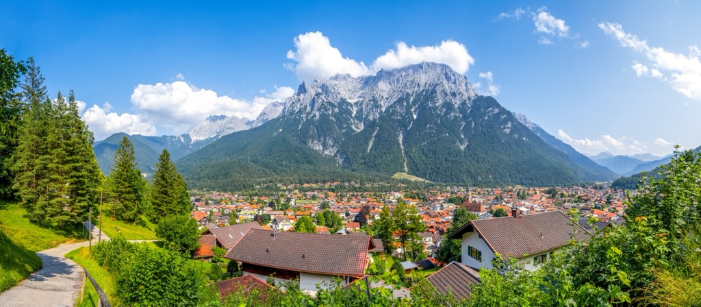
Mittenwald has a population of around 7,500 people and is 65 km (40 mi) south of Munich. It is a quiet but charming town. The house exteriors boast colorful mural paintings in a style known as Lüftlmalerei, specific to southern Germany and Austria, and the town is famous for the art of violin-making. Manufacturing began in the mid-1600s by the Klotz family when the father brought skills he learned in Italy; the museum Geigenbaumuseum dives into the instrumental history.
The Mittenwald Church is a 14th-century church of Saint Peter and Paul. Although it is not as ornate as other city churches, it’s worth passing by to appreciate the mural paintings that give the illusion of three dimensions.
The Karwendelbahn cable car is the second highest in Germany and climbs to 2,000 m (6,560 ft). The summit offers a restaurant, an information center, and the starting point for several hikes in the Karwendels. In winter, experienced skiers shouldn’t miss the Dammkar ski route. It is Germany's longest ski route at 7 km (4.3 mi) and descends 1,300 m (4,265 ft) down to Mittenwald.
Explore Wetterstein with the PeakVisor 3D Map and identify its summits.


