Get PeakVisor App
Sign In
Search by GPS coordinates
- Latitude
- ° ' ''
- Longitude
- ° ' ''
- Units of Length

Yes
Cancel
❤ Wishlist ×
Choose
Delete
The Mieminger Chain (Mieminger Kette), also known as the Mieming Range, is a mountain range in Tyrol, Austria. Often overlooked in favor of the nearby Wetterstein Mountains, the Mieminger Chain is a superb hiking destination off the beaten track. There are 127 named mountains in the Mieminger Chain. Hochplattig (2,755 m / 9,039 ft) is the highest point. The most prominent mountain is Tschirgant (2,372 m / 7,782 ft).
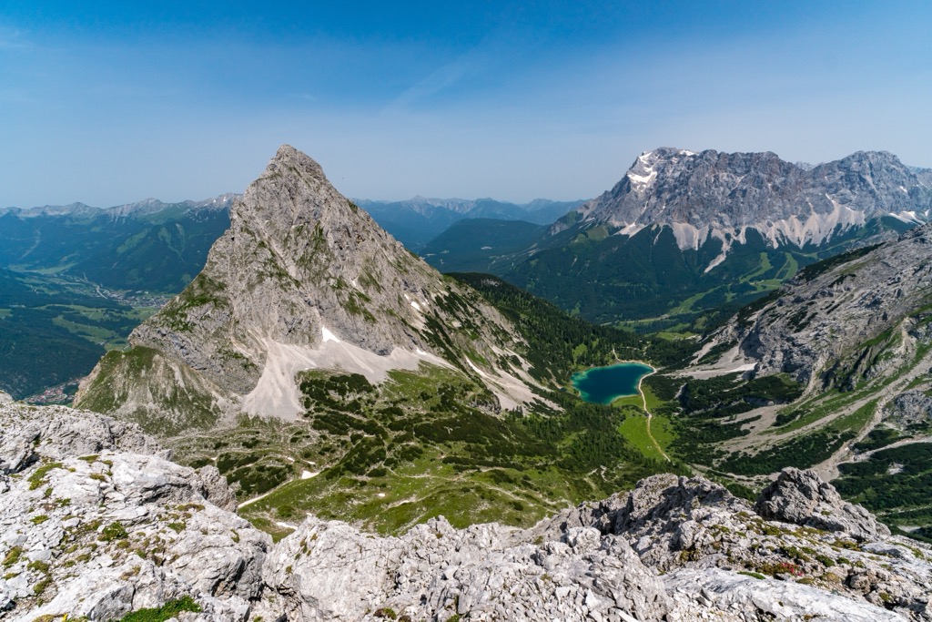
The Mieminger Chain is relatively compact, sandwiched between the Oberinntal to the south and the Gaistal to the north. It's significantly lower than neighboring ranges like the Ötztal Alps to the southwest, and the Wetterstein to the north — no summit in the Mieminger Chain exceeds 2,800 m (9,186 ft) in elevation.
The Mieminger Chain's main crest, which stretches for roughly 16 km (10 mi) from the Wannig (2,493 m / 8,179 ft) in the west to the Hohe Munde (2,662 m / 8,734 ft) in the east, is dramatic, with its jagged limestone and dolomite summits and knife-like arêtes. Due to its unique geological makeup, parts of the Mieminger Chain more closely resemble the Dolomites than the surrounding Austrian Alps.
Located entirely within Tyrol at the eastern end of the Northern Limestone Alps, Mieminger Chain is bordered by five other mountain ranges:
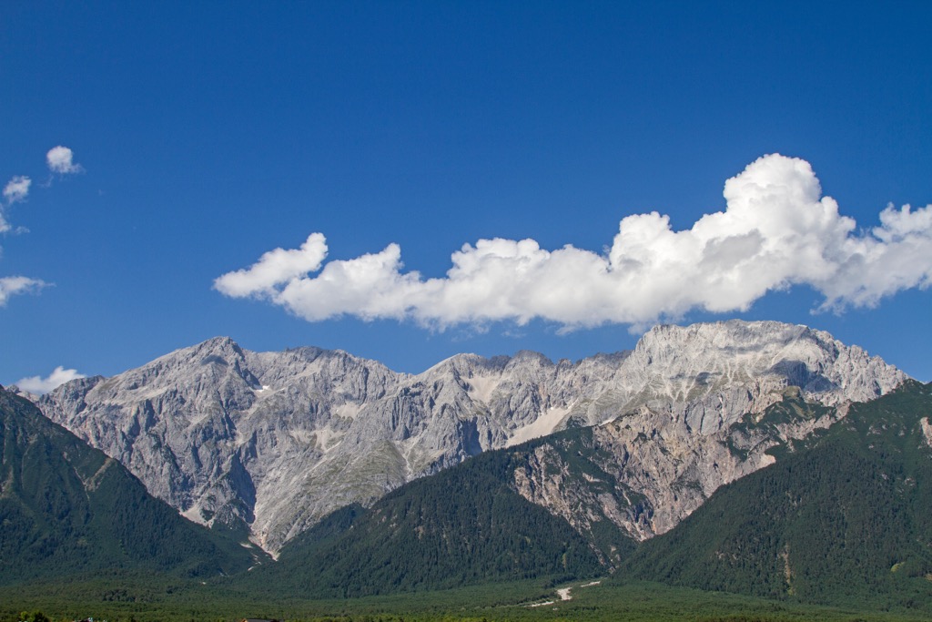
Despite being considered separate ranges, the Alpine Club's classification of the Eastern Alps groups the Wetterstein Mountains and the Mieminger Chain together. As a result, the Mieminger Chain is sometimes considered a sub-group of the Wetterstein.
While most of the central range is quiet and bereft of tourists, the area around the Coburger Hütte (1,927 m / 6,322 ft) at the western end of the range is popular with hikers.
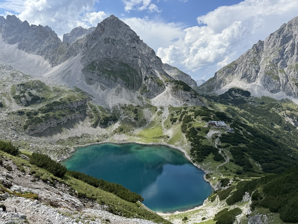
The area around the Coburger Hütte is home to Seebensee and Drachensee, two high mountain lakes encircled by the famous summits of Vorderer Tajakopf (2,450 m / 8,038 ft), Vorderer Drachenkopf (2,303 m / 7,556 ft), and the Ehrwalder Sonnenspitze (2,417 m / 7,930 ft). The Mieminger Chain's eastern end is also a popular destination, thanks to Hohe Munde.
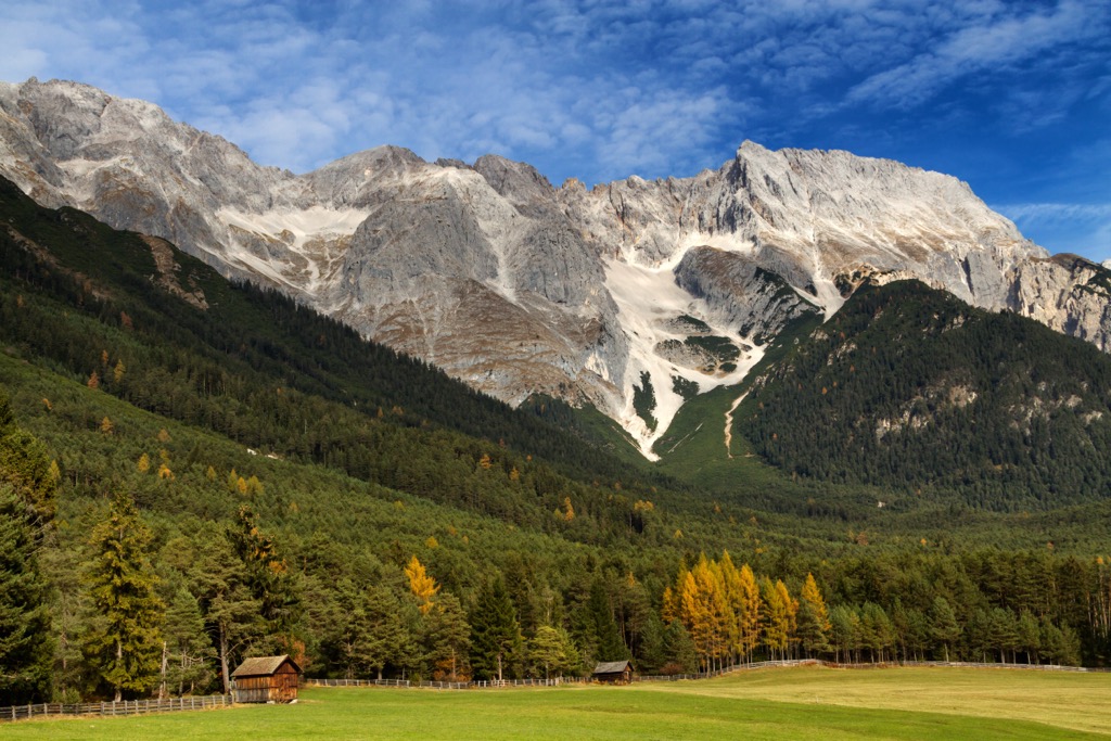
Several rivers spring from high in the Mieminger Chain and flow into the River Inn on its southern boundary. For example, the Griesbach forms near Hochwand (2,719 m / 8,921 ft) and Hochplattig, while the Sturlbach springs from between Wankspitze (2,208 m / 7,244 ft) and Grünstein (2,661 m / 8,730 ft).
One of the most famous geographical features of the Mieminger Chain is the Mieminger Plateau, a 14 km (8.5 mi) long and 4 km (2.5 mi) wide high mountain plateau between 800 m (2,624 ft) and 1,000 m (3,280 ft) in elevation. It sits at the range's southern foot within the Oberinntal and is popular for hiking, cycling, and cross-country skiing.
Major settlements in and around the Mieminger Chain include Telfs, Imst, Seefeld, and Zirl.
The Mieminger Chain is of particular interest to geologists due to its position between three geological rock units.
During the Alpine Orogeny mountain-building event less than 66 million years ago, these geographical rock units formed into thrust sheets known as nappes and were stacked atop one another. Today, each geological unit is exposed at the surface next to one another. The Mieminger Chain is part of one of these three rock stacks, called the Inntal Stack.
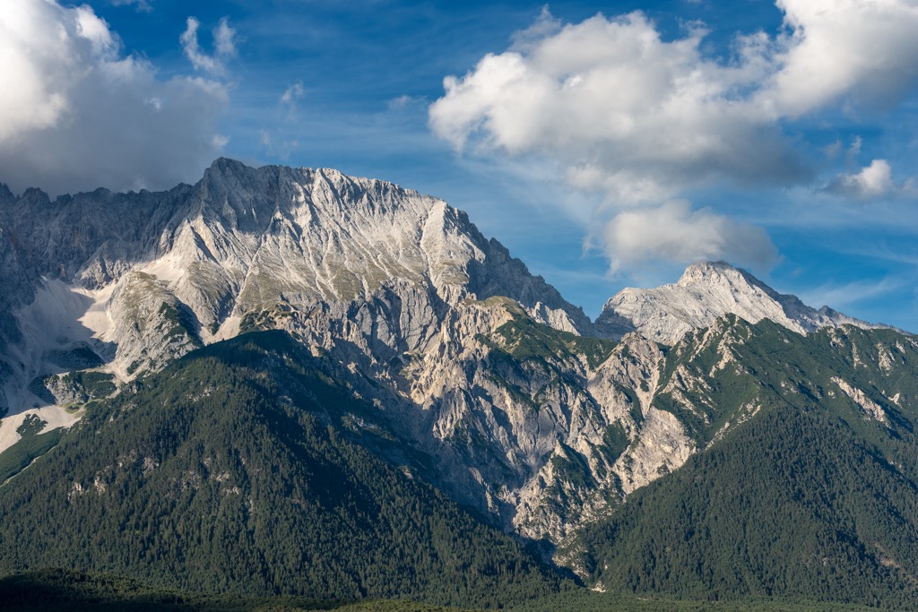
The oldest rocks in the Mieminger Chain are between 250 and 130 million years old, dating back to the Triassic and Jurassic Periods. At this time, the Mieminger Chain lay underneath a shallow tropical sea called the Alpine Tethys Ocean.
During this period, dolomitic rocks, breccias, and limestones formed around the Alpine Tethys Ocean's edge. A sequence of dark limestone known as Alpine muschelkalks, as well as Wetterstein limestones, also formed from reefs and coral. Many major summits in the Wetterstein Mountains and Mieminger Chain, like Sonnenspitze, Vorderer Igelskopf (2,224 m / 7,297 ft), and Zugspitze (2,962 m / 9,718 ft), are composed of Wetterstein limestones.
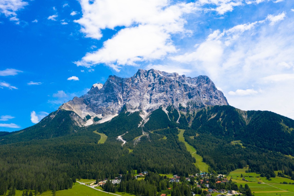
Around 35 million years ago, the rocks of the Mieminger Chain lay thousands of kilometers south of its current location. During the Alpine Orogeny, the African, Arabian, and Indian tectonic plates from the south collided with the Eurasian Plate to the north, pushing the Mieminger Chain into its current position.
As seen today, the summits, valleys, and moraines of the Mieminger Chain were shaped by the Würm glaciation approximately 10,000 years ago. Today, the Mieminger Chain is made up primarily of limestone and dolomite, as well as areas of sandstones, breccias, tuffs, argillites, and hornfels.
The Mieminger Chain's dense forests, alpine pastures, and broad valleys are home to a wide array of fauna and flora.
The largest mammal frequently spotted within the Mieminger Chain is red deer, which can weigh in excess of 200 kg (441 lbs). Brown bears are rare in Tyrol — only one or two bears are thought to visit the state, coming across the Italian border from Trentino.
Since being eradicated in the 19th century, gray wolves have slowly returned to Austria. As of 2022, over 50 individuals and several wolf packs have been identified.
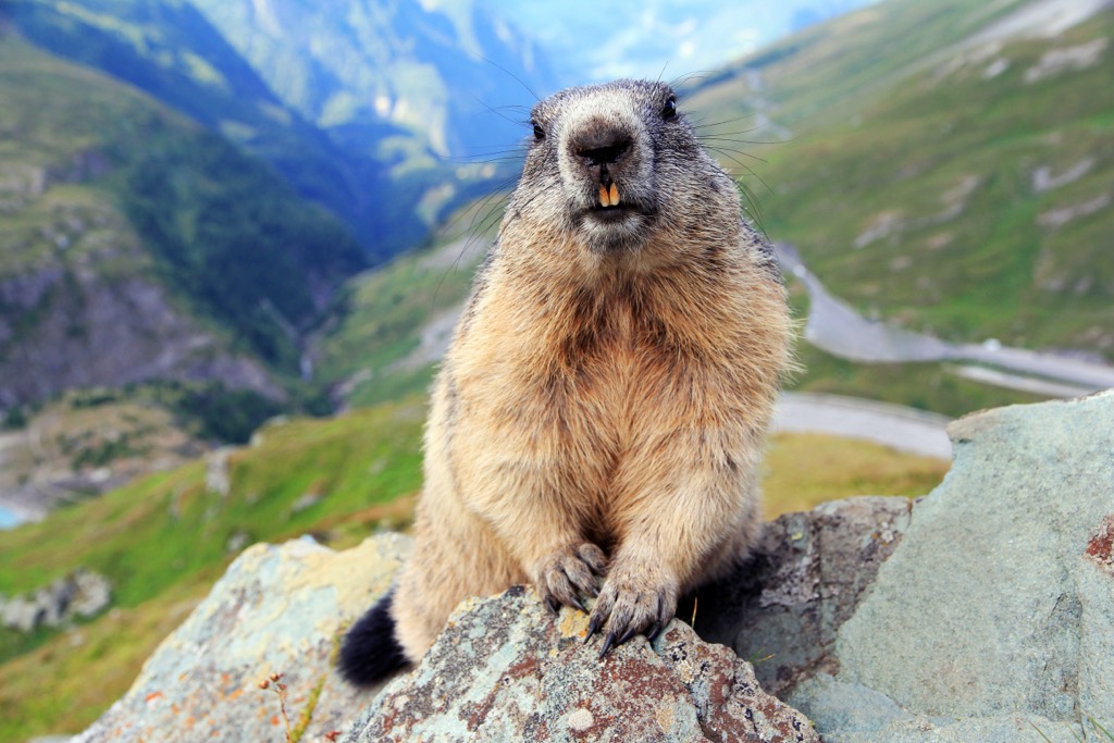
Other notable mammals inhabiting the Mieminger Chain include chamois, wild boar, marmots, pine martens, badgers, pipistrelle bats, and Alpine pine voles.
Large birds of prey can be spotted circling and hovering above the slopes of the Mieminger Chain. The largest of these is the bearded vulture, with a wingspan that can exceed 2.9 m (10 ft). Other notable birds of prey include golden eagles, peregrine falcons, common buzzards, and tawny owls.
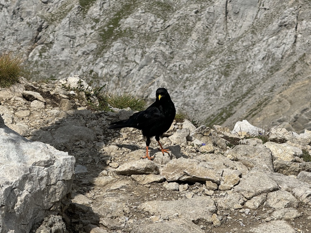
Other common smaller bird species within the Mieminger Chain include Alpine choughs, Eurasian blackbirds, Eurasian jays, wallcreepers, European goldfinches, and wrynecks.
The only venomous snake native to the Mieminger Chain is the common European adder. It's not considered an aggressive snake, and while its bite is painful, it's rarely lethal. Common European adders are usually found hiding under rocks or in bushes and can live at up to 3,000 m (9,842 ft) in elevation.
Over 47% of Austria is forested, and lush woodlands carpet large expanses of the Mieminger Chain. Its forests are typical of the Alps, with their composition changing with elevation.
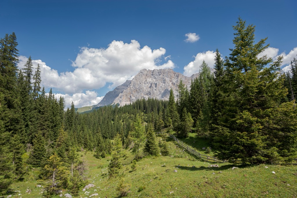
These forests consist primarily of deciduous broadleaf trees at low elevations, including English, Irish, and downy oaks. Higher up on the mountain slopes between 800 m (2,625 ft) and 1,200 m (3,937 ft) in elevation, broadleaf trees give way to mixed coniferous forests composed of mountain pines, Norway spruces, silver firs, European beeches, and birches.
Above the treeline, alpine pastures and craggy exposed mountainsides dominate the Mieming Range's landscape. At these high elevations, a surprisingly broad array of flowering plants thrive.
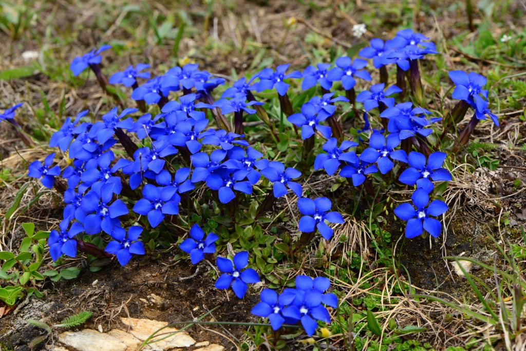
One notable example of alpine flowering plants is edelweiss, the National Flower of Austria. Other plant species that grow on the Mieminger Chain's alpine pastures include trumpet gentian, monkshoods, mountain arnicas, Bavarian gentians, and black yarrows.
Despite being relatively low compared to the likes of Zugspitze (2,962 m / 9,718 ft) and Wildspitze (3,768 m / 12,362 ft) in neighboring ranges, mountaineers didn't conquer some of the Mieminger Chain's summits until the latter half of the 19th century.
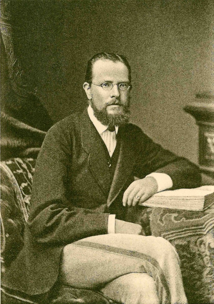
Hermann von Barth, a Bavarian mountaineer famed for climbing over 130 summits across the Wetterstein, the Karwendel, and the Allgäu Alps by the early 1870s, is credited with several first ascents in the Mieminger Chain.
Von Barth became the first person to reach the main summit of Hochpattig on August 11th, 1872, and made the first successful ascent of Hochwand on August 9th, 1873. He also made the first ascents of Hohe Munde (via its western flank) and Sonnenspitze.
The true first ascent of Hohe Munde was over 40 years earlier, in 1829, by Andrä Sauter. Andrä is notable for being the brother of Anton Sauter, a botanist credited with being the first to describe numerous plant species in the Eastern Alps.
While the Mieminger Chain has never been the most popular Tyrolean mountain range, the chain's interior became easier for hikers to access following the construction of the first Coburger Hütte in 1901.
The Mieminger Chain has been featured several times in recent Austrian pop culture. In 2009, Hohe Munde was the setting of an episode of the crime film series Tatort, titled Baum der Erlösung (Tree of Redemption). In the 90s medical drama series, Der Bergdoktor, the fictional village of Sonnenstein is located on the Mieminger Plateau.
The Mieminger Chain is the quiet neighbor of the Wetterstein Range, but with stunning and easily accessible mountains, it's highly underrated.
Consider wearing a helmet on steeper alpine hikes in the Mieminger Chain. The range's loose limestone composition means rockfalls are commonplace.
Ensure you bring appropriate equipment and plenty of provisions when hiking in the Mieminger Chain. Check local weather forecasts, map your route, and inform others of your itinerary.
You can find more information on the hiking and rock climbing grades in this guide. There is also information on Austrian via ferrata (klettersteig) classifications here.
The Hohe Munde (2,662 m / 8,734 ft) is a standalone mountain at the far eastern end of the Mieminger Chain's main ridge. Despite being one of the highest mountains in the Mieminger Chain, it's relatively straightforward to climb via its eastern ridge and boasts some of the range's best views.
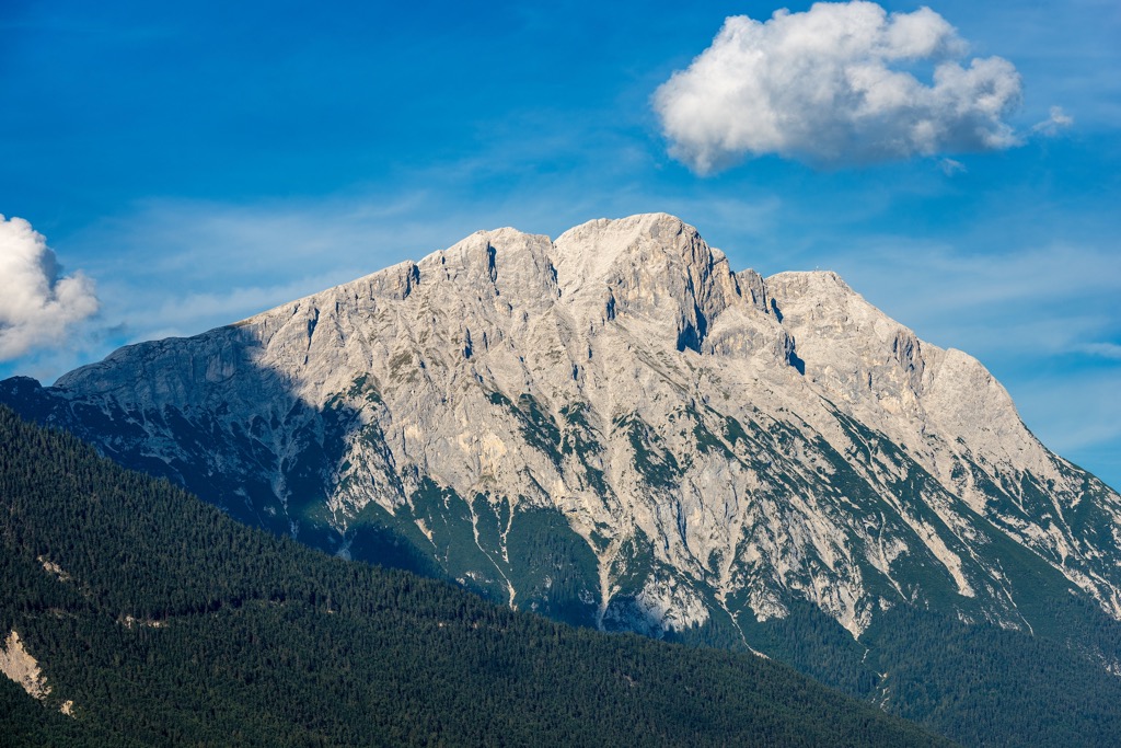
Located across the Gaistal from Wetterstein and with the Stubai Alps to the south, Hohe Munde affords panoramas of Zugspitze and across Telfs to Rietzer Grießkogel (2,884 m / 9,462 ft). On a clear day, it's possible to spot Großglockner (3,798 m / 12,461 ft) to the southeast.
Hohe Munde's simple ascent and impressive views make it one of the Mieming Range's most popular mountains. The best time to climb Hohe Munde is between June and September.
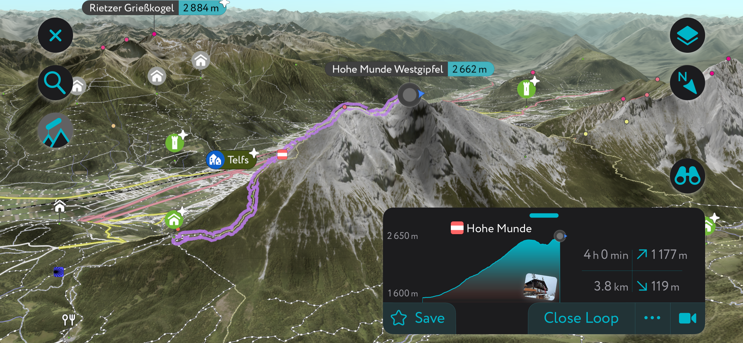
The trail to Hohe Munde starts from Leutasch-Moos via the Rauthhütte (1,600 m / 5 249 ft). Parkplatz Moos Rödlach is one of the best places to park near the trailhead.
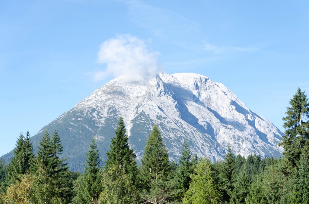
The trail leads over the Zugspitzblick and up the eastern ridge to Hohe Munde Ostgipfel (2,592 m / 8,504 ft). By crossing the mountain's saddle, you can extend your hike to Hohe Munde Westgipfel (2,662 m / 8,734 ft). Descend the way you came. This hike is approximately 11.5 km 97.1 mi) in length.
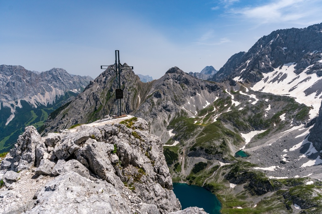
Drachenkopf is a mountain with dual summits on a northern side ridge of the Mieminger Chain. Its lower summit, Vorderer Drachenkopf (2,303 m / 7,556 ft), is very popular — it's located approximately an hour's hike from the Coburger Hütte (1,927 m / 6,322 ft).
From Vorderer Drachenkopf, you'll have stunning views of Drachensee and Sonnenspitze over Seebensee. You'll also have panoramas of Grünstein, Tajakopf, and Zugspitze's southern face.
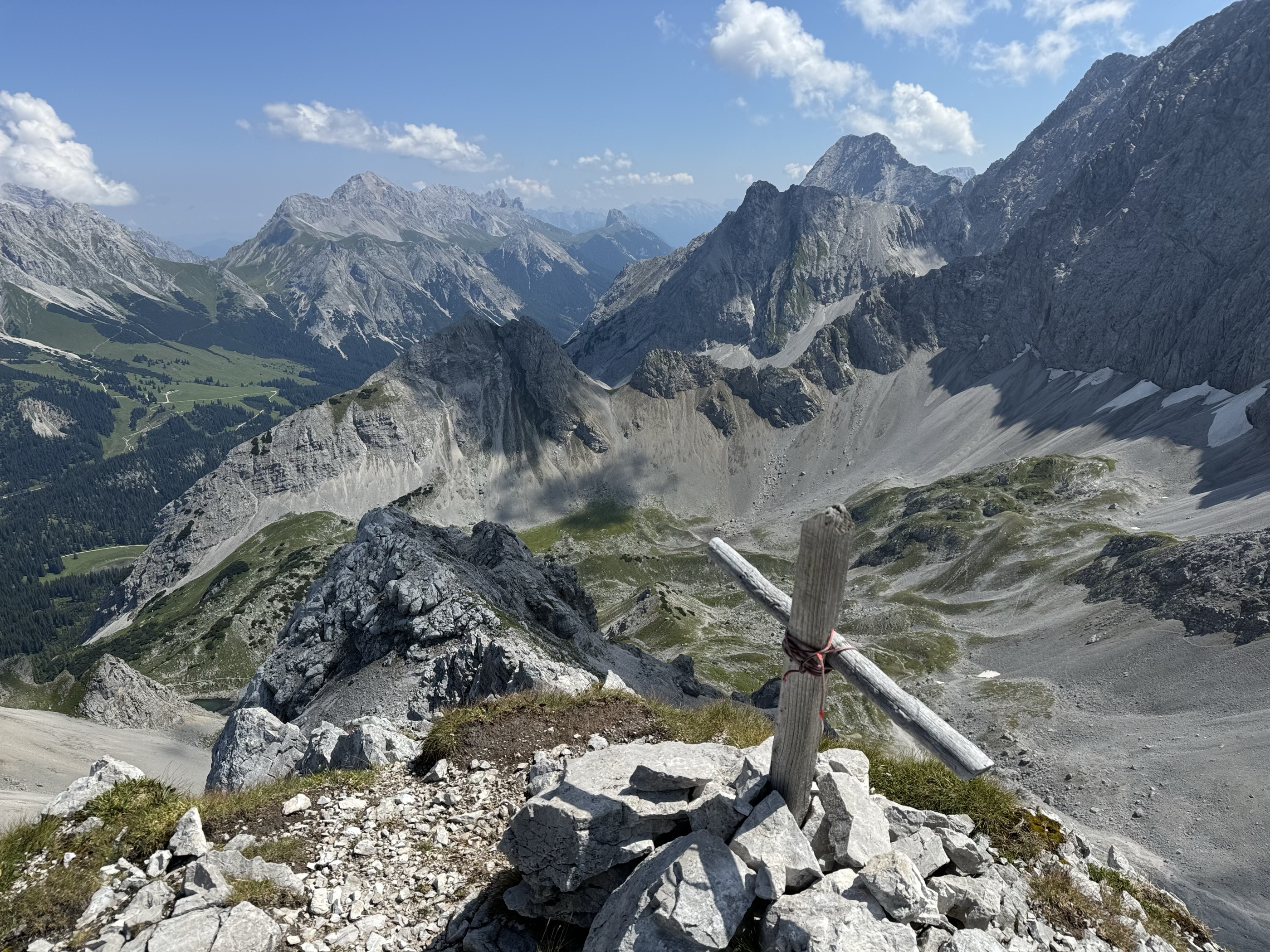
You can reach Vorderer Drachenkopf's summit by following the Drachenkopf Normalweg, graded T4 on the Swiss Alpine Club (SAC) hiking scale. This route loops around the mountain, ascending via its southwestern ridge. Descend the way you came. The Drachenkopf Normalweg is approximately 2 km (1.2 mi) in length.
It's possible to extend your hike to Drachenkopf's higher summit, Hinterer Drachenkopf (2,646 m / 8,681 ft). The ridge connecting Vorderer Drachenkopf and Hinterer Drachenkopf includes a UIAA II graded scramble, but nothing unmanageable for experienced hikers.
Tajakopf, or Tajaköpfe, is another dual-summit mountain located close to the Coburger Hütte. The hut's "home mountain," Tajakopf casts a long shadow over Seebensee below. The two summits separate two picturesque cirques: the Drachenkar and Brendlkar.
Tajakopf's highest summit, Vorderer Tajakopf (2,450 m / 8,038 ft), is hugely popular due to the beautiful yet technically challenging Tajakante via ferrata on its western ridge. The Tajakante is mostly graded D/E on the Austrian via ferrata classification.
Alternatively, you scale Hinterer Tajakopf (2,407 m / 7,897 ft) to the south of Vorderer Tajakopf, which is much less technical. Hinterer Tajakopf is popular for ski touring and hiking, with its summit providing views of the Seebensee and Drachensee, as well as the Stubai Alps to the south. If you're climbing Vorderer Tajakopf first, it's a straightforward scramble to Hinterer Tajakopf.
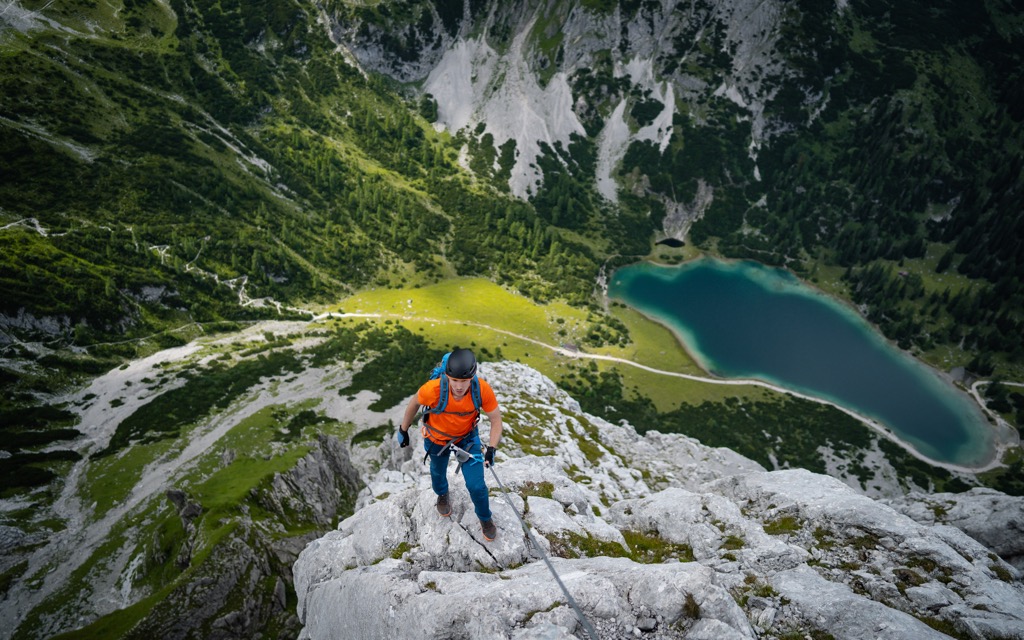
One popular route to Hinterer Tajakopf is from Brent Alm (1,116 m / 3,661 ft) to the north, near Ehrwald. This route includes a short section with secured ropes, so sure-footedness is required. It passes by the Coburger Hütte, where you can spend the night.
The route from Brent Alm to Hinterer Tajakopf is approximately 15 km (9 mi) round-trip.
Handschuhspitze (2,319 m / 7,608 ft) is a collection of several summits at the northeastern end of the Wannig (Hochwannig) Ridge. Some of the most westerly summits in the Mieminger Chain, Handschuhspitze and Wannig (2,493 m / 8,179 ft) provide some of the range's best views of the Ötztal Alps and the Lechtal Alps.
One popular route to Handschuhspitze starts from the Wanderparkplatz Arzkasten to the south. The route passes by the Marienbergalm (1,622 m / 5,322 ft) and then heads towards Marienbergjoch (1,817 m / 5,961 ft). A trail to the west just before the Marienbergjoch ridge leads to Handschuhspitze.
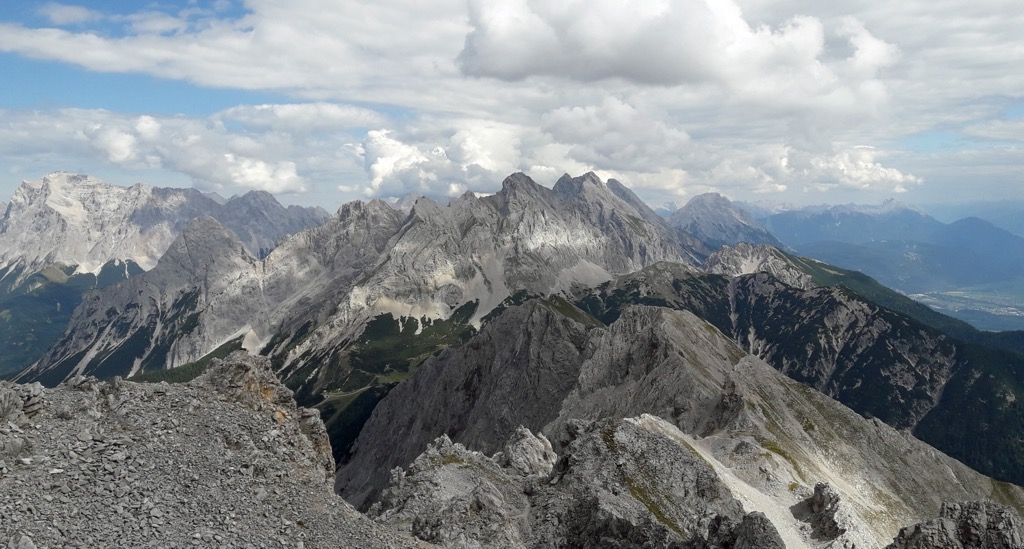
Handschuhspitze's summit cross isn't actually on its highest summit — it's placed on the highest summit visible from the valley below. Two other unnamed summits (P. 2349 and P. 2397) are higher. After reaching the summit cross, you can continue onto Wannig following a marked trail. The route leads along the gentler south side of the ridge, with some easy scrambles to overcome on the way.
From Wannig's summit, you can descend north and loop around via Bergltal and Sunnalm (1,632 m / 5,354 ft) to rejoin the route back to the Wanderparkplatz Arzkasten. Again, there's some scrambling on the descent into the Bergltal.
This looped route, which runs from Wanderparkplatz Arzkasten to the Wannig Ridge and through Bergltal, is approximately 21 km (13 mi) in length.
Traversing eight countries across 161 stages, the Via Alpina Red Trail is one of Europe's finest long-distance treks. Two Via Alpina Red Trail stages, R46 and R47, pass through the Mieming Range. These stages also give you the opportunity to explore parts of the Wetterstein and the Lechtal Alps.
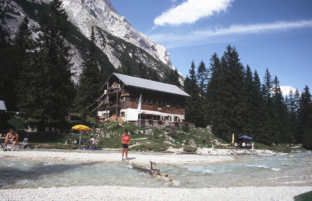
The Via Alpina R46 leads from the Reintalangerhütte (1,366 m / 4,482 ft) in Germany, southeast of Zugspitze, to the Coburger Hütte. You'll start by walking to the Knorrhütte (2,052 m / 6,732 ft) and over the Gatterl (2,024 m / 6,640 ft) and Feldernjöchl (2,045 m / 6,709 ft) to cross the Austrian border.
With impressive views of Wetterwandeck (2,698 m / 8,851 ft) and Plattspitze (2,680 m / 8,793 ft) to accompany you, you'll pass by Hochfeldernalm (1,739 m / 5,705 ft), Pestkapelle, and Seebenalm (1,566 m / 5,138 ft) before reaching the Coburger Hütte. The Via Alpina R46 is approximately 17.3 km (10.7 mi) in length.
It's worth noting that the Reintalangerhütte and Cobuger Hütte can get crowded — especially Reintalangerhütte, which is a popular base for climbing Zugspitze. The Hochfeldernalm is a great alternative place to stay, as it tends to be quieter.
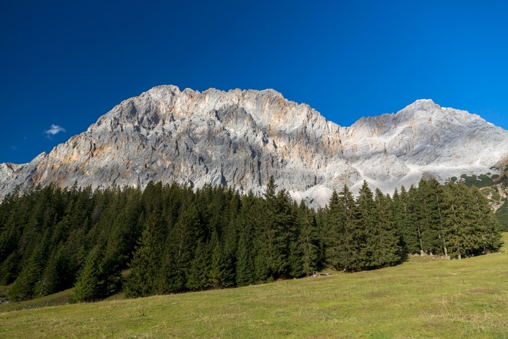
The Via Alpina R47 runs from the Coburger Hütte to the Wolfratshauser Hütte (1,751 m / 5,745 ft). Here, you'll leave the Mieminger Chain and enter the Lechtal Alps.
The highlight of this walk is the descent from the Biberwiererscharte (2,000 m / 6,562 ft) into the mixed forests below. You'll pass by Biberwier and the Grubigalm (1,702 m / 5,584 ft) to reach the Wolfratshauser Hütte. The Via Alpina R47 is approximately 12.2 km (7.5 mi) in length.
The main ski areas in the Mieminger Chain are a part of the broader Tiroler Zugspitz Arena. Parts of the Seefeld ski resort also fall within the range.
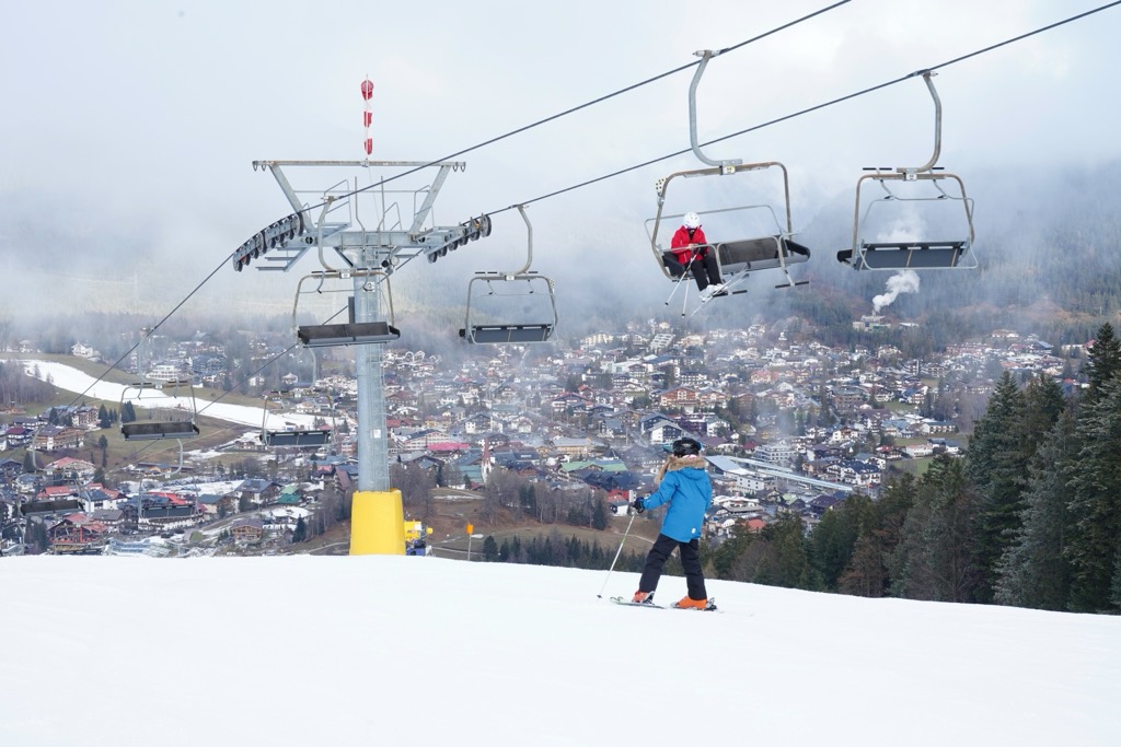
The main ski areas and resorts in the Mieminger Chain are:
The Mieminger Chain is a hidden gem for ski touring. It offers several classic ski tours without the crowds you'd encounter in the Wetterstein.
Here's a quick rundown of a few popular ski tours in the Mieming Range and some features that make the PeakVisor App paramount when planning year-round adventures.
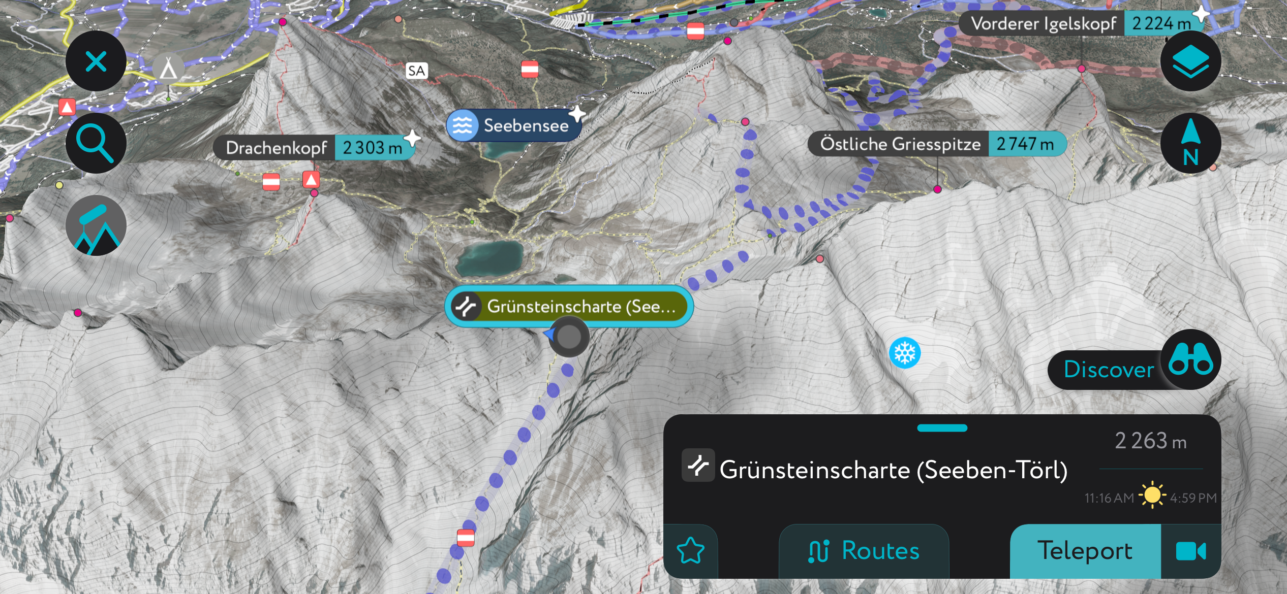
Grünsteinscharte is a mountain pass tucked between Grünstein (2,661 m / 8,730 ft) and Griesspitze (2,747 m / 9,012 ft). It's arguably the Mieminger Chain's classic ski tour, and its namesake, Grünstein, is a popular hiking destination in summer.
This ski tour is only suitable for experienced skiers with a knowledge of avalanches and snow depths. It leads from Biberwier Marienberg Valley station, over Hölltörl (2,126 m / 6,975 ft) and Grünsteinscharte (2,263 m / 7,425 ft), and past the Coburger Hütte and Ehrwalder Alm (1,106 m / 3,629 ft).
The descents from Hölltörl and Grünsteinscharte are extra special, particularly on fresh powder snow. This ski tour finishes at the Ehrwalder Almbahn Valley station, where you can get a bus back to Biberwier. This ski tour of Grünsteinscharte is approximately 13.5 km (8.4 mi) in length.
Wankspitze (2,208 m / 7,244 ft) is a mountain on one of the southern side ridges of the Mieminger main crest separated from Griesspitze by the Stöttltörl (2,036 m / 6,680 ft). It's a popular ski touring and hiking destination, offering 360-degree views of the Mieminger Plateau and the Stubai Alps.
One popular ski tour of Wankspitze starts from the Wanderparkplatz Arzkasten parking lot at the bottom of the toboggan run. It passes the Lehnberghaus (1,554 m / 5,098 ft) and then the Aussichtsplattform Lacke, which provides spectacular vistas of the Inntal. You can scale the southeast ridge to reach the summit. Descend the way you came.
This ski tour of Wankspitze is suitable for experienced ski tourers and is approximately a 10 km (6 mi) round-trip.
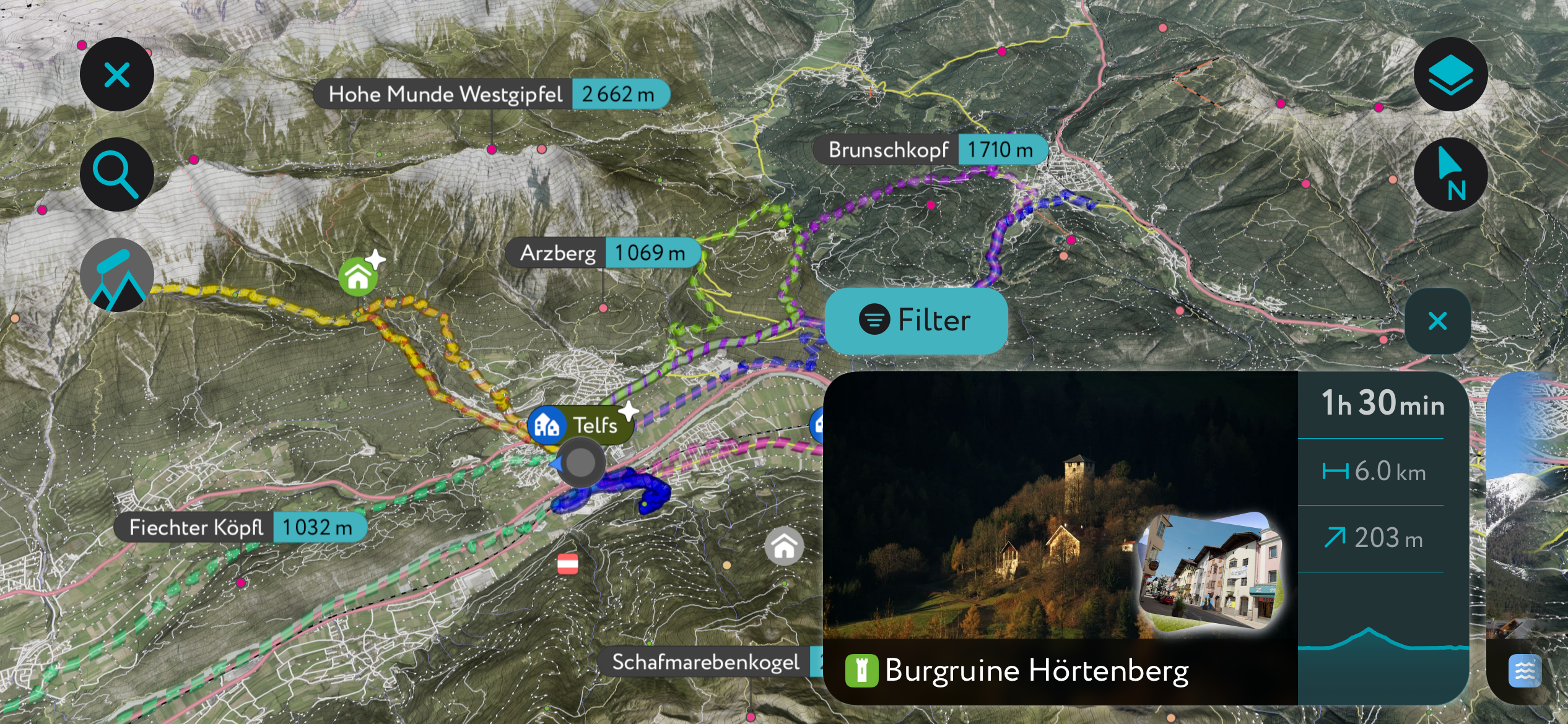
The Mieminger Chain is at the heart of one of our most thoroughly mapped areas. You'll find details on hundreds of ski tours, hiking trails, and mountain huts at your fingertips on the PeakVisor App.
Now, you can get the latest local weather reports and snow depths and receive up-to-date information on mountain huts, including opening hours, dining options, and overnight stays.
The PeakVisor App's new "Discover" feature highlights lets you instantly filter and view the best ski tours and hikes in your destination, making it easier than ever to plan the perfect getaway.
The nearest international airport to the Mieminger Chain is Innsbruck Airport, which is located 30 km (19 mi) to the southeast.
The Ausserfernbahn railway line connects Ehrwald with Garmisch-Partenkirchen and Kempten in Germany.
Telfs is the largest town and municipality in the Mieming Range, with a population of over 15,000 people.
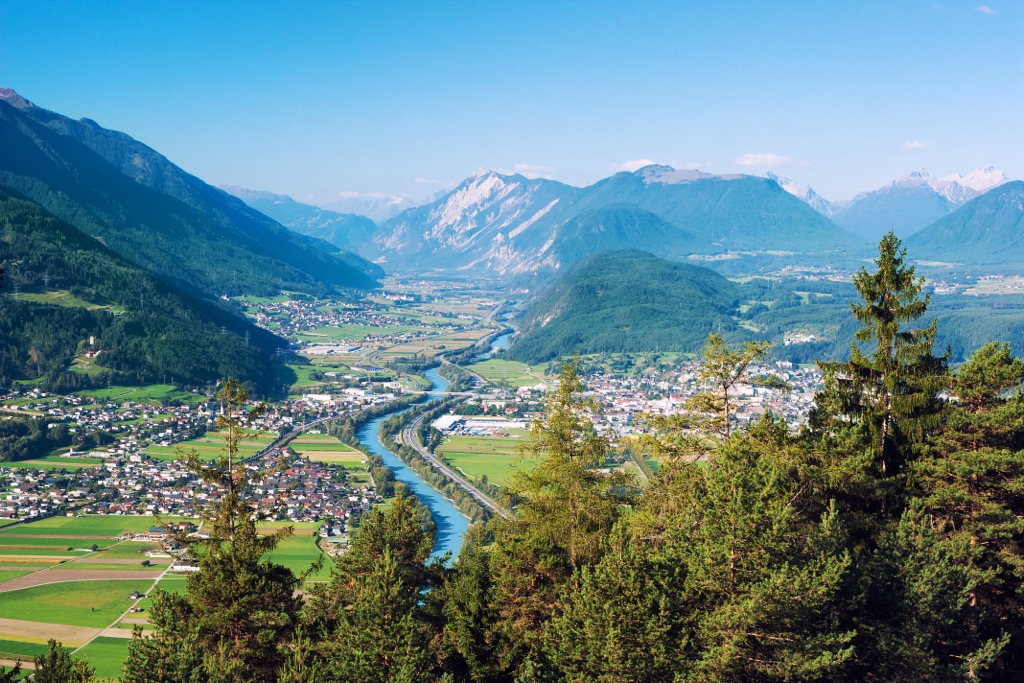
Telfs is located within the Inntal on the southeastern boundary of the Mieminger Chain. It's less than 2 km (1.2 mi) from Hohe Munde, one of the range's most popular hiking and ski-touring mountains.
Once an important market and industrial town, Telfs is now primarily a vacation destination. Every five years since the 16th century, Telfs has hosted the Telfer Schleicherlaufen, a carnival parade featuring 500 men wearing masks and costumes. The next festival commences on February 1st, 2025.
Imst is a small town on the Inn River between the Mieminger Chain and the Lechtal Alps. It has a population of around 10,000. It's located 5 km (3 mi) west of the Simmering - Tschirgant massif.
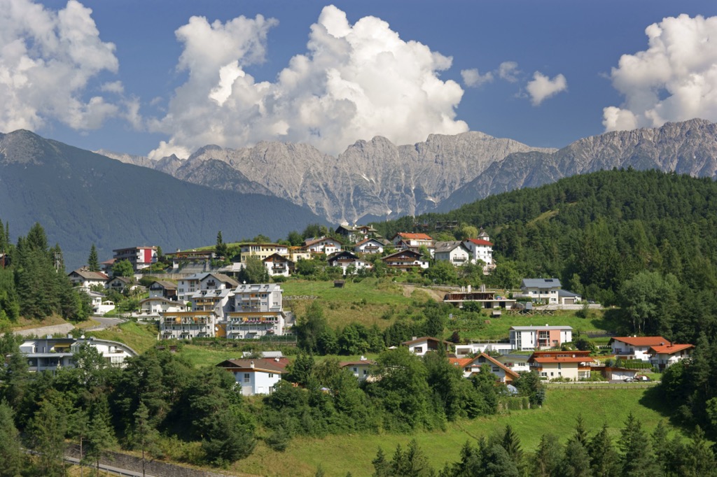
Imst is known for its ornate baroque architecture and for being home to the first artificially refrigerated luge track, built in 1958. Just west of Imst is the scenic Rosengartenschlucht, a fast-flowing river gorge with a waterfall.
Like Telfs, Imst hosts its own carnival parade every four years, called the Imst Schemenlaufen. It takes place on the Sunday before Shrove Thursday. The next Imst Schemenlaufen is on February 13th, 2028.
Seefeld in Tirol, or Seefeld, is a small village that has grown to be one of Tyrol's major ski resorts. Over a million people visit Seefeld annually to enjoy its winter sports facilities. Seefeld has a population of just over 3,000.
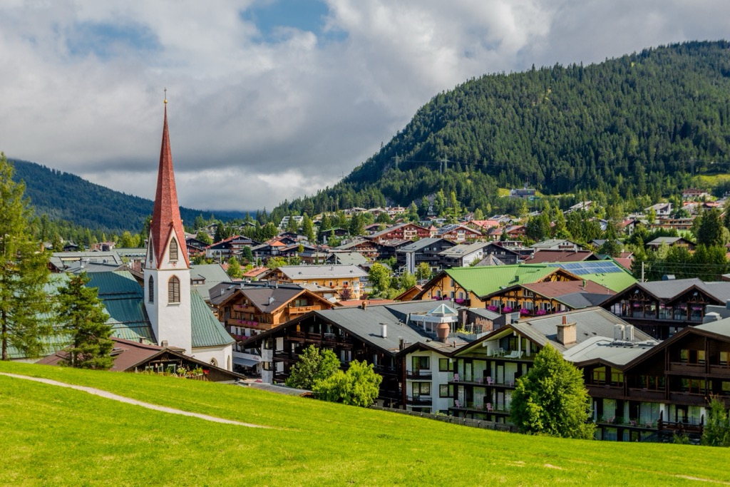
Seefeld's position between the Wetterstein, Karwendel, and Mieminger Chain makes it an excellent base for hikers and skiers. The village is less than 8 km (5 mi) from Hohe Munde. Over 560 km (348 mi) of ski slopes and 12 resorts surround Seefeld.
Explore Mieminger Chain with the PeakVisor 3D Map and identify its summits.


