Scan the QR code and open PeakVisor on your phone
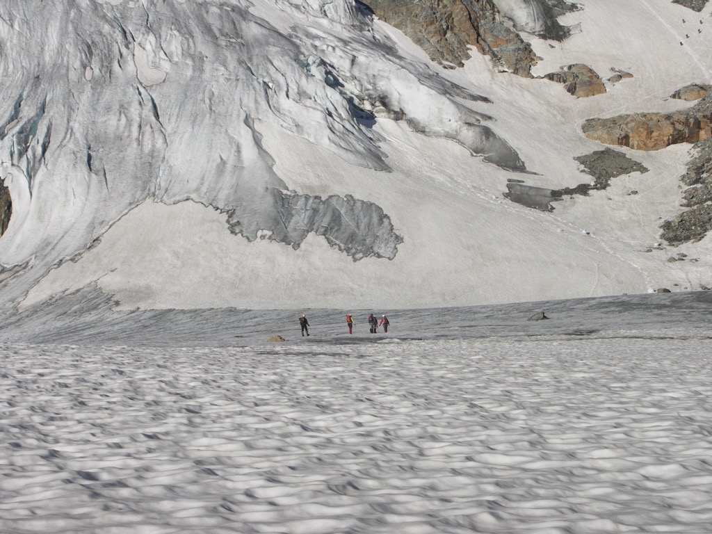
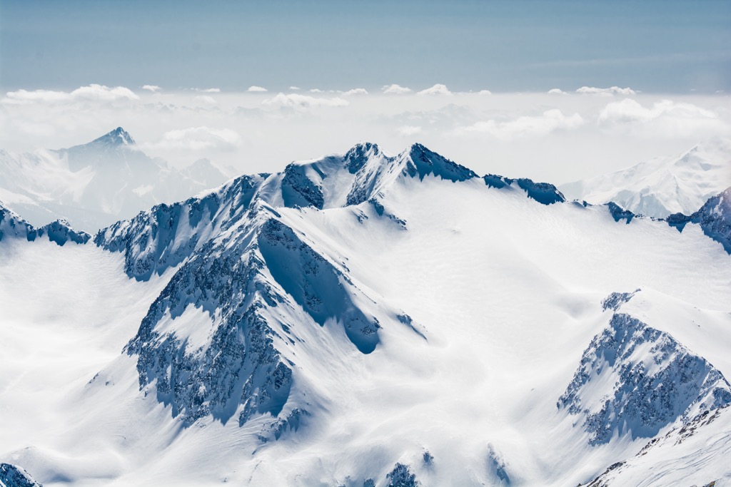
The Stubai Alps are one of three subranges of the Eastern Rhaetian Alps, along with the Ötztal Alps and Sarntal Alps. Located southwest of Innsbruck, the range falls in the state of Tyrol in Austria and extends to South Tyrol in Italy, forming part of the border between the two countries. There are 748 named peaks in the Stubai Alps; Zuckerhütl is the highest (3,508 m / 11,509 ft) and has the greatest proportional prominence (1,033 m / 3,389 ft). Zuckerhütl has a glacier on it, just one of dozens in the range.
The Stubai Alps extend from southwest of Innsbruck in Tyrol, Austria, to form part of the border with South Tyrol, Italy. The mountains are a subrange of the Eastern Rhaetian Alps and part of the Austrian Central Alps. Home to many attractions, including the popular eight-hut Stubai High Trail and the Stubai Glacier Ski Resort, the mountains offer an array of hiking trails, via ferratas, and ski resorts.
The range lies between the Wipptal and Ötztal Valleys. Neighboring ranges include the Tux Alps to the east, the Zillertal Alps to the southeast, the Sarntal Alps to the south, and the Ötztal Alps to the west. The northern boundary of the Stubai Alps marks the border between the Central Alps and the Northern Limestone Alps.
The tallest and most prominent peak in the range is Zuckerhütl (3,508 m / 11,509 ft). Located at the southern end of Stubaital Valley, the conical mountain’s name means “sugarloaf” in both German and Italian (“Pan di Zùcchero”).
On Zuckerhütl’s north face, the Sulzenauferner glacier drops 1,000 meters (3,280 ft) from the summit, while a 500-meter (1,640 ft) cliff falls sharply from the south face. Summiting Zuckerhütl is popular because it is challenging but not too technical, and views from the top take in the surrounding mountain ranges.
The Stubai Alps are part of the Eastern Rhaetian Alps. They comprise the Öztzal nappe, whose basement rock is pre-Mesozoic gneiss and schist. The range also contains a fair amount of limestone. The limestone, particularly in the range's northern sections, gives the peaks a similar appearance to the Italian dolomites.
Glaciers have shaped the range in more recent geological history, carving out valleys with the formation and retreat of ice.
The Alps formed during the Alpine Orogeny, a mountain-building event that occurred as the African and Eurasian plates collided and which has been ongoing since Cretaceous times. Most mountain building occurred between 65 and 2.5 million years ago, although the mountains continue to be uplifted. However, the uplift rate no longer outpaces erosion, and the Alps are not considered a growing range. Additionally, geologists have attributed the recent uplift to a rebounding effect as the Alps spring back after the weight of the last ice age’s ice sheet melts away.
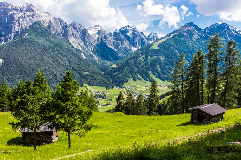
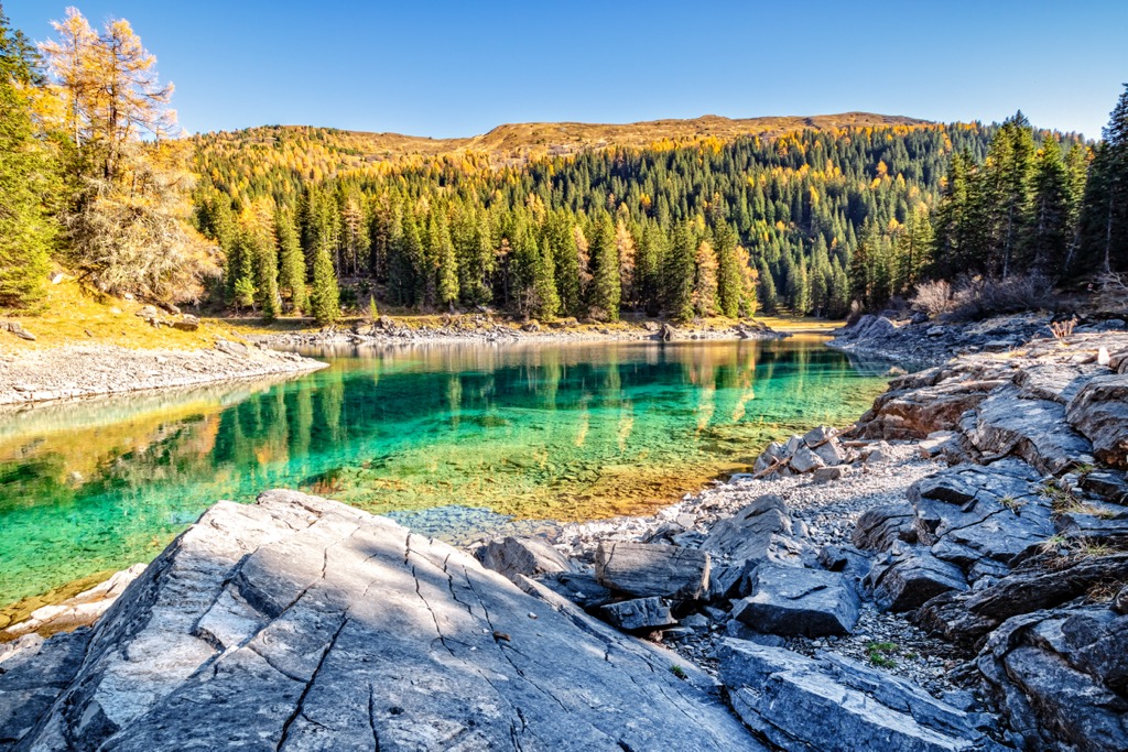
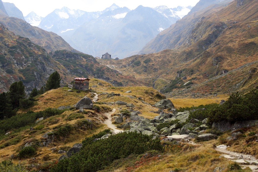
The rugged Stubai Alps boast several glaciers and are partially protected by the Ötztal Nature Park. Where some alpine valleys are broad and open, many of the lower valleys of the Stubai are deep and sometimes shaded by a thick cover of fir and spruce trees. Alpine meadows stretch along the slopes, and wildflowers bloom in the warmer months.
The forest cover is mainly spruce, fir, beech, larch, and Swiss pine. Dwarf-shrub heath, blueberry and bilberry bush, alpenrose rhododendrons, and wildflowers like alpine clematis appear at higher elevations.
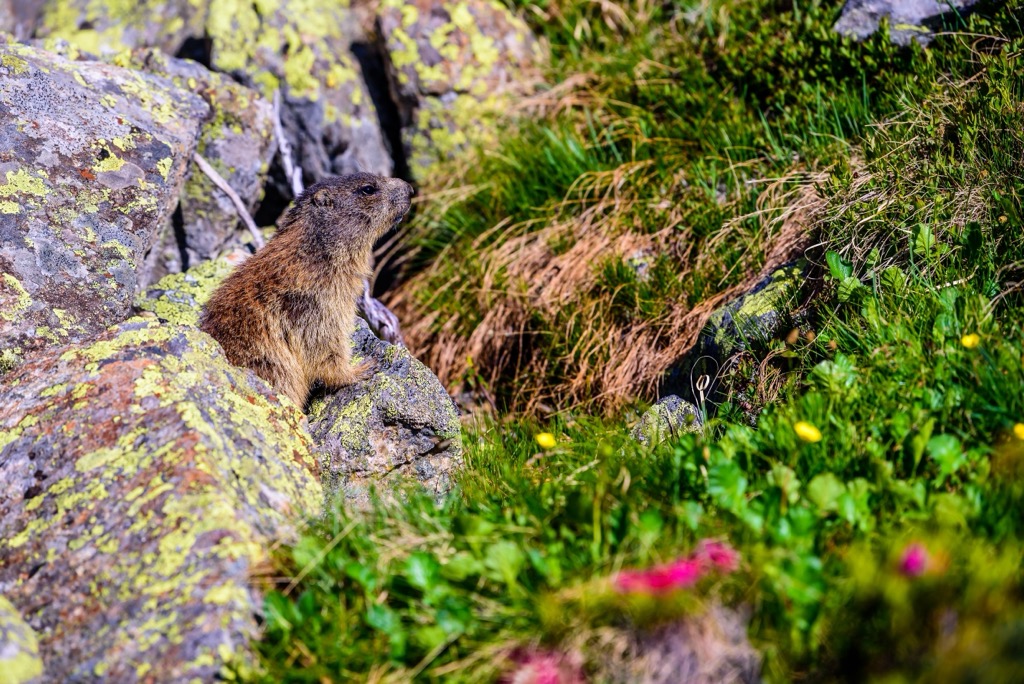
The mountains support red and roe deer living in the forests, ibex and chamois above treeline, and marmots at higher elevations. Bird species include golden eagles, bearded vultures, eagle owls, spotted nutcrackers, and snow finches. A few amphibians and reptiles, including the alpine newt, common frog, and dark brown common lizard, make their home in the range’s vast forests. The Stubai Alps are also known for their diverse insect life, and they are home to many uniquely adapted butterflies, ants, and spiders.
Located in Tyrol, Austria, and Southern Tyrol, Italy, the history of the Stubai Alps is tied to the politics of this region. The first organized tribes arrived around 10,000 BC or earlier. However, these tribes were replaced around 4,000 BC by groups who cultivated the land. The Iceman “Ötzi,” found in the neighboring Ötztal Alps and currently housed at the museum in Bolzano, lived more than 5,000 years ago and is the oldest natural mummy discovered in Europe.
The Romans did not consider Tyrol a vital region in which to settle but used the Passo del Brennero as a major traffic route. After the collapse of the Roman Empire, the Alps experienced a powerful wave of Christianity, to which the numerous churches and chapels are testament.
Tyrol was part of the Habsburg Empire from 1814 to 1919 and divided into northern and southern sections at the close of World War I in 1919. Visitors interested in learning more about life over the past century can stop by the Försterhaus in Neustift. The old farmhouse exhibits cultural artifacts such as agricultural and hand tools that give a sense of past rural life.
Joseph Anton Specht was the first to summit Zuckerhütl, the tallest peak in the Stubai Alps, in 1862. Specht was a founding member of the German Alpine Club.
From ski resorts and ski touring to alpine hut hikes, there’s no shortage of ways to enjoy the Stubai Alps. The Stubai High Route is well-known and an incredible way to spend eight days in the pristine upper slopes, staying at mountain huts each night. The Stubai Glacier is a popular ski resort close to Innsbruck.
In addition to the hikes and activities listed below, Cima Libera (Wilder Freiger) and the Hochstubai Panoramaweg are worthwhile hikes in the Stubai Alps. Whether you’re looking for a laid-back trail, a challenging day or multi-day hike, or skiing on and off the groomed pistes, the Stubai Alps have it all.
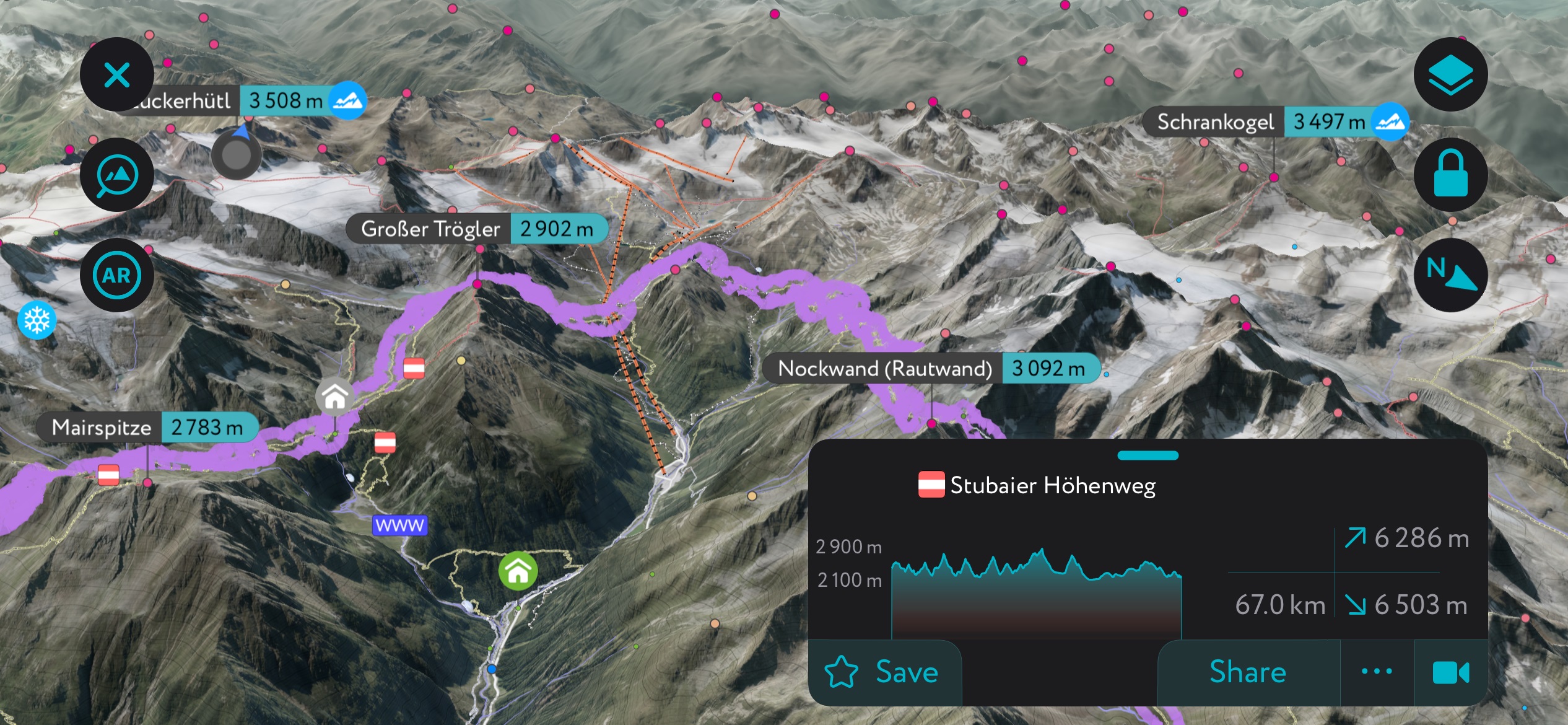
The Stubai High Trail (Stubaier Höhenweg), stretching nearly 80 km (50 mi) over eight days and with 6,000 m (19,685 ft) of elevation gain, is one of the best ways to experience the Stubai Alps. The route follows the range’s horseshoe shape around the Stubai Valley and passes eight refuges, allowing hikers to travel lightly without camping gear and food.
The range’s tallest peak, Zuckerhütle, features impressive glacier views from the top and is a popular destination for mountaineers. Hikers can approach from the east and west ridge, although the east ridge is the easiest. Dresdner Hut is a good starting point, located only 7 km (4.3 mi) from the summit. Trail #135 leads to the hut from a trailhead outside the town of Ranalt. The glacier crossings are crevassed but not exceptionally technical. However, proper gear, such as crampons, ice axes, and ropes, is necessary for a safe ascent.
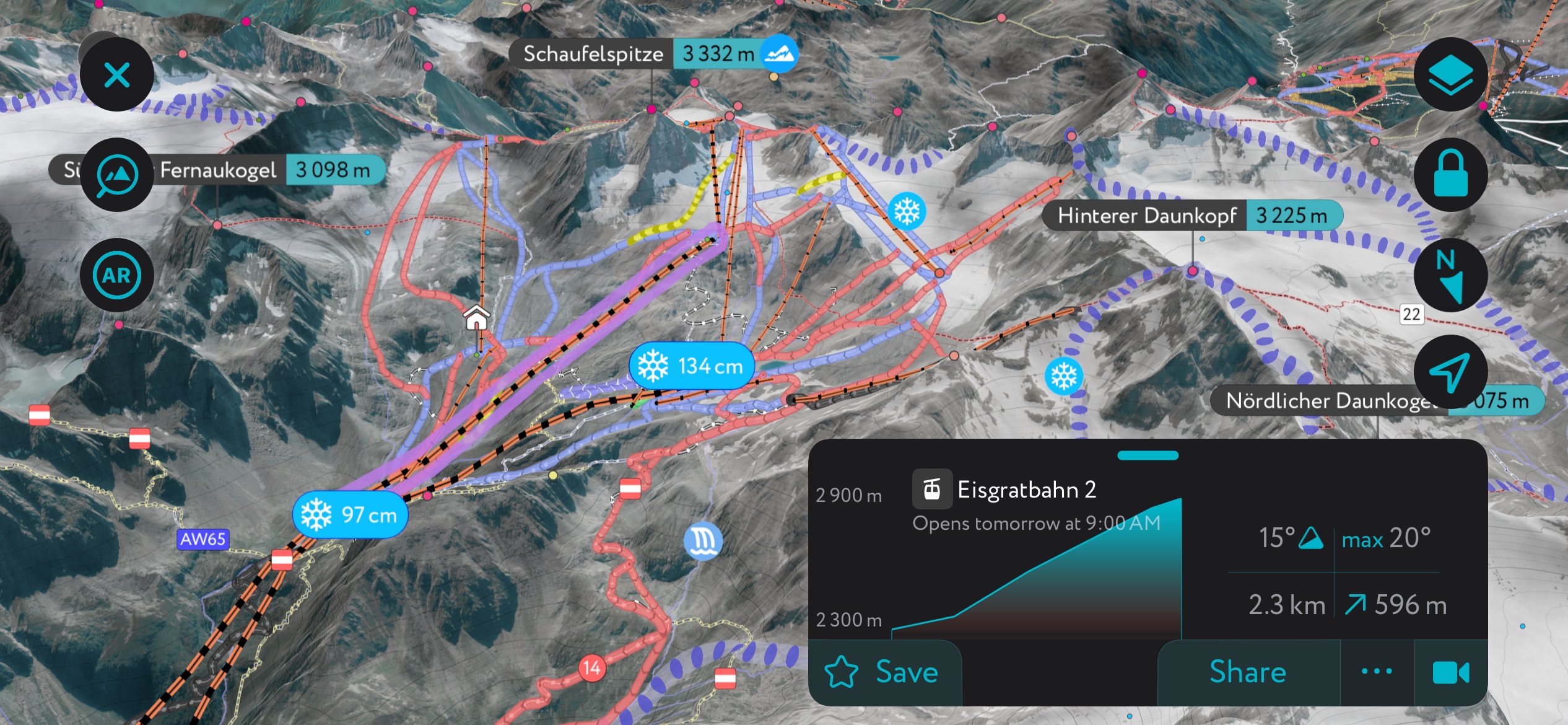
Stubai Glacier Ski Resort offers 68 km (42 mi) of slopes accessible via 26 lifts, suited for all levels of skiers and snowboarders. A few highlights of the resort include the extensive glacier skiing at the summit, summer skiing, and a 10 km (6.2 mi) valley run from the Wildspitz mountain station, with a change in elevation of nearly 1,500 m (4,920 ft).
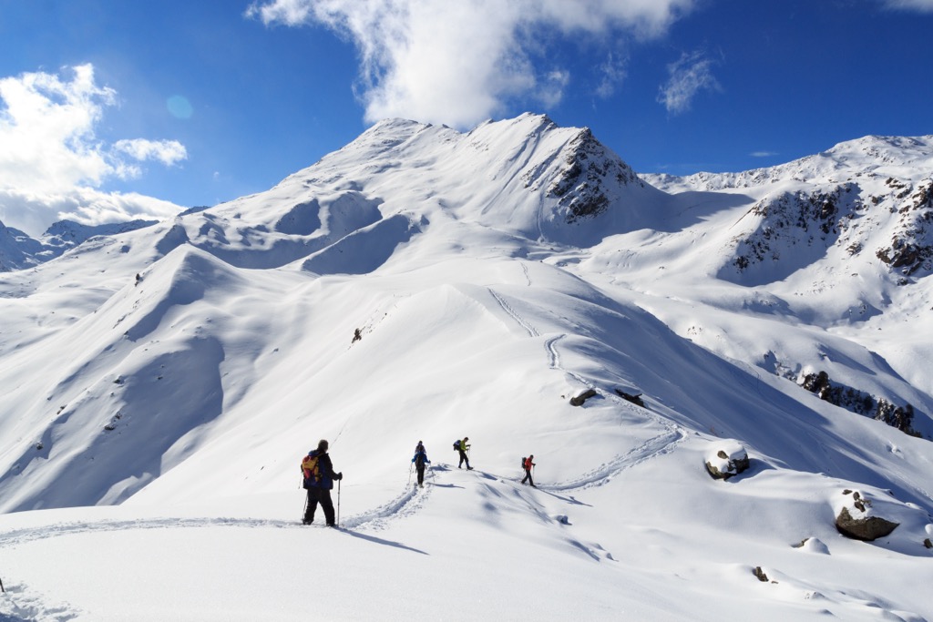
Here at PeakVisor, we believe ski touring is the best way to experience winter in the Stubai Alps. Routes range from beginner-friendly to technical ski mountaineering challenges.
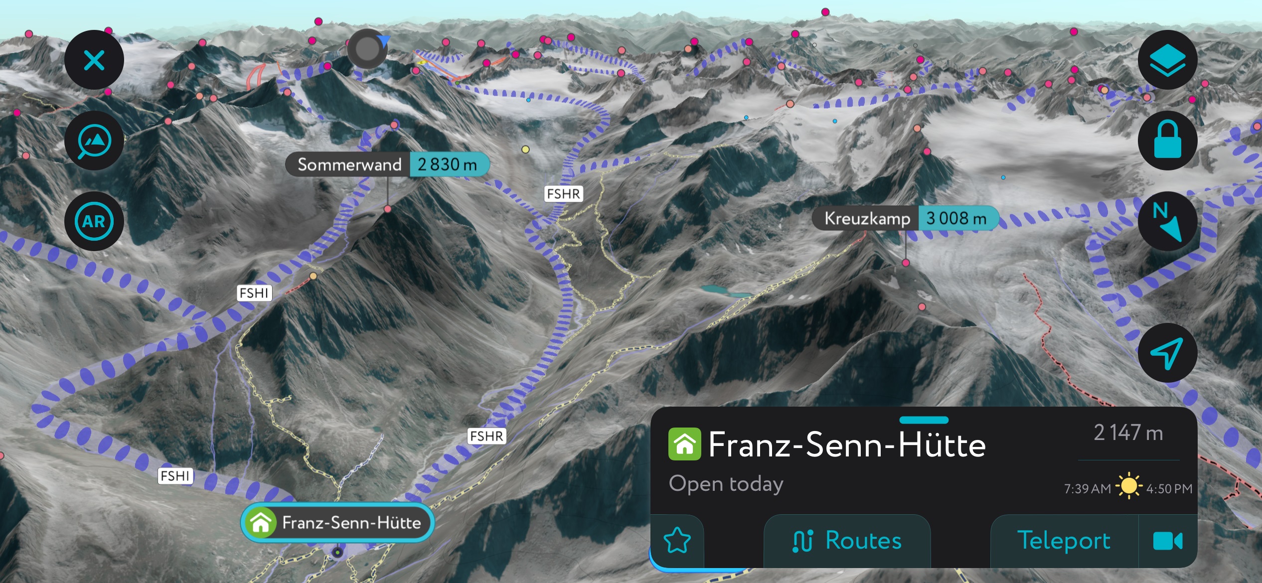
We’re talking about the Alps, meaning every great ski tour starts with a great mountain hut. The Franz-Senn Hut is the best starting point for the most iconic ski tours; dozens of tours are available from here.
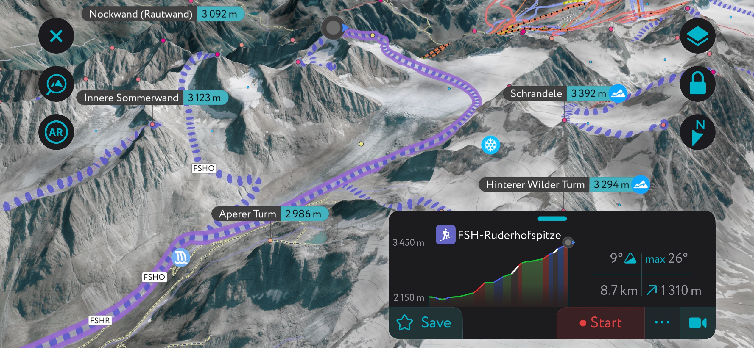
The most iconic tour from the FSH is the Ruderhofspitze, one of the highest peaks in the Stubai Alps and Austria as a whole. The tour is challenging in many ways. First, it’s long; the approach is nearly 9 km (5 miles) with a casual 1,300 meters (4,300 ft) of ascent. Secondly, much of the terrain is glaciated, which requires basic crevasse rescue techniques and gear. It’s essential to stay skiers’ right to avoid the ice fall as the glacier cascades into the valley.
Nevertheless, none of the terrain is particularly steep, and the glacier, while crevassed, is not exceptionally dangerous. The guardian at the FSH can provide a more detailed report on the conditions. Wait for a base to build up; this will ensure the snowbridges are as strong as possible. Like many high alpine tours, the Ruderhofspitze is best completed in spring rather than mid-winter.
The Stubai Alps stretch to the border between Austria and Italy; both Innsbruck and Bolzano have easy access to the Stubai Alps. Innsbruck is less than an hour’s drive from the northern part of the range, and Bolzano is less than two hours away. Closer to the peaks, there are alpine villages, ski resorts, and, of course, mountain huts.
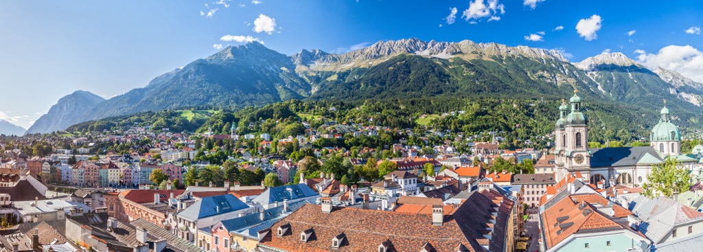
With a population of over 310,000, Innsbruck is an excellent destination for culture, nature, and proximity to mountain sports. It is the second-largest city in the Alps, after Grenoble, France, but arguably offers better mountain access. The city lies in a valley with steep mountains rising steeply around it; cable cars like the Nordkette and Patscherkofel provide quick access to the slopes for hiking, skiing, mountain biking, and paragliding.
Visitors can stroll through Old Town or pay a few Euros to climb the Town Tower. The Hofkirche church has 28 bronze statues, while the Cathedral of St. James exhibits Baroque architecture. The Schloss fortress, a medieval fortress turned Renaissance castle for Archduke Ferdinand II’s wife, displays armor and artwork. Innsbruck hosted the Winter Olympics in 1964 and 1976 and the 1984 and ‘88 Winter Paralympics; the stadiums still host sports events.
Purchasing an Innsbruck Card is a worthwhile investment if you want to go to multiple museums, ride some cable cars, and have free transport on buses, trams, and bikes. The passes can be purchased for 24, 48, or 72 hours.
Innsbruck is a 30-minute drive from both Italy and Germany. Trains arrive from Venice, Munich, Salzburg, and Zurich. The city also has a small but busy international airport and is a launching point for the famous Tyrolean ski resorts.
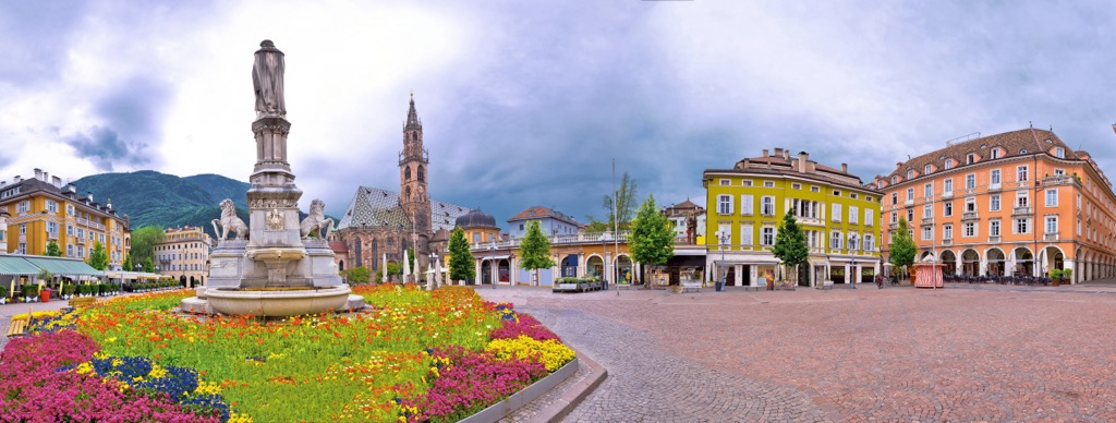
Bolzano is the largest city in South Tyrol, with a population just shy of 110,000. The city is sometimes called the gateway to the Dolomites and has lots to offer in terms of access to the mountains and culture. It is rich with German, Italian, and Austrian influences.
There’s impressive architecture, such as the largest Gothic church in South Tyrol and the Franciscan Friary. In winter, the city’s historic center houses Italy’s largest Christmas market. The Archeological Museum in town details the region's history dating back to the Stone Age.
Surrounded by mountains, you can take the Funivia Colle-Bolzano cable car up to Colle dei Contadini, a town about an hour’s walk from the city. The Dolomites are nearby, offering everything from easy hikes around Lake Garda to more challenging summit hikes.