
Scan the QR code and open PeakVisor on your phone
The Tux Alps include 230 named peaks. The highest is Lizumer Reckner at 2,886 m. Other notable peaks include Geier, Lizumer Sonnenspitze and Kalkwand.
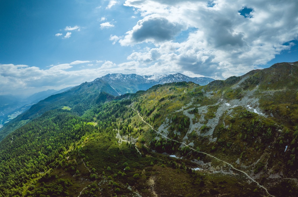
The Tux Alps - also known as the Tuxer Alps - are a subrange of the Tyrol Schistose Alps in Tyrol, Austria. The range is home to some of the best ski resorts near Innsbruck, despite its modest relief compared to the nearby and dramatic Zillertal Alps and Karwendel. There are 230 named peaks in the range. Lizumer Reckner (2,886 m / 9,469 ft) is the highest, while Kreuzjoch/Kellerjoch (2,344 m / 7690 ft) features the greatest proportional prominence (669 m / 2,195 ft).
The Tux Alps lie just outside Innsbruck in the state of Tyrol in Austria. The range stretches from Patscherkofel, near Innsbruck along the Zillertal Valley, to the Kellerjoch. It’s best known for its ski resorts in the north and west. The ski areas around Hochfügen-Hochzillertal, Glungezer, Kellerjoch, and Patscherkofel are proximate to Innsbruck - one of the capitals of the Alps - and draw many visitors each year.
The Karwendel, the Zillertal Alps, the Rofan Mountains, the Kitzbühel Alps, and the Stubai Alps neighbor the Tux Alps.
The Tux Alps are smaller and less impressive than their more dramatic neighbors. However, the relatively gentle topography is ideal for more family-friendly ski resorts. Overall, the range is most famous for its skiing and snowboarding. A plethora of ski touring options complement extensive lift networks and ski slopes. Patscherkofel and Glungezer are two popular ski summits that also offer hiking trails in summer.
The inner parts of the range can offer relative solitude in summer when other visitors flock to nearby spots in Innsbruck. Villages such as Tulfes and Igls have chairlifts that provide quick access to alpine zones.
Regionally, the Tux Alps are part of the Tyrol Schistose Alps. They are also part of the larger Central Eastern Alps and European Alps.
The Alps formed during the Alpine Orogeny, a mountain-building event that occurred as the African and Eurasian plates collided and which has been ongoing since Cretaceous times. Most mountain building occurred between 65 and 2.5 million years ago, although the mountains continue to be uplifted. However, the uplift rate no longer outpaces erosion, and the Alps are not considered a growing range. Additionally, geologists have attributed the recent uplift to a rebounding effect as the Alps spring back after the weight of the last ice age’s ice sheet melts away.
In geology, nappes are sheetlike rock bodies that have been moved above a thrust fault from their original position. Mountains in the Tux Alps are poised on the Tauern window, a section of the Central Eastern Alps. This window lies along the Austroalpine nappes, characterized by hard metamorphic rocks where the underlying Penninic nappes jut out.
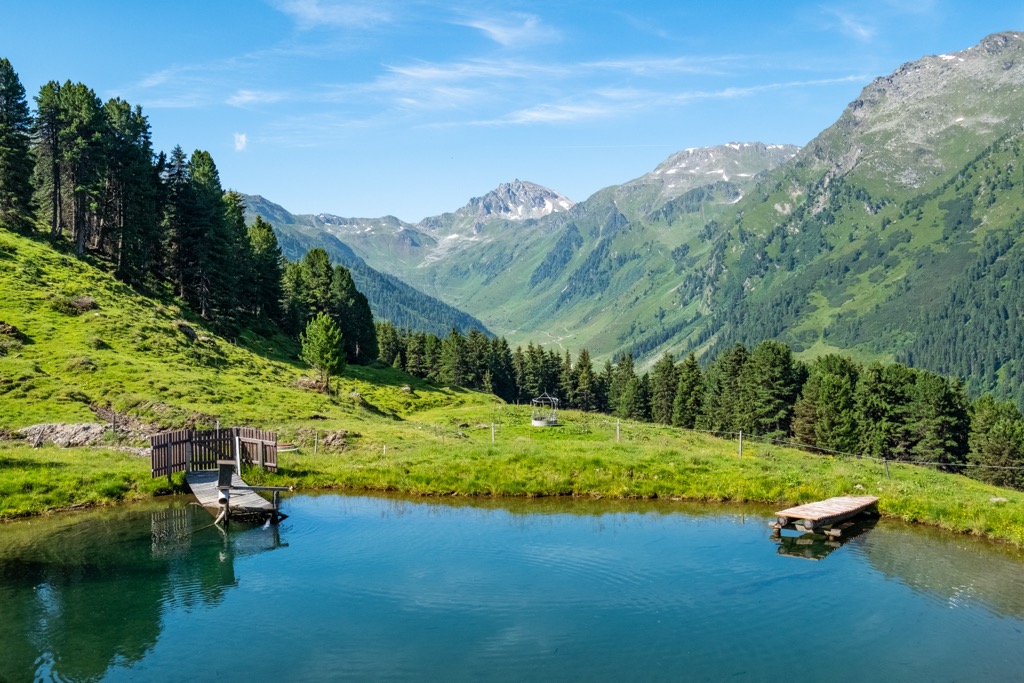
Like much of Austria’s alpine expanse, the Tux Alps are home to a variety of forest communities, including deciduous, conifer, and mixed forests. Stone pines, known as “zirbe” in German, grow in the mountains and give the famous Stone Pine Path its name.
The slopes support lush alpine pastures, which have been used for centuries for alpine livestock grazing. Alpine roses grow in abundance at higher elevations, such as around Lizumer Hütte, and wildflower blooms define the early summer.
The alpine gardens near the top terminal at Patscherkofel display hundreds of local plants, including dwarf shrub heath, yarrow, and golden primrose. The Ampass Basin is home to the oldest tree in Tirol, a stone pine over 700 years old.
As for fauna, the mountains support a variety of classic Central Alps species, including deer, rabbits, foxes, pheasants, eagles, and marmots around alpine zones.
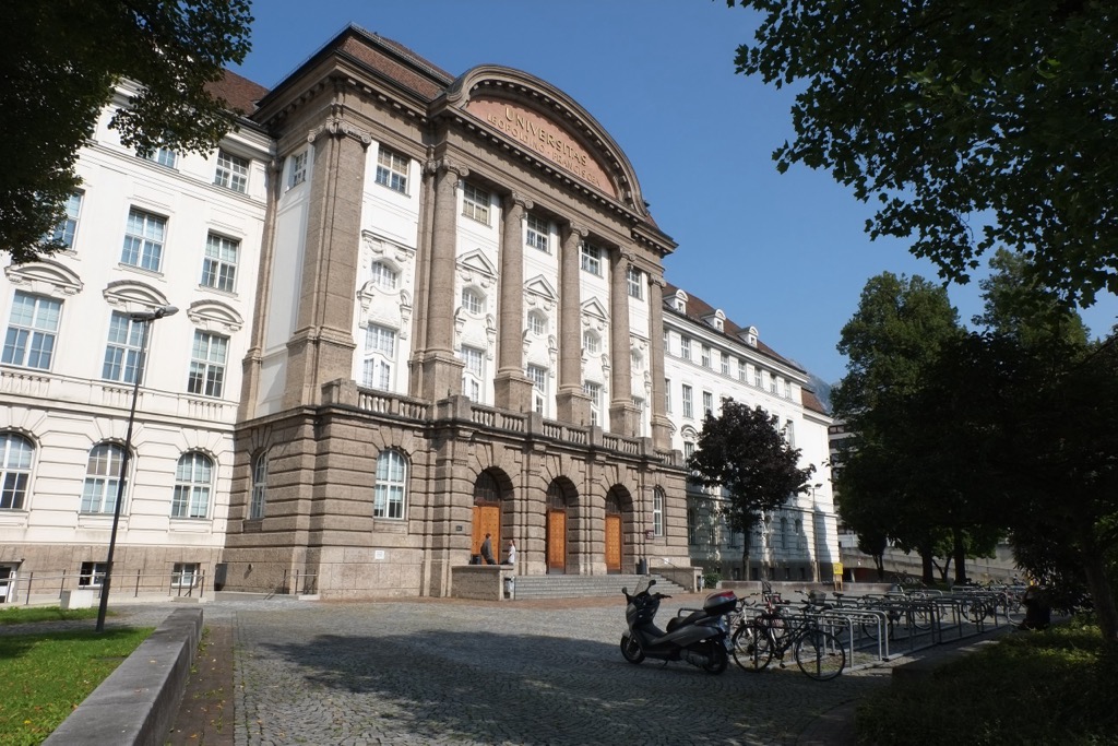
The Tux Alps lie south of Innsbruck. Beginning around 1500, Innsbruck became the center of the Habsburg Empire and remained so for around 200 years. The area's population grew as major political offices were moved to the city. The University of Innsbruck was founded in 1669 and is still operational today.
During the Napoleonic Wars, the region was ceded to Bavaria. Innsbruck remained under Bavarian control until 1814 when it was restored to Austria following the Vienna Congress.
During World War II, Nazi Germany annexed Austria. Between 1943 and 1945, the Innsbruck region suffered nearly two dozen air raids by Germany, resulting in immense damage to the city.
While the city of Innsbruck grew, farmers continued to utilize the lush alpine pastures as they have for centuries. Like most of the Alps, farmers have long brought cattle to the mountains to graze in summer.
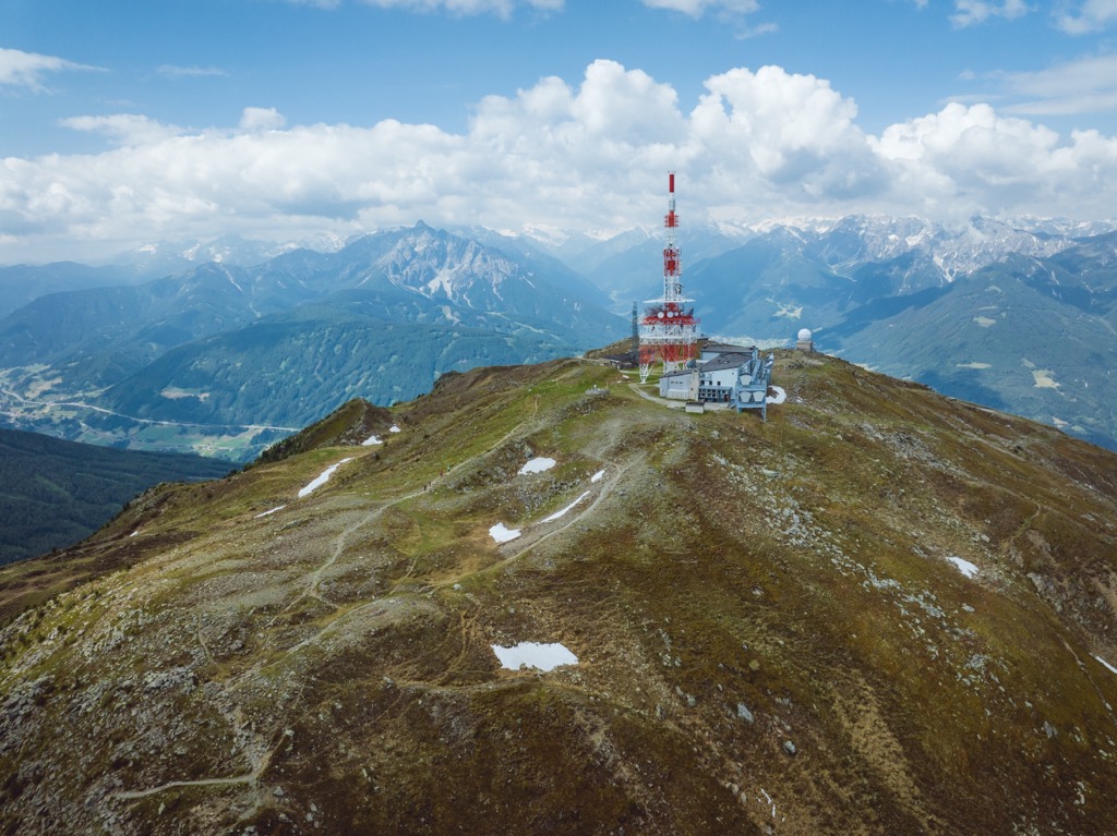
The Austrian military trains in the north-central part of the Tux Alps. The area is periodically closed to the public; closures are listed online. Innsbruck hosted the Winter Olympics in 1964 and 1976, and Patscherkofel was used for skiing and bobsled events.
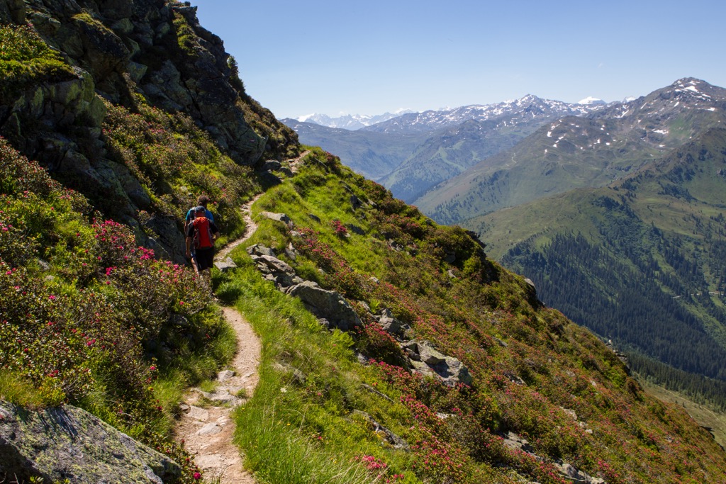
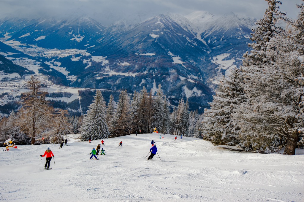
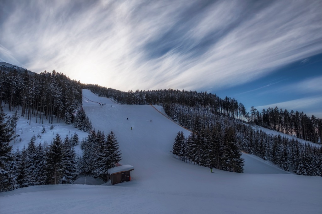
The Tux Alps are well known for their ski resorts. Some of the best known include Glungezer, Lixum im Wattental, Hochfügen-Hochzillertal, Penken, and Kellerjoch/Patscherkofel. In the summer, lift networks allow easy access to the upper slopes for hiking trails, via ferratas, alpine climbing, and mountain biking.
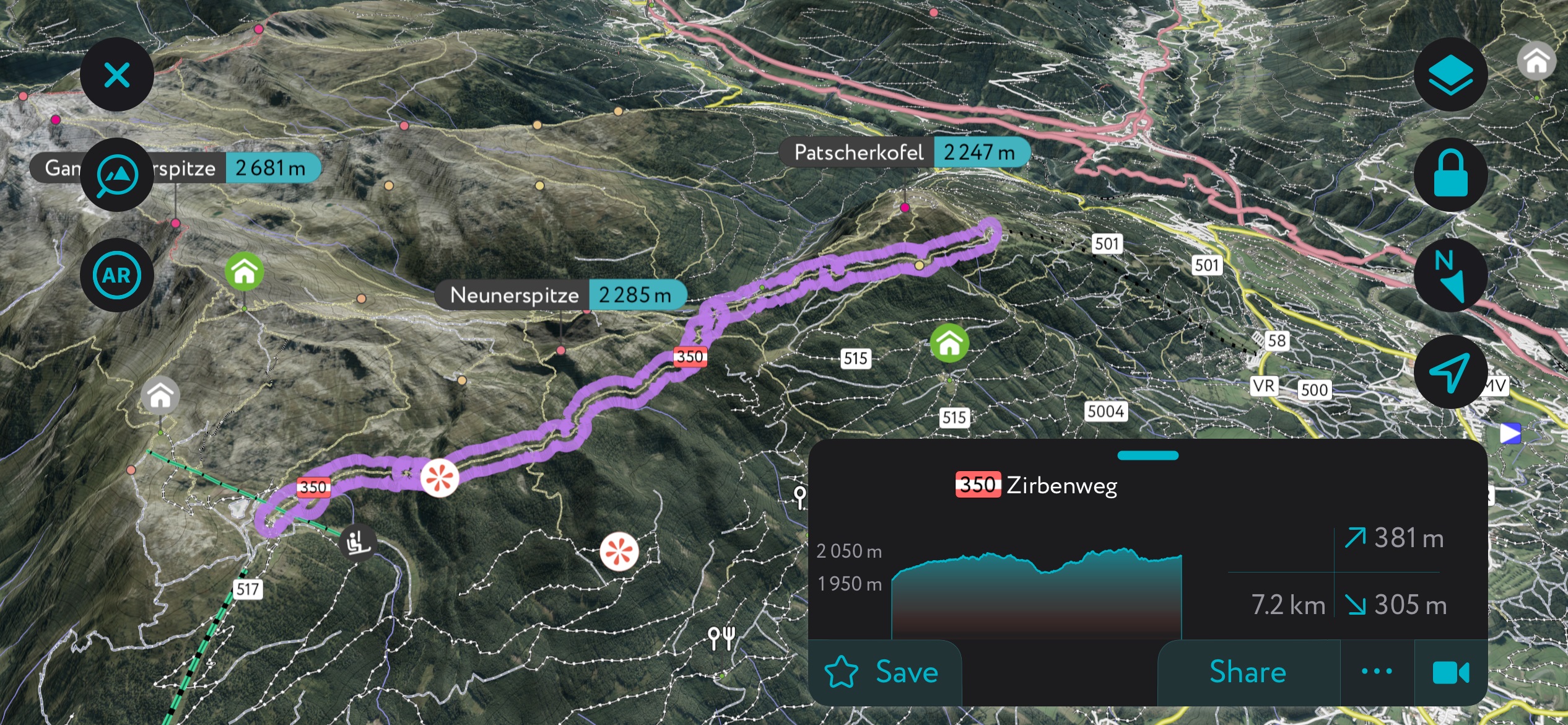
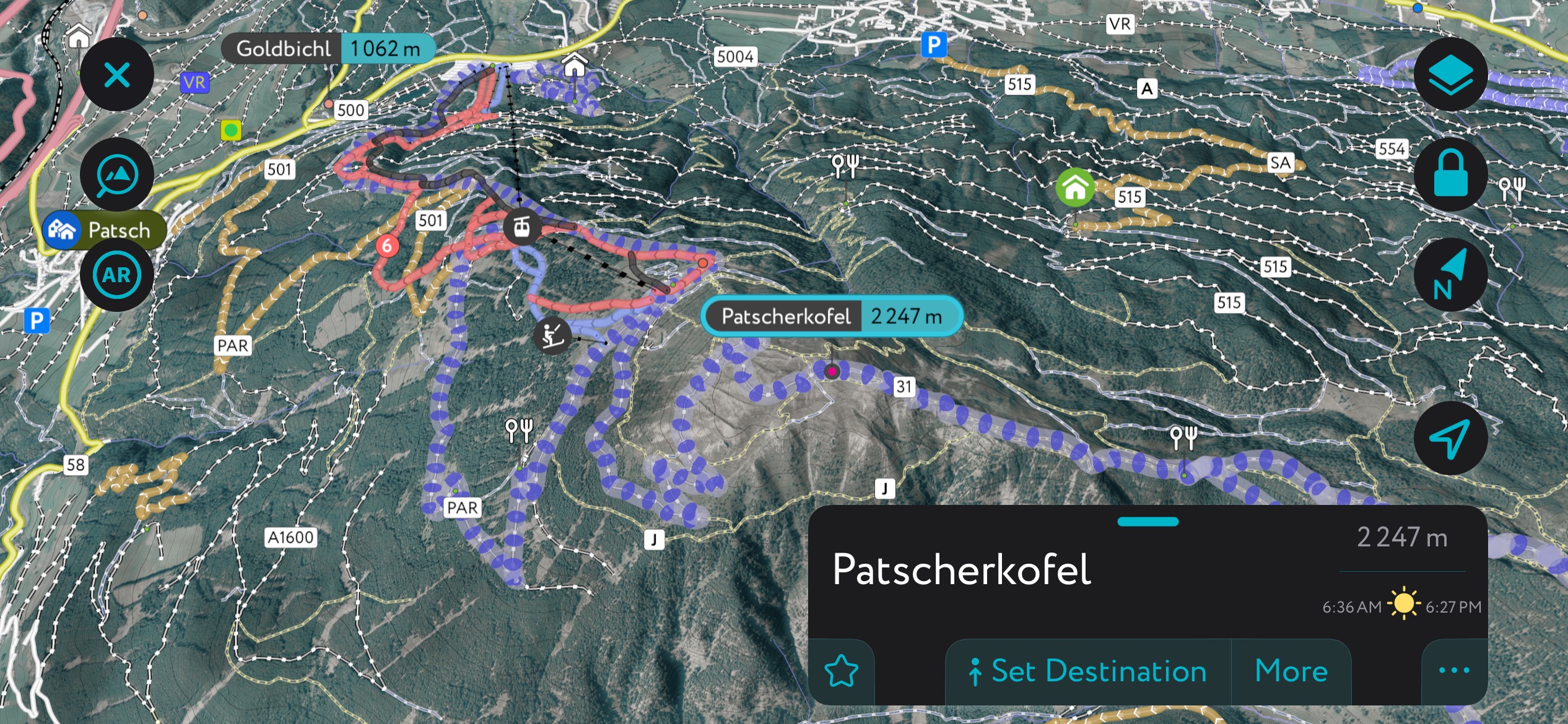
A quintessential trail in the Tux Alps is the Zirbenweg, called the “Stone Pine Path” in English. Using the Patscherkofel cable car from Igls, the trail begins at 1,970 m (6,460 ft) near the alpine botanical garden.
From the cable car's summit, the trail leads to the Boscheben Hütte, which offers stunning views across the Inn Valley and Karwendel Mountains. The trail then leads to the Glungezer cable car station and descends to Tulfes.
The trail is 7.6 km (4.7 mi) long and has gently undulating ascents and descents, making it an easy hike and accessible to many.
This challenging trail begins at Tulfes near the Glungezer Hütte and finishes at Wattenberg near the Lizumer Hütte. The trail is a highlight of the longer Munich-Venice Trail and takes in seven summits along the way.
One thing to note is that part of this trail, beginning near Naviser Jöchl, is within the military training area. The area is occasionally off-limit to the public, and hikers should check for closures while planning the hike.
With 19 km (12 mi) of slopes and six lifts, the Patscherkofel ski resort is considered Innsbruck's “home mountain” and a popular winter destination. It was the site of skiing and bobsled events for the Winter Olympic Games in 1964 and 1976.
The resort is only 6.5 km (4 mi) from Innsbruck and easily accessible via public transportation. In addition to a large beginner’s area, the resort offers more challenging pistes, a snow park for freestylers, and ski-touring and snowshoeing routes.
Although small, the Glungezer ski resort draws skiers of all levels and offers a popular 15 km (9.3 mi) descent into the valley. You can reach the long run by taking the ten-person gondola and the Tulfein Express chairlift/cable car combo to the resort’s highest point, just over 2,300 m (7,545 ft).
Views from the top take in sweeping views of the Nordkette Mountains and Inn Valley. The descent is over 1,300 m (4,265 ft) and passes the Glungezer Snow Park and restaurants along the way.
Those with small kids or looking to experience something unique to the region can try Klumpern, a family-friendly sport that uses a toboggan with just one runner. There are also ski touring options around Glungezer for those looking to enjoy the backcountry while still taking advantage of the ski lifts.
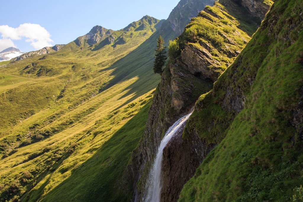
Ski touring is very popular in the Tux Alps. Although the mountains are less dramatic than other ranges in the Alps, they feature many mountainsides that serve as perfect templates for backcountry powder skiing. The absence of glaciers and major steeps makes the region accessible to backcountry skiers of all stripes and reduces the need for a guide.
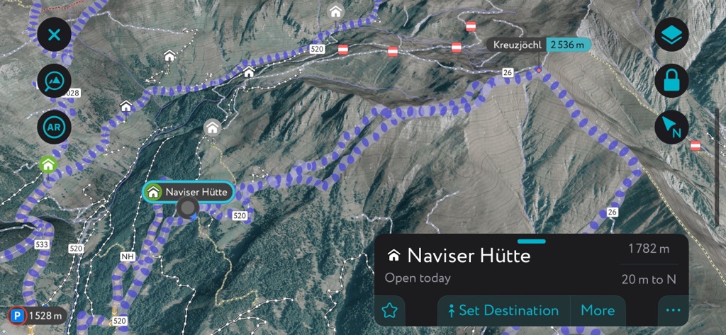
The Naviser Hutte is one of the Tux Alps' most popular backcountry refuges and is an excellent base for a few days of ski touring. The primary objective from the hut is the Kreuzjöchl (2,536m / 8,320ft). A modest 750 m (2,460 ft) of climbing brings skiers to the summit, where several descents on all aspects await.

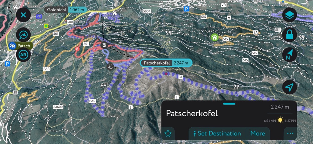
The Patscherkofel, Innsbruck’s home mountain, is one of the most accessible objectives in the Tux Alps. Exit the lift station at 1970 m and make your way up the track to the summit at 2,247 m for a breezy 277 m (908 ft) of climbing.
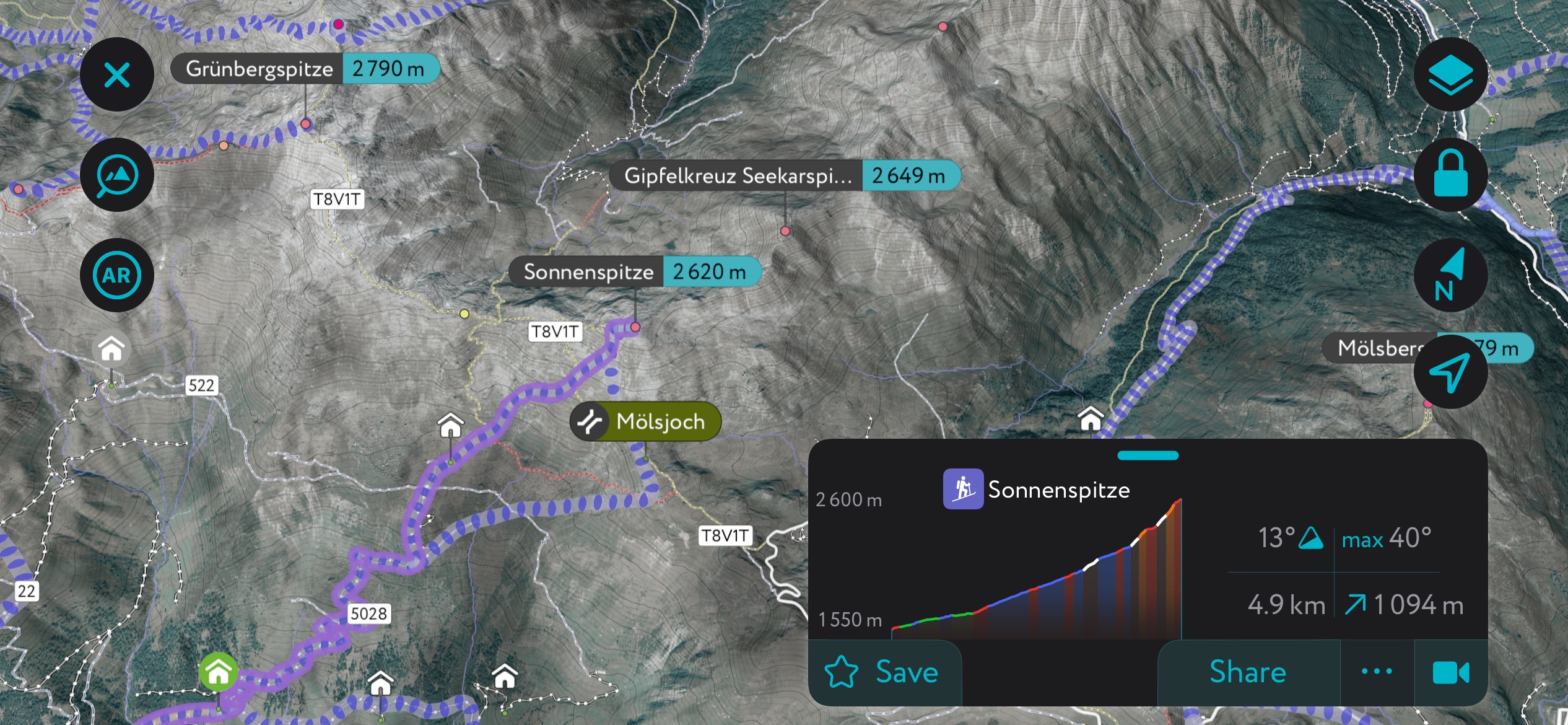
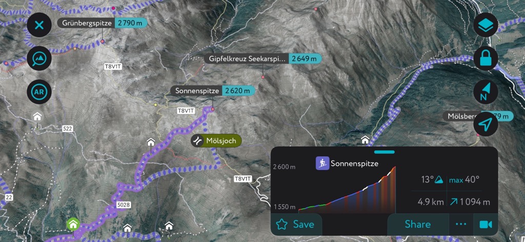
The Sonnenspitze is an excellent longer objective in the Tux Alps. You can depart from the parking above the village of Navis or from the popular Peeralm Refuge. The climb to the summit is over 1000 m (3,300 ft). Start early, because this climb is in the sun and can get hot. You can descend the way you came to harvest some south-facing corn snow or ski the north face and climb back over after. After skiing the north face, you can also continue down the valley to other refuges or even all the way into Innsbruck.
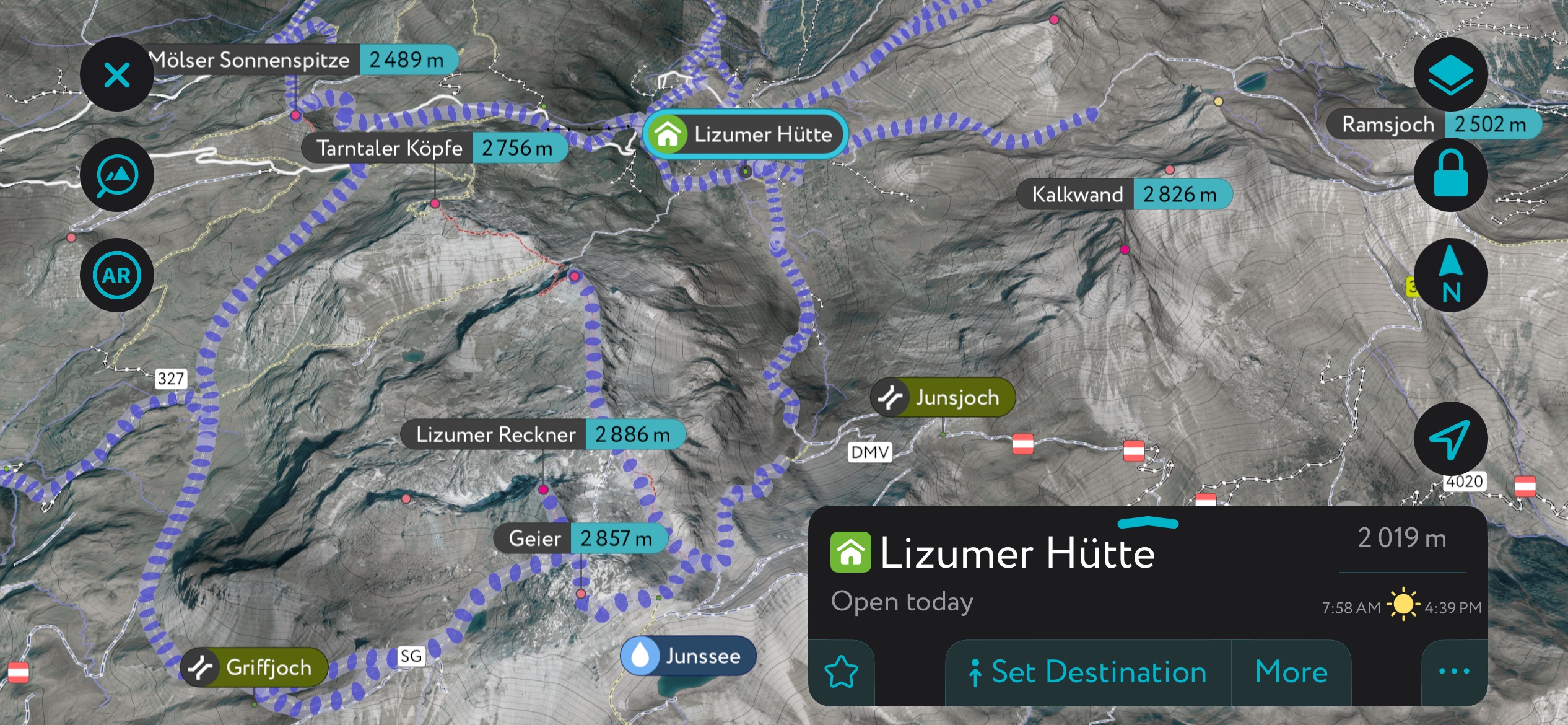
Possibly the best ski tour in the Tux Alps is the Geier or Lizumer Reckner from the Lizumer Hutte, which is only open in winter. It’s about 850 m of climbing; you can stop at Geier or continue past to the summit of Lizumer Reckner, the highest in the Tux Alps. The climb from the hut and the descent are north-facing, and there are several other north-facing routes accessible from this refuge.
With its international airport, cultural offerings, and mountain access, Innsbruck is an excellent choice if you plan to visit the Tux Alps. The city lies less than an hour northwest of the Tux Alps. If you’re looking for a less urban spot to stay closer to the mountains, consider staying at one of the ski towns, such as Tulfes or Igls.
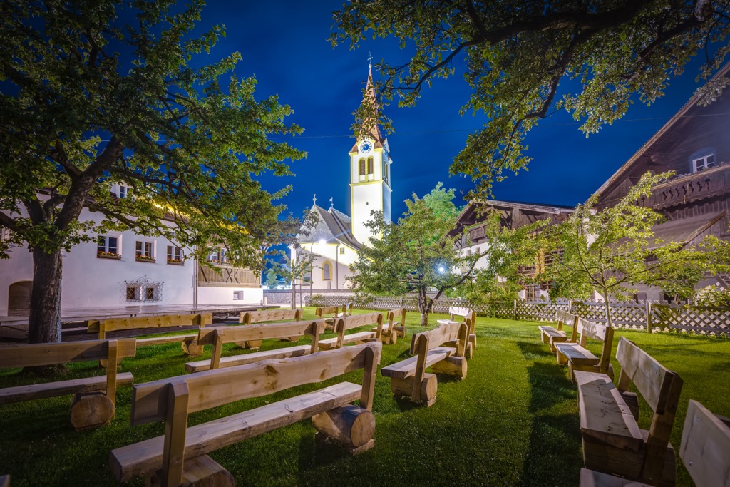
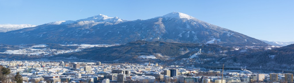
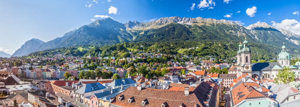
With a population of over 310,000, Innsbruck is an excellent destination for culture, nature, and proximity to mountain sports. It is the second-largest city in the Alps, after Grenoble, France, but arguably offers better mountain access. The city lies in a valley with steep mountains rising steeply around it; cable cars like the Nordkette and Patscherkofel provide quick access to the slopes for hiking, skiing, mountain biking, and paragliding.
Visitors can stroll through Old Town or pay a few Euros to climb the Town Tower. The Hofkirche church has 28 bronze statues, while the Cathedral of St. James exhibits Baroque architecture. The Schloss fortress, a medieval fortress turned Renaissance castle for Archduke Ferdinand II’s wife, displays armor and artwork. Innsbruck hosted the Winter Olympics in 1964 and 1976 and the 1984 and ‘88 Winter Paralympics; the stadiums still host sports events.
Purchasing an Innsbruck Card is a worthwhile investment if you want to go to multiple museums, ride some cable cars, and have free transport on buses, trams, and bikes. The passes can be purchased for 24, 48, or 72 hours.
Innsbruck is a 30-minute drive from both Italy and Germany. Trains arrive from Venice, Munich, Salzburg, and Zurich. The city also has a small but busy international airport and is a launching point for the famous Tyrolean ski resorts.
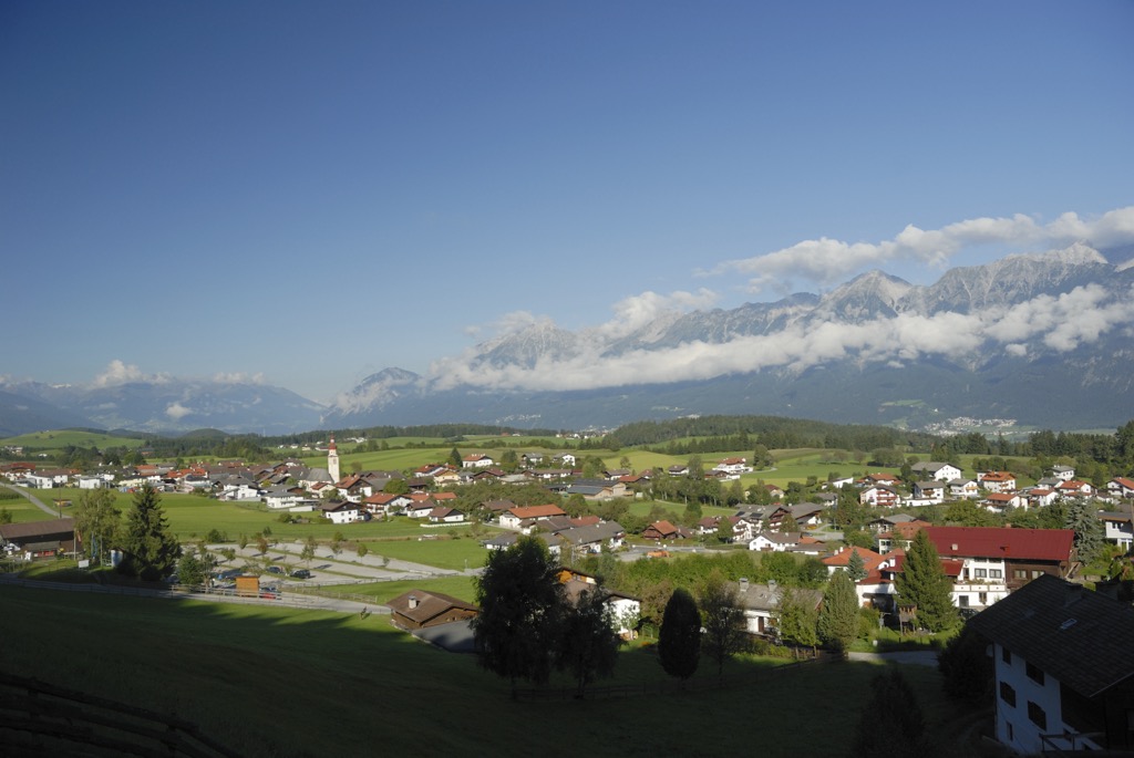
With a population of 1,500, the village of Tulfes offers picturesque valley walks and access to the impressive Glungezer. Tourists flock to the area in summer and winter to hike, bike, and ski, with the Glungezer Cable Car taking visitors up to nearly 2,000 m (6,560 ft). The town has an array of accommodation options and restaurants, and there are also restaurants on the mountain slopes.


The highest peak in the Tux Alps is Lizumer Reckner, at 2,886 m.
The Tux Alps have 230 named peaks.


