
Scan the QR code and open PeakVisor on your phone
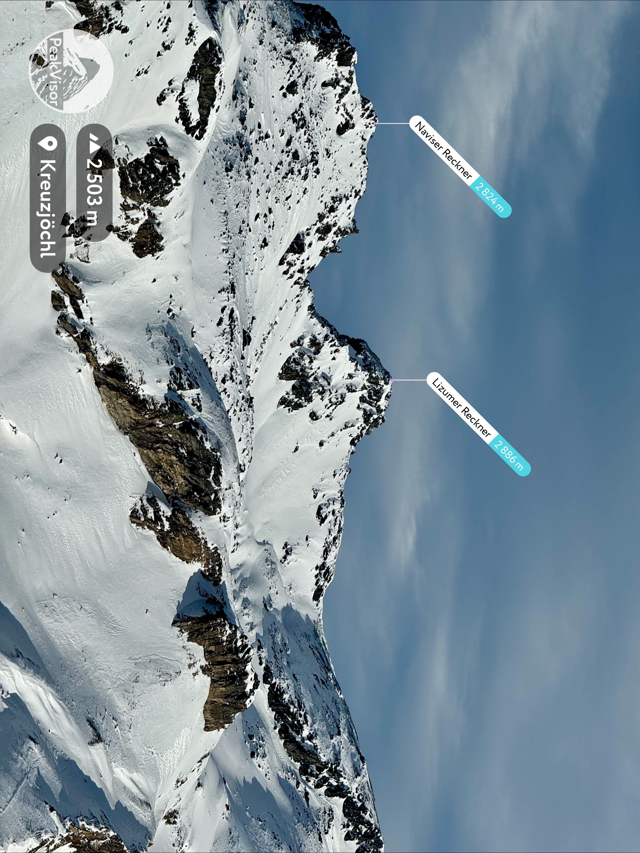
The Tyrol Schistose Alps (Tiroler Schieferalpen) is the name suggested by the International Standardized Mountain Subdivision of the Alps (SOIUSA) for a subdivision of the Northern Limestone Alps, encompassing the Tux Alps and the Kitzbühel Alps. There are 692 named mountains in the Tyrol Schistose Alps. Lizumer Reckner (2,886 m / 9,468 ft) is the highest summit. The most prominent mountain is Geißstein (2,366 m / 7,762 ft).
The Tyrol Schistose Alps encompass an area of over 2,000 sq km (772 sq mi) south of the Lower Inntal, from the Wipptal and Innsbruck to Zeller See. It's located almost entirely within Tyrol, with a small section in Salzburg. To the south of the Tyrol Schistose Alps are the Western Tauern Alps and Austria's largest national park, Hohe Tauern National Park.
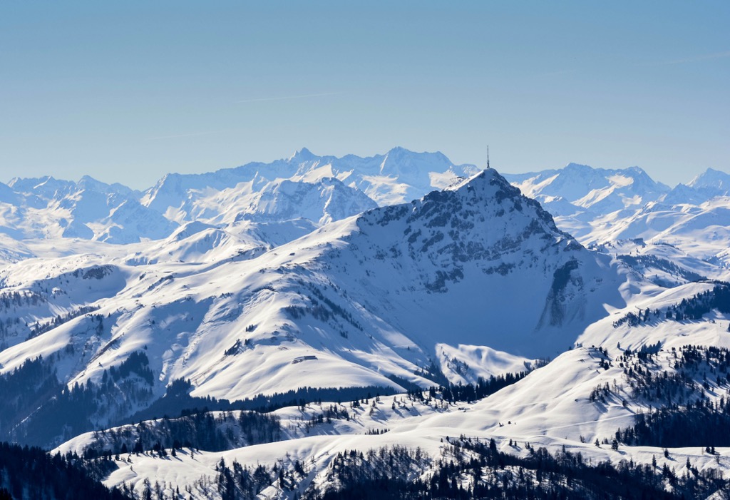
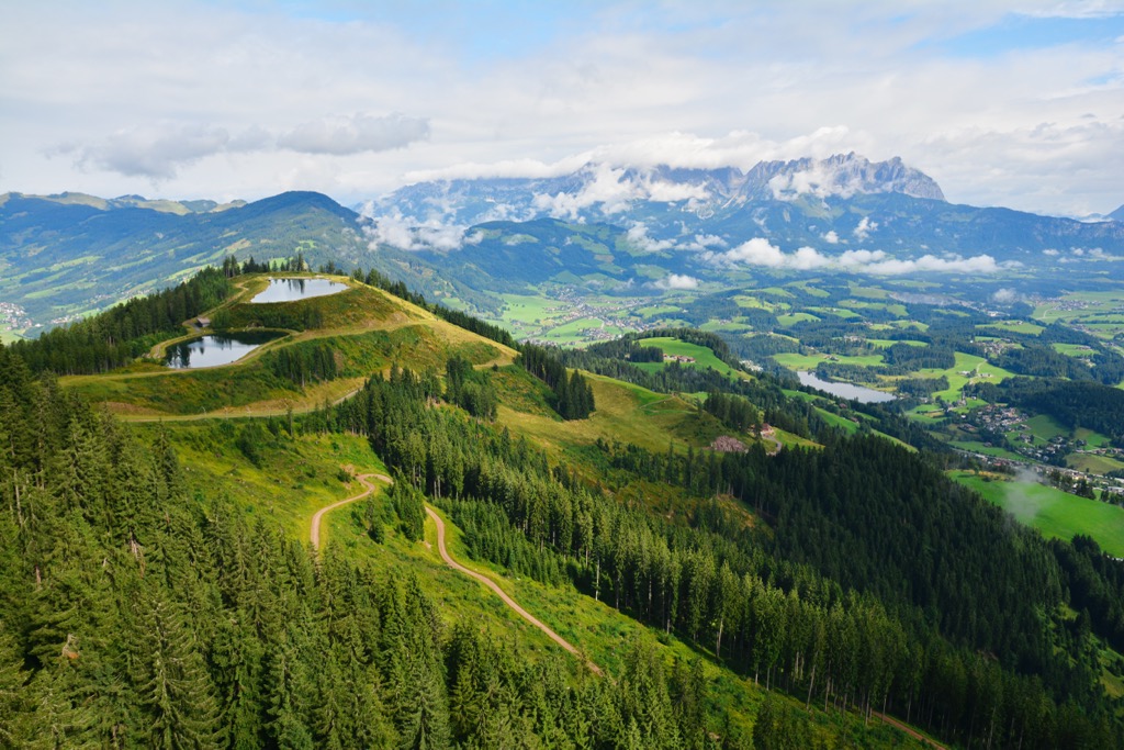
In the Tyrol Schistose Alps' western half is the Tux Alps, a subgroup that stretches as far as the Zillertal. The Zillertal Alps dwarf the Tux Alps to the south, which is why they became classified as prealps in the 19th century. However, they're far too lofty to be considered prealps and are home to the highest summits in the Tyrol Schistose Alps, including Lizumer Reckner, Geier (2,856 m / 9,373 ft), and Grünbergspitze (2,790 m / 9,154 ft).
The Tux Alps consist of several main ridges running from north to south, separated by sweeping valleys — only a couple of ridges on its southern boundary run from east to west.
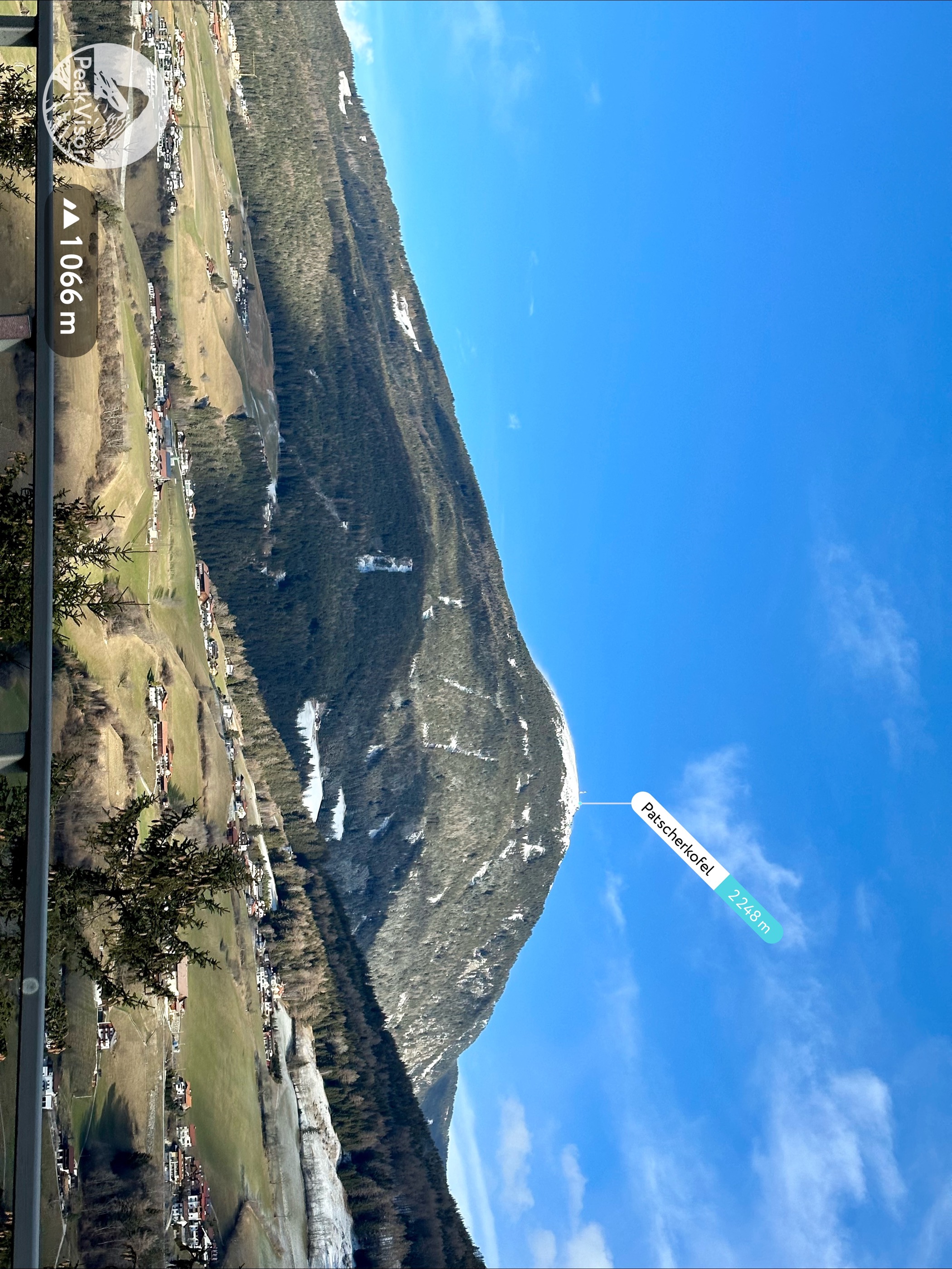
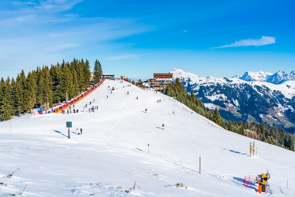
The Tux Alps are known for their world-class skiing, with Patscherkofel (2,246 m / 7,372 ft) used as a venue during the 1964 and 1976 Winter Olympics. One reason the Tux Alps are fantastic for skiing is because of their smooth slopes; the range's landscape is covered primarily in pastures and forests.
The Tux Alps take their name from Tux village, located within a side valley of the Zillertal on the range's southern boundary.
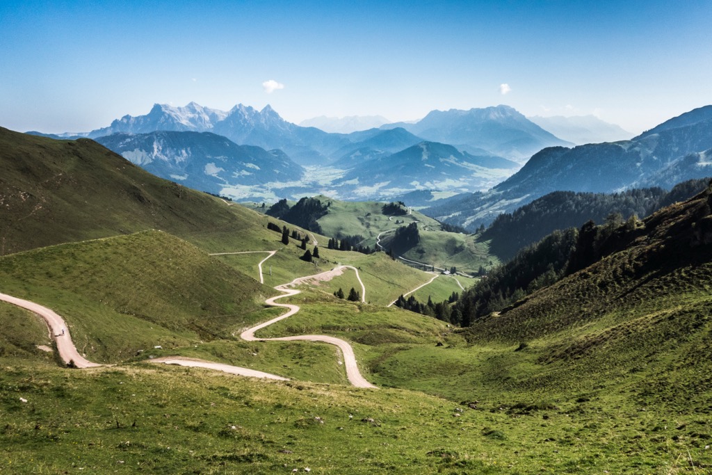
In the eastern half of the Tyrol Schistose Alps are the lower - but much more popular - Kitzbühel Alps. Like the neighboring Tux Alps, the Kitzbühel Alps have smooth slopes that are perfect for skiing. They’re also home to some of the best hiking mountains in Austria, like the Hohe Salve (1,829 m / 6,001 ft).
The Kitzbüheler Ache river divides the Kitzbühel Alps into two sub-ranges: the Glemmtal Alps to the east and the Kelchsau Alps to the west. The Kitzbühel Alps' highest summit is Kreuzjoch (2,558 m / 8,392 ft), located in the range's southwestern corner just north of Gerlos.
The Kitzbüheler Horn (1,996 m / 6,549 ft) is among the most famous summits in the Kitzbühel Alps — on its western flank is part of the Kitzbühel KitzSki resort, one of the best ski resorts in the world. It's also one of the most popular hiking spots in the range.
Innsbruck, nicknamed the "Jewel of the Austrian Alps," is Austria's fifth-largest city and is located on the northwestern boundary of the Tyrol Schistose Alps, with a population of 130,000. Other significant settlements in and around the Tyrol Schistose Alps include St. Johann, Kitzbühel, Kufstein, and Zell am See.
The Tyrol Schistose Alps are a part of the Central Eastern Alps and are composed primarily of sedimentary rocks. They began forming, along with the rest of the Alps, approximately 66 million years ago due to the Alpine Orogeny.
This mountain building occurred due to a continental collision between the African and Indian tectonic plates to the south and the Eurasian plate to the north. It built mountain ranges stretching from Europe's western edge to Asia, including the Pyrenees, the Himalayas, and the Carpathian Mountains.
The Kitzbühel Alps both fall within the greywacke zone, a band of metamorphosed sedimentary rocks. The range is composed mainly of phyllite and slate. Limestones and dolomites are also present in several areas of the range, like on Großer Rettenstein (2,365 m / 7,762 ft). Innsbruck quartz phyllites are present on the range's western edge.
Most of the Tux Alps are made up of low-grade metamorphic rocks, predominantly schist and quartz phyllite slate. Much of the southern area of the Tux Alps lies on the edge of the Tauern Window, where limestones, dolomites, and serpentinites are exposed at the surface. The two highest summits in the Tyrol Schistose Alps, including Lizumer Reckner and Geier, are composed primarily of serpentinite.
Covering over 2,000 sq km (772 sq mi) of Tyrol, the Tyrol Schistose Alps provide a snapshot of western Austria's varied flora and fauna.
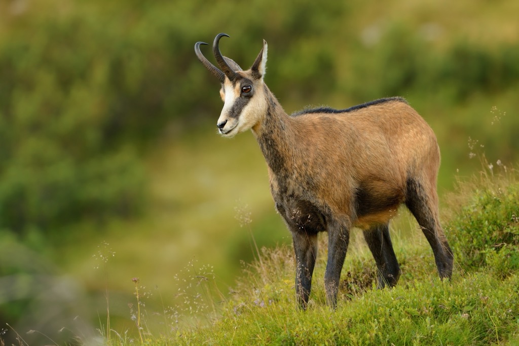
Red deer are the largest mammal hikers are likely to encounter in the Tyrol Schistose Alps — they can weigh as much as 240 kg (529 lbs). Many of the Alps' mountain specialist species, including mouflons, ibex, marmots, and chamois, inhabit this region. Kitzbühel is nicknamed "Chamois Town" as the mammal appears on its coat of arms and logo.
Bears have been spotted in Tyrol recently, usually wandering across from Trentino, but the chances of encountering one are slim to none. Gray wolves have returned to Tyrol after being extirpated in the late 19th century — there are now thought to be over 80 individuals across the state. Again, the chances of encountering one are very low.
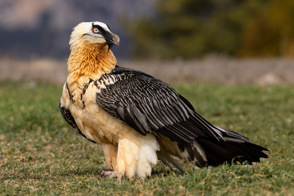
The Tyrol Schistose Alps' dense forests and mountain slopes are home to a wide variety of birds. One notable resident is the bearded vulture, the largest bird species in the Alps, with a wingspan of up to 2.9 m (9.5 ft). Another prominent resident is the rock ptarmigan, a member of the grouse family known for its seasonal camouflage plumage.
Other bird species in the Tyrol Schistose Alps include goldcrests, golden eagles, ring ouzels, gray herons, and Eurasian eagle-owls.
European common adders are the only venomous snakes in the Tyrol Schistose Alps. They can be found at up to 3,000 m (9,842 ft) in elevation; their bite is medically significant but rarely lethal. Other reptile and amphibian species in the Tyrol Schistose Alps include alpine salamanders, common frogs, European pond turtles, and fire salamanders.
Like the rest of Austria, the Tyrol Schistose Alps are heavily forested; forests carpet around 66% of the Kitzbühel Alps. The Kitzbühel Alps and Tux Alps' forests are a mixture of deciduous, coniferous, and mixed forests, depending on the elevation.
The Stone Pine Path between Glungezer (2,677 m / 8,782 ft) and Patscherkofel leads through the Alps' oldest stone pine forest. Along this trail within the Ampasser Kessel forest is the oldest tree in the Tyrol, a 750-year-old Swiss stone pine.
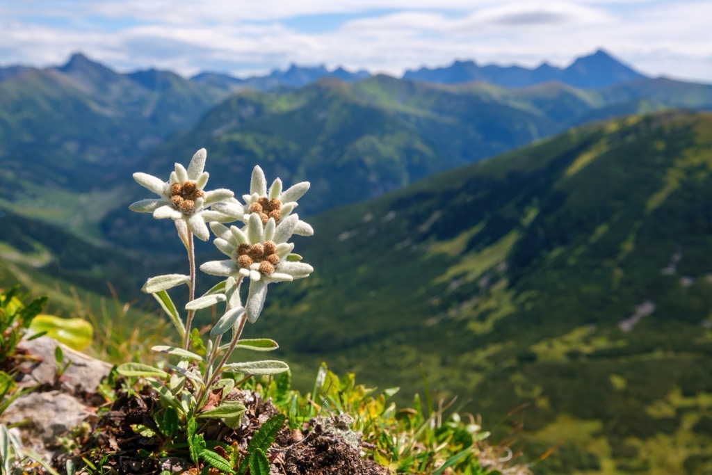
One of the best places to get a snapshot of the Tyrol Schistose Alps' wildflowers is the Alpine Flower Garden on the Kitzbüheler Horn. Here, you can see high-altitude species from around the world and over 400 local alpine flowers, including arnicas, edelweiss, and purple bellflowers.
Other notable wildflowers in the Tyrol Schistose Alps include monkshoods, broad-leaved marsh orchids, trumpet gentians, primroses, pasqueflowers, and rockfoils.
The hiking history of the Tyrol Schistose Alps isn't well-documented, mainly because most of the summits in the Tux Alps and Kitzbühel Alps are easily reached. As a result, little information is available on first ascents within the ranges.
Much of the modern hiking history of the Tyrol Schistose Alps dates back to the late 19th century with the rise in popularity of recreational hiking and skiing.
The now-defunct German and Austrian Alpine Club (DuÖAV), along with other local small ski clubs, helped build huts across the Tyrol Schistose Alps at the turn of the 20th century. These huts helped make many of the area's mountains accessible to casual hikers and skiers.
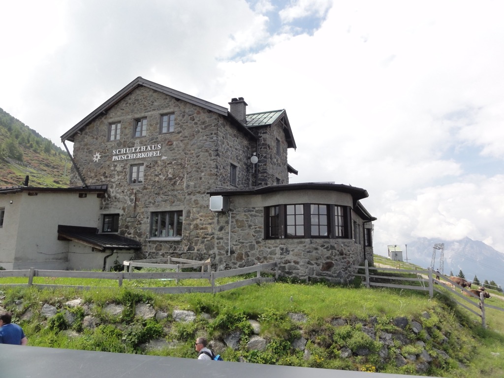
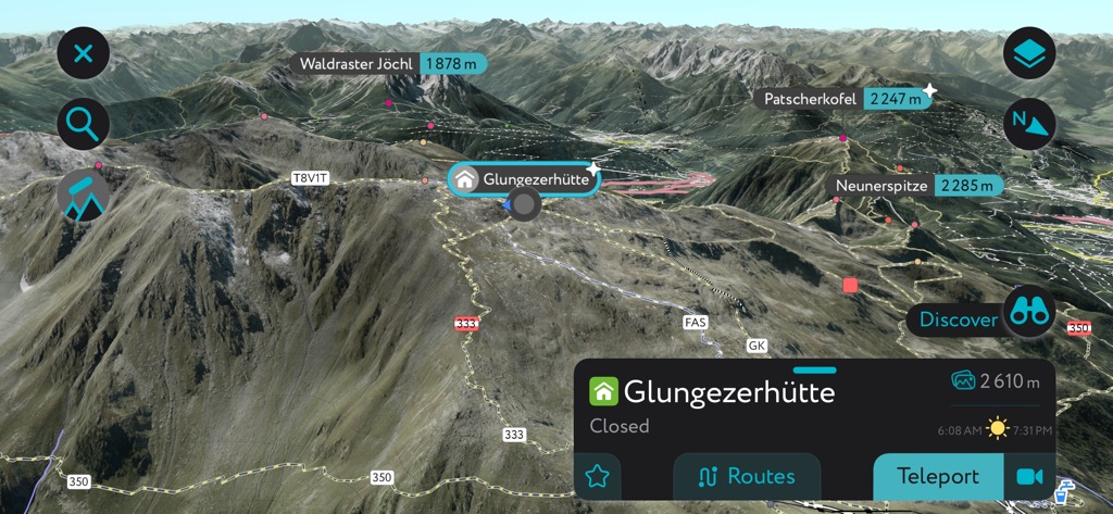
Among the earliest purpose-built mountain huts in the Tyrol Schistose Alps are the Patscherkofel Schutzhaus (1,939 m / 6,463 ft), built by the Austrian Tourist Club in 1884, and the Wildseeloderhaus (1,854 m / 6,083 ft), built by the DuÖAV in 1892. The highest hut in the Tyrol Schistose Alps, the Glungezerhütte (2,610 m / 8,563 ft), first opened in the early 1930s.
Skiing has been integral to the growth and development of the Tyrol Schistose Alps over the last 150 years. Franz Reisch was the first documented person to ski down the Kitzbühler Horn in 1893.
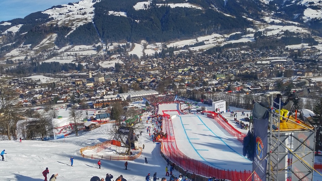
In 1931, Hahnenkamm (1,712 m / 5,617 ft) hosted the first Hahnenkamm Races, the second-oldest alpine skiing competition after the Lauberhorn Races in Switzerland. It's among the most celebrated FIS Alpine Ski World Cup races globally. Today, Kitzbühel Ski Resort is among the most famous resorts in the Alps, especially for piste skiers.
The Tyrol Schistose Alps cover two mountain ranges that are perfect for hiking, with their gentle slopes and well-marked trails. Still, it's worth taking plenty of precautions anytime you're hiking in the Alps.
Map out your route carefully, bring plenty of food and water, and inform others of your itinerary. The weather in the Tyrol Schistose Alps can be changeable, so check the latest weather forecasts before setting out.
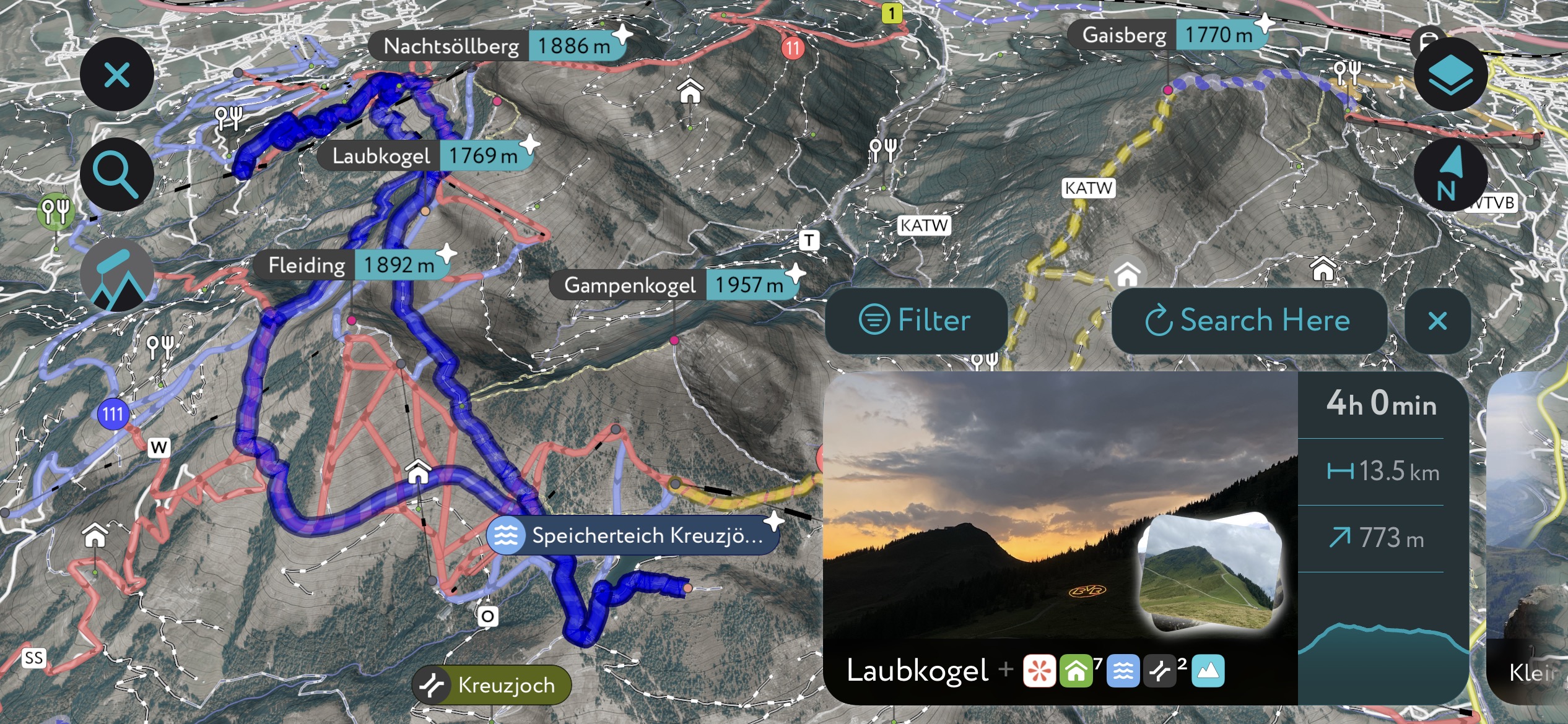
Discover the best hiking trails and ski tours across the Alps with the PeakVisor App.
We've compiled information on thousands of publicly maintained walking paths worldwide to help you plan the perfect outdoor adventure. We've also gathered details of ski tours and resorts if you're planning a winter getaway.
Originally simply a summit identification tool, the PeakVisor App is now so much more — it's one of the best portable 3D hiking map apps available. Track which summits you've bagged, post pictures, earn achievements, and map your favorite routes for others to try. Use our Hiking Map to create .gpx files on your desktop to follow on the go in the app.
We've been working hard to add even more valuable features to the PeakVisor App. You can now receive weather reports, including snow depths. In addition, you'll find the latest information on mountain huts, including dining options, accommodation, and opening hours.
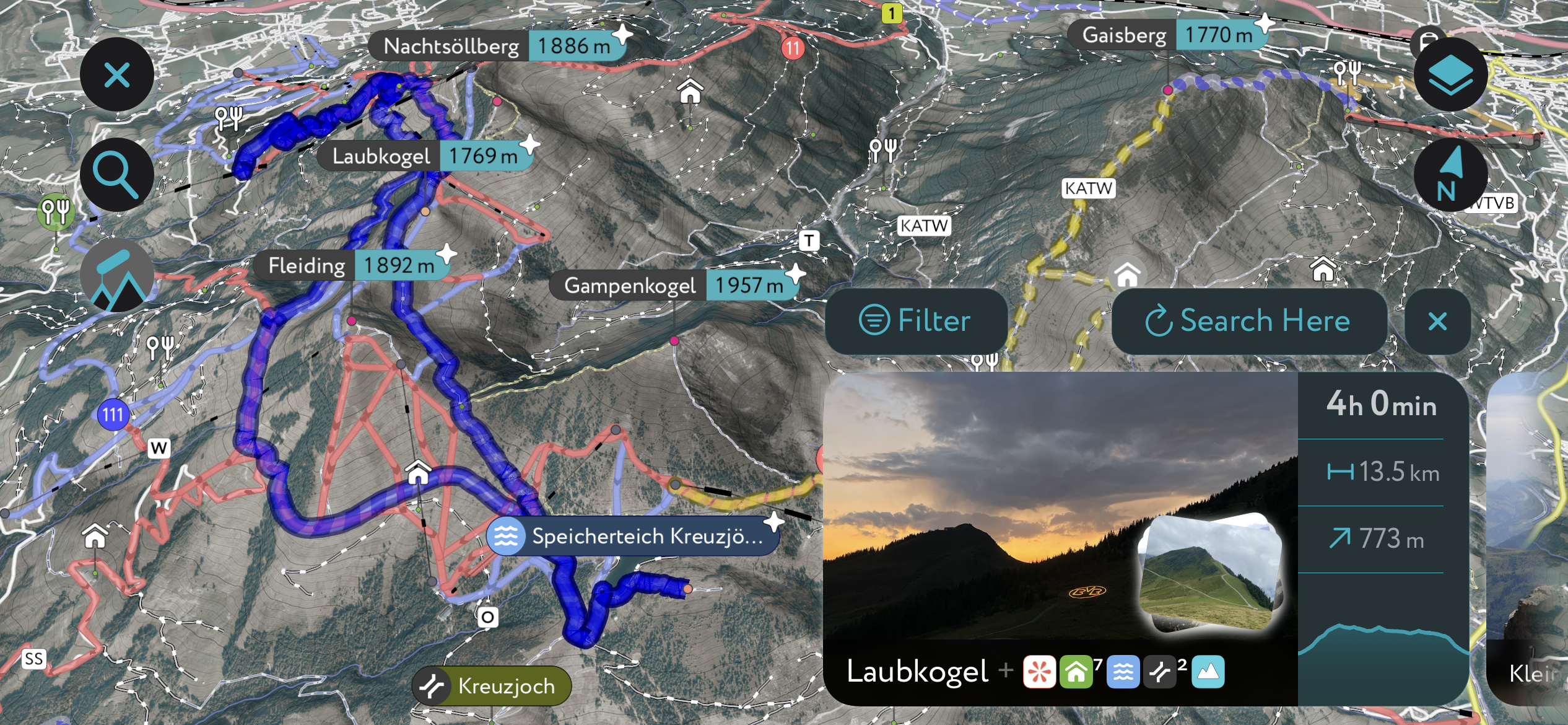
The Glungezer & Geier - High Altitude Trail is one of the best routes in the Tux Alps if you're looking to bag several summits in one go. The trail runs from the Glungezerhütte (2,609 m / 8,559 ft) to the Lizumer Hütte (2,019 m / 6,624 ft), crossing seven Tuxer summits over 2,600 m (8,530 ft) on the way.
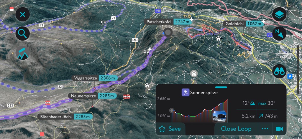
It's worth noting that part of this trail passes over the Naviser Jöchl (2,478 m / 8,133 ft) at Sonnenspitze, which is home to a military training area occasionally closed to the public. A head for heights is needed, and parts of the route are secured with ropes.
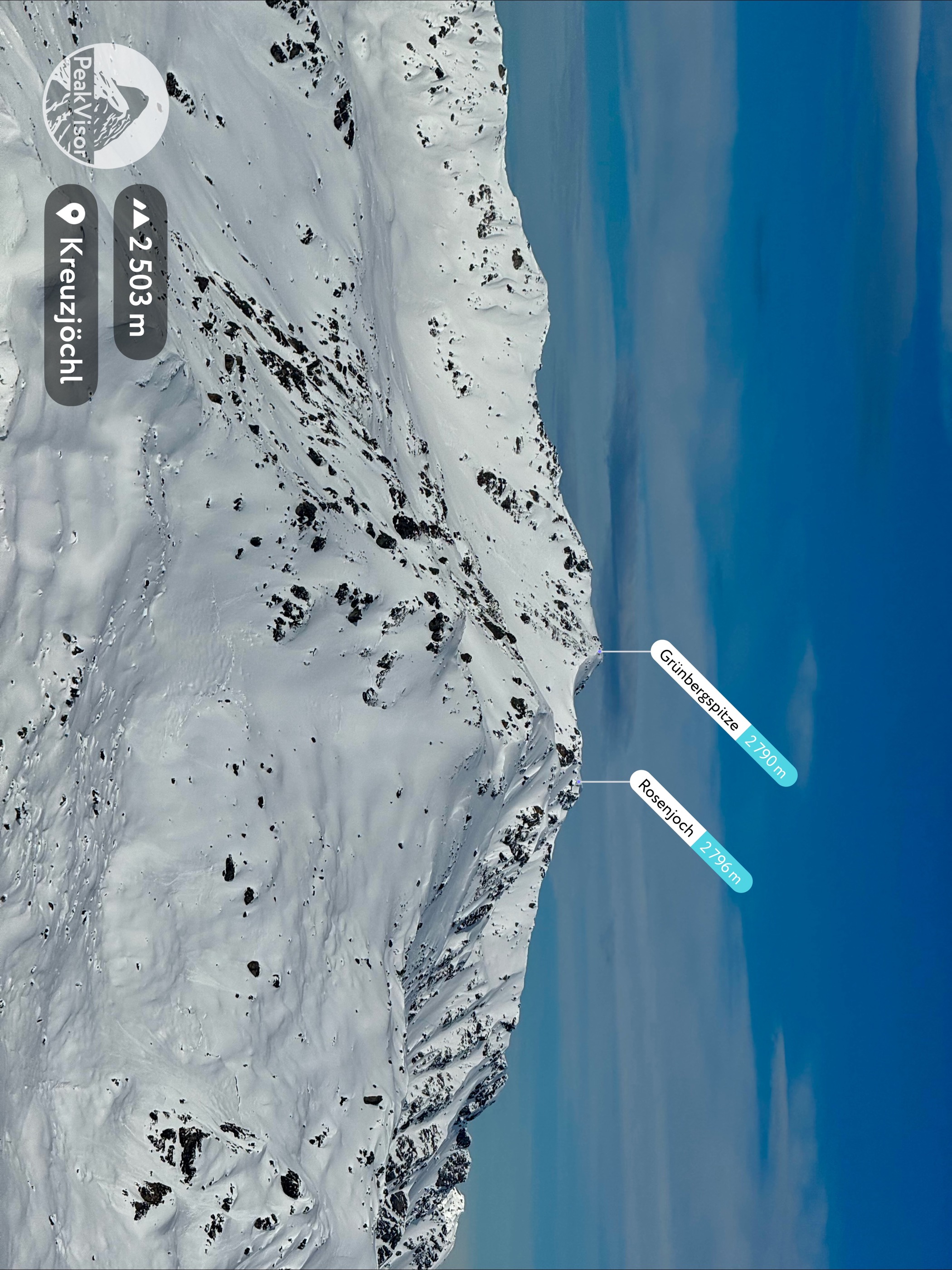
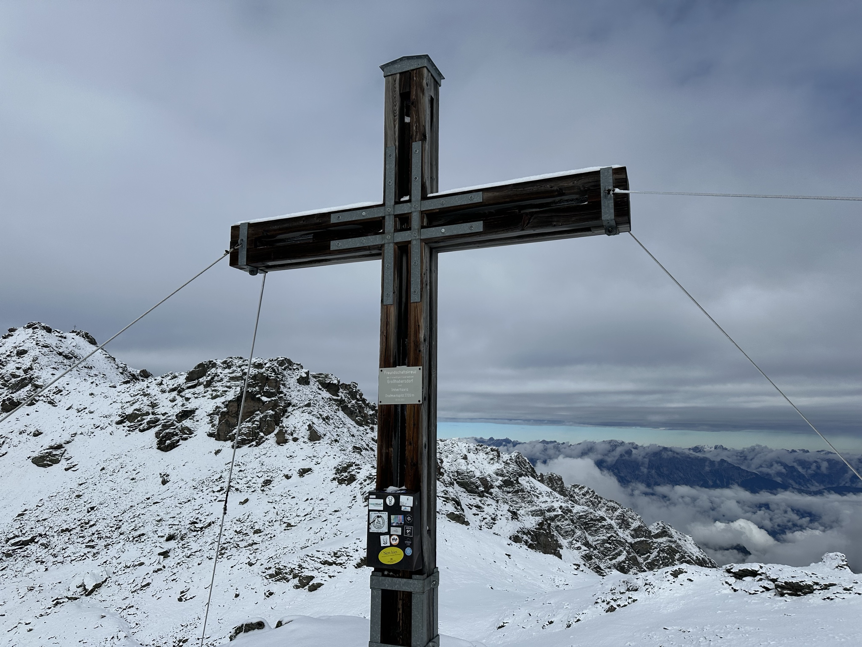
The High Altitude Trail passes along a ridge heading south from Glungezerhütte over Glungezer (2,677 m / 8,783 ft), followed by Gamslahnerspitze (2,681 m / 8,796 ft), Kreuzspitze (2,746 m / 9,009 ft), Rosenjoch (2,796 m / 9,173 ft), Grünbergspitze (2,790 m / 9,154 ft), Grafmartspitze (2,720 m / 8,924 ft), Sonnenspitze (2,620 m / 8,202 ft).
Finally, you'll cross the Mölsjoch (2,334 m / 7,657 ft) saddle to reach the final summit, Nördlicher Klammerschober (2,448 m / 8,031 ft). This trail is around 15.5 km (9.6 mi) long and takes around eight hours to complete.

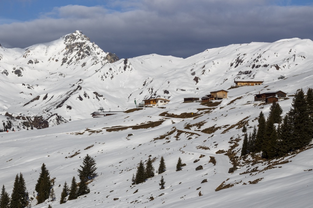
The Rastkogel (2,762 m / 9,062 ft) is the namesake of the Rastkogel Massif on the Tux Alps' main ridge. It's among the most frequented summits in the Tux Alps year-round. It's a rewarding hike in summer; in winter, it's one of the range's classic ski-touring mountains.
The views from atop the Rastkogel are incredible — you'll have sweeping views of the Karwendel and the Hohe Tauern, and, on a clear day, you'll be able to see as far as Zugspitze (2,962 m / 9,718 ft).
The normal - and easiest - route to the Rastkogel's summit is along the southeastern ridge from the Rastkogelhütte (2,124 m / 6,969 ft). It's graded T3 on the Swiss Alpine Club (SAC) hiking scale. The path is exposed but generally easy to follow along the ridgeline. Descend the way you came. This hike is approximately 14 km (8.6 mi) long.
The Hohe Salve (1,829 m / 6,001 ft) is among the most famous and visited mountains in the Tyrol Schistose Alps and the Kitzbühel Alps. One of the northernmost summits in the Kelchsau Alps, the Hohe Salve is known for its impressive conical summit and its views of the Hohe Tauern, the Zillertal Alps, and the Wilder Kaiser.
On a clear day, it's possible to see over 70 three-thousanders, including Großglockner (3,798 m / 12,461 ft) and Großvenediger (3,656 m / 11,998 ft). Atop Hohe Salve is the 18th-century Salvenkirchlein chapel, Austria's highest pilgrimage church. The summit is also home to the Gipfelalm Hohe Salve (1,827 m / 5,994 ft), a restaurant with a rotating observation terrace.
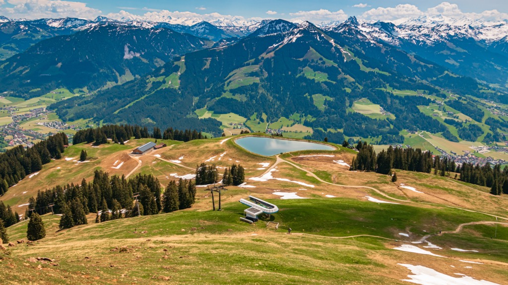
The Hohe Salve is a leisurely, family-friendly mountain hike with numerous trail options. One popular route leads past Salvensee, a popular viewpoint affording panoramas of the nearby mountains. You can pick up this trail from the Hopfgarten Middle Station, which you can reach by getting the Salvenbahn 1 cable car from Hopfgarten.
You'll start by following forest trail No. 99 and then No. 90/95 to reach the Hohe Salve's summit via its southern slopes. Descend by following trail No. 90/95 or take the cable car back to Hopfgarten. This hike is approximately 5.7 km (3.5 mi) long.
The Kitzbüheler Horn (1,996 m / 6,549 ft) is one of Kitzbühel's home mountains (alongside Hahnenkamm) and is among the most iconic mountains in the Tyrol Schistose Alps. In winter, it's one of the main mountains of the Kitzbühel KitzSki resort, and in summer, hikers and cyclists flock to the mountain.
Situated at the northern end of a ridge, the Kitzbüheler Horn provides spectacular vistas of the surrounding ranges, with the highest summits in the Venediger Group, the Wilder Kaiser, and the Loferer Steinberge all visible. Atop the Kitzbüheler Horn is the 102 m tall Kitzbüheler Horn Transmission Tower and the Kitzbüheler Horn Gipfelhaus (6,457 ft).
The Horn Summit Mountain Trail (Horn-Gipfel-Höhenweg) is one of the best routes up the Kitzbüheler Horn. From the Harschbichl Mountain Station, follow the trail south along a challenging, exposed trail to the summit.
Descend via the narrow Hoferschneid ridge to Huberalm. Keep left from Huberalm to return to your starting point. This hike is approximately 6.3 km (4 mi) long.
If you're searching for a multi-day hike in the Tyrol Schistose Alps, look no further than the KAT Alpine Walk. This 113 km (70 mi) trek runs from Hopfgarten to St. Ulrich, taking in some of the finest summits and sights the Kitzbühel Alps have to offer.
The KAT Alpine Walk features six stages and includes iconic summits like Hahnenkamm and the Kitzbüheler Horn, as well as picturesque settlements like St. Johann in Tirol.
The KAT Alpine Walk's six stages are as follows:
The Tyrol Schistose Alps' smooth slopes and varied terrain make it one of the best ski destinations in Tyrol, on-piste and off-piste. Popular ski-touring mountains in the Tyrol Schistose Alps include the Rastkogel, the Kellerjoch (2,343 m / 7,690 ft), the Mölser Sonnenspitze (2,488 m / 8,166 ft), and Patscherkofel.
Here's a quick look at a couple of the best Tyrol Schistose Alps ski tours.
Patscherkofel (2,246 m / 7,372 ft) is among the most famous mountains for skiing in the Tyrol Schistose Alps, alongside the Hahnenkamm. It hosted the men's downhill race in Alpine skiing at the 1964 and 1976 Winter Olympics, playing a role in the rise of ski stars like Franz Klammer.
There are several marked ski tours on Patscherkofel, including the Gipfelroute, which leads to its summit. It's a beginner-friendly ski tour starting from the Patscherkofelbahn Mountain Station.
This ski tour leads past the Patscherkofel Schutzhaus (1,964 m / 6,463 ft) and the Gipfelstube (2,242 m / 7,356 ft) to reach the summit. It is approximately 3 km (1.8 mi) long.

The Grafmartspitze (2,720 m / 8,924 ft) is ideal if you're searching for a more challenging ski tour off the beaten track in the Tyrol Schistose Alps. Its summit provides remarkable views of the Voldertal, the Zillertal Alps, and the Hintertux Glacier. It's suitable for ski tours even after very little snow, making it a great tour for the early season.
The best way to experience the Grafmartspitze is along the forest path to the south. From Grün Car Park, the trail leads past Grafmartalm (2,162 m / 7,096 ft) to Naviser Jöchl (2,478 m / 8,133 ft) and over the Sonnenspitze (2,500 m / 8,202 ft) to reach the Grafmartspitze. Descend the way you came. This ski tour is approximately a 14 km (8.7 mi) round-trip.
The Tyrol Schistose Alps cover a large area with numerous ski resorts across the Kitzbühel Alps and Tux Alps. Some of these resorts are large and overlap with surrounding ranges, like the Zillertal Alps.
The main ski resorts in the Tyrol Schistose Alps are:
Some of Tyrol's largest cities and best ski resorts are a stone’s throw from the Tyrol Schistose Alps.
Innsbruck International Airport is the nearest airport, located under 10 km (6 mi) northwest of the Tyrol Schistose Alps.
Innsbruck is the capital of Tyrol and its largest city, with a population of over 130,000. It's the perfect city to visit if you want to explore Tyrol's mountains — it borders the Karwendel, the Stubai Alps, and the Tux Alps. The Nordkette Cable Car takes you directly from Innsbruck into the North Chain of the Karwendel.
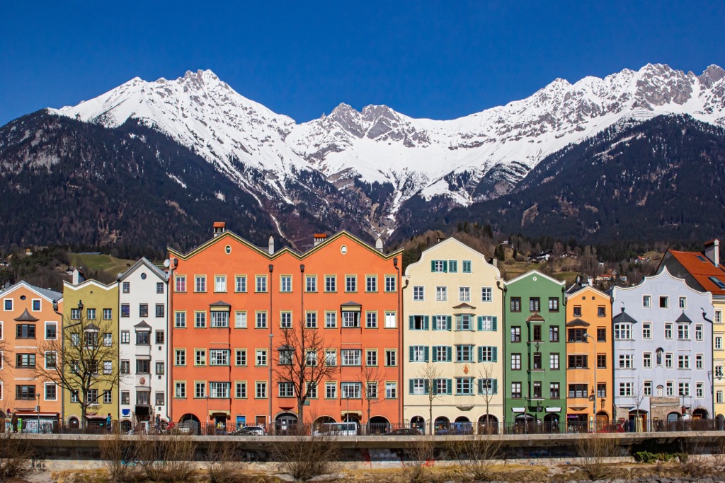
Aside from the nearby mountains, Innsbruck offers numerous family-friendly attractions to enjoy during your downtime, like the Alpenzoo, Ambras Castle, and the Tyrolean Folk Art Museum.
Innsbruck Airport is just 4 km (2 mi) from the city center, and Innsbruck Central Station connects the city by train to Vienna, Zurich, Budapest, and Munich.
Kufstein is the second-largest settlement in Tyrol with over 20,000 people. It's located about 15 km (9 mi) north of the Tyrol Schistose Alps near the German border.
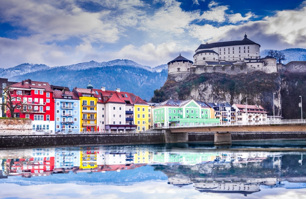
Kufstein is a picturesque town in the Lower Inntal between the Brandenberg Alps and the Wilder Kaiser. It sits in the shadow of the hilltop Kufstein Fortress, which dates back to before the 13th century. Traditional Tyrolean architecture and cobblestone streets add to its charm.
Kufstein Railway Station connects the town directly with Rosenheim, Salzburg, Zell am See, and Wörgl.
Kitzbühel is the principal town of the Kitzbühel Alps, with over 8,000 people. For over 100 years, people have flocked to Kitzbühel to take advantage of its outstanding winter sports opportunities. Over time, it has become one of Austria's most famous and exclusive ski resorts.
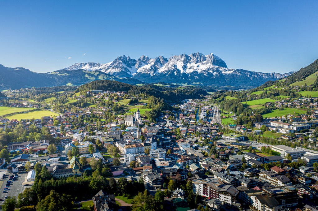
Kitzbühel's central location makes it one of the best places for hikers to stay in the Tyrol Schistose Alps. It's within 15 km (9 mi) of famous peaks like the Hohe Salve, the Kitzbüheler Horn, and Geißstein (2,363 m / 7,753 ft)


.JPG)