
Scan the QR code and open PeakVisor on your phone
The Kitzbühel Alps are a mountain range in the Eastern Alps split across the Austrian states of Salzburg and Tyrol. One of Austria's most luxurious resorts, 900 km (559 mi) of ski pistes, and over 1,000 km (621 mi) of marked hiking trails await visitors. There are 463 named mountains in the Kitzbühel Alps. Kreuzjoch (2,558 m / 8,392 ft) is the highest summit. The most prominent mountain is Geißstein (2,363 m / 7,753 ft).
The Kitzbühel Alps stretch approximately 80 km (50 mi) east to west between the Zillertal and the 105 km (65 mi) long Saalach River. The range is roughly 25 km (15 mi) wide, spanning from the Salzach River in the south to the Inn River, Fieberbrunner Ache, and Leoganger Achental in the north.
The western two-thirds of the range is part of Tyrol, while the eastern third falls within Salzburg. The 79 km (49 mi) long Kitzbüheler Ache flows through the central Leukental and splits the Kitzbühel Alps into two main subranges: Glemmtal Alps to the east and Kelchsauer Alps to the west.
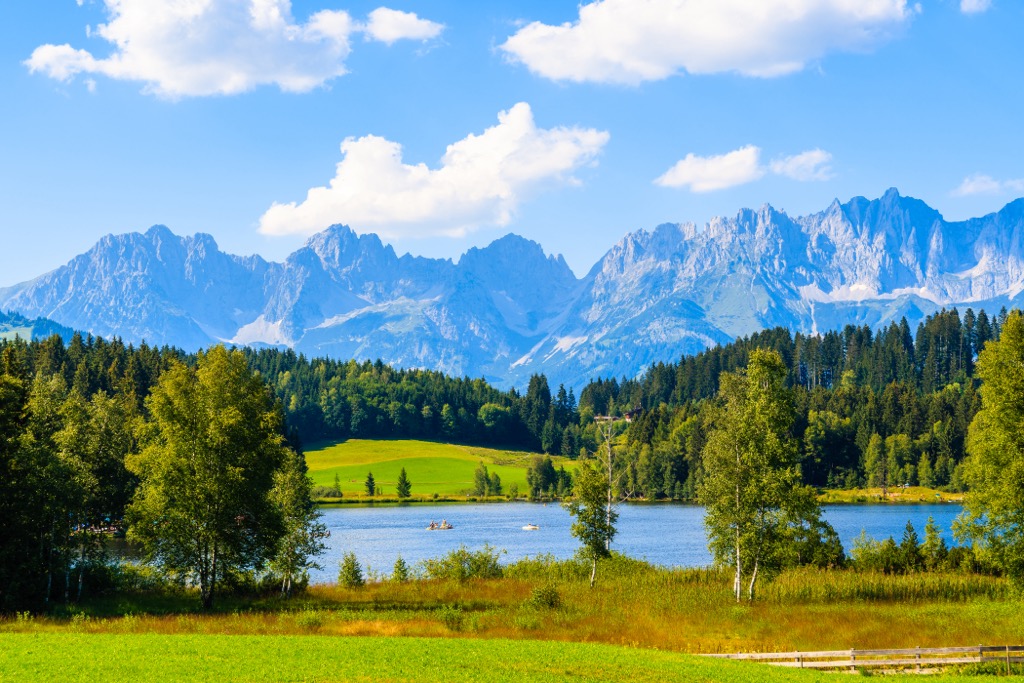
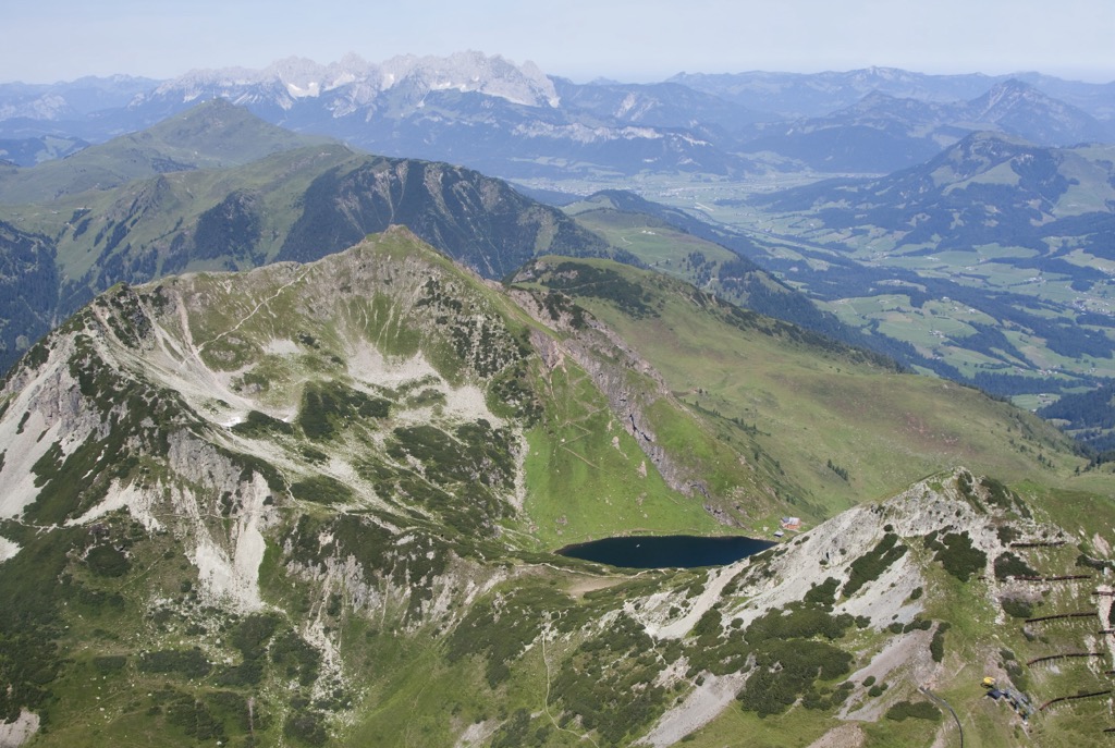
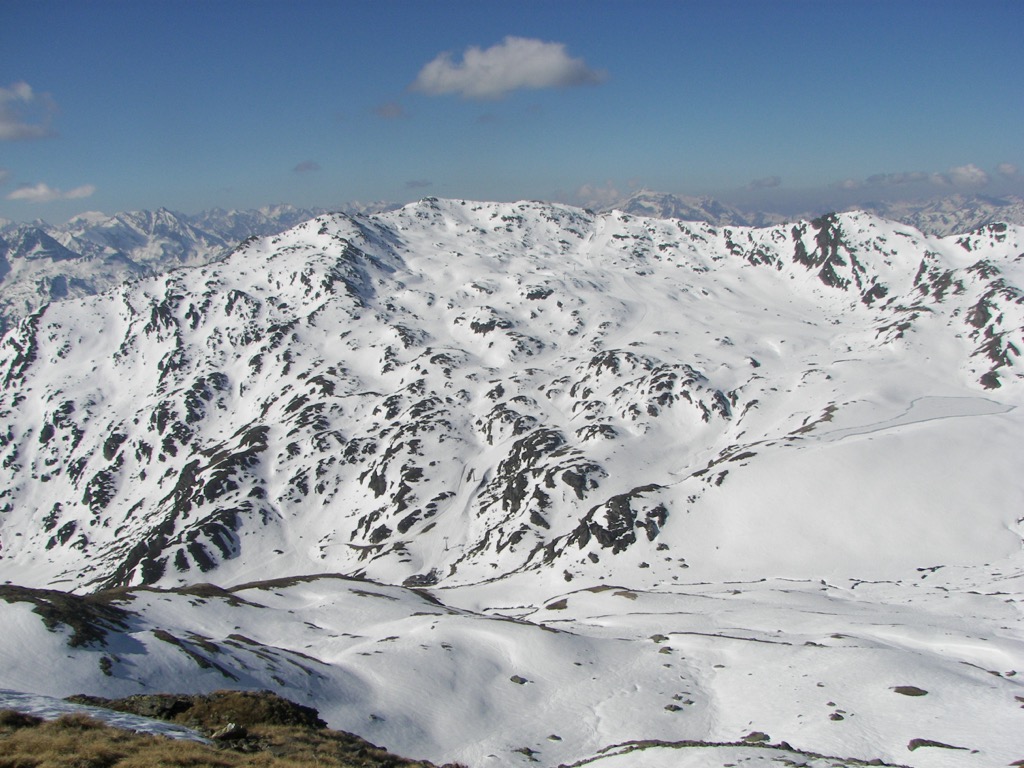
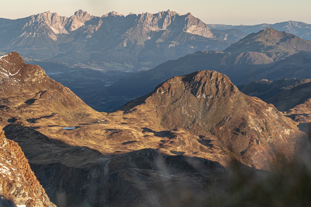
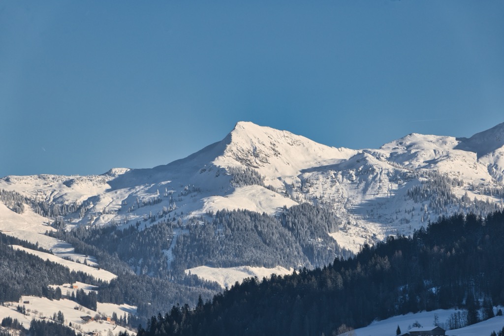
The Kitzbühel Alps are gently rolling mountains without many jagged peaks, making them ideal for hiking and skiing. No summits exceed 2,600 m (8,530 ft) in elevation. Many alms, small mountain lakes, and smooth cirques accentuate the region’s beauty.
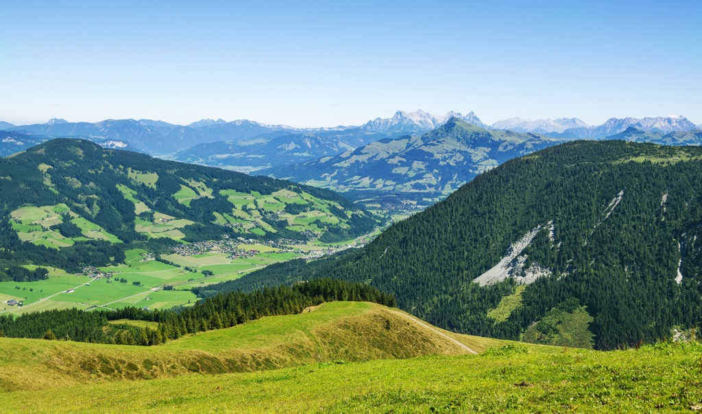
The range’s highest summit, Kreuzjoch, is located in the southwest corner, with heights slowly dropping from west to east. Most summits in the Kitzbühel Alps are between 2,500 m (8,202 ft) and 2,000 m (6,562 ft) in elevation.
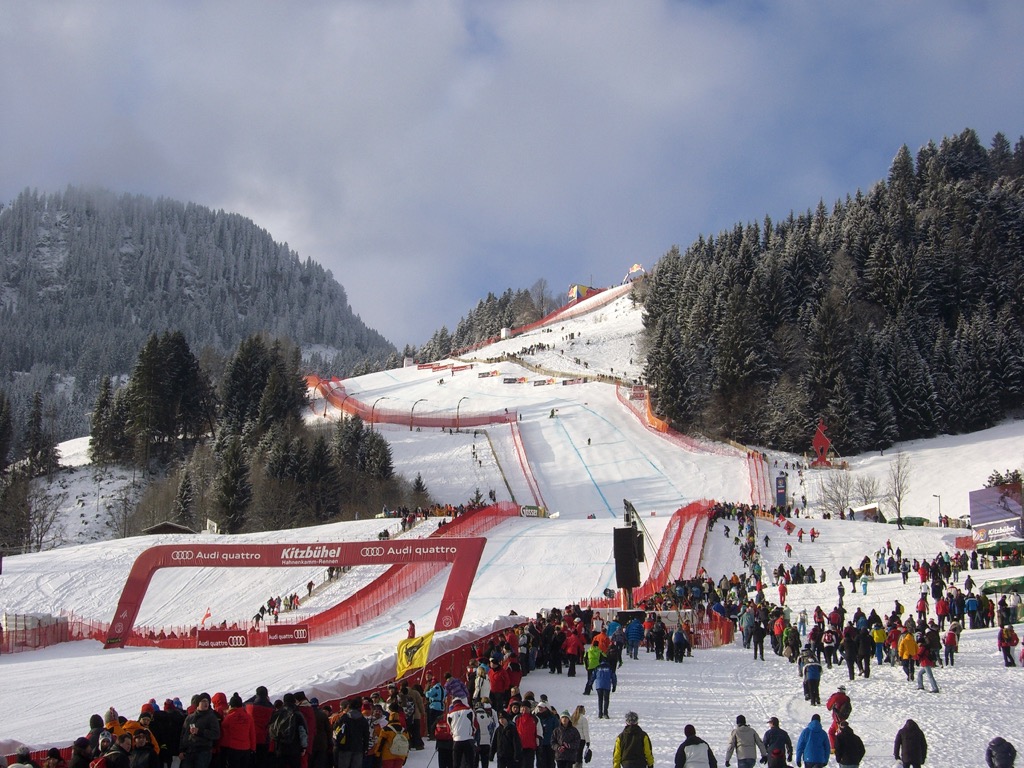
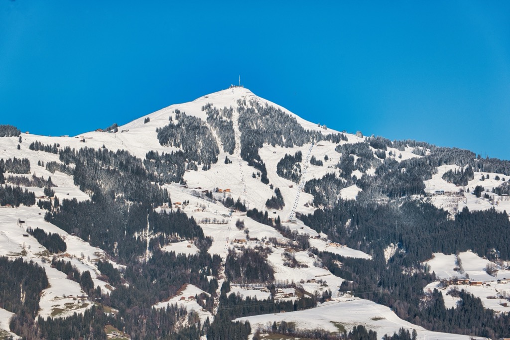
Despite being low and lightly glaciated, the Kitzbühel Alps are among Austria's most famous areas for winter sports. They're renowned for skiing partly due to Hahnenkamm (1,712 m / 5,617 ft), which hosts the Ski World Cup's Hahnenkamm Races (Hahnenkamm Rennen) and is home to the Steif, arguably the world's most famous and technical ski course.
The Kitzbühel Alps' position at the heart of the Central Eastern Alps means ten other mountain ranges surround it:
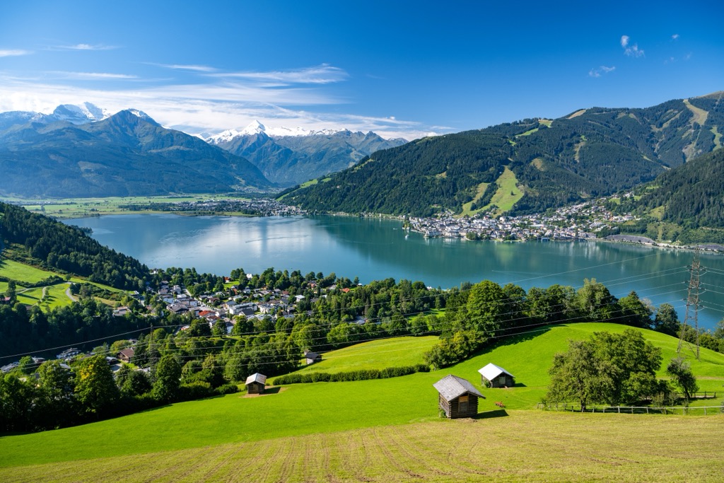
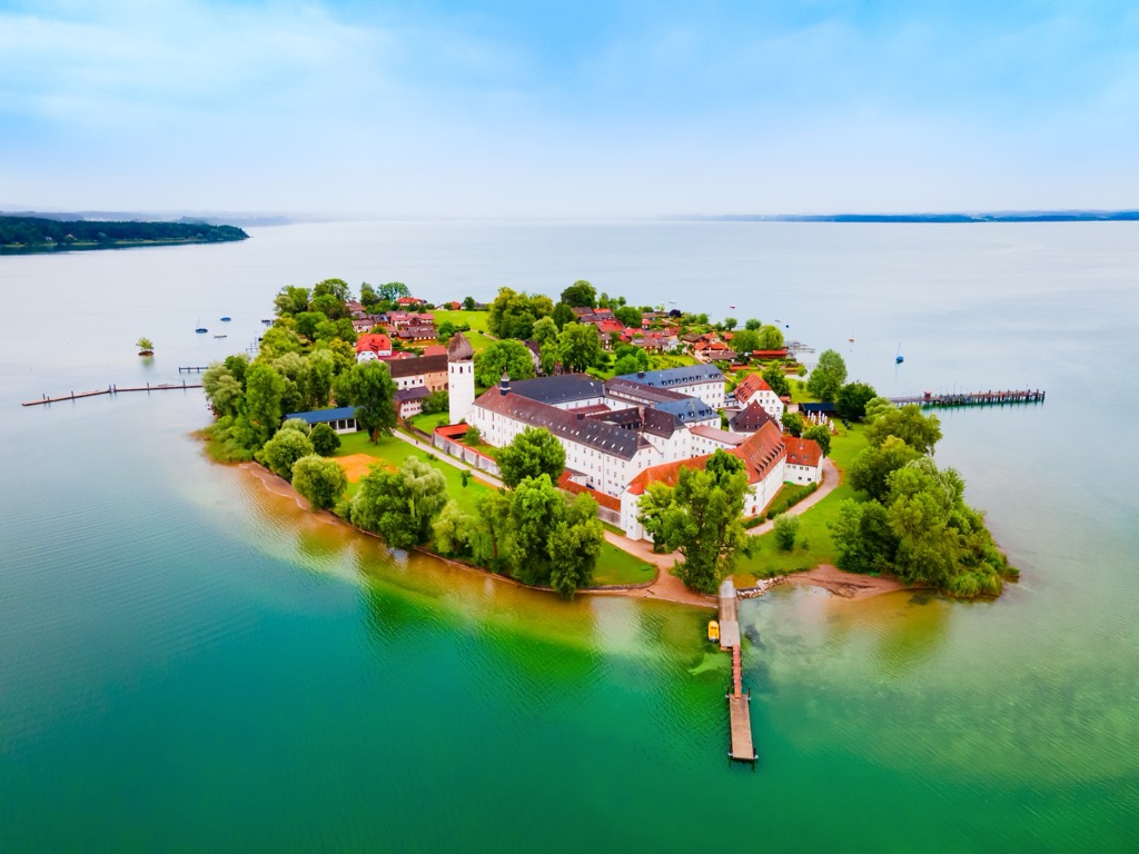
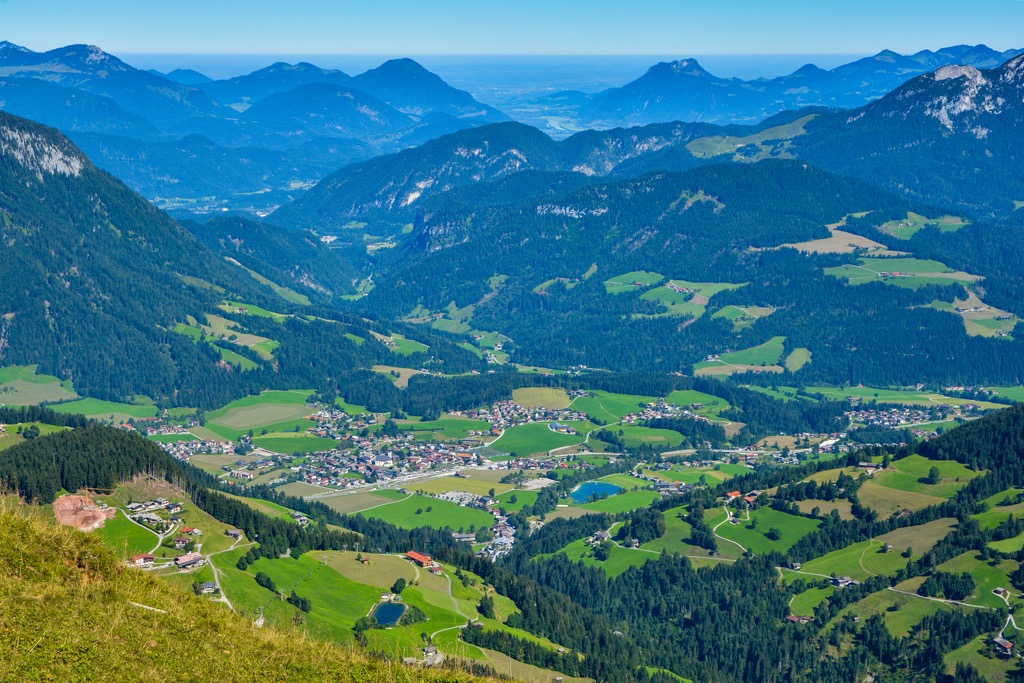
The Sallach River flows into Lake Zell (Zeller See) in the Kitzbühel Alps' southeastern corner. Zeller See is the largest lake in the range, with a surface area of 4.5 sq km (1.7 sq mi). The Sallach River is a principal tributary of the Salzach River.
The largest settlements in and around the Kitzbühel Alps are Kufstein, Zell am See, Kitzbühel, St. Johann in Tirol, and Mittersill.
The Kitzbühel Alps formed along with the rest of the Alps approximately 66 million years ago during the Alpine Orogeny. This mountain-building event occurred when the African, Arabian, and Indian tectonic plates to the south collided with the Eurasian Plate to the north.
Convergent movement between these plates created the Alps and many other mountain ranges worldwide, including the Himalayas, the Pyrenees, and the Carpathians. This relatively recent mountain-building event is ongoing in some parts of the Alps.
The Kitzbühel Alps are part of the greywacke zone, a band of rocks that spans the Austrian Alps from west to east and can be up to 2 km (1.2 mi) thick.
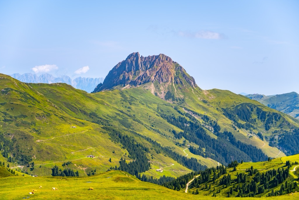
Most of the range comprises slate and phyllites. Limestones and dolomites are present in some areas, such as Großer Rettenstein (2,362 m / 7,762 ft), which has a 400 m (1,312 ft) high limestone summit block.
The oldest rocks in the Kitzbühel Alps date back to the Ordovician period, approximately 450 million years ago. Among them is Wildschönau slate, which takes its name from the Wildschönau municipality of Kufstein.
Above this layer of slate lies a 600 m (1,968 ft) thick slab of volcanic rocks, primarily made of quartz-blended igneous rock and tuff. Around Kitzbühel within the Leukental are limestones and dolomites dating back to the Silurian period, around 420 million years ago.
Encircled by some of the largest ranges in the Austrian Alps, the Kitzbühel Alps provide a snapshot of the flora and fauna that thrive in this sublime Alpine region.
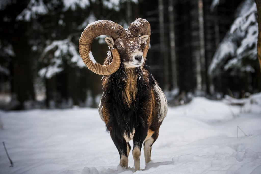
Tyrol is home to iconic mountain mammals, many of which inhabit the Kitzbühel Alps, including ibex, mouflons, and marmots. Other common mammal species include red deer, roe deer, squirrels, rabbits, wild boars, pine martens, and pipistrelle bats.
One mammal species hikers may be surprised to encounter is the raccoon. Native to central and northern America, raccoons have inhabited Austria since they first escaped captivity in 1974.
Eurasian lynx, Europe's largest wildcat species, has been successfully reintroduced to Austria since they were hunted to extinction locally at the end of the 19th century. There are now thought to be between 60 and 80 individuals living along the Austro-German-Czech border.
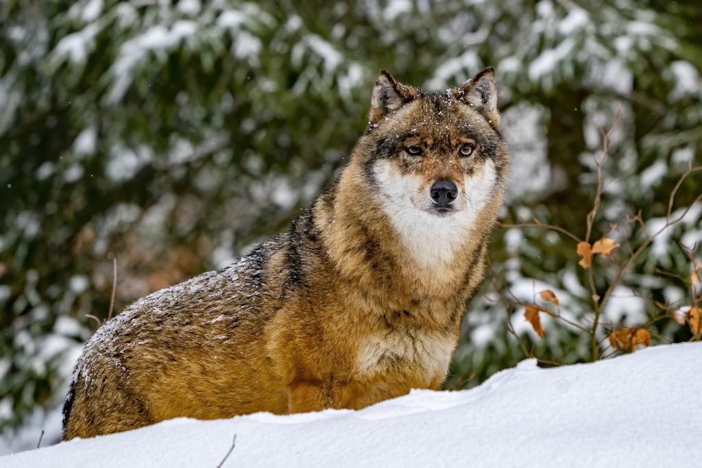
Eurasian brown bears have been spotted in Austria but are purely migratory, usually arriving from Italy or Slovenia. Over 50 gray wolves live in Austria.
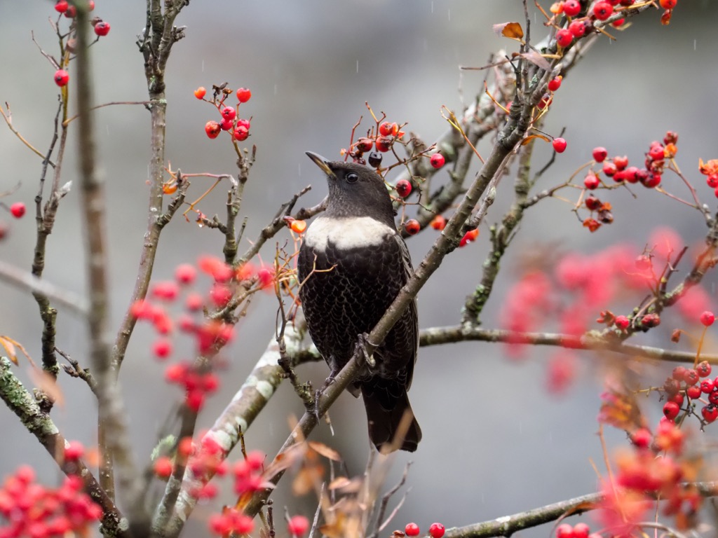
With dense forests, sizable lakes, and grassy mountains, the Kitzbühel Alps are home to an array of bird species. Lucky hikers might get a chance to spot a black eagle, the National Bird of Austria, circling overhead. The largest bird species in the Kitzbühel Alps is the bearded vulture, which has a wingspan of up to 2.8 m (9 ft 3 in).
Other notable bird species in the Kitzbühel Alps include golden eagles, Eurasian eagle-owls, black grouse, three-toed woodpeckers, kingfishers, wallcreepers, capercaillies, gray herons, and ring ouzels.
The common European adder is one of the most dangerous animals in the Kitzbühel Alps. The only venomous snake in Tyrol, it can live up to 3,000 m (9,842 ft) in elevation and is usually found hiding in bushes or under rocks. However, it isn't aggressive, and its bites are rarely fatal.
Other reptile and amphibian species native to the Kitzbühel Alps are alpine newts, slowworms, smooth snakes, and European pond turtles.
Over 45% of Austria is forested, and the Kitzbühel Alps are no different. The range's forests change with elevation. In the valleys, forests are primarily deciduous broadleaf trees, like English oaks, sessile oaks, and downy oaks.
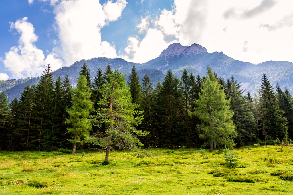
Higher up in the mountains around the montane zone, the deciduous broadleaf forests make way for mixed coniferous forests composed of Norway spruces, silver firs, European larches, birches, and pines.
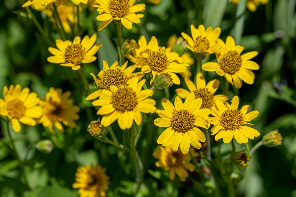
The forests disappear at the highest elevations and are replaced by Alpine meadows. A wealth of vibrant wildflower species grow across these meadows and on the alms at lower elevations. During the warmer months, livestock usually occupy these grassy meadows.
Notable flowering plants that grow across the alpine meadows of the Kitzbühel Alps include edelweiss, mountain arnicas, monkshoods, wood cranesbills, broad-leaved marsh orchids, trumpet gentians, and rampions.
Throughout summer, blueberry and mountain cranberry bushes produce edible berries; however, eating wild berries in the Kitzbühel Alps isn't recommended, as fox tapeworm contamination is rife in the region.
The Kitzbühel Alps have been inhabited continuously by humans for at least 3,000 years.
Due to the region's long history and the fact that most of the mountains in the range are relatively easy to climb, the hiking history of the Kitzbühel Alps is not well-documented.
The human history of the Kitzbühel Alps is long — Illyrian miners were the first to settle in Kitzbühel circa 1,000 BCE. Following the fall of the Western Roman Empire, Bavarians began settling and clearing forests in the region around 800 CE.
The "Kitzbühel" appears for the first time as "Chizbuhel" in 12th-century documents by Frauenwörth Abbey in Chiemsee. Chizzo is the name of a Bavarian clan, while Bühel refers to a settlement on a hill. The Kitzbühel Alps are named after this medieval town, which is near the range's center.
Kitzbühel was largely unaffected by wars throughout the 18th and 19th centuries. However, during the Napoleonic Wars, Kitzbühel briefly became part of Bavaria from 1805 until the fall of Napoleon at the Congress of Vienna in 1814. The town was largely unaffected and undamaged during the First and Second World Wars.
Kitzbühel became a popular tourist destination in the late 19th century following the completion of the Salzburg-Tyrol railway. It hosted its first ski race in 1894.
Skiing and winter sports are central to the Kitzbühel Alps' modern identity. Since 1931, it has hosted the Hahnenkamm Races, the second-oldest ski race after Lauberhorn.
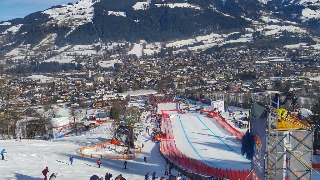
This race on the Streif ski course is watched by over 50,000 people annually, with a global audience of over 300 million. The KitzSki ski area is now one of the most famous in the Alps and, together with surrounding ski areas, is one of the largest ski regions in Austria.
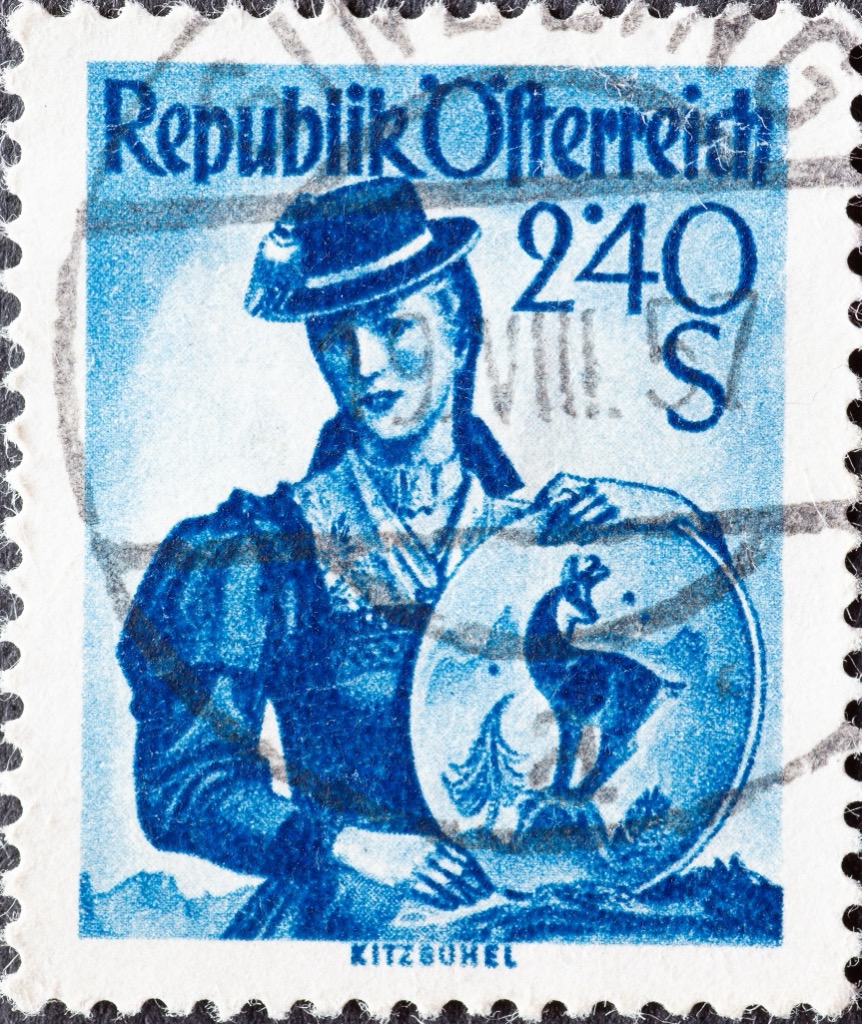
The traditional tracht, or costume, in Kitzbühel is the Röcklgwand. Also known as Kasettl, it's traditionally worn by married women and consists of a skirt and bodice made of black silk. The bodice is long-sleeved, with lace and ruffles around the neckline. It's still prevalent in the lowlands and is gaining popularity, with locals trying to keep this tradition alive.
If you visit around Christmas, make sure you visit the Kitzbühel Advent Market. It's one of the most traditional markets in Tyrol, and live festive concerts are held in the town square.
The Kitzbühel Alps are a hub for delicious Tyrolean cuisine, and mountain huts serve traditional fare from across the Alpine region.
Cuisine worth seeking out includes kaiserschmarrn, Vorarlberger Bergkäse cheese, Tiroler gröstl, and schlutzkrapfen. And, of course, there's a selection of locally made craft beer to sample from across the Kitzbühel District.
The Kitzbühel Alps offers over 1,000 km (621 mi) of signposted hiking trails, with exciting expeditions catered to hikers of all abilities.
Ensure you bring the correct hiking equipment and plenty of food and water when hiking in the Kitzbühel Alps. Map your route, check local weather forecasts, and inform others of your itinerary.
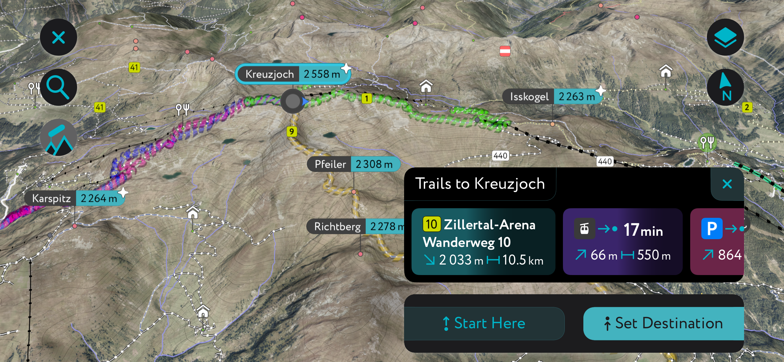
Plan a hike to Kreuzjoch (2,558 m / 8,392 ft) if you're seeking a demanding yet rewarding summit walk within the Kitzbühel Alps.
Located in the southwestern corner of the Kitzbühel Alps just east of the Zillertal, Kreuzjoch is part of the highest chain in the range, with Torhelm (2,494 m / 8,182 ft) to the northeast and Isskogel (2,263 m / 7,425 ft) to the east. In winter, Kreuzjoch is a popular summit, forming part of the Zillertal Arena ski area.
You can hike to the Kreuzjoch from the base of the Isskogelbahn cable car. This walk follows black trail markers. This trail is difficult with a narrow ridge walk — sure-footedness and decent fitness levels are needed.
The walk heads north along the Krummbach River, circling around Wilde Krimml (2,350 m / 7,710 ft) to scale Kreuzjoch on its northwestern ridge before continuing onto Isskogel. From Isskogel, ride the Isskogelbahn cable car back to your starting point.
From Isskogel and Kreuzjoch, you'll be treated to sweeping views of the Hohe Tauern National Park and the Zillertal Alps. This trail is approximately 17 km (10.5 mi) in length.
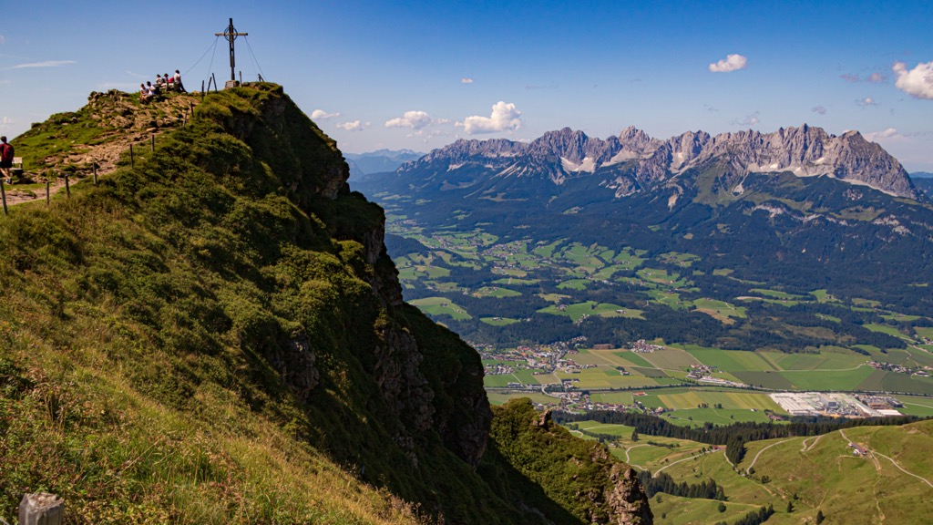
Geißstein (2,363 m / 7,753 ft) is the most prominent peak in the Kitzbühel Alps and the highest grass-topped mountain in Europe. It's a beautiful area for a summer hike, starting with relaxing walks through verdant forests before opening up onto exciting exposed slopes, including a sharp arête on its southern side.
One of the best routes up Geißstein is from the Parkplatz Schradler to the south of Jochberg. The trail starts by following the Sinterbach River past the beautiful Sintersbacher Wasserfall.
You'll also pass near the Sintersbach Grundalm (1,654 m / 5,427 ft) before heading south of Geißstein and over Schusterscharte (1,985 m / 6,512 ft) to reach the summit from its western ridge. The last few hundred meters around the summit are hazardous.
You'll descend to the north, around Mittagskogel (2,036 m / 6,680 ft) and Torsee, before crossing Sintersbachscharte (2,036 m / 6,677 ft). On the way to your starting point, you'll pass Richtung Wildalm. This walk is approximately 23 km (14 mi) in length.
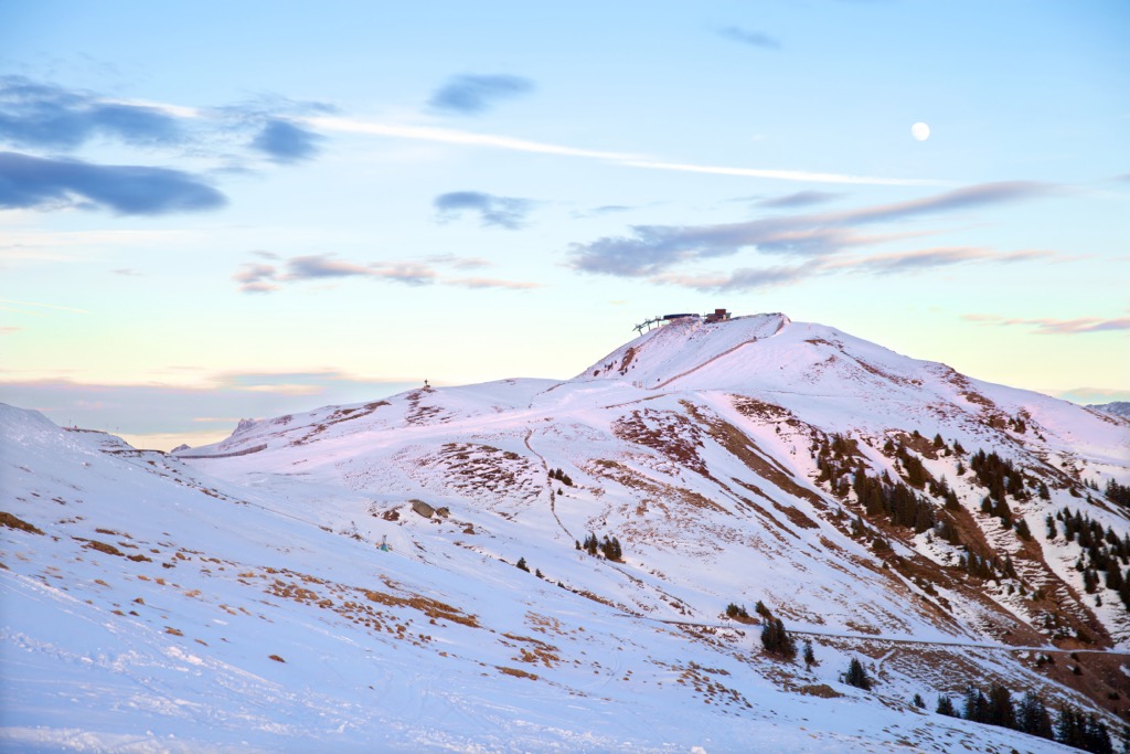
Hohe Salve (1,829 m / 6,001 ft) is by no means the highest mountain in the Kitzbühel Alps, but its classic conical shape and excellent views make it one of the most visited summits in the range.
Hohe Salve is part of the Brixental ski area in the winter. Atop Hohe Salve are the Salvenkirchlein chapel, Austria's highest pilgrimage church, and the Gipfelalm Hohe Salve (1,827 m / 5,994 ft) restaurant, which features a rotating observation terrace.
From atop Hohe Salve, you'll have views of the Kaisergebirge to the north and the Brandenberg Alps to the northwest. On a clear day, you can see as far as Großglockner (3,798 m / 12,461 ft) and Großvenediger (3,657 m / 11,998 ft).
Numerous paths lead to Hohe Salve's summit, and one of the best is from Hopfgarten, following trail no. 99 / 90. The straightforward path leads directly to the summit in the shadow of the Slavenbahn cable cars.
You can ride the cable car back to your starting point. This hike is approximately 6 km (4 mi) in length.
The KAT Walk Alpine is the ultimate multi-day hike in the Kitzbühel Alps, covering 106 km (66 mi) from Hopfgarten to St. Ulrich am Pillersee. It includes many of the Kitzbühel Alps' top attractions, like the Kitzbüheler Horn (1,996 m / 6,549 ft) and its Alpine Flower Garden, home to over 400 plant species.
The KAT Walk Alpine has six stages with red-white-red markers as signposts. Most days can easily be completed as a day hike.
Stage 1, which is 20 km (12.5 mi) long, leads from Hopfgarten to Kelchsau. Its highest point is 1,338 m (4,390 ft), just after Haagalm (1,349 m / 4,426 ft), where you can stop for a well-deserved breather.
Stage 2 is 18 km (11 mi) long and runs from Kelchsau to the Steinberghaus Inn. It leads across panoramic alpine pastures and over the summit of Lodron (1,925 m / 6,316 ft), the highest point on this stage. This summit provides views of the Hohe Tauern and the Kaisergebirge.
Stage 3 heads to Aschau and is 19 km (12 mi) long. It crosses moors and passes Hintenkarscharte (1,829 m / 6,001 ft) and Hintenkar Hochalm (1,722 m / 5,650 ft) for an impressive view of Großer Rettenstein (2,362 m / 7,762 ft). Here, you'll have the opportunity to scale Gerstinger Joch (2,043 m / 6,703 ft) or Floch (2,057 m / 6,749 ft) on short detours.
Stage 4 reaches the heart of the Kitzbühel Alps, passing over Pengelstein (1,938 m / 6,358 ft) and Steinbergkogel (1,972 m / 6,470 ft). It then traces the tracks of the iconic Hahnenkamm ski race to reach Kitzbühel. Stage 4 is roughly 16 km (10 mi) in length.
Stage 5 is possibly the KAT's most spectacular day, passing over the Kitzbüheler Horn on the way to St. Johann in Tirol. Ensure you stop at the Gipfelhaus (6,457 ft) on the summit to take in the incredible panoramas. Stage 5 is approximately 21 km (13 mi) in length.
Stage 6 is the final stage, ending in St. Ulrich am Pillersee Tal. After Oberhofen, follow signposts towards Kalkstein before branching off to Baumoosalm. You'll then pass by Gerstbergalm and Winterstelleralm (1,423 m / 4,668 ft) on the way to St. Ulrich am Pillersee. Stage 6 is approximately 20 km (12 mi) in length.
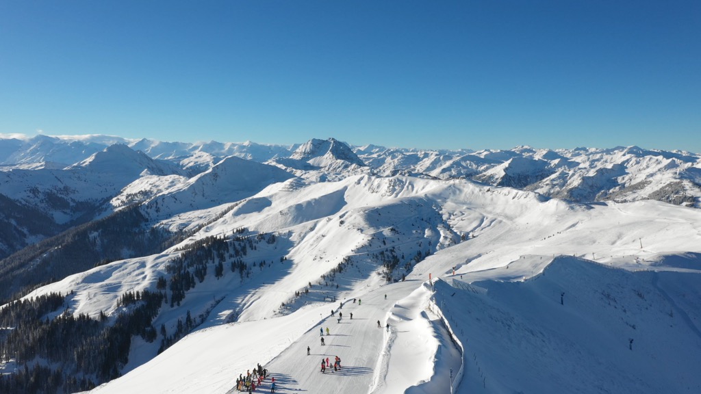
Boasting one of the world’s most famous ski resorts and slopes, the Kitzbühel Alps are an incredible spot for a winter sports getaway.
There are four ski areas located wholly or partly within the Kitzbühel Alps:
The Kitzbühel Alps, with their low, smooth summits and well-equipped ski areas, are ideal for ski touring and snow-shoeing.
The Kitzbühel Alps are located at the heart of one of our most thoroughly mapped areas, with hundreds of ski tours detailed on the PeakVisor App ready to be explored.
Let's quickly examine two of the most popular ski tours in the Kitzbühel Alps and some new features that make the PeakVisor App the perfect tool for planning a ski tour adventure.
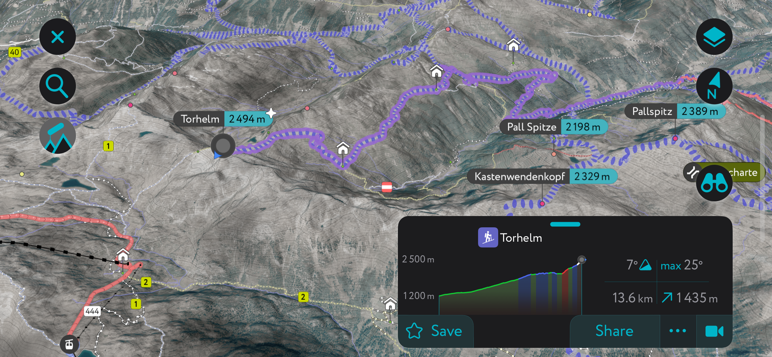
The Kitzbühel Alps' fourth-highest summit, Torhelm (2,494 m / 8,182 ft), is hugely popular with skiers looking for a long-distance spring tour. It's also the highest accessible summit in the range year-round and a popular summer hiking destination.
One of the most popular ski tours of Torhelm is from Martl Erlaualm (1,328 m / 4,357 ft) via Tiefentalalm (1,436 m / 4,711 m) and Öfelersattel. The gentle slopes of Torhelm make this tour's descent especially memorable. This ski tour of Torhelm is roughly 18 km (11 mi) in length.
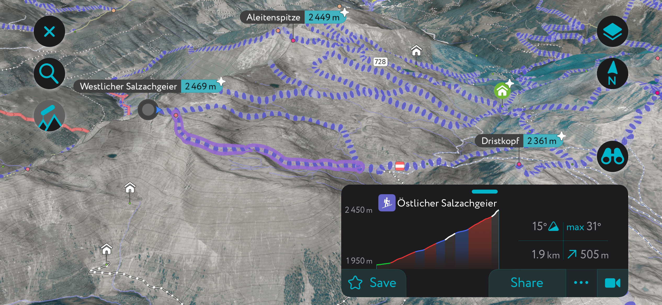
The Salzachgeier (2,469 m / 8,100 ft) is home to the headwaters of the Salzach River, the largest river in Austria north of the Salzburg Central Alps. It's a jagged mountain composed of dual peaks where five summits converge — stunning cirques and meadows make this a special mountain to explore.
The Salzachgeier's eastern slopes are popular for ski tours in winter, with the Neue Bamberger Hütte (1,756 m / 5,761 ft) serving as a cozy base. One possible ski tour leads from Gasthof Wegscheid (1,143 m / 3,750 ft) to Neue Bamberger Hütte and Östlicher Salzachgeier (2,469 m / 8,091 ft) via Salzachjoch (1,988 m / 6,522 ft). This ski tour is approximately 19.5 km (12 mi) in length.
Download the PeakVisor App for up-to-date regional maps and information, making planning your next ski tour easier than ever.
We've been working hard to add the latest weather reports with information on snow depths. You'll also have access to local mountain hut details, including opening hours, overnight accommodation, and dining options.
From lavish resorts like Kitzbühel to major settlements like Kufstein, the Kitzbühel Alps has something for everyone.
The nearest international airport to Kitzbühel is Salzburg Airport, roughly 75 km (47 mi) northeast.
Wörgl Hauptbahnhof, located 35 km (22 mi) west of Kitzbühel, is a major railway junction connecting the region with Munich, Innsbruck, and Verona.
Kufstein is Tyrol's second-largest settlement after Innsbruck, with a population of around 20,000 people. It's located north of the Kitzbühel Alps, less than 10 km (6 mi) from Großer Pölven (1,595 m / 5,233 ft).
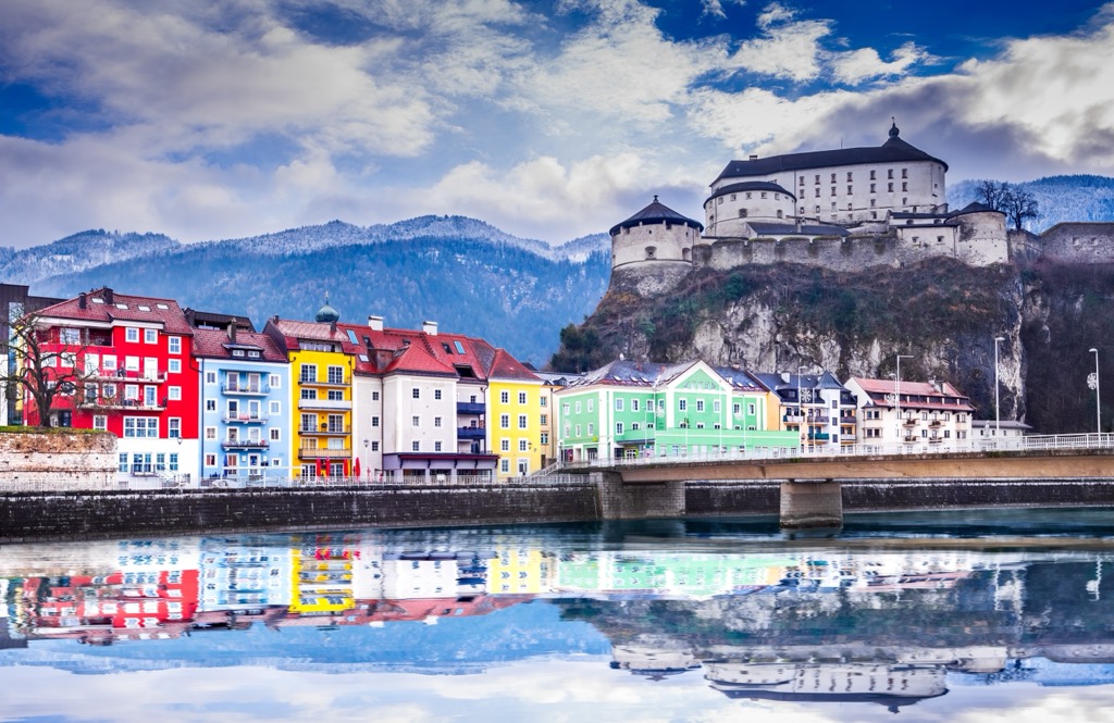
Kufstein is a picturesque town in the shadow of the Pendling (1,563 m / 5,128 ft). Its main attraction is the 13th-century Kufstein Fortress, which houses the City Museum of Kufstein.
Kufstein railway station connects the town with Wörgl, Salzburg, and Innsbruck.
Located within the Leukental along the Kitzbüheler Ache is Kitzbühel. It has a population of over 8,000 people.
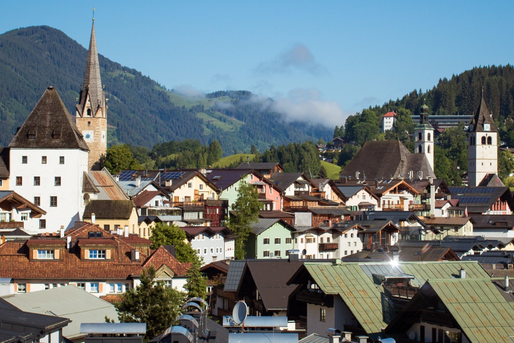
This medieval town is now one of the most famous and exclusive resorts worldwide, attracting the rich and famous from all corners of the globe. It's hosted the Hahnenkamm Races for over 90 years, which includes the infamous Streif ski race.
Kitzbühel Hauptbahnhof is a stop on the Salzburg-Tyrol Railway, connecting the town to Innsbruck and Graz.
Zell am See is located on the southeastern edge of the Kitzbühel Alps on the shores of Zeller See. It has a population of over 10,000 people.
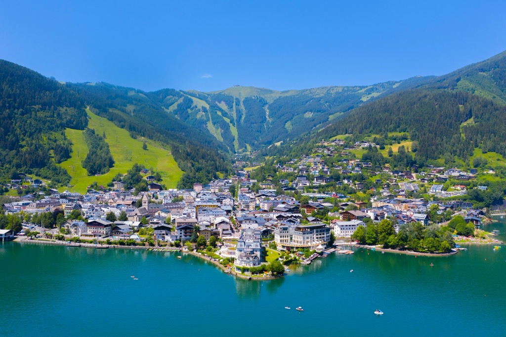
Zell am See is a popular year-round destination, with lakeside walks and its local mountain, Schmittenhöhe (1,965 m / 6,447 ft), offering numerous skiing and hiking opportunities. You'll also have some of the top attractions in Hohe Tauern National Park on your doorstep, including the Gipfelwelt 3000.
The Zell am See railway station is on the Salzburg-Tyrolean Railway, with connections to Innsbruck and Salzburg.


