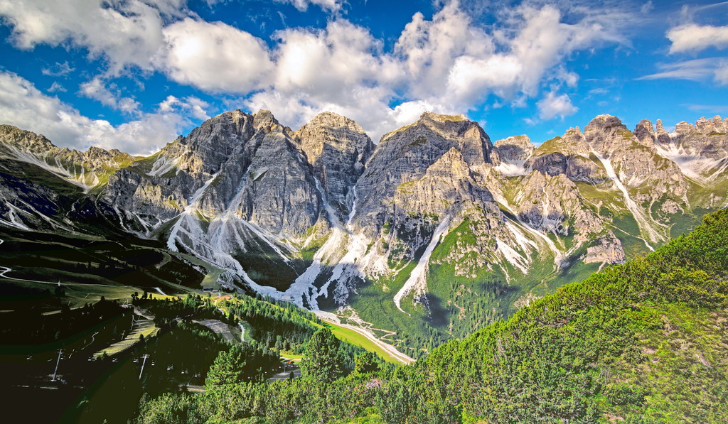
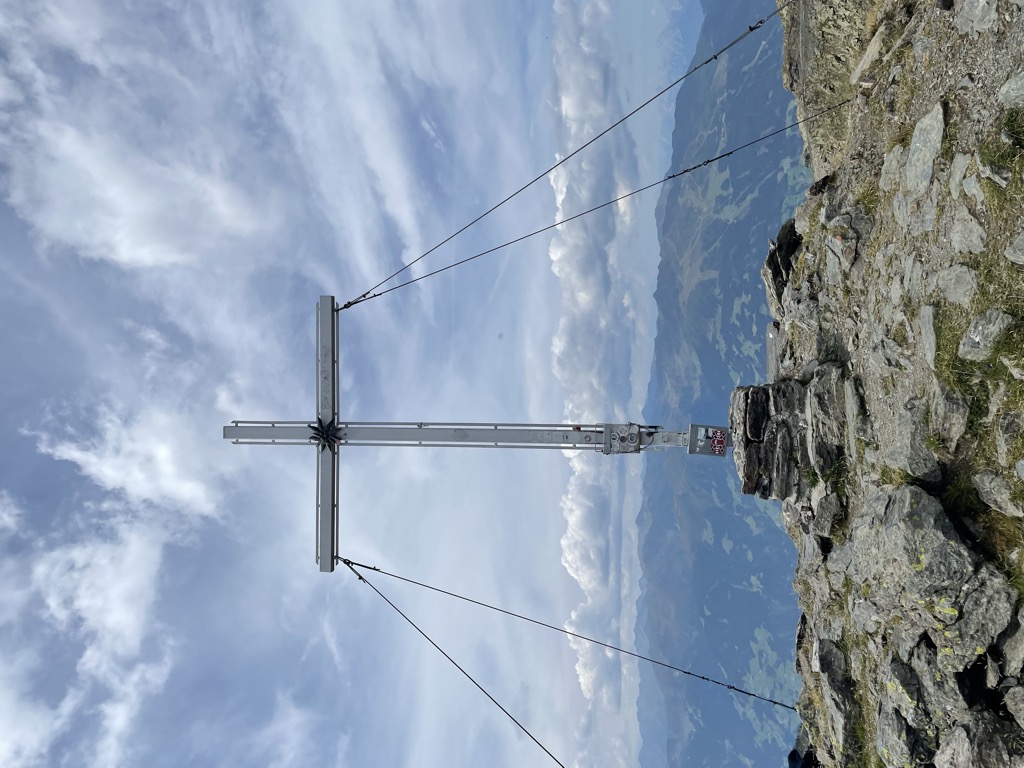
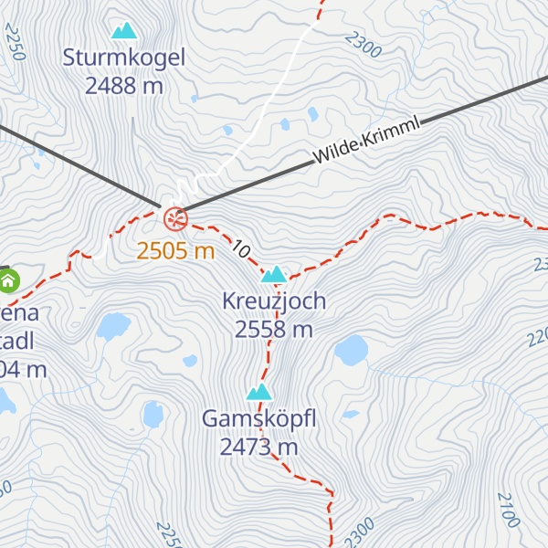
At 2,558 m above sea level (AA) the Kreuzjoch is the highest peak in the Kitzbühel Alps in the Austrian state of Tyrol.
The Kreuzjoch also forms the southwestern end of the Kitzbühel Alps. To the west it is bounded by the Ziller valley, to the southeast by the Gerlos valley. The Kreuzjoch's neighbouring peak is the Torhelm (2,494 m).
There's a hiking trail (T2) called 10 leading to the summit.
By elevation Kreuzjoch is
# 57 out of 691 in the Tyrol Schistose Alps # 1 out of 463 in the Kitzbühel Alps
By prominence Kreuzjoch is
# 51 out of 23502 in Austria # 18 out of 5947 in Tyrol # 5 out of 885 in Bezirk Schwaz # 2 out of 691 in the Tyrol Schistose Alps # 2 out of 463 in the Kitzbühel Alps
We use GPS information embedded into the photo when it is available.
3D mountains overlay
Adjust mountain panorama to perfectly match your photos because recorded by camera photo position might be imprecise.
Move tool
Rotate tool
Zoom
More customization
Choose which peak labels should make into the final photo and what photo title should be.
Next
Photo Location
Satellitte
Flat map
Relief map
Latitude
Longitude
Altitude
OR
Latitude
°'''
Longitude
°'''
Apply
Register Peak
Peak Name
Latitude
Longitude
Altitude
Register
Teleport
PeakVisor
This 3D model of Sagarmatha National Park in Nepal was made using the PeakVisor app topographic data. The mobile app features higher precision models worldwide, more topographic details, and works offline. Download PeakVisor maps today.
Download OBJ model
PeakVisor
The download should start shortly. If you find it useful please consider supporting the PeakVisor app.
PeakVisor for iOS and Android
Be a superhero of outdoor navigation with state-of-the-art 3D maps and mountain identification in the palm of your hand!