
Scan the QR code and open PeakVisor on your phone
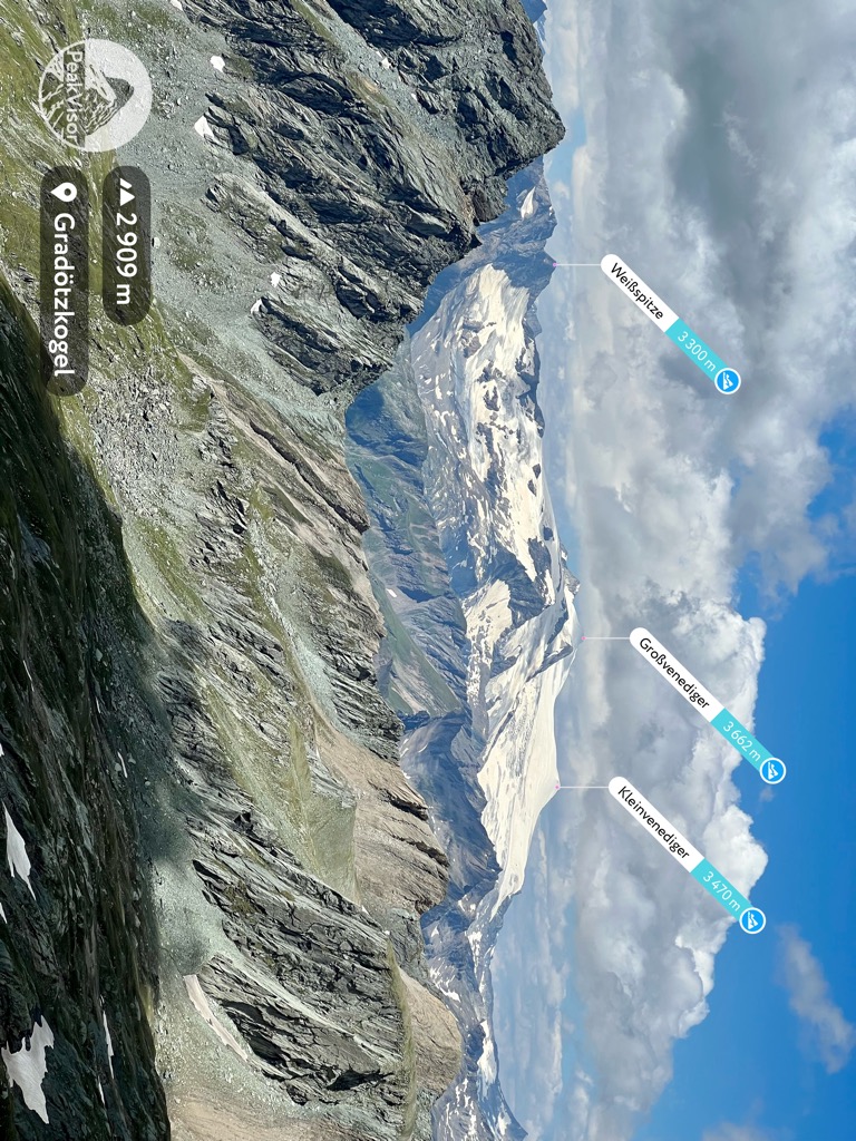
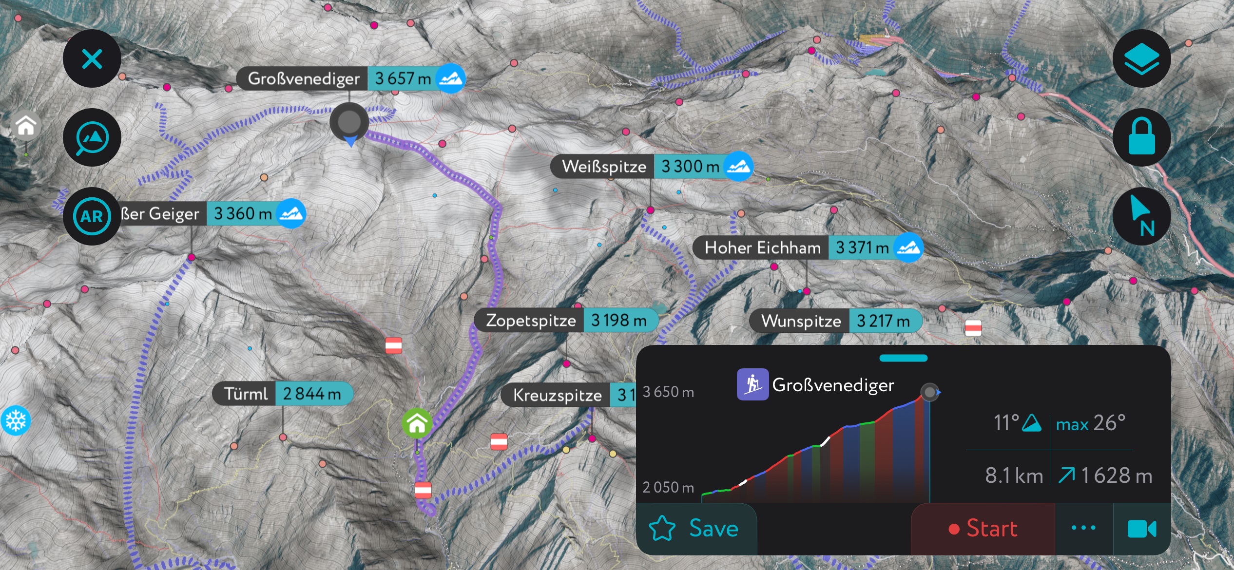
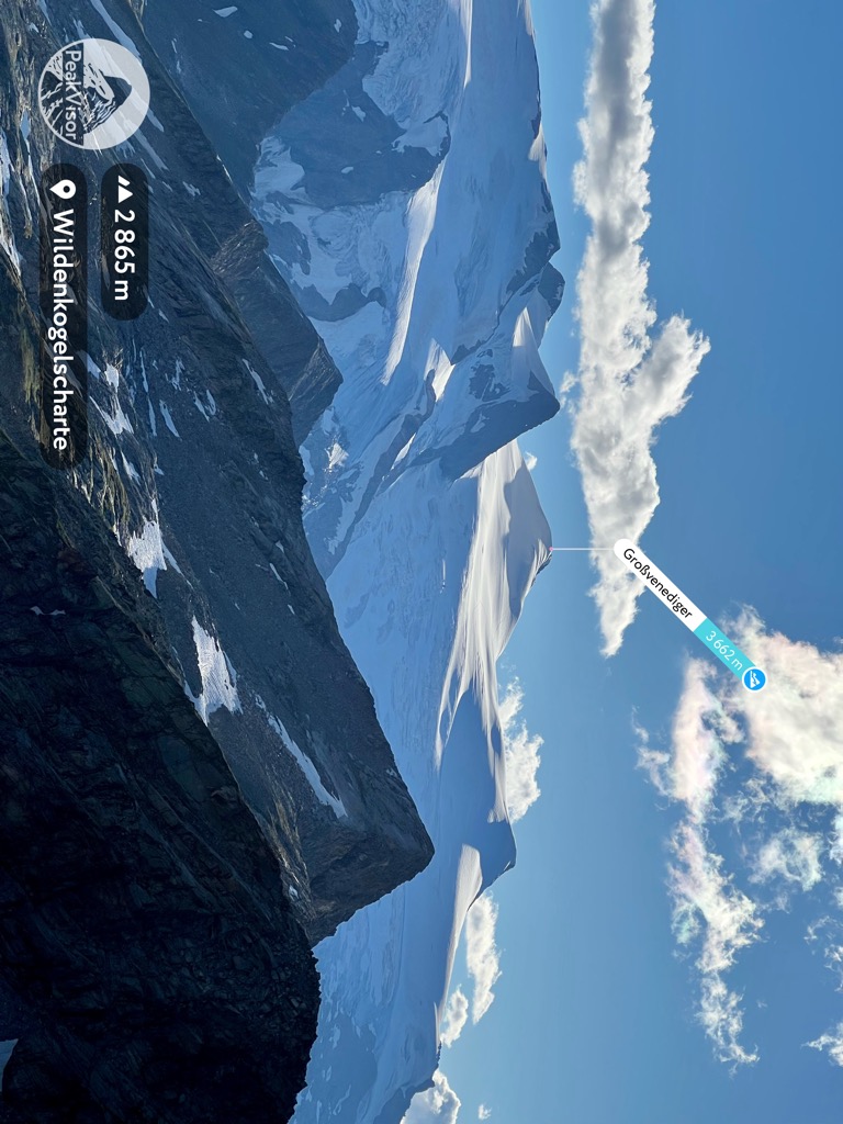
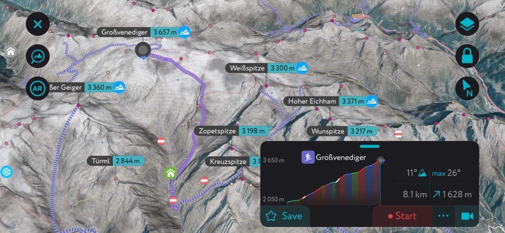
The Venediger Group lies primarily in the states of Tyrol and Salzburg in Austria, with the southwestern edge of the range extending into Italy’s South Tyrol. The group belongs to the Hohe Tauern Range and is partly protected within the Hohe Tauern National Park. Of the 549 mountains in the Venediger Group, Großvenediger is the highest (3,657 m / 11,998 ft) and the most prominent (1,193 m / 3,914 ft). Excluding subsidiary summits, it claims the title of the fourth-highest peak in Austria.
The Venediger Group stretches between Tyrol and Salzburg, Austria, and into South Tyrol in Italy. The group forms the northwestern part of the Hohe Tauern Mountains within the greater Western Tauern Mountains. Hohe Tauern National Park protects a portion of the Venediger Group, Glockner Group, and Goldberg Group.
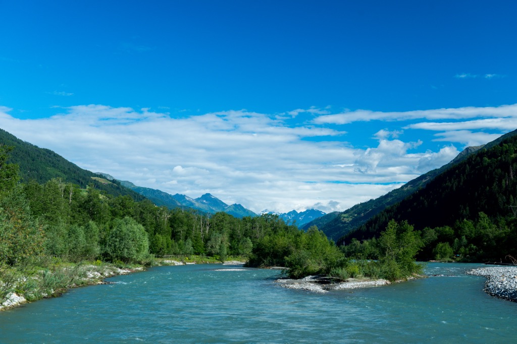
The Kitzbühel Alps border the mountains Alps to the north, the Granatspitze Group to the east, the Villgraten Mountains to the south, the Rieserferner Group to the southwest, and the Zillertal Alps to the west. The group feeds the Isel, the Eastern Alps’ last free-flowing glacial river. The Felbertauernstfaße road runs along the eastern side of the range.
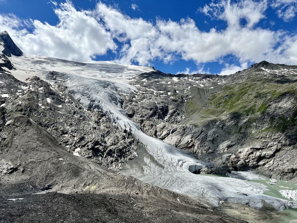
Glaciers cover the upper slopes and summit of the Großvenediger and other tall peaks. The Venediger Group, along with the Ötztal Alps, is one of the most glaciated corners of the Eastern Alps.
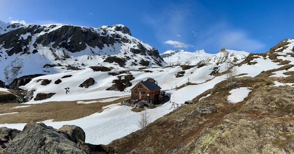
The group’s southern side offers several hut and trail networks. With plenty of variations, the Venediger High Route and Lasörling High Route wind between huts and allow hikers to spend a week in the mountains without descending to the valleys.
With much of the range protected within the National Park, no cable cars exist in the mountain group. However, ski touring and ski mountaineering are popular, and there are a few local ski resorts near towns at the base of the mountains.
The mountain group bore the name Stützerkopf until 1797. The current name comes from the Venediger (“traveling traders”) or the German word “Venedig” for the view that reaches Venice.
The Tauern Window is a primary geologic feature for much of the Hohe Tauern landscape. The window consists of exposed rock strata revealing geologic processes that took place over millions of years.
Driven by forces deep within the Earth’s core, earth’s crust shifted, and layers of the crust stacked on top of each other. Over millions of years, strata that would otherwise exist at much lower geologic layers rose to the top as these layers jutted upwards.
The window is composed of four enormous cores of gneiss at the center. It is 160 km (99 mi) long and runs between the Katschberg in the east and the Brenner Pass in the west. It overlaps not just with the Venediger group but also with the Zillertal Alps, Tux Alps, and, among the Hohe Tauern, the Glockner, the Granatspitz, the Sonnblick, the Goldberg, and the Ankogel groups.
The gneiss developed from solidified magma that was initially granite, granodiorite, and tonalite before turning into gneiss. The Upper Schist originated from sediment in the basin of the Piemonte Ocean, and the limestone and dolomite in the range formed during the early Mesozoic in the Tethys Ocean.
During the early Cretaceous era, around 140 million years ago, the African plate drifted north, pushing sediment and folding deposits on the ocean floor over each other. The Alpine orogeny raised the Alps when the African and Eurasian plates collided. The majority of mountain building occurred between 65 and 2.5 million years ago. The uplift no longer outpaces the rate of erosion, so the Alps are not considered a growing range.
Glaciers shaped and continue to shape the Venediger Group today. As glaciers advance and retreat, they carve out valleys and glacial cirques, forming and feeding waterways around the mountains.
The Hohe Tauern National Park covers part of the Venediger Group, as well as portions of the Glockner and Goldberg Group. The park features a core area with little human disturbance and an outer section that utilizes a blended landscape-use approach with human activity.
A few plant species have remained through the ice ages. Edelweiss originated in Central Asia but migrated to the Alps during the ice age. Glacier buttercups are specialized to high altitude scree and produce thick roots that simultaneously help stablize both the flowers and rocks.
Montane habitat occurs between 700 and 1,600 m (2,300 and 5,250 ft). As elevation increases, deciduous mixed forests transition to mountain spruce forests. Dead trees provide a base for fungi, lichens, and birds, such as the black woodpecker. Montane habitat also houses red deer, foxes, squirrels, red crossbills, and pygmy owls.
The subalpine habitat exists between 1,600 and 2,300 m (5,250 to 7,545 ft). Here, larch-stone pine forests dominate, although this habitat was historically heavily impacted by human activity. Centuries ago, farmers cleared forests to create grazing areas, changing the proportions of forest cover to alpine meadow. The undergrowth is composed of blueberries and alpine roses, while avian species include black grouse and spotted nutcracker.
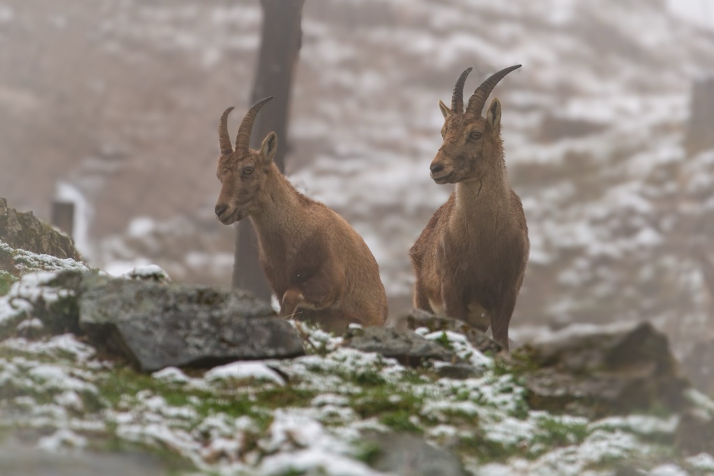
The alpine zone occurs between 2,300 and 3,000 m (7,545 to 9,840 ft). Montane grassland thrives, supporting grasses like bent sedge and mat grass, mountain arnica, bearded bellflowers, and alpine avens. The alpine zone is the territory of ibex, marmots, and alpine salamanders.
The zone over 3,000 m (9,840 ft) features extreme temperatures, high UV radiation, and strong winds. Although there is little vegetation, a handful of plants have adapted to this harsh environment. A few examples include the glacier buttercup, alpine toadflax, and lichens.
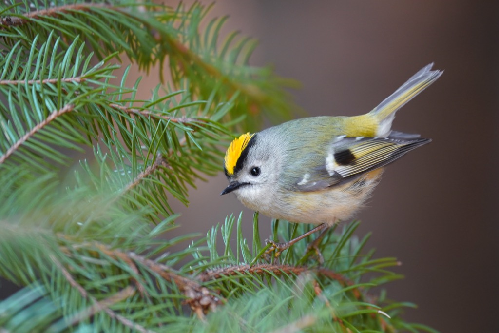
Bird species of note in the mountains include golden eagles, bearded vultures, griffon vultures, ptarmigans, and the smallest native songbird—the goldcrest, which weighs five to six grams. Around 1,100 ibex live in the Hohe Tauern National Park after a successful reintroduction in the 1960s.
Much of the Venediger Group belongs to Hohe Tauern National Park. The park was formed between 1981 and 1992 in a joint effort between the states of Carinthia, Salzburg, and Tyrol and was Austria’s first national park.
Efforts to establish a protected area date back to the Austrian monarchy. In 1913, driven by a member of the Salzburg Provincial Parliament named August Prinzinger, the German-Austrian Conservation Park Association purchased 1,100 ha (2,715 acres) in the Amer and Stubach Valleys. World War I stifled conservation efforts, but post-war efforts to protect Hohe Tauern picked up where they left off. In 1918, Albert Wirth, a forest industrialist from Carinithia, donated over 4,000 ha (9,885 acres) to the Austrian Alpine Club, which would later form part of the core conservation area.
The German Reich annexed Austria in 1938, and the National Socialist conservation elite chose the area for the Greater German National Park. The director of the Berlin Zoo, Lutz Heck, backed the plan, but it fizzled out at the onset of WWII.
Following World War II, development and conservation clashed. Industries for water power, road construction, oil pipelines, expanding agriculture, and tourism looked to expand while conservation proponents doubled down to protect natural resources.
In 1970, the Council of Europe declared it the “European Nature Conservation Year”. By 1971, governors of all three states had signed an agreement for the future formation of a park.
In 2006, Salzburg and Tyrol received a “category II” listing from IUCN. The designation reflects that the park has both a core zone that develops without human disruption and an outer zone that allows for traditional cultivation and supports land-use agreements between the national park, landowners, and hunters.
If you’re visiting the Venediger Group, hut-to-hut hikes and ski touring should be at the top of your list. The extensive hut and trail system lets visitors enjoy the protected mountain slopes for days at a time. The Venediger Group has a couple of of small local ski hills, but there are no major ski resorts. With no cable cars or resorts, ski touring takes you into the heart of the mountains, linking shorter routes together for longer stretches such as the ‘Ski Route Hoch-Tirol.’
Consider using Essener-Rostocker Hütte or Kürsinger Hütte as your base for ski tours. Ski touring is best from March to May, while peak hiking season extends from mid-July through September.
One of the Eastern Alp’s most impressive routes, the Hoch-Tirol Ski Route traverses the Venediger and Glockner Group, covering more than 90 km (56 mi) and over 18,000 m (59,000 ft) of elevation in about six days.
The route begins in Kasern in South Tyrol and crosses the Venediger group before reaching the Großglockner (3,798 m / 12,461 ft), Austria’s tallest peak. The route climbs multiple summits, passes over and around glaciers, and offers convenient overnights in mountain huts. Days range from 11 to 23 km (7 to 14 mi). Ultimately, the route finishes in the village of Kals am Großglockner.
This route combines two high trails (‘höhenweg’ in German)—the Venediger and Lasörling High Trails—and takes seven to ten days to complete. Highlights include enormous glaciers, hiking with views of Großvenediger and Großglockner, a variety of the trail and views from day to day, and a route that, while challenging, does not require technical mountaineering skills or gear.
The Venediger High Trail begins at Matreier Tauernhaus and ends in Hinterbichl. The Lasörling High Trail starts in Hinterbichl and ends in Virgen. The trail is well marked and huts along the way offer half- and full-board, with reduced prices for German and Austrian alpine club members.
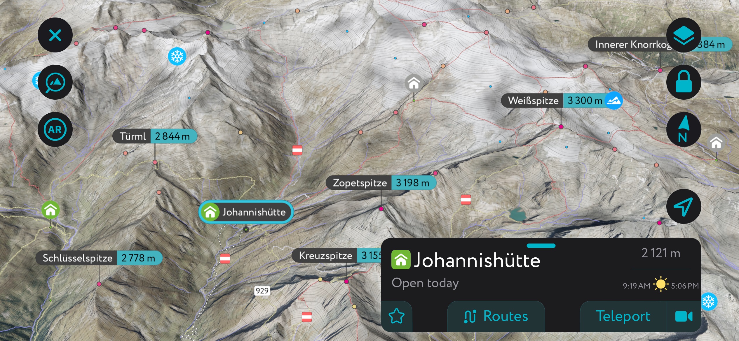
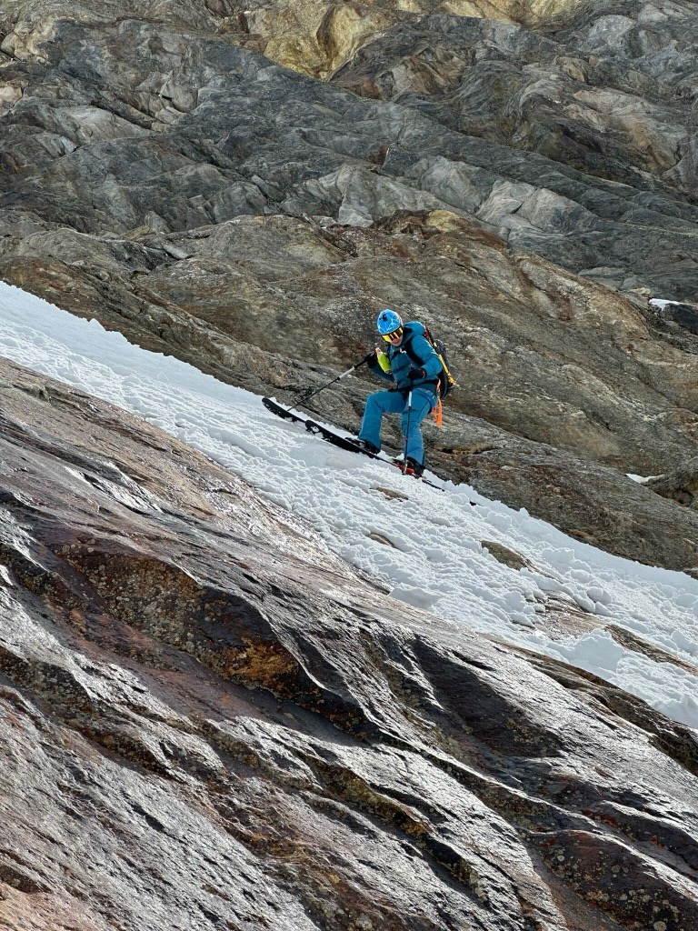
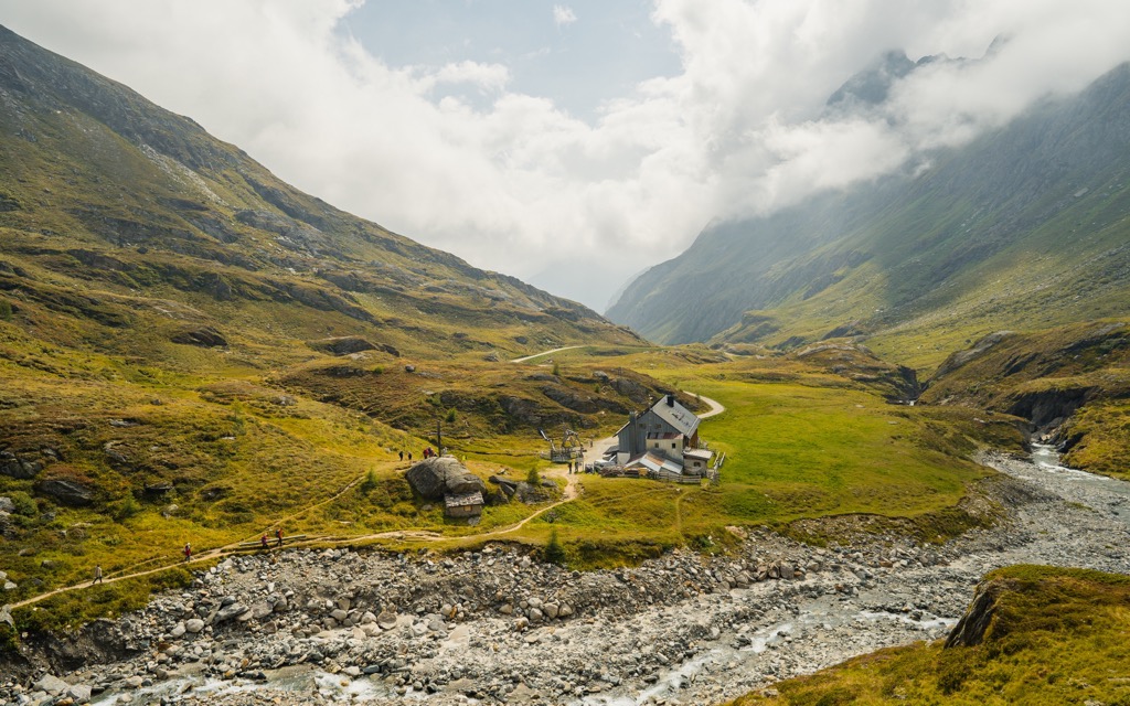
The southern ascent of Großvenediger is considered one of the easier alpine climbs, although it still requires mountaineering skills or hiring a mountain guide. The trail departs from Johannishütte and tracks 16 km (10 mi) out and back with nearly 1,525 m (5,000 ft) of elevation gain.
The route passes Defreggerhaus along the way. Hikers should come with proper equipment as the trail requires extensive glacier crossings and crevasse exposure. Additionally, a portion of the trail is supported by ropes.
In winter, the peak is popular for ski tourers. For skiers, this is by far the superior way to summit the mountain, because it affords an epic descent as a reward. The crevasses are generally well-covered by this time, but are also subject to collapsing snowbridges, so it could be wise to rope up, depending on the snowpack.
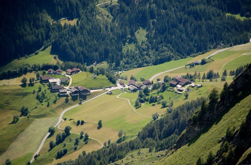
Mountain villages and alpine huts offer stays in or at the base of the Venediger Group. The village of Prägraten is one option for visitors hoping to complete the Venediger High Trail or shorter hikes around the valley and mountains. Matrei in East Tyrol is an all-season tourist town offering easy access to trails and slopes through the surrounding valleys and mountains.
Prägraten is home to around 1,200 people. Encircled by dozens of mountains that tower over 3,000 m (9,845 ft), including Großvenediger, this town is a prime spot to start your foray into the Venediger Group.
It is the starting point for the Venediger High Trail and leads to trails ranging from alpine hikes to the Umbalfälle Waterfall hike that winds past whirlpools and gorges. In winter, it’s a popular spot for ski tourers.
For a bit of culture and history, visit the Islitzer Mühle, the historic corn mill, and the local history museum in Oberbichl. Hinterbichl is only a few kilometers away and has a selection of accommodations ranging from picturesque European-style lodges to campsites.
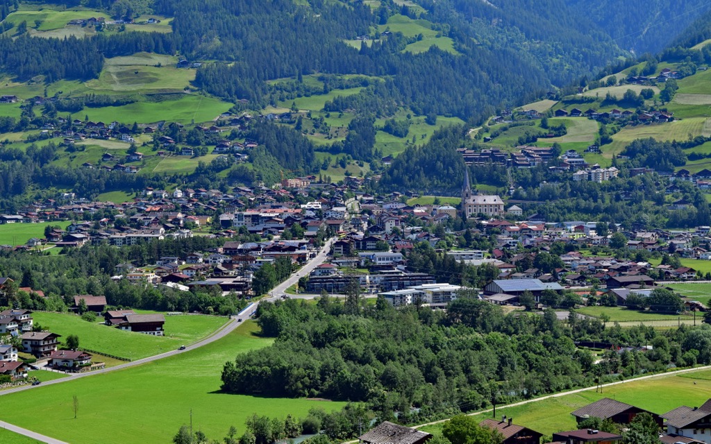
Matrei in Osttirol is located in the heart of Hohe Tauern National Park, which is situated primarily in the Tauern Valley and parts of the Isel Valley. The town has a population of 5,000 and remains lively throughout the year with restaurants, shops, and boutiques in the downtown catering to tourists. Weissenstein Castle lies near the town’s gates, the Kienburg ruins are nearby, and historic churches, chapels, and shrines pepper the landscape.
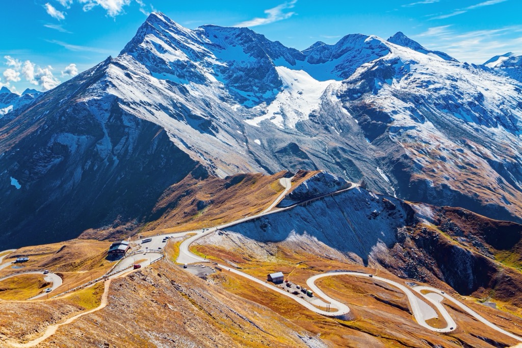
Matrei draws visitors with its access to the outdoors. Trails through the scenic Gaschlößtal Valley open up views of the heavily glaciated Großvenediger. Other routes wind through old larch forests or offer day hikes up to some of the alpine huts. Cycling and mountain biking routes surround the town. In winter, Matrei offers access to the nearby Großglockner Resort, the Osttirol IcePark for artificial ice climbing, and a series of trails for cross-country skiing.


.jpg)