
Scan the QR code and open PeakVisor on your phone
The Glockner Group include 361 named peaks. The highest is Großglockner at 3,798 m. Other notable peaks include Kleinglockner, Hofmannspitze and Glocknerwand.
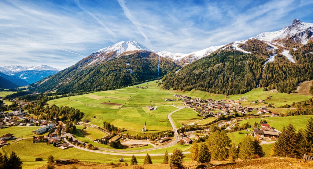
The Glockner Group is one of Austria’s most inspiring mountain ranges, featuring both the Großglockner, the tallest peak in Austria, and the Pasterze, the country’s longest glacier. Located in the states of Tyrol, Carinthia, and Salzburg, the range is protected by Hohe Tauern National Park. Of 361 mountains in the group, Großglockner is the tallest (3,798 m/12,461 ft) and most prominent (2,427 m / 7,963 ft).
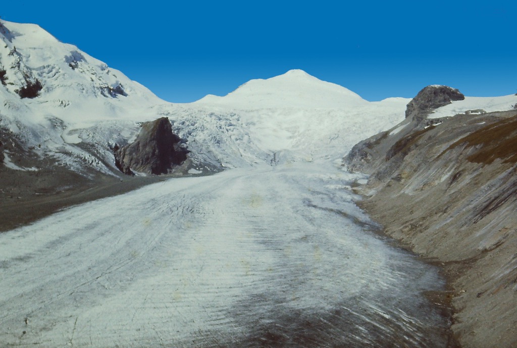
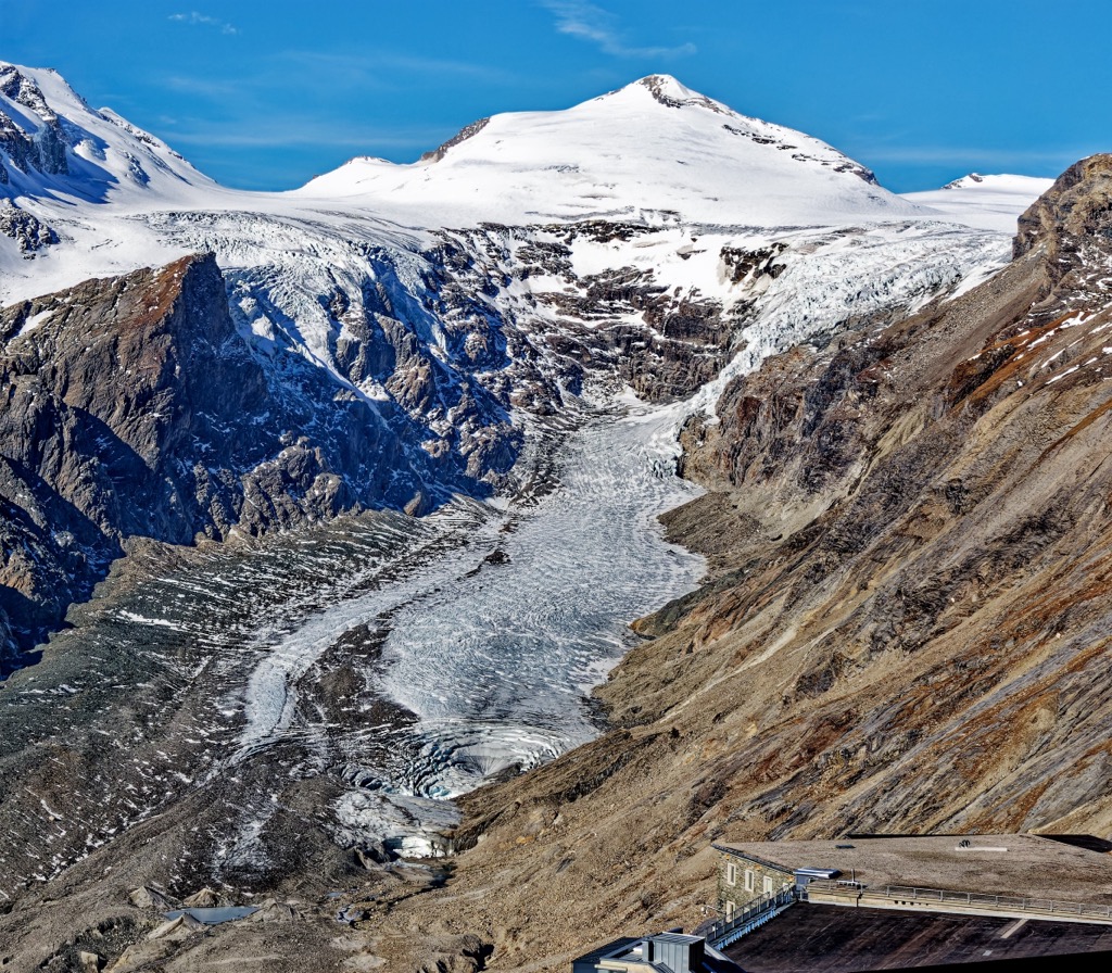
The Glockner Group is part of the Hohe Tauern range in the Western Tauern Alps. The mountain group lies in the states of Tyrol, Carinthia, and Salzburg, Austria, and is protected by the Hohe Tauern National Park. The range boasts Austria’s tallest peak, Großglockner, and Austria’s longest glacier, Pasterze, on Großglockner’s eastern slope.
Rich with a long history of alpinism, home to the scenic mountain roadway Großglockner Hochalpenstrasse, and boasting several resorts that make access to the highest elevations possible year-round, the mountains draw thousands of visitors each year.
Geographically, the Glockner group is neighbored by the Granatspitz Group to the west, the Goldberg Group to the east, and the Schober Group to the south. On the northern side, it is bordered by the Salzach Valley and, beyond it, the Kitzbühel Alps and Salzburg Slate Alps.
The Alpine Orogeny defines the overarching geology of the Glockner Group. During the early Cretaceous era, around 140 million years ago, the African plate drifted north, pushing sediment and folding deposits on the ocean floor over each other. The Alpine orogeny raised the Alps when the African and Eurasian plates collided. The majority of mountain building occurred between 65 and 2.5 million years ago. The uplift no longer outpaces the rate of erosion, so the Alps are not considered a growing range.
One of the most significant geologic features specific to the Glockner Group is the Tauern Window, an exposed rock strata offering a unique look at millions of years of geologic processes.
Driven by forces deep within the Earth’s core, the planet’s crust shifted and stacked on itself. Over millions of years, strata that would otherwise exist at much lower geologic layers rose to the top as these layers jutted upwards.
The window is composed of four enormous gneiss cores at the center. It is 160 km (99 mi) long and runs from the Katschberg in the east to the Brenner Pass in the west. It overlaps not just with the Glockner group but also with the Zillertal Alps, Tux Alps, and, among the Hohe Tauern, the Granatspitz, the Sonnblick, the Goldberg, and the Ankogel groups.
The gneiss developed from solidified magma that was initially granite, granodiorite, and tonalite before turning into gneiss. The Upper Schist originated from sediment in the basin of the Piemonte Ocean, and the limestone and dolomite in the range formed during the early Mesozoic in the Tethys Ocean.
Glaciers significantly shaped the region during the ice ages. They carved out U-shaped valleys and cirques. Pyramid-shaped peaks, such as Großglockner's, formed as the result of the formation and movement of cirque glaciers and are sometimes called glacial horns.
Many glaciers remain today, although they are rapidly shrinking. The Pasterze glacier is roughly 16 sq km (6 sq mi) in size and reaches about 4 km (2.5 mi) in length, making it the largest glacier in the Eastern Alps. Scientists have measured the Pasterze annually since 1879, and from 2006 to 2016, the glacier receded an average of 40 m (131 ft) per year.
Although the mountains are now protected within the national park, gold, iron, limestone, and talc have been mined in the region.
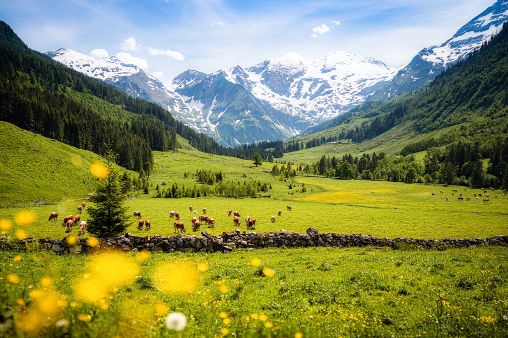
The Hohe Tauern National Park overlaps with the Glockner Group, as well as the parts of the Venediger Group and the Goldberg Group. The rugged habitats range from valleys to alpine glaciers and are home to a wide array of flora and fauna. Many species have unique adaptations to survive in the dramatic conditions of the Alps.
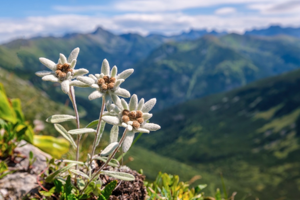
A few plant species have remained through the ice ages. Edelweiss originated in Central Asia but migrated to the Alps during the last series of ice ages. Glacier buttercups are specialized to high altitude scree and produce thick roots that simultaneously stabilize the rocks and the flowers themselves.
Montane habitat occurs between 700 and 1,600 m (2,300 and 5,250 ft). As elevation increases, deciduous mixed forests transition to mountain spruce forests. Dead trees provide a base for fungi, lichens, and birds such as the black woodpecker—this habitat houses red deer, foxes, squirrels, red crossbills, and pygmy owls.
The subalpine habitat exists between 1,600 and 2,300 m (5,250 to 7,545 ft). Here, larch-stone pine forests dominate, although this habitat has historically been heavily impacted by human activity. Centuries ago, farmers cleared forests to create grazing areas, altering the proportions of forest cover to alpine meadows. The undergrowth is composed of blueberries and alpine roses. Avian species include black grouse and spotted nutcrackers.
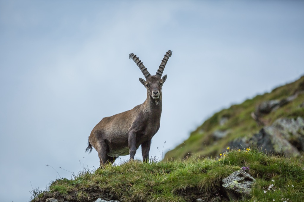
The alpine zone exists between 2,300 and 3,000 m (7,545 to 9,840 ft). Here, montane grassland supports species like bent sedge, mat grass, mountain arnica, bearded bellflowers, and alpine avens. The alpine is the territory of ibex, chamois, marmots, and alpine salamanders.
The zone over 3,000 m (9,840 ft) features extreme temperatures, high UV radiation, and strong winds. Although there is little vegetation, a handful of plants have adapted to this harsh environment. A few examples include the glacier buttercup, alpine toadflax, and lichens.
Bird species of note in the Glockner Group include golden eagles, bearded vultures, griffon vultures, ptarmigans, and the smallest native songbird—the goldcrest, weighing five to six grams. After a successful reintroduction in the 1960s, around 1,100 ibex now live within the Hohe Tauern National Park boundaries.
The Glockner Group is one of Austria’s most iconic ranges, and Gloßglockner was an important hub in the early days of alpinism.
The story of alpinism and Großglockner begins with Belsazar Haquet, a science professor from Ljubljana. He traveled to the area and wrote a book in 1783 that claimed the Großglockner had never seen an ascent. Franz Xaxer Salm-Reifferscheidt, a local bishop, went on to organize an expedition to scout an ascent via the Leitertal Valley. He sent two locals, Martin and Sepp Klotz, scouting ahead and followed after. The first attempt with the bishop and a larger crew took place in August 1799, 16 years after Haquet’s initial voyage.
The team built a hut for the bishop to stay in and erected a cross near the top. However, the cross was not correctly placed at the true summit, and the church pushed for a second attempt the following year. On the second try, they successfully erected the cross at the top.
Corbinia Steinberger made the first ascent by a single climber in 1851, while the first winter ascent was made in early 1875.
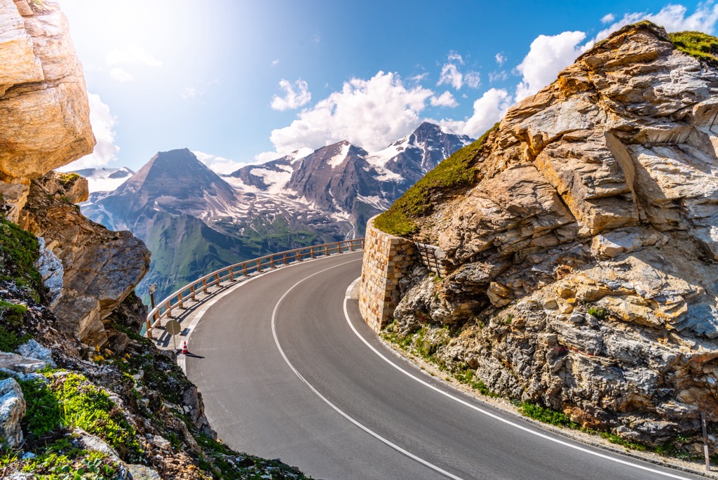
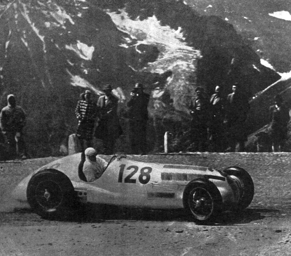
The famous “Großglockner Hochalpenstrasse” mountain road is open from May to October. The road was completed in 1935. It is 48 km (30 mi) long and is Austria’s highest paved road. It’s estimated that 800,000 to 1,000,000 tourists visit the road each year.
With summer and winter resorts, hundreds of kilometers of hiking and biking trails, ski slopes and touring routes, via ferratas, and breathtaking views from the valleys to the summits, the range has no shortage of outdoor activities.
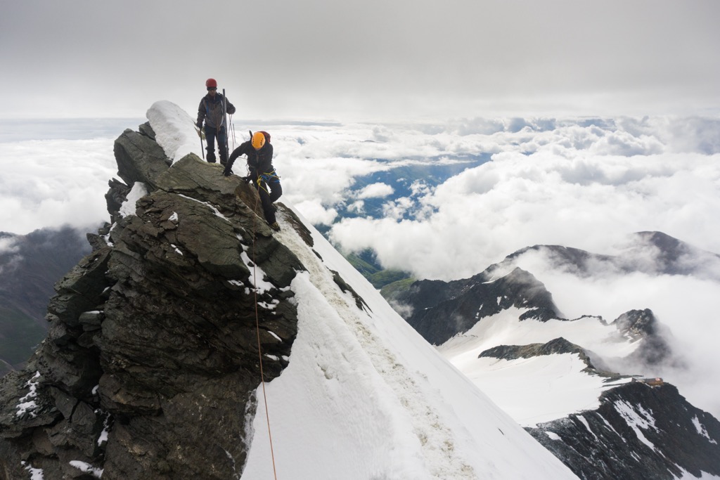
Großglockner and other major summits like Großes Wiesbachhorn, Hoher Tenn, and Hocheiser are challenges for experienced hikers and mountaineers or those accompanied by a guide. Due to glaciers, only part of the range is open for pure hiking; skills for technical glacier travel are required on many of the peaks. It’s best to follow marked routes, as navigating glaciers, crevasses, and high-altitude weather changes can be challenging. Day hikes are possible to mountain refuges, and hikers can organize numerous multi-day routes between huts. Ice climbing is popular in some parts, particularly around Oberwalder Hut. There are challenging climbs up Großglockner and easier routes on the lower slopes of Pasterze glacier.
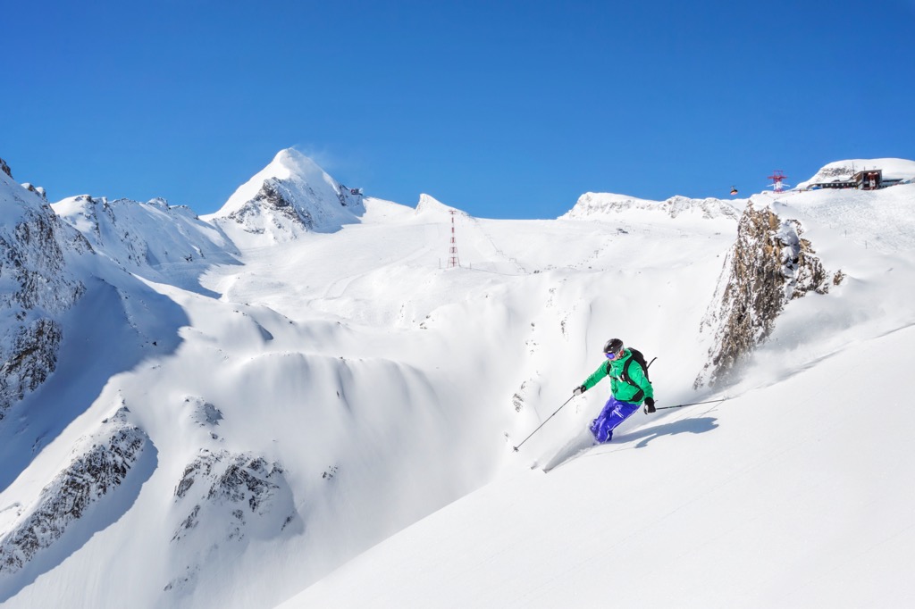
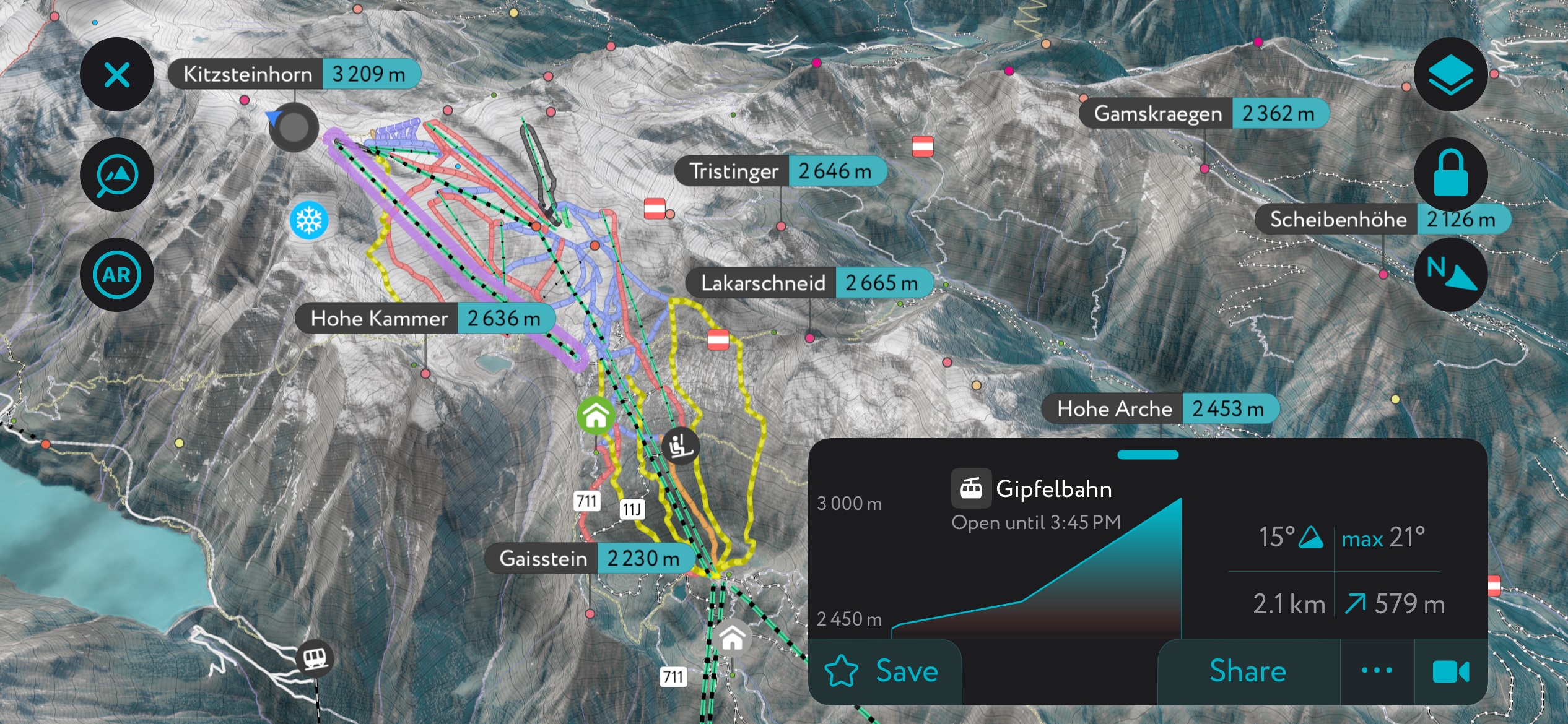
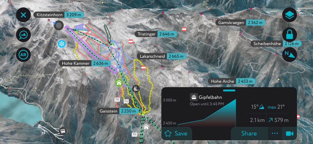
There are six ski resorts in the Glockner Group, and one of the best-known is Kitzsteinhorn/Maiskogel-Kaprun. It has 61 km (38 mi) of slopes and 10.5 km (6.5 mi) of ski routes. It was Austria’s first ski resort on a glacier. In 2019, a cable car opened connecting the Kitzsteinhorn and Maiskogel ski resorts. The slopes range from easy to difficult, including some well-known challenges like the steep “Black Mamba.” With an abundance of off-piste terrain and a massive snow park, the resort is popular among freeriders and freestylers.
Although many variations exist, here is a sample seven-day tour of the Glockner Group in Hohe Tauern National Park outlined by the Austrian Alpine Association. The route is for experienced hikers; less experienced hikers are advised to hire a mountain guide. Although this route can be modified with easier trails or entered from various points, it begins and ends at Kaprun in its complete form.
This route's overnights are at Rudolfshütte, Sudetendeutsche Hütte, Kals am Grossglockner, Salmhütte, Glocknerhaus, and Fusch. The trail is over 100 km (62 mi) and climbs and descends many thousands of meters over the course of the week.
The tallest peak in the group, Großglockner, attracts summer hikers and winter ski-tourers.
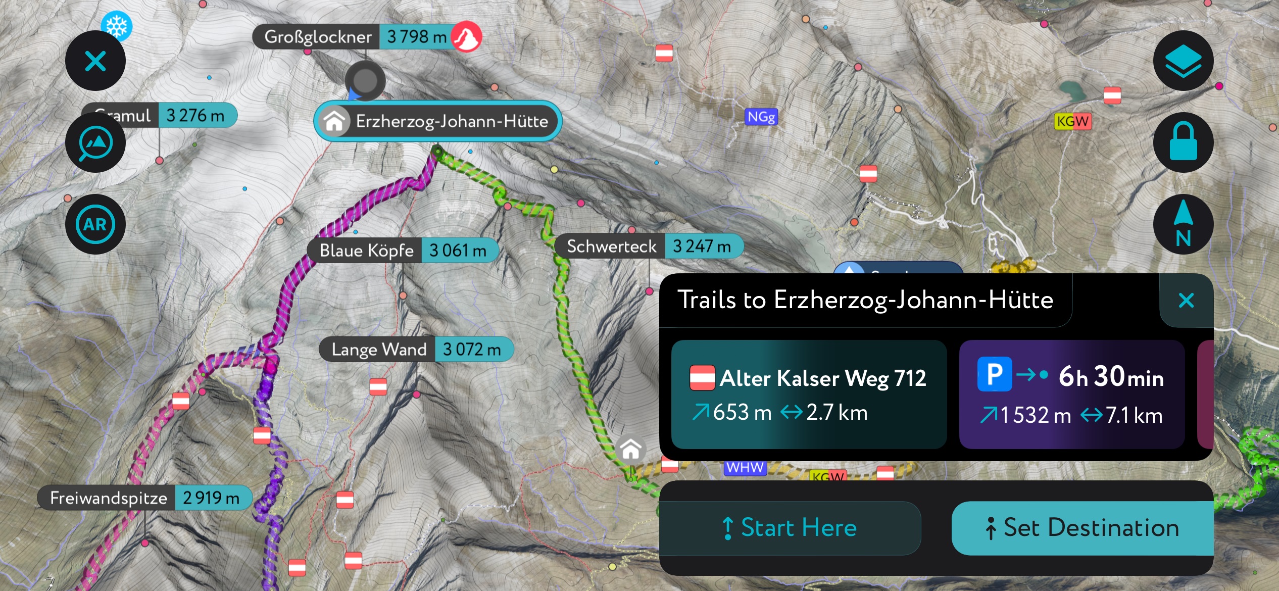
For hiking, one of the popular routes to summit Großglockner leaves from Lucknerhaus. It is an 18 km (11 mi) out-and-back trail with 2,350 m (7,715 ft) elevation gain. Along the way, the trail passes the Stüdnlhütte via the Lucknerhütte, then the Erzherzog-Johann-Hütte via the Ködnitzkees before summiting.
This can be done in one day, but many choose to stay overnight at Stüdnlhütte. The route includes a via ferrata and glacier crossing, requiring alpine experience and proper equipment to undertake safely.
A ski-touring option includes circumnavigating the peak. This, too, can be done in one day for the fit or split into two days. The tour is stunning but requires perfect conditions. It’s advised to contact huts in advance to check whether glaciers, particularly Teufelskampkees, have enough snow cover to avoid the risk of crevasses and ensure that avalanche conditions are safe and there is good visibility.
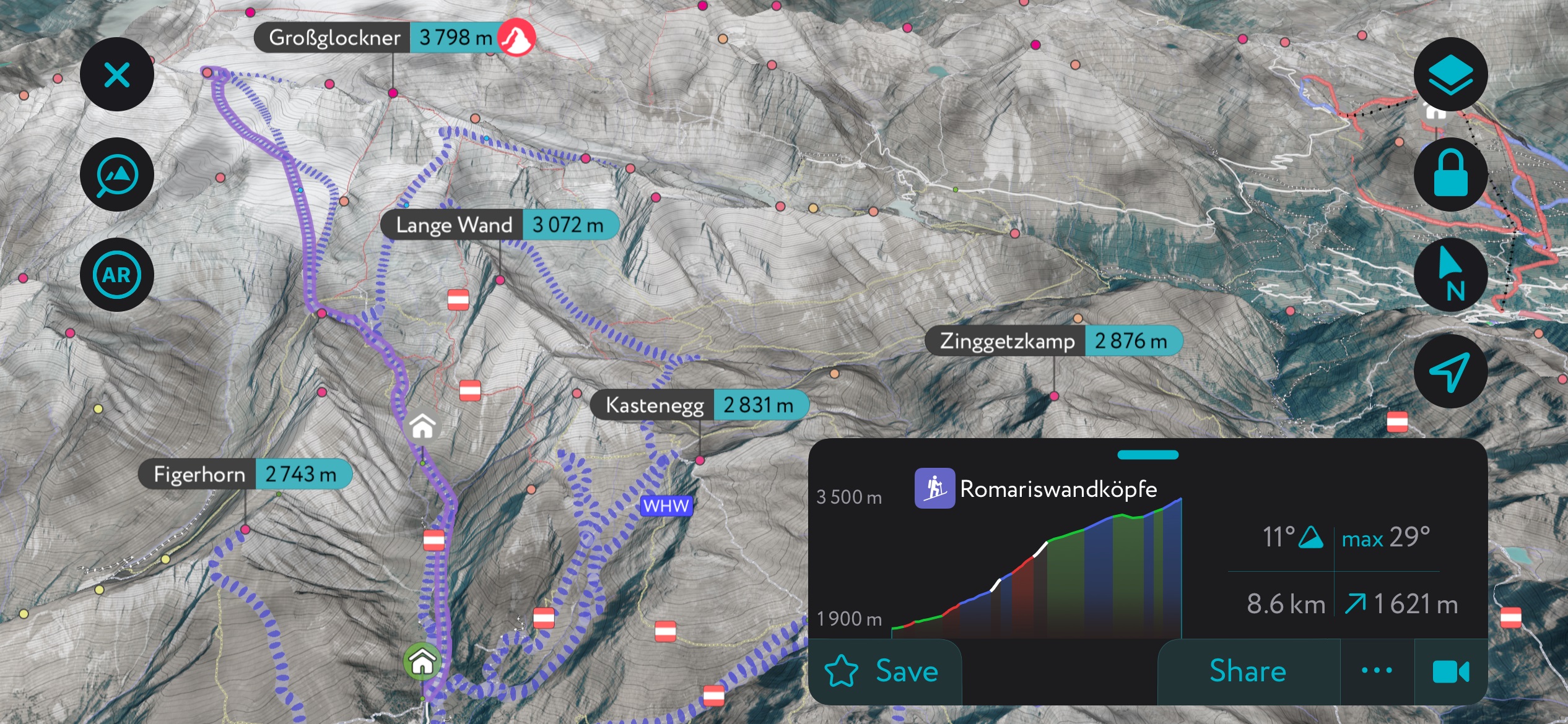
The ski touring route is 12.8 km (8 mi) with 1,800 m (5,905 ft) elevation gain and takes eight hours. It departs from Stüdlhütte, passes Romariswand saddle with an option to climb Romariswandköpfe, and descends to the valley below Pasterze glacier before beginning the long ascent.
The option to summit Großglockner exists if conditions allow. Depending on conditions, ski-tourers might be able to follow the rope-supported ridge below the Adlersruhe to the Ködnitzkees. The final step is a descent down wide slopes with the choice to return to Stüdlhütte or head directly to Lucknerhaus.
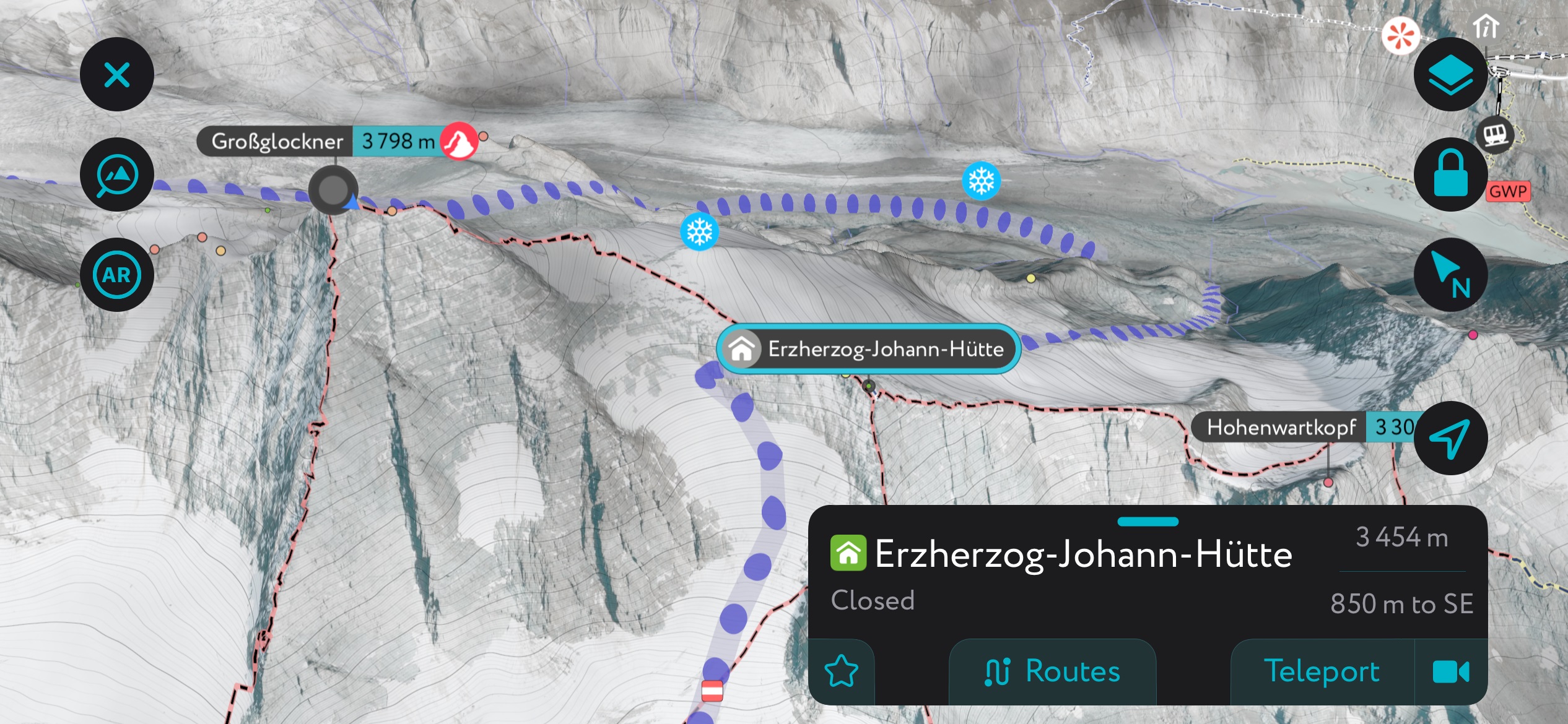
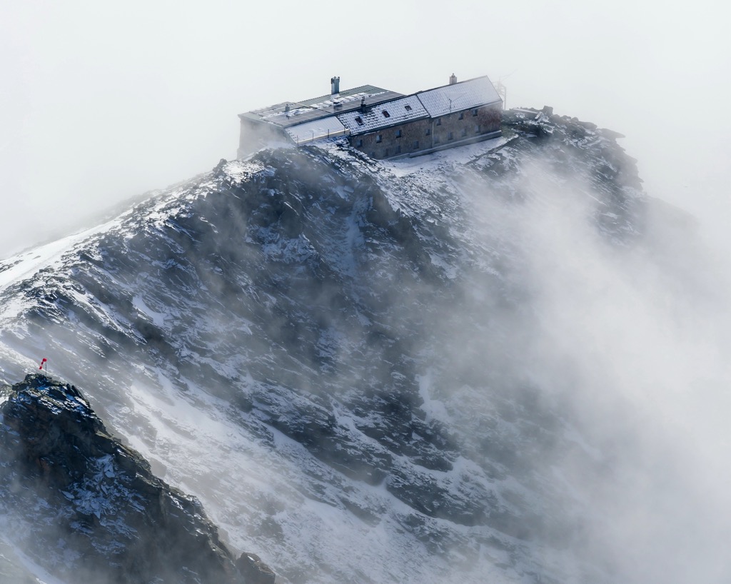
The Ezherzog is undoubtedly one of the Alps’ most remarkable alpine refuges, and that’s saying something. It’s owned and operated by the Austrian Alpine Club and is the highest refuge in Austria, sitting at over 3,450 m (11,318 ft). Having been expanded several times since its conception in 1880, it’s on the larger side for an alpine hut, with 120 bunks and ten beds.
The refuge sits on a ridge just below the summit of Großglockner, flanked by glaciers on all sides. As a standard stop on the normal route up Austria’s highest peak, this hut is also well-attended, so make sure you reserve in advance. Do NOT go up without reservations expecting to get a spot!
It’s a summer-only refuge, but there is an encampment with about ten beds during the winter.
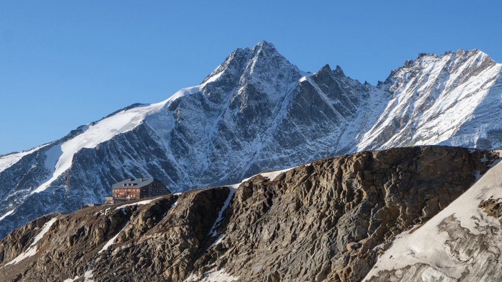
The Oberwalderhütte sits at nearly 3,000 m (10,000 ft) on an outcropping above the Pasterze Glacier, with the towering Glockner Group just across the valley. Like the Erzherzog, the hut is best utilized as a base for mountaineering in the summer, as it is unguarded in the winter. However, a winter area also offers basic shelter without the usual niceties of an Alps refuge. Itineraries from the hut include several of the range’s lesser-known peaks like Hohe Riffl (3,338 m / 10,951 ft) and Great Wiesbachhorn (3,564 m / 11,692 ft).
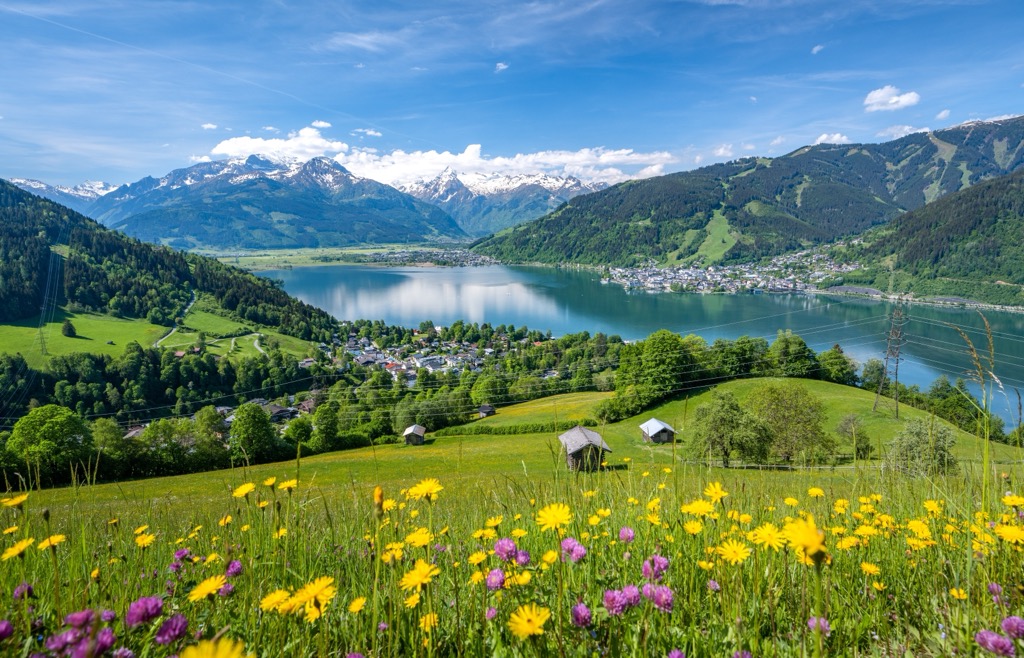
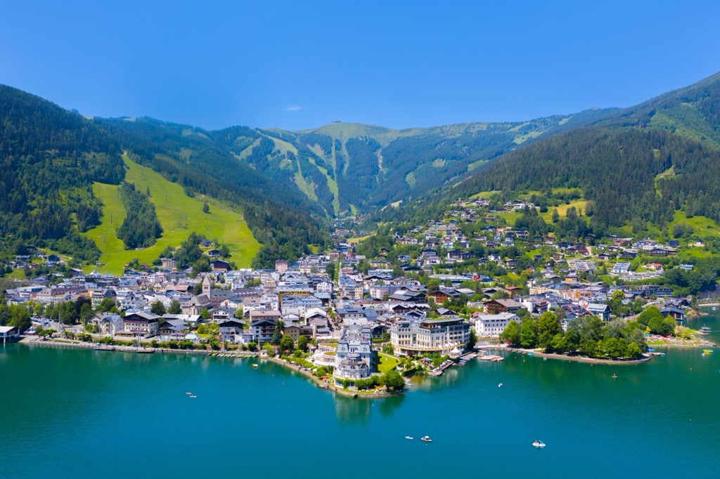
Several towns and ski resorts offer picturesque accommodations at the foot of the range. These include Kals am Großglockner, Zell am See, and Heiligenblut. Salzburg is a large city less than a two-hour drive away and has an international airport for those coming from further afield.
As a small village, Kals am Großglockner has a population of around 1,100 and sits at a prime location at the base of the Großglockner next to Hohe Tauern National Park.
The area boasts 250 km (155 mi) of hiking trails around the valleys, the Kalser cable cars, Glocknerstrasse Road for convenient and scenic inroads to alpine zones, as well as scores of mountain biking trails.
In winter, the Großglockner Resort Kals/Matrei is the largest ski area in East Tyrol. In addition to pistes, there are plenty of ski touring options. From Kals, you can easily ski tour the Lienz Dolomites, Hohe Tauern National Park, alpine valleys in Villgratental, and glacial zones in the northern part of the region.
Zell am See has a population of around 10,000 and is a summer and winter resort town. Its primary draw is ski holidays in winter. The town has plenty of restaurants and shopping options for tourists, and those who want a more mountainous experience can easily reach the alpine town of Kaprun from Zell. It sits at the base of Schmittenhöhe mountain, on the shores of Lake Zell, and close to the Kitzsteinhorn glacier.
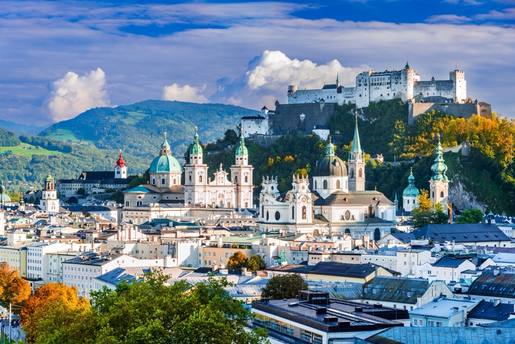
Salzburg is Austria’s fourth largest city and home to just over 150,000 people. It has an international airport and is a UNESCO World Heritage Site. The city is a popular tourist destination with a well-preserved historic center, festivals throughout the year, and copious mountains and lakes nearby.
Upon arriving, you can orient yourself to town with a guided or self-guided tour. A few must-see historical sites include the Salzburg Cathedral, the medieval Hohensalzburg Fortress, and Mozart’s home.
The city hosts numerous festivals, including the Salzburg Festival in July and August and Mozart Week in January. Several elaborate gardens are worth visiting. In just over an hour, visitors can reach the scenic village of Hallstatt on the banks of Lake Hallstatt for a day trip. Salzburg’s proximity to the mountains and its urban amenities offer visitors a cultural experience while working as a base for day hikes or a kick-off point for longer treks.
Salzburg’s downtown is pedestrian-friendly. The city is well connected to the region via buses and trains, making it easy for visitors to get from the urban center into smaller mountain towns.


The highest peak in the Glockner Group is Großglockner, at 3,798 m.
The Glockner Group have 361 named peaks.


.jpg)