
Scan the QR code and open PeakVisor on your phone
Carinthia is home to 2,459 named mountains. The highest is Großglockner at 3,798 m.
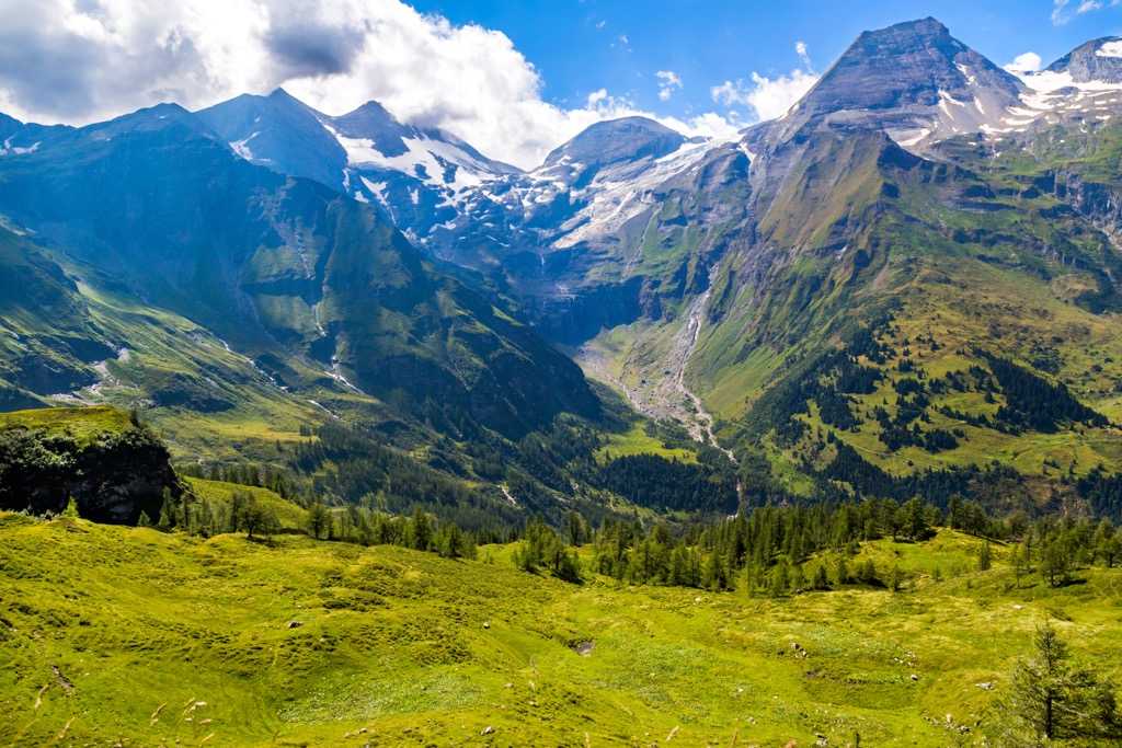
Carinthia is the southernmost of Austria's nine states and home to the highest Alpine summits east of the Brenner Pass, including Austria's highest mountain (Großglockner). Its magnificent mountains and lakes make it a bucket list destination for many hikers.
There are 2459 named mountains in Carinthia. The highest and the most prominent mountain is Großglockner (3,798 m / 12,461 ft).
Carinthia (Kärnten) is the fifth-largest Austrian state, covering an area of approximately 9,536 sq km (3,682 sq mi). It sits on Austria's southern border, with Italy to the southwest and Slovenia to the southeast. Carinthia borders three other Austrian states: Salzburg to the northwest, Tyrol to the west, and Styria to the east.
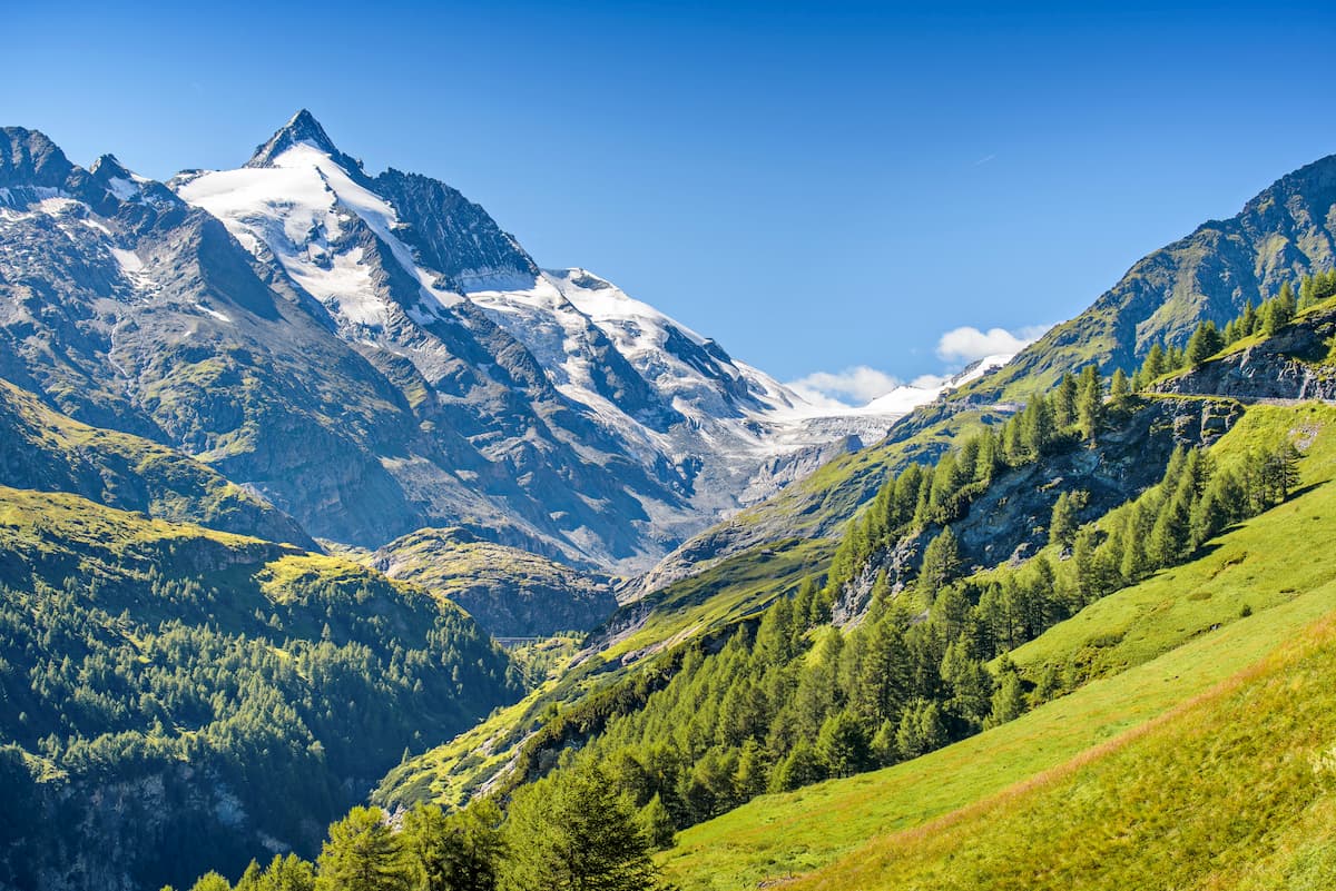
Dominated by the Eastern Alps, Carinthia's boundaries are defined by mountain ranges, rivers, and valleys. The High Tauern (Hohe Tauern), which includes Austria's highest summit, Großglockner, separates Salzburg and Carinthia. The Lavanttal valley in the Lavanttal Alps stands between Carinthia and Styria.
Meanwhile, the Drava River carves a valley between Carinthia and Tyrol. The Carnic Alps and the Karavanks split Carinthia from Slovenia and Italy.
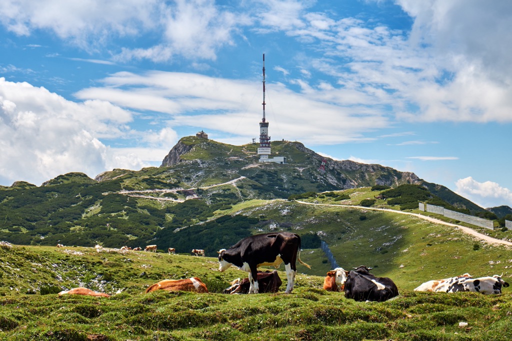
Carinthia is almost entirely mountainous except for the large Klagenfurt Basin, which covers around one-fifth of the state's area. It's a triangular valley in southern Carinthia bounded by the Karavanks to the south and the Gurktal Alps to the north. The basin is home to Klagenfurt, the capital and largest city in Carinthia. On the basin's western rim is Villach, Carinthia's second-largest city.
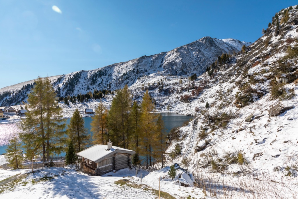
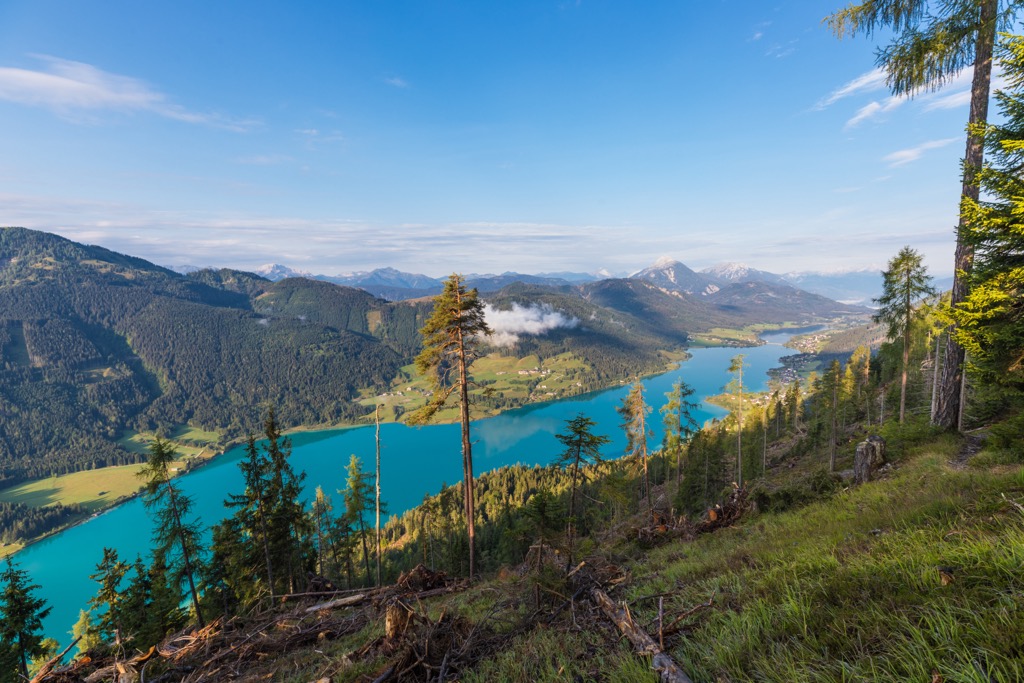
The Drava is Carinthia's main river, with its tributaries, the Gurk, the Glan, the Lavant, and the Gail, also snaking their way across the state. Carinthia is home to over 1,200 lakes, the largest of which is Wörthersee, with a surface area of 19.4 sq km (7.5 sq mi).
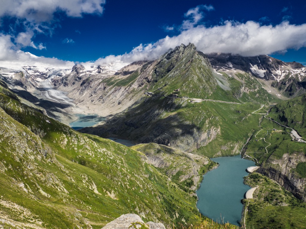
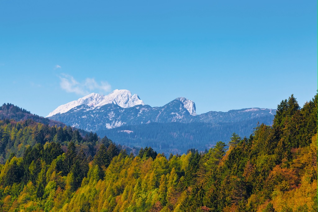
Due to its position in the high Eastern Alps, Carinthia experiences long winters and heavy snowfall. Glaciers are widespread, with 43 scattered across the state’s high peaks.
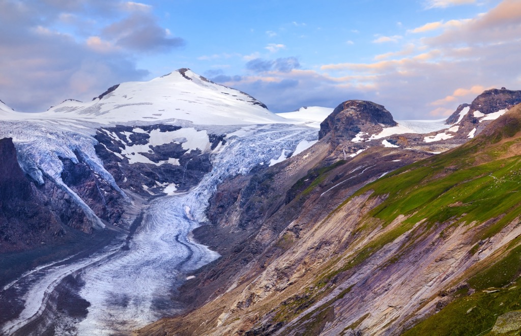
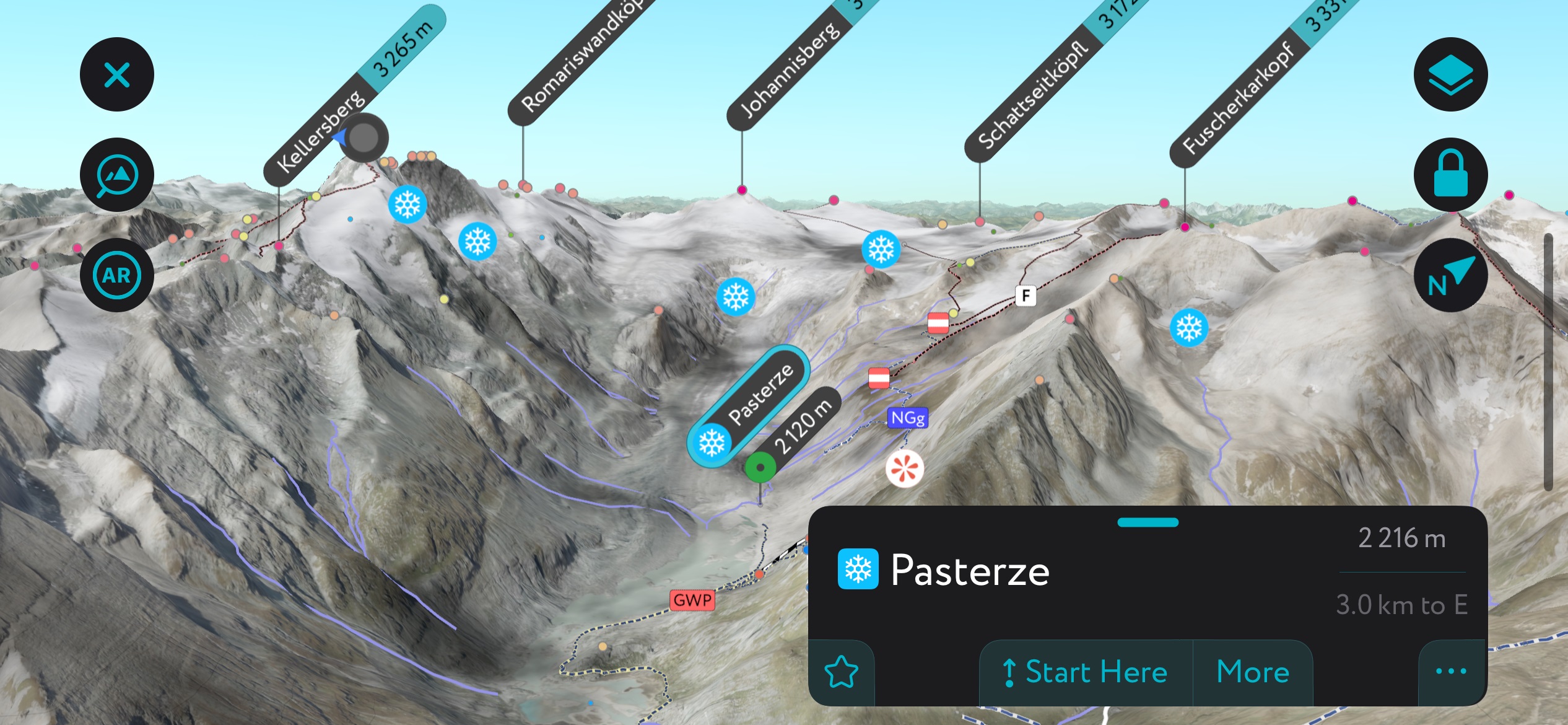
The Pasterze below Großglockner is Carinthia's longest glacier, with a surface area of approximately 18 sq km (7 sq mi). Despite its long winters, Carinthia experiences the highest average annual sunshine of all Austrian states.
Carinthia has several nature parks, including Dobratsch Nature Park (Naturpark Dobratsch) and Nockberge Biosphere Park (Biosphärenpark Nockberge).
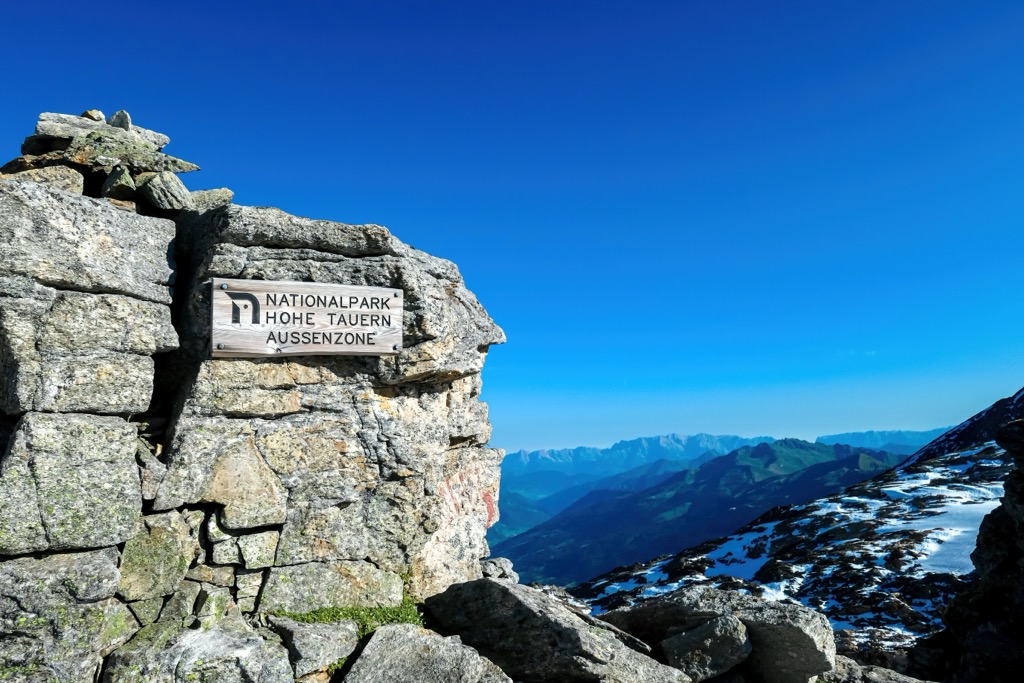
The most famous park in Carinthia is High Tauern National Park (National Park Hohe Tauern), Austria's largest national park. It encompasses an area of 1,856 sq km (716 sq mi) across western Carinthia, Tyrol, and Salzburg.
Due to its location in the Central Eastern Alps, much of Carinthia has been shaped by the Alpine Orogeny. The Alpine Orogeny is an ongoing mountain-building event that began approximately 65 million years ago in the Late Mesozoic.
Convergent movements between the African, Arabian, and Indian plates to the south and the Eurasian Plate to the north caused the Alpine Orogeny. These movements began in the Cretaceous but only became an orogenic event in the Paleocene.
The Alpine Orogeny is one of Europe's three major mountain-building events and helped shape many significant ranges worldwide, including the Himalayas, Atlas Mountains, the Pyrenees, and the Hindu Kush.
Due to its long history with rocks formed over hundreds of millions of years, the Alps can be split into several distinct areas. Most of the range comprises Austroalpine nappes consisting of gneiss and slate. Exceptions include the High Tauern, which is primarily Jurassic limestone. Some areas, such as the Rieserferner Group, also comprise granite.
The Central Eastern Alps is home to the highest and most glaciated mountains in the Eastern Alps. There are several ranges within the eastern Alps, such as the High Tauern, the Levanttal Alps, the Gurktal Alps, and the Karavanks.
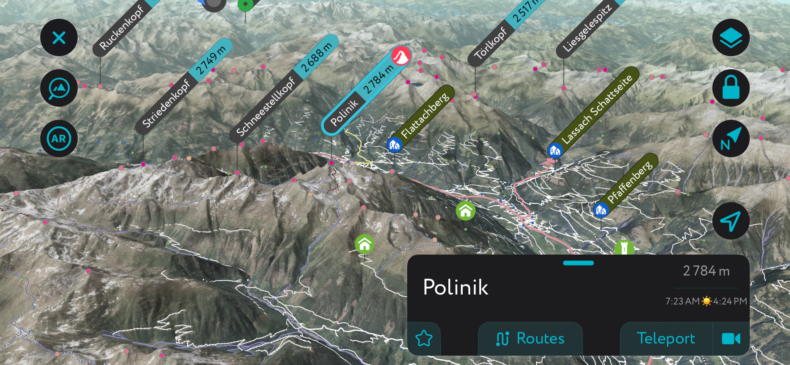
Aside from Großglockner, notable mountains in Carinthia include Glocknerwand (3,710 m / 12,175 ft), Johannisberg (3,453 m / 11,329 ft), Polinik (2,784 m / 9,134 ft), and Reißkofel (2,371 m / 7,779 ft).
With its varying landscape ranging from the Klagenfurt Basin to the Eastern Alps' highest summits, Carinthia boasts a wealth of biodiversity.
Carinthia is home to many animal species — High Tauern alone boasts over 15,000 species, accounting for one-third of Austrian biodiversity.
Notable mammals in Carinthia include red foxes, wild boar, red deer, red squirrels, and European badgers. Ibex, chamois, marmots, are common high in mountains. Carinthia also has a small cross-border population of brown bears, numbering less than 25 individuals.
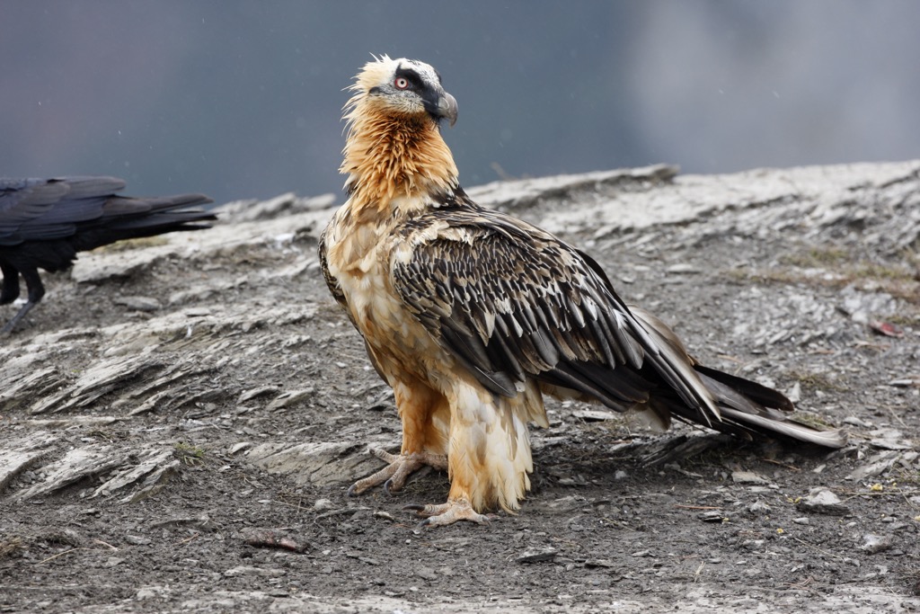
The Eastern Alps are home to many impressive birds of prey. One of the most striking is the bearded vulture, with a wingspan of almost 3 m (10 ft). Around 40 breeding pairs of golden eagles inhabit the High Tauerns. Other notable bird species in Carinthia include ptarmigans, bearded eagles, goldcrests, great spotted woodpeckers, and European robins.
A few venomous snake species can be found in Carinthia, most notably the common European adder and nose-horned viper. Carinthia's notable amphibian and reptile species include European toads, alpine salamanders, European tree frogs, and alpine newts.
Several venomous spider species inhabit Austria and can be found in Carinthia, including false widows, yellow sac spiders, and European sac spiders.
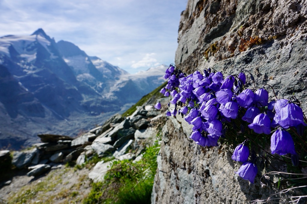
Thousands of plant species grow across Carinthia, with many endemic species in alpine areas due to Carinthia's unique climate, soil conditions, and geographic isolation. One example is wulfenia, an ornamental purple flower that grows only on the slopes of Gartnerkofel (2,195 m / 7,201 ft) in the Carnic Alps.
The High Tauerns are highly biodiverse, with over 3,500 plant species, including 1,300 ferns and flowers.
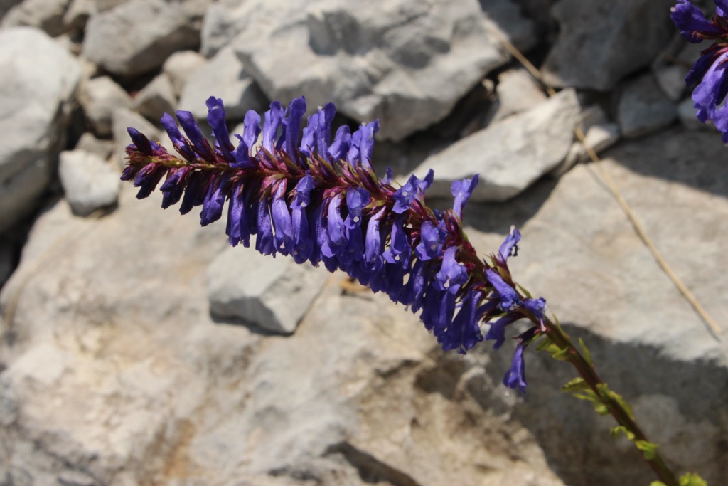
Edelweiss, the national plant of Austria, is a common sight on the Alps' rocky and grassy slopes. Glacier buttercups are another flower well-adapted to life at high altitudes and in harsh conditions. Other notable flowers of Carinthia's mountains include Rudolph's saxifrage, alpenrose, and Bavarian gentian.
Approximately 60% of Carinthia is carpeted by forests. Most of these woodlands are coniferous and are composed of mountain pines, spruces, and silver firs. Deciduous trees in Carinthia include European beeches, silver birches, and Scots pines.
Composed primarily of some of the highest mountains in the Eastern Alps, Carinthia has a rich mountain history.
Großglockner has only been Austria's highest mountain for just over a century. It became the country's highest summit when Ortler (3,905 m / 12,812 ft) became a part of Italy's South Tyrol region in 1919.
The first ascent of Großglockner took place between 1799 and 1800. In 1799, Gurk prince-bishop Count Franz Xaver of Salm, Sigismund Ernst Hohenwart, and Baron Franz Xaver von Wulfen were led via the Leitertal valley by two peasant guides to Kleinglockner's (3,770 m / 12,370 ft) summit. These two peasant guides became known as the "Glockners" for their achievements.
The following year, another expedition reached Kleinglockner and placed a summit cross. Eventually, a team of 62 people, including the "Glockners," set out to scale Großglockner. Only six people, including two priests and the Glockners, managed to cross the Obere Glocknerscharte to Großglockner's summit.
High Tauern National Park, one of only six Austrian national parks, was established in 1992. But, the framework for the park is much older, dating back to 1913.
Carinthian forest industrialist Albert Wirth and Salzburg parliamentarian August Prinzinger were the first to develop a protected area between Großglockner and Großvenediger (3,657 m / 11,997 ft). During this time, Albert Wirth donated around 41 sq km (16 sq mi) to the Austrian Alpine Club, which became the basis of the future park.
The Austrian Alpine Club (Österreichischer Alpenverein or ÖAV) is Austria's largest mountaineering organization, founded in 1862 in Vienna and comprising over 500,000 members. It manages over 230 mountain huts and 26,000 km (16,155 mi) of trails across the region.
One of Carinthia's most unique cultural aspects is the Slovene-speaking minority called Carinthian Slovenes, who inhabit the state's southern and southeastern areas. While officials cannot tell the exact number of Slovene speakers due to census boycotts, they're believed to number in the tens of thousands.
Hundreds of serene lakes and sublime summits make Carinthia one of Austria's best hiking destinations.
Some of Carinthia's best hikes, especially within High Tauern National Park, are potentially dangerous. Bring the correct hiking equipment, plenty of food and water, and appropriate clothing when hiking in Carinthia. Map your route carefully, check local weather forecasts, and consider hiring a guide if you're unfamiliar with the area.
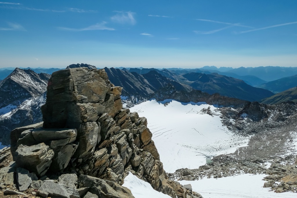
High Tauern National Park is the largest of Austria's six national parks, covering an area of approximately 1,856 sq km (716 sq mi). It's split between the states of Carinthia, East Tyrol, and Salzburg. The park encompasses the highest peaks in the High Tauern mountain range.
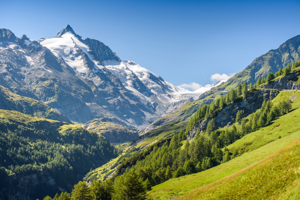
Carinthia's section of the park is located in the state's northwestern corner. The highest summits east of the Brenner Pass are within the park's boundaries, and many hikers are drawn to the area to visit Großglockner, Austria's highest summit.
Nicknamed the "Tauern King," Großglockner is a pyramidal mountain composed of two summits, Großglockner and Kleinglockner. The Pasterze, Austria's longest glacier, is situated on Großglockner's eastern slope.
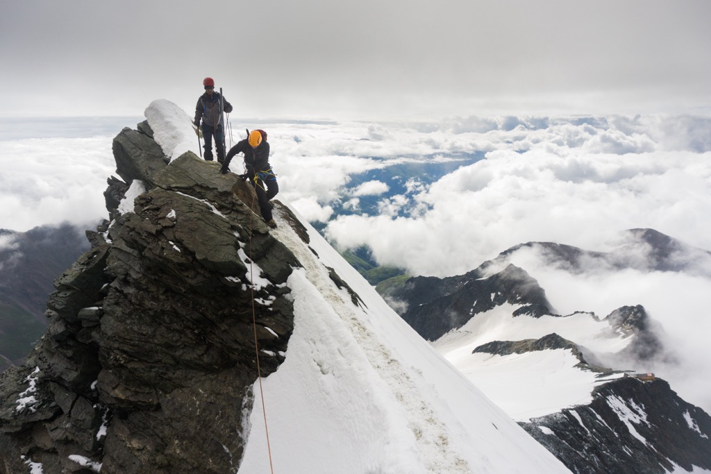
Experienced hikers consider Großglockner one of the finest Alpine mountains, with its reputation only rivaled by Mont Blanc (4,810 m / 15,781 ft) and the Matterhorn (4,478 m / 14,692 ft). Due to its fame, many inexperienced alpinists attempt the mountain with the incorrect equipment.
The standard route to the summit of Großglockner is dangerous and involves climbing a 35-degree slope covered in ice and walking along a UIAA II-rated exposed ridge. Even reaching the starting point at Erzherzog-Johann-Hütte (3,453 m / 11,332 ft) is perilous, with hazardous glacial crevasses en route. The climb from Erzherzog-Johann-Hütte to Großglockner's summit is approximately 13 km (8 mi) long.
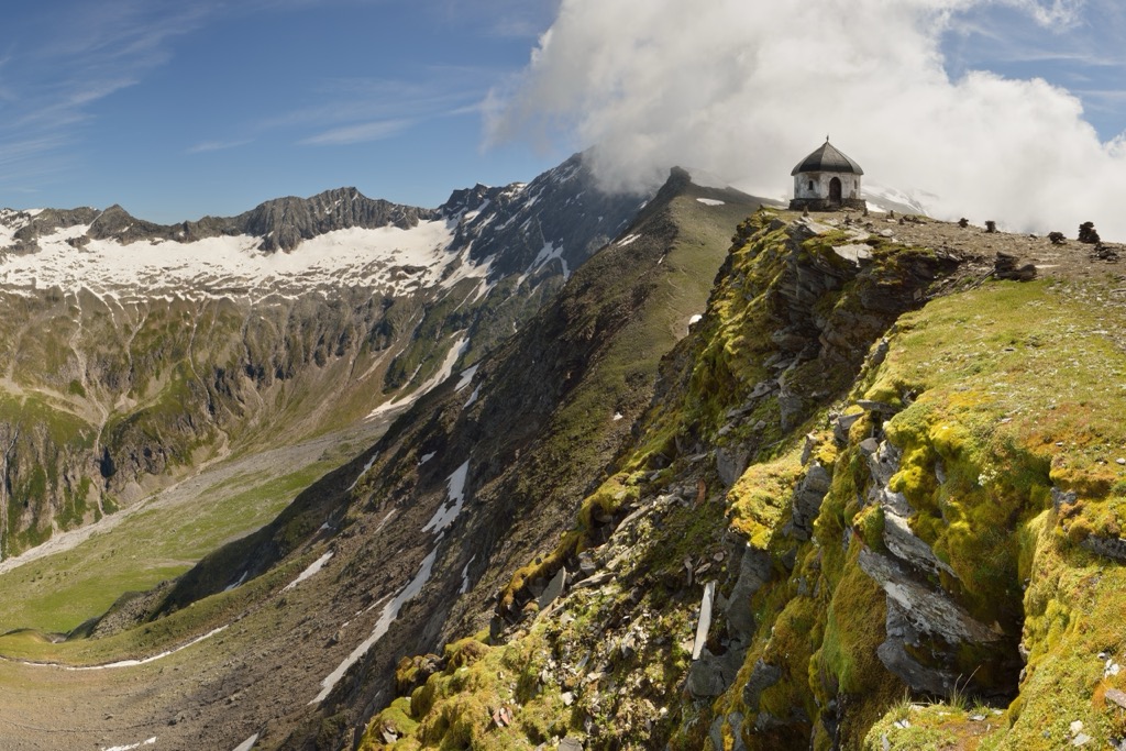
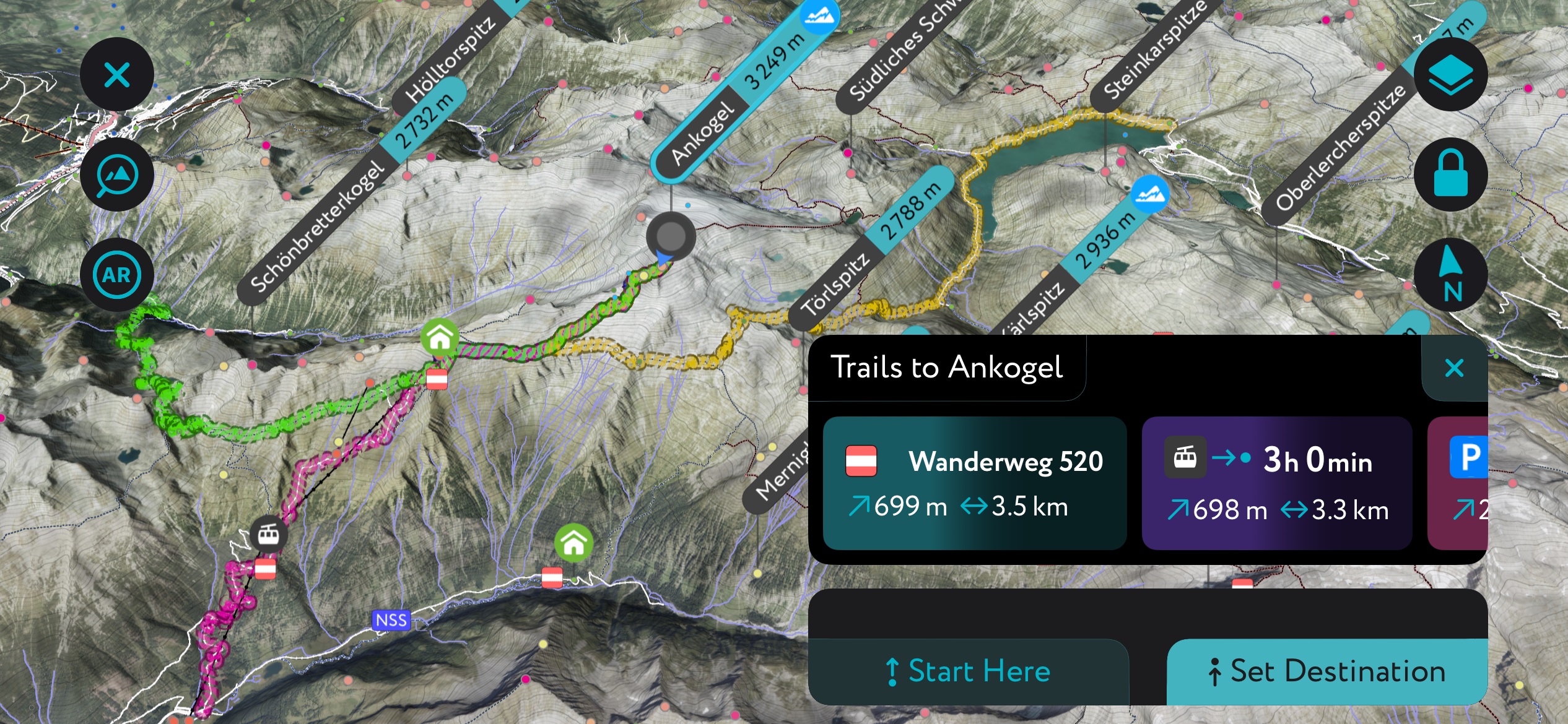
Check out Ankogel (3,252 m / 10,659 ft) for a more straightforward three-thousander to climb than Großglockner. Ankogel is Ankogel Group's namesake and its second-highest summit after the "Tauern Queen," Hochalmspitze (3,360 m / 11,020 ft).
Ankogel is an accessible mountain due to the Ankogelbahn cable car from Mallnitz, which takes you 2,631 m (8,631 ft). The hike up Ankogel is short but tricky and would be graded T4 by the Swiss Alpine Club (SAC). On a clear day, the views are far-reaching from the summit, with the Dolomites visible. From the Ankogelbahn station, this out-and-back walk is roughly 3 km (1.8 mi) in length.
Other popular peaks in High Tauern National Park include Hochalmspitze, Hoher Sonnblick (3,106 m / 10,190 ft), and Großer Hafner (3,076 m / 10,092 ft).
Nockberge Biosphere Park (Biosphärenpark Nockberge) is a nature reserve in Upper Carinthia, centering around the Nock Mountains. It was a national park until 2012 and now forms part of the cross-border Salzburger Lungau und Kärntner Nockberge Biosphere Park. The park's highest summit is Kleiner Hafner (3,018 m / 9,902 ft).
One of the park's most popular summits is Königstuhl (2,336 m / 7,664 ft). Located directly on the tripoint between Styria, Salzburg, and Carinthia, Königstuhl is topped with alpine pastures and provides sweeping views of the Gurktal Alps.
You can pick up the trail to Königstuhl from Eisentalhöhe bistro, following the Eisentalhöhe trail. This out-and-back trail is approximately 7 km (4.3 mi) in length.
Another well-trodden summit in Nockberge Biosphere Park is Falkert (2,308 m / 7,572 ft). This challenging route is very popular with rock climbers and involves a difficulty D via ferrata called Falkensteig. You can pick up this trail from Falkertsee. This looped trail is approximately 4 km (2.5 mi) in length.
Other mountains in Nockberge Biosphere Park include Lungauer Kalkspitze (2,471m / 8,107 ft), Glöcknerin (2,433 m / 7,982 ft), and Mallnock (2,226 m / 7,303 ft).
Dobratsch Nature Park is located on Carinthia's southern border, approximately 20 km (12.5 mi) west of Villach. The park centers around the Villacher Alps, part of the Gailtal Alps foothills. The park's highest summit is Dobratsch (2,166 m / 7,106 ft).
Dobratsch Nature Park's proximity to one of Carinthia's second-largest settlements and its various trails for hikers of all abilities make it one of the state's most popular parks.
The hike to Dobratsch's summit is one of the park's most rewarding walks. From the extensive plateau-like summit, you'll be treated to one of the best views of the Carnic Alps, the Karavanks, and the Julian Alps. To the east, you can spot the Drava Valley and several Alpine lakes.
Atop Dobratsch is the Dobratsch Gipfelhaus (2,143 m / 7,030 ft), a summit hut offering traditional Austrian cuisine with breathtaking views. You can reach the summit of Dobratsch by following the Dobratsch Gipfelweg from the parking area at Aussichtspunkt Rosstratte scenic lookout. This out-and-back trail is approximately 9 km (5.5 mi) in length.
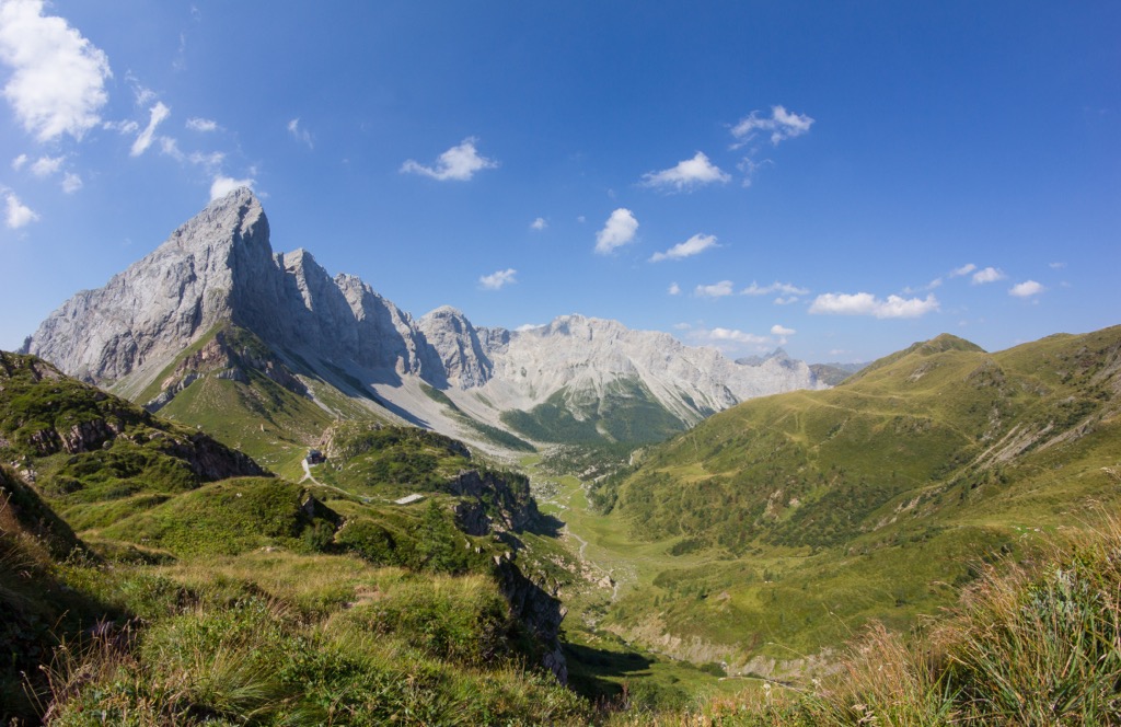
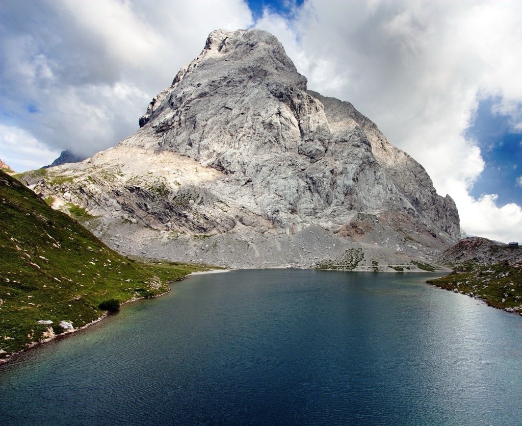
The Carnic Alps are a part of the Southern Limestone Alps, forming a natural border between the Austrian states of Carinthia and East Tyrol and Friuli Venezia Giulia in northeastern Italy.
Many of the Carnic Alps' highest summits straddle the Austria-Italy border, including Hohe Warte (Monte Cogliàns) (2,780 m / 9,121 ft). The Carnic Alps' highest summit, Hohe Warte, and the surrounding group are renowned for their beauty due to their jagged limestone summits.
At Hohe Warte's western foot is Wolayerseehütte (1,960 m / 6,430 ft), a lakeside mountain hut that sleeps over 60 people and makes an excellent starting point for many of the main Carnic Ridge's best tours.
It's possible to climb Hohe Warte from the Wolayerseehütte initially following the marked route to the Valentintörl mountain pass (2,137 m / 7,014 ft). The walk is challenging with a UIAA-II-rated climb that's very exposed and relatively straightforward via ferrata.
The route is marked the whole way to Hohe Warte's summit. It's safest to descend from Hohe Warte via the Italian standard route to the south. It takes around 3 hours to reach Hohe Warte's summit from Wolayerseehütte.
Other notable summits in the Carnic Alps include Kellerspitzen (Creta della Chianevate) (2,769 m / 9,084 m), Große Kinigat (Monte Cavallino) (2,689 m / 8,822 ft), and Trogkofel (Creta di Aip) (2,280 m / 7,480 ft).
The Karavanks, also called the Karawanks or Karavankas, are one of the longest mountain chains in Europe, running from east to west for 120 km (75 mi) through Slovenia and southern Austria. Many of the Karavanks' most popular and highest mountains sit on the Austria-Slovenia border.
Hochstuhl (Stol) (2,236 m / 7,336 ft) is the highest mountain in the Karavanks and is a hugely popular spot for mountain climbers. Its steep 500 m (1,640 ft) high north face can be climbed by via ferrata.
Alternatively, you can scale Hochstuhl from the Austrian side of the border via the Klagenfurter Hütte (1,663 m / 5,459 ft). This walk still poses dangers despite not involving a via ferrata, so proceed with caution. Hochstuhl's summit provides one of the best views of the Karavanks and the Drava Valley to the north.
You can pick up this trail from the Stouhütte parking area in Bärental. This looped trail is approximately 9 mi (14.5 km) in length.
Other popular mountains in the Karavanks include Wertatscha (Vrtača) (2,180 m / 7,152 ft), Mittagskogel (Kepa) (2,145 m / 7,037 ft), and Kahlkogel (Golica) (1,835 m / 6,017 ft).
Situated in the Spittal an der Drau district, Weißensee Nature Park (Naturpark Weißensee) consists of the famous lake resort, Weißensee, surrounded by the Gailtal Alps. The park encompasses an area of approximately 76 sq km (29 sq mi) with over 200 km (124 sq mi) of hiking trails.
Weißensee Nature Park's family-friendly hiking trails lead gently up into the Gailtal Alps and are ideal if you want to take a break from Carinthia's more difficult hiking areas.
One of the best hikes in Weißensee Nature Park is the "3-Täler-Blick" circular hiking trail. This route leads near the Naggler Alm (1,324 m / 4,343 ft), a mountain hut and restaurant. The trail meanders through the surrounding countryside, providing fantastic views of the three nearby valleys and Weißensee.
You can pick up this trail from the Weißensee Bergbahn station. This looped trail is approximately 5.3 km (3.3 mi) in length.
Carinthia is popular with tourists, with many lakeside alpine cities, towns, and villages from which to plan the perfect hiking adventures.
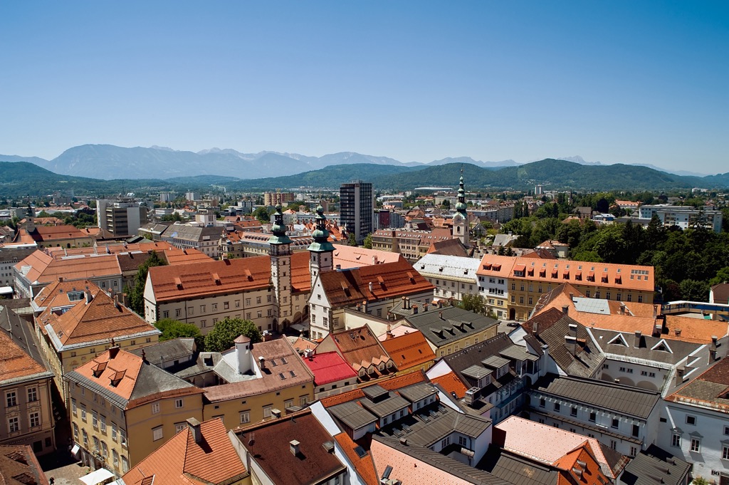
Klagenfurt, officially Klagenfurt am Wörthersee, is Carinthia's capital and largest city and is located just north of the Karavanks in southeastern Carinthia. With a population of over 105,000 people, it's Austria's sixth-largest city.
The University of Klagenfurt and the Carinthia University of Applied Sciences are in Klagenfurt, making it a significant university city. It rests on the eastern edge of Wörthersee, Carinthia's largest lake, and a major tourist destination. Attractions worth visiting in Klagenfurt include Minimundus, the State Museum for Carinthia, and Kindwurm Fountain.
Klagenfurt Airport (Flughafen Klagenfurt), Caritnhia's main international airport, is located 2 km (1.2 mi) north of central Klagenfurt.
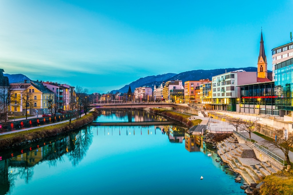
Villach is the seventh-largest city in Austria, with a population of over 61,000 people. The city sits on the Drava River, approximately 40 km (25 mi) west of Klagenfurt.
Villach is well known for its week-long Villacher Kirchtag festival. It's Austria's largest traditional summer festival, running since 1936. Dobratsch Nature Park is 20 km (12.5 mi) west of Villach. Top attractions in Villach include the Museum of the City of Villach (Museum De Stadt Villach), Atrio Villach, and Villach-St. Jakob.
Klagenfurt Airport is the closest airport to Villach, 40 km (25 mi) to the east.
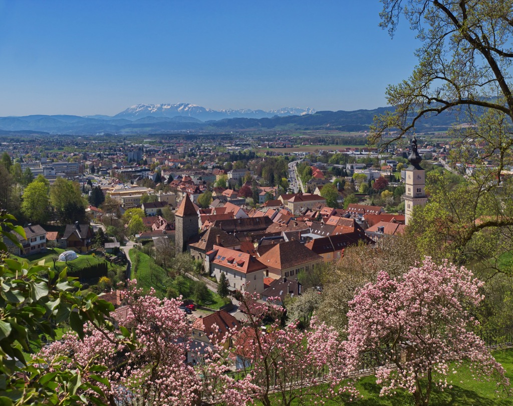
Wolfsberg is the third-largest settlement in Carinthia and the capital of the Wolfsberg District, the state's easternmost district. It has a population of over 25,000 people.
Wolfsberg is a popular destination for skiers, with Koralpe ski resort less than 20 km (12.5 mi) to the northeast. You'll also find a couple of popular mountains to climb near Wolfsberg, like Ladinger Spitz (2,079 m / 6,821 ft) in the Saualpe mountains.
Located 60 km (37 mi) to the southwest, Klagenfurt Airport is the nearest airport to Wolfsberg.
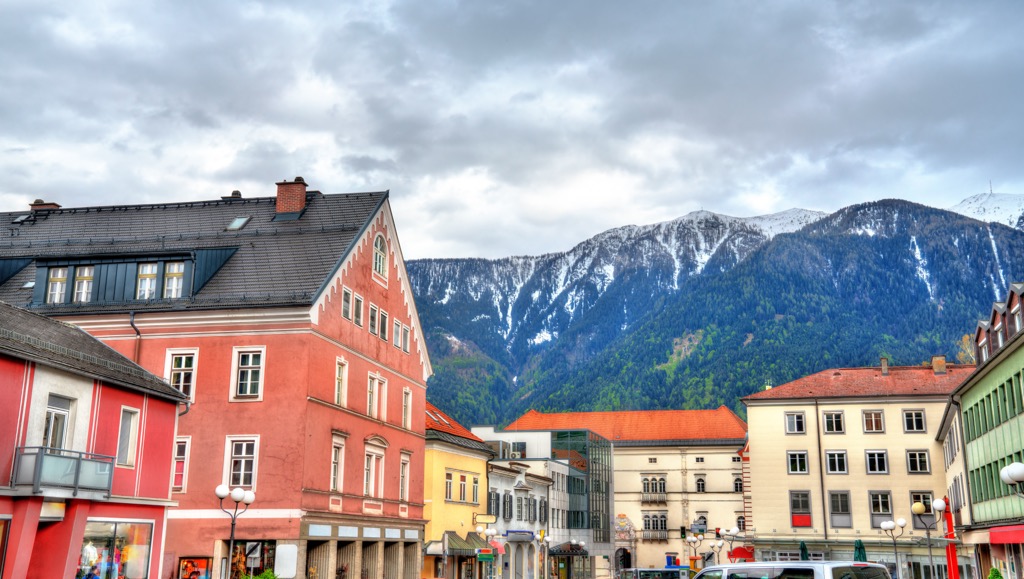
Spittal an der Drau is the capital of Austria's second-largest district of the same name, located in western Carinthia. The town sits on the Drava River on the southern slopes of the Gurktal Alps. Spittal an der Drau has a population of over 15,000 people.
Spittal an der Drau is adjacent to Millstättersee and the town of Millstatt, both of which are popular tourist destinations. Spittal an der Drau is an excellent base to explore Nockberge Biosphere Park, which is less than 40 km (22 mi) to the northeast.
Spittal an der Drau's nearest airport is Klagenfurt Airport, 65 km (40 mi) to the east.


Yes. Carinthia has 2,459 named mountains. The highest is Großglockner at 3,798 m.
The highest mountain in Carinthia is Großglockner, at 3,798 m.
Carinthia has 2,459 named mountains.


