
Scan the QR code and open PeakVisor on your phone
Friuli Venezia Giulia is home to 2,074 named mountains. The highest is Monte Cogliàns / Hohe Warte at 2,780 m.
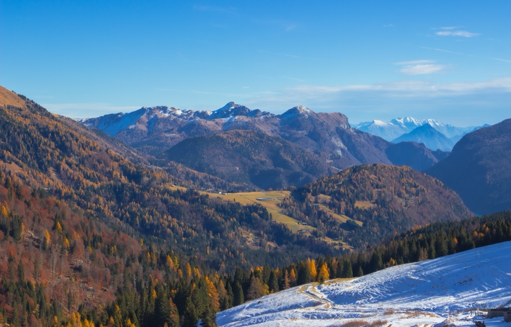
Friuli-Venezia Giulia is the fifth-smallest of Italy's 20 regions, covering an area of 7,924 sq km (3,059 sq mi). Friuli-Venezia Giulia's mix of coastal plains, rolling hills, and Alpine landscapes make it an excellent destination for hikers.
There are 2074 named mountains in Friuli-Venezia Giulia. Monte Cogliàns / Hohe Warte (2,781 m / 9,124 ft) is the highest point. The most prominent mountain is Col Nudo (2,471 m / 8,106 ft).
Friuli-Venezia Giulia is nestled in Italy's northeastern corner, bordered by Slovenia to the east and Austria to the north. Monte Forno (1,508 m / 4,948 ft) is the tri-point between the three countries. The Italian region of Veneto borders Friuli-Venezia Giulia to the west. Friuli-Venezia Giulia has approximately 111 km (68 miles) of coastline along the Adriatic Sea to the south.
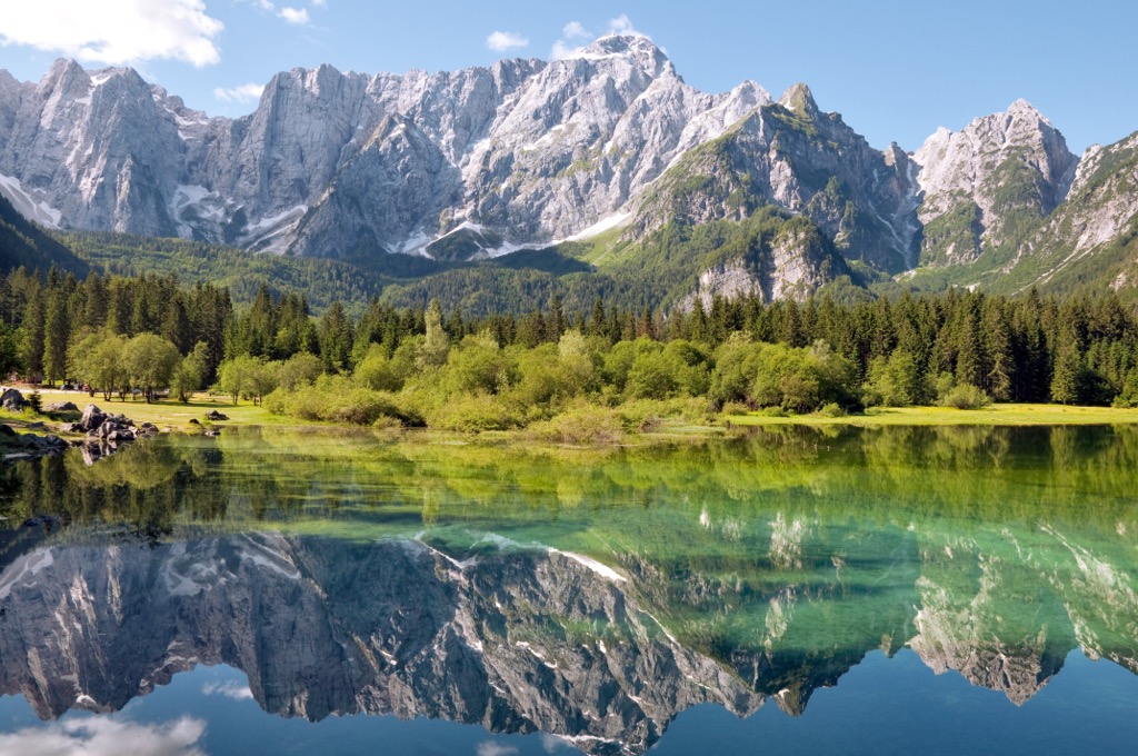
Friuli-Venezia Giulia's location in the Alps makes it one of Italy's most mountainous regions. Approximately 42.5% of the region's landscape is Alpine mountains.
Friuli-Venezia Giulia is a combination of two historical regions, each with its own unique culture. Friuli includes the provinces of Pordenone, Udine, and partly Gorizia and encompasses most of Friuli-Venezia Giulia. In the southeastern corner is Venezia Giulia, which includes Trieste and part of Gorizia.
Friuli-Venezia Giulia's provinces aren't technically provinces and are called "regional decentralization entities." Friuli-Venezia Giulia is one of only five autonomous regions in Italy with a special statute.
Pordenone is Friuli-Venezia Giulia's westernmost province, covering an area of roughly 2,275 sq km (878 sq mi). Its capital is Pordenone.
Pordenone's landscape consists of valleys separated by several mountain ranges. To the north are the Carnic Prealps and the Friulian Dolomites, with the Venetian Prealps on Veneto's border. Notable mountain valleys include Val d'Arzino, Val Vajont, and Val Zemola.
The Mauria Pass on Pordenone's border with Veneto is the source of the 178 km (111 mi) long Tagliamento, one of Friuli-Venezia Giulia's most important rivers.
Friulian Dolomites Natural Park (Parco naturale regionale delle Dolomiti Friulane), is located in western Pordenone.
Udine is Friuli-Venezia Giulia's largest province, encompassing an area of around 4,969 sq km (1,918 sq mi) across the province's central and eastern regions. Its capital is Udine, Friuli-Venezia Giulia's second-largest city.
Udine is defined by the Tagliamento River, which meanders down the province's spine towards the Adriatic Sea. Southern and central Udine is defined by the heavily populated capital area and the Lower Friulana floodplains.
In northwestern Udine in the Alto Friuli is the historical Alpine region of Carnia, home to a large part of the Italian Carnic Alps. Many of Friuli-Venezia Giulia's highest mountains are in Carnia, including Monte Cogliàns / Hohe Warte. Carnia is home to six primary valleys: Val Tagliamento, Val Degano, Val Pesarina, Valcalda, Val But, and Val Chiarsò.
Northeastern Udine is also mountainous and home to the Tarvisiano - Canal del Ferro. This region's main features are the Val Canale and Canal del Ferro, two mountain valleys that separate the Carnic Alps, the Julian Alps, and the Karavanks.
Julian Prealps Natural Park (Parco Naturale Regionale delle Prealpi Giulie) is located near the Slovenian border in northeastern Udine. Friuli-Venezia Giulia's largest natural lake, Lago di Cavazzo, is in Udine and has a surface of 1.74 sq km (0.67 sq mi).
Gorizia (Gurize) is a provincial area in southeastern Friuli-Venezia Giulia between the provinces of Udine and Trieste. It covers an area of around 467 sq km (180 sq mi), and its capital is Gorizia.
It's a partly coastal province that stretches from the Adriatic Sea to the Slovenian border. Around 11% of Gorizia's population is ethnically Slovenian.
One of Gorizia's defining features is the Isonzo River, arguably Friuli-Venezia Giulia's second most important river. It flows for 43 km (27 mi) through Italy, entering the country from Slovenia near Gorizia city.
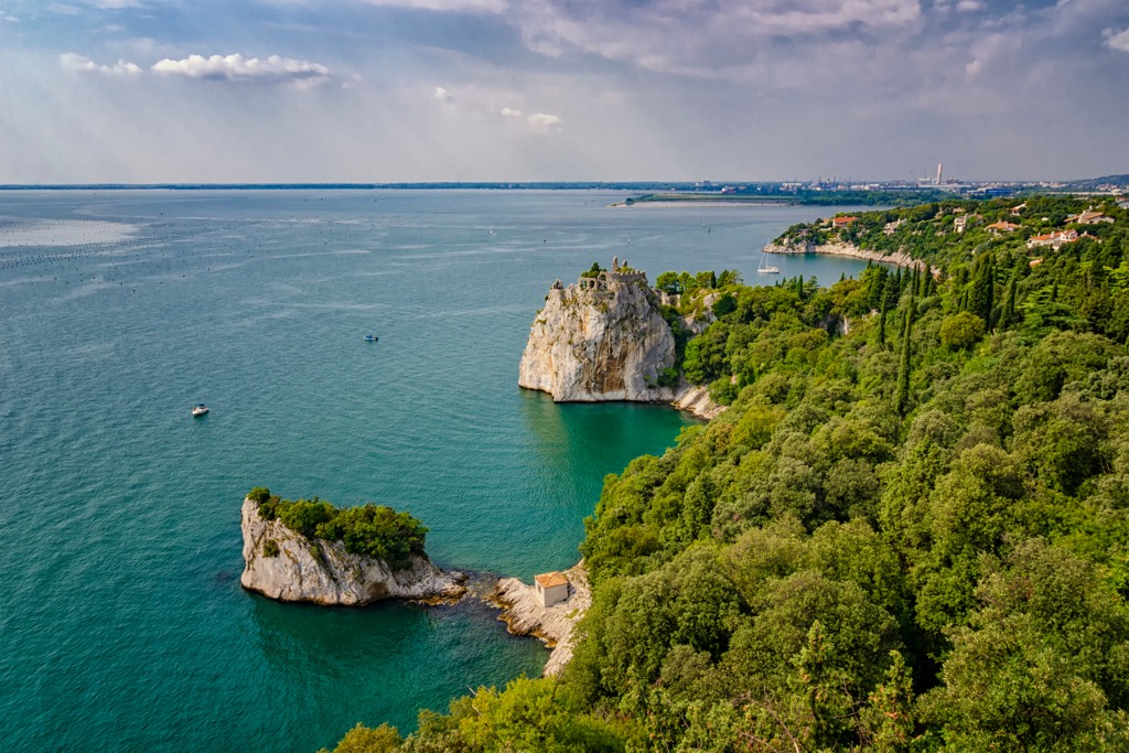
Most of Gorizia's landscape is coastal plains. Venezia Giulia's karst landscape means sinkholes and cave systems are common in the area.
Trieste is the smallest and most southern province of Friuli-Venezia Giulia, covering an area of approximately 212 sq km (82 sq mi). The city of Trieste is Friuli-Venezia Giulia's capital.
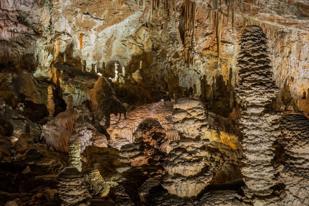
Trieste snuggly borders Slovenia and overlooks the Gulf of Trieste. The landscape of Trieste is a karstic plateau with many caves and sinkholes, including Grotta Gigante, a cave that holds the record for the world's largest natural room at 114 m (374 ft) high and 280 m (918 ft) long.
Much of Friuli-Venezia Giulia's geology is related to the Alps, which cover nearly half of the region. The Alpine Orogeny, an ongoing mountain-building event, created the Alps during the current Cenozoic era over 60 million years ago.
The African, Arabian, and Indian plates colliding with the Eurasian Plate caused the Alpine Orogeny. Convergent movements between these plates helped build the Alps and many other mountain ranges worldwide, including the Himalayas, the Pyrenees, and the Carpathians.
Most of the mountains in Friuli-Venezia Giulia are part of the Southern Limestone Alps at the western edge of the Eastern Alps. As their name suggests, these mountains are made primarily from limestone. Dolomite, marl, and sandstone are also present. Much of southern Friuli-Venezia Giulia's landscape is karstic due to the region's limestone geology.
Friuli is situated on a fault line and has been deemed at moderate to high risk of earthquakes. One famous recent earthquake was the 1976 Friuli earthquake, a 6.5 magnitude earthquake considered the fifth worst seismic event in Italy's 20th-century history.
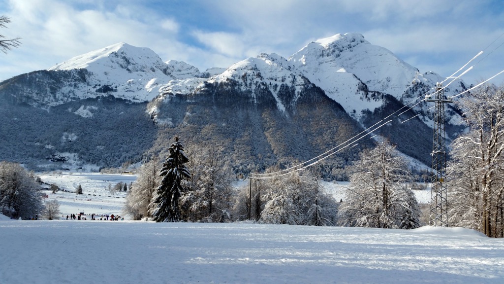
Friuli-Venezia Giulia boasts numerous high Alpine summits, many exceeding 2,700 m (8,858 ft) in elevation. Aside from the highest summit in the Carnic Alps, Monte Cogliàns / Hohe Warte, notable mountains in Friuli-Venezia Giulia include Creta della Chianevate / Kellerspitzen (2,774 m / 9,101 ft) Jôf di Montasio (2,752 m / 9,029 ft), and Cima dei Preti (2,706 m / 8,881 ft).
From limestone summits to Mediterranean coastal plains, Friuli-Venezia Giulia features environments that can support a wide variety of wildlife.
Common mammals often seen in Friuli-Venezia Giulia's Alpine areas include chamois, ibex, stoats, and marmots. Away from the mountains across Friuli-Venezia Giulia's plains and hills, mammals such as hares, wild boars, roe deer, and foxes are more common.
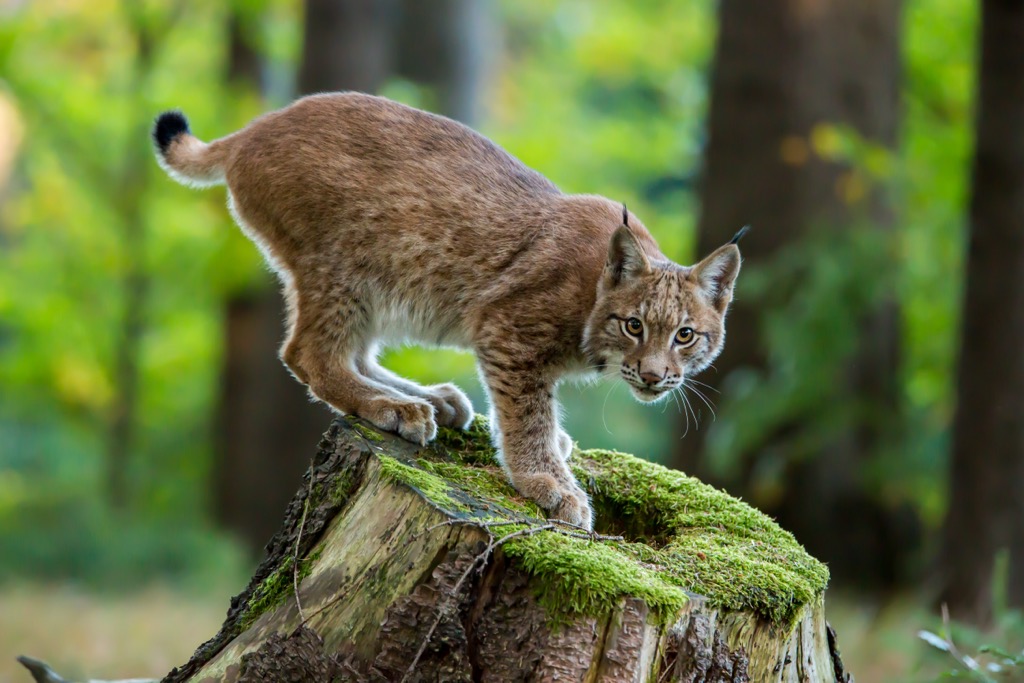
Several mammals that went extinct from Friuli-Venezia Giulia have been successfully reintroduced from neighboring Slovenia, including brown bears and European lynxes. Golden jackals are proliferating in Friuli-Venezia Giulia and are sometimes seen at low altitudes in the Julian Alps.
Many birds of prey, including common buzzards, golden eagles, peregrine falcons, and short-toed owls, can be spotted hunting high over Friuli-Venezia Giulia's Alpine slopes. Other notable bird species in mountainous areas include capercaillies, black grouse, rock partridges, and black woodpeckers.
In southern Friuli-Venezia Giulia, water-faring bird species like widgeons, gray herons, little egrets, and teals thrive in flatter areas with lagoons.
There are several venomous snake species native to Friuli-Venezia Giulia, the most dangerous of which is the horned viper, followed by the relatively common adder. Two of Friuli-Venezia Giulia's most famous amphibian species are endemic to the Alpine arc: the Alpine newt and the Alpine salamander.
Common fish species that inhabit Friuli-Venezia Giulia's streams and rivers include trout, barbel, and tench.
Human intervention, especially between the 15th and 18th centuries, changed much of southern Friuli-Venezia Giulia's flora. This widespread deforestation mainly affected the coastal and central plains, with the hilly and mountainous areas mostly untouched.
There are roughly 3,000 plant species in Friuli-Venezia Giulia, with populations differing from region to region. Southern coastal lagoons are mostly shrubland interspersed with pine forests. This landscape is home to one of Friuli-Venezia Giulia's rarest plants, the Venetian apocynum.
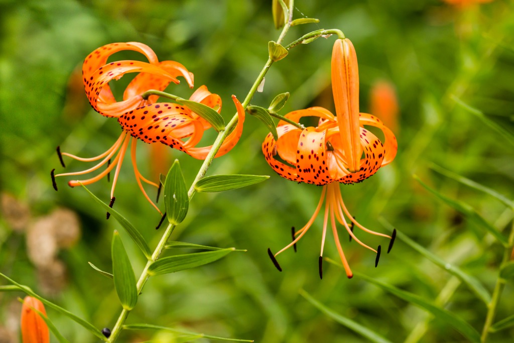
Friuli-Venezia Giulia's coastal plains are more heavily wooded, with forests consisting of ash trees, poplars, and hornbeams. Trieste's valleys, such as Val Rosandra, are also wooded and home to vibrant wildflowers like turban lilies, Grecian foxgloves, and flat sea holly.
Heading north into the Prealps and Alps, the floral landscape changes significantly. Wooded areas in the Prealps are made up of oaks and birches, with the occasional lime tree, elm tree, and maple. Larches and firs dominate true Alpine forests in this region.
Higher up between 1,700 m (5,577 ft) and 1,800 m (5,905 ft), forests change and are characterized mainly by alders and mountain scrub. Notable endemic plant species in Friuli-Venezia Giulia include Arenaria huteri, Karawanken gentian, wulfenia, and Daphne blagayana.
Since the mid-19th century, there has been a fierce debate between Italian, Austrian, and German alpinists on which summit is the highest in the Carnic Alps: Creta della Chianevate / Kellerspitzen or Monte Cogliàns / Hohe Warte.
On the Austrian side, Paul Grohmann, Fritz Frech, and Georg Geyer believed Creta della Chianevate to be the highest of the two. Across the border, Giovanni Marinelli and Arturo Ferrucci of the Italian Alpine Club (Club Alpino Italiano) believed Monte Cogliàns to be higher.
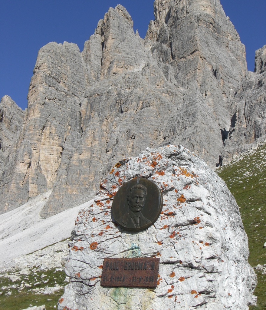
While the Italians were right about Monte Cogliàns being taller by around 6 m (19.5 ft), an Austrian was the first person to reach the summit of both mountains. Renowned geologist Paul Grohmann was the first to reach the summit of Monte Cogliàns on September 30, 1865.
Grohmann was also part of an expedition that was the first to reach the lower West Top of Creta della Chianevate on 15 July 1868, but a storm prevented them from reaching the true summit. It wasn't until almost exactly a decade later that Giovanni Hocke and Adam Riebler managed to summit the true East Top of Creta della Chianevate.
Jôf di Montasio, the second-highest summit in the Julian Alps, was first scaled on 18 August 1877 by Hermann Findenegg and Antonio Brussoferro. Cima dei Preti, the Friulian Dolomites's highest peak, was first reached on 23 September 1874 by Santo Siorpaes and Maurice Holzmann.
Several hiking areas in Friuli-Venezia Giulia are remote, especially the Carnic Prealps, considered one of Central Europe's last true wildernesses.
Plan your route carefully and check local weather forecasts while hiking in Friuli-Venezia Giulia. Bring plenty of food and water, appropriate hiking gear, and a GPS if needed.
Alternatively, use the PeakVisor mobile app to plan your hiking adventure in Friuli-Venezia Giulia. Pick from hundreds of trails, or upload .gpx files if we don't already have a trail on our servers. Discover our detailed 3D maps, check in to our regional registers, and create a truly unforgettable hiking experience!
Julian Prealps Natural Park (Parco Naturale Regionale delle Prealpi Giulie) is a nature park in Udine, covering an area of approximately 100 sq km (38.6 sq mi). It stretches across six municipalities, less than 10 km (6 mi) from the Slovenian border.
Despite the park's name, Julian Prealps Natural Park includes some massifs within the Julian Alps, including the Canin Mountains. Monte Sart (2,324 m / 7,625 ft) is one of the most popular mountains to climb in the Canin Mountains.
Also called Žrd, Monte Sart is partly popular due to its dramatic karstic landscape and view of the surrounding Canin Mountains. The mountain features two summits with a steep ridge connecting the two.
The quickest way to scale Monte Sart is by riding the cable car up to Rifugio Celso Gilberti (1,850 m / 6,070 ft). This trail is considered challenging. The walk follows the CAI 632 trail and passes by Bivacco Elio Marussich (2,040 m / 6,693 ft). This walk is approximately 13.5 km (8.4 mi) in length.
Another excellent option in Julian Prealps Natural Park is Monte Plauris (1,958 m / 6,424 ft), the highest mountain in the Julian Prealps. Also known as Lopič in Slovenian, Monte Plauris is a demanding mountain with stunning panoramas to the north and east.
You'll be able to spot the highest summits in the Carnic and Julian Alps from atop Monte Plauris, including Jôf di Montasio, Monte Sernio (2,187 m / 7,175 ft), and Monte Canin (2,587 m / 8,488 ft).
One of the most popular routes to Monte Plauris is from Stavoli Tugliezzo to the northwest. The path crosses the Piana dai Portolans and passes the Ricovero Elio Franz (1,034 m / 3,392 ft). This out-and-back trail is approximately 11 km (7 mi) in length.
Other popular mountains in Julian Prealps Natural Park include Monte Musi (1,785 m / 5,856 ft), Monte Cadin (1,818 m / 5,965 ft), and Monte Canin.
Friulian Dolomites Natural Park (Parco Naturale Regionale delle Dolomiti Friulane) is the largest natural park in Friuli-Venezia Giulia. It covers an area of 369.5 sq km (142.6 sq mi) across Pordenone and a small part of Udine.
The park centers around the Friulian Dolomites and the upper Tagliamento Valley. Cima dei Preti is the park's highest summit. Consider climbing Monte Raut (2,027 m / 6,650 ft) if you're searching for a challenging trek in Friulian Dolomites Natural Park.
Located at the southern end of the Carnic Prealps, Monte Raut is a challenging hike but one of the easiest in the Monte Raut massif. It's popular due to its summit vistas, with views as far as the Adriatic Sea. Dramatic mountains like Monte Duranno (2,666 m / 8,747 ft) and Cima dei Preti are visible, with the true Dolomites in the backdrop.
One of the most popular routes up Monte Raut is from Forcella di Pala Barzana to the south. This hike would be ranked T3 on the Swiss Hiking Scale (SAC) and follows the marked No. 967 trail. This out-and-back trail is approximately 8.5 km (5.3 mi) in length.
Monte Toc (1,920 m / 6,302 ft) is another famous and accessible mountain in Friulian Dolomites Natural Park. It's known locally as The Walking Mountain due to its many landslides over the years, including the tragic 1963 landslide that killed 1,918 people.
One of the most popular ways to climb Monte Toc is from the north, starting at the Col delle Damade near Falesia di Erto. It's a relentless uphill hike to the summit, but it's worth the effort for the stunning views of the surrounding Venetian Prealps and the Vajont Dam. This out-and-back trail is approximately 11 km (6.8 mi) in length.
Other popular mountains in Friulian Dolomites Natural Park include Cima dei Preti, Monte Pramaggiore (2,478 m / 8,130 ft), and Monte Dosaip (2,062 m / 6,765 ft).
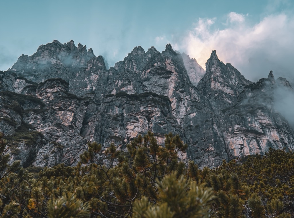
The Carnic Alps (Alpi Carniche) are a part of the Southern Limestone Alps that stretch across Carinthia and Tyrol in Austria and Friuli-Venezia Giulia and Veneto in Italy.
Some of the highest summits in the Carnic Alps are located in Friuli-Venezia Giulia, including Monte Cogliàns / Hohe Warte. Perched on the Italy-Austria border, Monte Cogliàns / Hohe Warte is the range’s highest mountain. Its karstic jagged summits make it one of the most impressive mountain groups in the Alps.
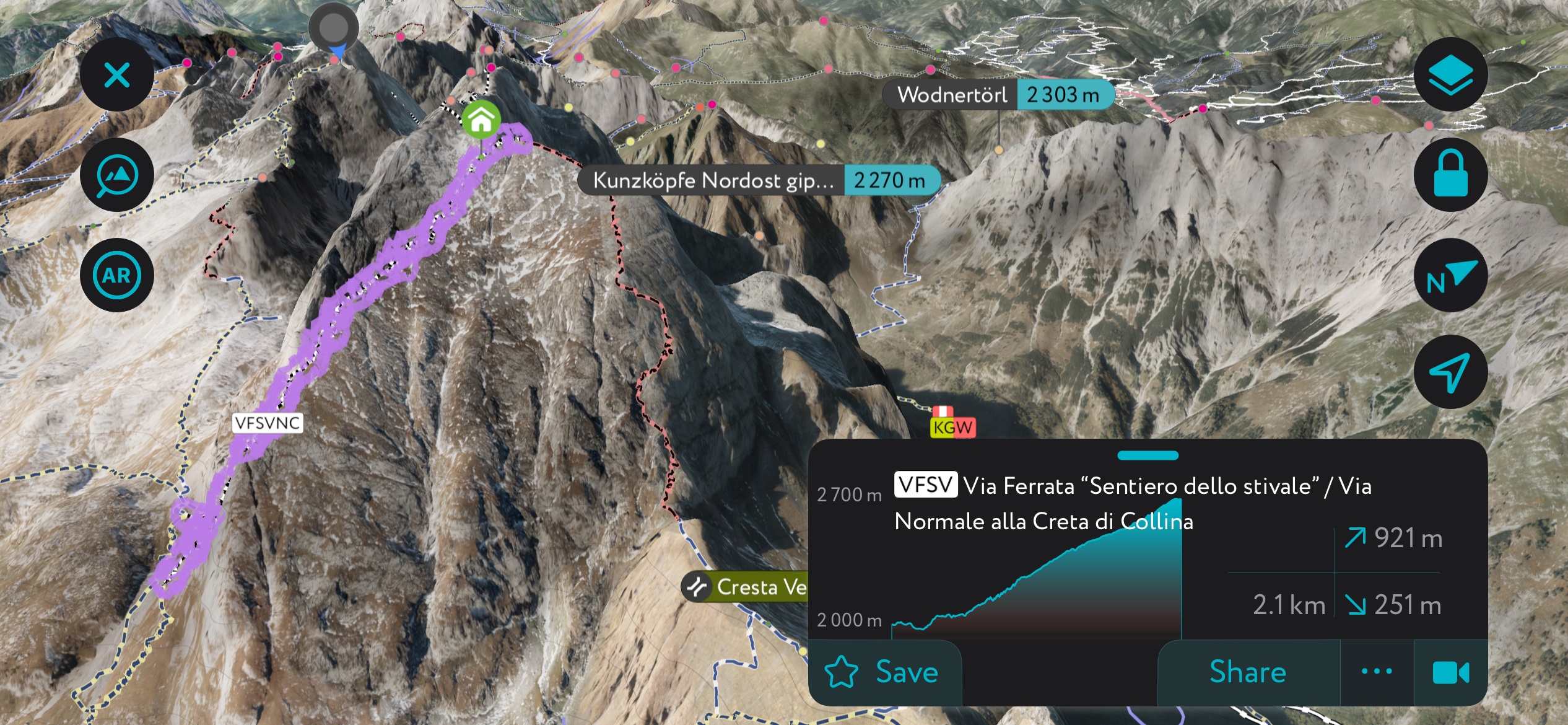
The normal route to Monte Cogliàns / Hohe Warte starts at the Rifugio Giovanni e Olinto Marinelli (2,111 m / 6,925 ft). The route begins by following the No. 143 trail up the southern slopes of Pic Chiadin (2,251 m / 7,385 ft).
The summit of Monte Cogliàns provides incredible panoramas on a clear day, with the High Tauern and the Adriatic Sea visible. This route takes around 9 hours and is only suitable for expert hikers.
You should consider hiking Creta della Chianevate / Kellerspitzen during your adventure in the Carnic Alps. The second-highest peak in the Carnic Alps, Creta della Chianevate, is equally as demanding as nearby Monte Cogliàns.
There is no easy direction from which to scale Creta della Chianevate, with towering, rugged walls on all sides of the mountain. The Italian normal route to Creta della Chianevate is from the southwest, starting at Passo di Monte Croce Carnico / Plöckenpass (1,360 m / 4,461 ft). This hike takes about 5 hours.
Other popular mountains in Friuli-Venezia Giulia's Carnic Alps include Kreuzleithöhe / Punta di Giramondo (2,160 m / 7,086 ft), Monte Bìvera (2,474 m / 8,116 ft), and Monte Cocco (1,941 m / 6,368 ft).
The Venetian Prealps form part of the southeastern Alps, running across parts of Trentino Alto Adige, Veneto, and Friuli-Venezia Giulia. Col Nudo, which rests on Friuli-Venezia Giulia's border with Veneto, is the range's highest mountain.
You can climb Friuli-Venezia Giulia's most prominent mountain, Col Nudo, starting from Pieve d'Alpago in Veneto. Col Nudo is considered a challenging climb that is only suitable for expert hikers.
The summit provides one of the best views of the Dolomites in Friuli-Venezia Giulia, with uninterrupted views of the summits around Val di Zoldo and Cortina d'Ampezzo. This out-and-back trail is approximately 12.5 km (7.7 mi) in length.
Additionally, you'll find some famous mountains worth visiting around the Piancavallo ski resort in Aviano.
One of the best trail loops near Piancavallo leads to the Casera del Medico hut, skirting the western slopes of Monte Caseratte (1,266 m / 4,154 ft). It's a straightforward hike that affords beautiful views of Aviano. You can pick up this trail from the Pacrheggio Rampy car park in Piancavallo. This looped walk is approximately 9 km (5.6 mi) in length.
Or, consider hiking up Cimon del Cavallo (2,251 m / 7,385 ft) for a more demanding adventure. Cimon del Cavallo is the highest summit encircling Piancavallo, with some far-reaching views. On a clear day, it's possible to see the Učka Mountains in Croatia above the Adriatic Sea and from Monte Raut to Monte Ressetum (2,067 m / 6,781 ft) in the Carnic Prealps.
You can reach Cimon del Cavallo by following the No. 924 trail from Piancavallo to Val Sughet. This looped hike is approximately 7 km (4.3 mi) in length.
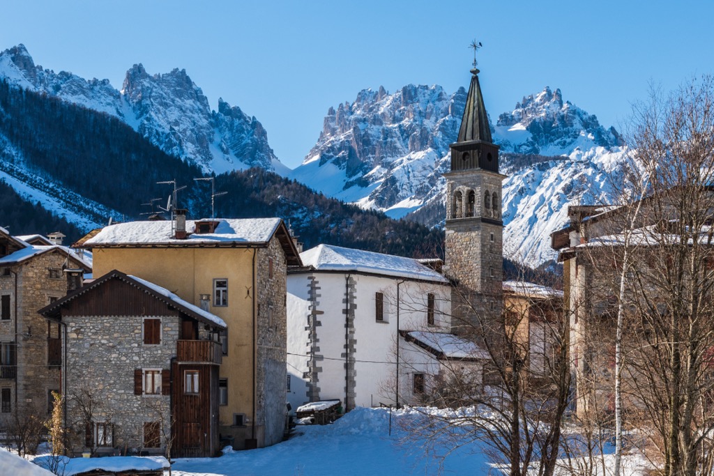
Friuli-Venezia Giulia's position on the Slovenian and Austrian border means its cities and towns are rich in culture and history, unlike elsewhere in Italy.
Trieste is Friuli-Venezia Giulia's largest and capital city. It's one of northern Italy's main sea ports, stretching across a small strip of territory between Slovenia and the Gulf of Trieste. It has an urban population of over 230,000 people.
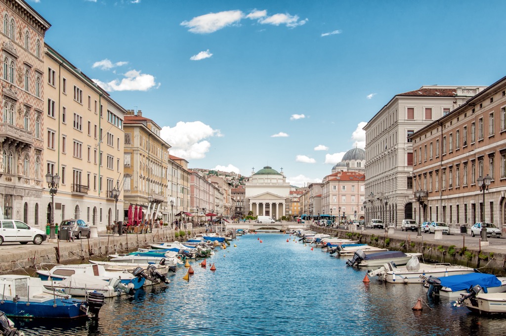
Trieste has a long and important history. It was the Habsburg Empire's main seaport in the 19th century and the fourth-largest city in the Austro-Hungarian Empire. As a result, it's home to many impressive historical sites such as Castello di Miramare, Cattedrale di San Giusto Martire, and the Roman Theatre of Trieste.
Val Rosandra Natural Reserve (Riserva Naturale della Val Rosandra) and Monte Lanaro Natural Reserve (Riserva Naturale Regionale del Monte Lanaro) are within 20 km (12.5 mi) of Trieste.
Friuli Venezia Giulia's main international airport, Trieste Airport, is approximately 45 km (28 mi) from Trieste city center.
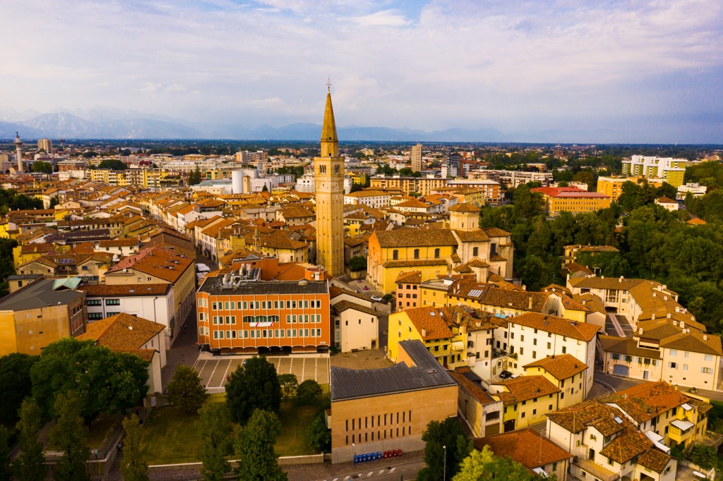
Udine is the historical capital of Friuli and Friuli-Venezia Giulia's third-largest city, with a population of over 100,000 people. It’s a historic city, having been inhabited since the Neolithic age.
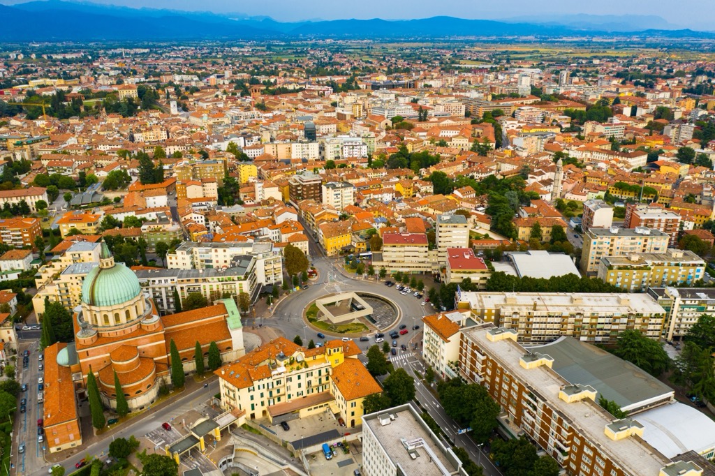
Udine is located just south of the Julian Prealps, less than 35 km (21 mi) south of Julian Prealps Natural Park, and 85 km (53 mi) south of the Carnic Alps. Udine main attractions include Piazza Giacomo Matteotti and Castello di Udine.
The nearest international airport to Udine is Trieste Airport, which is located 45 km (28 mi) to the southeast.
Pordenone is the capital of the Pordenone province and the third-largest city in Friuli-Venezia Giulia, with over 51,000 people.
Pordenone sits at the foot of the Venetian Prealps, approximately 30 km (18.6 mi) from Piancavallo and 50 km (31 mi) from Friulian Dolomites Natural Park. Pordenone's main attractions include Parco dei Laghetti di Rorai and Parco del Castello di Torre.
Venice Marco Polo Airport is the nearest international airport to Pordenone, located 75 km (46.5 mi) to the southwest.
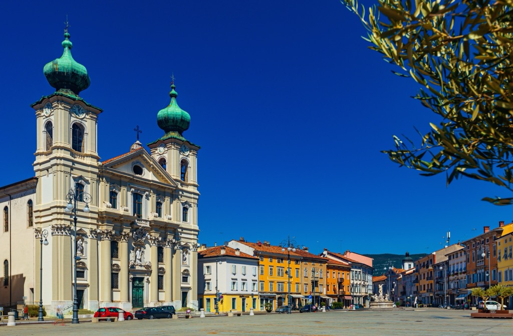
Gorizia is the capital of the Gorizia province and the fourth-largest city in Friuli-Venezia Giulia, with over 37,000 people.
Gorizia is on the Slovenian border, connected to the city of Nova Gorica. Its location on the border allows one to visit Slovenian hiking areas like Panovec Forest (Gozd Panovec) and Skalnica. Main attractions in Gorizia include the 11th-century Castello di Gorizia and Chiesa di Sant'Ignazio.
The nearest international airport to Gorizia is Trieste Airport, which is located less than 30 km (18.5 mi) to the southwest.
Monfalcone is a town in Gorizia and the fifth-largest settlement in Friuli-Venezia Giulia, with a population of over 29,000. It's a coastal town overlooking the Gulf of Trieste.
Monfalcone is 20 km (12.5 mi) from Gorizia and 40 km (25 mi) from Trieste. Natural Reserve of Doberdò Lakes and Pietrarossa (Riserva Naturale Laghi di Doberdò e Pietrarossa) and Foce dell'Isonzo Natural Reserve (Riserva Naturale Regionale della Foce dell'Isonzo Isola della Cona) are within 20 km (12.5 mi) of Monfalcone.
Monfalcone is the nearest town to Trieste Airport, which is located less than 6 km (3.5 mi) to the northwest.


Yes. Friuli Venezia Giulia has 2,074 named mountains. The highest is Monte Cogliàns / Hohe Warte at 2,780 m.
The highest mountain in Friuli Venezia Giulia is Monte Cogliàns / Hohe Warte, at 2,780 m.
Friuli Venezia Giulia has 2,074 named mountains.


