
Scan the QR code and open PeakVisor on your phone
The Carnic and Gailtal Alps include 1,902 named peaks. The highest is Monte Cogliàns / Hohe Warte at 2,780 m. Other notable peaks include Große Sandspitze, Creta della Chianevate / Kellerspitzen and Antecima Est.
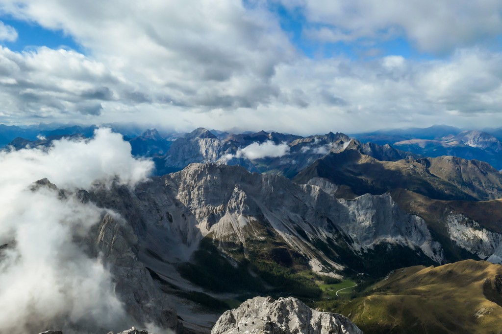
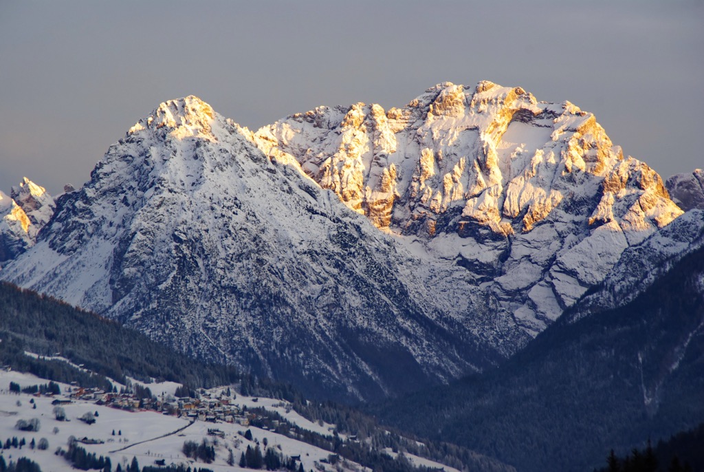
The Carnic and Gailtal Alps are one of the large mountain ranges in the Eastern Alps, located between Italy and Austria. The main feature of the range is its highest peak, Monte Cogliàns / Hohe Warte (2,780 m / 9,121 ft). The most prominent mountain, which is just slightly short of the Ultra-peak (1,427 m / 4,681 ft of prominence) with the mysterious name of Cima dei Preti ("Priests' Peak"), is no less famous for being also the highest (2,707 m / 8,881 ft) in the Friulian Dolomites, a part natural UNESCO site. However, the range is full of other interesting features at the junction of geography and landscape, geology, and human history, which makes it a must-hike in this part of the world. In total there are 1902 named mountains in the Carnic and Gailtal Alps.
The name of the mountain range consists of two words meaning the following:
The names of the mountain range in Italian and German are Alpi Carniche e della Gail and Karnische und Gailtaler Alpen, respectively.
Unlike some other mountain ranges in the Alps with relatively simple geography, in the case of the Carnic and Gailtal Alps, it is quite complicated. But I will try to help make sense of it.
The range consists of two large parts, the Carnic Alps and Gailtal Alps:
If we focus on the major cities, the Carnic and Gailtal Alps are the mountains north of Udine, northeast of Belluno and east of Auronzo di Cadore in Italy, and south of Lienz and Mollbrucke, and west of Klagenfurt in Austria.
The main towns within the range are Tolmezzo in the Carnic Alps; and Kotschach, and Hermagor in the Gailtal Alps.
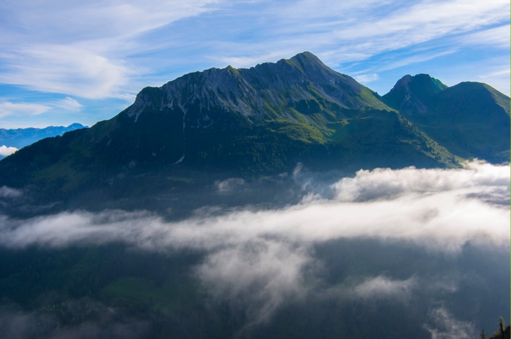
The Carnic and Gailtal Alps are bordered by the following other major ranges of the Alps: the Western Tauern Alps in the north; the Dolomites in the west; the Venetian Prealps in the southwest; the Julian Alps and Prealps, and the Carinthian Slovenian Alps in the southwest; and the Carinthian Styrian Alps in the east. To the south of the range is the Venetian Plain, the eastern part of the larger Padana Plain, which covers all of northern Italy between the Alps and the Apennines.
The easiest and fastest way to get to the Carnic and Gailtal Alps is from Venice via Belluno, and from Udine via the towns of Maniago, San Daniele del Friuli, and Gemona del Friuli, from which you can travel deep into the mountains. By public transport, you need first the Trenitalia.com train and then the Dolomitibus.it in Veneto and Tplfvg.it in Friuli Venezia Giulia.
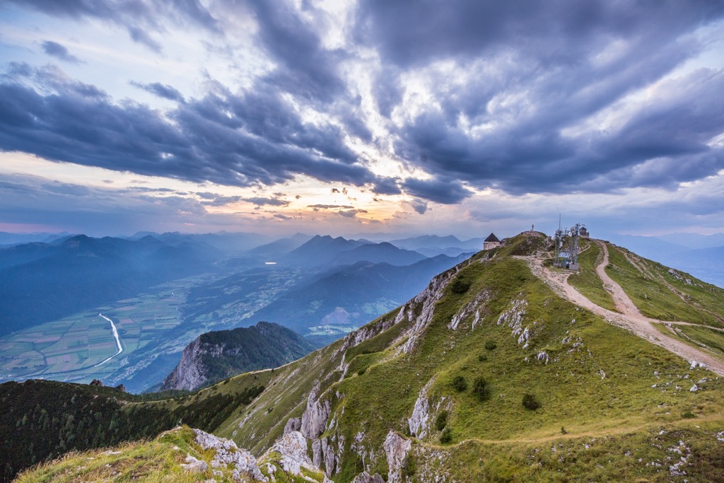
The main thing to know about the geology and landscape of the Carnic and Gailtal Alps is that, like the neighboring and better-known Dolomites to the west, this mountain range is characterized by a predominance of karst topography, starting from the highest peak, Monte Coglians / Hohe Warte.
This means that these mountains also have acquired their current shape (sharp peaks and vertical walls, caves and canyons) by the washout of relatively soft rocks such as limestone, chalk, sandstone, dolomite and others, all present in the mountain range in various volumes.
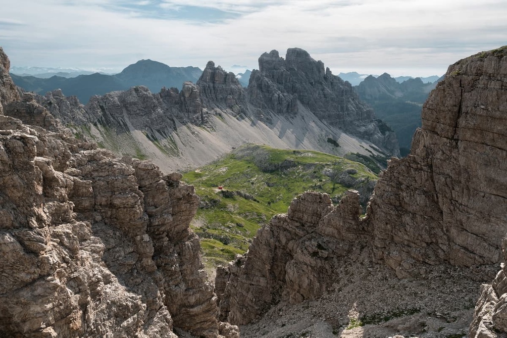
In particular, one of its main subranges, the Friulian Dolomites, is geologically part of the latter, despite its more eastern geographic location from the main central Dolomites groups such as Sella, Tofane, Tre Cime, Pelmo, and many others. This is confirmed by the fact that the range is the fourth of the 9 large mountain groups in the UNESCO classification, made on the basis of geology—the Dolomiti Friulane e d'Oltre Piave (the Dolomites of Friuli and Upper Piave River).
One of the two subgroups of the Gailtal Alps, the Lienz Dolomites, named after the nearest large town, which is not part of the Dolomites either geologically by UNESCO classification, or even geographically, also consists partly of dolomite, otherwise it would not get its name, it is just much less here, it is mostly just solid limestone.
More: there is also a third group of dolomite mountains called Pesarine Dolomites (Dolomiti Pesarine), one of the Carnic Alps subgroups.
But in the Gailtal Alps, there are also harder rocks, such as crystalline, for example.
According to the Italian classification of the Alps, the SOIUSA, together with the surrounding ranges, the Carnic and Gailtal Alps, belong to the Southeastern Alps. Then, the mountain range inside is divided into three main subranges or parts (plus one to those in the name itself), which, in turn, consist of several more groups each with their respective highest peaks:
The Carnic Alps (Alpi Carniche, Karnischer Hauptkamm) is the main ridge of the range, which stretches in a thin band along the border of Italy and Austria. It consists of four main groups:
The Carnic Prealps (Prealpi Carniche, Südliche Karnische Alpen) are more extensive mountains south of the main range, much of which are occupied by the Friulian Dolomites. These mountains consist of the following three groups:
The Gailtal Alps (Alpi della Gail, Gailtaler Alpen also known as Drauzug) is the Austrian part of the mountain range. It consists of two main groups with some more subgroups:
According to the classification of the Eastern Alps by the German-Austrian Alpine Club (AVE), the Carnic and Gailtal Alps are divided into these three separate parts in the Southern Limestone Alps, two of which are called slightly differently: Carnic Main Crest (57a), Southern Carnic Alps (57b)—the Carnic Prealps in the SOUSA, and Gailtal Alps (56).
Another peculiarity of this classification is that the southern part of the Southern Carnic Alps coincides with the eastern part of Venetian Prealps, namely its two subgranges, Belluno Dolomites and Treviso Prealps, from the SOIUSA.

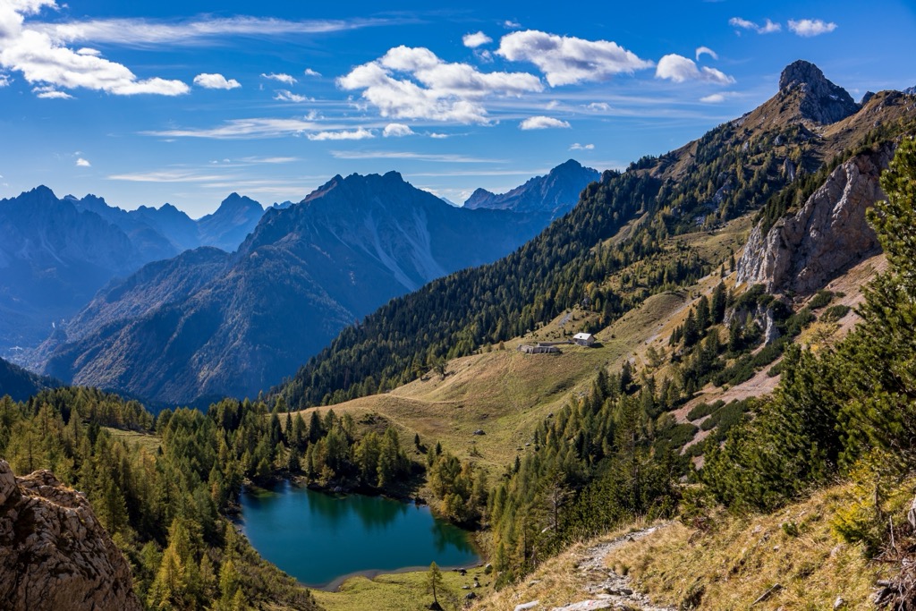
There are three main areas for hiking in the Carnic and Gailtal Alps:

In each of the areas, you will find a variety of hiking trails of different lengths and levels of difficulty.
Friulian Dolomites Nature Park. The main trail in the park is the namesake Friulian Dolomites Ring (Anello Dolomiti Friulane). It takes you around the central and most beautiful part of these mountains. Its length is 38 km (23.6 mi). This hike is also one of the many loop routes in the Dolomites, which also includes the Tre Cime di Lavaredo Loop, Sassolungo Loop, and Pelmo Loop, among others.
The park's territory is also crossed by the Alta Via 6, one in the series of long hiking trails in the Dolomites. It runs between Sappada, Belluno, and Vittorio Veneto, Treviso. The route is 180 km (111.8 mi) long and it is split up into 11 stages.
But, of course, there are also separate routes to some of the park's main peaks. Learn more about them in the guide to the park by following the link.
Alba Valley Nature Reserve. The reserve was created to protect the landscape, flora, and fauna of the Alba River valley in the Eastern Tolmezzo Alps subrange of the Carnic Alps, with which it almost perfectly coincides. In the reserve you can follow the long (but not circular) route Alta Via CAI Moggio. It is named after the nearest village to the west of the park and which refers to the aforementioned trails in the Dolomites. It runs through the reserve from south to north but captures many peaks, most of which require climbing skills and equipment to pass through the sections known as "via normale" (the most simple but still the mountaineering route), as well as of I, II and III levels of difficulty. But you can hike parts of the trail by studying this map on the park’s website and this one on the CAI website.
In the north of the park, there is also a separate circular route Monte Chiavals—Forcella della Vacca—Creta dai Rusei of 15 km (mi). The route is also considered difficult with an elevation gain of more than 1,300 m (ft). Here, too, there are many other trails, many of which lead to rifugio Vualt, the main and the only one in the park, where you can spend the night before going back.
Other small similar ring trails in other parts of the park are Malga Coot—Monte Guarda—Bivacco Costantini, and a trail called “Borgo Cros Rio Serai”.

Lienz Dolomites. Although there are no nature parks in the Gailtal Alps, this section of the range, including its main feature, the Lienz Dolomites, can also be hiked on marked trails. For example, of the variety of routes, I would mention the circular path from the village of Gaimberg just north of Lienz through the mountains of the adjacent High Tauern above the town. It is 8.5 km (5.2 mi) with an elevation gain of 700 m (435 ft). Yes, the trail runs through another range, but it offers great panoramic views of the Lienz Dolomites, so it has the same official name, “View of the Dolomites” .
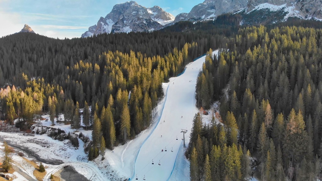
For skiing and snowboarding enthusiasts, there are more than 10 ski resorts in the Carnic and Gailtal Alps, which are located throughout the range.
The two largest ski resorts in the Carnic and Gailtal Alps of the same size are Goldeck–Spittal an der Drau in the Gailtal Alps with more than 25 km (16 mi) of slopes and more than 5 ski lifts, and Zoncolan in the Carnic Alps with more than 23 km (14.2 mi) of slopes and more than 10 ski lifts.
Other major areas for skiing in the Carnic and Gailtal Alps with more than 10 km (6.2 mi) of slopes and more than - ski lifts each include the following in descending order of size:
Check the Carnic and Gailtal Alps ski resorts map on the larger Italy and Austria ski resorts maps in the World Mountain Lifts section of the site. It includes information about open ski lifts / slopes in the Carnic and Gailtal Alps in real-time with opening dates and hours. There are also year-round cable cars, funiculars, cog railways, aerial tramways, and all other types of mountain lifts.
Before or after the hike, visit one of the official hiking centers in the Carnic and Gailtal Alps. The two main ones are located in Belluno and Lienz:
Piero Rossi Cultural Center
Piazza Piloni, 32100, Belluno, Veneto, Italy
+39043727030
centroculturale@dolomitipark.it
Information Office Lienz Dolomites
Mühlgasse, 11, 9900, Lienz, Tyrol, Austria
+4350212400
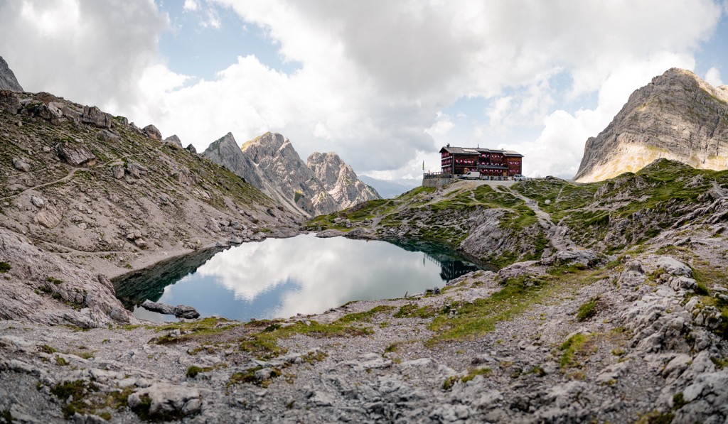
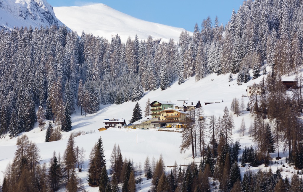
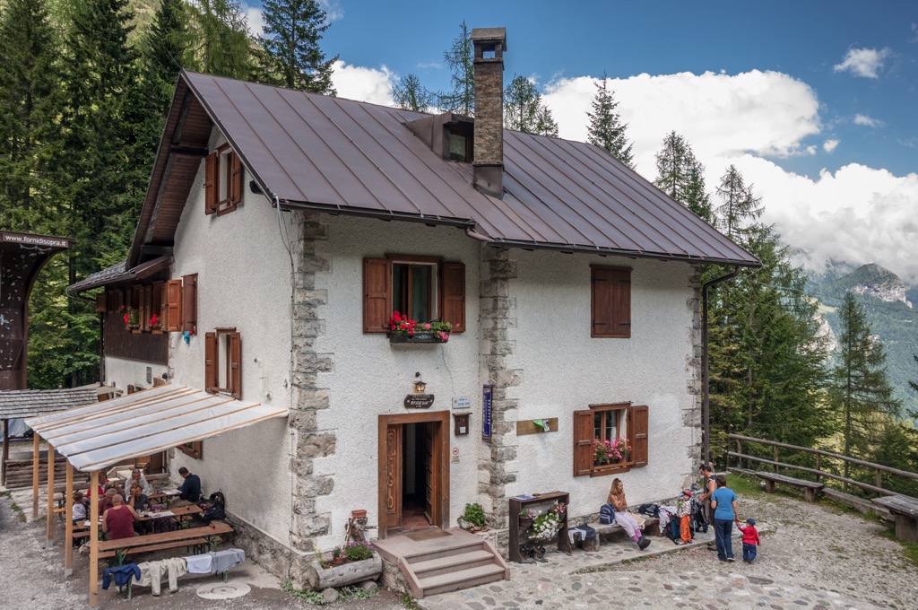
As in other mountain ranges in the Alps, during the hike, you can stay in one of the mountain huts, of which there are many.
The main huts in the Friulian Dolomites, lying on their main circular trail deep in the park are rifugio Pordenone, rifugio Giaf, rifugio Flaiban Pacherino, rifugio Maniago, rifugio Casera Mela, and many others. In the Lienz Dolomites, there are Dolomitenhütte, Gasthaus Kreithof, Karlsbader Hütte, Instein-Hütte, Almhütte Almruhe, Almwellness-Resort Tuffbad, and many others.
Throughout the mountain range, there are also a relatively large number of alpine shelters, for which you do not have to pay to stay, they are always open, even in winter, if you manage to hike the mountains on the snow. In the Alba Valley, for example, there is the bivacco G. Bianchi, Cjasul dal Sior, and others, and in the Lienz Dolomites is ÖTK—Linderhütte Biwak.
To spend the night before and after the hike, you can easily find accommodation in any village in the mountain range. There is literally everything—hotels, campsites, spas, mountain chalets, and more. You can also pitch your tent in specially designated places, usually at the same campings.
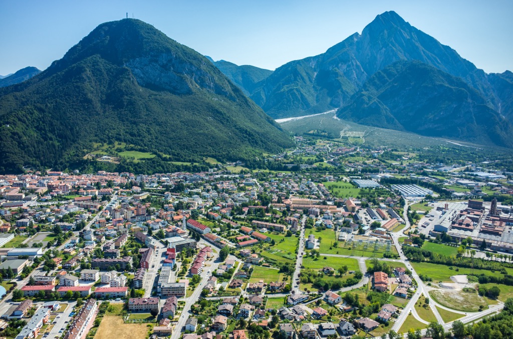
The main cities, towns and resorts on the borders of the mountain range were already clear as we went along, so I will tell you more about Tolmezzo, the main town deep in the mountains.
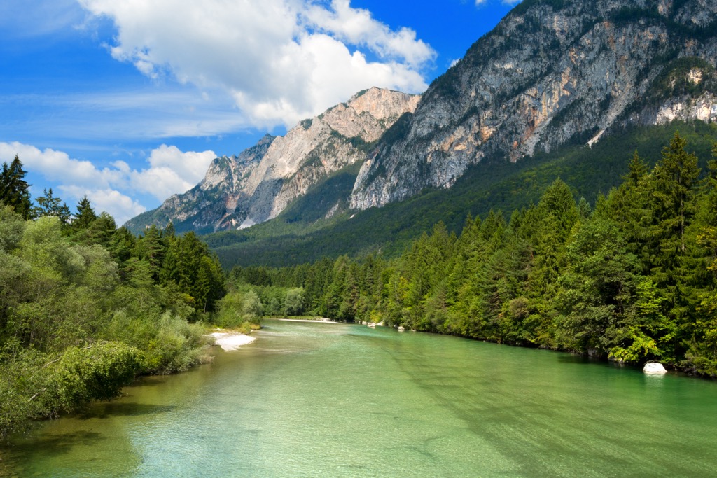
It is a relatively large settlement in the province of Udine in the Friuli Venezia Giulia region with almost 10,000 inhabitants, located at 323 m (1,060 ft) under the Mount Strabut (1,104 m / 3,622 ft) on the Tagliamento River, second most important in the region after Gail. The neighboring and higher Mount Amariana (1,905 m / 6250 ft) is another home peak of the town.
The main architectural and cultural attractions of the Tolmezzo are the Duomo (cathedral) with its high tower, and three palaces of the local noble families of the 18–19th centuries: Palazzo Campeis, Palazzo Linussio, and Palazzo Frisacco. The first one is a must-visit with a folk art museum inside it, the “Museo carnico delle arti popolari ‘Michele Gortani’”. The main church is the Chiesa di Santa Caterina.


The Carnic and Gailtal Alps are part of the Alps.
The highest peak in the Carnic and Gailtal Alps is Monte Cogliàns / Hohe Warte, at 2,780 m.
The Carnic and Gailtal Alps have 1,902 named peaks.


