Get PeakVisor App
Sign In
Search by GPS coordinates
- Latitude
- ° ' ''
- Longitude
- ° ' ''
- Units of Length

Yes
Cancel
❤ Wishlist ×
Choose
Delete
The Carinthian-Slovenian Alps, also known as the Karavanke Alps or simply the Karawanks, are a mountain range in northern Slovenia (and on the border with the state of Carinthia in southern Austria). They form part of the Southern Limestone Alps and have 1100named mountains. The highest and most prominent mountain is Grintovec (2,588 m / 8,392 ft).

Carinthia, known as Koroška in Slovene and Kärnten in German, is a traditional region in northern Slovenia and southern Austria. Slovenian Carinthia is one of the country's smallest regions.
Carinthia is home to the Carinthian-Slovenian Alps, a subrange of the Southern Limestone Alps and, in turn, the greater European Alps.
The range covers approximately 478 sq. km (184.5 sq. mi) and is divided into two sections. The first is the Karawanks, the longest Slovenian mountain range, extending 120 km (74.5 mi) from Trbiž to Slovenj Gradec. Its peaks include Stol (2,236 m / 7,336 ft).
The second section is known as the Kamnik-Savinja Alps, named after the town of Kamnik and the Savinja River. Over two-thirds of the area is forested, with coverage growing. Its rocky peaks exceed 2,500 m (8,202 ft), including Grintovec (2,558 m / 8,392 ft).

The Carinthian-Slovenian Alps comprise layers of limestone formed from sediments deposited by an ancient sea. The range contains sediments from the Paleo-Tethys and Tethys Oceans, a treasure trove of ancient marine fossils.
Tectonic forces gradually pushed this section of crust north, and the Alps formed from the collision of the African and Eurasian plates. Over time, erosion and glaciation have continually reshaped the landscape into the rugged backdrop of today's peaks.
The Kamnik-Savinja Alps lie south of the Karawanks. A small patch of ice below Mount Skuta (2,532 m / 8,307 ft) comprises the easternmost glacier in the Southern Alps. It’s the final remnant of a vast network of thick valley glaciers during the Pleistocene.

The Carinthian-Slovenian Alps are rich in biodiversity. Many rare plants and animals inhabit this corner at the eastern edge of the Alps. Local endemics include the Zois’ bellflower, Kamnik orchid, and Peca meadow oat grass. These species thrive in environments ranging from rock walls to meadows to marshes.
The Eastern Karawanks are crucial for bird species. They are breeding grounds for wood grouse, black grouse, ptarmigan, hazel grouse, Eurasian pygmy owls, boreal owls, woodpeckers, golden eagles, and peregrine falcons.
The region lies in the montane and subalpine zones, and much of it extends above the treeline. Forests are mainly coniferous (76%), and due to thermal inversions, conifers also dominate the valleys. Fir-beech forests are the most common, and spruce is native to the montane and subalpine zones. The forests support a large wildlife population, including deer, roe deer, chamois, and wild boar.

Historically, this region marked the border between the duchies of Carinthia, Styria, and Carniola. The name comes from the medieval Slavic principality of Carantania, whose territory extended from today's Carinthia to the Styrian lands along the Sava River.
As the Carinthian duchy, the region was part of the Habsburg Empire and soon a part of Austria-Hungary. After World War I, southern Carinthia was occupied by the Kingdom of Serbs, Croats, and Slovenes (later Yugoslavia).

During World War II, Nazi Germany annexed the area, and after the end of the war, Yugoslav Partisans took over. This region became part of Yugoslav Slovenia and later independent Slovenia in 1991.
The lead and zinc mines in the Meža Valley, once a key industrial area, closed in the 1990s. Today, TAB, a battery manufacturer, operates in the area, and Metal Ravne, a steel mill, continues to produce alloy steel and machinery components.
Heavy industry has come at a cost for the environment. Slovene Carinthia still faces significant forest damage, with some areas seeing 40% of trees affected by sulfur dioxide emissions from the Šoštanj Power Plant and local iron works. Moreover, many valleys around the range are contaminated by the extensive lead mining.
The Carinthian-Slovenian Alps have seen a greenification in recent years. Five hydroelectric plants now operate on the Drava River. Tourism is a growing industry, with outdoor recreationists heading into the mountains.

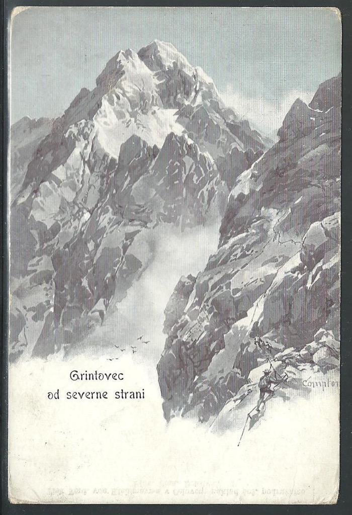
Grintovec is the highest peak of the Kamnik-Savinja Alps, lying above the Ljubljana basin. This hike is a 1,700 m (5,577 ft) climb, doable in one day or with a stay overnight at Cojzova Koča hut. The trail begins on the Kokrško Sedlo saddle. One can also include a circular route descending via the Mlinarsko Sedlo saddle via ferrata sections. The descent offers wild karstic landscapes towards Cojzova Koča.

Češka Koča is a mountain hut at 1,543 m (5,062 ft) in Spodnje Ravni, below the northern face of Mt. Grintovec. Built in 1900 by the Slovene Mountaineering Association, the hut has welcomed hikers for over a century. Reach it from Planšarsko Jezero Lake to the Ancel tourist farm, following marked signs to the cargo cableway station. You’ll need about an hour to make it to the hut.

Stol, also known as Hochstuhl in German, is the highest peak of the Karawanke mountain range. It reaches 2,236 m (7,336 ft) in northwestern Slovenia, near the Austrian border.
Several routes lead to the summit, the most popular one being the one from Valvasorjev Dom mountain hut. Although the Stol trail is not technically challenging, it requires good physical fitness. This 11 km (6.8 mi) route involves an ascent and descent of more than 1,300 m (4,265 ft).
At PeakVisor, we love information. That’s why we write articles like this one.
Check out the PeakVisor app for even more information on thousands of additional hikes, ski tours, and ski resorts across the Alps. In fact, we’ve compiled information on all publicly maintained walking tracks worldwide, formatted onto our 3D maps.

PeakVisor started as a peak identification tool but we’ve evolved into purveyors of the finest 3D maps available. We continue to expand our offerings. You can track your hikes directly on the app, upload pictures for other users, and keep a diary of all your outdoor adventures.
Most recently, the PeakVisor App has included up-to-date weather reports, including snow depths, at any destination. We've also been hard at work adding the details of hundreds of mountain huts, including information on overnight accommodation, dining options, and opening hours. You can also use our Hiking Map on your desktop to create .GPX files for routes to follow later on the app.
Kranj is Slovenia's fourth-largest city, with a population of approximately 37,000. Situated at the confluence of the Sava and Kokra rivers, Kranj is often called the "Gateway to the Slovenian Alps." The city boasts a charming medieval old town with narrow streets, traditional architecture, and notable landmarks like the 16th-century Khislstein Castle and the Church of St. Cantianus.

Ljubljana (pop. 300,000), the charming capital of Slovenia, is known for its old town featuring narrow cobblestone streets, baroque buildings, and the Ljubljana Castle overlooking the city. The Ljubljanica River flows through the heart of the city, lined with lively cafes, restaurants, colorful architecture, and the iconic Dragon Bridge.

Klagenfurt, officially Klagenfurt am Wörthersee, is Carinthia's capital and largest city. It is located in southeastern Carinthia, just north of the Karavanks. With a population of over 105,000, it is Austria's sixth-largest city.
Klagenfurt is a significant university city, home to the University of Klagenfurt and the Carinthia University of Applied Sciences. It is located on the eastern edge of Wörthersee, Carinthia's largest lake and a major tourist destination. Attractions worth visiting include Minimundus, the State Museum for Carinthia, and Kindwurm Fountain.
Klagenfurt is characterized by its Renaissance architecture, such as the iconic Lindwurm Fountain, which depicts a dragon from local legend. The city is surrounded by mountains and is a gateway to hiking, cycling, and water sports in the summer and skiing in the winter.
Klagenfurt Airport (Flughafen Klagenfurt), Carinthia's main international airport, is located 2 km (1.2 mi) north of central Klagenfurt.

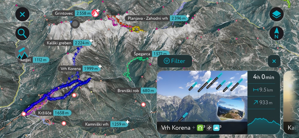
Explore Carinthian Slovenian Alps with the PeakVisor 3D Map and identify its summits.


