
Scan the QR code and open PeakVisor on your phone
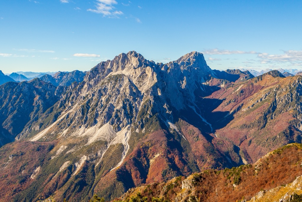
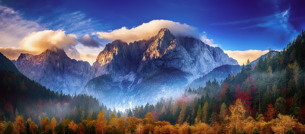
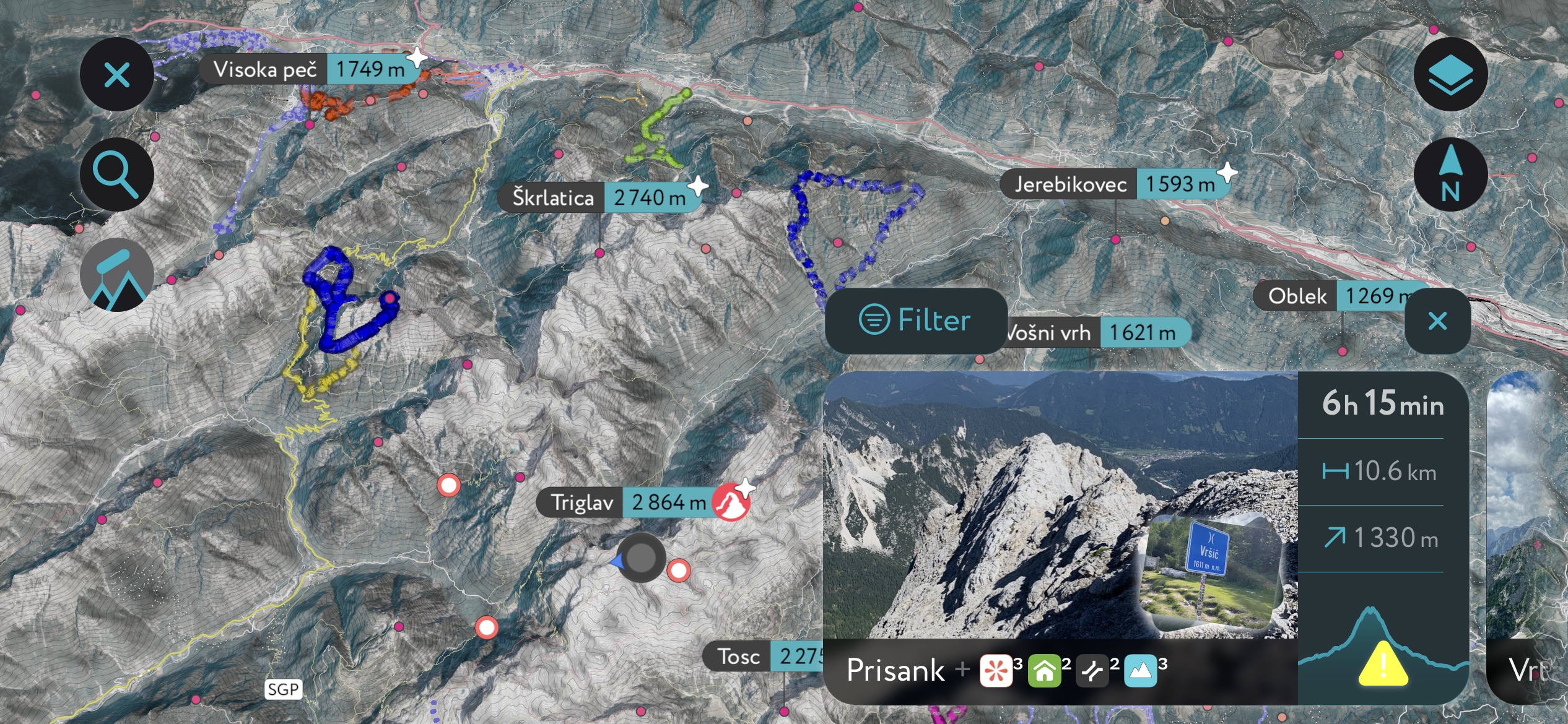
The Julian Alps and Prealps include 1,571 named peaks. The highest is Triglav at 2,864 m. Other notable peaks include Jôf di Montasio, Škrlatica and Mali Triglav.
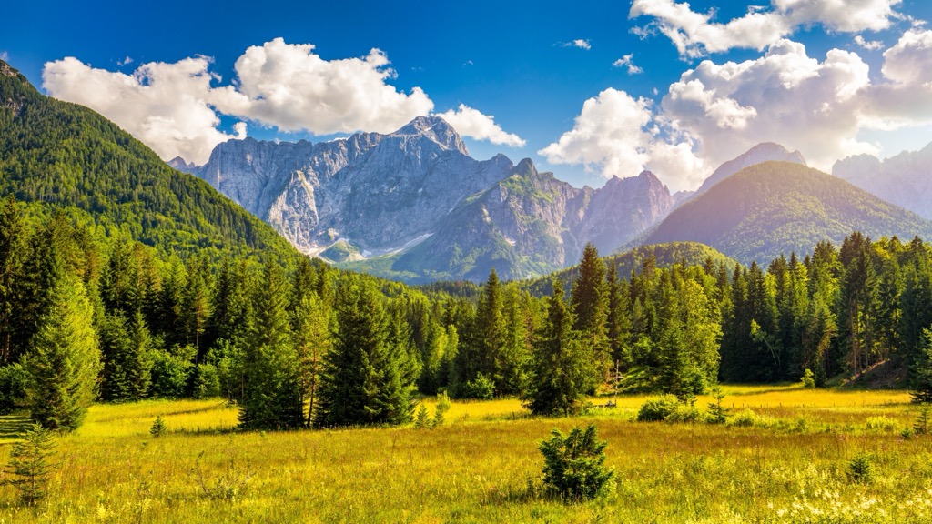
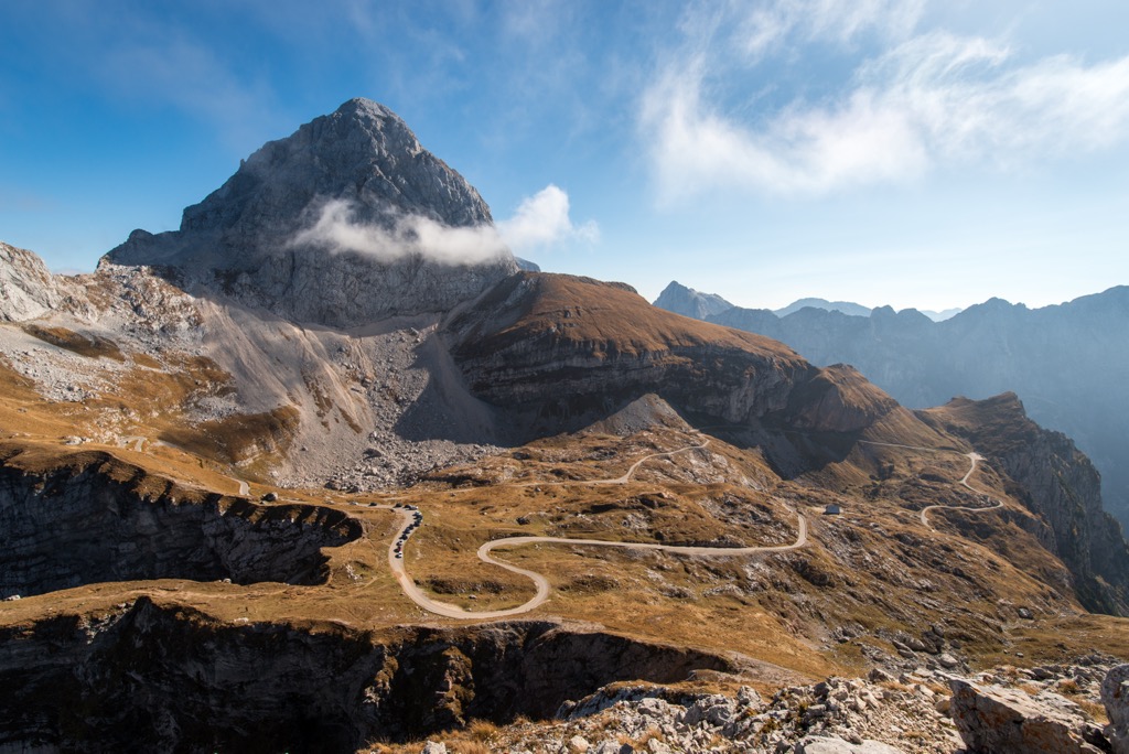
The Julian Alps and Prealps are a subrange of the greater European Alps located in northwestern Slovenia and northeastern Italy. The range’s alpine portion is home to Slovenia’s only national park, Triglav National Park, while the foothills feature a patina of vineyards, villages, and other pastoral scenes. The Julian Alps and Prealps have 1571 named mountains, the highest and most prominent of which is Triglav (2,864 m / 9,396 ft), also the highest peak in Slovenia.
The Julian Alps split into two regions: Italy's Western Julian Alps and Slovenia's Eastern Julian Alps.
The Italian side is steeper and more rugged, with towering limestone and dolomite cliffs. The range sits between the Fella River and the Upper Isonzo River in northeastern Italy. Some of the tallest peaks in the Western Julian Alps include Mangart (2,668 m / 8,724 ft), Jof Fuart (2,666 m / 8,743 ft), Jof di Montasio (2,753 m / 9,032 ft), and Canin (2,587 m / 8,454 ft).
The Eastern Julian Alps host Triglav, the highest peak in Slovenia and a national symbol for the country. Triglav National Park, which encompasses the peak, is also home to Lake Bohinj and Lake Bled. The blue Soča River is another highlight of the park’s beauty.
Despite the relatively low valley floors (600-800 m / 1,968-2,625 ft), the region experiences harsh winters due to cold winds from northeastern Europe. The significant height differences between the valleys and peaks (up to 2,000 m / 6,561 ft) have historically made this area attractive to dedicated mountaineers.
Apart from Triglav National Park, this area is protected under Nature Reserve Val Alba and the Italian Julian Alps Biosphere Reserve, created in June 2019 as part of UNESCO’s "Man and the Biosphere" program. On the Slovenian side, the Julian Alps Biosphere Reserve was established in 2003 and includes Triglav National Park.
The Julian Alps are comprised of layers of limestone, which were formed from sediments deposited by an ancient sea. As a result, the range is a trove of ancient marine fossils.
Tectonic forces gradually pushed this section of crust north, and the Alps formed from the collision of the African and Eurasian plates. Over time, erosion has continually reshaped the landscape, creating valleys, caves, and striking karst features.
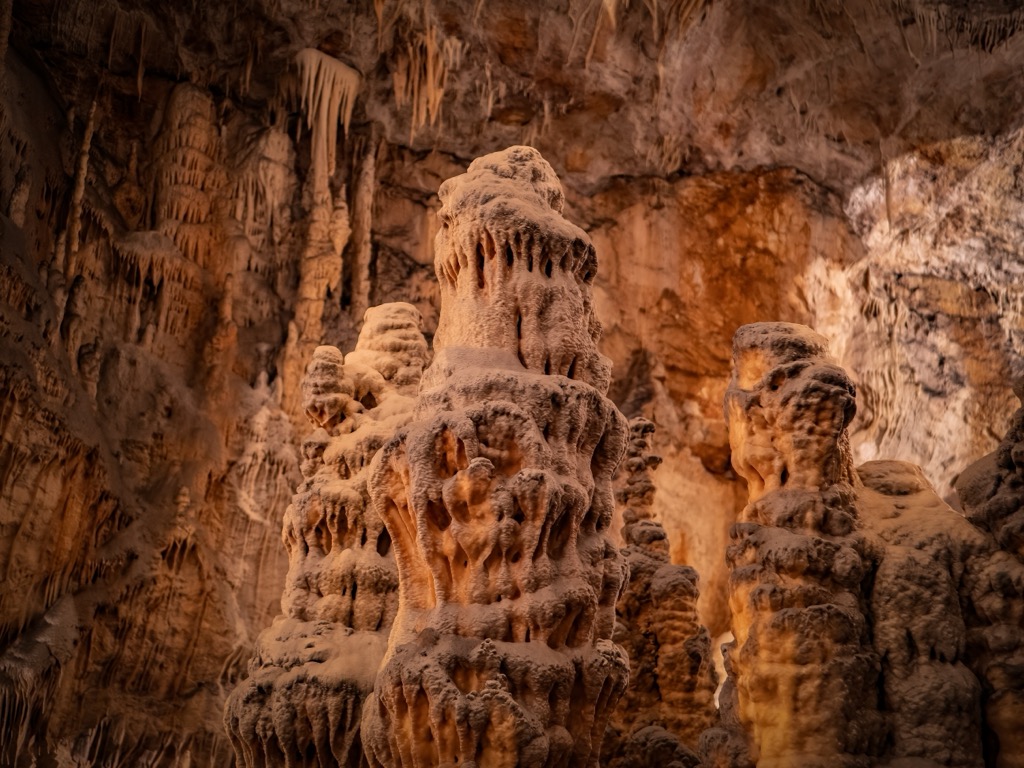
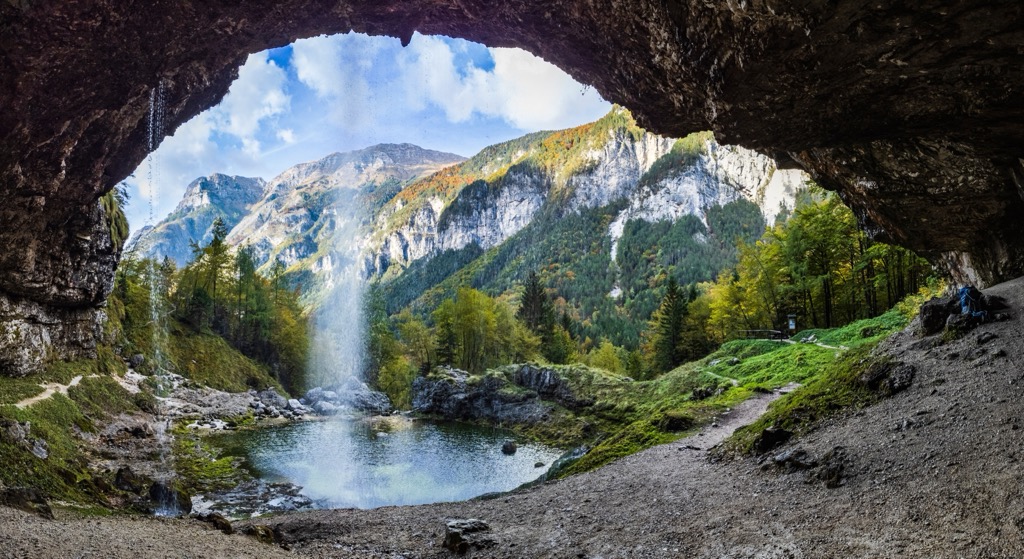
The area combines river formations with glacial features in a relatively small area. Glacial formations are still well-preserved in the higher parts of the valleys. North of Mount Canin’s summit, a small glacial remnant still exists, though it is dwindling and will not persist much longer. The area near Col delle Erbe is especially notable for its large caves over 1,000 m (3,281 ft) deep.
Limestone has also produced many gorges and waterfalls in the valley floors. The Fontanone Barman and Fontanone di Goriuda are particularly impressive examples.
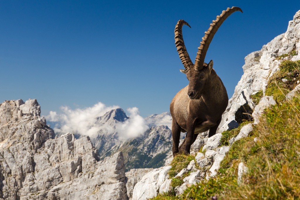
The range is home to various ecoregions of both Mediterranean and alpine origin. Alpine mammals like roe deer, red deer, chamois, ibex, and wild boar live here in the higher Julian Alps. More reclusive residents include wolves and brown bears.
The alpine region has recorded around 100 bird species, with 89 confirmed as nesting. Birds of prey are common, including the golden eagle, goshawk, griffon vulture, and several owls. The rock partridge is well distributed across the southern slopes.
The combination of high rainfall and a unique geological base supports a rich variety of vegetation. The area's flora includes over 1,250 species, with more than 60 endemics, such as Zoys’s Bellflower and Julian Alps Poppy. Beech forests dominate the wooded areas (nearly 60%), followed by black pine and Scots pine forests. Mountain pine forests cover smaller areas but are also notable.
The Julian Alps were known in ancient times as Alpes Iuliae and have been referred to by various names, such as Alpes Julianae and Alpis Julia. Like many things in Western civilization, the range is named after Julius Caesar.
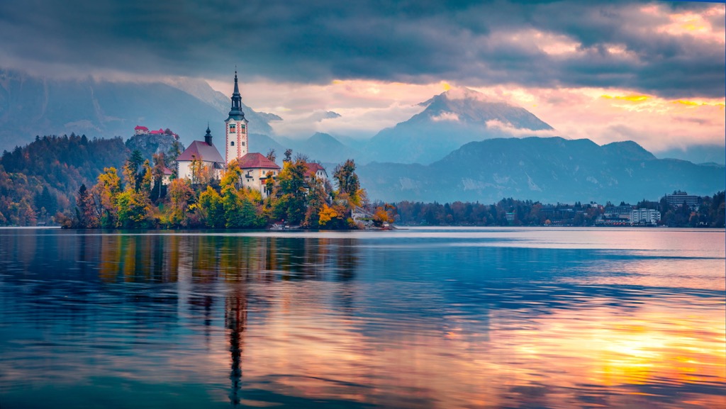
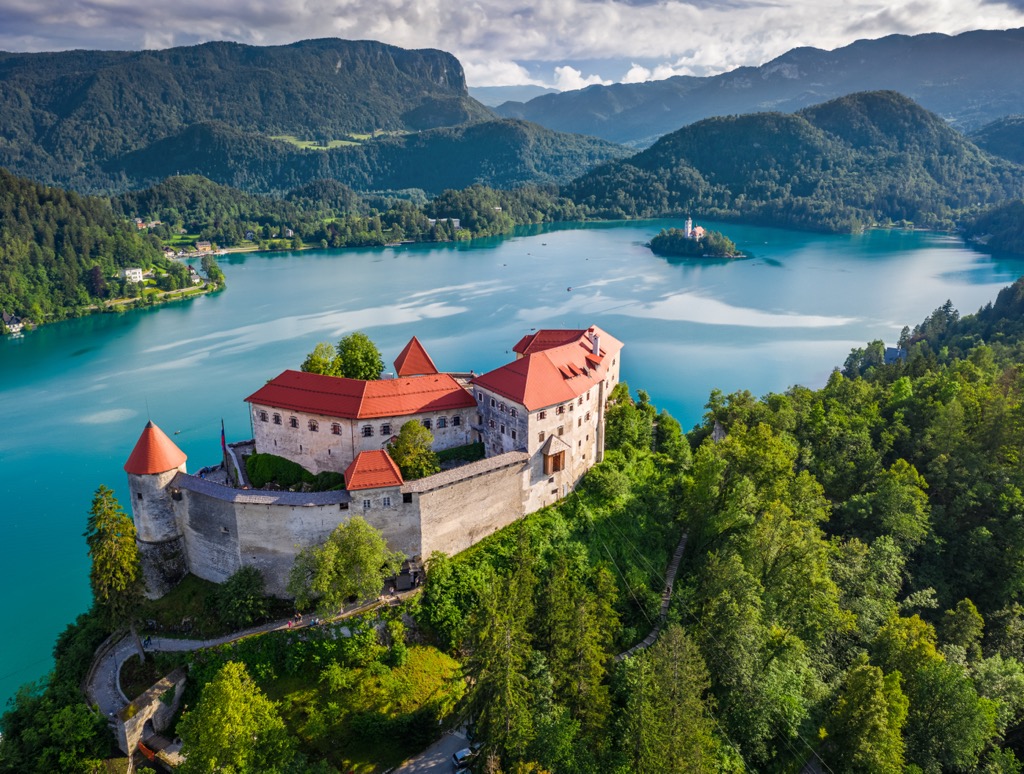
Slovenia’s medieval towns are filled with Gothic, Renaissance, and Baroque treasures. The most notable example is Bled Castle, which towers 130 m (427 ft) above Lake Bled. This eleventh-century fortress, with a small Gothic chapel, offers stunning views of the Julian Alps.
Kobarid and the Isonzo River were the frontlines of some of World War I’s bloodiest battles. Peaceful memorials and museums now commemorate the war's horrors. The Walk of Peace, which stretches 400 km (248.5 mi) through Slovenia and Italy, is a hike one can take along the first lines of the front.
Triglav is the Julian Alps’ highest peak and is a Slovenian national symbol. Following the Seven Lakes route, the ascent of Mount Triglav from Blato Meadow is the longest and one of the most scenic paths.
Starting at Blato Meadow, located above Lake Bohinj, the trail takes you through a mix of meadows and rocky terrain in the picturesque Seven Lakes Valley. A via Ferrata brings you directly to Triglav’s summit. It’s an overnight hike, taking around two days and totaling 17 to 19 hours of travel.
Montaž is the second-highest peak in the Julian Alps and offers various climbing routes. The easiest is the Pipan Ladder route, which climbs the south wall via a 60-meter (197-foot) ladder to the ridge. The more challenging Via Amalia climbs the north wall.
The starting point for this hike is Mangart Saddle, where a narrow road leads to the parking area. Follow the grassy slopes towards Mangart. At a marked crossroads, the Slovene route goes right, and the Italian route goes left. Due to steel cables and exposed sections, the Slovene route is recommended only for experienced hikers. It ascends diagonally across Mangart’s west wall, with some challenging parts higher up. The summit marks the Slovenia-Italy border and offers stunning panoramic views.
At PeakVisor, we love information. That’s why we write articles like this one.
Check out the PeakVisor app for even more information on thousands of additional hikes, ski tours, and ski resorts across the Alps. In fact, we’ve compiled information on all publicly maintained walking tracks worldwide, formatted onto our 3D maps.

PeakVisor started as a peak identification tool but we’ve evolved into purveyors of the finest 3D maps available. We continue to expand our offerings. You can track your hikes directly on the app, upload pictures for other users, and keep a diary of all your outdoor adventures.
Most recently, the PeakVisor App has included up-to-date weather reports, including snow depths, at any destination. We've also been hard at work adding the details of hundreds of mountain huts, including information on overnight accommodation, dining options, and opening hours. You can also use our Hiking Map on your desktop to create .GPX files for routes to follow later on the app.
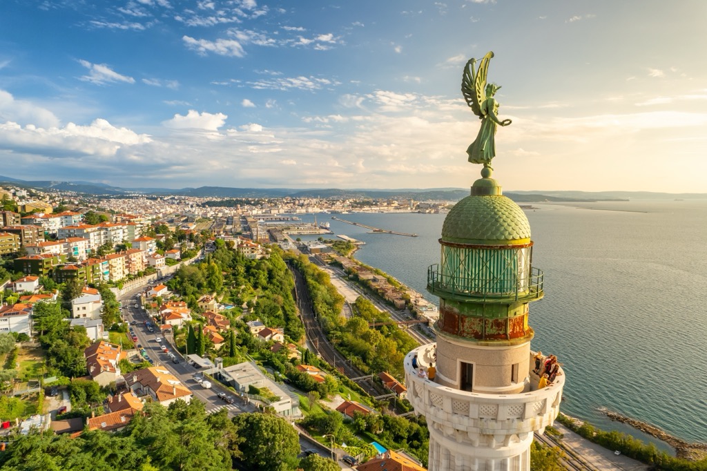
Trieste (population 200,000) is at the crossroads of the Latin, Slavic, and Germanic worlds. Situated on the edge of the Adriatic Sea and close to the Slovenian border, it has long served as a major port and a gateway between Eastern and Western Europe.
The city boasts neoclassical buildings, ornate Habsburg-era palaces, and a picturesque waterfront. Trieste is also famous for its coffee culture, with historic cafés that writers like James Joyce and Italo Svevo once frequented. Val Rosandra and the nearby Karst plateau are popular outdoor getaways.
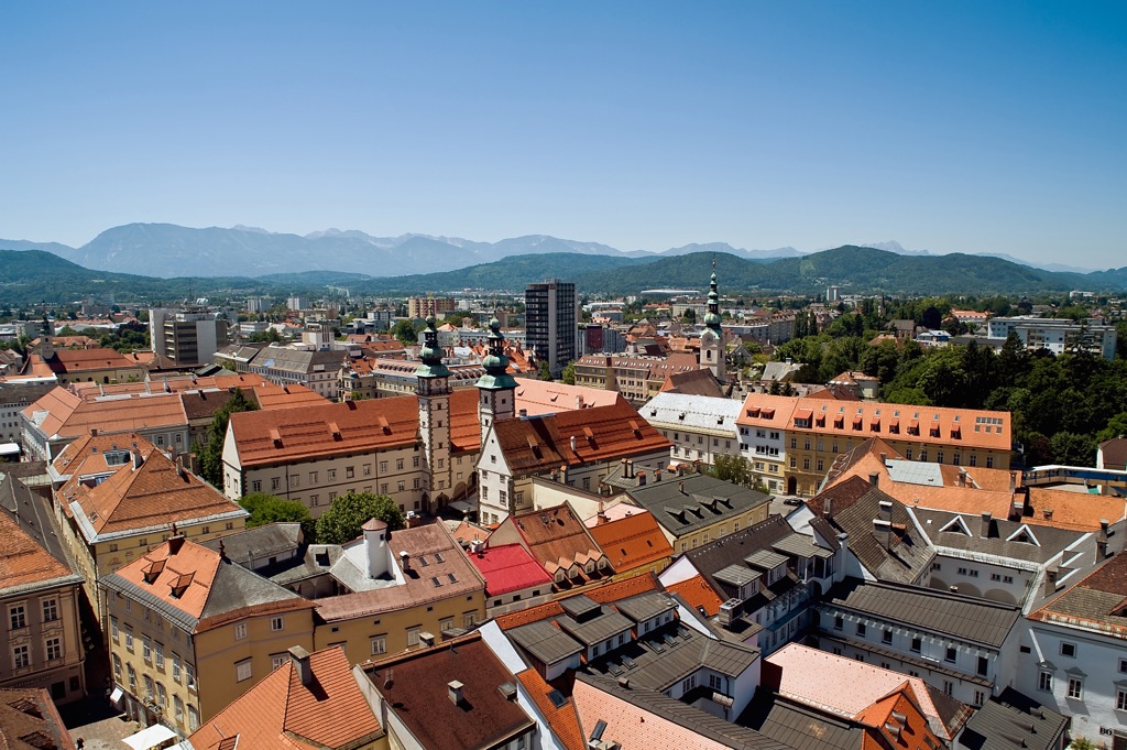
Klagenfurt, officially Klagenfurt am Wörthersee, is Carinthia's capital and largest city. It is located in southeastern Carinthia, just north of the Karavanks. With a population of over 105,000, it is Austria's sixth-largest city.
Klagenfurt is a significant university city, home to the University of Klagenfurt and the Carinthia University of Applied Sciences. It is located on the eastern edge of Wörthersee, Carinthia's largest lake and a major tourist destination. Attractions worth visiting include Minimundus, the State Museum for Carinthia, and Kindwurm Fountain.
Klagenfurt is characterized by its Renaissance architecture, such as the iconic Lindwurm Fountain, which depicts a dragon from local legend. The city is surrounded by mountains and is a gateway to hiking, cycling, and water sports in the summer and skiing in the winter.
Klagenfurt Airport (Flughafen Klagenfurt), Carinthia's main international airport, is located 2 km (1.2 mi) north of central Klagenfurt.
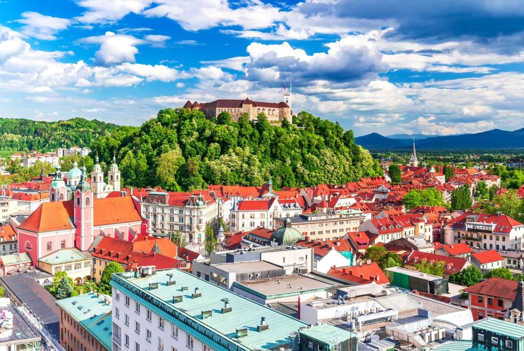
Ljubljana (pop. 300,000), the charming capital of Slovenia, is known for its old town featuring narrow cobblestone streets, baroque buildings, and the Ljubljana Castle overlooking the city. The Ljubljanica River flows through the heart of the city, lined with lively cafes, restaurants, colorful architecture, and the iconic Dragon Bridge.


The Julian Alps and Prealps are part of the Alps.
The highest peak in the Julian Alps and Prealps is Triglav, at 2,864 m.
The Julian Alps and Prealps have 1,571 named peaks.


