
Scan the QR code and open PeakVisor on your phone
Croatia is home to 7,907 named mountains. The highest is Dinara at 1,831 m.
Though a relatively small country on an international scale, the amount of natural beauty packed into the rugged coasts, scenic mountain ranges, and lush green fields of the Balkan country of Croatia is undeniable. There are 7907 named peaks in Croatia, the tallest of which is Dinara 1,831 m (6,007 ft) and the most prominent of which is Sveti Jure 1,762 m (5,781 ft).
Alongside a rich and long historical legacy that involves Illyrians, Romans, Slavs, Ottomans, and more, Croatia overflows with places to see, things to learn, and landscapes to behold. The country has an area of around 56,594 sq. km (21,851 sq. mi) and a population of approximately 4 million people.
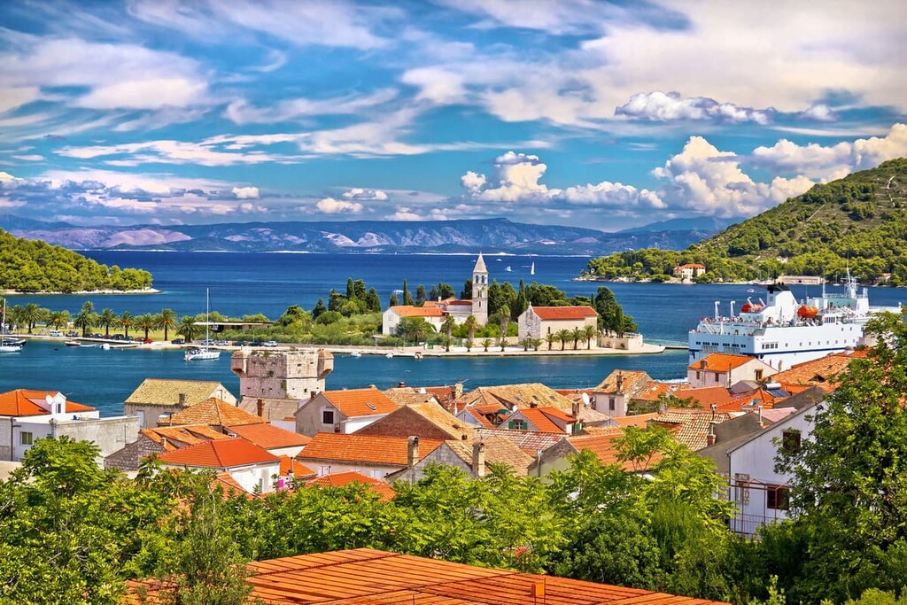
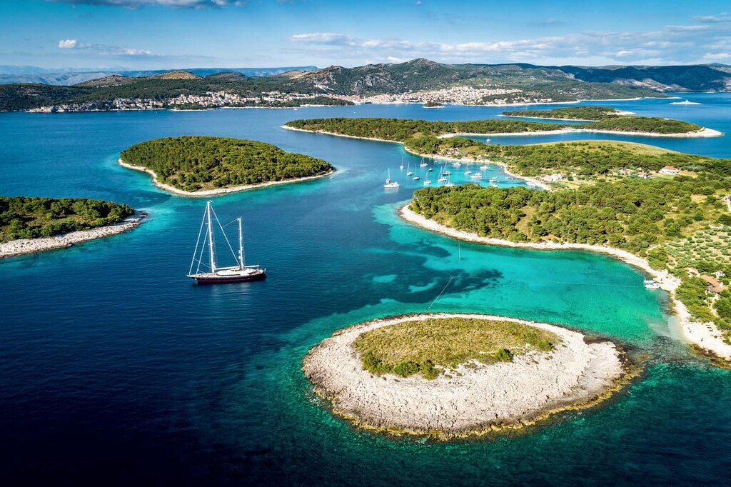
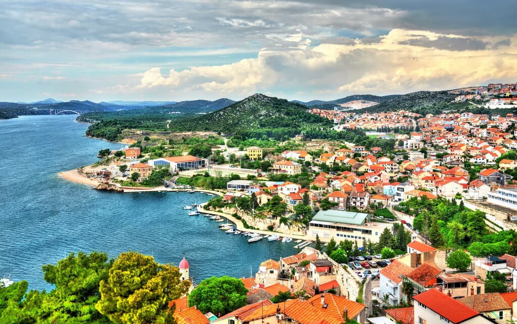
Croatia’s unique shape, as a narrow crescent around neighboring Bosnia and Herzegovina, means that it boasts some 1,777 km (1,104 mi) of coastline. In fact, if you count the more than 1,200 islands that are part of Croatia, the country has an additional 4,058 km (2,522 mi) of coastline along the Adriatic Sea.
Furthermore, Croatia is located in the northwestern section of the Balkan peninsula, and it is generally considered to be in both central and southeastern Europe. To the north of Croatia is Slovenia, while Hungary is located to the northeast and Serbia is located to the east. Furthermore, Bosnia and Herzegovina surround Croatia on three sides.
To the west of Croatia is the Adriatic Sea. Near the southern edge of the country, Croatia shares a 22.6 km (14 mi) border with Montenegro in the south.
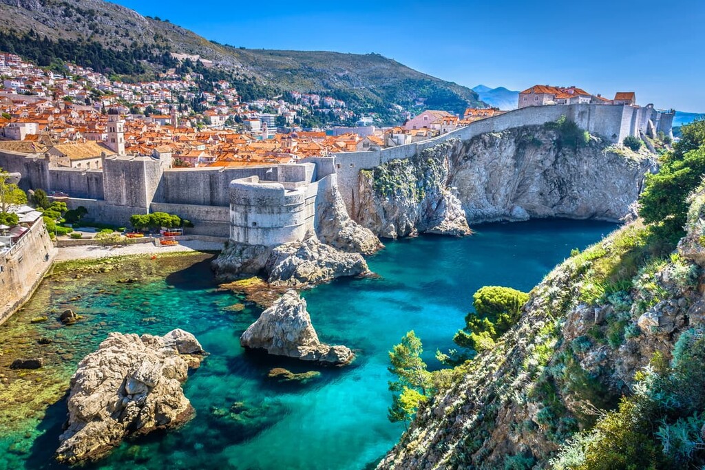
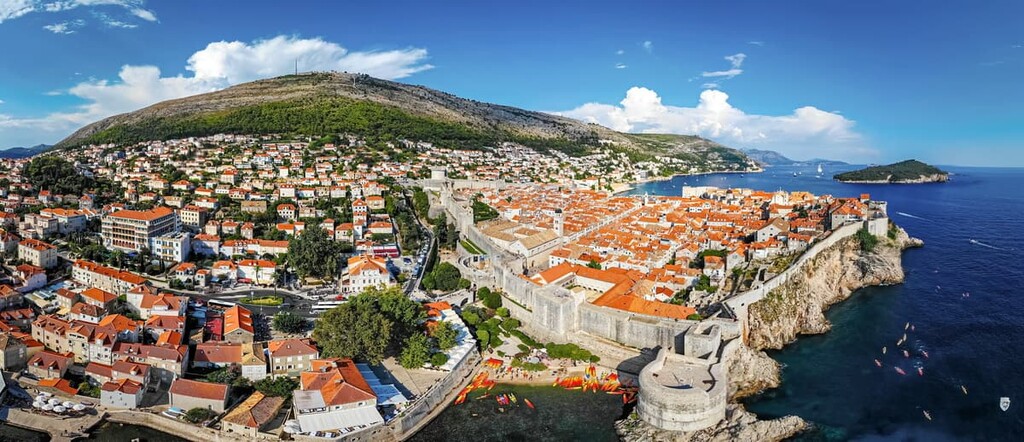
Interestingly, Croatia’s coastline, stretching from Slovenia to Montenegro, is actually not uninterrupted, as Bosnia and Herzegovina contains about 20 km (12 mi) of coastline that splits the Croatian county of Dubrovnik-Neretva into two. Thus, the southern part of Dubrovnik-Neretva, where the famous city of Dubrovnik is located, is Croatia’s only major terrestrial exclave.
There are four historical and cultural regions that make up Croatia, namely:
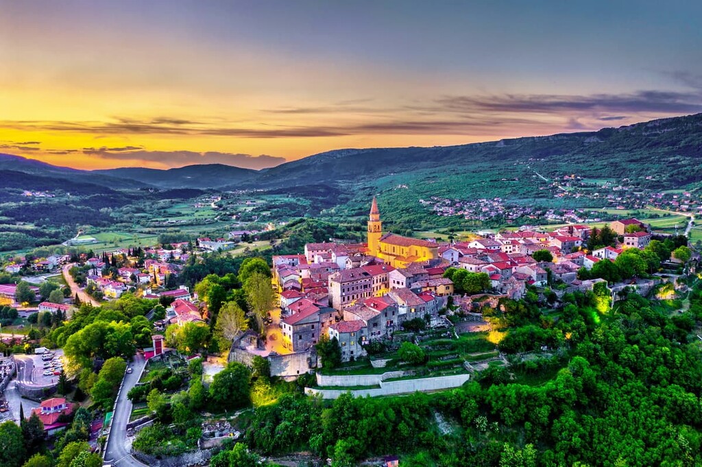
Slavonia, as well as other large swaths of northern and central Croatia, is made of vast lowlands. These lowlands are part of the Pannonian plain and they comprise some 50 percent of Croatia’s land area. About a quarter of Croatia’s land rises between 200 and 500 m (660 and 1,640 ft) above sea level, with 17 percent between 500 and 1,000 m (1,600 and 3,300 ft).
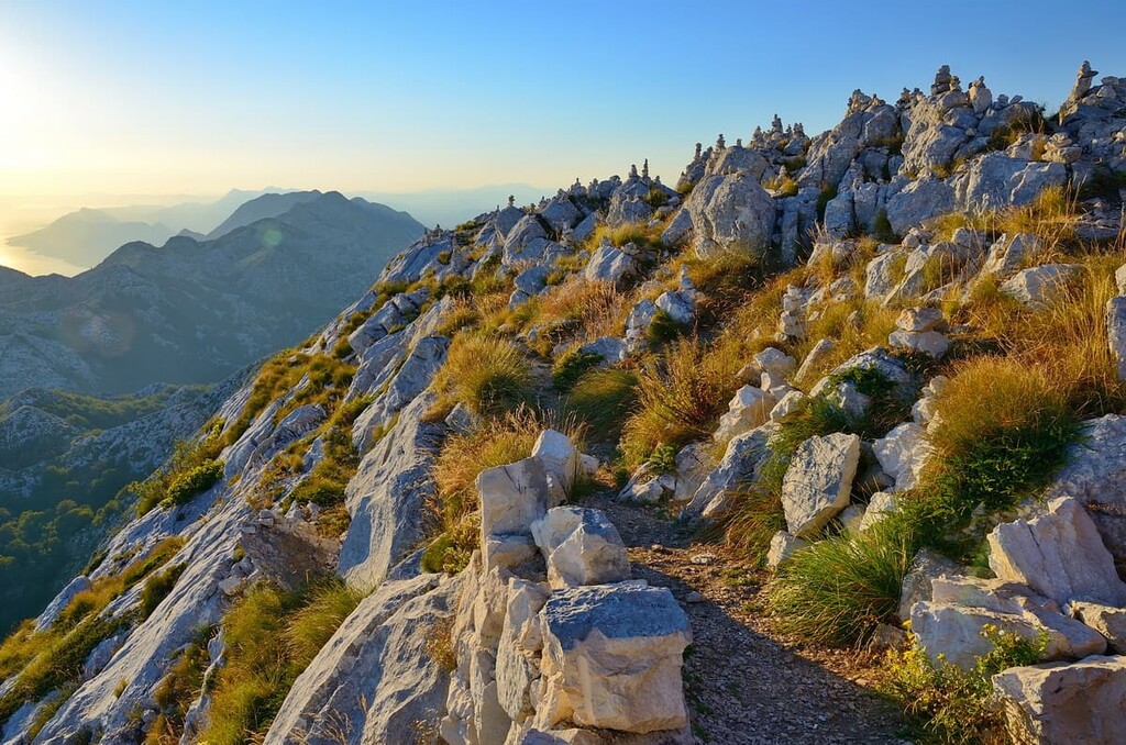
The highest elevations of the country are concentrated in the Dinaric Alps, Croatia’s main mountain range. This range stretches through central Croatia and the Dalmatian coast, particularly in the traditional regions of Lika (now part of Lika-Senj County) and Gorski Kotar. There’s also the Adriatic basin, containing the country’s lengthy Adriatic coast and the islands scattered along it.
Together, the Pannonian plain, Dinaric Alps, and Adriatic basin comprise the three major topographical features of Croatia.
The Black Sea drainage basin is the main hydrographical feature of Croatia. The country’s largest rivers, such as the Danube, Sava, and Mura, flow into the Black Sea or its tributaries. Fewer major rivers drain into the Adriatic, the longest of which is the 101 km (63 mi) Cetina River.
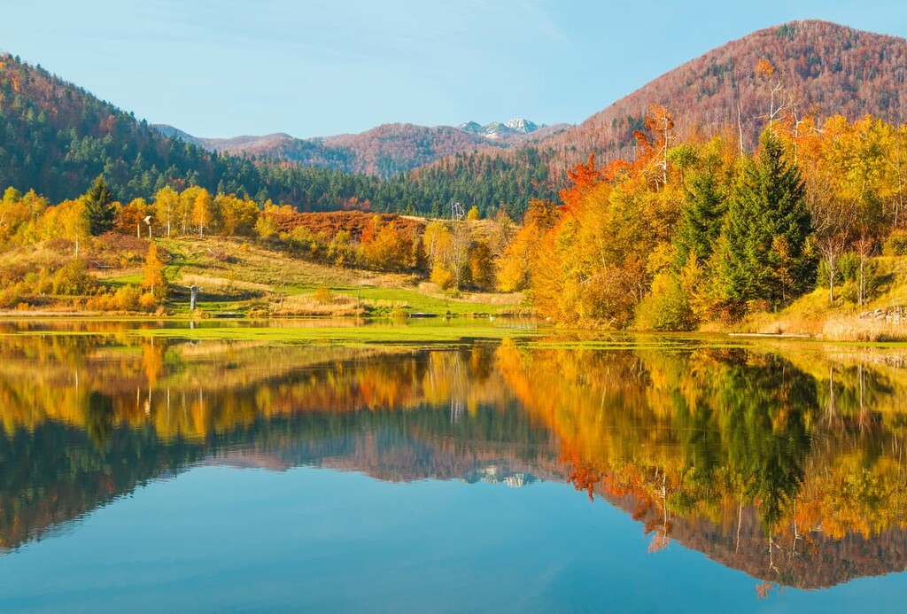
There are many small and pristine lakes that speckle the Croatian landscape, with the largest being Lake Vrana in Dalmatia, and the most famous being the 16 Plitvice lakes. Otherwise, Croatia is also home to many ecologically important wetlands along its rivers, such as Lonjsko Polje and Kopački Rit.
The climate of Croatia is typical of the mountainous regions of the Balkans and it is classified as a continental climate. Generally speaking, this climate is warm and fairly rainy, but it is prone to variability, given the differences in elevations and proximity to the Mediterannean.
For example, the highest levels of precipitation occur on the high peaks of the inland mountains, particularly in Dinara. Meanwhile, the islands off the Croatian coast experience far less precipitation.
Along the coast, the climate is especially Mediterranean, and it is known for its warm and moderate nature. Both the highest and lowest temperatures ever recorded in Croatia were measured further inland. In fact, the high-elevation inland regions of Lika and Gorski Kotar are generally the coldest and snowiest in the entire country.
The administrative regions of Croatia are divided into 20 counties with their own administrative centers. These counties are further divided into 127 cities and 429 municipalities. However, the capital city of Zagreb, while surrounded by Zagreb County, is its own administrative unit that is not part of any county.
Despite being smaller than any county by area, the city of Zagreb is larger than any county in population, with almost 800,000 inhabitants. Split, the second-largest city and the primary metropolitan area of Split-Dalmatia, has around 350,000 inhabitants.
The primary geological feature of Croatia is undoubtedly the presence of the Dinaric Alps, a range whose formation began around 200 million years ago as the Tethys Sea grew out of a massive rift, separating the landmasses of Laurasia and Gondwana.
In the Mesozoic, marine sediments began to pile onto the Tethys Sea floor, and in the Cenozoic, collisions between tectonic plates uplifted the sediments of the Tethys Sea into a series of mountain ranges that now run throughout modern central and southern Europe.
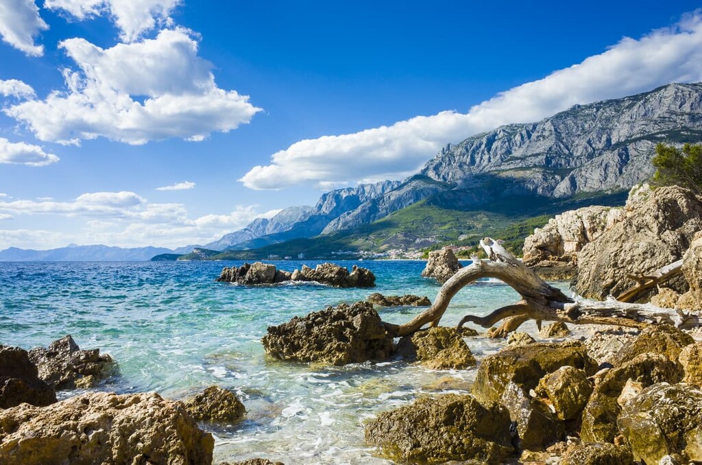
The Dinaric Alps are composed mostly of sedimentary rocks that give Croatia its immensely karstic nature, with many of Croatia’s major mountains–including its tallest mountain, Dinara–consisting entirely of limestone and dolomite. Poljes like the Ličko Polke, which are wide, flat karst fields, are another formation common to such landscapes and present in Croatia.
Additionally, thanks to Croatia’s karst landscape, the country contains many caves, gorges, and ravines. These features are the result of limestone’s easily erodible and dissolvable character, epitomized in locations like the Plitvice Lakes.
The Pannonian Plain, meanwhile, dominates the eastern portion of the country. For several million years, this plain was the Pannonian Sea, until it began to dry out during the Pliocene. As a result, the sediments that once filled the Pannonian basin consolidated into the rock that is now found at the surface.
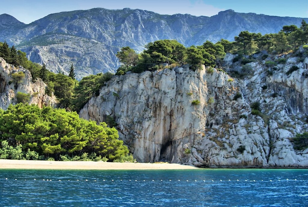
Parts of the Dalmatian coast, which is widely known as one of the most beautiful seashores in Europe, are bordered by mountain ridges, with island chains shooting off the shore. As is typical for Croatia, its beaches are mainly made of limestone, usually in the form of larger rocks like pebbles, rather than sand.
Otherwise, Croatia is home to or borders a handful of fault zones, like the Donat, Sava, and Medvednica. Part of the Mediterranean Bauxite Province also lies within Croatia, boasting a quantity of largely Cretaceous bauxite orders atop layers of karst.
Other interesting geological anomalies in Croatia include the Rupnica, an outcrop of volcanic rhyolite in western Slavonia, and the Jelar Formation, a formation of Paleogene breccia.
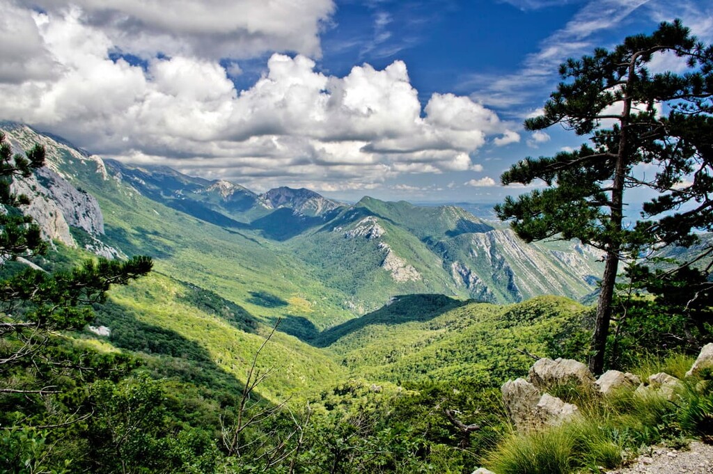
The ecology of Croatia is one of the richest and most biodiverse in all of Europe, thanks to its lush and plentiful forests, great variations in elevation, friendly climate, and presence of numerous aquatic or pseudo-aquatic ecosystems.
It’s estimated that between 30 to 40 percent of Croatia’s land is forested, with these forests divided into three primary ecoregions: Pannonian mixed forests, Illyrian deciduous forests, and Dinaric Mountains mixed forests.
There are also smaller areas of Tyrrhenian-Adriatic sclerophyllous and mixed forests, as well as grasslands, scrublands, wetlands, and bogs and fens, found in Croatia. Additionally, the country is home to 8 national parks, 11 nature parks, and 2 special reserves.
Running through northwestern Croatia are the montane forests of the Dinaric Alps, which are known as the Dinaric Mountains mixed forests. As a mixed forest, there is a wide variety of trees to be found, largely depending on elevation. Higher elevations, between around 1,200 to 2,500 m (3,937 to 8,202 ft), contain conifer forests of silver fir, Norway spruce, black pine, European beech, and occasional limestone outcrops where calcareous block fir forests arise.
Below these conifer forests is a thick strip of elevation dominated by deciduous trees, such as the Turkey, Hungarian, and downy oak, as well as hornbeams, European ashes, and field elms.
In Plitvice Lakes National Park, there are around 75 endemic plant species, like the Edraianthus tenuifolius. There are also other rare species, such as the spurge-laurel and common butterwort, in addition to over 50 species of orchid.
The Dinaric Mountains Mixed Forests boast a high degree of endemism alongside staple species of the Balkans. Notable mammals include Eurasian lynxes, gray wolves, brown bears, European wildcats, around 20 kinds of bats, and European polecats. Many birds reside or breed in these forests, too, including white-throated dippers, golden eagles, Eurasian eagle-owls, peregrine falcons, and kestrels.
There are about a dozen amphibian species, like the alpine newt and the incredibly rare olm, found in this region. The ecoregion is also home to numerous reptile species, such as the European pond turtle, dice snake, viviparous lizard, and European green lizard.
The Illyrian Deciduous Forests are found primarily along the Croatian coast. They are most prominent in the country’s northwesternmost and southwesternmost peninsulas These humid, subtropical ecoregions of Mediterranean forests, woodlands, and scrub foment a complex of conifer forests, mixed broadleaf forests, and maquis shrubland at varying elevations.
Similar to the Dinaric Mountains Mixed Forests, Illyrian forests have a conifer zone around 1,200 to 2,500 m (3,937 to 8,202 ft) of black pines, silver firs, spruces, and beeches. Below these, mixed oak and general broadleaf forests, which include sweet chestnuts and hop-hornbeams among other typical Balkan deciduous trees, are the most prominent.
Meanwhile, the lowest elevation locales support maquis shrubs, like the terebinth, green olive, and strawberry tree, alongside Aleppo pines and holm oaks.
Fauna in Illyrian forests is fairly typical for the Balkans. This includes chamois, roe and red deer, brown bears, and lynxes, as well as griffon vultures, kestrels, peregrine falcons, and capercaillies.
In the central and eastern parts of Croatia, where the mountains become rolling hills and begin to lower in elevation into the Pannonian plain and adjoining basin, Pannonian mixed forests dominate the landscape.
These temperate broadleaf and mixed forests consist of mixed oak and sessile oak forests, mixed oak-hornbeam forests, sub-Mediterranean lowlands, and herb-grass steppes, particularly in highly mountainous areas.
Pannonian mixed forests are rife with large and diverse bird populations, including western capercaillies, ural owls, wallcreepers, fieldfares, and various warblers, whitethroats, doves, thrushes, nuthatches, and many more.
The mammals in this area are typical for European forests, such as brown bears, wild boars, wolves, rabbits, and minks, though the region does have many unique reptiles and amphibians, such as Orsini’s viper and the Balkan wall lizard.
This rare and limited ecoregion is mainly found in Croatia’s Dalmatian Islands, where Aleppo pine, holm oak, and black pine form the primary tree base. These islands also contain around 179 endemic species of flora and fauna, such as Dalmatian wall lizards and many species of butterfly.
There are also notable ecosystems within the karst caves and springs of Croatia, where unique shrimp species and many endemic fish call home.
Croatia has been inhabited by humans since the ages of stone and iron, particularly its river valleys in the north. Though these cultures were vast and diverse, and even included a number of raiding Celtic tribes, the main early settlers of Croatia were the Illyrians, an Indo-European people who overlapped temporally with the ancient Greeks and Romans.
The Greeks had established colonies on various Croatian islands, such as Korčula and Hvar, while the Romans took things one step further and actively conquered Illyrian land. The Illyrian land of Dalmatia was encroached upon by the Romans in the late 200s and early 100s BCE. Eventually, around 30 BCE, Dalmatian Illyria became the Roman province of Illyricum, spanning from the River Drin (in modern Albania) to just below the peninsula of Istria.
The Pannonians were another Illyrian people who inhabited what would become northern and eastern Croatia, thriving atop the fertile soil of the Pannonian plain. They, too, became a Roman province, and together with the Dalmatians they attempted to overthrow the Romans in the first century CE; however, this was to little avail.

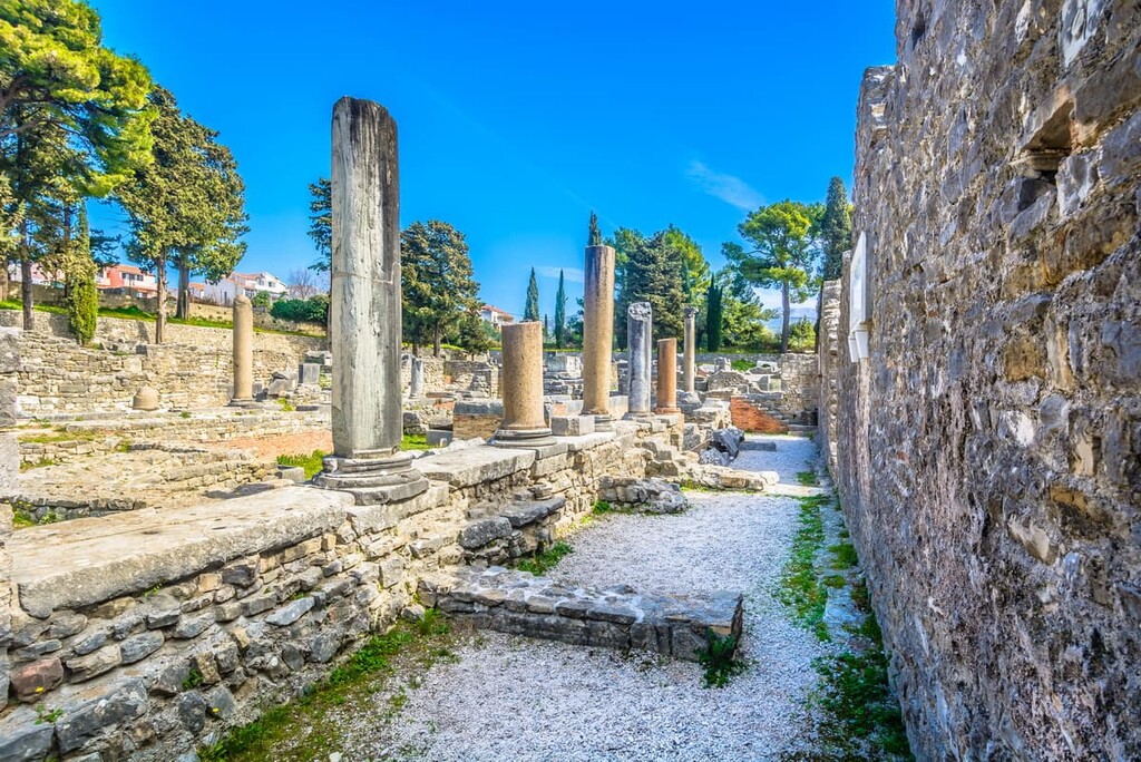
Notably, the Pula Arena in the Istrian city of Pula contains a 2,000-year-old Roman amphitheatre, one of Croatia’s most famous and well-preserved ancient monuments. Pula was a regional center for the Romans in Istria, and thus there was special importance in constructing a truly massive amphitheatre there. Also notably, the emperor Diocletian was born in Dalmatia, and it was his palace that would form the foundation for the modern city of Split.
Indeed, urban centers in Croatia became very romanized throughout the first few centuries CE. People in these cities generally spoke Latin and participated in Roman culture. When the Western Roman Empire collapsed at the end of the fifth century, the region soon found itself under Byzantine rule.
The end of romanization in Croatia is considered to have occurred in the sixth and seventh centuries, when invasions by Slavic and Eurasian peoples—including the Croats, from which the country took its name—resulted in the destruction of Roman towns and a large-scale migration of Romans out of major urban centers.
The Croats formed the Duchy of Croatia in the seventh century, which would eventually become a full-fledged kingdom around 925 under the rule of Tomislav. This Croatian kingdom peaked in the 1000s, but found itself in turmoil as the 1100s approached, with Hungarian kings setting their sights on the now dynasty-less kingdom. They defeated the Croatians in the Battle of Gvozd, forming a union between Croatia and Hungary under the rule of Hungarian king Coloman.
The next several hundred years saw threats from the Ottoman and the Venetians. In the following century, the Ottomans defeated the Croatians in key battles, resulting in the splitting up of Croatian territories. Many of these territories came under Habsburg control, as the Croatian parliament had sought the help of the Habsburgs in protecting them from further Ottoman threat.
After Croatian victory against the Ottomans in the 1593 Battle of Sisak, they gained a general stability in their borders and territory, while the Great Turkish War of the late 1600s further cementing Croatia’s borders, some of which continue to be in place today.
However, the arrival of the First French Empire in the lead-up to the nineteenth century brought a new challenge, as the French established the autonomous province known as the Illyrian Provinces along Croatia’s Adriatic Coast. These lands were soon gained by the Austrians, who formed the Kingdom of Dalmatia.
A Croatian National Revival known as the Illyrian Movement sprung up in the middle of the century, promoting Croatian culture and rejecting Hungarian influence. Croatia sided against the Hungarians in coming wars, until the Austro-Hungarian Compromise of 1867 created a newfound union between Austria and Hungary that put Croatia under Hungary’s domain.
The settlement formed between Croatia and Hungary as to the governing of Croatia would be in effect until 1918, when the Croatian Parliament severed its ties to Hungary and declared its own independence. They joined a group of Slavic states that would eventually become known as Yugoslavia, which would take a new form after the destruction of World War II as the Socialist Federal Republic of Yugoslavia.
Amid rising political turmoil and tensions, Croatia ended up declaring independence again in 1991, though various internal tensions continued for several years in the form of the Croatian War of Independence until 1995.
Croatia is home to no shortage of great hiking and outdoor recreation destinations. Here are some of the best places to check out in the country:
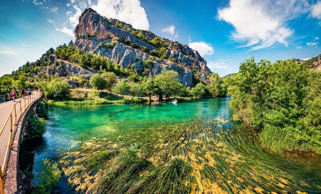
Centered around its namesake river, Krka National Park in southern Croatia is a grand display of exquisite Croatian forests, cinematic sequences of picture-perfect waterfalls, and turquoise pools. Resting in the foothills of the Dinaric Alps between the cities of Zadar and Split, the natural, geological, and historic value of Krka is nearly unparalleled.
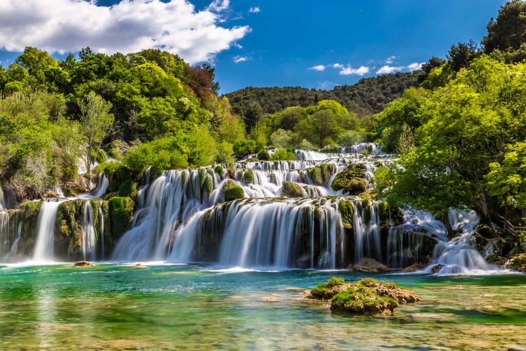
There are over 20 hiking trails in the park, with one of the most significant being the 3.4 km (2.1 mi) Skradin Bridge–Skradinski Buk Waterfall Trail, which winds along dramatic rocky cliff sides, cascading waterfalls, and bursts of lush vegetation. The Goriš–Torak trail is also of note, beholding unique green islets formed along the confluence of two rivers, tranquil karst springs, and great views of the rolling landscape.
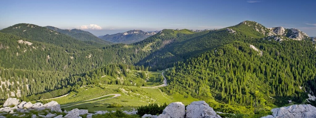
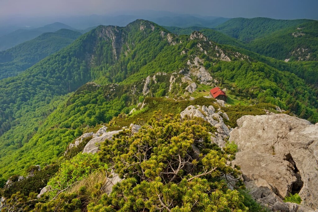
Northern Velebit National Park spans much of the Velebit Mountains near Croatia’s northern Adriatic coast, a part of the Dinaric Alps that comprises the largest mountain range in the country. Croatia’s limestone constitution appears in full force in the Velebits, with massive gray rock formations that jut out from verdant plains and into the skyline above.
The most famous trail is the Premužić Trail, also famous as one of the best hiking trails in Croatia. Approximately 16 km (10 mi) of this trail runs through the park, with several dozen kilometers extending outside the park to the rest of the Velebit Mountains. The trail can be broken up into day trips, offering great chances to explore the shining karstic mountainsides, bright green forests, vast plains, and endless views of the Velebits from atop its summits.
Other notable trails, though by no means all of them, include the Velebit Botanical Garden, boasting vibrant seas of wildflowers and other unique Croatian flora; the Lubenovac Trail, through the park’s flourishing valleys and pockmarked with the stone huts of shepherds; and the Štirovača, which travels along some of the park’s thickest forests.
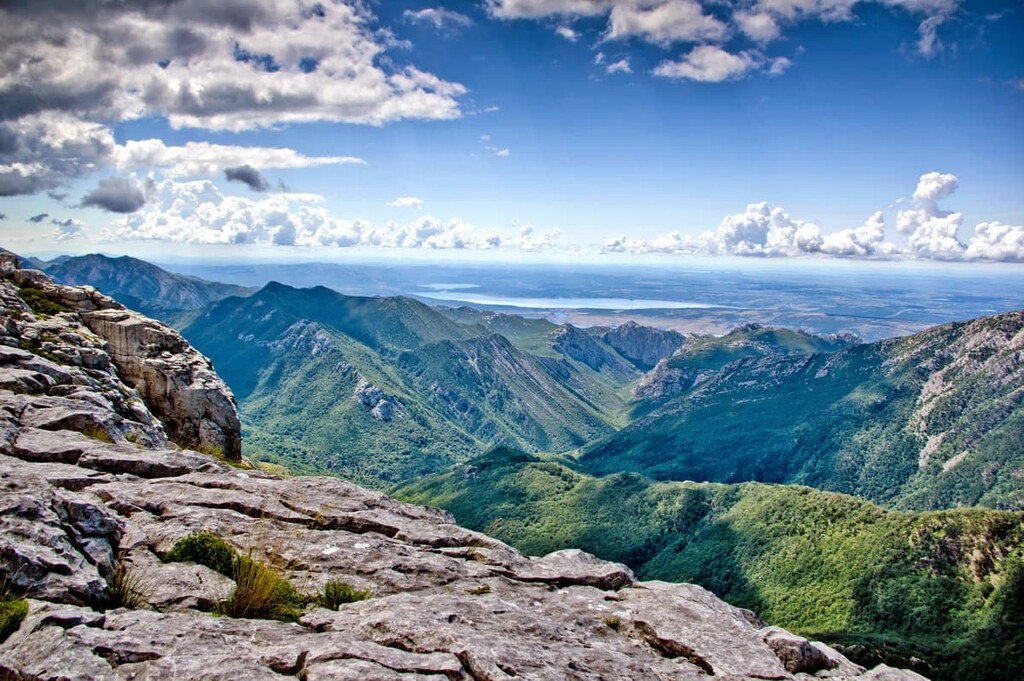
The southern portion of the Velebit Mountains is protected and preserved as well, under the boundaries of Paklenica National Park, containing the Velebit’s tallest peaks of Vaganski vrh at 1,757 m (5,764 ft) and Sveto Brdo at 1,751 m (5,745 ft). Though its most beautiful sites are above ground, there is plenty of interest down below as well, where a Yugoslavian underground military complex has become a popular visitor’s center dedicated to the history of climbing.
A trail system totalling between 150 km (93 mi) and 200 km (124 mi) runs throughout the park, offering opportunities for hikers and mountaineers alike. The Velika Paklenica canyon is the starting point to some beautiful shorter hikes, usually around 1.5 to 2.5 hours in length, such as the ones to the Paklenica Mountain Hut or Manita Peć Cave.
More strenuous hikes come out of the Struge Mountain Shelter, including the demanding 7.5-hour hike to Velika Paklenica canyon, which wonderfully showcases the alpine environment of Paklenica, and the similar hike to the Ivine Vodice Mountain Shelter, which can also function as a two-day hike.
For the best experiences of the park’s thick black pine and beech forests are the 6-hour hikes out of mountain hut Paklenica. This includes one to Velika Paklenica canyon at a maximum elevation around 1,110 m (3,642 ft) and another to the Vlaški grad shelter at 1,753 m (5,751 ft). However, there are a number of other hikes throughout the park that offer great opportunities for exploring all that Paklenica has to offer.
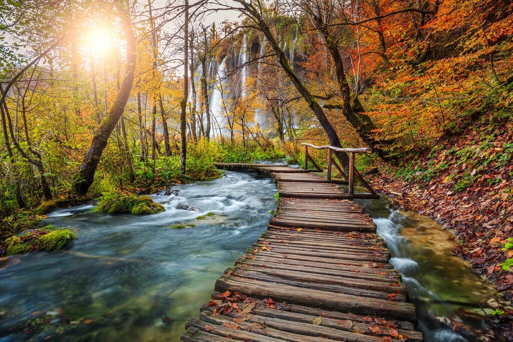
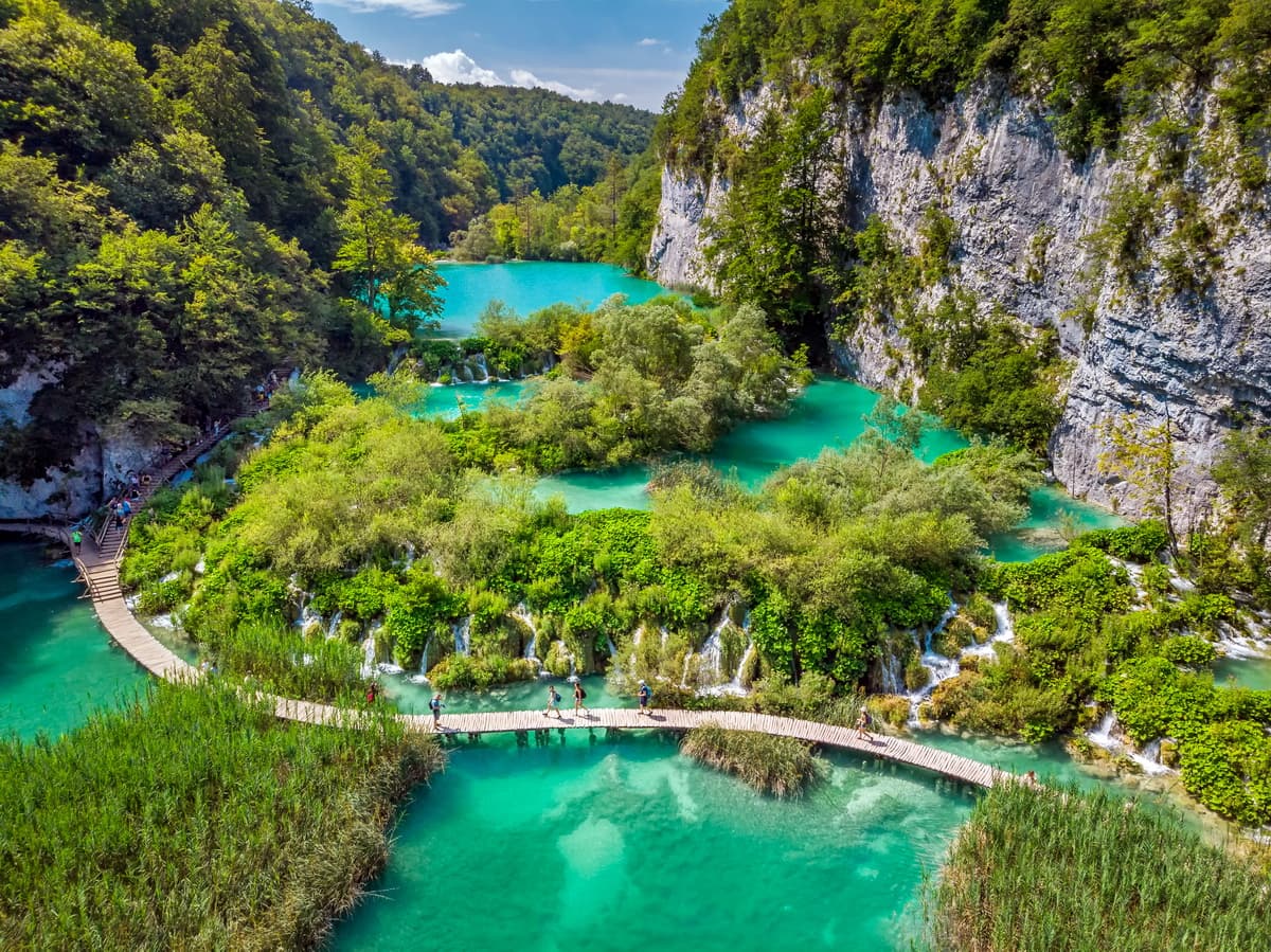
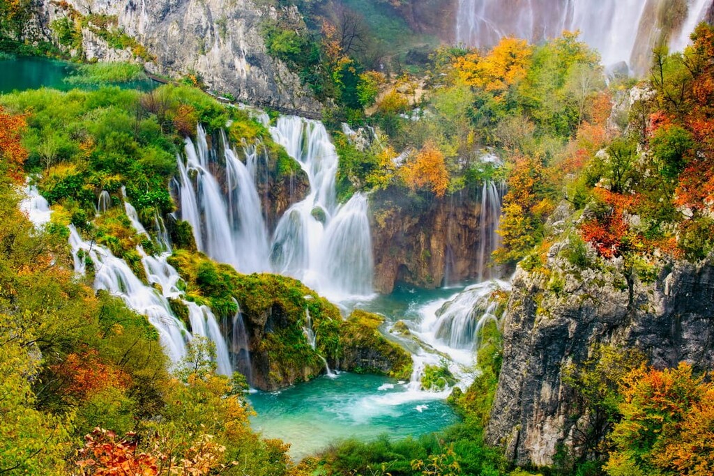
Plitvice Lakes National Park, located on the border to Bosnia and Herzegovina in central Croatia, is one of Croatia’s most famous, oldest, and largest protected areas. The park rests in karstic terrain at the feet of the Dinaric Alps, between the mountains of Plješevica and Mala Kapela.
Though this mountainous landscape is attractive in and of itself, the true draw of Plitvice lies in its system of 16 emerald and turquoise lakes of great historical and cultural significance. These lakes are connected by and adorned with waterfalls, rivers, caverns, and formations of tufa, a type of unique limestone. Further, the forests of Plitvice are rich and biodiverse, boasting populations of famous mammals, rare Balkan species, and endemic flowers.
The park has two main entrances from which their many hiking trails stem off, with the North Entrance generally being the more popular one due to its proximity to many of the lakes and the Veliki Slap waterfall. Trails are organized alphabetically and are extremely well-marked and well-characterized in terms of length and duration.
Trails A, B, C, F are perfect half-day trips through the Lower Lakes, with E leading to the Upper Lakes instead, and H allowing for sights of both. For the most holistic experience of the park, one can embark upon the more substantial Trail K hike, a 6 to 8 hour hike that forms an 18.3 km (11.5 mi) loop around the park.
In northern Croatia, among the forested mountains of Gorski Kotar, is Risnjak National Park, part of an area that has been explored by awestruck botanists for centuries, and visited by organized mountaineering trips for around a century. Strict protections have helped the park to remain pristine throughout the years, though numerous traditional settlements of wood-shingled houses remain and make for interesting destinations along the way.
As a result, the landscape of limestone mountains, rich beech forests, flowery meadows, caverns, and turquoise ponds is a sight to behold. Risnjak is also one of the bastions for Croatia’s lynx, wolf, and bear populations, though the odds of seeing any such creature in the wild are slim.
The main hiking attractions of the park are the opportunities to climb the Veliki Risnjak and Snježnik mountains, the park’s tallest at 1,528 m (5,013 ft) and 1,506 m (4,941 ft), respectively.
Though these are not long trails, with Veliki Risnjak being about a 3 hour hike from the park’s entrance, and Snježnik about a 1.5 hour hike from the Palatak ski resort, it is generally recommended that hikers have some experience before hiking these trails, given their elevation gain and difficulty.
The ghost town atop the 1,490 m (4,888 ft) tall Guslica is another notable hiking destination, also providing, like the aforementioned two hikes, great views of the valleys, mountains, and grasslands of the park. The Kupa and Leska paths, meanwhile, are more relaxed hikes through which you can see Risnjak’s hydrological beauty and vegetative diversity.
Looking for a place to stay in Croatia? Here are some of the best places to check out:
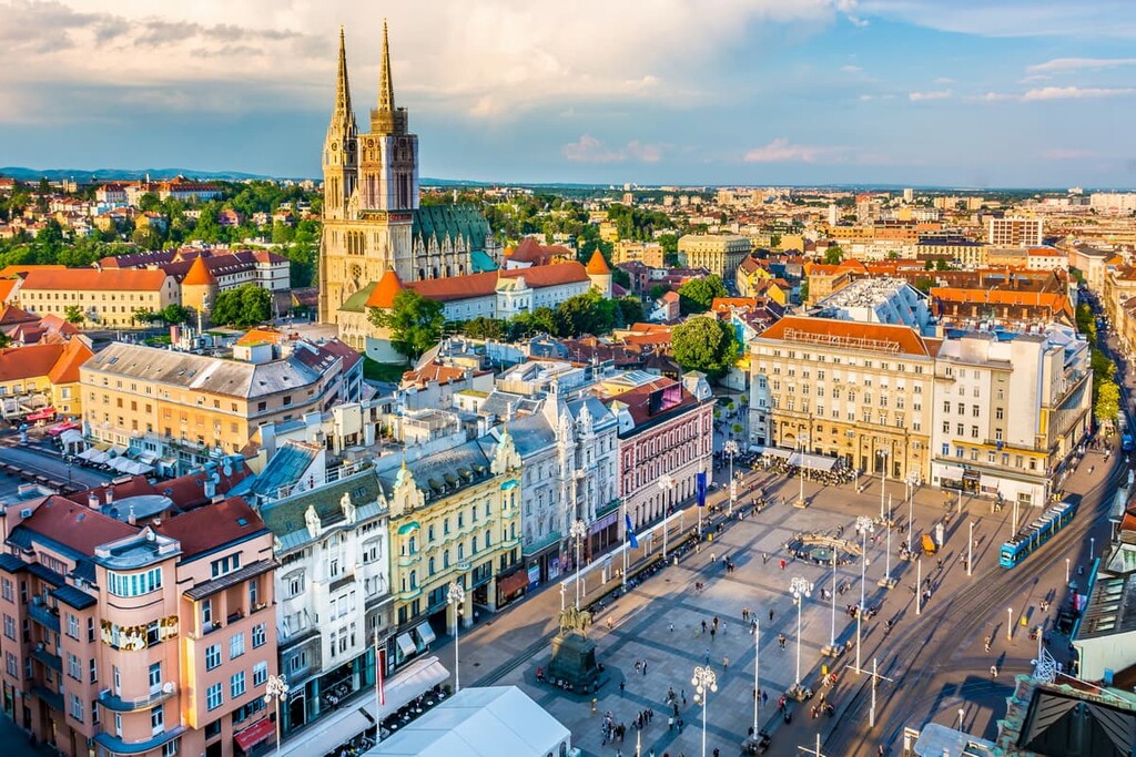
As Croatia’s capital and largest city, Zagreb is a key location for any visit to the country. The sights and landmarks in the city are truly endless, including centuries-old Gothic cathedrals, Medieval fortifications and town walls, beautiful Art Nouveau structures, open-air markets, statues and art galleries around every corner, boutiques, and an incredible collection of cultural, archaeological, historical, and science museums.
Some of the greatest collections of such sights include the bustling Republic of Croatia Square, the wonderful architectural hodgepodge of Ban Jelačić Square, and the cobblestone-lined Upper Town. The Upper Town is also the location of Tklačićeva Street, a quaint and colorful pedestrian area where cafés and boutiques abound. Much of the city is devoted to such lively pedestrian zones, and its main landmarks are generally within walking distance of city center.
Events are plentiful in Zagreb, with major music, movie, and cultural festivals hosted throughout the year. Further, nightlife is everywhere in Zagreb but is at its most vibrant in the nightclubs, bars, and restaurants sat upon the shores of the crystalline Jarun Lake, a popular recreational and athletic spot during the day. Other stunning nature sites within the city include the serene Zrinjevac Park, the Lenuzzi Horseshoe, and Maksimir Park.
The heart of Zagreb can be traversed through its tram system, with buses and commuter rail lines serving the outer regions. As for getting in and out the city, Zagreb is the home to Zagreb Airport, Croatia’s major international airport, and to Croatia’s largest railway station, which includes trains to other Croatian cities and nearby Slovenia.
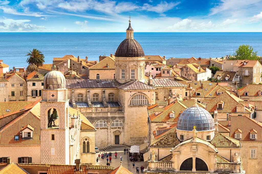
With around 180,000 inhabitants, Split is the second-largest city of Croatia, and a cultural tour de force in its own right. Having been an urban center for over 2,000 years, founded as a colony by the Greeks in Dalmatia, the city teems with historical landmarks, museums, and galleries through which its extensive history is lovingly documented.
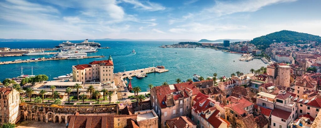
Perhaps the historical centerpiece of Split is the famed Diocletian’s Palace and the adjoining Cathedral of Saint Domnius, forming a massive Roman complex that spans much of Split’s beautiful Old Town. Within the Old Town, you can also see the gleaming marble of Marmont Street, a prime location for shopping and dining; the traditional markets at the Fruit Square; and the European architectural medley at Pjaca Square.
As Split rests on the Adriatic, the coast is of much importance, with beaches and café-lined boardwalks like The Riva all along the shore. Split and the Adriatic are easily viewed from atop the nearby Marjan Hill, a popular site to experience nature near the city. Also near the city are quality wineries, green river valleys, and all sorts of small islands and islets.
These islands can be reached from the Port of Split, which also has ferries to locations elsewhere in Croatia and across the Adriatic to Italy. Bus lines run in and around Split, with the city connected to Zagreb by the Zagreb-Split freeway, and the city has its own international airport, the second busiest in Croatia.


Yes. Croatia has 7,907 named mountains. The highest is Dinara at 1,831 m.
The highest mountain in Croatia is Dinara, at 1,831 m.
Croatia has 7,907 named mountains.


