Scan the QR code and open PeakVisor on your phone
The Dinarides, or Dinaric Alps, are an extension of the Julian Alps that extend from Slovenia to Albania. The Dinaric Alps are home to some of Europe’s most beautiful landscapes, and they offer breathtaking peaks, rugged karst formations, and a rich cultural history There are 30548 named mountains in the Dinaric Alps. Marijash / Bogdash (2,533 m/ 8,310 ft) is the highest point in the range while the most prominent mountain is Bobotov Kuk (2,523 m/ 8,277 ft).
The Dinaric Alps, or as the locals call them Dinaridi or Dinarsko Gorje, stretch from the Julian Alps in Slovenia to the border between Albania and Montenegro. However, despite their name, the Dinarides are not a division of the European Alps, which are located to the north.
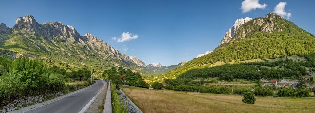
Once the range passes over the Albanian border, they become another range that’s known as the Albanian Alps. The most prominent peak of the Albanian Alps is Maja e Jezercës (2,694 m/ 8,839 ft) or Maja Jezerce. It is often said to be the highest peak of the Dinarides, however, this is a misconception because Maja Jezerce is located in Albania, making it part of the Albanian Alps—not the Dinarides proper.
However, don’t be fooled by these naming contentions. The Albanian Alps are not exclusively made up of the Prokletije massif. They include all of the mountain massifs of the Dinarides that are located inside Albania. While these mountains do form a geological unit with the Dinarides, they are not politically part of them.
In fact, if you ask locals inside the Dinaric region whether Albanian Alps are part of the Dinaric Alps, they will likely say that the Albanian Alps are part of the range. On the other hand, Albanians don’t agree and they say that the Albanian Alps are part of the Dinaric region.
Where is the border between the Dinaric and Albanian Alps, you might ask? It lies (politically, at least) on the border between Kosovo, Montenegro, and Albania. The border divides the Prokletije mountains in half, but there is no real topographic partition between the ranges.
The Dinaric Alps stretch across the Western Balkans. They cover Bosnia and Herzegovina, Croatia, Kosovo, Montenegro, Serbia, and Slovenia. Some believe Albania should be included on this list too, because the Dinaric Alps form a unit with the Albanian Alps. The highest peak of this mountain range is Marijash / Bogdash (2,533 m/ 8,310 ft) in Kosovo.
Generally speaking, the range lies between the Pannonian Plain, Julian Alps, Adriatic Sea, Albanian Alps, and the Šar or Sharri Mountain. The Dinarides run in a northwest to southeast direction and they are about 500–700 km (310–434 mi) long and 50–200 km (51–124 mi) wide.
The Dinaric Alps got their name from the peak Dinara, which lies between Bosnia and Herzegovina and Croatia. There is another theory that says that they got their name from the word Dēnārus, which means “heavenly” or “of heaven.” In any case, the peak of Dinara got its name from the province of Dalmatia in the Roman Empire, which, in turn, got its name from the Illyrian tribe called Dalmatae.
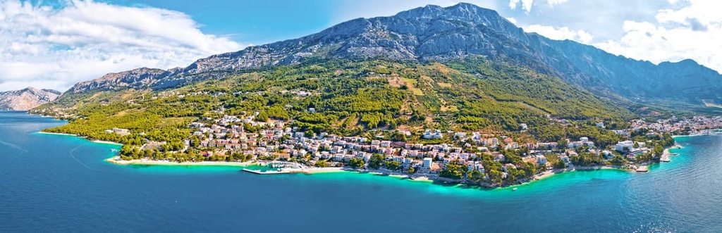
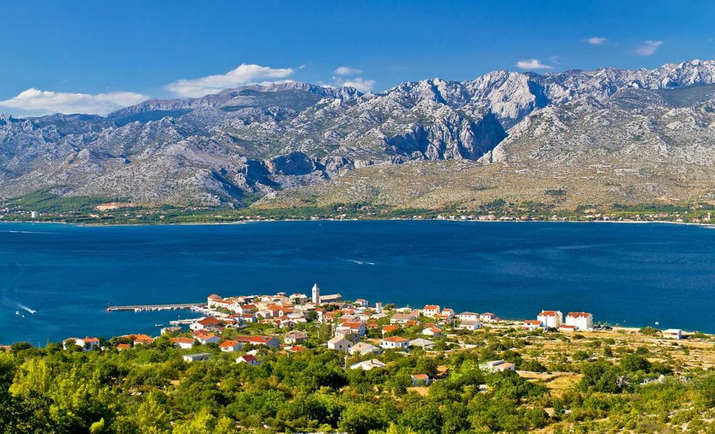
Geographically speaking, the Dinaric Alps run down the coast of the Adriatic Sea. One might even think the sea is the western border of the range. But, in fact, all Adriatic Islands are of Dinaric origin, which means that all the islands in Croatia and Montenegro are part of the Dinaric Alps, too.
In the east, the Dinarides venture into Serbia, and their border is defined by the Drina, Kolubara, Ibar, and Sitnica rivers. The Dinarides also serve as a natural border between the Mediterranean climate and the Balkan Peninsula hinterland.
Behind the mountains, one can find arable land and a number of relatively densely populated areas. Most people in the region live in cities and towns within valleys that are full of rivers and streams.
On the other hand, the higher elevations of the Dinaric Alps are home to limestone and karst formations that are often devoid of water and are otherwise inhospitable to the growth of long-term human settlements.
Here are some of the must-sees when visiting the Dinarides:
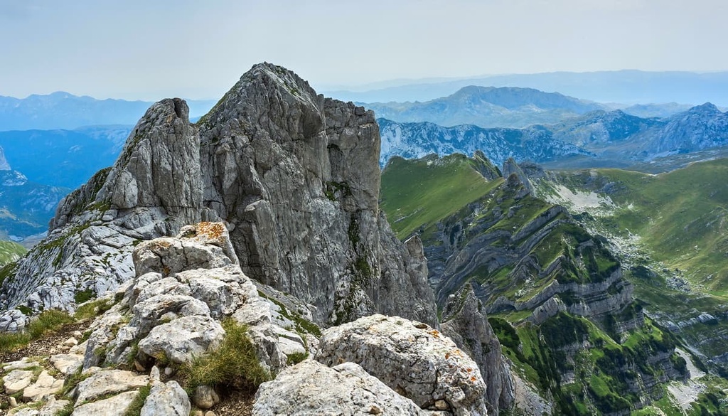
The Dinaric Alps are known for their steep slopes and rugged terrain. The Alpine orogeny of the Dinarides happened during the Paleocene Cenozoic era some 43 to 66 million years ago. The Dinaric Alps formed when the European Plate collided with the Adriatic Microplate, creating the Dinaric Alps and Adriatic Islands in the process.
These mountains include a part of a unified geologic formation, whose most notable rocks formed in the Tertiary Period. Together with the Julian Alps, Albanian Alps, and Sharri Mountain, the Dinaric Alps form the Adriatic carbonate platform.
Within the range, the rocks are primarily carbonates that include flysch, limestone, and the occasional dolomite. The limestone of the Dinarides formed in the Mesozoic Era, while the range itself formed during the Cenozoic Era.
Of course, the most notable feature in the face of the Dinarides is karst. Dinaric karst forms due to constant water flow and the dissolution of limestone rocks. Since limestone rocks and stormy weather are so common here, it’s no wonder that we can see karst formations almost everywhere.
Even though one might expect glaciers below the tops of the Dinaric Alps, there are no glaciers in the range today. In fact, only the Prokletije massif shows definitive signs of glaciation, while the rest of the mountains appear to have experienced relatively little ice during the last major glaciation. In fact, only a few peaks, like Prenj and Durmitor, feature glacially carved landscapes.
The Dinaric Alps also have another characteristic that distinguishes them from other mountains in the region—their plethora of water sources and numerous rivers. Needless to say, they are the result of eons of karstification and waterwork.
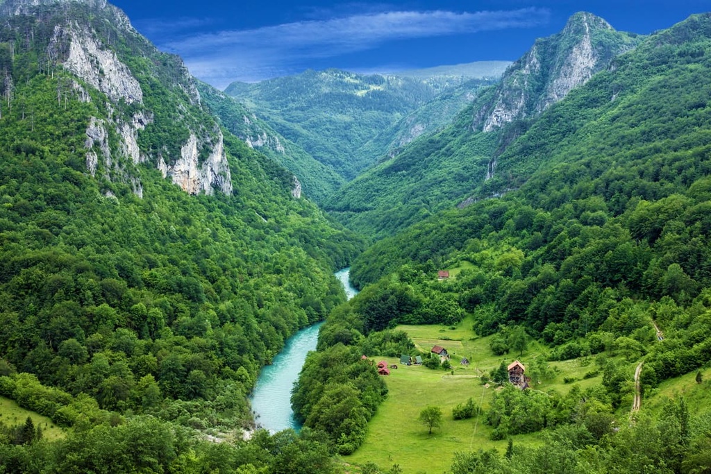
Some of the biggest rivers in the Dinaric Alps include Krka, Cetina, Sava, Drina, Vrbas, Bosna, Drina, Tara, Neretva, Piva, Sutjeska, Morača, and Lim. All of these rivers flow through deep canyons, and the Tara River possesses one of the deepest river canyons in Europe.
Of course, even the massifs are home to lots of rivers and lakes, such as the Treskavica massif in Bosnia and Herzegovina, which has 365 water sources. Numerous caves have also formed in the region as a result of constant water flow. These are most common in the southern and western parts of the Dinarides.
Furthermore, here are the highest peaks of the Dinaric Alps:
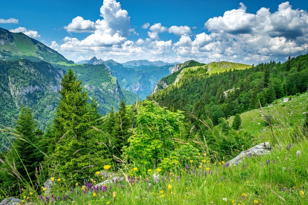
Most of the Dinaric Alps feature the Dinaric Mountains Mixed Forest ecosystem, which will be discussed in detail later in this article. The lowest slopes in the range are home to silver fir, mountain pine, beech, oak, and Norway spruce. The highest mountain peaks are mostly alpine meadows that give way to bare rock and, in the winter, icy slopes.
The Dinaric Alps have so much to offer since they are home to thousands of animal species. Species like chamois, Eurasian lynx, Eurasian wolf, wild boar, and Eurasian brown bear are all found in the range.
The climate in the range is relatively mild, especially when you consider the fact that the range is located in close proximity to both Mediterranean and continental climates. In fact, the Dinaric Alps form a border between these two climates, and therefore storms and harsh winds are to be expected on the mountains.
Generally speaking, the climate in the range is mostly sunny with occasional rain showers and snowstorms in the lower elevations. In the alpine regions of the range, long, harsh winters are the norm, though the days tend to be relatively sunny. One can even expect an alpine climate on the highest peaks of the Dinarides.
The Dinaric Alps primarily consist of a handful of major ecoregions, including the Balkan Mixed Forests, Dinaric Mountains Mixed Forests, and Illyrian Deciduous Forests. The most common ecoregion in the range is the Dinaric Mountains Mixed Forests.
The Balkan Mixed Forests is most commonly seen in the Rila and Šar regions or the nearby massifs. Of course, one can see this ecosystem in the Dinaric Alps as well, mostly on elevated plateaus in Montenegro and Bosnia and Herzegovina.
Some of the main tree species in this ecoregion include juniper pine and shrubby pine. The fauna in this ecoregion includes wolves, bears, deer, and wild boars.
Another ecosystem often seen in the lower elevation of the Dinaric Alps throughout Croatia, Serbia, Slovenia, Bosnia and Herzegovina, Montenegro, and Kosovo are Illyrian Deciduous Forests. These forests are full of voles and small rodents, snakes, birds of prey, deer, and wild boars.
These forests feature black pines and silver firs. Since most Illyrian Deciduous Forests grow at lower elevations, there are also stands of oaks, spruces, beeches, chestnuts, and hornbeams.
The Dinaric Mountains Mixed Forests ecoregion is a terrestrial ecoregion found in the Dinaric Mountains of southeastern Europe. The Dinaric Mountains Mixed Forest ecosystem is part of the larger Mediterranean forests, woodlands, and scrub biome. This ecoregion is primarily found in southeastern Europe, and it includes parts of Albania, Bosnia and Herzegovina, Croatia, Montenegro, Serbia, Slovenia, and Kosovo.
The climate in this ecoregion is temperate with warm summers and cold winters. This region has a humid continental climate with high precipitation year-round. The average temperature is between 10°C (50°F) to 12°C (54°F) and it has an average annual precipitation rate of 1,500–2,000 mm (59–78 in).
The Dinaric Mountains Mixed Forests ecoregion has a rich biodiversity with many endemic species. Human activity impacts the region, and now only about 10% of its original vegetation remains.
In particular, illegal logging is common throughout the Dinarides. People throughout the range cut down its forests and sell illegal firewood, which has had a huge negative impact on the ecology of the region as a whole.
Preventing this sort of illegal logging is particularly important when one considers that the range is one of the largest contiguous forested areas on the continent. Here, the most well-known predator is the Eurasian lynx, though you can also see the critically endangered Balkan lynx subspecies (Lynx lynx balcanicus) if you’re lucky. In addition to lynx, one can see bears, wolves, deer, and chamois in the range.
This ecoregion also features a zone of conifer trees at elevations between 1,200–2,500 m (3,937–8,202 ft). This zone consists of spruce, silver fir, and black pine. At lower elevations, one can see beech and oak forests, too.
Humans have inhabited the area surrounding and inside the Dinaric Alps for centuries. Here are some of the most important periods in the history of the Dinarides:
Humans have inhabited the Dinaric Alps for over 20,000 years. The earliest evidence of human occupation in this region dates back to the Paleolithic Period.
However, the Dinarides have long acted as a natural barrier to human migration between the inland plains and the sea. None of the first humans to live in the area are believed to have crossed the Dinaric Alps, so relatively few artifacts from this period can be found in the range.
In the Neolithic period, there was an increase in population density in the region due to the adoption of agriculture and animal husbandry. This led to a shift from hunting-gathering lifestyles to farming lifestyles among local communities.
What influence did this change have on the mountains, one might ask? As a result of this shift toward a more agricultural society, more people in the region needed to be closer to the sheep pastures in the mountains, so they started living at the bottom of the mountains for easier access to water and food. This is when humans first began living in the Dinaric Alps proper.
Today, the Dinaric Alps are home to many different cultures and ethnicities, including ehtnic Bosnians, Croats, Montenegrins, Serbs, and Slovenes. In prehistory, the area was inhabited by numerous tribes that spoke a similar language.
During the Iron Age, when humans learned how to manipulate and use iron, many different tribes lived in the Dinarides. These tribes were collectively known as the Illyrians.
The Illyrians were a group of Indo-European speaking peoples who lived throughout the area that we now call the Balkans. They spoke a language called Illyrian, which some researchers believe is most closely related to modern Albanian (though more research is needed to understand this connection).
The Illyrians, according to many sources, were a people who lived in the region along the coasts of the Adriatic and the Ionian seas, or, in other words, from present-day Albania to Bosnia and Herzegovina. In antiquity, they were often known as pirates who raided coastal settlements on both coasts of the Adriatic Sea.
Therefore, almost all of the Illyrian tribes gravitated toward the sea, though some tribes survived primarily off of agriculture and animal husbandry. Life for the Illyrians was not easy, they were constantly under threat of war. They were known to battle over land, horses, and even water sources. The biggest war the Illyrians faced together was against the Roman Empire.
The Romans had been expanding their empire for centuries, but they met their match when they came to Illyria. The Illyrians were fierce warriors who resisted Roman rule for years. In 168 BCE, the Romans started to conquer Illyria, forcing the Illyrians to submit to the laws of the Empire.

The fighting stopped at the turn of the first century BCE. when the Illyrians surrendered after years of fighting. This also meant that the Dinaric Alps were soon mainly part of the province of Dalmatia in the Roman Empire.
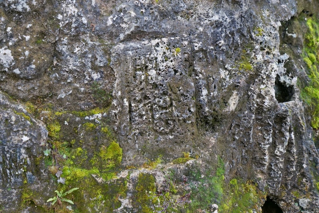
The Dinarides were places of pilgrimage to medieval people of the Western Balkans. They often chose exposed locations like mountain tops and viewpoints to build churches and chapels.
This custom comes from early medieval Slavic people that inhabited the Dinaric Alps in the sixth century. In addition to their language, the Slavs also brought with them their folk tales and beliefs. The word "Slav" is derived from the ancient words slov or slovo, which literally meant ‘people speak or talk in the same language.’ By some accounts, slovo simply meant ‘word.’
One of the Slavic tribes’ best known practices was their tradition of placing shrines for their Gods on the tops of mountains. Nowadays, the descendants of these Slavic tribes today inhabit a massive contiguous region in Central and Eastern Europe that includes everything from Russia, Poland, and Ukraine to the bulk of the Balkan Peninsula.
The Slavs on the Balkan Peninsula inhabited what is now Bosnia and Herzegovina, Croatia, Kosovo, Montenegro, Serbia, Slovenia, Greece, and North Macedonia. Of course, this also included the Dinaric Alps, since most Slavs built their shrines here.
In the medieval period, the Dinaric Alps were divided between kingdoms and the Dinarides themselves often served as a border between these kingdoms. Some of the many kingdoms and duchies that were formed in the region included the Bosnian Kingdom, Croatian Kingdom, Serbian Kingdom, Kingdom of Austria-Hungary, Duchy of Zeta (today Montenegro), Kingdom of Ragusa (today Dubrovnik).
Soon after these medieval kingdoms fell, numerous other rulers tried to control the Dinarides. These included Ottomans, Habsburgs, and Greeks, among others, though none of these governments stood the test of time.
In the nineteenth century, the borders that we know of today started to form as different nations sought independence. During the golden age of alpinism, the Dinaric Alps were less frequently climbed than other European mountain ranges.
In fact, the birth of hiking and mountaineering in the range primarily took place at the turn of the twentieth century. It started with the first ascents on peaks like Velebit, Prenj, and Durmitor.
The most notable period in the contemporary history of the Dinarides was the unification of Yugoslavia. At first, Yugoslavia acted as a kingdom, and soon as a federative republic with a communist rule. Why is this period important for the Dinarides? It meant a unified state that ruled over them and tried to conserve their natural beauty.
This is the time when the region built the range’s first national parks, which stand proudly to this day. Today, we have six different nations governing over the parks that protect the beauty of the Dinaric Alps.
With so many peaks, sights, and, most importantly, so many different landscapes to enjoy, the Dinarides are a truly incredible hiking destination. Here are some of the must-see national parks in the Dinaric Alps.
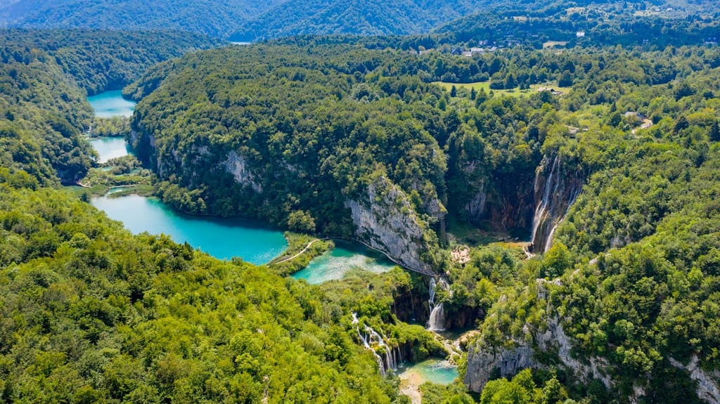
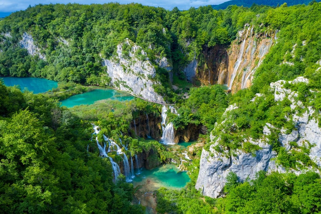
Plitvice Lakes National Park is a national park located in Croatia. It is a UNESCO World Heritage Site, and it was the first national park in Southeast Europe.
The Plitvice Lakes are a series of 16 lakes connected by natural waterfalls that are situated in the Dinaric Alps, which form part of the mountainous karst terrain that covers most of this region.
The lakes were created by natural dams and they are surrounded by a type of limestone known as travertine. The best known and most visited lake in the park is Prošćansko Jezero.
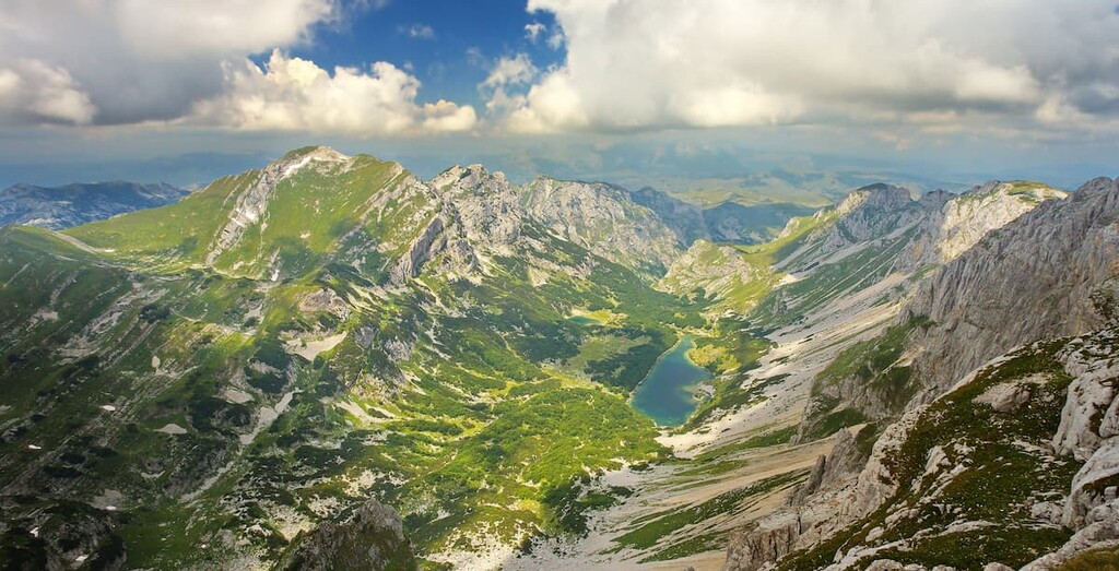
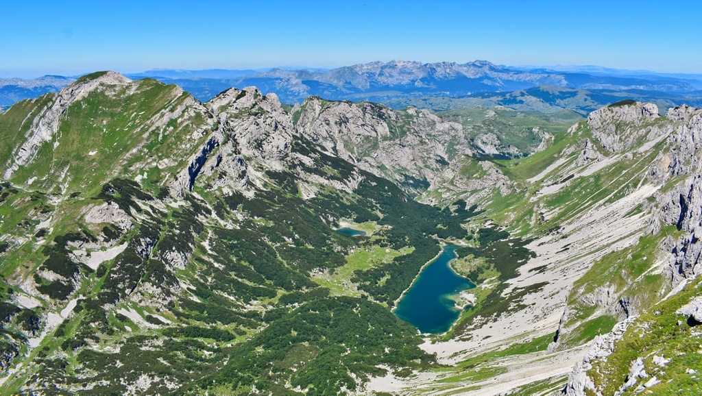
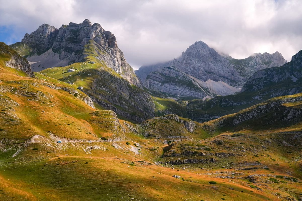
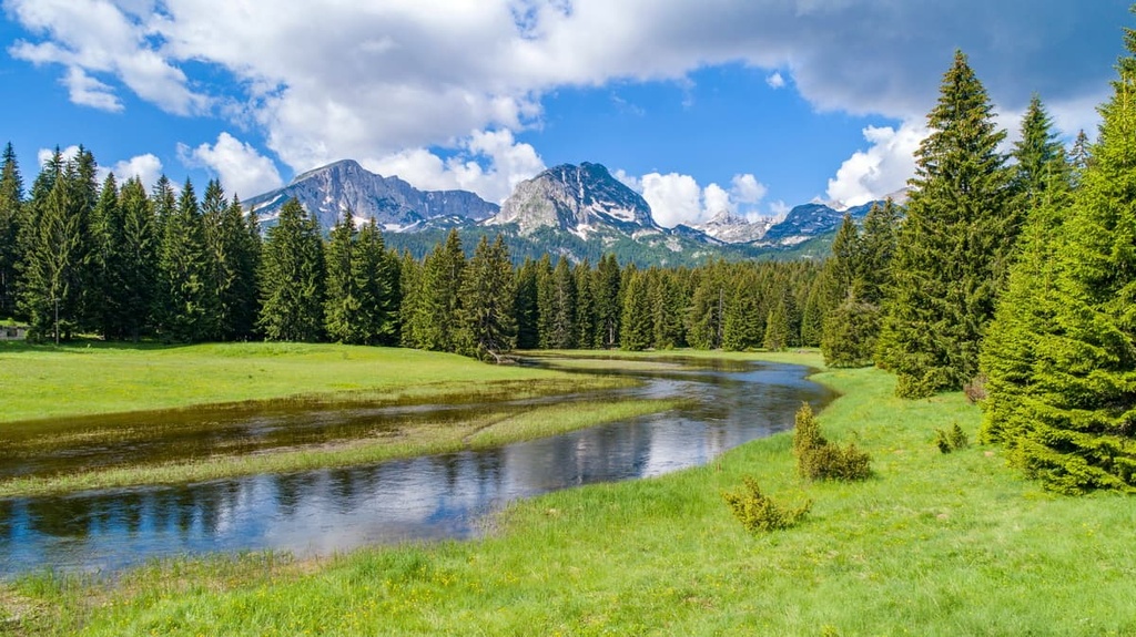
Durmitor National Park is a national park in Montenegro. It lies in the northwestern part of the country, near its border with Bosnia and Herzegovina. The park was established in 1962, and it is one of the oldest national parks in Europe. It was declared a UNESCO World Heritage Site, thanks to its numerous rocky peaks and stunning deep lakes.
Here, one can see the Tara River Canyon. It is located on the country’s border with Bosnia and Herzegovina and is one of the deepest canyons in Europe. The Tara River created the canyon out of limestone and dolomite over the course of millions of years.

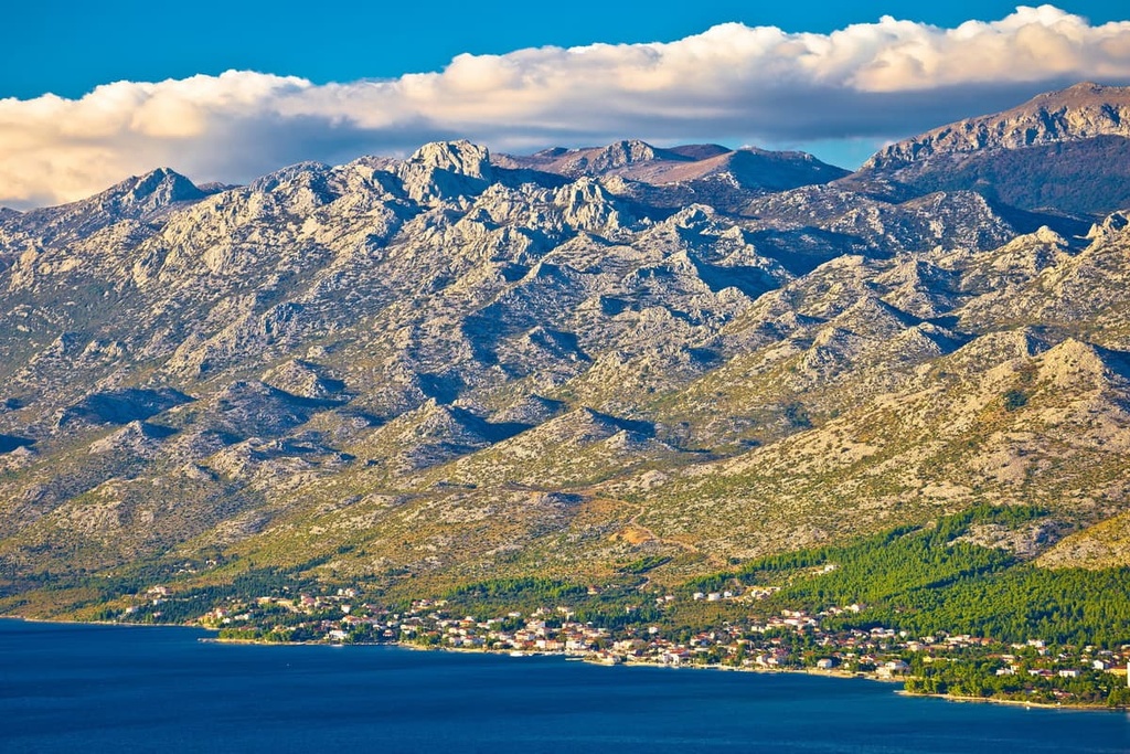
Velebit Nature Park is a park in Croatia that consists of Paklenica National Park and Northern Velebit National Park. It was established in 1998.
The park is the largest and arguably most diverse of Croatia's national parks. It contains a wide variety of habitats, including karst, meadows, forests, and mountainous rocks. The park is home to many endangered species such as the brown bear, lynx, and griffon vulture.
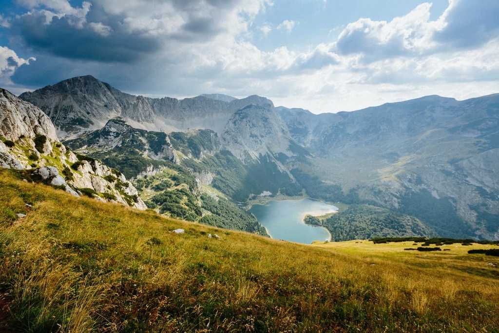
Sutjeska National Park lies to the southwest of Bosnia and Herzegovina, near the country’s border with Montenegro. The park was established on September 27, 1962 in order to protect the region's natural beauty.
It includes parts of Zelengora, Lelija, Volujak, Maglić, and Bioć mountains. Sutjeska National Park is home to many species, including bears, wolves, lynxes, wild boars, deer. It also features the incredible Peručica Primeval Forest.
Blidinje Nature Park is a protected area in Bosnia and Herzegovina. It is located in the municipality of Konjic and Jablanica in the region of Herzegovina, near the country’s border with Croatia. The park was established in 2005.
Blidinje includes three mountains: Čvrsnica, Vran, and Čabulja. It also features a plateau called Blidinje, which is home to the Blidinje Lake. The park has a rich diversity of flora and fauna and it contains a number of endemic species such as Bosnian pine.

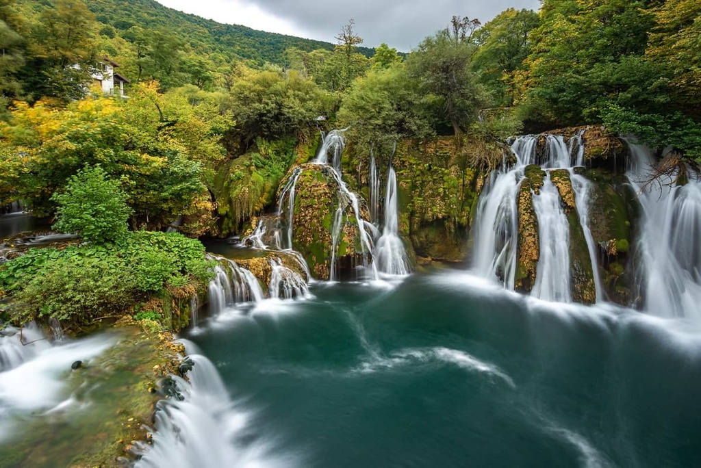
Una National Park is a national park in Bosnia and Herzegovina. It lies in the Una River valley, near the town of Bihać. The park was established in 1999 and includes a section of the Una River Valley. It is best known for its beautiful meandering waterfalls on the River Una.
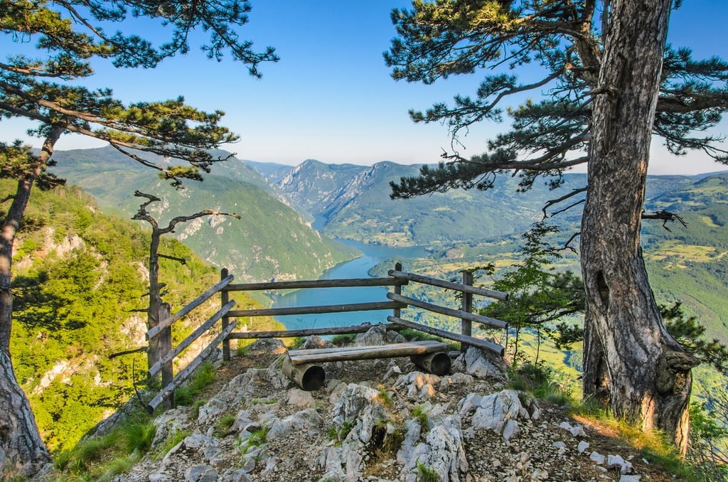
Tara National Park is a national park in Serbia. It lies in the geographical region of Šumadija in the central part of the country.
The park was established in 1981, and it is one of the most visited protected areas in Serbia. It is home to a variety of flora and fauna species, but what most visitors want to see is the park’s beautiful forest landscapes.
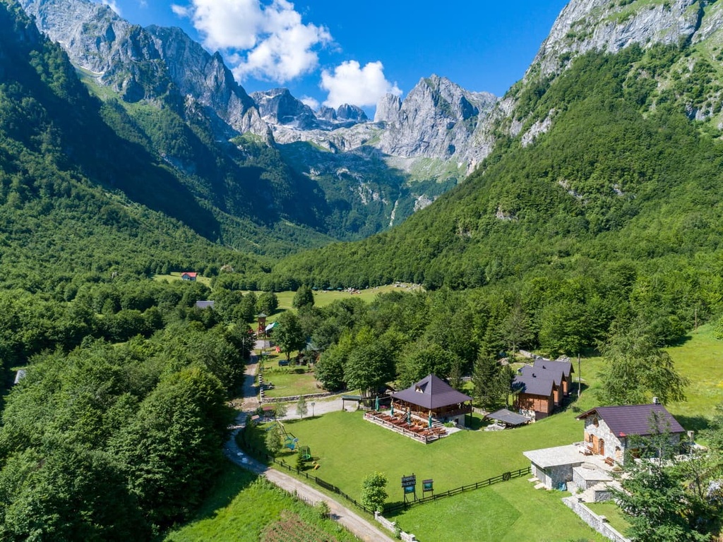
Prokletije National Park is a national park in Montenegro. It lies in the southeastern part of the country, on the border with Albania.
The park was established in 1981. By some accounts, it marks the southern end of the Dinaric Alps as the Albanian Alps are located to the south. However, this is a political, rather than a geologic, division between the two ranges.
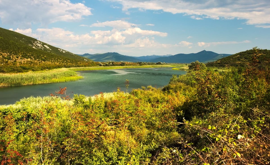
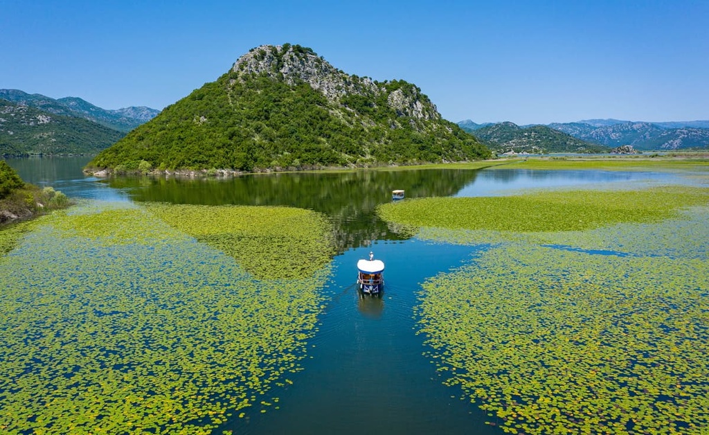
Skadar Lake National Park is a national park in Montenegro. The park’s lake is the largest lake in the Balkans, and it lies on the border of Albania and Montenegro.
The park was established in 1983 and is one of the most important tourist attractions in Montenegro. It offers many activities for tourists such as hiking, biking, fishing, and boating.
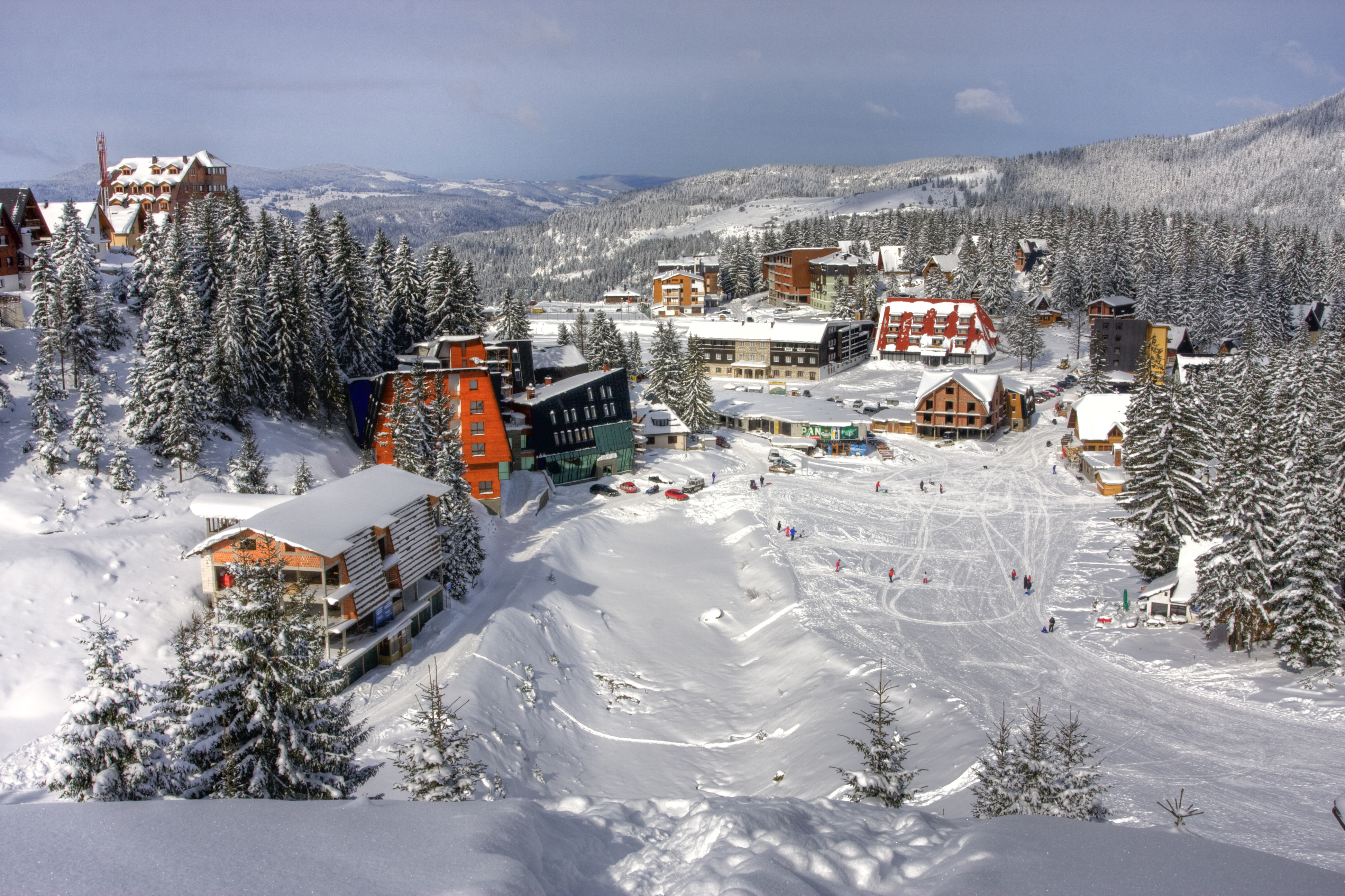
For skiing and snowboarding enthusiasts, there are more than 60 ski resorts in the Dinaric Alps, which are located throughout the range, but mainly as three groups in its central, northern and southern parts, where you will find most of the resorts, including also the largest of them. It is also one of the main areas for skiing in the Balkans.
The largest ski resort in the Dinaric Alps is Kopaonik in Serbia with more than 50 km (31 mi) of slopes and more than 25 ski lifts. The is also the main ski resort near Belgrad, the capital of the state.
Except for one resort, all other major areas for skiing in the Dinaric Alps are located in Bosnia and Herzegovina including Jahorina with more than 45 km (28 mi) of slopes and more than 15 ski lifts as the second-largest in the range and several smaller ones such as Babin Do-Bjelašnica, Adria Ski-Kupres, Ravna Planina, Vlašić, and other. The exception is Kolašin 1450 / Kolašin 1600 in Montenegro with more than 45 km (28 mi) of slopes and more than 5 ski lifts in Montenegro.
These are also the main ski resorts near Sarajevo and Podgorica, the capitals and the largest cities in the aforementioned countries.
Check the Dinaric Alps ski resorts map in the World Mountain Lifts section of the site. It includes information about open ski lifts / slopes in the Dinaric Alps in real-time with opening dates and hours. There are also year-round cable cars, funiculars, cog railways, aerial tramways, and all other types of mountain lifts.
If you’re looking to stay somewhere fun and exciting when visiting the Dinaric Alps, you have plenty of excellent cities to choose from. Remember, there are plenty of village and mountain hut accommodation options in the Dinarides, too, but checking out the local culture in the range’s many nearby cities is also well worth the effort.
Ljubljana is the capital and largest city of Slovenia. It is situated on the Ljubljanica River in the central part of the country. It lies near both the Julian Alps and Prealps and the Dinaric Alps.
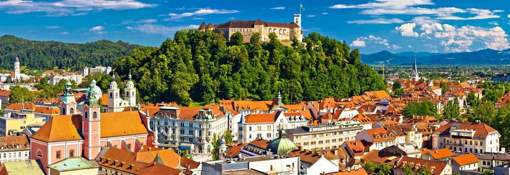
The city has a rich history of art and culture and it currently features many museums, galleries, theaters, cinemas, and other cultural institutions. You can reach Ljubljana by car, bus, rail, or air.
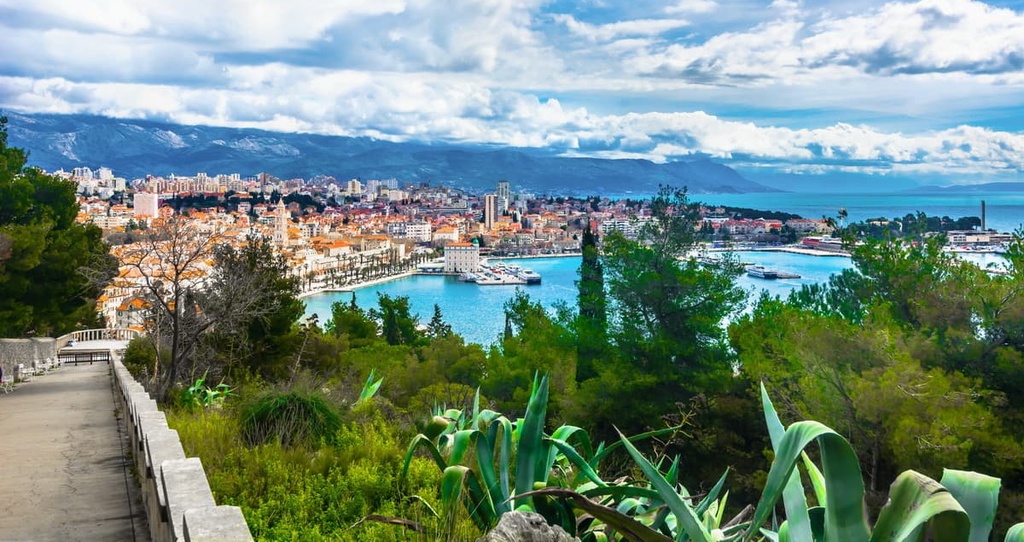
Split is the second-largest city in Croatia. It is located on the eastern shore of the Adriatic Sea and has a population of 178,000 people.
Split is a popular tourist destination because of Diocletian's Palace, which Emperor Diocletian built in 305 CE as a retirement palace. Split is also located near Velebit Nature Park, Paklenica National Park, Northern Velebit National Park and Biokovo National Park.
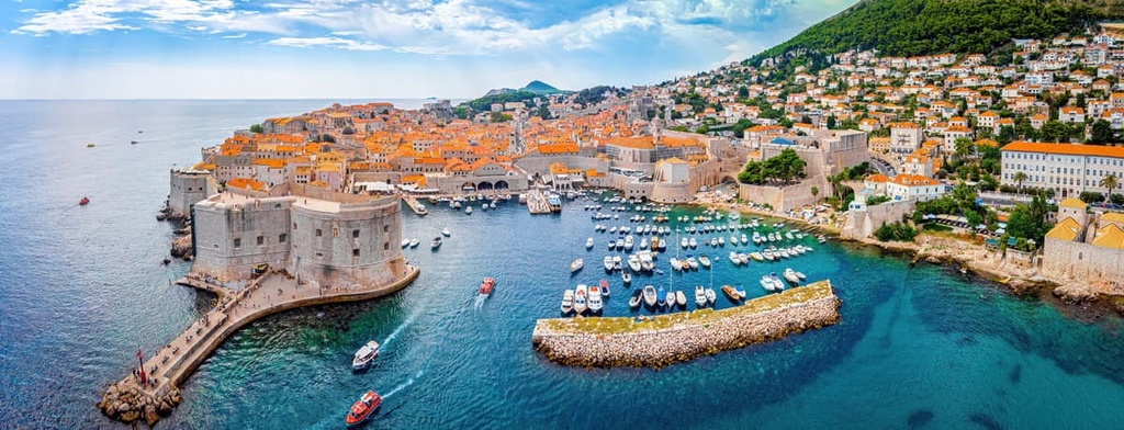
Dubrovnik is a true wonder to behold. This popular tourist destination, which attracts over one million tourists per year, lies on the Croatian Adriatic Coast.
The city was a major maritime republic in the Mediterranean during the Middle Ages, and its strategic location made it an important stopover on trade routes between Greece and Italy. The most significant attraction in Dubrovnik is its well-preserved medieval walls.
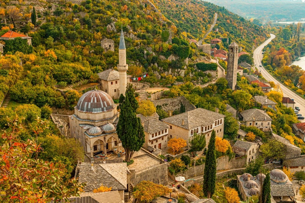
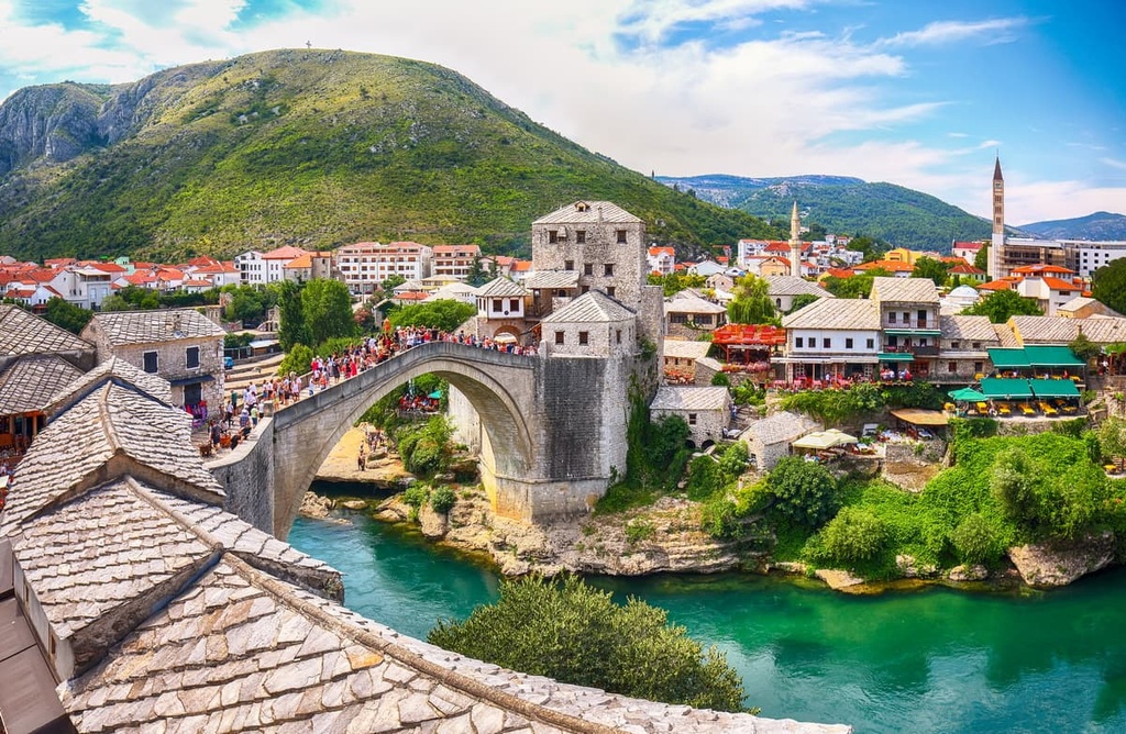
The city of Mostar lies in the southern part of Bosnia and Herzegovina. It is a popular tourist destination and recognized as a UNESCO World Heritage Site.
The Old Bridge, which was built in 1566, is one of the most recognizable landmarks in the city. The bridge spans the Neretva River and connects two parts of town on either side of the river.
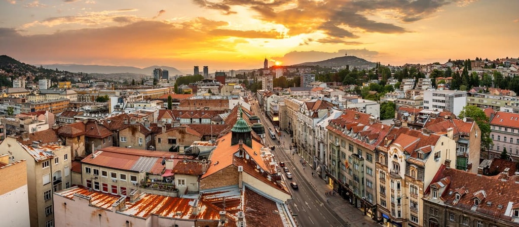
Sarajevo is the capital and largest city of Bosnia and Herzegovina. Sarajevo is also known for its multicultural heritage and religious diversity.
It has been home to people of different ethnicities and religions since its founding in the fifteenth century. Sarajevo is known for its central location in the Dinaric Alps. It is relatively close to almost all of the local mountains.
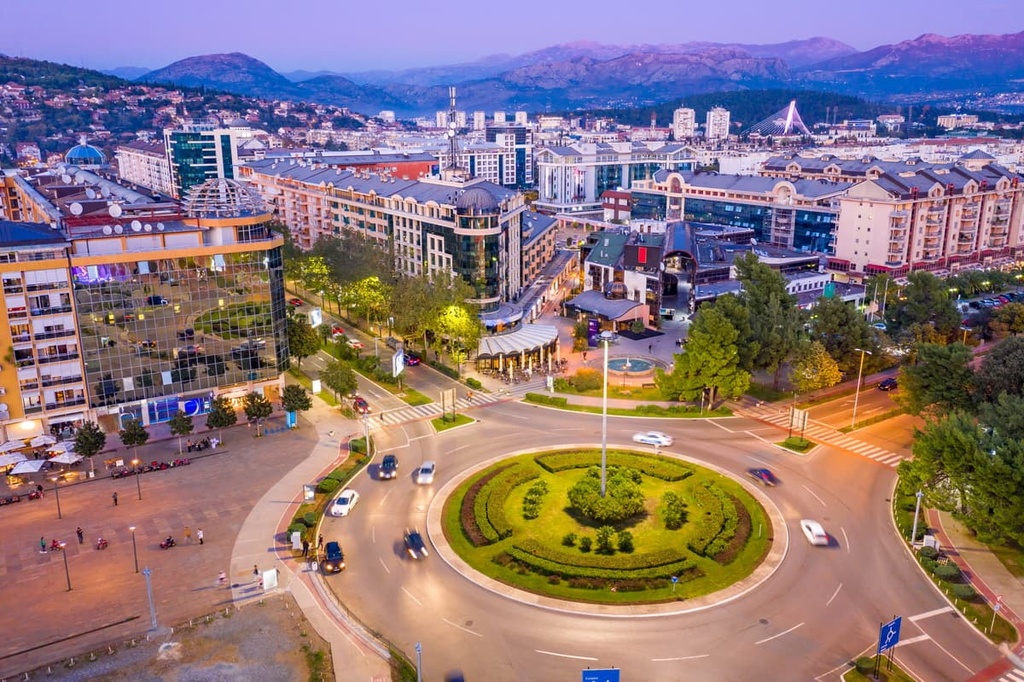
Podgorica is the capital and largest city of Montenegro. Podgorica is a beautiful city with a population of around 220,000 people.
It is situated in the valley of the Morača River and lies surrounded by mountains. Podgorica has a rich cultural heritage, and it is home to many museums, galleries, libraries, theaters, and other institutions. If you’re in Podgorica, you are also located halfway between both the Durmitor and Prokletije massifs, which are popular hiking destinations.