Scan the QR code and open PeakVisor on your phone
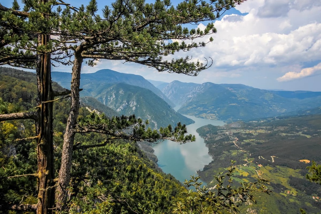
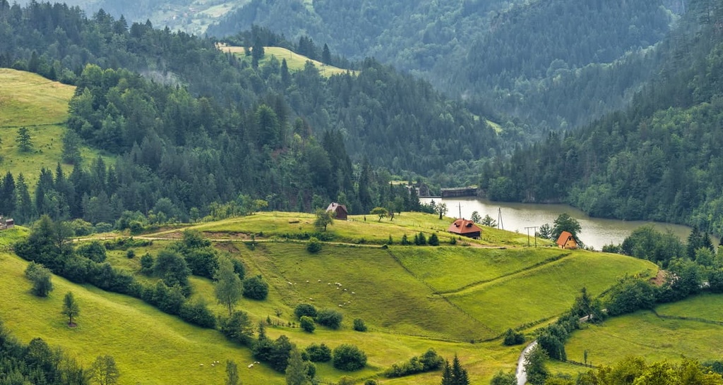
Tara National Park is a protected area located in western Serbia right along the country’s border with Bosnia and Herzegovina. It is one of the largest national parks in the country, and it features lush forests with beautiful vistas and steep canyons. There are 60 named mountains in Tara National Park. Kozјi Rid (1,591 m/5,219 ft) is the highest point in the park while the most prominent mountain in the park is Smiljevac (1,451m/ 4,760 ft).
The area around Tara Mountain was declared a National Park on July 13, 1981. It is located in the Starovlaška Mountains in Serbia. It is located in the extreme western part of Serbia and covers a wide area up to the elbow of the Drina River near Višegrad.
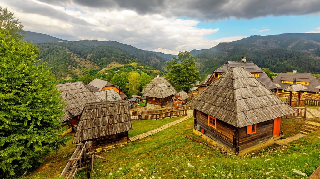
The park’s flora and fauna are particularly biodiverse, and it offers many opportunities for outdoor recreation, including hiking, camping, cycling, horse riding, and fishing. In addition to the park’s natural beauty, Tara National Park also has numerous cultural heritage sites that are protected under law.
Tara National Park is located in Serbia, right on the border with Bosnia and Herzegovina. It runs along the Drina River between Višegrad and Bajina Bašta. The peaks in the park are part of the old Vlach Mountains.
The Tara massif, in particular, is composed of the mountains of Kaludjerka Bara, Tara, Aluška planina, Crni vrh, and Zvezda. It has an area of 183 sq. km (113 sq. mi), a length of 50 km (31 mi), and a width of 22 km (13 mi).
The area of Tara National Park occupies the most significant part of the Tara massif along the Drina river with Bosnia and Herzegovina. The eastern and southern borders of the massif are located on the administrative line of the Bajina Bašta municipality, which covers and governs the entire area of the national park.

Tara could be considered a medium- to high-elevation mountain range for the region as it has an average elevation of 1,000–1,200 m (3,280–3,937 ft). The highest peak in the park is Kozјi Rid, which has an elevation of 1,591 m (5,219 ft).
There are several reasons why Tara has been declared a national park. The most important reason is its plant life since the area is home to well-preserved forest ecosystems. Here, one can also find endangered Pančić spruce. Last but not least, there is quite a lot of biodiversity found throughout the park.
Tara National Park includes the largest parts of the Tara and Zvijezda mountains, which the Derventa Gorge naturally separates. It lies in the eastern part of the Dinaric Alps. Tara gently descends into the Kreman Valley to the south side as it makes its way toward the Solotuška River.
The park is essentially a mosaic of areas that are intersected by various rivers and streams. The most important rivers in the park include Rača, Derventa, Beli Rzav Rivers and Brusnički Potok.
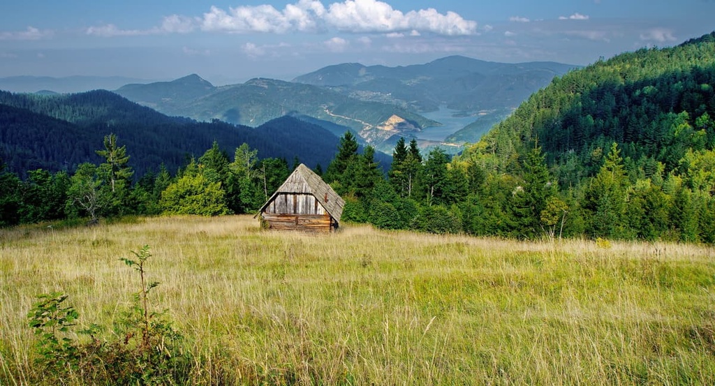
Tara offers great views, deep forests, mountain lakes, and natural beauty. Adventuring here will provide you with a unique opportunity to explore remote, untouched areas. Here are some of the areas you can see when visiting the park:
Tara is one of the most beautiful places in Serbia, and it’s a great place to learn about the region's long and tumultuous geological history. Tara is built out of igneous, metamorphic, and sedimentary rocks that were created by geological forces in the Paleozoic Era.
The geology of Tara National Park is diverse as it includes limestone, sandstone, and conglomerate formations. There are also karst formations in the park that feature sinkholes, caves, and underground rivers.
The assortment of rock types found in the park is quite diverse as there is a mix of shale, sedimentary rock, peridotite, amphibolite, and limestone. The oldest rock formations in the park are Paleozoic shales, sandstones, and conglomerates that are present on the northern and northeastern slopes of Tara mountain towards the Drina. Over these geological formations lie the Verfen layers, which formed in the Lower Triassic.
But that is not all Tara National Park has to offer. Lower Triassic conglomerates, sandstones, and limestones of the Zvijezda and Tara mountain formations are also found in the park. Jurassic sediments exist as well, as do Upper Cretaceous sediments.
Perućačka and Topla peć are two of the many caves found in the national park. Other notable subterranean features in the park include caverns, sinkholes, and canyons. Karst formations are characteristic of the terrain found in Tara National Park.
Tara mountain is composed of limestone but still has numerous surface water flows. Beneath the peaks of Tara and Zvijezda, there are several fast-moving rivers as well as streams and springs. One can even see and enjoy hot springs in the park.
The park has a lot of water sources, including springs, lakes/reservoirs, and flowing waterways (e.g., rivers and streams). Springs form when water emerges from an underground source, lakes/reservoirs collect and store water that is released as rain or snowmelt, and flowing waterways like rivers and streams move water downhill.
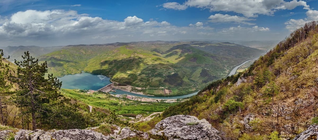
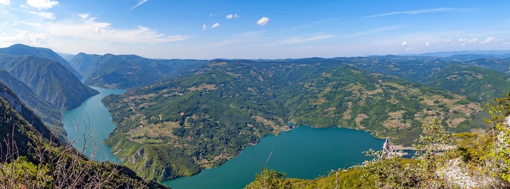
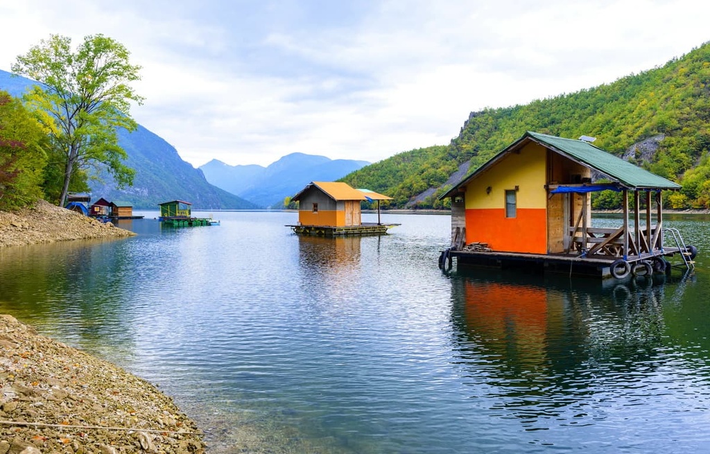
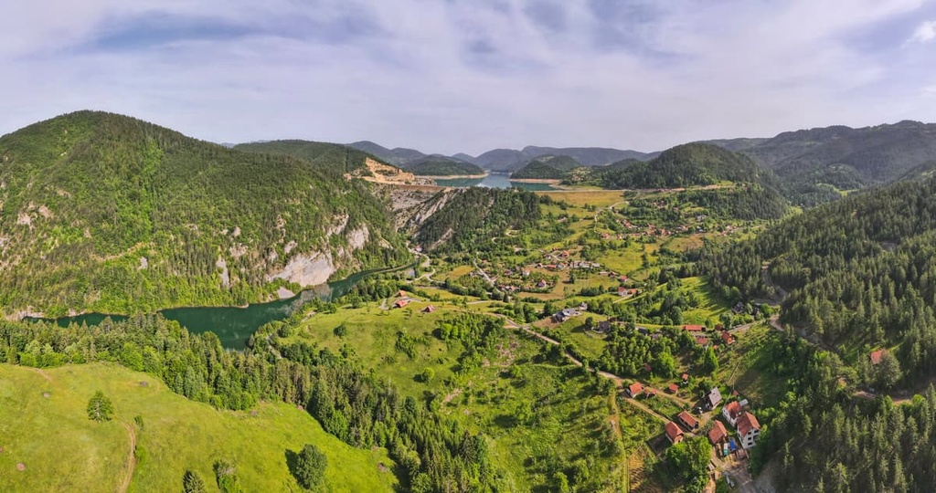
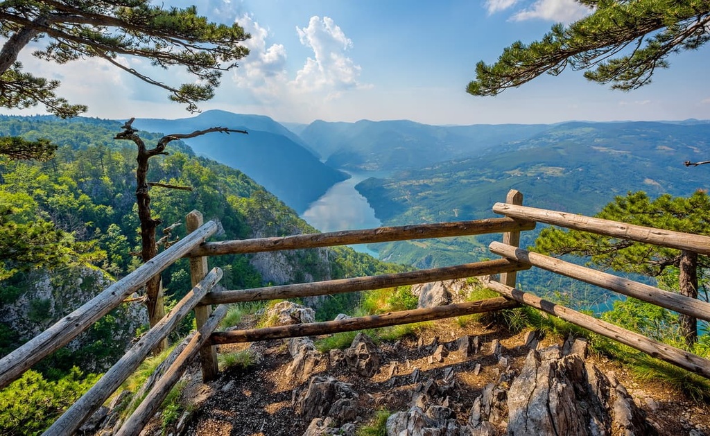
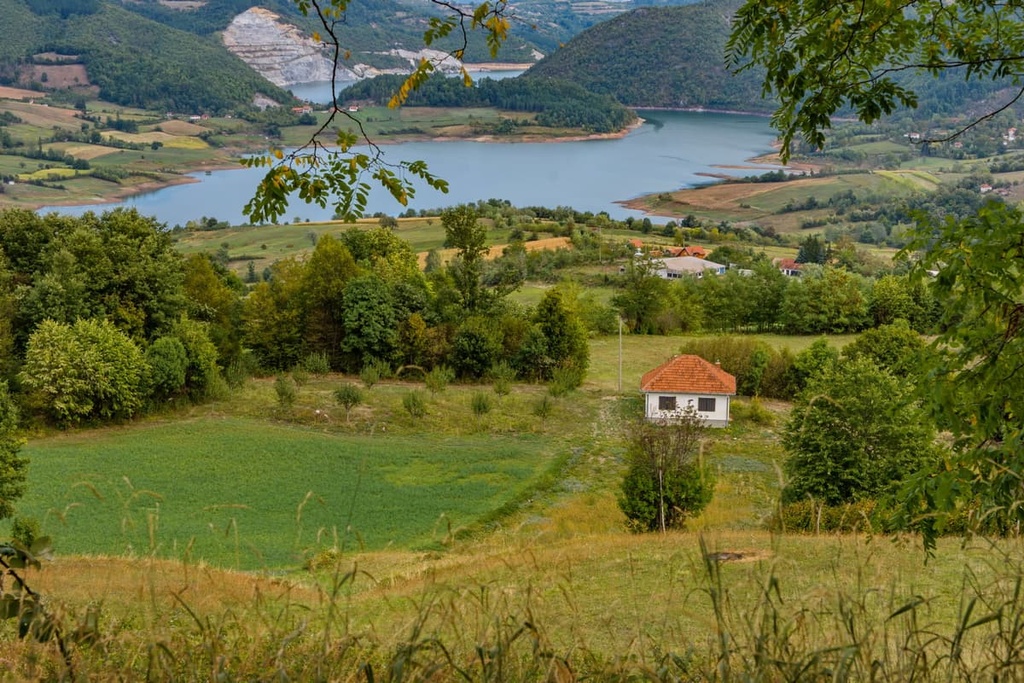
Additionally, the park is home to the canyon of Drina, which is a narrow river valley with beautiful steep cliffs covered in vegetation. It is believed to be one of the largest canyons in Europe. The most notable lakes in Tara National Park are Zaovine and Peručaćko Lake.
The highest peaks of Tara National Park include:
The climate in Tara is generally continental in nature, though the area also experiences Alpine-like winters. Tara’s climate has a definite mountainous influence and a higher humidity level in relation to what you find in central Serbia.
The geographical location of Tara is responsible for the many unique climatic characteristics of this area. Another reason for the uniqueness of the climate in this area is the high degree of precipitation found in the region. The average number of days in a year that the park experiences rain, snow, or clouds is usually around 150 days per year. Most of these days occur in January, April, and June.
Tara National Park is a natural haven that’s home to many rare plant species. Over 1,000 plant species grow in the national park. In fact, the park is home to 36 percent of the total number of plant species in Serbia, and it is known for being home to the unique Pančić spruce.
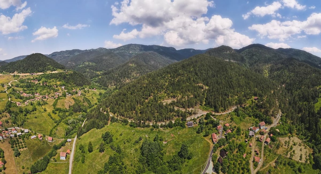
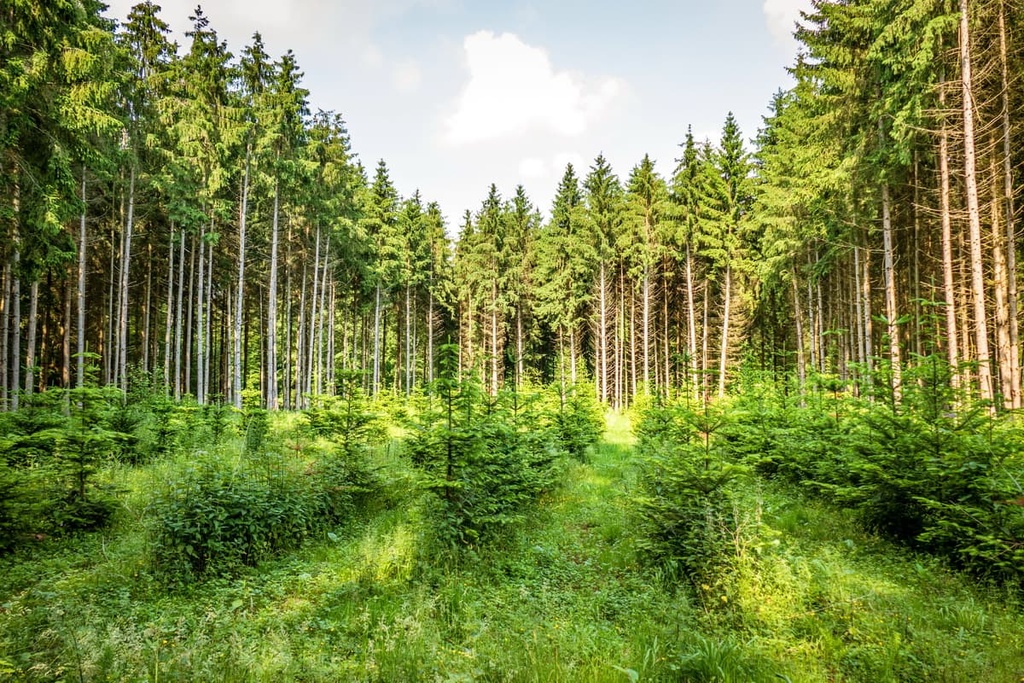
Interestingly, Tara National Park is one of the most forested areas in this part of Europe. The forests here are among some of the best-preserved on the continent, and they're also a vital part of this protected natural area. In fact, various forest ecosystems cover more than 75 percent of the park’s total area.
Tara National Park has forests that we can classify into deciduous, deciduous-coniferous, and coniferous. Beech, fir, and spruce make up a large part of the forests at Tara National Park. Black ash, black pine, and sessile oak are also quite prominent in the park.
The park is also home to a number of alpine meadow ecosystems, which are primarily the result of human land development. However, these are important ecosystems because they support a number of rare and unique plant species. In addition to these meadows, Tara National Park is also home to a handful of smaller peat wetlands and meadow peat bogs.
Furthermore, the park contains many rocky areas that support their own fragile ecosystems. One such area is the cornflower community that grows directly out of the limestone at Derventa. Other species that you’ll frequently find in these areas include milkweed on steep serpentine rocks.
Endemic species are the rarest and most interesting plants in this area. Unlike common plants, they're found locally, mostly in cracks and crevices in rocks or on cliffs. So far, 30 endemic species were recorded in the park, the most famous of them being the Pančić spruce, which was first identified by botanist Dr. Josif Pančić in 1875.
Thanks to laws on forestry in the region, the Pančić spruce has been protected from commercial harvesting over the last 40 years. The park is actually home to one of the largest and most significant populations of these trees, so it’s a superb destination for the botanists among us.
When it comes to wildlife, 19 species of fish and 13 species of amphibians have been identified in the park alone. Researchers have also identified 53 species of mammals in the park including brown bears, wolves, and lynx. Other mammals found in the park include wild cats, deer, wild boars, and otters.
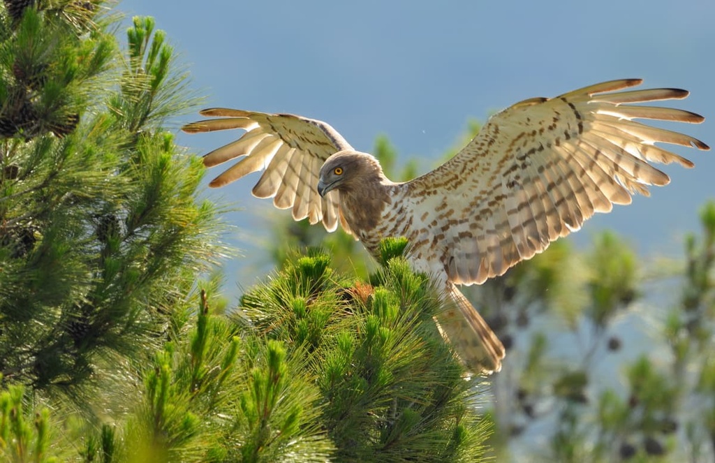
There have also been 135 species of birds recorded so far in the park. Tara National Park is one of the many internationally important bird conservation sites in Europe. The park includes rare and endangered species like the bald eagle and snake eagle as well as the European owl and Ural owl.
The first human settlers of the region were nomadic peoples that arrived and settled in what is now Serbia. They probably ventured into Tara National Park as they traveled the area in search of animals to hunt and plants to gather.
The earliest known civilization to have lived in present-day Serbia was the Neolithic Starcevo culture, which existed from around 4200 to 2700 BCE. They built houses of stone with clay walls in the Drina valleys and beyond. In fact, these were the first settlers who lived permanently below Tara mountain.
In the centuries that followed, communities in the region began to produce a large amount of bronze, copper, and iron, with which they made tools, weapons, and ornaments. The metal they used came from local mines, some of which were probably found below Tara.
At this time, the local people started calling themselves the Illyrians. In addition to the Illyrians, the area that is now Serbia was also home to some Celtic tribes. But, the most widespread peoples in the Western Balkans at this time were the Illyrians.
The Illyrians were a group of tribes that inhabited the Balkans and the Adriatic Sea region in ancient times. They were one of the most powerful tribes in Europe. The Illyrians had their own language, religion, and culture. Their demise came at the hands of the Roman Empire who took over the area and formed the Roman Province of Illyricum. Parts of Serbia were later conquered and were part of Moesia Roman Province.
The Serbian Empire, which existed from 1219 to 1346, was the first Serbian state to be established and ruled by an autocratic monarch. It achieved a large measure of autonomy from the Byzantine Empire, and it soon gained its independence. Serbia was one of the great powers in this part of Europe from roughly 1200 until the early 1800s, along with Russia, Austria, and Hungary.
The Serbian territories were ravaged during Ottoman occupation but ultimately expanded under Serbian rule to include areas as far away as Greece, Bosnia and Herzegovina, Kosovo, Montenegro, and Croatia. During this time, the Serbian Orthodox Church played a major role in the development of the Serbian identity. The church had a significant influence on Medieval Serbia's political, social, and cultural life.
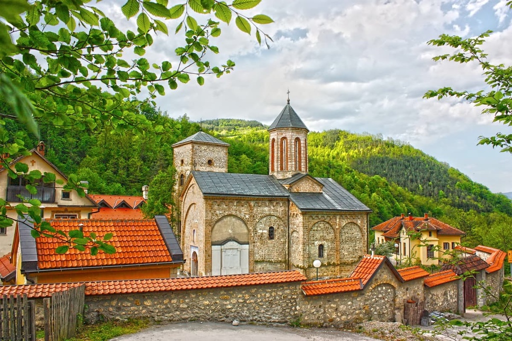
This was also when the Rača Monastery was built. In the thirteenth century, King Dragutin founded a monastery out of gratitude to the Virgin Mary. Since then, the monastery fell twice, but its present-day appearance dates back to 1835.
The Ottoman conquest of Serbia was a military campaign that took place in the late fourteenth and early fifteenth centuries. During this time, the Ottomans managed to conquer Serbia because they had superior military technology, which included cannons, muskets, and other firearms. They also had a larger army than the Serbs. Ottoman rule of the area lasted until 1830, at which point the Kingdom of Yugoslavia came to power.
Before the first Serbian uprising in 1804, the surface of Serbia was mostly forested. Travelers of that time described the forests as “endless.: In its prime, Tara was home to what was perhaps one of the most impressive coniferous forests in this part of Europe, with trees over 1 m (3.2 ft) in diameter.
The Kingdom of Yugoslavia, also called the Kingdom of Serbs, Croats, and Slovenes in its earlier days, was a country in Europe that existed from 1918 to 1943. It was formed after the dissolution of the Austro-Hungarian Empire and the Russian Empire, and it existed in various forms throughout the two World Wars. The Kingdom consisted of six South Slavic states: Slovenia, Croatia, Bosnia and Herzegovina, Serbia, Montenegro, and Macedonia.
Tara was a major battlefield during the wars, and many soldiers lost their lives there. This loss is evident from the numerous war monuments that have been created in the park’s valleys. Both commercial timber exploitation and decades of warfare ravaged the area that is now Tara National Park, leaving behind just a fraction of the trees that once thrived in the region.
The government of Yugoslavia soon realized the natural and floral significance of the region. In 1981, the local government decided to declare this area a protected nature reserve, a status it has held to this day.
Tara National Park features more than 230 km (142 mi) of marked hiking trails. These trails are maintained throughout the year, and there are 30 routes for visitors to choose from. Most of these trails are fairly casual, so there’s something for everyone to enjoy in Tara National Park.
The hike to Manastir Rača starts at Kaluđerske Bare, and it happens to be the most strenuous trail in Tara National Park.
When heading from Kaluđerske Bare to Rača Monastery, you’ll climb more than 750 m (2,460 ft) in elevation. This hike is about 12 km (7.5 mi) long round-trip, and it takes people around 6 hours to complete.
Banjska Stena is a beautiful area that overlooks Drina Canyon. The trailhead for this hike is at Mitrovac, and the route itself passes through Velika Livada village, where there is drinking water available at a public fountain.
This hike is 6.5 km (4 mi) long, and it has almost zero elevation gain as it is nearly flat. Most people take around 2.5 hours to complete this trail, and afterward, many hikers enjoy a picnic on top of the Banjska Stena where they can take in the view.
This simple yet enjoyable hike takes you from Mrka Kosa to Kozјi Rid (1,591 m/5,219 ft). Kozji Rid is the park's highest peak, so this is a great hike for the peak baggers among us.
Despite the fact that it climbs to the top of the park’s highpoint, this trail is still relatively casual as it is just 2 km (1 mi) long and it gains just 150 m (492 ft) of elevation. Generally, it takes visitors around 1 hour to reach the summit, so this is a great trail if you’re looking for a half-day adventure in Tara National Park.
Tara National Park is located in the west of Serbia between Višegrad and Bajina Basta. It’s easy enough to reach from a number of towns in Bosnia and Herzegovina or you can easily travel to the park from cities in Serbia, such as Belgrade, Bajina Bašta, Užice, or Zlatibor.
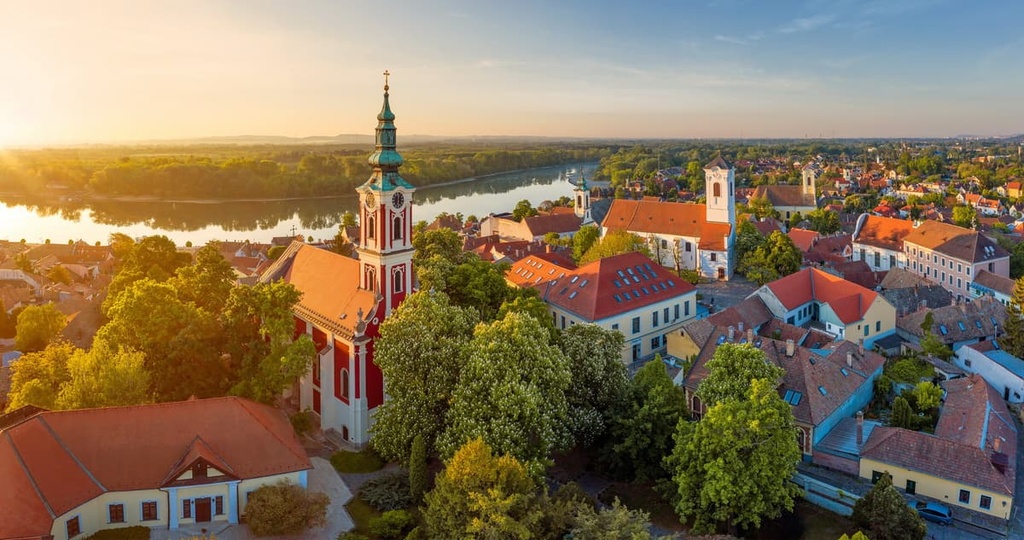
Bajina Bašta is a small town in Serbia. This small municipality has a population of about 10,000 people. The town was founded during the rule of the Ottoman Empire, so it’s rich in history and culture.
Tara National Park is actually located completely inside this municipality, making it a great starting point for adventures in the mountains. There are a number of great accommodation options to choose from in Bajina Bašta and you can get to the town by road or rail.
Zlatibor is a town located in western Serbia that’s located on its namesake mountain, Zlatibor. The region around Zlatibor has been known for its beauty since ancient times when it was called “the golden horn” because of its unique shape.
This small mountain city is the perfect place to stay if you plan on traveling throughout this part of western Serbia. The town of Zlatibor is located near Tornik, which is popular among skiers in the winter months. Additionally, the area caters to outdoor-minded tourists all year long, so it has a superb collection of hotels and restaurants for visitors to choose from.
Belgrade is the capital and largest city of Serbia. It lies at the confluence of the Sava and Danube rivers, where the Pannonian Plain meets the Balkans. One can reach the city by air, rail, and road, and there are accommodations available in Belgrade to suit every visitor.
The city’s most famous landmarks include Saint Sava Temple, Belgrade Fortress, Kalemegdan Park, Knez Mihailova Street, and Republic Square, the latter of which features a statue of Josip Broz Tito (one of the most famous leaders in Yugoslavia’s history) in front of City Hall.