
Scan the QR code and open PeakVisor on your phone
Hungary is home to 5,254 named mountains. The highest is Kékes at 1,015 m.
Despite being dominated by the flat Great Hungarian Plain, Hungary boasts numerous beautiful mountains for hikers to discover. There are 5254 named mountains in Hungary. The highest and most prominent mountain is Kékes (1,014 m/3,327 ft).
Hungary (Magyarország) covers an area of approximately 93,030 sq km (35,920 sq mi) across the Carpathian Basin in Central Europe. It's the seventeenth-largest country in Europe and has a population of roughly 9,689,000 people.
Completely landlocked, Hungary shares its borders with seven countries: Slovakia to the north, Ukraine to the northeast, Romania to the east and southeast, Croatia and Slovenia to the southwest, Serbia to the south, and Austria to the west.
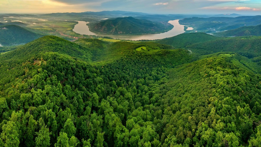
The geography of Hungary is shaped by the courses of its two longest rivers, the Danube and the Tisza. The Danube, the second-longest river in Europe at 2,850 km (1,770 mi) in length, flows from north to south through the middle of Hungary. The Tisza, whose total length is 966 km (600 mi), snakes its way across eastern Hungary.
These rivers split Hungary into three geographical areas. Transdanubia (Dunántúl) encompasses an area of 38,000 sq km (14,672 sq mi) to the west of Budapest. It consists of plains, rolling hills, and low mountain ranges.
Transdunubia features several mountain ranges, including the easternmost limits of the Alps, Alpokalja. The central area of Transdunubia is home to Transdanubian Mountains, while the Mecsek Mountains (Mecsek-hegység) and Villány Mountains (Villányi-hegység) lie to the south.
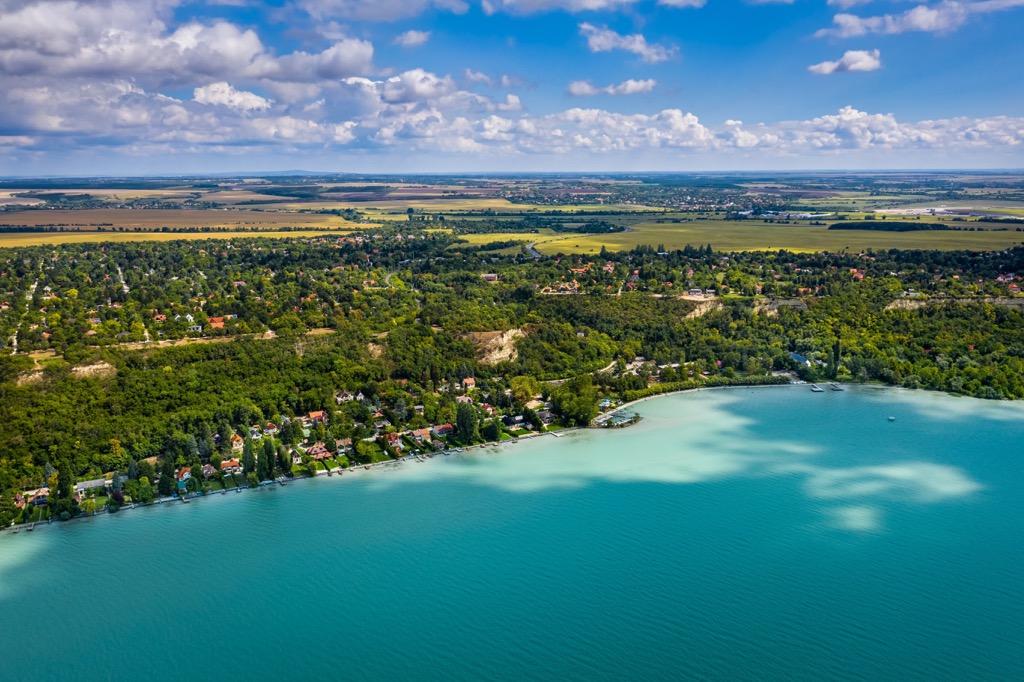
Írott-kő (884 m/2,900 ft) in Alpokalja is the region's highest mountain. Transdunubia contains Lake Balaton, the largest lake in Hungary and Central Europe, with a surface area of 600 sq km (230 sq mi).
Hungary's other two regions, Tiszántúl (beyond the Tisza) and Duna-Tisza kőze (between the Danube and Tisza), occupy the east and central areas of the country, respectively.
These regions are characterized by the Great Hungarian Plain (Alföld), which covers around 52,000 sq km (20,000 sq mi) of Hungary. The Great Hungarian Plain is mostly lowlands and is known for its agriculture.
In the north of Duna-Tisza kőze along the Slovakian border is the Mátra Mountains, which forms part of the foothills of the Carpathians. The Mátras contain Kékes (1,014 m/3,327 ft), the highest mountain in Hungary.
Hungary is split administratively into 19 counties. Kecskemét is the largest county, with an area of 8,444 sq km (3,260 sq mi). Pest is the most populated county, with a population of over 1,200,000 people.
Hungary is home to ten national parks, the largest of which is Hortobágy National Park, with an area of 809 sq km (312 sq mi). A part of the Great Hungarian Plain in eastern Hungary, Hortobágy National Park is Europe's largest semi-natural grassland.
Other notable national parks include Bükk National Park (Bükki Nemzeti Park), Danube-Ipoly National Park (Duna-Ipoly Nemzeti Park), Aggtelek National Park (Aggteleki Nemzeti Park), and Őrség National Park (Őrségi Nemzeti Park)
Budapest is Hungary's largest and capital city. Other large cities include Debrecen, Szeged, and Miskolc.
Hungary forms a part of the Carpathian Basin, a large area of lowlands surrounded by the Carpathians to the north, the Alps to the west, and the Dinarides to the south and southwest. Approximately 68 percent of Hungary lies below 200 m (656 ft) in elevation. Mountains cover roughly 2 percent of Hungary.
The Carpathian Basin, also known as the Pannonian Basin, consists of several basins, including the Hungarian Great Basin, Drava Basin, Vienna Basin, and the Transylvanian Basin. Inselbergs separate each basin. As a result, the Carpathian Basin isn't composed of one solid block but of rock from different geological periods.
Most of Hungary's landscape was sculpted during the Late Cenozoic around 33 million years ago. Large back-arc basins were created on the northern shoreline of the Tethys Ocean and the edge of the Eurasian plate as a part of the Alpine orogeny.
Unusual crust thinning and a high geothermal gradient caused the creation of these back-arc basins. Geologists believe the high geothermal gradient was the result of high volcanic activity, with andesitic rocks causing Hungary's thin crust. Hungary has the thinnest crust in continental Europe, apart from Italy.
The oldest rocks in Hungary are found in the Zemplén Mountains (Zempléni-hegység), dating back 900 million years. The geological formation of Hungary is highly varied.
The Sopron Mountains (Soproni-hegység) and the Velencei Mountains (Velencei-hegység) are composed mainly of Carboniferous granite.
The Triassic period saw the formation of limestone summits, including the Transdanubian Central Mountains, the Villány Mountains, and parts of the Mecsek Mountains. This limestone was deposited during the Jurassic period. In the Balaton Highlands near Lake Batalon, Lower Paleozoic phyllite and carbonates are present.
The North Hungarian Mountains have the most complex geology of all of Hungary's mountainous regions. Geologists have uncovered Paleozoic slate and carbonate in the Szendrő and Uppony Hills, while the Bükk mountains consist of metamorphosed sedimentary and igneous rocks from the Jurassic and Upper Paleozoic. Strips of Carboniferous granite are found in Mecsek Mountains.
Aside from Hungary's highest peak, Kékes, notable summits in Hungary include Hidas-bérc (991 m/3,251 ft), Galya-tető (965 m/3,166 ft), Csóványos (938 m/3,077 ft), and Hármashatár-hegy (485 m/1,624 ft).
Roughly 10 percent of Hungary's landmass is protected by national park status, so there’s no shortage of places to reconnect with nature. Read on to learn about Hungary's wildlife.
Hungary boasts a diverse mammal population, which includes brown bears, moose, Eurasian wolves, roe deer, wild boars, and European badgers.
Smaller mammal species include Eurasian otters, Eurasian pygmy shrews, European moles, and greater noctule bats. Hungary is also home to several rare and endangered mammal species, such as Carpathian lynxes, European hamsters, and Przewalski's horses.

The Danube and Lake Balaton make Hungary an essential stopover for many migratory birds, especially water birds. Notable examples of Hungary's water birds include black storks, egrets, crested grebes, pygmy cormorants, and herons. Additionally, many rare bird species inhabit Hungary, including Montagu's harriers, great bustards, saker falcons, meadow owls, and stone curlews.
Just over a dozen reptile species can be found in Hungary, including two venomous snakes: nosed-horned vipers, and common European vipers. Other reptiles include common wall lizards, slowworms, and European pond turtles. Common amphibian species include European tree frogs, alpine newts, and European green toads.
Insects are the most common fauna in Hungary, with an array of fascinating species, such as beautiful demoiselles, scarce swallowtails, Lesser purple emperors, southern green shield bugs, stag beetles, Alpine longhorn beetles, and European praying mantises.
A wide variety of fish species lurk beneath the surface of Hungary's vast lakes and rivers, such as pike, catfish, and perch.
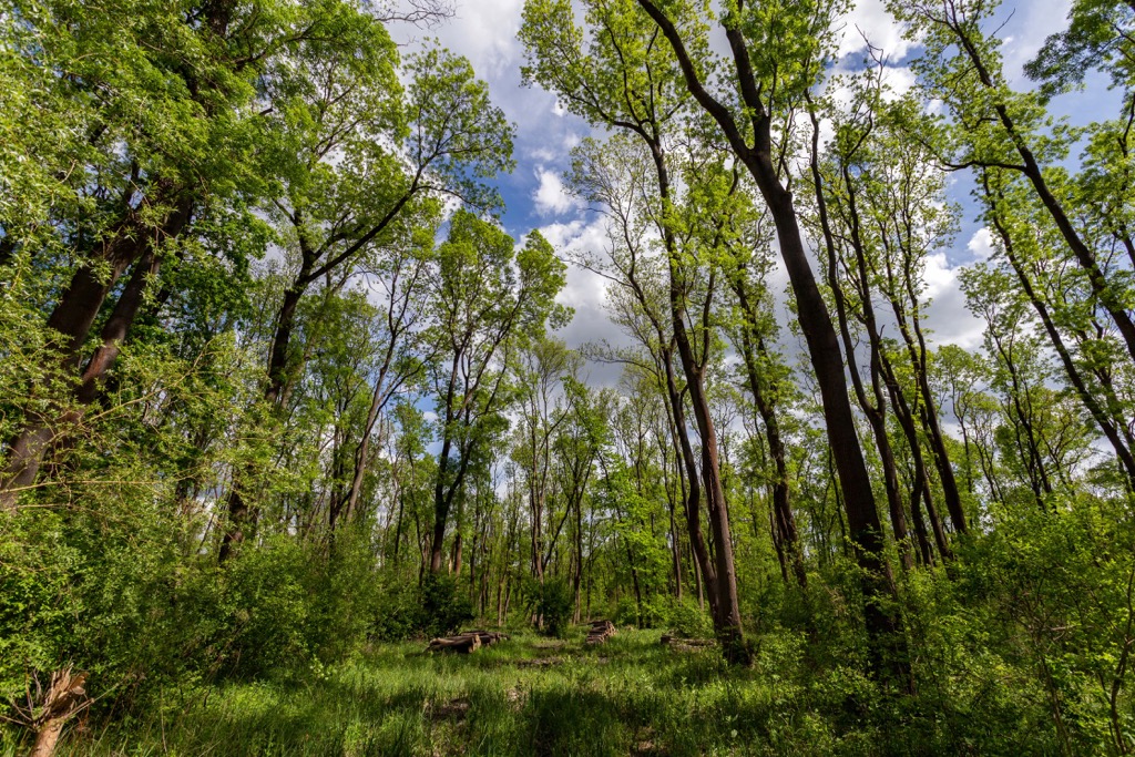
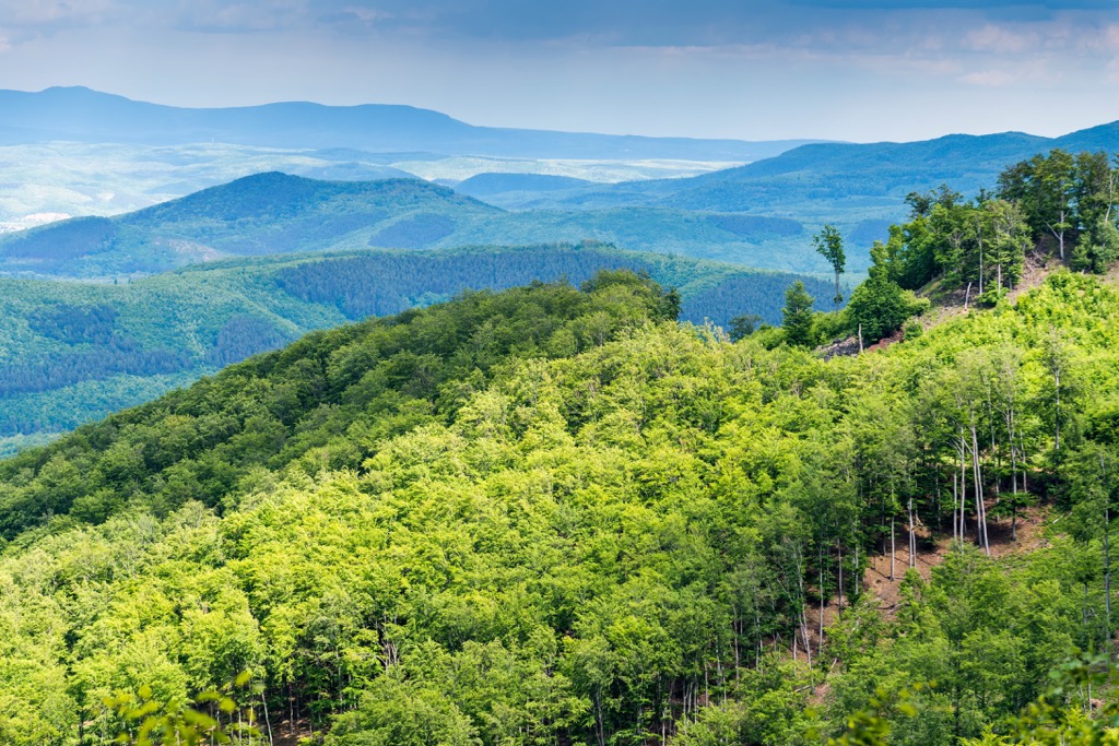
Approximately 22 percent of Hungary is forested. The most common trees are oaks, beeches, birches, and pines.
One notable forest in Hungary is Gemenc Forest (Gemenci erdő). Located along the Danube, Gemenc is Europe's largest contiguous floodplain forest, covering an area of 340 sq km (131 sq mi). It's also the only remaining tidal area of the Danube in Hungary. Willows and poplars are most common near the river, but further from the Danube, oak, ash, and elm forests are widespread.
Over 2,200 species of flowering plants grow in Hungary. A number of plant species are endemic to Hungary, such as dolomite flax, dolomite seseli, Hungarian Vincetoxicum, and Hungarian pear trees.
Hungary's flowering plants are incredibly varied and change with the season. In the winter, snowdrops can be found in the forests, while spring brings primroses, cuckoo flowers, hellebores, crocuses, and wild garlic are typical in spring.
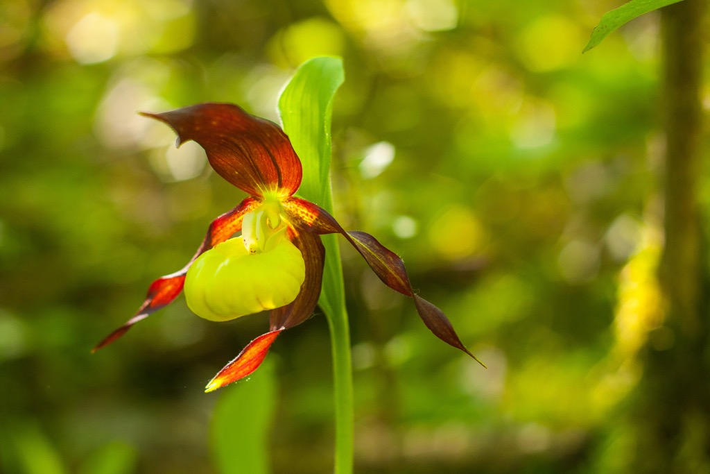
In summer, an array of orchids grow across Hungary, such as monkey orchids, lady orchids, and bog orchids. Other common summer plants include sunflowers, foxgloves, peonies, and golden chervils. The tulip is the national flower of Hungary.
Humans have been inhabiting the area that's now Hungary since the Middle Paleolithic period. Archeologists discovered the remains of Homo heidelbergensis that date back over 300,000 years. Modern humans have inhabited Hungary for over 33,000 years.
Read on to learn more about Hungary's history.
During the Iron Age (800 BCE), Hungary sat on the border between Celtic tribes, Dalmatian tribes, and Germanic tribes. Hallstatt culture, the Pannonians, and the Celts influenced Hungary's early civilization.
The Pannonians were invaded by the Romans between 35 and 8 BCE. The word Pannonia comes from the Hungarian Roman province. During this period, the Romans only controlled Transdanubia, which became part of Pannonia. The Roman Empire lost control of Pannonia following the Hunnic Invasions between 370 CE and 410 CE.
The Hunnic Kingdom collapsed following the death of Attila the Hun, with Hungary becoming a part of the Germanic Ostrogothic Kingdom between the fourth and sixth centuries. The nomadic Eurasian Avar Khaganate controlled Hungary from the sixth to the ninth century.
By the 10th century, the Magyars, a nomadic people from the Ural Mountains, had settled in the region. In 1000 CE, Hungary was established as a Christian kingdom, under the rule of Stephen I, the first king of Hungary. Stephen I was a part of the Árpád dynasty, which ruled Hungary for three centuries.
During the Middle Ages, Hungary experienced a period of growth and prosperity, becoming one of Europe’s most powerful kingdoms and expanding its rule to the Adriatic coast. However, the kingdom was decimated by the Mongols, who invaded and seized control in 1241. Hungary's ruler, King Béla IV, fled to the Holy Roman Empire.
The Árpád dynasty ended in 1301, with Hungary coming under pressure from the Ottoman Empire for the following two centuries. The Ottoman–Hungarian wars culminated in the Battle of Mohács in 1526, with Hungary losing significant territory.
Now under the control of the Habsburg Empire, Hungary regained its territory following the Great Turkish War. Nationalist sentiments and the Austro-Prussian War led to the Austro-Hungarian Compromise of 1867, with Austria and Hungary becoming a joint monarchy under the Habsburgs, partially re-establishing the Kingdom of Hungary.
In the aftermath of the Austro-Hungarian Compromise of 1867, known as the Ausgleich, Hungary experienced a period of rapid economic and social modernization. New industries and infrastructure were built, and the country established itself as a major power in Central Europe.
This period also saw the rise of the nationalist movement in Hungary, which pushed for greater autonomy and independence from Austria-Hungary. The dual monarchy of Austria-Hungary lasted until the end of the First World War when both Austria and Hungary declared their independence from each other.
The Treaty of Trianon, which ended the First World War, severely weakened Hungary, with 72 percent of its territory ceded to surrounding countries, including Czechoslovakia, the Kingdom of Serbs, The Second Polish Republic, and the Kingdom of Italy. From 1938 and 1941, Hungary recovered parts of its territory.
Hungary's weakened condition led to its occupation by Nazi Germany in 1944. It was then under Soviet occupation until the end of the war. Hungary became an independent socialist state called the Second Hungarian Republic from 1949 until the end of Hungarian communism in 1989.
The Third Republic of Hungary was established in 1989 with a more conservative government and an amended version of the 1949 constitution. A new constitution was adopted in 2011. Today, Hungary is a democratic republic and a member of the European Union.
Despite being mainly flat, Hungary boasts a wide variety of mountain hikes, from long treks through Mátras to family-friendly strolls in the Buda Mountains.
Some of Hungary's best hikes are in remote locations, so come prepared. Ensure you bring appropriate hiking gear, topographic maps, and plenty of food and water. Check weather forecasts and inform others of your itinerary.
Read on to learn about some of the best mountain hikes in Hungary.
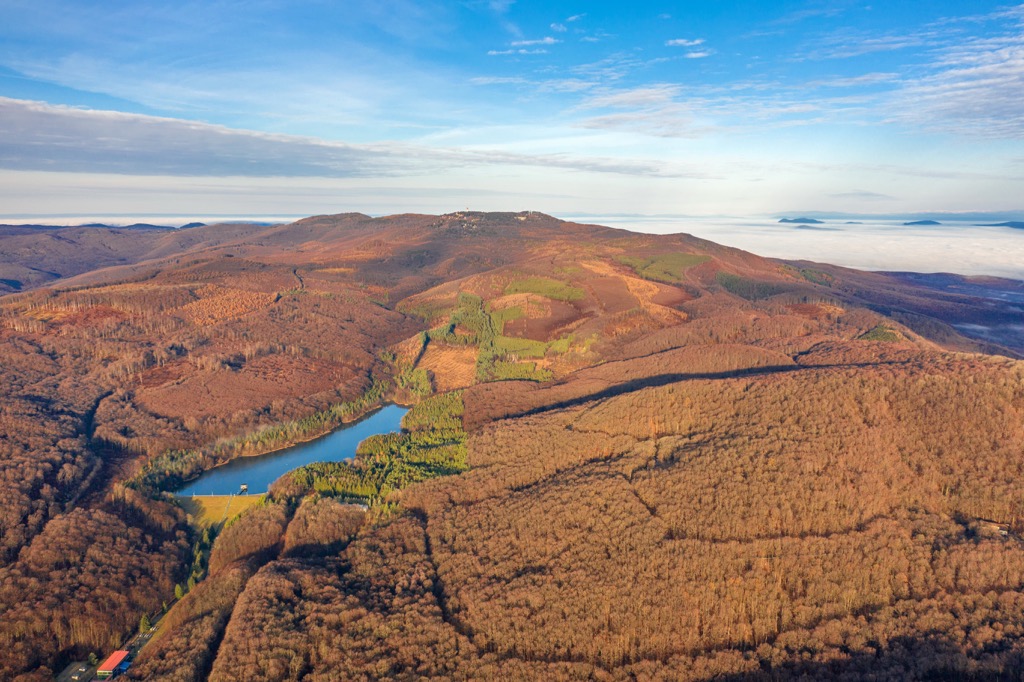
The Mátra Mountains are a mountain range located in northern Hungary, about 96 km (60 mi) northeast of Budapest. The majority of the Mátras fall within the boundaries of the Mátrai Landscape Protection Area (Mátrai Tájvédelmi körzet).
The Mátras are characterized by their steep slopes and rocky terrain. The range contains the three highest summits in Hungary, Kékes (1,014 m/3,327 ft), Hidas-bérc (991 m/3,251 ft), and Galya-tető (964 m/3,166 ft).
The Mátra Mountains are a popular tourist destination, offering a variety of activities such as skiing, hiking, and cycling. The area is also a popular spot for rock climbing and is home to several caves, including the Mátra Cave (Mátra-barlang), the largest cave system in Hungary.
One of the best ways to climb Hungary's highest summit is by following the Kékestetö Loop (Kékesi-tetői Körtúra). You can pick up the trail from the Matrahaza car park (Mátraházai Parkoló).
The trail leads through forests and meadows to the summit of Kékes, which is marked by the 176 m (577 ft) tall Kékestető TV Tower (Kékes TV-torony). The summit offers sweeping views of the Mátra Mountains, with Budapest visible in the distance. The Kékestetö Loop is approximately 10 km (6.2 mi) in length.
Another popular hike in the Mátra Mountains is Galya-tető. Known as the "roof of Hungary," this mountain boasts breathtaking views of the nearby Szalajka Valley and the Bükk Mountains.
One of Galya-tető's secondary summits, Péter hegyese (964 m/3,166 ft), is topped with the 30 m (98 ft) tall Galya Lookout Tower (Galya-kilátó), which provides superb views of Kékes. On clear days, you can even spot the High Tatras to the north from the lookout.
One of the quickest ways to hike Galya-tető is on the out-and-back trail from Mátraszentimre. The trail ascends gently through forests to the summit of Galya-tető. After climbing the Galya Lookout Tower, you can relax at the visitor's center before descending. This trail is approximately 8 km (5 mi) in length.
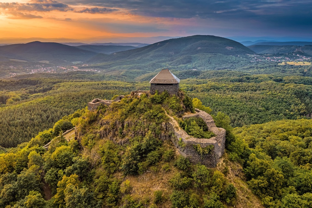
Bükk National Park covers an area of approximately 431 sq km (166 sq mi) within the Bükk Mountains to the west of the Mátra Mountains. It's Hungary's third oldest national park, having been founded in 1977.
Bükk National Park contains the highest summits in Hungary outside of the Mátra Mountains, including Szilvási-kő (968 m/3,176 ft) and Istállós-kő (958 m/3,143 ft). Composed primarily of limestone, the landscape of Bükk National Park is karstic, with over 1,100 caves, including the 275 m (902 ft) deep Istvánlápa, one of the country’s deepest caves.
Hike up to Szeleta Cave (Szeleta-barlang) if you want to experience Bükk National Park's caves firsthand. Located on the southern slopes of Szeleta-tető (407m/1,335 ft), Szeleta Cave is a famous archeological site with relics dating back 40,000 years.
You can enjoy a leisurely hike to Szeleta Cave on an out-and-back trail from the Hungarian Museum of Technology and Metallurgy Museum of Transport (Magyar Műszaki és Közlekedési Múzeum Kohászati Múzeuma) in Felsőhámor. The hike to Szeleta Cave is approximately 2.7 km (1.6 mi) in length.
Or, hike up Bálvány (957 m/3,140 ft) if you'd prefer to scale one of the Bükk Mountains' limestone summits. The mountain is topped with the 18 m (59 ft) tall Petőfi lookout, the highest observation tower in the Bükk Mountains. The views from the lookout are impressive, with the whole of the Bükk Mountains visible, including Istállós-kő and the rim of the Bükk Plateau.
For a long walk through the Bükk Mountains to Bálvány, follow the yellow and green marked trails from Nagyvisnyó. This walk is approximately 7.3 km (4.5 mi) in length.
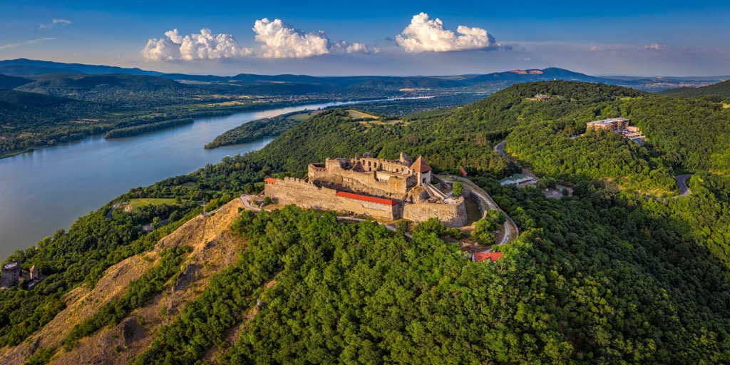
Danube-Ipoly National Park is the second-largest national park in Hungary, encompassing an area of approximately 603 sq km (232 sq mi).
The park is home to the Danube and Ipoly Rivers, as well as three mountain ranges: the Pilis Mountains, the Visegrád Mountains, and the Börzsöny Mountains. Many animals inhabit the park, including the Hungarian zingels, pygmy shrews, and bald eagles.

One of the finest mountains to climb in Danube-Ipoly National Park is Csóványos (938 m/3,077 ft). Straddling the Slovakian border, Csóványos is the highest peak in the Börzsöny Mountains. It's topped with a 28 m (92 ft) tall lookout tower which provides some of the park's finest views.
You can climb Csóványos on an out-and-back trail from Diósjenő. This strenuous hike leads continuously uphill through forests and over Három-hárs (789 m/2,589 ft) before reaching Csóványos. The descent passes over Hangyás-hegy (869 m/2,851 ft) and Nagy-Hideg-hegy (864 m/2,835 ft) before ending in Királyrét. This route is approximately a 20 km (12 mi) round-trip.
The Danube Bend is one of Danube-Ipoly National Park's most beautiful locations, and you can fully explore the area on the Gesztenyés study trail from Nagymaros. The trail leads through lush forests to Hegyes-tető (489 m/1,604 ft).
Atop Hegyes-tető is the Julianus Lookout (Julianus-kilátó), which offers panoramas of the Visegrád Mountains and the Danube Bend. On a clear day, you can see the lookout tower of Csóványos. The trail’s descent loops back on the slopes of Szent Mihály-hegy (493 m/1 617 ft) to your starting point. This route is approximately 8.4 km (5.2 mi) in length.
Other popular mountains worth climbing in Danube-Ipoly National Park include Pilis-tetö (757 m/2,484 ft) and Dobogó-kő (707 m/2,320 ft).
The Buda Mountains (Budai-hegység) is a low mountain range located on the Buda side of Budapest. These mountains are extremely popular with hikers due to their proximity to Budapest and the views they afford of the Hungarian capital.
You'll find numerous family-friendly hikes within the Buda Mountains, including the climb to the summit of Hármashatár-hegy (495 m/1,623 ft). The mountain is called the Three Border Mountain in English, as it separates Buda, Óbuda, and Pesthidegkút.
One of the most popular routes up Hármashatár-hegy is following the Green Trail from Normafa. This trail is approximately 12.7 km (7.8 mi) in length.
You'll find some spectacular viewpoints along this out-and-back trail, including Tündér-hegy (402 m/1,319ft), which boasts views of the Zugliget neighborhood and the Pilis Mountains in the distance beyond Nagy-Hárs-hegy (454 m/1,490 ft).
The Árpád Lookout (Árpád-kilátó) on Látó-hegy (376 m/1,233 ft) also provides stunning views of the Danube and Budapest. The Stone Gate Cave (Kőkapu-barlang), a publicly accessible cave, is along this route.
Atop Hármashatár-hegy is another observation point, the unique Guckler Károly Lookout (Guckler Károly-kilátó). From the tower, you'll be able to see Gellért-hegy (235 m/771 ft) overlooking the Danube and the Visegrád Mountains in the distance.
Nagy-Hárs-hegy is another popular mountain to climb in the Buda Mountains. You can climb to the summit of Nagy-Hárs-hegy on the looped trail from the Szépjuhászné train station.
The hike up Nagy-Hárs-hegy is an easy climb through forests to the Kaán Károly Lookout (Kaán Károly-kilátó), an old wooden fire watchtower. The views from Kaán Károly Lookout are among the finest in the Buda Mountains, with panoramas of Budapest and Csóványos visible on a clear day. This trail is approximately 3.1 km (1.9 mi) in length.
The Zemplén Mountains (Zempléni-hegység), also known as the Tokaj Mountains (Tokaji-hegység) are the southern part of the Eperjes-Tokaji Mountains within the Carpathians. Large parts of the range fall within the boundaries of the Zemplén Landscape Protection Area (Zempléni Tájvédelmi Körzet).
Nagy-Milic (899 m/2,949 ft), the highest mountain in the Zemplén Mountains, is one of the range's most rewarding treks. Resting on the Hungarian-Slovak border, Nagy-Milic is a relatively straightforward climb through some of Hungary's most peaceful forests.
One of the best ways to hike up Nagy-Milic is on the out-and-back trail from the Lászlótanya hiking area to the west of the mountain. The trail skirts around the summit of Hajagos-hegy (843 m/2,766 ft) on the way to Nagy-Milic.
Atop Nagy-Milic's sister peak, Kis-Milic (892 m/2,926 ft), is the 16.8 m (55 ft) tall Károlyi Lookout (Károlyi-kilátó), which provides unmatched views of the Castle of Füzér (Füzér vára) to the south. This trail is approximately 6.4 km (4 mi) in length.
The southernmost summit of the Zemplén Mountains and the North Hungarian Mountains is another popular peak, Tokaji-hegy (515 m/1,690 ft). Also known as Tokaj Mountain, Tokaji-hegy is located within the romantic Tokaj Wine Region, considered the “Tuscany of Hungary.” The mountain looms over the Tisza River. A 1960s transmission tower marks Tokaji-hegy's summit.
One popular route to the peak of Tokaji-hegy is on a loop from the Tisza Bridge (Tisza-híd). The hike up Tokaji-hegy is gentle and suitable for mountain bikers. On your ascent, you'll pass near the summit of Tehéntánc-tető (290 m/951 ft).
The best views from Tokaji-hegy are from the transmission tower. From here, you'll be treated to stunning views of the surrounding pain, with the U-shaped Halastó Lake in the foreground. This hike is approximately 9.2 km (5.7 mi) in length.
Balaton Uplands National Park (Balaton-felvidéki Nemzeti Park) encompasses an area of 569 sq km (219 sq mi) along the northern shoreline of Hungary's largest lake, Lake Balaton.
The park is split into six landscape protection areas, including the Tihany Peninsula, the Tapolca Basin, and the Keszthely Mountains. It receives over 500,000 visitors annually, making it one of Hungary's most popular national parks.
The landscape of Balaton Uplands National Park is regarded by many as the most beautiful in Hungary, with many standalone witness mountains casting a shadow over Lake Balaton.

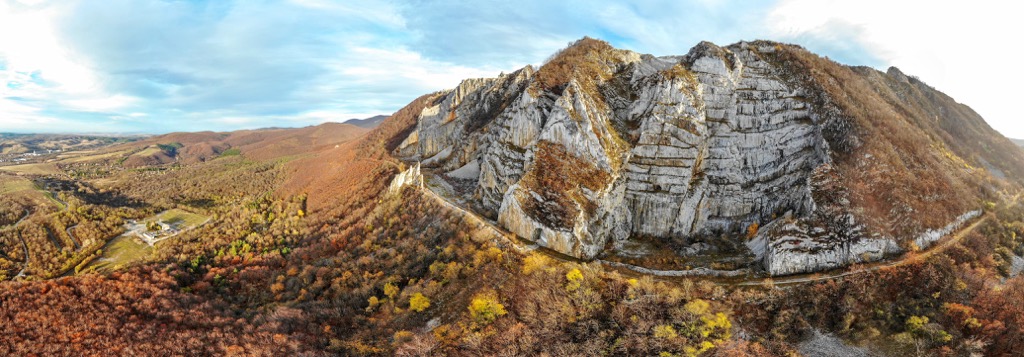
The park is home to possibly the finest peak in the Transdanubian Mountains, Badacsony (437 m/1,460 ft). A geological relic, Badacsony stands tall in the Tapolcai Basin.
The highest butte in the region, Badacsony affords remarkable vistas of Lake Balaton and the lakeside town of Fonyód. Additionally, the mountain is famed for its wineries and association with famous playwright Ferenc Herczeg.
You can climb Badacsony on the looped trail from the Rózsakő parking lot (Rózsakő parkoló). Along this short trail, you'll pass the Kőkapu basalt columns and Tördemic, an abandoned basalt mine pit.
You'll stumble across several viewpoints on your way to the summit of Badacsony, including the Egry József observation platform and Tördemic. The summit of Badacsony is marked with the 18 m (59 ft) tall Kisfaludy Lookout (Kisfaludy-kilátó). Combined, these viewpoints provide a 360-degree panorama of Balaton Uplands National Park. This trail is approximately 5.9 km (3.6 mi) in length.
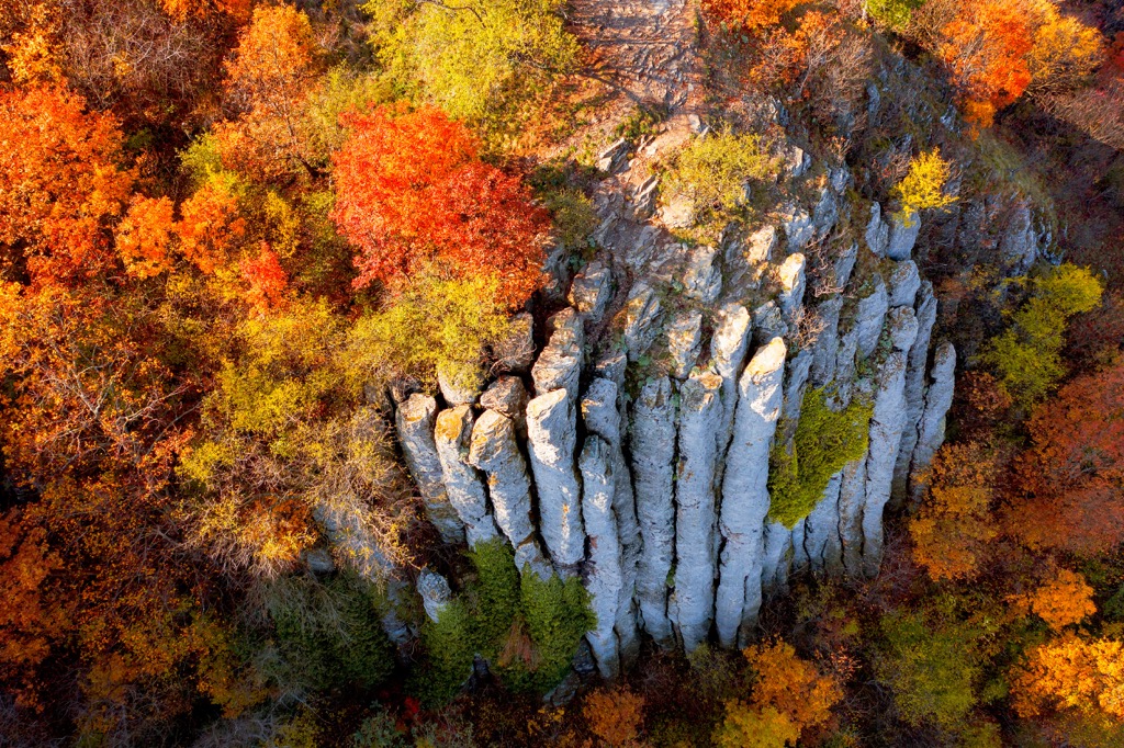
Only the nearby butte of Szent György-hegy (415 m/1,362 ft) rivals the beauty of Badacsony. Known as Saint George's Hill in English, Szent György-hegy is home to basalt columns, vineyards, and the Dragon's Cave (Sárkány-barlang). At the bottom of the hill are four picturesque chapels.
Szent György-hegy is one of the symbols of the Tapolcai Basin due to its unique shape. One of the most popular paths up Szent György-hegy is the looped trail from the Kisapáti bus stop (Kisapáti, autóbusz-váróterem).
Past the Holy Cross Chapel (Szent Kereszt-kápolna), you'll reach the Kaán Károly Kulcsosház, a turnkey house that can accommodate 30 people. All four of Szent György-hegy's beautiful chapels are located along this route.
The views from the summit of Szent György-hegy are gorgeous, with Badacsony to the southeast, Tóti-hegy (347 m/1,138 ft) and Gulács (393 m/1,289 ft) to the east, and the Keszthelyi Mountains (Keszthelyi-hegység) to the west. This trail is approximately 9.2 km (5.7 mi) in length.
Tourists flock from around the world to experience Hungary's unique cultural delights and incredible historical sites. Read on to learn about the main cities and towns in Hungary.
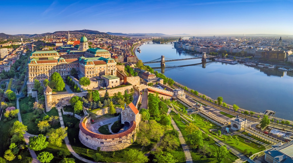
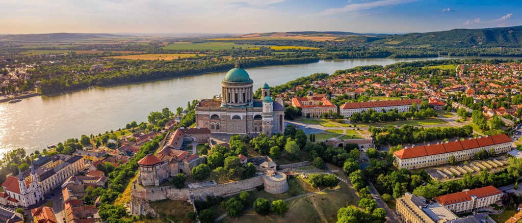
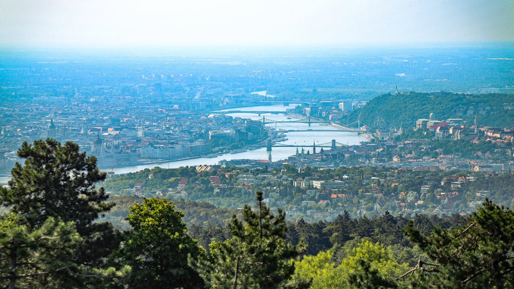
Budapest is Hungary's largest and capital city. It's the second-largest city on the Danube and, with a population of over 3,300,000 people, is home to a third of Hungary's population.
Budapest is unusual as it's split into two distinct districts by the Danube. The river's west bank is home to the historic Buda, while the vibrant and modern Pest sits on the east. Budapest offers something for everyone, whether you're recuperating at the Széchenyi Thermal Bath or wetting your whistle at a ruin pub.
And, despite being a bustling metropolis, you're just a stone's throw from nature with the Buda Mountains encircling the city. Plus, Danube-Ipoly National Park is just 20 km (12.5 mi) to the north of Budapest.

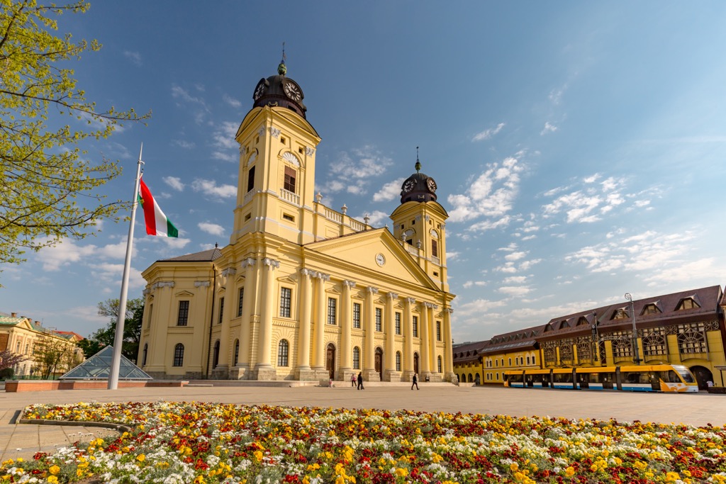
Hungary's second city, Debrecen is an important historical and cultural center. Debrecen was Hungary's largest city in the eighteenth century and the capital during the 1848–1849 revolution.
Today, Debrecen is a university city home to some architectural marvels, like the neoclassical Reformed Great Church of Debrecen (Debreceni Református Nagytemplom). You'll also find attractions for all ages, including the Debrecen Zoo and Amusement Park (Debreceni Állatkert és Vidámpark) and the Déri Museum (Déri Múzeum).
Located in Tiszántúl in eastern Hungary, Debrecen is less than 25 km (15.5 mi) from Hungary's largest national park, Hortobágyi National Park.
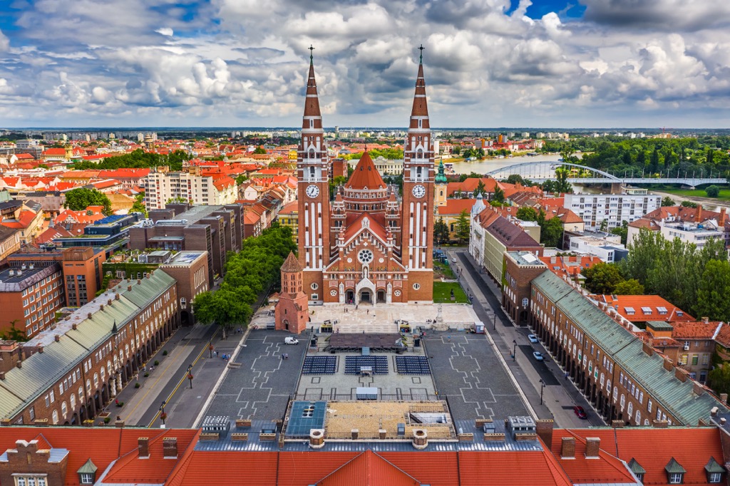
Straddling the Tisza is Szeged, the largest city in southern Hungary. Szeged is a university city with an incredible architectural heritage, from the thirteenth-century Dömötör Tower and the twentieth-century Gróf Palace (Palatul Gróf).
Szeged is home to a variety of attractions, like Szeged Zoo (Szegedi Állatkert), the Móra Ferenc Museum (Móra Ferenc Múzeum), and Széchenyi Square (Széchenyi tér). The best time of year to visit Szeged is in late spring to catch the famed Szeged Open-air Festival (Szegedi Szabadtéri Játékok) on May 21.
You'll find few more convenient cities to visit in southern Hungary than Szeged. Szeged is located just south of the Pusztaszer Landscape Protection Area (Pusztaszeri Tájvédelmi Körzet) and around 150 km (93 mi) from Danube-Dráva National Park (Duna-Dráva Nemzeti Park).
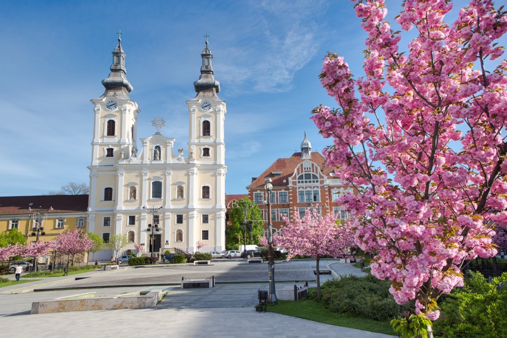
Miskolc is Hungary's fourth-largest city and the largest popular center in northeastern Hungary. One of the main draws of visiting Miskolc is its proximity to the Bükk Mountains, with Bükk National Park located adjacent to the city.
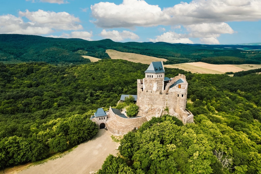
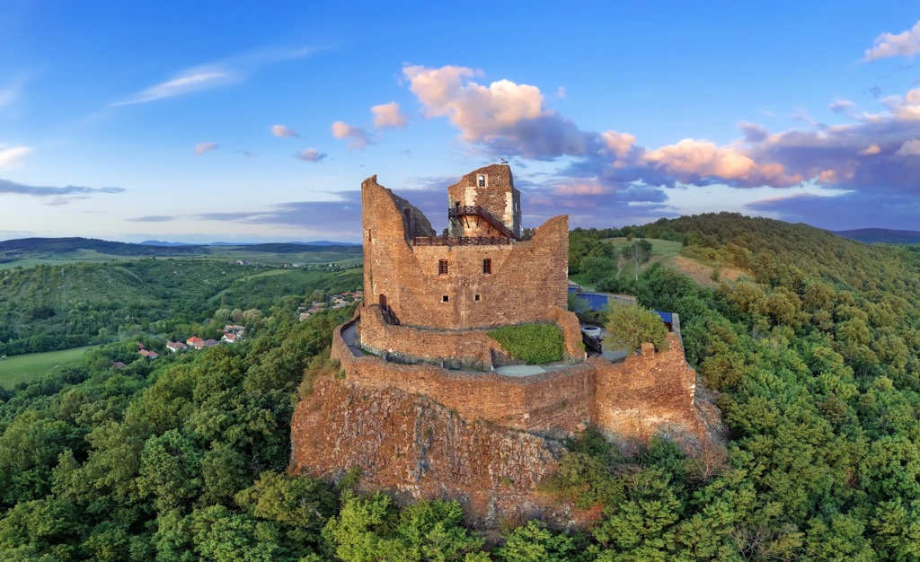
As well as being a hub for hikers, Miskolc boasts some unmissable sights. Rest your aching muscles in the thermal waters of the Cave Bath (Barlangfürdő). Or, discover Hungary's medieval history at the twelfth-century Diósgyőr Castle (Diósgyőri vár).
Miskolc makes an excellent base for hikers, with the Mátras located 100 km (62 mi) to the east and the Zemplén Mountains located 80 km (50 mi) to the northeast.
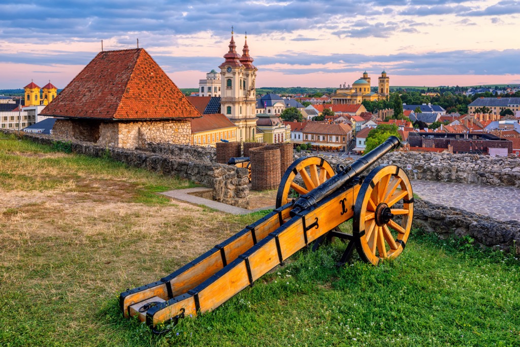
Eger is one of Hungary's most historic settlements and the second-biggest city in northern Hungary. Eger was founded in the tenth century and still contains many historic buildings, including the world's northernmost Ottoman minaret and the medieval Eger Castle (Egri vár).
The city is famed for the Szépasszony Valley (Szépasszonyvölgy), which is home to over 200 wine cellars producing some of Hungary's finest wines. You can also take a dip in Eger’s 400-year-old Turkish Baths.
Eger is located between Bükk National Park and the Mátras, with both hiking areas less than 40 km (25 mi) from the city.


Yes. Hungary has 5,254 named mountains. The highest is Kékes at 1,015 m.
The highest mountain in Hungary is Kékes, at 1,015 m.
Hungary has 5,254 named mountains.


