
Scan the QR code and open PeakVisor on your phone
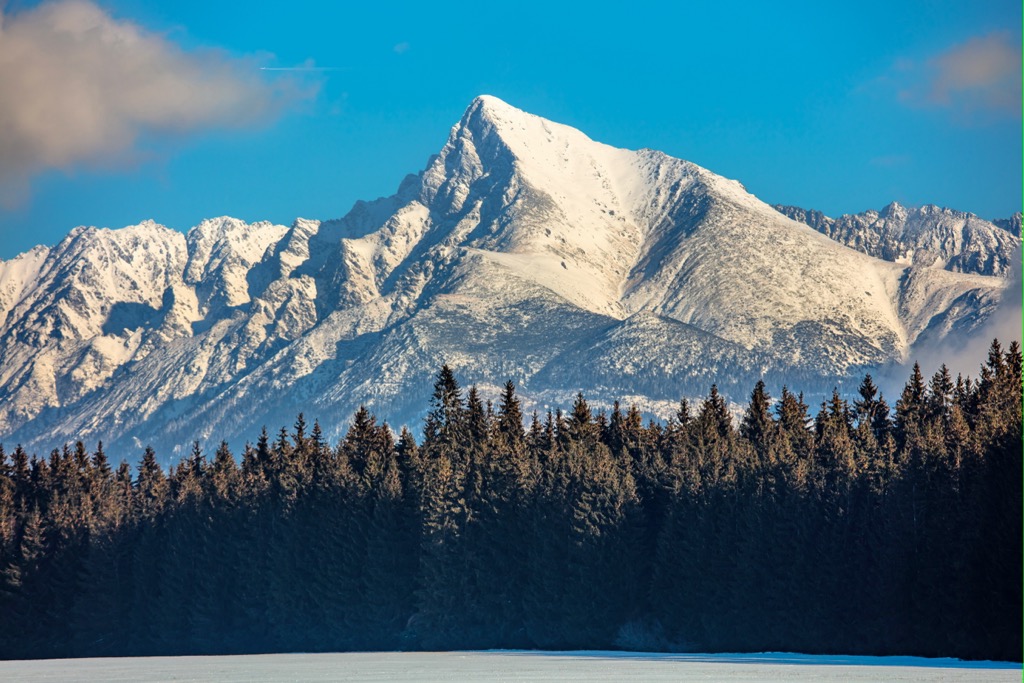
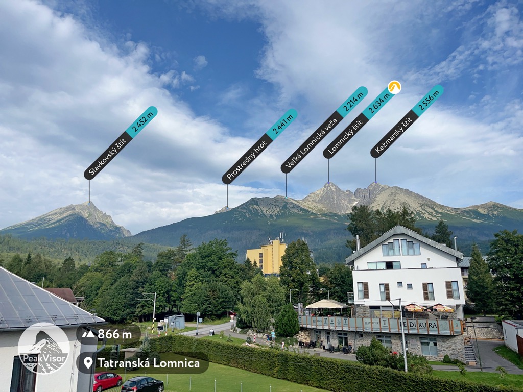
The High Tatras include 221 named peaks. The highest is Gerlachovský štít at 2,654 m. Other notable peaks include Gerlachovská veža, Lomnický štít and Ľadový štít.
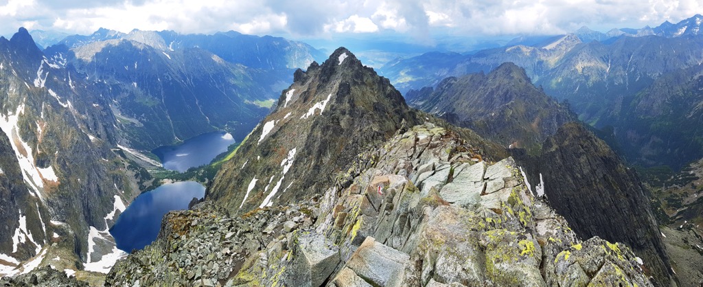
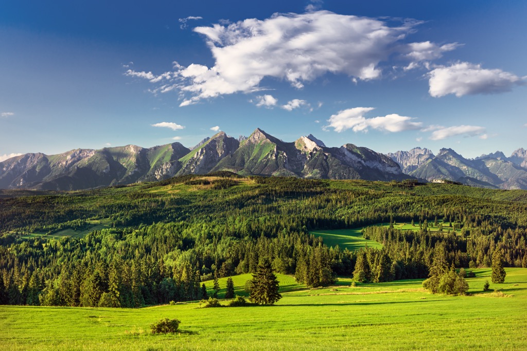
The High Tatras (Vysoké Tatry in Slovakian and Tatry Wysokie in Polish) is a steep, prominent mountain subrange that extends roughly 50 km (31 mi) along the Slovakia-Poland border. It defines the northwestern edge of the greater Carpathian Mountains and is home to the range’s highest peak, Gerlachovsky Štit (2,650 m, 8,711 ft). The High Tatras are one of the only areas of the Carpathians with true alpine ecosystems (along with the Southern Carpathians of Romania).
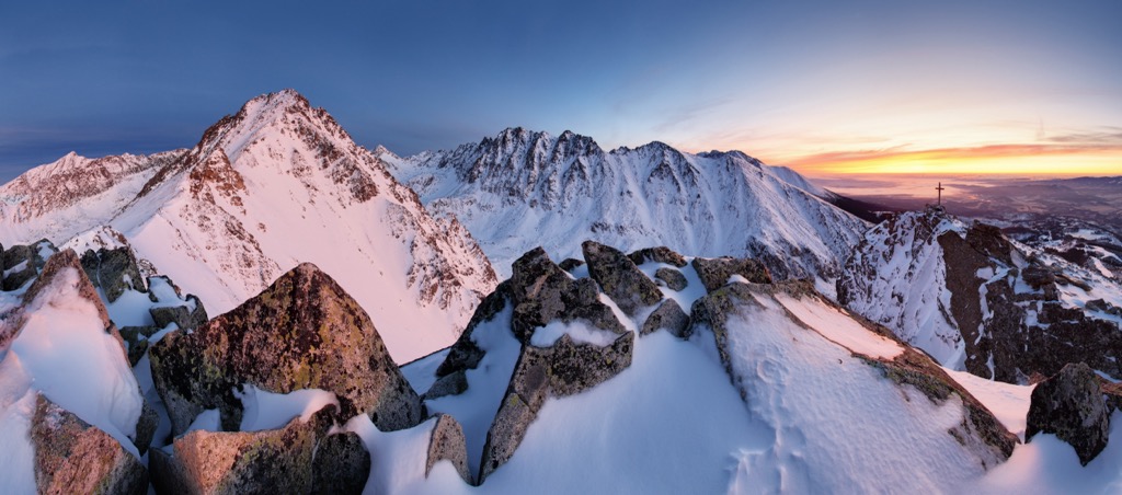
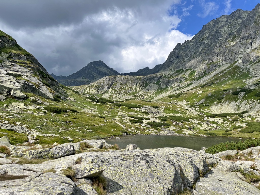
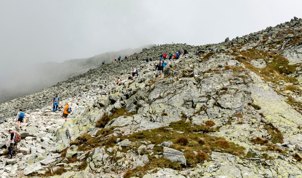
Although the High Tatras are lower than the nearby Alps, their alpine character and prominence make them a popular destination for hikers, mountaineers, and skiers. Viewed from either the north or south, the profile of the range is very dramatic, rising nearly 2,000 m (6,562 ft) above the valley floors. U-shaped canyons full of glacial polish, alpine tarns, granite buttresses, and gendarmes bisect the high peaks.
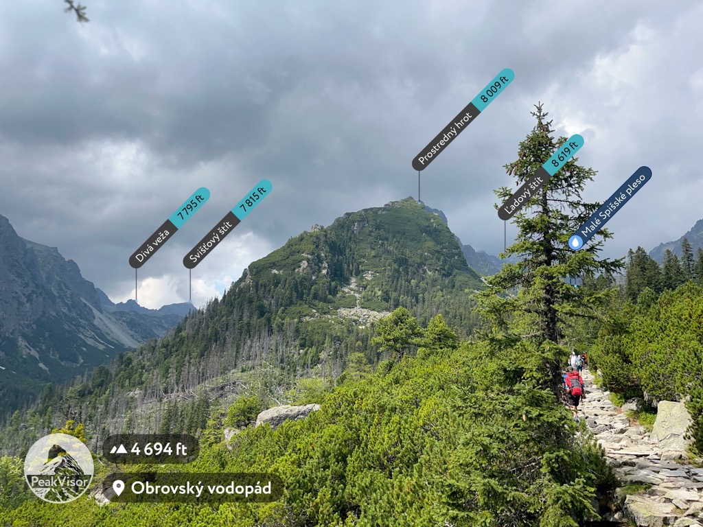
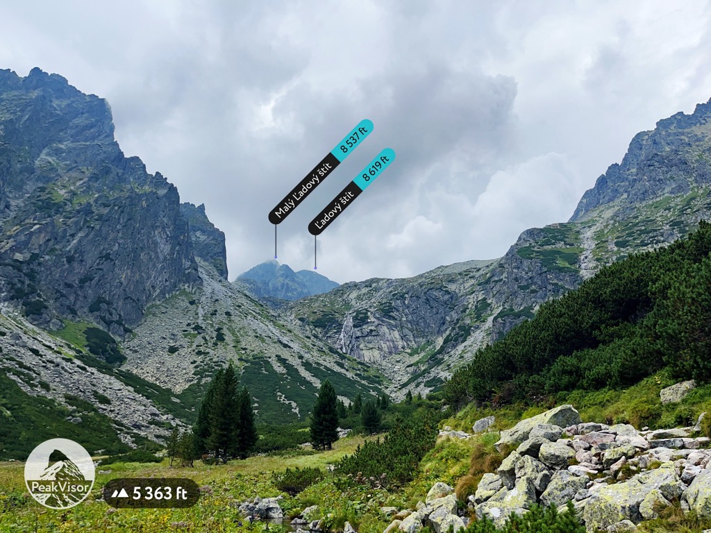
The ten tallest peaks in the High Tatras fall between 2,600-2,650m (8,530-8,711 ft), including some of the range’s most charismatic peaks: Gerlachovsky Štit, Gerlachovská Veža (2,642 m / 8,668 ft), Lomnicky Štit (2,633 m / 8,638 ft), Ľadový Štít (2,627 m / 8,619 ft), and Pyšný Štit (2,623 m / 8,550 ft).
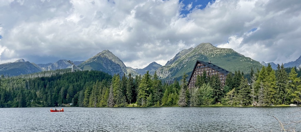
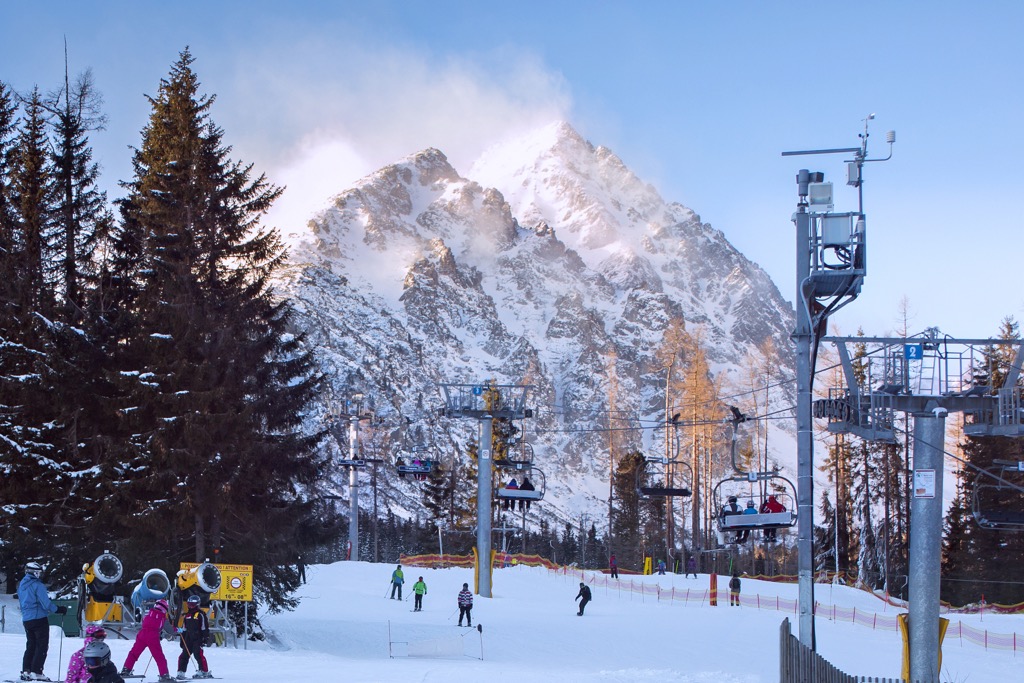
There are 221 named peaks in the High Tatras, including Slovakia’s national symbol, Kriváň (2,494 m / 8,812 ft). The high country is easily accessible and attractive to adventure sports enthusiasts. In the summer, a robust infrastructure network (trains, chairlifts, gondolas, trails, and alpine huts) shuttles tourists into the high country. In the winter, ski fields in Tatranská Lomnica, Štrbské Pleso, Strednica Ždiar, and Stary Smokovec draw local (and some international) skiers.
The High Tatras are Slovakia and Poland's tallest and most prominent mountains. They sit north of the neighboring Low Tatras, west of the Belianske Tatras, and east of the Lesser and Greater Fatras (Malá Fatra and Veľká Fatra).
More broadly, the High Tatras occupy the western extreme of the Carpathians, a colossal, 1,500 km-long (930 mi) horseshoe-shaped range sprawled across Eastern Europe. The majority of the Carpathians are densely forested, rolling, and hilly. They possess continental Europe’s most wild, undisturbed ecosystems.
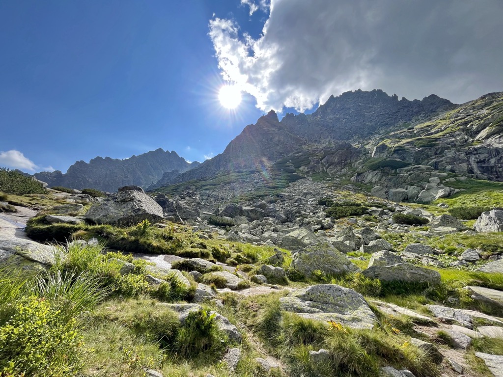
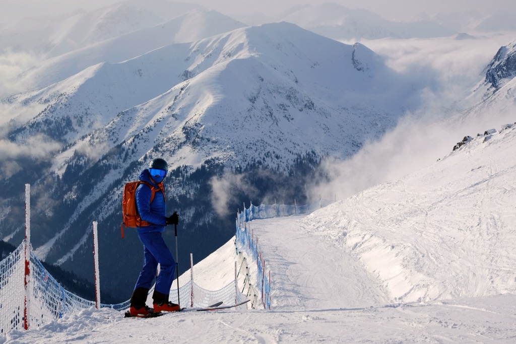
However, the High Tatras and Romania’s Southern Carpathians take on a much more extreme, rocky, alpine character. Rising out of the surrounding coniferous forest, the upper reaches of the mountains are full of sparse grasses, wildflowers, and talus. Steep knife ridges and cliff walls define the peaks overhead. Many permanent snowfields are the result of heavy snowfall each winter.
Like most rural places, the easiest way to see the High Tatras is with a car. But if you don’t have a car, a lot of infrastructure still makes it easy to get there (and get around). If you’re coming from Poland, you can take a bus from Krakow. It takes about two hours and costs about 50 PLN.
On the Slovakian side, Poprad Tatry is the nearest train station and is a reasonably large station with many arrivals from different parts of the country daily. From Poprad Tatry, the TEŽ railway connects all of the minor towns at the base of the mountains. You can buy a day ticket for 4€. The trains run every hour from about 4:00 a.m. until about midnight.
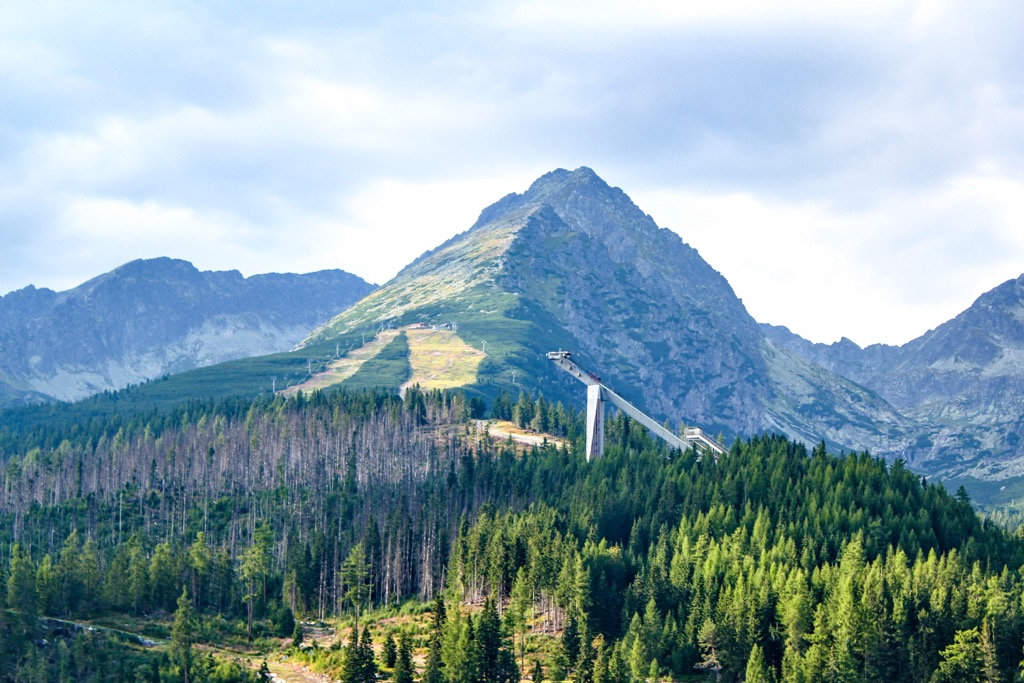
Chairlifts and gondolas make it easy to get into the high country. The ski fields Tatranska Lomnica, Štrbské Pleso, and Kasprowy Wierch sell summer tickets to take a chairlift or gondola part of the way up the mountain. It’s nice to get a little boost for hikes with long approaches.
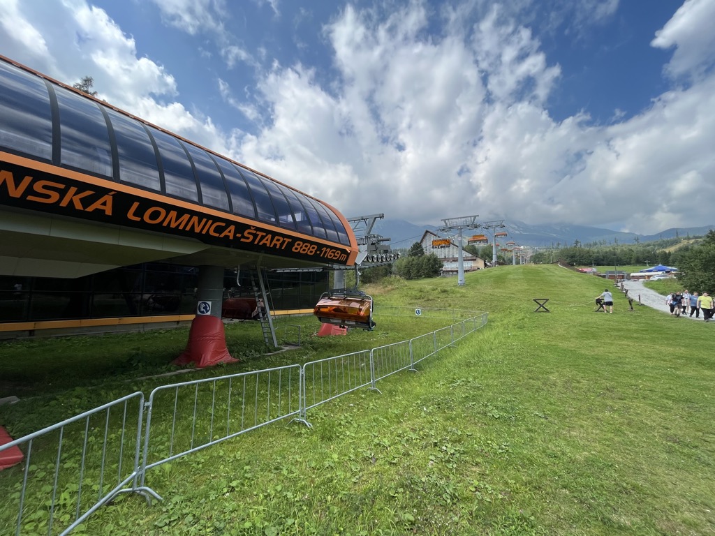
One of the most popular gondola rides takes you from Tatranska Lomnica to just below the summit of Lomnicky Štit. You can’t climb above the top shack of the gondola, but if you’re not a mountain climber, this is the best way to see the Tatras.
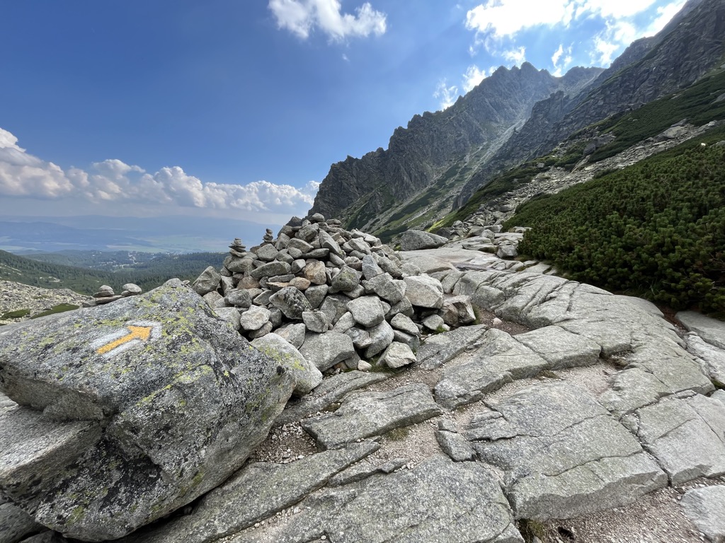
The entirety of the High Tatras sits inside Tatra National Park. This protected area (also a UNESCO nature reserve) was Europe's first cross-border national park, including both the Slovakian and Polish sides of the range. The park maintains a dense trail network that allows visitors to access almost every corner of the range.
Because the national park is protected for conservation, there are regulations on where you can be, what you can do, and when you can do it.
Most high peaks are illegal to climb unless you are a UIAA member accompanied by a registered guide. This includes Gerlachovšky Štit and Lomnicky Štit, even though the upper elevations of Lomnicky Štit are accessible by gondola. Hiking off-trail is also illegal unless accompanied by a guide.
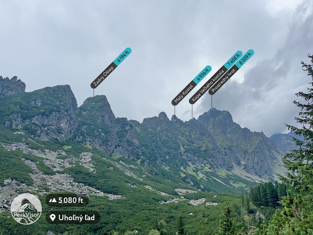
The peaks you can hike without a guide are Kriváň, Predne Solisko (2,117 m / 6,946 ft), Kôprovsky Štit (2,367 m / 7,766 ft), Rysy, Východná Vysoká (2,429 m / 7,969 ft), Slavkovský Štít (2,452 m / 8,045 ft, Veľká Svišťovka (2,038 m / 6,686 ft), Jahňací štít (2,230 m / 7,316 ft) in Slovakia, and Kozi Wierch (2,291 m / 7,516 ft), Świnica (2,301 m / 7,549 ft), and Szpiglasowy Wierch (2,178 m / 7,146 ft) in Poland.
Another limitation is crossing the Slovakia/Poland border. There are several trails over the ridgeline of the Tatras, but the only route where hikers can cross the international border is over the summit of Rysy (2,503 m / 8,212 ft).
Additionally, you cannot camp or start fires anywhere in the park. There are huts along most major canyons and popular hikes where mountaineers can stay the night. This is the only overnight option for through-hiking. Luckily, the huts are incredibly comfortable, cheap, and have food and drink on-site.
Lastly, Tatra National Park peaks must be climbed between June 15 and November 1. In the winter, mountaineers are required to be accompanied by guides.
33 km (20.5 mi) point-to-point, 2,134 m (7,000 ft) of elevation gain total
One of the most popular adventures in the High Tatras is to cross the border over the summit of Rysy. How you approach this route will vary depending on whether or not you do it in one day or two and in which direction you’re going.
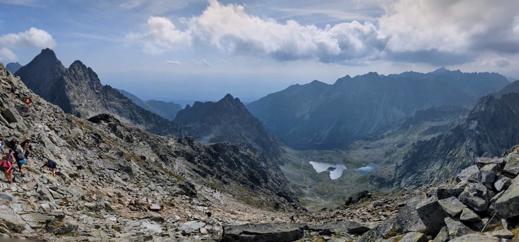
Starting from Zakopane, the route is straightforward. You ascend southeast, then gradually turn southwest in a long, curved canyon (Dolina Rybiego Potoku) along the Slovakian border. Eventually, you’ll come to the first opportunity to stop and rest for the night at Morskie Oko Chalet.
The chalet sits at the lake of the same name, directly underneath the north flank of Rysy. Distance-wise, this is roughly the halfway mark between Zakopane (Poland) and Štrbské Pleso (Slovakia). Many hikers turn around at this point and return to Zakopane. Morskie Oko Lake is the most popular day hike from the Polish side and the most scenic part of the Polish High Tatras.
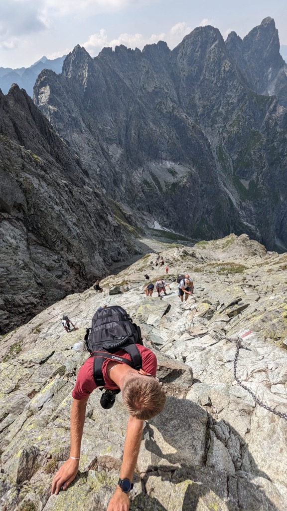
Whether or not you stop for the night, the next section is the steepest and most technical. From the lake to the summit of Rysy is a difference of 1,104 m (3,622m), more than half of the total vertical on the route.
There are permanent handlines (chains) for safety on the steep, rocky scramble. The exposure on the final push to the summit is exhilarating. The ridgeline extending west is a jagged knife ridge with cliffs on both sides.
After crossing into Slovakia, you descend to a saddle. Here, the trail turns right and descends the mountain's southern flanks. There is another hut just below the saddle (Chata Pod Rysami). If approaching from the Slovakian side, this is the place to overnight before the summit push.
The rest of the trail descends through Mengusovska Dolina (canyon), past Popradske Pleso (which has a hotel), and finally to Štrbské Pleso.
Distance depends on the starting point; roughly 1,130 m (3,727 ft) of elevation gain
You won’t believe Tery’s Hut exists when you first see it. It’s a full-fledged mountain lodge with a restaurant and beer on tap. The hut’s staff haul loads of perishables and supplies up the hill on wooden frame backpacks daily. Stationed below the Lomnicky Štit and Ľadový Štít (2,627 m / 8,619 ft), these are some of the best views you can find in the High Tatras.
But it’s no easy task to get there. Depending on where you start, the total distance can be anywhere from 13 km (8 mi) to 23.2 km (14.4 mi). The vertical is also intense. If you start in Tatranska Lomnica and do the whole trail on foot, you’ll climb over 1,000 meters.
There are three main approaches to Tery’s Hut. You can start in either Stary Smokovec, Tatranska Lomnica, or from one of the stops on the Lomnicky Štit chairlift. Taking the chairlift is the easiest, quickest, and most expensive route. You can buy a return ticket to and from Skalnate Pleso for 21€, cutting the total distance almost in half.
If you don’t take the chairlift, you will start from Tatranska Lomnica or Stary Smokovec. Stary Smokovec is the shorter of the two but climbs almost the same amount.
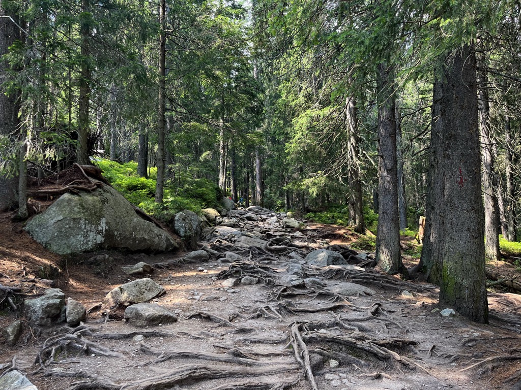
Either way, the trail's first leg ascends through coniferous forest to the base of Velká Studena Dolina (Big Cold Canyon). You’ll come to a large waterfall - Vodopadhy Studeno Potoka. Cross the bridge, proceed up the left side of the river, and you’ll come to the first of three huts, Rainerova Chata.
Keep following signs for Tery’s Hut. The trail crosses back over the river, passes another large waterfall, and enters Mala Studena Dolina (Little Cold Canyon). You should start to see the higher peaks from this point, and the ridge dividing the two canyons is very picturesque.
After a short, steady climb, you’ll reach the second hut on the way, Zamkovskiego Chata. This is an excellent spot to rest, snack, or grab a beer. Many visitors hike this route just to get to this point, so the traffic on the trail thins out considerably after this.
But the last leg of this trail is by far the best. You finally ascend out of the forest into alpine country, surrounded by peaks on all sides. The trail mellows and becomes much flatter until a final headwall. Tery’s Hut sits at the top of this nearly vertical cliff. It’s a perfect place to take a victory lap after an arduous ascent. If you plan ahead, you can stay the night before descending.
9.6 km (6 mi) out and back, 458 m (1,502 ft) of elevation gain
If you’re not up for a massive day of hiking but still want to get into the high country, one of the most accessible routes is to head up Mlynicka Canyon from Štbské Pleso. This trail still ascends a fair amount of elevation, but in just 4.8 km, the Tatras change from dense old-growth forest to shrubby canyon country to high alpine grassland.
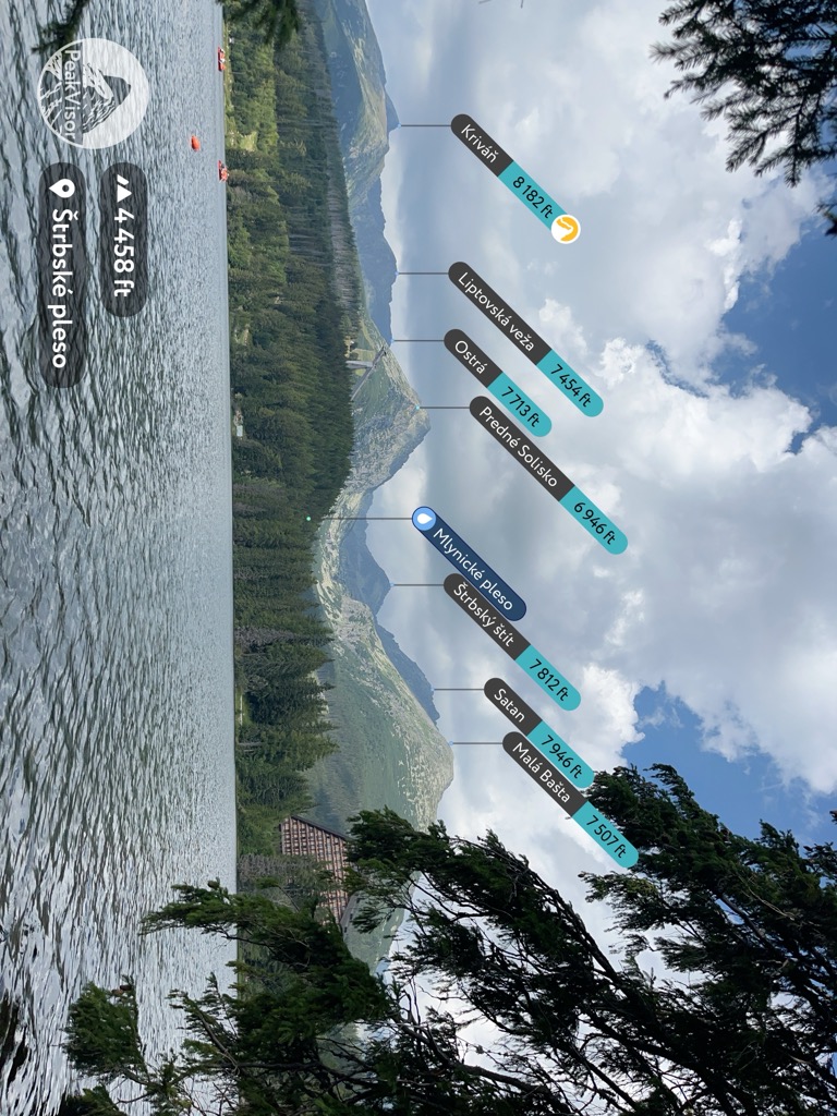
From Štrbské Pleso, head east around the lake and up the mountain. You will see the Solisko Express lift of Štrbské Pleso ski field. Follow under it until the trail passes into a thick forest. The trail is well-maintained, broad, and decently steep throughout. As you climb, the scenery changes steadily. The nearby peaks Štrbský Štit (2,8381 m / 7,812 ft), Hlinská Veža (2,340 m / 7,677 ft), and Satan (2,422 m / 7,946 ft) form an imposing black ridgeline in the distance.
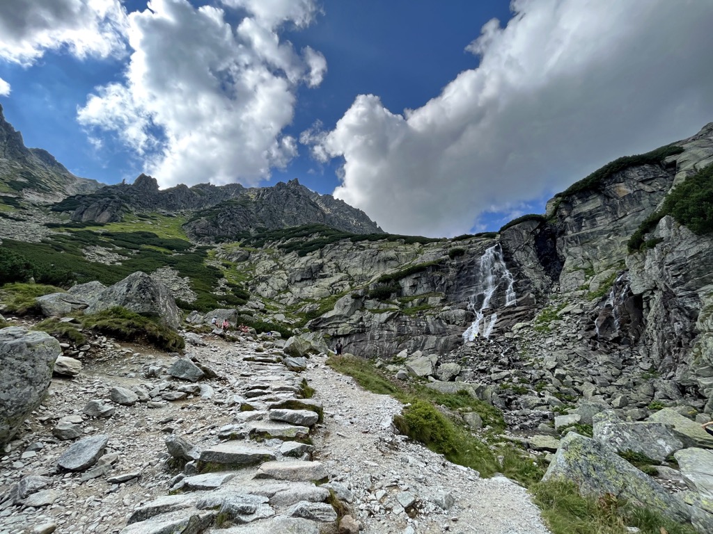
Eventually, you arrive at a lovely waterfall. You can proceed up the left side of the waterfall, using the chains as handlines - watch out for slick rock. Just past the waterfall is Pleso nad Skokum, a pristine alpine lake.
You could continue past this point. The trail forks another few kilometers down; right heads toward the north ridge of Satan and left toward Capie Pleso, another beautiful alpine tarn.
19.2 km (12 mi) out and back, 2,494 m (8,182 ft) of elevation gain
For fans of high points, Kriváň is a no-brainer. It’s a powerful national symbol for Slovakia, provides excellent views of the surrounding peaks, and takes much less legwork to get to than Rysy.
There are two ways to start this trail. The shortest and easiest is to start from Tri Studnicky hotel, a few kilometers from Štrbské Pleso. However, you can’t get to this trailhead by train, so this is only an option if you have a car. The shorter variation usually follows a loop route with a separate return trail.
The other option is an out-and-back route starting in Štrbské Pleso. Most hikers take this route despite the extra distance. Like most trails in the area, this route is well-signed and maintained. Follow the red trail markers out of town. You will traverse west, gaining elevation slowly.
Once you arrive at Jamské Pleso, follow blue trail markers and turn right at the fork. This is where the route begins to climb steeply and doesn’t let up until the summit. The trail leads out of dense forest to a long talus field under the south face of Kriváň. You will climb to a saddle on a thin ridge. Head north (left). The summit push is steep, exposed, and dramatic.
If you are headed back to Štrbské Pleso, follow the same trail. If you started at Tri Studnicky, you can take a right at the first fork and head west (away from Jamské Pleso). The trail descends a series of switchbacks, more or less directly back to the hotel.
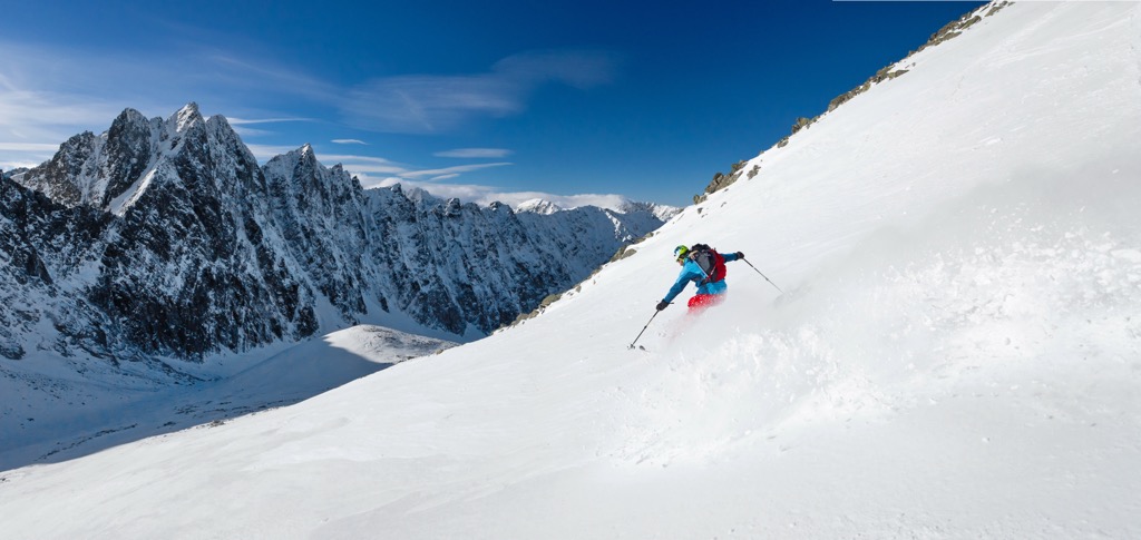
The High Tatras draw just as many winter visitors as in the summer. The mountains are full of small ski fields, and while they don’t stack up to the Alps resorts, they’re very popular with locals.
The ski season in the Tatras generally lasts from December until April. The mountains are relatively low (base depth rarely exceeds 100cm), so bases are often supplemented with artificial snow. Ski fields here are commonly just that: a single piste serviced by a lift. In some cases (like Kasprowy Wierch), it’s possible to ski off-piste, but most of the resorts are geared toward beginners.
Don't get your hopes up if you’re looking for tree skiing, big cliffs, or deep powder. Skiing in the High Tatras is more about enjoying the scenery, which is fantastic. These are a few larger and more popular ski resorts around the High Tatras.
The largest, highest, and most popular ski resort in the High Tatras climbs from the mountain town of Tatranska Lomnica almost to the summit of Lomnicky Štit. The most impressive thing about Tatranska Lomnica is the vertical drop. From the base to the top of the summit shack is 1,302 m (4,271 ft)!
A straight shot groomer back down the Lomnicky Štit is the main event here. Most of the mountain’s lifts service this one straight line. And while it’s an amazing amount of vertical to do in one run, there isn’t much in the way of features or exciting terrain to explore. Passes run about 55€ per day.
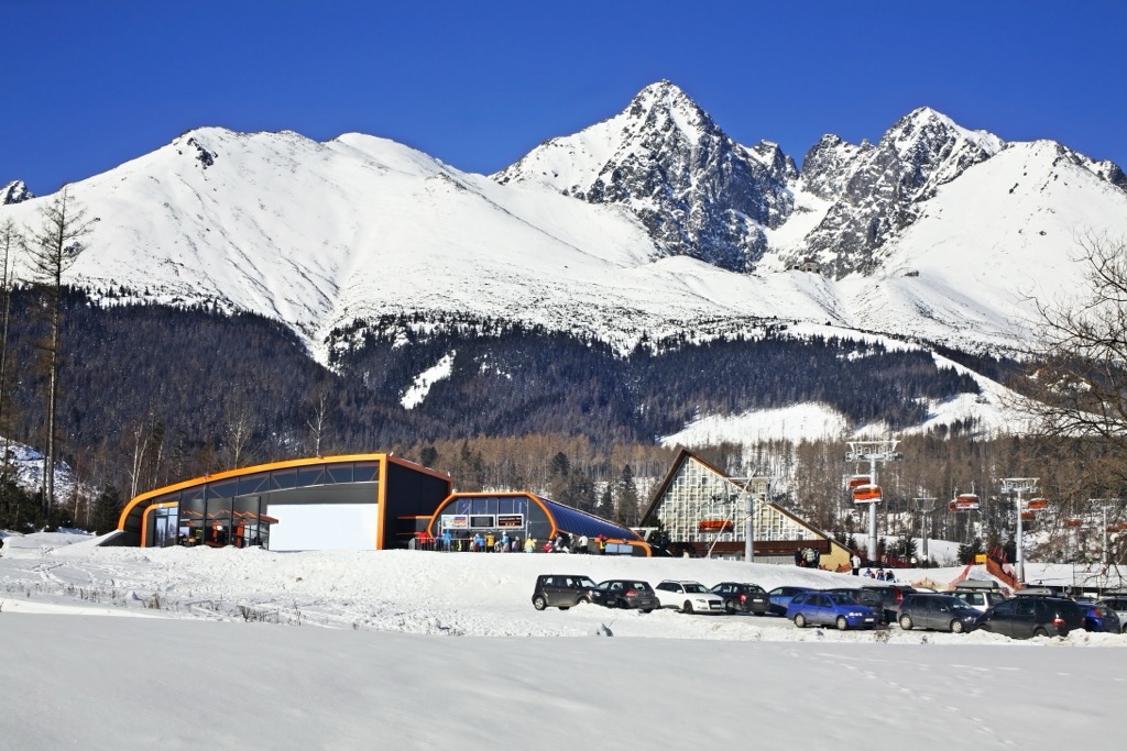
Just west of Tatranska Lomnica is the second largest ski area in the Slovakian High Tatras, Štrbské Pleso. It climbs halfway or so to the summit of Predné Solisko. It features a few rope tows and T-bars, as well as three chairlifts.
Like at Tatranska Lomnica, the resort is more or less a straight line back down from the top shack. The terrain is well-suited to learning to ski, which you will see a lot of on the hill. Day passes are about the same as Tatranska Lomnica, around 55€ per day for adults.
On the Polish side of the High Tatras, Kasprowy Wierch is the best ski area by far. It’s the highest lift-accessible area in Poland, topping out at the summit of Kasprowy Wierch (1,987 m/6,519 ft). The whole ski area encompasses considerable expert terrain, including off-piste skiing in dramatic open bowls. However, many areas are often closed for avalanche danger. Kasprowy Wierch is the only ski area in the High Tatras intended for experts, with sprawling terrain and a surprising amount of vertical. Day passes here are slightly cheaper, too, around 179 PLN (40€).
Outside the resorts, vast expanses of backcountry terrain are only accessible to ski mountaineers. There are a lot of impressive routes and objectives here, like the High Tatras Haute Route, which summits Gerlachovsky Štit. But you’ll need a registered guide (and several days) to take on anything of this size.
The mountain town of Zakopane sits on the northern flanks of the High Tatras. It’s the most common starting point for the Rysy through-hike and the biggest mountain destination in Poland. As mentioned, you can get to Zakopane easily from Krakow by bus.
Zakopane is a large town with a population of nearly 30,000. There are accommodations of all kinds here, from budget hostels to luxury hotels. Expect to pay anywhere from 65 to 850 PLN for lodging here. There are also some private campgrounds in the area. You can take a bus from the city to many of the major trailheads, including the Morskie Oko/Rysy summit hike.
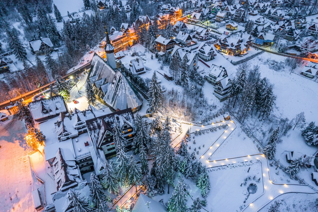
On the Slovakian side, a collection of smaller towns (Štrbské Pleso, Stary Smokovec, Tatranska Lomnica, etc.) around the base of the mountains is often referred to as Vysoke Tatry. The TEŽ railway makes it easy to quickly get from one town to another.
In general, Vysoke Tatry is a more expensive destination to visit than Zakopane. The most inexpensive option for lodging here is camping, and many private campgrounds are scattered around the foot of the mountains. There are also a few hostels, but most visitors stay in hotels, most of which are upscale and very luxurious. Expect to pay around 10€ for campsites, 40-50€ for a hostel bed, and anywhere from 100-250€ per night for a hotel room. Vysoke Tatry is also a much smaller town than Zakopane. There are plenty of restaurants and basic services, but finding a pharmacy or grocery store here may be more complicated.


The highest peak in the High Tatras is Gerlachovský štít, at 2,654 m.
The High Tatras have 221 named peaks.


