
Scan the QR code and open PeakVisor on your phone
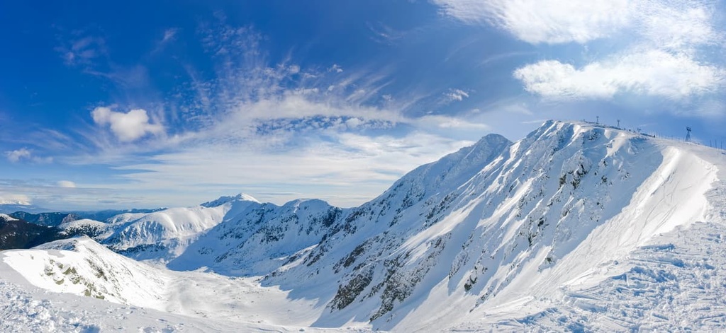
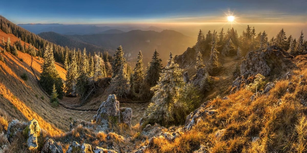
Approximately 8489 named mountains mold Slovakia’s 49,035 sq. km (18,933 sq. mi) landscape, with peaks spanning almost the country’s entire dominion except its southwestern corner. Gerlachovský štít proudly holds the title of Slovakia’s tallest and most prominent mountain, at 2,655 m (8,711 ft) in elevation and 2,356 m (7,730 ft) in prominence, which also makes it one of the ten tallest mountains in the Carpathian Mountains.
Slovakia is a land-locked country located in Central Europe. It is located just along the edge of Eastern Europe as a result of its eastern border with Ukraine. Occupying most of Slovakia’s northern border is Poland while Czechia is situated to the northwest, Austria is located to the west, and Hungary is nestled to the south.
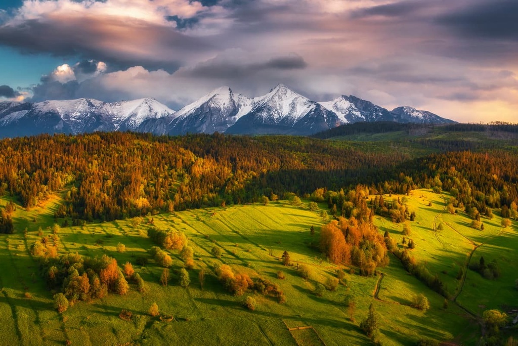
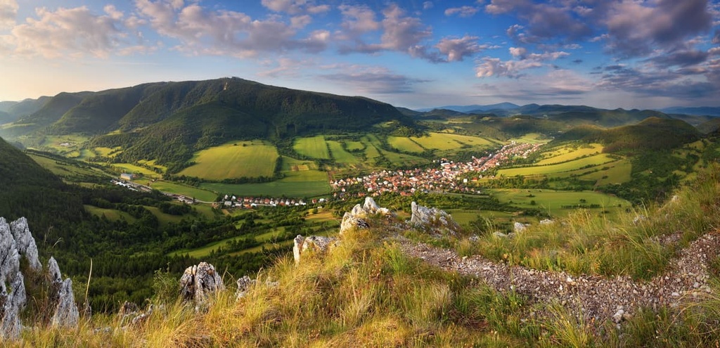
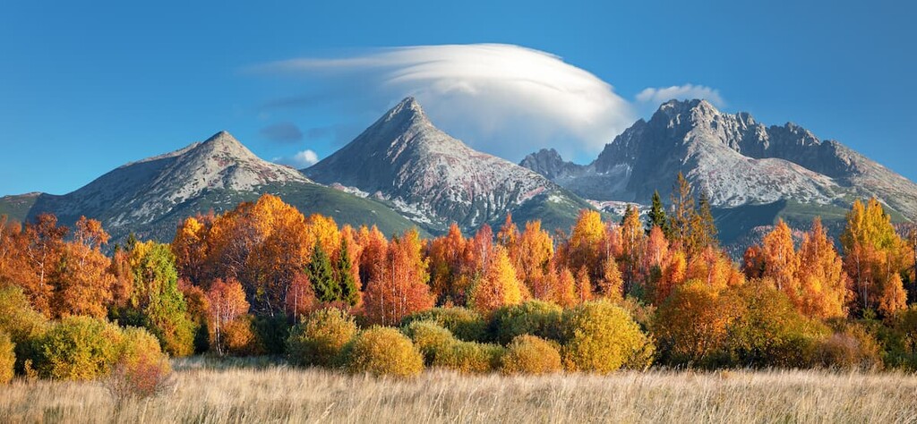
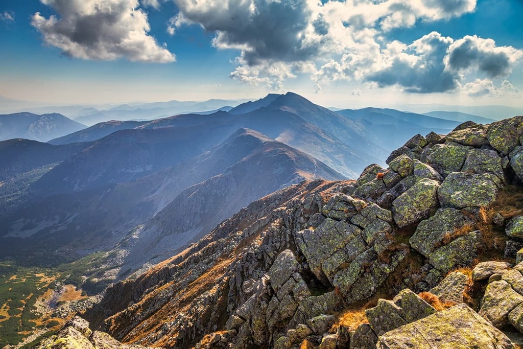
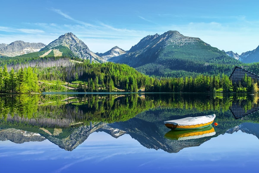
Overall, Slovakia is a rather narrow country that arches over the Tatra Mountains. The High Tatras contain Slovakia’s tallest mountain and make up most of its northern landscape, especially around the Poland border, crafting Slovakia’s reputation as a high, mountainous country.
The Tatra Mountains are the highest of the Carpathian Mountains, though they specifically belong to the Western Carpathians. There are also the Low Tatras, a separate range that’s located in central Slovakia.
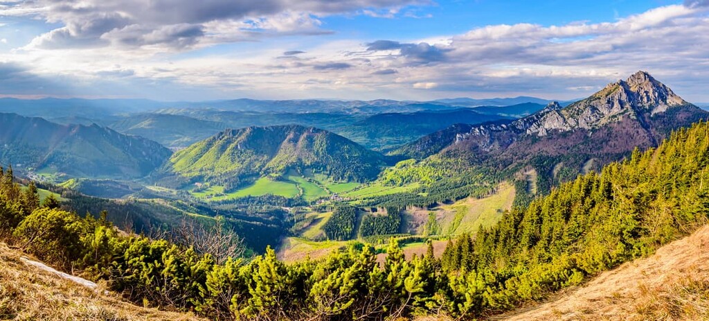
The Low Tatras are split in half by the Čertovica Pass. Meanwhile, the Tatra Mountains can also be split into Western and Eastern Tatras. Alongside the Low Tatras, they belong to the Inner Western Carpathians division as part of the Fatra-Tatra Area, which contains the Greater Fatra (Vel’ká Fatra) and Lesser Fatra (Malá Fatra) mountains, too.
The Slovak Ore Mountains are located near Slovakia’s south-central border with Hungary. The range’s tallest peak is Stolica and it is famous as the home to the Domica Cave, one of the largest caves in all of Europe. Meanwhile, the Slovak Central Mountains are located between the Ore Mountains to the east and the Fatra-Tatra Area to the north and northwest.
Another notable mountain range in Slovakia is the Beskid Mountains, which are home to Babia Góra. The range stretches from the Czech Republic in the west along Slovakia's Polish border to the east.
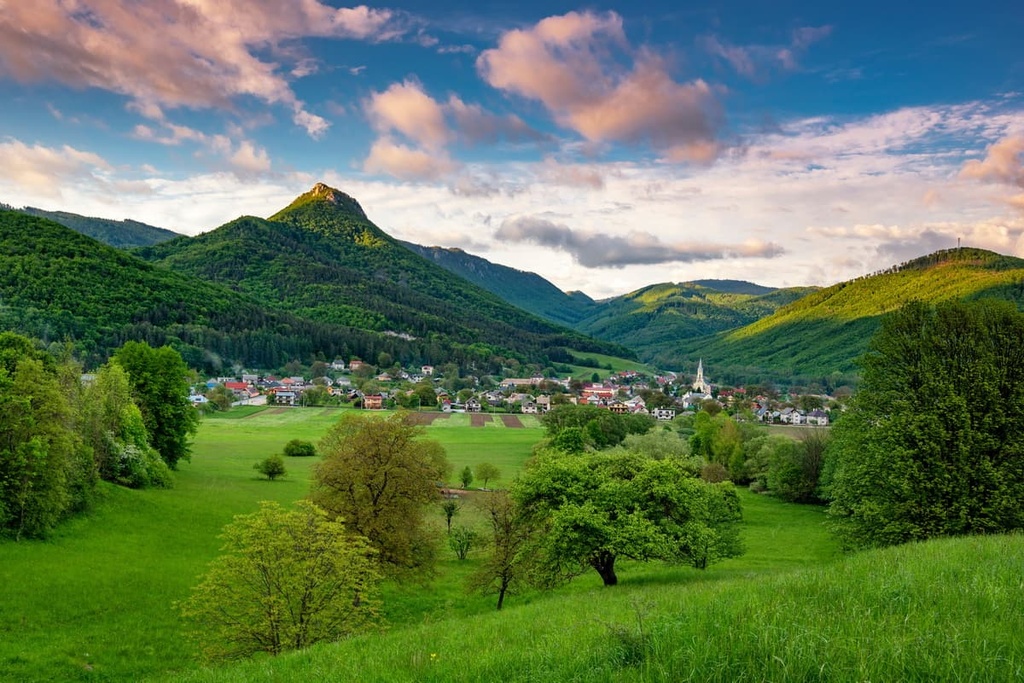
Although these vast mountain ranges cover the heart of Slovakia, they leave its southernmost corners empty. Instead, these southern regions of the country are occupied by lowlands, with the Eastern Slovak Lowland (belonging to the Pannonian basin) in the east. This area also borders Hungary and Ukraine. It is nestled along the edges of the fertile Danubian Lowland, which is based around the Danube that runs along the border of Austria, Slovakia, and Hungary.
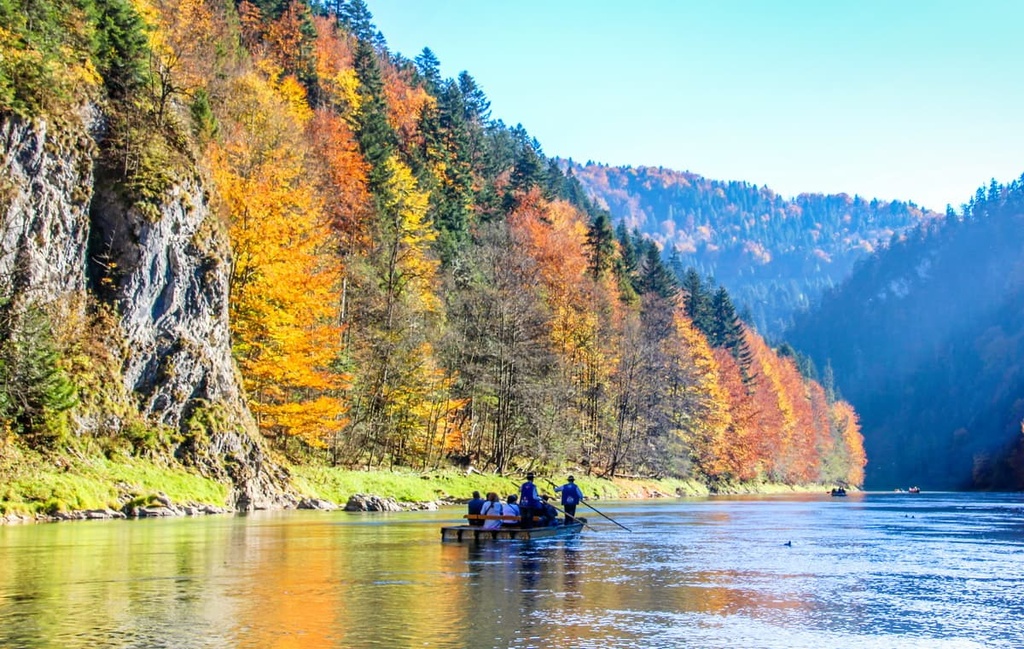
Rivers are fairly abundant in Slovakia, especially in its mountain ranges. The Dunajec runs along the Polish border while the Morava carves its way along the northern half of the Austrian border. Within Slovakia, the longest river is the 403 km (250 mi) Váh. Other rivers of note include the Nitra, Orava, Myjava, Hron, Slaná, and Hornád, among many others.
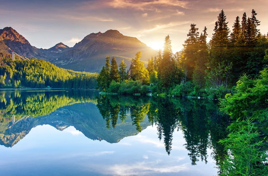
Slovakia’s mountains are home not just to rivers, but valleys and a vast system of caves and caverns. In fact, five of the country’s caves are UNESCO World Heritage sites. Additionally, while the country does not contain any notably large lakes, it does have many pristine and scenic alpine lakes that rest among its mountains.
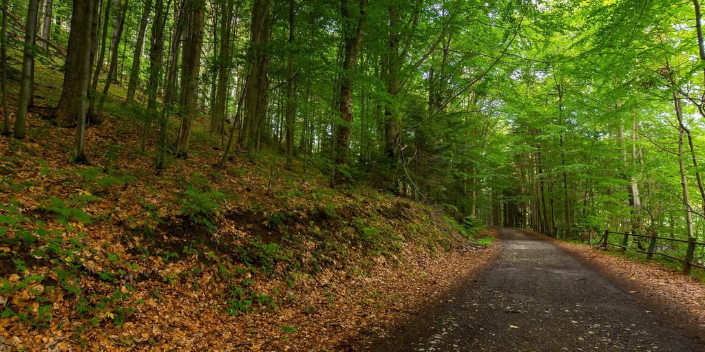
There are also nine national parks in Slovakia. They cover approximately 6.5 percent of its land surface, while about 41 percent of the country’s land surface is covered by forests.

Slovakia’s location above the Balkans allows it to feel the effects of both the continental and temperate climate zones.
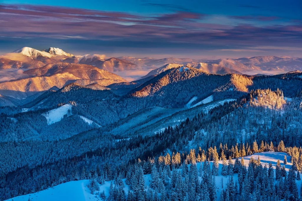
Summers in the country are warm, especially around the capital and in the south. Spring begins rather coolly while winters are cold, wet, and cloudy. Finally autumns are warm and dry at first, though they transition to cooler and rainier weather around mid-October.
Of course, there is a degree of variation between the northern mountain regions and the southern plains of the country. Lowland Slovakia and the valleys often see fog in the winter, and snowfall usually does not remain too long on the ground. In the mountains, the snow can last through the first month of spring when temperatures regularly drop below freezing.
There are eight kraje, or administrative regions, that make up Slovakia, all of which take their names from their capital city.
The Bratislava region, with a population around 660,000, thus takes its name from Slovakia’s capital, Bratislava, which is also its largest city at around 450,000 residents. It is located near the Austrian border on the Danube.
However, the largest region is the Prešov region, at around 825,000 residents, or around 15 percent of Slovakia’s population of 5.5 million people.
The geology of Slovakia is primarily determined by that of the Western Carpathians, though a small part of the country is also part of the Pannonian Basin.
The Western Carpathians came about during the Alpine orogeny that began in the Late Mesozoic, with relics preserved from the Hercynian orogeny as well. The general structure of the region thus consists of a multitude of layers of rocks and the many large nappes that have been thrusted over them.

On the extremities of the Carpathians, toward the northern borders, are groups of nappes known as the Oravicum, narrow belts of Mesozoic sediments klippes that form steep cliffs over the landscape, and the Magura and Krosno systems, which contain nappes of Cretaceous and Paleogene sediments. The Magura and Krosno systems are part of what is known as the Flysch Belt, an immense wedge formed of shales and sandstones in a flysch style.
To their south are other internal groups of nappes, the Paleo-Alpine tectonic units split into an upper, lower, and middle group. These are also organized into zones known as “belts,” namely the Core mountains Belt as the most northern, the Vepor Belt to its southeast, and the Gemer Belt even more southeast. Separating the Core and Vepor belts is the Čertovica thrust, and between the Vepor and Gemer belts is the Margecany-Lubeník thrust.
The Core Belt consists of crystalline basement rocks, mainly granites and crystalline schists, that are located below layers of Late Paleozoic, Mesozoic, and Cenozoic sediments. The tectonic structures either wholly or partially included in the belt include the Tatricum, Veporicum, Vahicum, Fatricum, and Hronicum units.
The Hronicum unit notably contains sequences of Triassic carbonates like limestones and dolomites, as well as igneous rocks and sediments from the Carboniferous and Permian.
The Vepor Belt, likewise, consists of crystalline basement rocks like granitoids, mica schists, and gneisses from the Early Paleozoic, with Late Paleozoic-Mesozoic layers of sediments on top. The Veporicum, Hronicum, and Silicium units are all included within the Vepor Belt.
Then there is the Gemer Belt, which is the highest of the Alpine nappe structures in the Western Carpathians. It consists largely of Paleozoic and Mesozoic rock sequences, though it also includes metamorphic Paleozoic rocks alongside its Paleozoic sediments from the Gemericum unit. There is also the Meliaticum unit, a mix of Triassic radiolarites, volcanites, and carbonates, and Jurassic shales and radiolarites.
The Gemer Belt is also supplied by a karst plateau from the Turnaicum unit, and from the Silicicum unit, a relatively flat area of sediments that includes a notable quantity of Middle and Upper Triassic shallow water limestones that are home to many fossils.
Meanwhile, in the southern extremities of the country, where the Pannonian becomes more prominent, the landscape largely consists of sedimentary basins.
There are two main ecoregions in Slovakia: the Carpathian montane conifer forests and the Pannonian Mixed Forests. Here’s a brief overview of the characteristics of each ecoregion.
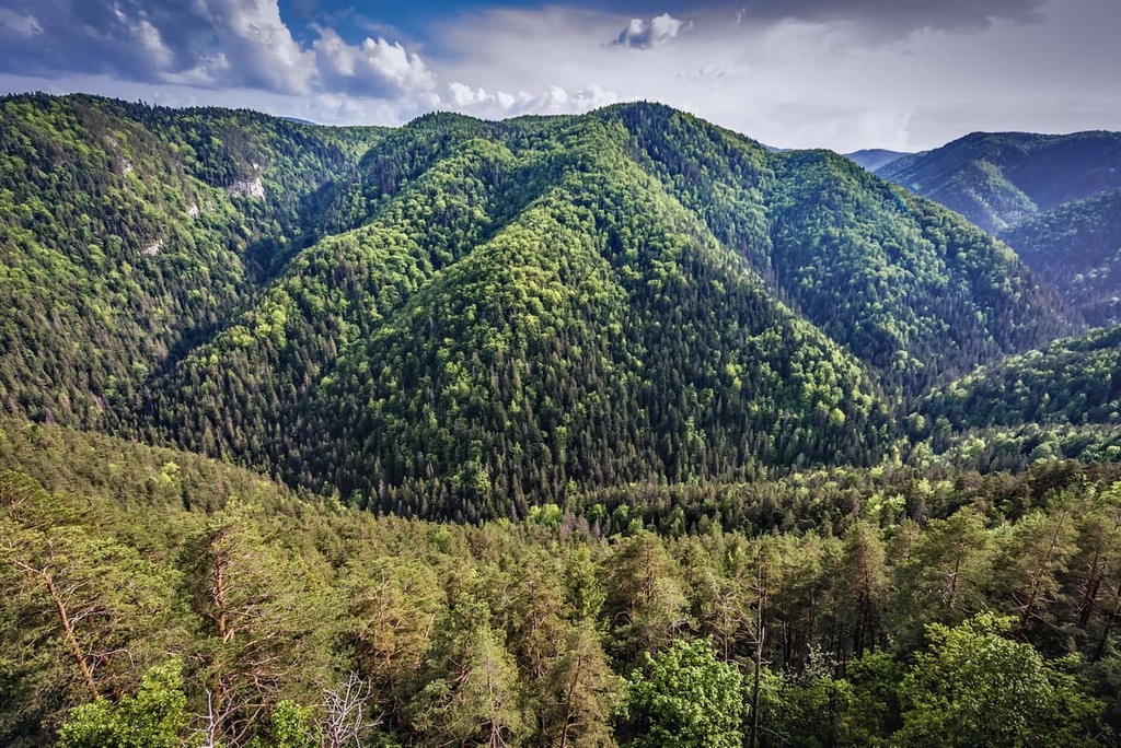
Central, northern, and northeastern Slovakia are home to the Carpathian montane conifer forests, an ecoregion of temperate coniferous forests with a diverse array of elevation-distinguished ecosystems. Over 100 endemic plant species reside in the Carpathians, which contain the largest concentrations of endemism in the Tatras Mountains.
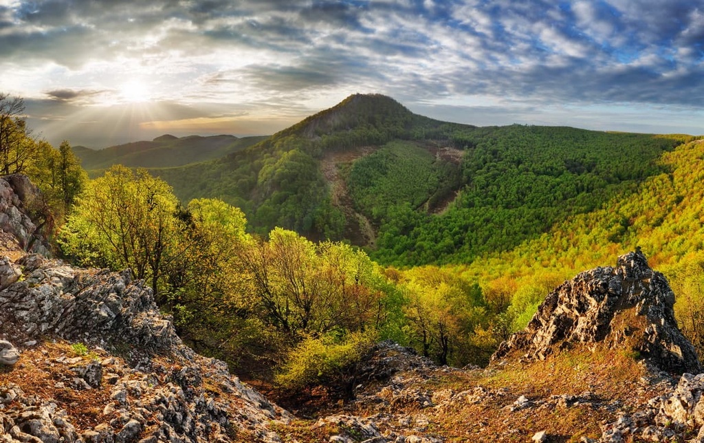
Forests in the Carpathian foothills, which are usually located below 600 to 650 m (1,969 to 2,133 ft), are populated by mixed deciduous forests of various broadleaf trees, like hornbeam, European oak, lime tree, and many other species of oak.
Above that, in the montane zone, which reaches up to 1,100 m (3,609 ft) or 1,450 m (4,757 ft), depending on location, the forests consist mainly of silver firs and European beeches. In some parts of the Western and Eastern Carpathians, these forests are almost entirely made of beech, though in others, Norway spruces, sycamores, and silver firs dominate in similar measure. Otherwise, there are communities mostly consisting of silver firs and Norway spruces.
In the Tatras, these forests tend to consist of Norway spruce, Swiss and Scots pine, European larch, and mountain pine, as well as some maples. Some species endemic to these mountains include yellow mountain saxifrage and Tatra scurvy-grass.
The subalpine zone is mostly made of Norway spruce, with some rowan trees and some stone pines in the higher reaches of the Tatras and other high mountain ranges. Where the forests begin to recede, thickets of dwarf junipers, green alders, and mountain pines start to take over, until those, too, give way to thick alpine meadows.
‘At the highest peaks, especially in the Tatras, vegetation is incredibly sparse, and the landscape is instead rocky and rugged.
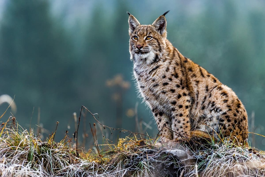
As for fauna, populations of large predators like brown bears, wolves, and lynxes exist in the thousands. The marten, marmot, otter, and wild cat also call the Carpathians its home, as does the European bison. The Tatra Mountains have its own subspecies of chamois, and like much of the mountainous spans of Europe, the Carpathians are home to roe and red deer, too.
Over a hundred species of birds can be found in the mountains. These include the ring ouzel, spotted nutcracker, three-toed woodpecker, eagle-owl, saker falcon, black stork, and golden eagle, the latter of which likes to nest among its peaks.
In eastern, southern, and southwestern Slovakia, the land is part of the northern reaches of the Pannonian mixed forest, an ecoregion of temperate broadleaf and mixed forests. These forests consist of communities of hornbeams and mixed oaks, like European and sessile oaks.
The animal communities in these forests are vast and varied. This region is home to many types of mammals and birds. Large predators like brown bears and wolves reside alongside foxes, wild boars, and innumerable small mammals, like Alpine shrews, European moles, parti-colored bats, pygmy shrews, and squirrels.
All sorts of birds, including owls, thrushes, nuthatches, doves, whitethroats, and warblers, populate these forests. Also common are newts like the alpine newt, smooth newt, and Carpathian newt.
The history of humans in Slovakia extends back thousands and thousands of years, with presumably human-made tools found in the area, especially in caves, that date back well into the Paleolithic.
The Bronze Age was a time of great change and development for the peoples inhabiting what is now Slovakia. Abundant copper production supported local economies in the region. Various cultures came and went, with archeological remnants of forts and tombs to remind us of their existence.
The Thracian tribes settled parts of Slovakia in the early Iron Age, building burial mounds in which they left behind all sorts of products and decorations. Later, around 500 BCE and onwards, the land would be settled by groups of Celts, who built oppida, a type of fortified settlement, in modern-day Bratislava and Devín.
Around 2 CE, the area that would become Slovakia, much like large swaths of Europe, saw the arrival of the Romans, who established many outposts, military forts, and seasonal military camps. Evidently, Slovakia became important to Roman military strength and positioning, with wars like the Marcomannic Wars occurring in and around it.
In the sixth century, the Avar peoples began to consolidate power around the Pannonian lowlands and establish their own empire. This would face strife shortly after, in 623, when the Slavic peoples of western Pannonia, under the unifying leadership of a Frankish merchant named Samo, formed their own empire. The Avar empire would soon face a slow decline, with its disestablishment occurring officially in the early ninth century.

Also in the ninth century, various Slavic polities combined to form the Great Moravian Empire, during whose existence the Saints Cyrial and Methodius arrived and brought an expansion of Christianity’s influence throughout the land. These saints also brought the creation of the Glagolitic alphabet, a pre-Cyrilic script that’s considered to be the oldest known Slavic alphabet.
The Great Moravian Empire hit its territorial peak under the rule of Svatopluk I when it cast a wide net over much of east-central Europe. In the late 800s, however, internal feuds and external conflicts whittled away at the empire’s outer territories. The empire is considered by historians to have been dissolved between 902 and 907, though its influence on the religion, culture, and language of the area would persist well beyond these dates.
Without the Great Moravian Empire, Slovakia largely fell under the rule of the Kingdom of Hungary, and became part of the Hungarian nation for quite some time. Over the centuries, the population also diversified, seeing the arrival of groups like Carpathian Germans, Jewish people, and Hussites from the thirteenth to fifteenth centuries. At one point, with the Ottoman encroaching Hungary’s territory, Bratislava was even named the state’s capital.
Modern Slovakia became a site of cultural and artistic change, development, and cultural conflict, as it was the location of constant strife between Catholics and Protestants and skirmishes with the Ottomans. The land was greatly devastated by the various wars fought between the Kingdom of Hungary and the Ottomans, such as the Austro-Turkish War in the 1660s.
When the Ottoman threat was no longer as pressing to Hungary, Slovakia as a territory began to lose its importance to the broader nation, and the idea of Slovakian independence from Hungary became more appealing. The relationship between the two grew tense, and this culminated in the departure of Slovakia from the Austro-Hungarian Empire after World War I and the formation of Czechoslovakia.
Czechoslovakia underwent a lot of strife in the build-up to World War II, with Nazi Germany threatening to take parts of Slovakia. Slovakia then seceded from Czechoslovakia to form the first Slovak state, known as the First Slovak Republic, with much political influence from Nazi Germany.

An anti-Nazi resistance movement attempted the Slovak National Uprising, an armed insurrection, against the Nazi regime. Eventually, in 1945, Soviet and Romanian forces liberated Slovakia from the Nazis, and not long after, the country again constituted part of Czechoslovakia, which would remain under Soviet occupation and/or influence for several decades.
Slovakia and the modern Czech Republic began to take shape in 1969 when Czechoslovakia became two main federated states, the Slovak Socialist Republic and Czech Socialist Republic.
With the dissolution of communist rule in Czechoslovakia came the dissolution of Czechoslovakia, and so came about the Slovak Republic. Slovakia declared its sovereignty in 1992 and officially parted ways with the Czech Republic the year after.
In Slovakia, many parks and hiking areas close or open certain trails depending on the season. In fact, some mountains only open for hiking during very limited times of the year.
Slovakia is also traversed by a few of the major European long-distance paths, namely the E3 and E8.
The E3 goes through the Malá Fatras and the Tatras for about 170 km (106 mi), while the E8 spends about 740 km (460 mi) in the country, traversing numerous mountain ranges from the southwest to the northeast.
Low Tatras National Park is the largest national park in all of Slovakia. It offers an abundance of natural sights, from caves deep below the Earth to mountains high above, for visitors to see and hike.
At the heart of the park is the mountain ridge of the Low Tatras, which spans a distance of almost 90 km (56 mi) from Dovocaly to Čertovica, with an average elevation between 1,500 and 2,000 m (4,921 and 6,562 ft) above sea level.
The option to hike the whole ridge at once, normally a 5 day affair, certainly exists, though most opt to travel it in sections. Furthermore, this route is but a small selection of over 1,000 km (621 mi) of marked hiking trails in the park.
Popular hikes in the park include the hikes up the peaks of the Chopok and Ďumbier mountains. The shortest option up Chopok is about 2.5 hours from Vrbicke Pleso, though there are other options like the 8.5 hour hike from Srdiecko.
Ďumbier, the tallest peak in the Low Tatras at 2,043 m (6,703 ft), hosts great views and limestone views. It also has a few hiking options, like the 3.5 hour walk from Čertovica or the 4 hour trek from Demänovská dolina.
The opportunities in the park are truly endless. Some other popular hiking destinations include:
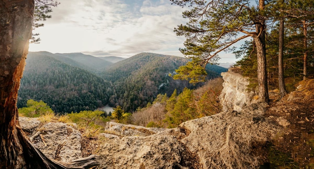
The heavily forested mountains of Malá Fatra National Park contain all sorts of wonders, including a crystalline cave, imposing waterfalls like Šotovsky Vodopád and Horné Diery, gorges and canyons, centuries-old castles like Strečno, and great populations of Slovakian wildlife.
The scenery is endless in this park, which also holds particular cultural, religious, and artistic and architectural significance.
Some of the park’s most iconic peaks are Veľký Rozsutec, Malý Rozsutec, and Veľký Kriváň. Velky Rozsutec is considered by some to be the most beautiful mountain in Slovakia, with extraordinary views of the landscape at its peak.
The 10.6 km (6.6 mi) loop from Terchová is one popular way to climb the peak, though there are several. To its north is Maly Rozsutec, a smaller mountain that offers a more difficult climb.
Veľký Kriváň, the tallest mountain of the Malá Fatra, tends to be scaled by cable car more often than hiked, but many hikers choose to hike it alongside a group of other nearby peaks, like Poludňový grúň, Chleb, and others. There are trailheads to the peak from several villages like Štefanová, Terchová, Martin, and Kral’ovany.

There is also the Janošikove diery gorge, an easy 5.8 km (3.6 mi) non-mountain-based hike that windows through gorgeous waterfalls and rivers.
Other notable hiking locations in the park include:
Muránska Planina National Park is one of the younger national parks in the country. It was recognized in the late 1990s for its great natural beauty and rich biodiversity.
Over 300 km (186 mi) of marked hiking trails are interwoven through the park, with the villages of Ćervená Skala, Murán, and Tisovec providing some of the most popular access points for hiking the plateau and its caves, gorges, and castles.
Located on the border with Poland is Pieniny National Park, Slovakia’s smallest national park. The park is famous for its mountains, the presence of the Dunajec river, its lime trees, and the long history of folklore and Christian significance in the area.
The main hiking attractions of Pieniny National Park is the Three Crowns massif, which was named for its triangular peaks. However, these peaks are located primarily on the Polish side of the park.
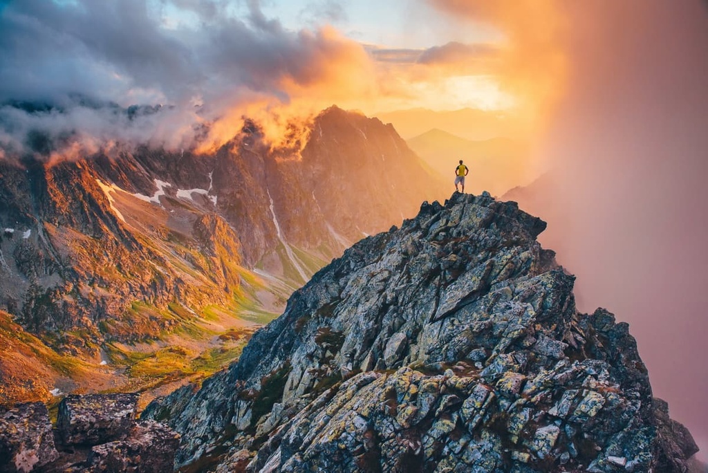
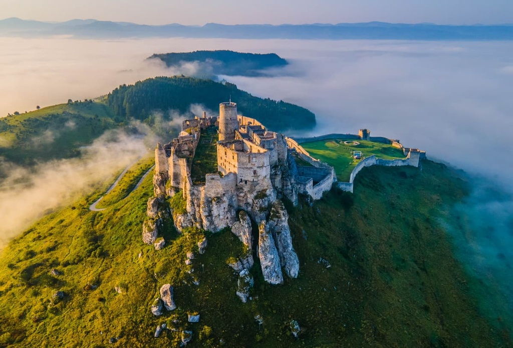
Situated along the Polish boundary is Tatra National Park. The park spans part of the High Tatras, Eastern Tatras, and sections of the Western Tatras.
Additionally, it is the home of Slovakia’s tallest peak, Gerlachovsky štít, which may be a must-see for many. However, one should keep in mind that hiking trails in the park’s mountains are closed from the public between November 1 and June 15, and from October onward. Some trails may only be available through guided tours throughout the year.
The number of great hikes in the park is incredible. Gerlachovsky štít is one of the hikes in the region that requires a certified mountain guide to come with you and special equipment to embark upon the full-day affair, regardless of the time of year.
The tallest mountain accessible for anyone in the park is Lomnicky štít, which stands at an impressive 2,634 m (8,642 ft), though no trail leads to the peak.
The tallest hikeable peak, then, is that of Rysy, the 2,503 m (8,212 ft) mountain located on the Polish border, which provides a popular and challenging day hike through beautiful and rugged terrain. Another iconic peak is the horn-shaped Kriván, which is famous as a national symbol of Slovakia. It features amazing panoramas though it takes about 7.5 to 8 hours to hike it.
Not only is the park home to must-see mountains, but lakes as well, with the 5.5-6 hour long Three Lakes Trail offering sights of the three pristine lakes of Strbské, Popradském and Vel’ké Hincovo. This trail also features great views, flourishing wildflowers, and flanking creeks. Notably, Hincovo is the deepest glacial lake in the High Tatras.
Other notable hiking locations in the park include:
Situated in southeast Slovakia is Slovak Karst National Park, which is famous for, as its name suggests, the resplendence of karstic features that make up its landscape. Indeed, the park features over 1,100 caves and abysses hidden underground. Though much of the appeal of the park lies underground, there is plenty to be said about the hiking above ground, as well.
For example, the karstic gorge of Zadielska Valley, which is about 300 m (984 ft) deep and adorned with a creek, cascades, and waterfalls, makes for a lovely 4 to 5 hour long loop hike. There are also clusters of small waterfalls, known as Háj waterfalls, that can be visited along a 4-hour hike that also takes you to see the ruins of Turna Castle.
Taking its wonderful name from the incredibly enticing Slovak Paradise Mountains, which are part of the Slovak Ore Mountains, Slovak Paradise National Park is home to around 300 km (186 mi) of hiking trails, endless gorges, an abundance of waterfalls, interesting and varied geographic reliefs, and the stunning Dobšiná Ice Cave.
Note that many of the gorges in the park use wooden ladders in parts to help get around. Some trails in the park may also require that you bring or rent climbing gear.
The most popular hiking path in the park may be the Prielom Hornádu, which is named after the 18 km (11 mi) gorge it winds along. The Hornad River is a pristine companion to the walk, which is made even more interesting by the catwalks, ladders, cliffs, and—at certain points—great views of the Tatra Mountains.
Another popular gorge hike is the one through Sucha Bela, a 3.5–4 hour long loop that’s known for the cascades of waterfalls that flank it and the wooden ladders used to scale up the gorge’s sides.
The remote gorge of Velky Sokol is known for its width and for the occasional appearance of wildlife like deer and chamois. It takes about 5 hours to loop around the gorge itself. The sense of solitude and natural beauty in the gorge, highlighted by the rush of its waterfalls and views of the hills overhead, is described by visitors as extraordinary.
Beech-filled Carpathian forests abound among the mountains of Vel’ká Fatra National Park, where caves, cliffs, and carnivores contribute to a rich and beautiful natural ecosystem. The many valleys and peaks in the region provide beloved hiking destinations for visitors to enjoy.
The highest peaks of the park, Ostredok and Krížna, can be scaled in one challenging but convenient full-day 20.7 km (12.9 mi) hike from Staré Hory, as the two are located right next to each.
This hike is famously scenic, with views of the mountains and the forests at every turn. Another hike of similar length and difficulty is the 17 km (10.6 mi) hike up Rakytov from Liptovská Osada, which likewise features stunning views of the local greenery and heights.
There’s also the hike up Ploská. This hike is shorter than that up the aforementioned peaks but just as beautiful. It is about 14 km (8.7 mi) long from Vyšna Revúca, which also has great sights of the local grasslands.
Other notable hiking locations in the park include:
Looking for a place to stay during your visit to Slovakia? Here are some of the best cities and towns to check out in the country:
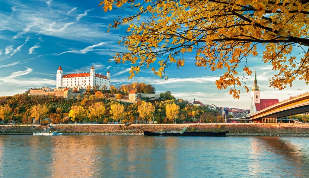
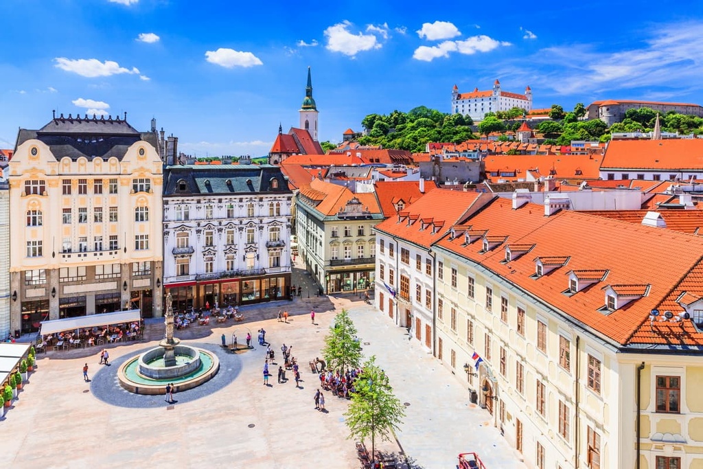
Bratislava is the capital, largest city, and cultural heart of Slovakia. It is located on the country’s border with both Austria and Hungary.
Bratislava is a gorgeous city full of traditional architecture, with red tile roofs, church spires, and fairytale palaces abound, though it also contains many interesting artistic and architectural communist relics to explore as well.
The aesthetic beauty of Bratislava is undeniable, as is the palpable feeling of history that resonates throughout the city, from the 1,100-year-old ruins of Devín Castle to the massive white walls of Bratislava Castle.

The Old Town of Bratislava is home to all sorts of cafés and restaurants, with narrow winding roads and outdoor terraces adding to the charm. It is also, of course, home to many historic buildings, museums, and lively town squares; the Bratislava City Museum, Michael’s Gate, Main Square, Grassalkovich Palace, and Church of St. Elizabeth are but a handful of the Old Town’s many cultural and architectural offerings.
The Danube riverfront, lakes, forests, and parks provide the city with plenty of natural beauty, and the outdoor markets provide the city with plenty of traditional and artisanal flair. The city is also known for the medley of cultural influences that have shaped its current artistic scene. There are many theaters, art museums and galleries, concert venues, clubs, breweries, and bars in the city.
Buses, trams, and trolleybuses are all available for public transportation throughout the city. Conveniently, Bratislava is a rail hub that connects to Slovakia’s neighboring countries and cities, and it has its own international airport, M.R. Štefánik.
On the other side of the country is Košice, Slovakia’s largest city in the east, and second-largest city after Bratislava.
Košice is famous for its extremely well-preserved historical center, where buildings ranging from the Gothic to Baroque to Art Nouveau make up the cityscape. Museums and galleries, too, like the East Slovak Museum, East Slovak Gallery, and Slovak Technical Museum contribute to the rich history and culture of the city.
Religious architecture, including all sorts of churches and the pink New Orthodox Synagogue, is especially notable in the Košice, as it contains Slovakia’s largest church, the gothic and wonderful St. Elisabeth Cathedral, alongside other beautiful buildings like St. Anthony of Padua Church, St. Urban Tower, and St. Michael Chapel.
Other prime locations in the city include Hrnčiarska, the stone-lined crafts street full of artisanal shops of all sorts, bakeries, and bars. There’s also the Renaissance-inspired State Theater, the gorgeous Jakab’s Palace, the army-barracks-turned-cultural-center of Kulturpark, and the many streets adorned with centuries-old statues, modern street art, and restaurants and cafés.
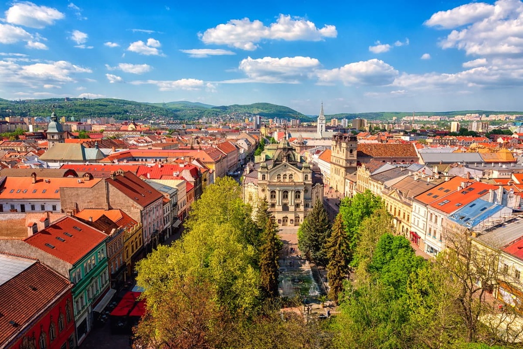
Like Bratislava, trams, trolleybuses, and buses are useful for getting around the city of Košice, which is also a rail hub to the nearby cities and countries. The city is also home to a smaller international airport, Košice International, which connects regularly to cities like Vienna, Warsaw, and Prague.


