Scan the QR code and open PeakVisor on your phone
The Great Fatra (Veľká Fatra) mountain range is expanding over the area of 78,400 ha in the north-western part of central Slovakia. Due to its unique natural scenery and preserved character, Great Fatra was declared a protected landscape area in 1973 and became the youngest national park in Slovakia on the 1st of April 2002 with a protection zone of 26,132 ha. The range contains 276 named mountains, the highest and most prominent of which is Ostredok (1,596 m/5,236 ft).
The Great Fatra mountain range lies in the north-western part of central Slovakia, spanning across the regions of Turiec and Liptov and partly in the regions of Horehronie and Orava. It lies to the south and east of the Malá Fatra (Little Fatra) mountain range, which is higher in terms of elevation but it is called "little" due to the smaller area it covers.
Great Fatra borders the Chočské vrchy to the northeast, the Low Tatras to the east, the Starohorské vrchy to the southeast, and the Kremnické vrchy to the south. It also borders the vast Turčianska kotlina (Turiec Basin) to the west and Liptovská kotlina (Liptov Basin) to the east.
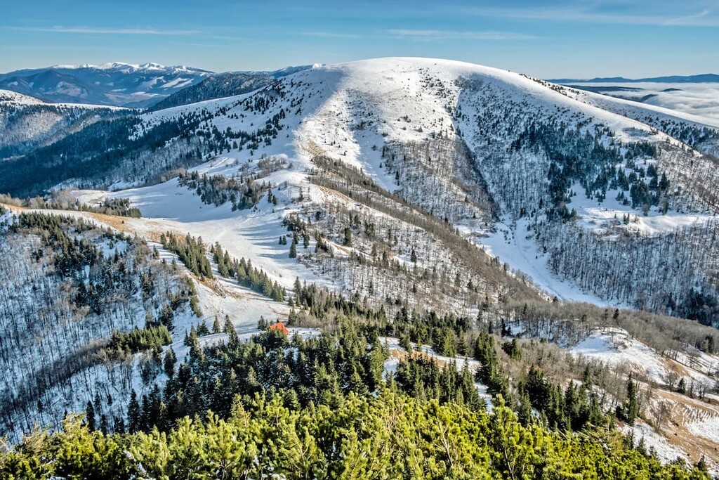
The main ridge Hôľna Fatra stretches from the south, starting with the peak Krížna, continuing to the north through the highest peak Ostredok, and Suchý vrch, Kýšky to Ploská. Round grassy peaks create a distinctive character of this ridge. Other distinctive peaks in this part of Great Fatra are Frčkov, Smrekovica, Suchý vrch, Rakytov and Borišov.
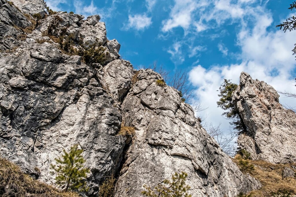
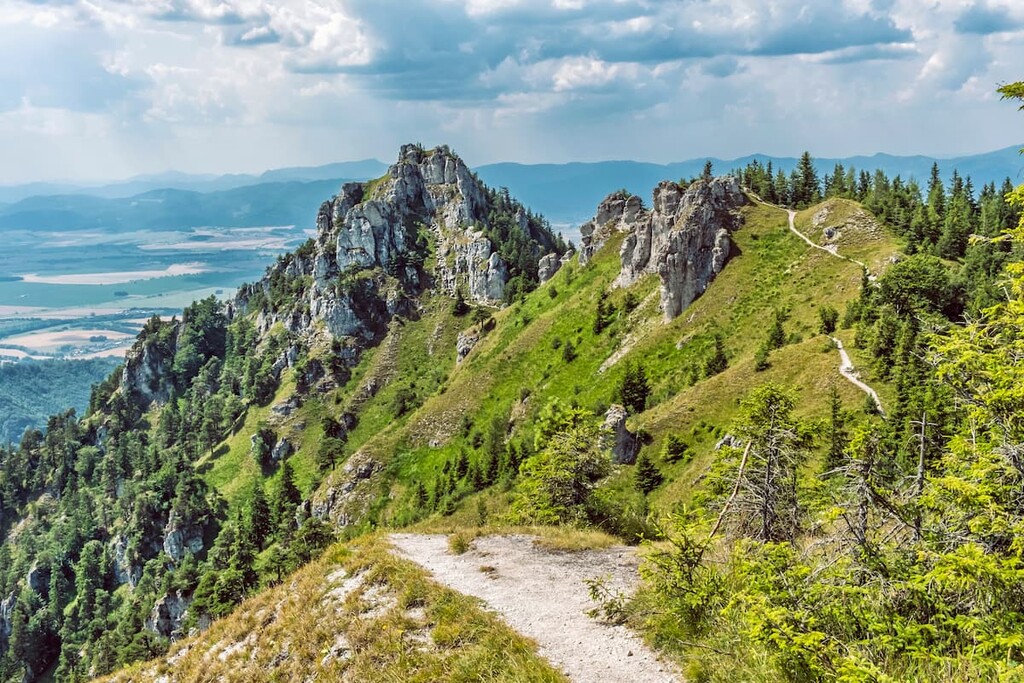
The more rugged and rocky southern subrange of Great Fatra—Bralná Fatra— is home to popular peaks of Tlstá and Ostrá, dominating Great Fatra in the Upper Turiec region around the city of Martin.
There are 37 named peaks higher than (1,300 m/4,265 ft) in the Great Fatra.
Great Fatra is part of the Inner Western Carpathians, which belong to the Fatra-Tatra Area. It is one of the most extensive core mountain ranges in the Western Carpathians. Its crystalline core is made up of granitoid rocks (granites, crystalline shales) which rise to the surface only in its northern part in the area of Smrekovica and Ľubochnianska valley.
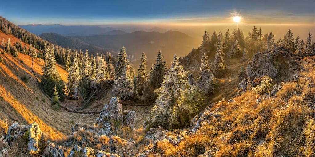
The rest of the area is formed by the Mesozoic sedimentary rocks. Being formed mostly by granite, limestone, and dolomitic limestone, it is no wonder that this mountain range is typical of its deep, canyon-like valleys, bald peaks covered by grass and shrubs as well as various rocky formations.
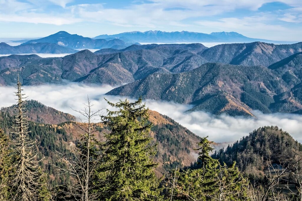
Despite the relatively low elevation of its peaks, Great Fatra can be classified as high mountains due to rather rugged terrain and big elevation differences. The main ridge known as the Hôľna Fatra, with its typical bald mountains, is in stark contrast to its other major part, the Bralná Fatra, with its impressive rocky sceneries and characteristic karst walls, towers, windows, and overhangs.
It is here where some of the most popular valleys can be found: Gaderská, Blatnická, Belianska, and Bystrická. Great Fatra is also home to the longest valley in Slovakia, a 25 km (15.5 mi) long Ľubochnianska Valley, stretching from north to south.
So far, more than 50 caves have been discovered in the area of Great Fatra, many of which are famous for prehistoric settlements and cave drawings.
However, only one of them is accessible to the public—the stalactite Harmanecká Cave located in the southern part of Great Fatra, one of the most important caves in Slovakia for its abundance of moon milk and for being a winter refuge to over a thousand bats each year. Other famous caves include Mažarná Cave, Dolná, and Horná Túfna or Ľadová Cave located at the foothill of the Šíp peak.
The slopes of Great Fatra are prone to erosion, encouraged not only by their inclined character, climate, and the characteristics of soils but also by building roads, logging, cattle pasture, and tourism.
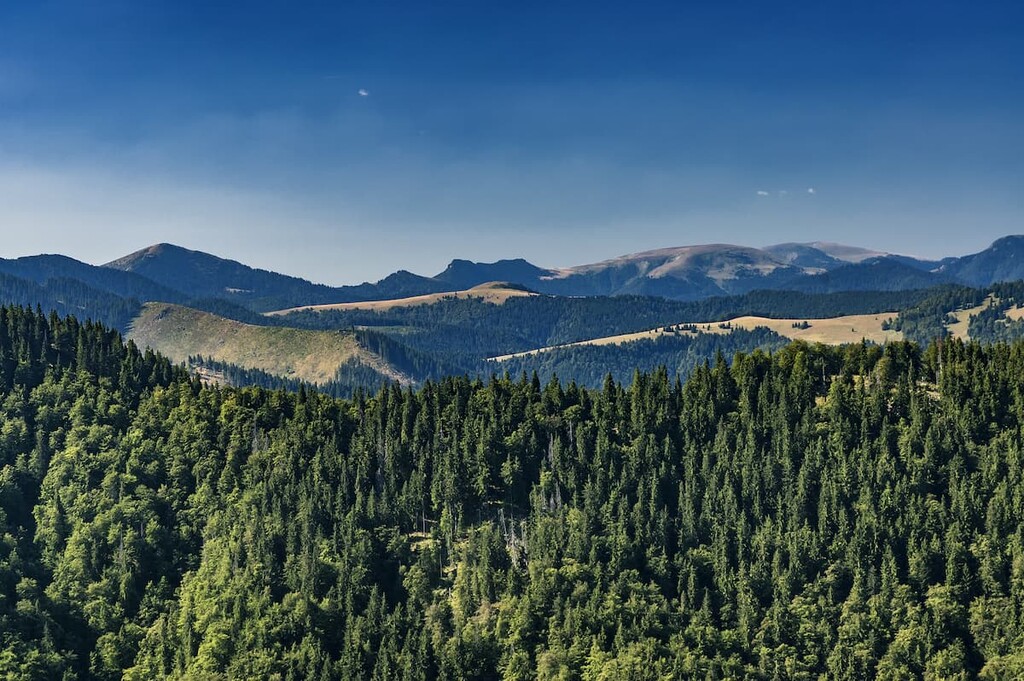
Great Fatra is ecologically diverse and nearly 90% of the territory is covered by mixed forests with beech, spruce, and fir trees. In the area of Harmanec, one of the largest original occurrences of yew tree in Central Europe can be found. Yew tree is a glacial relic—a plant that has been left behind after the last glacial maximum. It can also be found in the logo of the Greater Fatra National Park.
Thanks to diverse environmental conditions created by vast forests, alpine meadows, rocky mountain massifs, streams, and caves, Great Fatra is home to a host of different species of insects, as well as more than 220 bird species and mammals including chamois, bat, deer, falcon, badger, brown bear, wolf, and lynx.
Great Fatra is also home to a precious endemic flower, Cyclamen fatrense, which can’t be found anywhere else in the world except in Great Fatra and the western part of the Low Tatras. This beautiful violet flower protected by law can be spotted in the woods from July to September. Other captivating plant species include martagon lily, perennial honesty, dame’s rocket, and edelweiss.
In addition to offering beautiful scenery, Great Fatra also has an interesting history of human settlement. The first indirect evidence comes from the Early Stone Age from the Horná Trúfna Cave, where remains of hearth and broken bones of cave bears were found, dating back approximately 40,000 years ago.
The most intensive settlement can be traced back to the Late Bronze Age, to the people of the Lusatian culture, who were famous for their practice of cremating the dead and placing their ashes in urns which were then buried in special fields. Numerous findings of bronze weapons, tools as well as bronze statues also come from this period.
An important point in history is marked by the arrival of the Slavic population in the ninth century. The establishment of the first historical settlements of Great Fatra can be traced back to the twelfth and thirteenth centuries, with the first written records dating back to 1113. This period was followed by Tatar invasions, leaving behind fatal consequences for the local population.
The construction of the first fortified castles, such as Blatnický hrad, began in the thirteenth century. The landscape of Great Fatra was significantly reshaped during Wallachian colonization and the region wasn’t spared during the fights during the Slovak National Uprising in World War II, either.
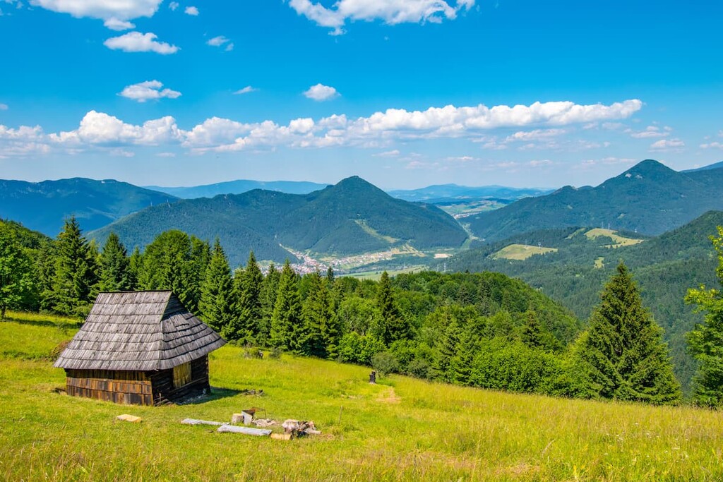
Mentioning human settlements in Great Fatra wouldn’t be complete without Vlkolínec, a preserved settlement comprising 45 traditional houses typical of a central European village. Located in the southern part of the main ridge of Great Fatra in the Liptov region, this remarkable place was listed by UNESCO as the World Heritage site in 1993.
Thanks to the diverse geology, long valleys, preserved forests, beautiful scenery, spectacular views, and conveniently located huts and shelters, the mountains of Great Fatra offer year-round possibilities for nature enthusiasts, whether it’s hiking along the main ridge or wandering through long picturesque valleys. Overall, there are around 300 km (186 mi) of marked hiking trails and cycle routes.
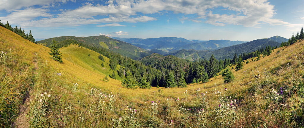
Although popular, Great Fatra is still far from being a tourist hotspot so it is therefore perfect for those who wish to avoid crowds. In fact, it is one of the few national parks in Slovakia where you can still enjoy silence, untouched nature, and green wilderness. In summer, you can see meadows covered with wildflowers.
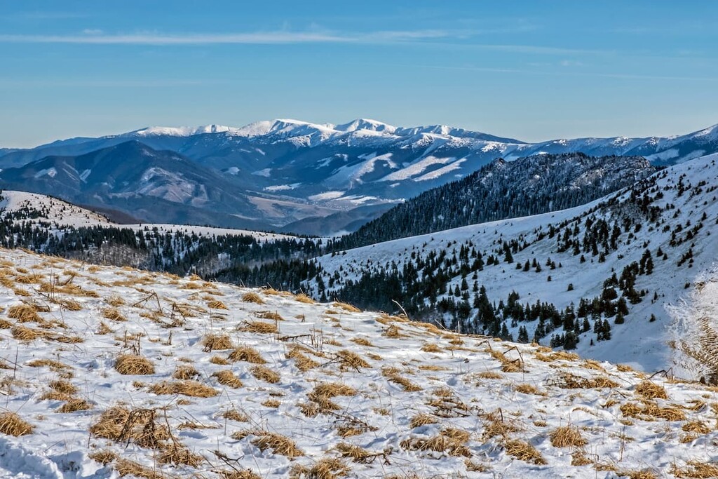
In winter, the snow-covered ridges present ideal conditions for ski alpinism or snowshoeing. However, it is important to note here that the terrain is prone to avalanches, especially in the Hôľna Fatra, and safety should always be in the first place.
All the hiking paths in Central Europe have an excellent trail marking system and Great Fatra is no exception. Trails are marked mostly by paint marks on the trees and posts. When hiking on a clear day, it is also possible to see the peaks of High and Low Tatras in all their splendor. Here are some of the most popular hikes:
The geology of this mountain range makes it possible to do ridge hikes offering spectacular views along the way. The one passing the main ridge is among the most popular ones. It is a three-day, physically demanding trail, mainly because of the big elevation differences.
The trail starts in the city of Ružomberok in the Liptov region, easily accessible by car, bus or train, and passes through the most notable peaks, namely Smrekovica (1 530m/5,020 ft), Rakytov (1,567 m/5,141 ft), Ploská (1,532 m/5,026 ft), Borišov (1,510 m/4,954 ft) Ostredok (1,596 m/5,236 ft), Krížna (1,574 m/5,164 ft) and Suchý vrch (1,550 m/5,085 ft).
The total length of the trail is around 55 km (34 mi) and the elevation gain of about 3,000 m (9,842 ft). Despite its strenuous character, it is one of the most beautiful and rewarding trails in Slovakia.
One of the most popular and frequented trails passes through two dominant limestone peaks in the Turiec region with a markedly different appearance. While Ostrá (meaning “sharp”) with an altitude of 1,247 m (4,091 ft) is mostly rocky and accessible by use of chains, Tlstá (meaning “fat”) with an altitude of 1,373.3 m (4,506 ft) is round and grassy.
Each of these peaks offers unique 360° views of the surrounding valleys and slopes. This intermediate trail is very popular among locals, the estimated duration is 6 hours and the elevation gain is 1,150 m (3,772 ft).
The starting point for this hike is the village of Blatnica, particularly from the Gaderská Valley, one of the most popular valleys in Slovakia. Although Blatnica can be accessed by bus, the service is not that frequent and coming by car is probably the most convenient option.
Doing the round-trip hike is the most popular option, anyway. The trail also passes the Mažarná Cave, one of the largest caves in Great Fatra which is nearly 130 meters (426 ft) long. It is possible to peak inside, but a torch is needed for better visibility.
A hike to Borišov that boasts an altitude of 1,510 m (4,954 ft) is one of the Great Fatra classics. It is a distinct and sharp peak located in its central part to the west of Ploská, from which it is separated by the characteristic wide saddle. Borišov can be accessed both from the regions of Turiec and Liptov.
The starting point from the Turiec side is either from the village of Belá-Dulice through the Belianska Valley or from Necpaly through the Necpalská Valley. Both valleys are approximately 11 km long, the latter one prohibiting the entrance of vehicles at some point and requiring longer walking. Coming from the Liptov side, the trail starts in Liptovské Revúce, a village accessible by buses from Ružomberok.
The estimated duration of this hike is 7 hours and the elevation gain is around 1,300 m (4,265 ft). And no hike to Borišov is complete without visiting the iconic “Chata pod Borišovom” (a chalet under Borišov), a cozy year-round mountain hut located at the crossroads of several hiking trails in Great Fatra.
Great Fatra is easily accessible from different cities that surround it. Here are the major cities to check out during your visit:
Situated to the east of Great Fatra in the Liptov region, the city of Ružomberok is a sought-after destination among hiking enthusiasts due to its convenient location near the Low Tatras, Great Fatra, and the Chočské vrchy. The city is not only a great starting point for the exploration of the surrounding mountains but also home to Vlkolínec, the UNESCO World Heritage site, as well as a famous ski resort Skipark Ružomberok also known as Malinô Brdo.
First-time visitors might be surprised by the unpleasant smell when entering the city. The smell comes from the biggest paper and pulp mill in Slovakia. Over the years, the smell has become somewhat symbolic of the city.
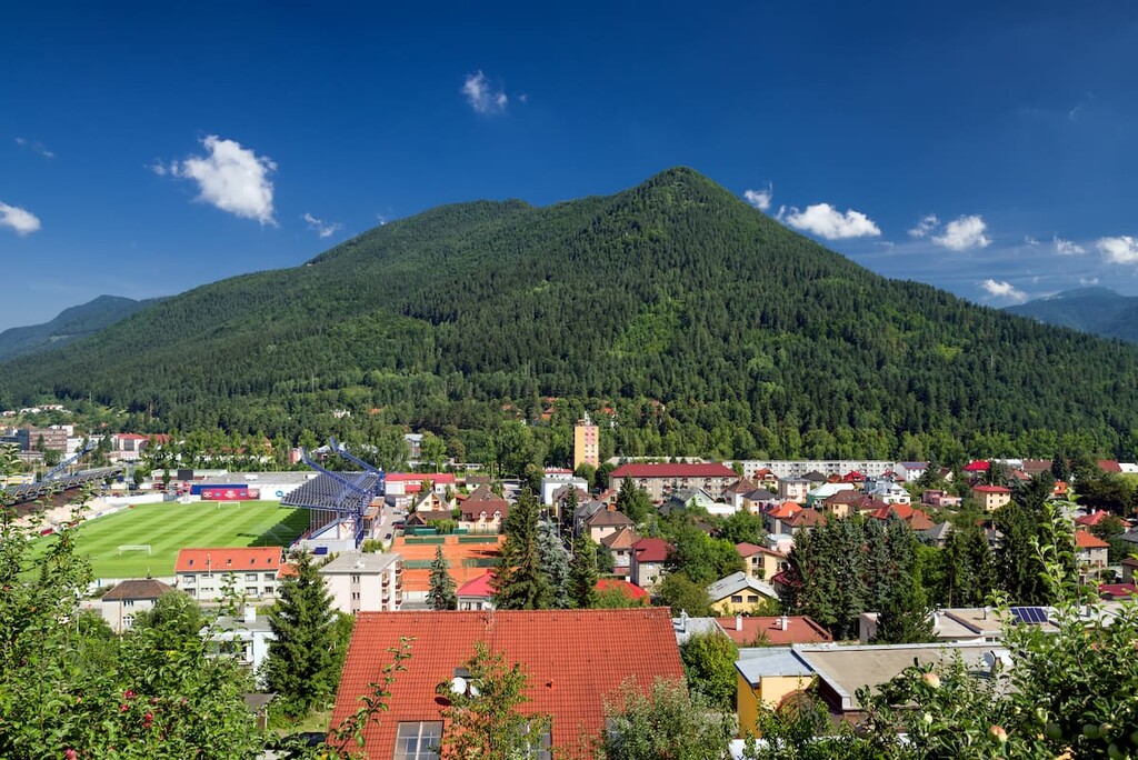
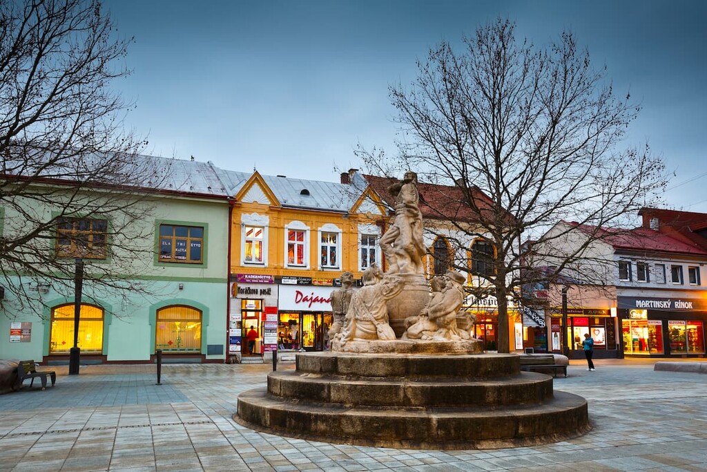
The historic center of the Turiec region, the city of Martin was the cultural center of Slovakia in the nineteenth century. It is surrounded by the mountains of Great Fatra to the east and Little Fatra to the north and west, making it a great place to stay when visiting the area.
The city is home to important cultural institutions (Slovak National Library, National Cemetery, Museum of the Slovak Village, etc.) and the whole region of Turiec offers excellent possibilities for year-round outdoor activities including skiing in one of the local ski centers (Martinky Winter Park in Little Fatra, Snowland and a ski center Jasenská dolina).
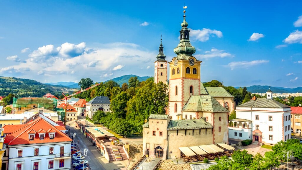
Situated in the heart of Slovakia at the southern foothills of Great Fatra, Banská Bystrica is a regional capital with a population of over 75,000 people. It is also home to the Museum of the Slovak National Uprising and a good starting point for hikes to Krížna and Ostredok.
A popular ski resort called PARK SNOW Donovaly is located north of the city right at the border between Great Fatra and the Low Tatras. Harmanecká Cave is also located here and a large waterpark Aqualand provides an excellent opportunity for relaxation during the summer months.
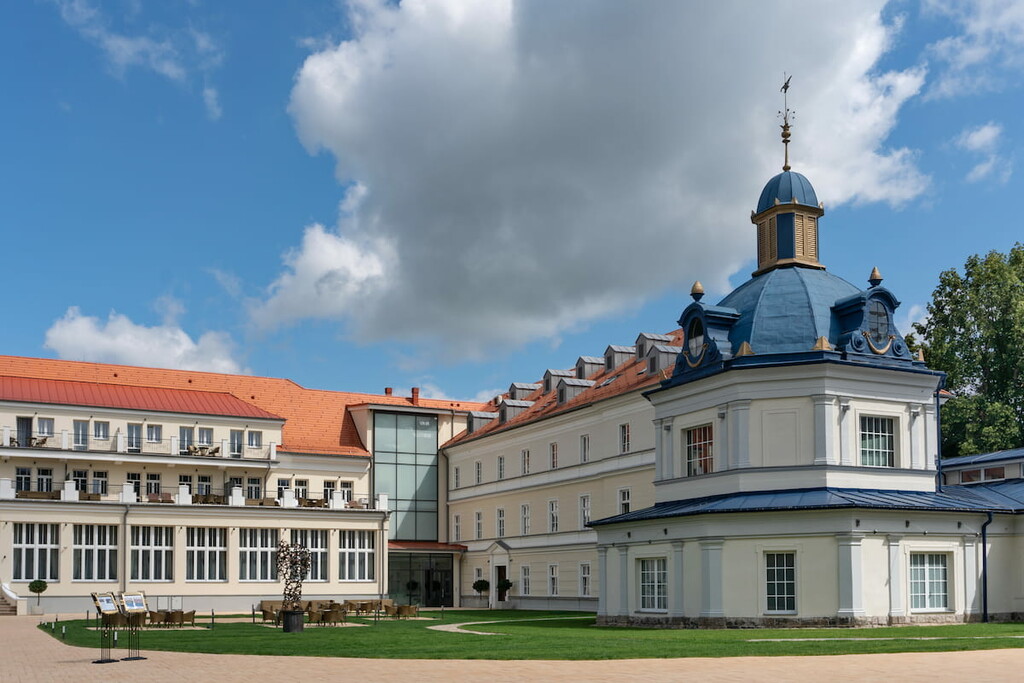
Famous for its Spa Spa & Aquapark with thermal healing mineral water, the city is situated in the southern part of Turiec Basin, halfway between the cities of Martin and Banská Bystrica. The 10 km (6 mi) distance from the village of Blatnica makes it a perfect starting point for hikes to Tlstá and Ostrá.