Scan the QR code and open PeakVisor on your phone
Low Tatras National Park (Slovak: Národný park Nízke Tatry; abbr. NAPANT) is a mountainous park situated in the north central region of Slovakia. Including the buffer zone, the park marks the largest national park by area in the country. There are 246 named peaks with the tallest and most prominent being Ďumbier (2,043 m/ 6,703 ft).

Low Tatras National Park lies in north central Slovakia, south of Tatra National Park. The protected landscape is situated between the Vah river valleys to the north and the Hron river valleys to the south.
The park is named after the Low Tatras Mountains, a subrange of the Tatra Mountains which span across northern Slovakia. The tallest peaks in the country lie north of the park, though the park still features rugged ridgelines and mountains.
Low Tatras National Park, including its buffer zone, spans 1,102 square kilometers (425 square miles) across central Slovakia, marking the largest national park in the country. The park spans in a west-east fashion, following along the Low Tatras.
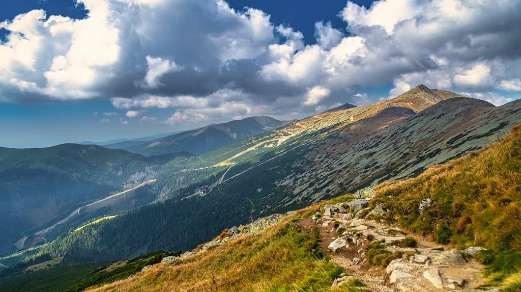
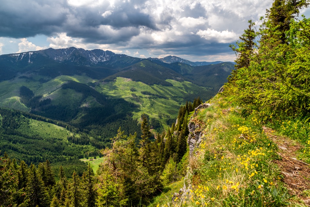
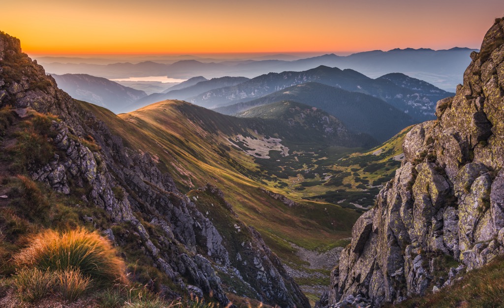
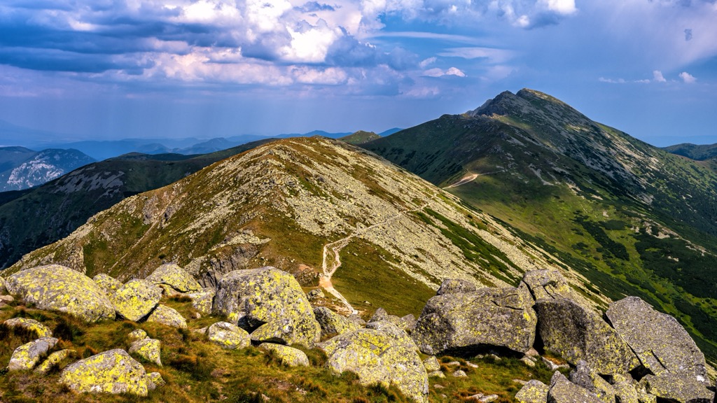
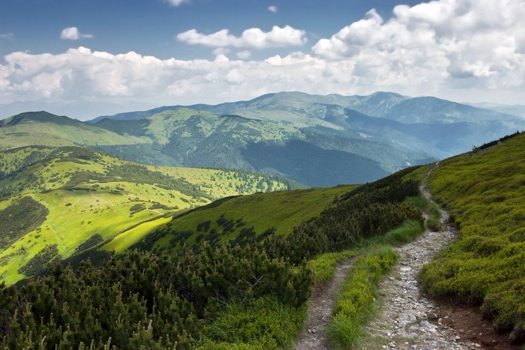
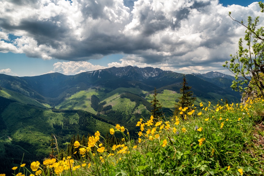
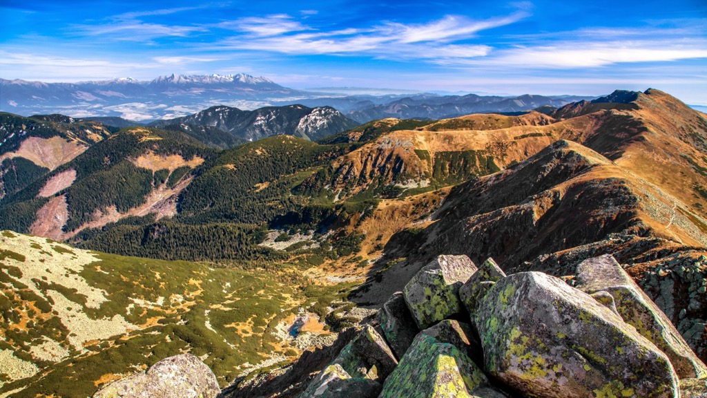
The foothills of the range are marked by grasslands and sweeping valleys. Many of the hillsides are densely forested, giving way to long valleys, deep canyons, and rocky ridgelines. Lack of tree coverage in the alpine terrain, provides hikers with sweeping views.
Numerous creeks and streams run through the park, with waterfalls scattered throughout the terrain. The park covers land in the Banská Bystrica Region, Žilina Region and Prešov Region. Major rivers in the region include the Váh, Hron, Hnilec and Hornád.
Along the main ridgeline of the range lie numerous karst areas. There are multiple caves within the range that are open to the public.
Low Tatras National Park is surrounded by numerous areas for outdoor recreation. Just north of the range lies Tatra National Park along with Tatra National Park in Poland. Malá Fatra National Park is situated to the northwest while Slovak Karst National Park is to the southeast.
The Low Tatras Mountains are a subrange of the Tatra Mountains. These peaks mark a subrange of the larger Carpathian Mountains which span across sections of Slovakia, Poland, Czech Republic, Romania, Serbia, and Moldova.
Low Tatras lies south of the Tatras proper, separated by the Váh and Poprad rivers. Peaks within the park, and the entire Carpathian Mountains, began forming during the Alpine Orogeny. This major mountain building event took place around 65 million years ago.
As the African and Eurasian tectonic plates collided with one another, the land was thrust upward, forming the base of these peaks. Other ranges built during the Alpine Orogeny include the Alps, Pyrenees, and Himalaya.
Bedrock in the region dates back 250-100 million years ago, long before the Alpine Orogeny. Within the park lie igneous, metamorphic, and sedimentary rocks. The core of the peaks is primarily granite while outer layers consist of sandstone, limestone, and dolomite.
Widespread glaciation further carved out the landscape, leaving behind glacial cirques, alpine basins, and the vast network of caves. The Čertovica pass cuts across the range, dividing it into two distinct parts.
Along the southern and northern edges of the main ridgeline lie numerous karst areas. The entire region is known for its plethora of caves and karst formations. Caves open to the public in the park include Važecká Cave (Slovak: Važecká jaskyňa), Demänovská jaskyňa Slobody, Demänová Ice Cave (Demänovská ľadová jaskyňa), Bystrianska Cave, and Cave of Dead Bats (Jaskyňa mŕtvych netopierov).
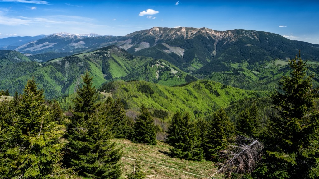
Major peaks within the park include Ďumbier, Kráľova hoľa, Chopok, Salatín, and Veľký bok.
Low Tatras National Park features less alpine terrain compared to the nearby Tatra National Park. Amidst the varying terrain lies a wide range of both flora and fauna.
Grasslands mark the lowest elevations in the park, which quickly give way to forested hillsides. Dwarf pines are scattered throughout the densely forested landscape along with maple, larch, spruce, and beech trees.
The lower montane zone is densely forested with patches of spruce, beech, fir, and larch trees. As elevations increase the forest transitions to a higher montane zone, populated primarily with spruce trees.
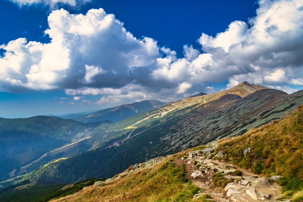
The highest peaks and ridgelines within the park are free of flora, often only have some low growing grasses or lichen. Lack of flora amidst these peaks allow hikers to have panoramic views of the terrain.
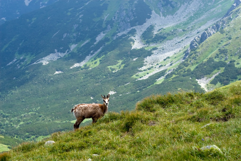
Larger mammals found in the park include Eurasian brown bear, Eurasian lynx, and wolf. Hikers are also likely to spot steinbok and alpine marmot. The endemic Tatra chamois lives in the alpine meadows of the park and are currently listed as a critically endangered species.
The land within and surrounding present-day Slovakia has been inhabited by humans for thousands of years. Stone tools found in western Slovakia, are believed to be from the Middle Paleolithic era (200,000-80,000 BCE).
The surrounding region experienced numerous cultural changes during the Bronze Age, 2,000-800 BCE. During this time the Čakany and Velatice cultures began to disappear while the Lusatian began to thrive. The culture was centered around trade and agriculture while the production of copper began to soar.
Present-day Slovakia was home to a series of Roman outposts during the height of the Roman Empire. In the centuries that followed the fall of the Roman Empire, groups of Huns began to invade the region and occupy what was known as Pannonia; a region of land that spans around the Mediterranean Sea.
Slavic tribes settled in present-day Slovakia during the fifth century. In the seventh century the region became the base for the Samo empire, followed by the Slavic state referred to as the Principality of Nitra in the eighth century. Together, with nearby Moravia, this region formed the core of the Great Moravian Empire.
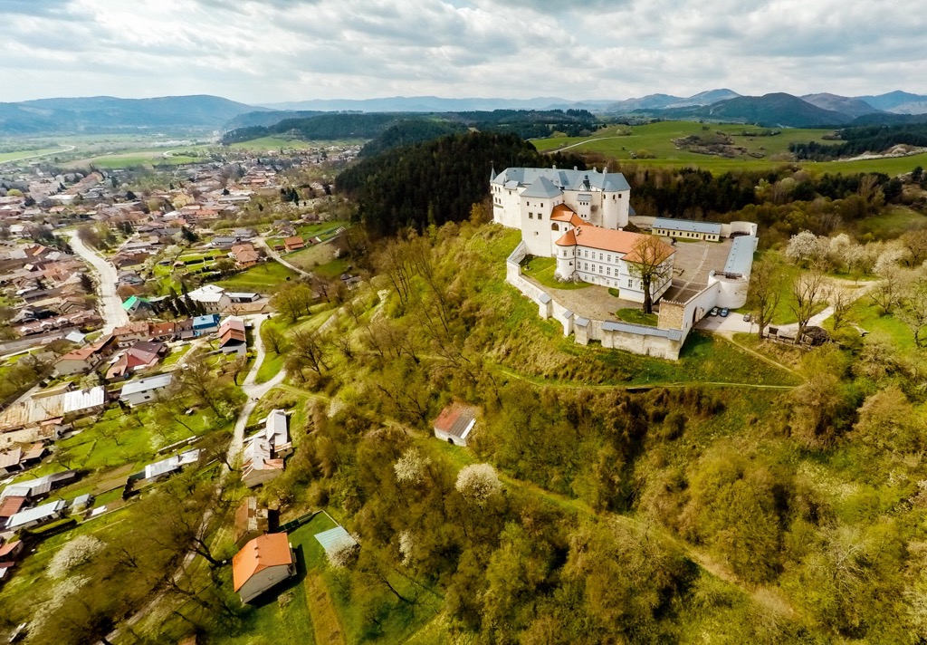
After the fall of the Great Moravian Empire, the land became part of the Kingdom of Hungary. Academia Istropolitana, which marks the oldest university in Slovakia, was established in 1467.
The royal house of the Habsburgs held the throne in the region until 1918. At this time the Slovak nation joined the nearby Czech nation to form the Czecho-Slovak Republic.
The independent Slovak State was established in 1939 though following World War II, the region was reestablished as Czecho-Slovakia. The communist party ruled over the area until 1989, being brought to a halt by the Velvet Revolution.
First attempts to protect the Low Tatras region began in 1918 and continued following World War II. In 1978 the park was established and later expanded in 1997 by the government of the Slovak Republic.
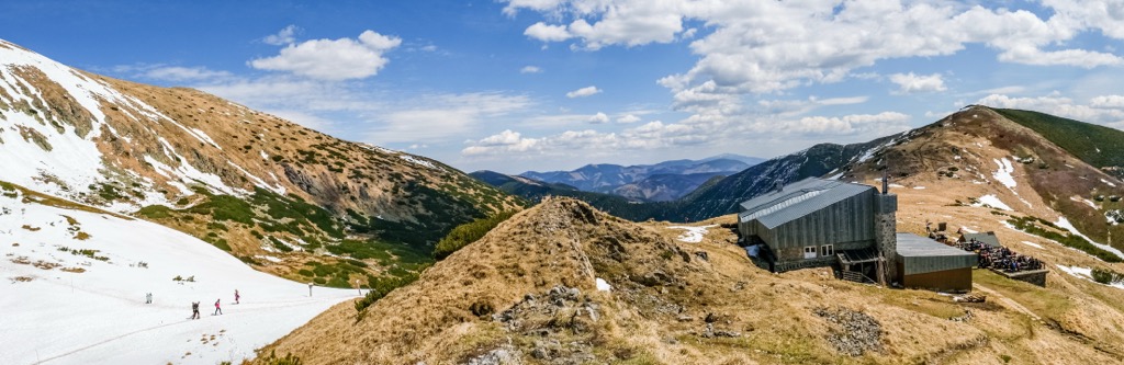
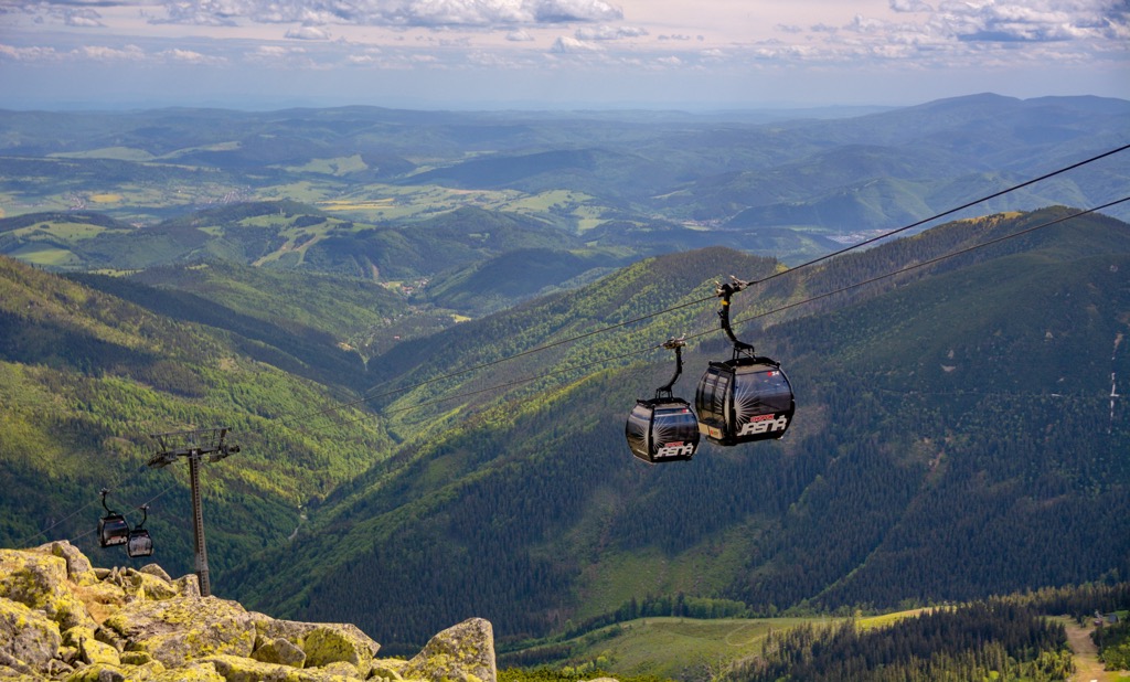
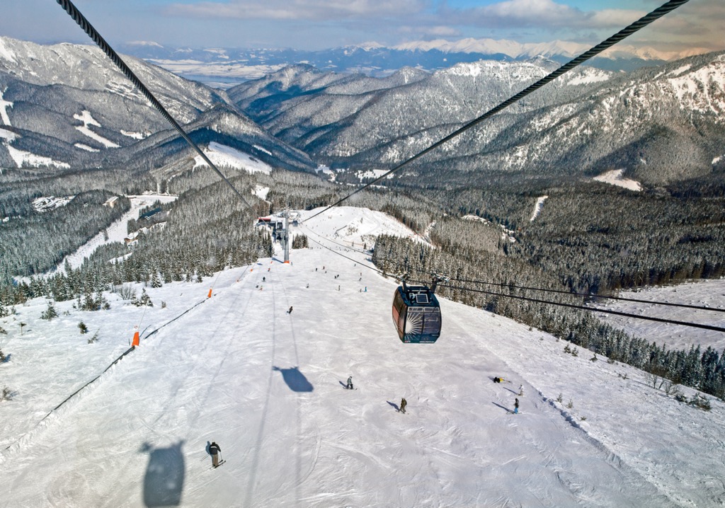
Today the Low Tatras and High Tatras are a hub for hiking, backpacking, and winter skiing. There are numerous ski resorts dotted throughout the region.
Low Tatras National Park is home to a plethora of hiking trails showcasing the stunning mountain landscape. Here are some of the most popular trails in the park:
The Low Tatras Ridgeline hike takes hikers along the main ridgeline of the range, traversing much of the national park. This major route begins in Donovaly and ends in Télgárt. Hikers have access to shelters along the route.
The route passes through forested hillsides and sweeping ridgelines while passing many of the major peaks in the park. This multi-day route normally takes around four days to complete. The point-to-point trail is 97 km (60 miles) in length and features over 5,000 m (16,404 ft) of total elevation gain.
This hiking route takes visitors up to the summit of Ďumbier, the tallest and most prominent peak in the park. The trail begins in the parking lot of the General Milan Rastislav Štefánik. Cottage.
The route begins relatively flat before climbing steadily up to the summit. Prior to reaching the summit of Ďumbier, the trail also passes along the summit of Krúpova hola. Hikers are rewarded with panoramic views of the surrounding park, countryside, and forested hillsides. Round trip this route is 6 km (3.7 miles) in length and features 353 m (1,158 feet) of total elevation gain.
This loop trail follows along part of the main ridgeline in the park while traveling through the forested hillsides in the region. The loop begins by climbing steadily through the forested landscape before reaching the alpine terrain.
This hike passes along the summits of Chopok, Konské, and Kráľova hoľa, before descending back down the rocky terrain and into the trees. The trail passes along numerous creeks and streams throughout, fed by the snowpack each season. Round trip the route is 13 km (8.1 miles) in length and features 1,144 m (3,753 feet) of total elevation gain and loss.
Looking for a place to stay near Low Tatras National Park? Here are some of the best cities and villages to check out near the range:
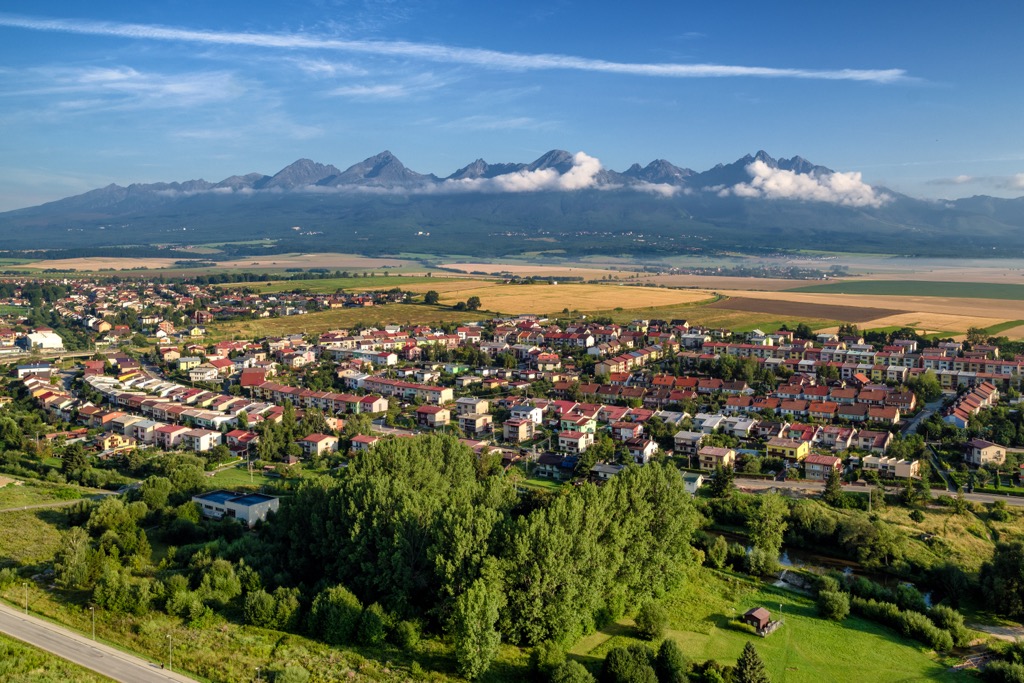
Poprad lies on the northeastern edge of the national park, along the Poprad River. The city is home to around 50,000 residents, marking the tenth most populous city in the country. Known as a gateway to the Tatra Mountains, Poprad is situated between Low Tatra National Park, to the south, and Tatra National Park to the north.
Sites to see in the city include the historic St. Egidius square. Here visitors will find homes from the eighteenth century while the nearby Catholic Church of St. Egidius dates back to the thirteenth century. Poprad has blossomed into a more tourist and resort destination with its close proximity to nature, hiking trails, and ski resorts.
Banská Bystrica lies along the southwestern edge of Low Tatras National Park. The town is situated along the Hron River and is home to around 76,000 residents, marking the sixth most populous municipality in the country.
The town is surrounded by numerous mountains, including the Low Tatras that lie in the park, the Veľká Fatra, and the Kremnica Mountains. Often referred to as one of the most beautiful cities in the country, Banská Bystrica features a well preserved Old Town. The close proximity to surrounding mountains and hills has made it a hub for those looking to hike, backpack, or ski throughout the year.