
Scan the QR code and open PeakVisor on your phone
Northern Velebit National Park has 39 named peaks. The highest is Gromovača at 1,676 m. Other notable peaks include Veliki Pivčevac, Vratarski kuk and Veliki Zavižan.
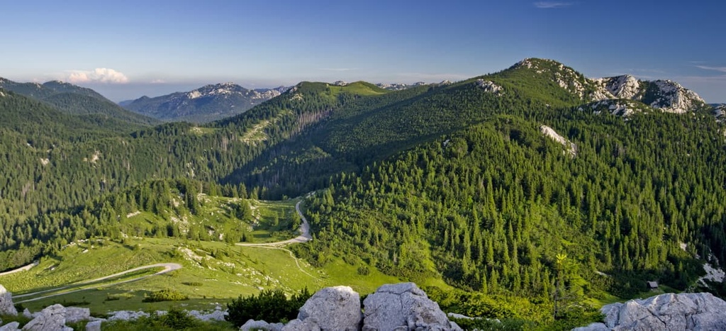
Northern Velebit National Park is a small protected area located in west-central Croatia. It is the protected northern part of the country’s largest mountain range, Velebit. The park is known for its mosaic of habitats, which include porous karst, lush ancient forests, and a wild seaside. There are 39 named mountains in Northern Velebit National Park. Gromovača (1,676 m/5,498 ft) is the highest point and Zečjak (1,622 m/5,321 ft) is the most prominent.
Northern Velebit National Park is located in Croatia between the seaside and continental plains.
While not the highest range in the country, Velebit is the largest of all the mountain ranges in Croatia. It is positioned in the northernmost part of the Dinaric Alps. The highest peak of Velebit is Vaganski Vrh at 1,757 m (5,764 ft) in elevation.
The park is approximately 30 km (16 mi) long and much of it is still very remote. The protected area starts at the Vratnik Pass and ends on Alan Pass, giving it a total area of 102 sq. km (42 sq. mi). The local government proclaimed this area a national park with the intention to protect its beautiful karst formations and ancient forests.
That said, while Velebit mountain isn’t the highest peak of Croatia, it is the most well-known mountain in the country. The whole massif is protected by Velebit Nature Park and is further divided into two parts.
The northern part of the nature park is the Northern Velebit National Park and the southern part is called Paklenica National Park. While the northern part of the park is known as a hiking destination, the southern part is perfect for sport climbing and alpinism.
The massif itself is divided into 4 regions:
The terrain in the park is rugged as it is formed out of karst limestone, which is often full of crevices and barren fields. However, getting to the park is relatively easy as one can reach it from Zagreb, which is only 170 km (105 mi) away through Otočac.
The park’s main area is Krasno, which is located near Zavižan hut (1,594 m/5,229 ft). Krasno is home to the park’s visitor center and administrative buildings. The nearest town is Senj and the nearest city to the park is Rijeka.
Furthermore, the highest meteorological station in Croatia, Zavižan, is located inside the mountain hut Zavižan and is owned by the Croatian Meteorological and Hydrological Service.
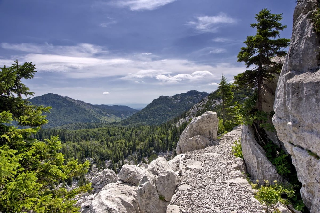
Velebit also boasts a beautiful hiking trail called Premužićeva Staza (literally Premužić Trail), which was built back in 1933, as well as one of the deepest caves in the world, called Lukina Jama.
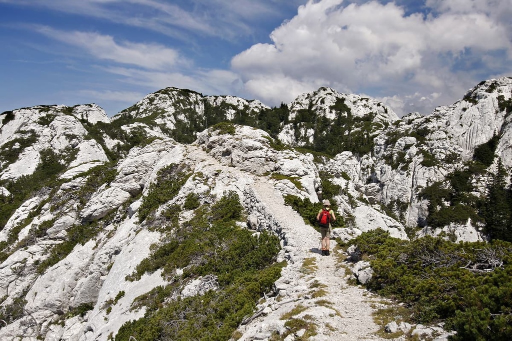
The Northern Velebit National Park landscape possesses a recognizable karst relief which, due to its diversity, is one of the most interesting karst formations in the world. The park has three highly protected areas, which include:

The Hajdučki and Rožanski Kukovi karst ridges are divided by the Skrbina Draga and Veliki Lubenovac Fields. This reserve is closed to the general public during certain times of the year. Only researchers are allowed to enter the karst formation reserve when it is closed.
The geological history of Velebit is long and complex. The sandstones of Velebit mountain are up to 310 million years old, which is when the history of Velebit starts. Most of the rocks in the park are porous limestones that formed the karst landscape we know of today.
All the rocks in the Northern Velebit National Park are of sedimentary origin. One can mostly see limestones in the park, but there are also some dolomites and other rock types. Most carbonate rocks on Velebit formed during the Jurassic period.
Another interesting find in the park is Velebitski kršnik (Velebit breccia), a type of rock only found on Velebit and its surroundings. It was formed during the Tertiary period. One can marvel at it in the Hajdučki and Rožajski Kukovi rock formations and in the Skrbina Draga and Veliki Lubenovac Fields. This breccia consists of older Jurassic and Cretaceous rocks that were once crushed and then bound together by limestone.
What one can notice at first glance while looking at this mountain are its solid rock formations and high cliffs. That said, in the past, the mountain was but a tectonic wrinkle that was located some 10,000 km (6000 mi) away from its current resting point. Due to tectonic movement, Velebit rose quickly alongside the rest of the Dinaric Alps, which continue to grow to this day.

In the past, researchers used the word “desolate” to describe the karst terrain of Velebit. Indeed, karst might seem uninviting to most humans. But once one understands how many years of wind, water, and sun it took to form these diverse shapes, one realizes that karst is, in fact, nature’s masterpiece.
Karst is a type of natural rock formation formed through karstification. This phenomenon occurs when stormwater dissolves calcite in dolomite or limestone. While the karst relief forms on the Earth’s surface, underground waterways, too.
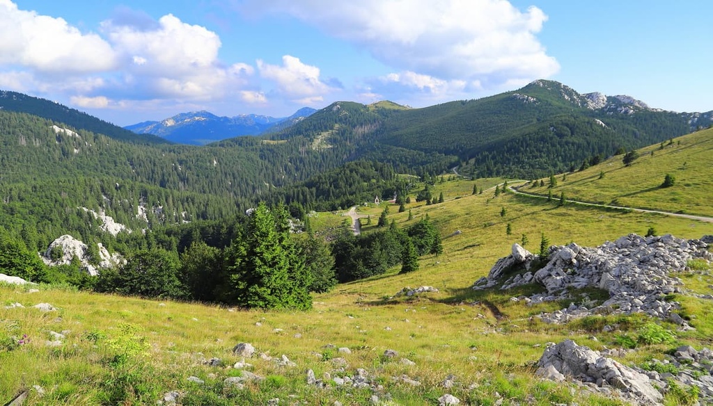
Different forms of karst topography are visible all over the park, such as in huge karst fields. Karst fields are sunken areas or depressions that are mostly located between two or three elevated hills.
For instance, Štirovačko Polje is a karst field located in Northern Velebit National Park. It is 8 km (5 mi) in length and 3 km (1.8 mi) in width. The field has several springs in its northern region that are supplied by water coming through the underground karst and snowmelt.

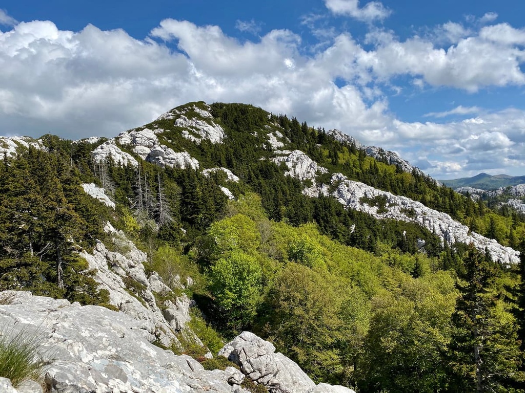
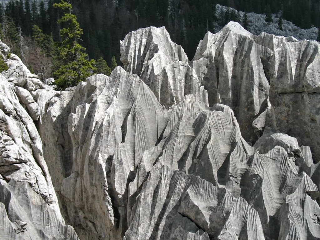
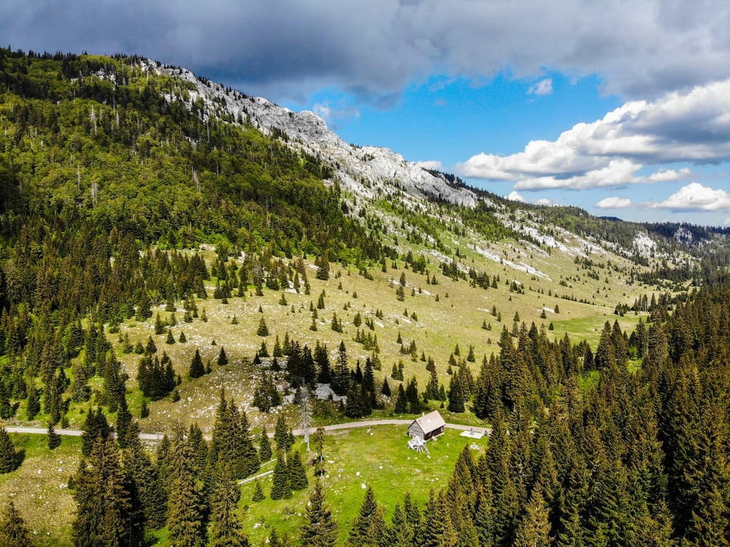
Another feature that stands out in the Velebit karst relief is “Kukovi” (literally Hips). These are limestone rock formations that rise above the surrounding terrain. In other words, they are prominent limestone boulders. The Velebit Kukovi, in particular, are carved out by the elements to form Velebit breccia obelisks.
Additionally, the Hajdučki and Rožanski Kukovi were proclaimed a strict nature reserve in 1967. Many decades later, in 2017, they were designated as a UNESCO World Heritage Site. Together with their forests, the Kukovi are under strict protection of the state. The goal for the park administration and researchers is to preserve the wild form of this area, so no walking outside of trails, littering, or marking is allowed.
The Kukovi are effectively boulders that formed into steep karst cliffs. They are surrounded by a wild forest and numerous caves. Some of them reach the height of 200 m (656 ft), and the highest peaks are located in a Hajdučki Kukovi segment called Golubić (1,650 m/5,413 ft) and at Kuk (1,649 m/5,410 ft).

Due to a prolonged period of karstification, which is visible on the ground’s surface and even more prominent below, stormwaters carved out a thick web of underground tunnels in the Northern Velebit National Park. These tunnels, caves, and pits drain water from the mountains and swiftly transport it into the valleys.
The national park is full of these caves. Most of them are large, vertical, and very deep. They occur naturally through the mechanical and chemical effects of water. Today, there are 617 speleological objects found in the park, and speleologists declared almost all of them pits or “Jama.”
Velebit’s caves are popular in the world of cave exploration, and rightfully so. The deepest cave in Croatia is Lukina Jama. It is the fourteenth deepest known cave in the world with a maximum depth of 1,413 m (4,635 ft), and it is located in the protected area around Hajdučki and Rožanski Kukovi.
Velebit is the most extensive mountain massif in Croatia. It stretches from the source of the Zrmanja River to Vratnik Pass, a distance of some 145 km (90 mi).
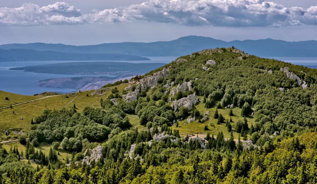
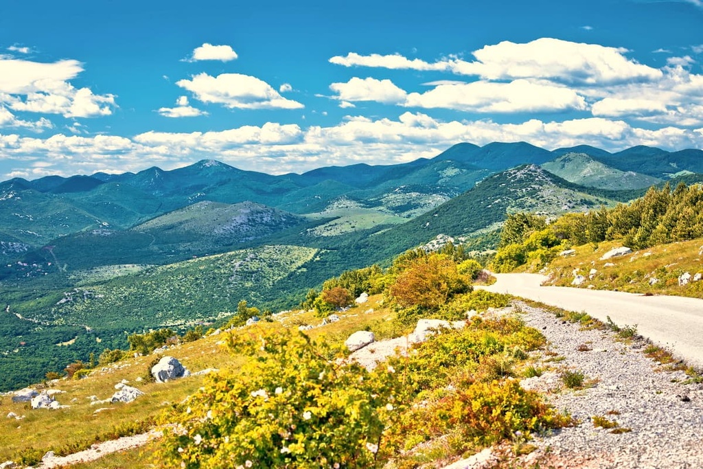
The mountain also forms a natural border between the Lika continental region, which has a continental climate, and the seaside, which has a Mediterranean climate. Therefore, when looking at Velebit, one can see that one side is covered with lush forests, and the other is barren and carved out of rocks.
The entire mountain range is a designated nature park that’s further divided into two protected parts: northern part or Northern Velebit and southern part or Paklenica, both of which are national parks. While the Velebit massif exceeds 1,700 m (5,577 ft) and has 7 peaks, there are also over 40 summits on the massif that are above 1,600 m (5,249 ft).
That said, the peaks of Northern Velebit National Park are all below 1,700 m (5,577 ft). The highest peaks in the park include:
While there are 4 peaks with an elevation of 1,676 m (5,498 ft) or more in the park, the most well-known and popular hiking destination is the Veliki Zavižan or Zavižan Peak (1,676 m/5,498 ft). It is beloved for its beautiful view and accompanying mountain hut that features a meteorological station.
Considering that it rises from the sea, Velebit is a high mountain for the region. These are some of the highest peaks of the Velebit massif that are not located in Northern Velebit National Park:

Velebit mountain and Northern Velebit National Park ecosystems are predominantly wilderness areas. Indeed, there are numerous endemic species in the park as well as little evidence of human habitation.
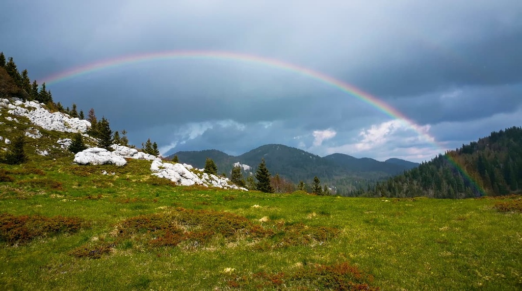
There are two climatic zones in the park, which is known for receiving some not-so-great weather.
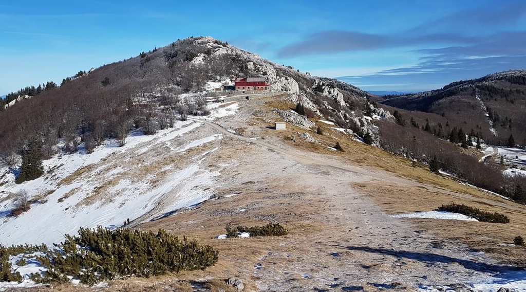
The highest weather station in Croatia is located at 1,594 m (5,229 ft) below the summit of Vučjak (1,645 m/5,396 ft) in Zavižan hut (1,594 m/5,229 ft). This hut is partially a mountain hut and partially a meteorological station. It has been operating continuously since 1953.
Thanks to this weather station, we know that Velebit’s peaks receive more rainfall than anywhere else in Croatia. Fog, storms, and lighting are sights often seen on Velebit’s peaks.
Therefore, hikers need to prepare themselves for all kinds of weather when visiting the park. Even though the mountains are located near the coastline, it often snows in these hills. Snow can last as long as seven months, and unexpected light snow can fall even in July.
The highest wind speed ever recorded on the mountain is 185 km/h (114 mph), and the highest snowfall in a season was 15 m (49 ft). Therefore, we can conclude that Velebit features variable and sometimes harsh weather. All visitors should be aware of these dangers and they should check the weather forecast before venturing to Northern Velebit National Park.
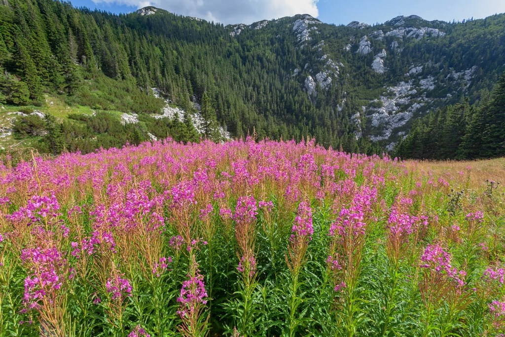
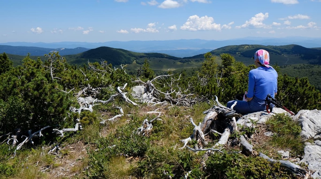
The climate of the Velebit mountain still allows rich flora and fauna to thrive. The park’s ecosystems have thrived in its wild and untouched landscapes. These ecosystems include grasslands, forests, rock and karst terrains, aquatic, and subterranean habitats.
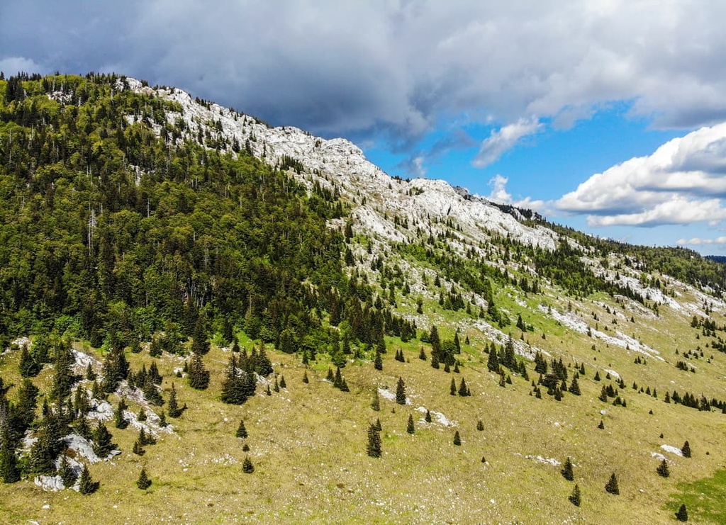
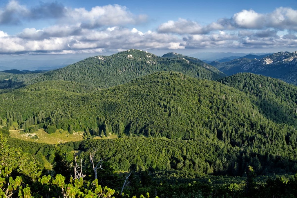
Forests cover around 80 percent of the Northern Velebit National Park. Forests are present in the coastal and inner or continental slopes and the mountain tops.

The peaks are mostly covered with European mountain pines, while the forest types differ on each slope. The coastal slope forests mainly consist of downy oak and coastal beech, while the continental slope mostly contains subalpine spruce.
The second most commonly seen ecosystem in the Northern Velebit National Park is rocky terrain. Nevertheless, animal and plant life still thrives in this ecosystem.
Many plants have adapted to this rocky environment, as have lichens. Fauna that inhabits rocky terrain includes various chamois, spiders, insects, and reptiles.
Grasslands are very scarce in the Northern Velebit National Park. Most grasslands are human-made as a result of years of cultivation due to the need to raise livestock on the mountain. Most grasslands on the mountain are rocky and naturally form only through the process of karstification.

Although it’s mostly hidden from view, a rich ecosystem of flora and fauna thrives underground in the park. In fact, several new species are discovered in the Velebit region every year. Snails, insects, and bats mainly live in these karst caves.
Aquatic habitats are scarce here since water tends to quickly flow underground in the park. While most of these ecoregions seem like they have been here for a long time, the truth is that most of them are constantly changing. Some ecosystems mix with each other, while others change their appearance or welcome new species.
Velebit is home to a wide variety of flora and fauna for visitors to see and admire.
Velebit, and specifically Northern Velebit National Park, were proclaimed one ofCroatia’s four Centers of Endemism. There are over 950 species in the park, including 40 endemic plant species. These include Croatian bittercress (Cardaminopsis croatica), Illyrian iris (Iris illyrica), and edelweiss (Leontopodium alpinum).
The park’s fauna is very diverse, especially considering the small area it inhabits. The wildlife includes different species of amphibians, reptiles, birds, and mammals. The birds mostly seen in the park are woodpeckers, capercaillies (Tetrao urogallus), and Ural owl (Strix uralensis). The park is home to over 100 bird species.

At the same time, the mammal species in the park include everything from the brown bear (Ursus arctos) and gray wolf (Canis lupus) to the Eurasian lynx (Lynx lynx) and chamois (Rupicapra rupicapra).
If you’re interested in seeing the unique flora and fauna of Northern Velebit National Park first-hand, a trip to the Velebit Botanical Garden is an absolute must.
Botanical Reserve Zavižan-Balinovac-Velika Kosa, with a surface area of 68 ha (168 acres) and an altitude of 1,480 m (4,855 ft), is home to about 300 species of plants. The most prominent part of the reserve is Velebit Botanical Garden, a must-see if you are here to enjoy the abundance of plant life. This botanical garden was established in 1967 by Dr. Fran Kušan.
Since the garden is located near Zavižan hut (1,594 m/5,229 ft), all visitors to the park can enjoy easy access to the beauty of Velebit. From the hut, one can also hike to summits like Balinovac (1,602 m/5,255 ft) and Veliki Zavižan (1,676 m/5,498 ft).
That said, this is not the only botanical reserve in the park. So if you’re looking to find out more about the park’s flora and fauna, be sure to visit Visibaba Botanical Reserve, tool.
Velebit Mountain, including the Northern Velebit National park area, has long been used by humans despite its ruggedness.
In the past, Velebit was known as the White Mountain or Albion oros for the ancient Romans and Mons albinus for the ancient Greeks. There are two theories as to why they named it White Mountain.
The first theory says that this name is a result of the mountain’s tendency to be covered in snow throughout much of the year. The other reason is because of the mountain’s white silhouette when viewed from the sea. The latter is the most probable reason since Roman and Greek ships sailed the Adriatic sea and saw the mountain’s white rocky peaks in the distance.
The first settlers here were Illyrian tribes called the Iapodes, who inhabited the area during the Iron Age. The Illyrian tribes built their fortified settlements here, mostly on high hills above the seaside. They were also known for cattle farming, which they took part in during the summer months on the Velebit mountain. They lived in lower elevations, on the seaside and the mountain slopes in the winter.
Prehistoric roads passed through the mountain and today’s Northern Velebit National Park. These roads connected the seaside and continental plains, making trade much easier.
In the first century, the Roman conquest of the Lika area brought much exploration of Velebit. Mostly, Romans took advantage of the woodlands in Velebit, cutting down these lush forests and transporting its timber all around their empire.
Life on the Velebit mountain was quiet after the arrival of a Slavic tribe called the Croats in the sixth and seventh centuries. During the threat of an Ottoman invasion, Velebit offered refuge to people fleeing from conflict.
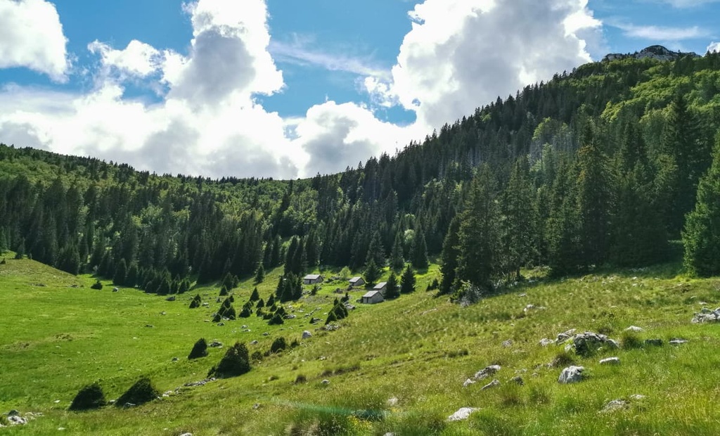
Even though the eighteenth and nineteenth centuries brought better roads with them and connected small towns with centers of trade, people on Velebit still herded cattle and migrated.
This means they would have spent their summers with livestock in the mountains and the winters near the seaside. What is left of this lifestyle today are only abandoned shepherd’s houses on Velebit’s plains.
During the nineteenth century, mountaineers and scientists first approached this region, intending to research it. The first people to take interest in the region were biologists, historians, and geologists who studied Velebit. Today, Northern Velebit is a national park that still has so much to offer for scientists, researchers, and tourists, alike.
Since the dawn of local mountain exploration at the start of the last century, local nature enthusiasts have been in love with the Velebit massif. Croatia shortly proclaimed the area of Northern Velebit National Park a protected area in 1928. This law only lasted for one year, after which the park lost its protected status.
The first mountain hut on Velebit was Krajačeva Kuća (lit. Krajač House), which was built in 1923, though it burned down in the Second World War.
Ante Premužić built the first hiking trail in Northern Velebit National Park in 1933. The trail runs for 16 km (10 mi) through the Northern Velebit National Park, while the whole trail is 57 km (35 mi) long.
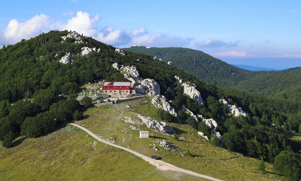
Soon afterward, the local administration built the mountain hut on Zavižan (1,594 m/5,229 ft) in 1953. Today, it serves as a weather station and is Croatia’s highest elevated year-round populated area.
In 1967, the first botanical garden on Velebit mountain was founded, and today it is part of the park’s two botanical reserves. The second effort to protect this beautiful landscape was in 1969, when Hajdučki Kukovi, which is part of today’s Northern Velebit National Park, was proclaimed a nature reserve.
The park’s official birthday is June 9, 1999. Since then, Northern Velebit has operated on a national park level, while the whole Velebit massif is governed over as a nature park.
One can learn more about the Northern Velebit National Park in the Velebit House. This visitor center offers exhibits and information about the history, ecology, biology, geology, and heritage of Velebit.
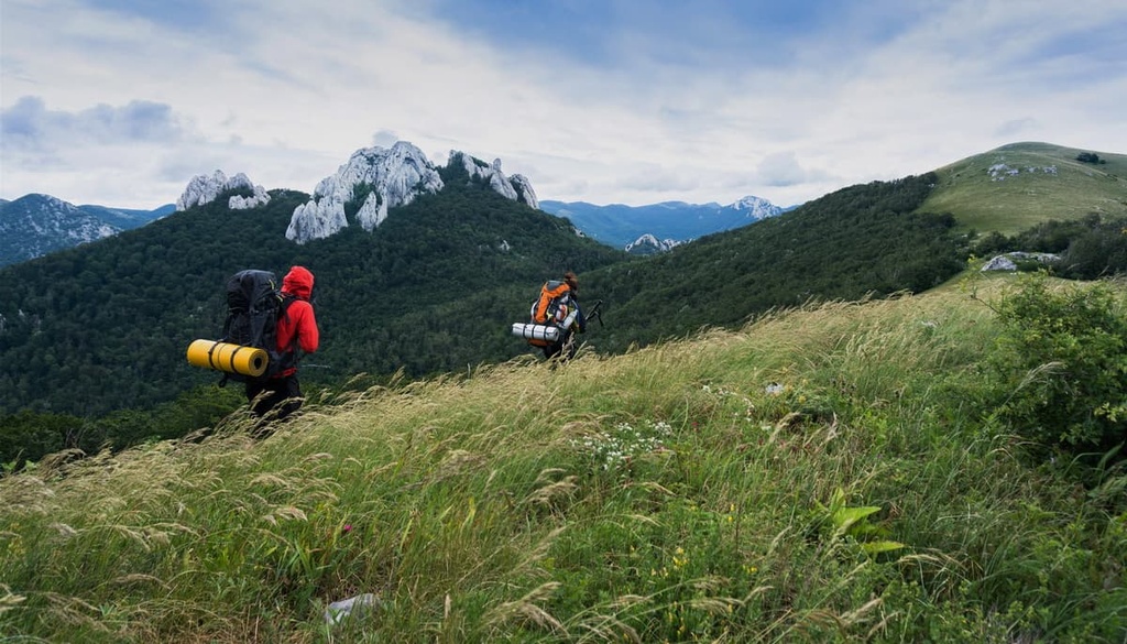
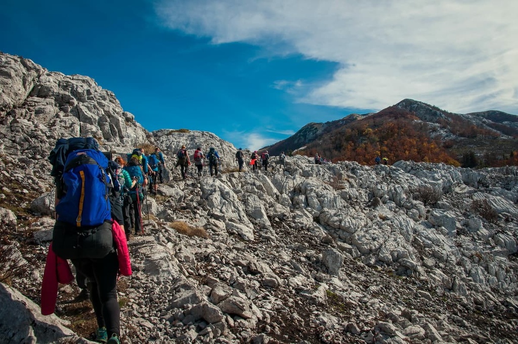
Hiking trails crisscross the Velebit massif from every angle. Since the area is so hiker-friendly, there is a trail for any type of adventure.
Of course, hiking isn’t the only thing you can do to pass the time in the park. You can try cycling, caving, and birdwatching, or you can simply head out to learn about the local flora, fauna, or heritage.
Before setting out on your hike, you need to know that walking outside of marked trails is prohibited in the park, as is lighting fires, camping, and picking flowers. If you’re heading to the national park with your dog, remember that it should be on a leash at all times.
The designer of the Premužić Trail was Ante Premužić, a lover of Velebit and enthusiastic mountaineer. He wanted to make Velebit accessible not only to mountaineers but also to the general public.
Fund gathering for the trail construction started in the 1920s and trail construction began in 1930. Due to a funding halt, the construction stopped for a whole season. It resumed in 1933, when they finalized the trail.
According to local stoneworkers, the hardest part of the trail build was a karst field between Čepuraš to Gromovača (1,676 m/5,498 ft). Nowadays, the maintained trail is 56 km (34 mi) long and 1.2 m (4 ft) wide. The trail passes by Hajdučki and Rožanski Kukovi, the most rugged part of the park.
The trail starts at Zavižan hut (1,594 m/5,229 ft) and ends in Baške Oštarije (927 m/3,041 ft), with numerous branches of other paths crossing it. Only 16 km (10 mi) or 4 hours of hiking trail runs through the Northern Velebit National Park, and the rest curves through Velebit Nature Park. The trail takes around 3 days to hike in its entirety.
If you are looking for a short but rewarding hike, this stroll from Zavižan hut to its nearby peaks should do the trick.
This route takes you from Zavižan hut (1,594 m/5,229 ft) to Vučjak (1,645 m/5,396 ft) in 10 to 15 minutes. From there, you can reach Velika Kosa (1,620 m/5,314 ft) and descend to Velebit Botanical Garden. This is a short hike, with an ascent of only 100 m (328 ft). It takes most people less than 2 hours to complete.
Your starting point on this Northern Velebit adventure is Zavižan hut (1,594 m/5,229 ft). From here, two paths lead to Veliki Zavižan (1,676 m/5,498 ft), both of which start in the Velebit Botanical Garden.
Most of the trail passes through forests, while the mountain top is rocky and free of any vegetation. From the summit, one can enjoy the beautiful view of the surrounding islands and other Velebit peaks. The total ascent is 300 m (984 ft) and most people can complete the hike in less than 4 hours.
Hajdučki and Rožajski Kukovi are strictly protected natural reserves that sometimes close their doors to visitors. If you are lucky enough to visit Northern Velebit National Park when hiking is allowed in the reserve, we recommend this short but wild hike.
The hike starts at Veliki Lubenovac trailhead, where you can leave your vehicle. From there, it is an ascent of only 350 m (1148 ft) and a hike duration of 3.5 hours. You will reach the summit of Golubić (1,650 m/5,413 ft) and Kuk (1,649 m/5,410 ft), both of which offer a beautiful view of the surrounding national park and other limestone peaks.
Before setting out for this hike, make sure you have a guide or GPS track of the hike. This trail is no longer marked due to the strict preservation laws of the reserve that it crosses through.
Mali Rajinac (1,699 m/5,574 ft) is the highest point of the Northern Velebit Ridge. However, it is not located in the Northern Velebit National Park but in the Velebit Nature Park.
One can reach this peak from Zavižan hut (1,594 m/5,229 ft) or Rossi hut (1,580 m/5,183 ft), but if you’re looking for a full day hike, you can make a loop to both huts and the summit.
The starting point of this loop hike would be Zavižan hut (1,594 m/5,229 ft). Form here, you can make the 300 m (984 ft) ascent to Mali Rajinac (1,699 m/5,574 ft), the descent to Rossi hut (1,580 m/5,183 ft), and the ascent to Zavižan hut (1,594 m/5,229 ft) via the Premužić Trail. The whole hike would take up to a day, with 400 m (1,312 ft) of ascent.
The Northern Velebit National Park is located in west-central Croatia, and one can reach it from the coast and via inland roads.
The park’s center is the village of Krasno, where the park administration is located. If you are traveling from Zagreb or Rijeka via the inland road, you should take the highway, exit on the ramp to Otočac, and take the road to Krasno.
If you’re coming from the coastal side of the park, you can first travel to the small town of Sveti Juraj and take the 12 km (7 mi) road to Oltari, where you will see waymarks to the park entrance.
The north entrance of the park is Babić Šića, and the south entrances are Štirovaća and Alan. The park is only accessible via private vehicle. However, local authorities sometimes offer a summer season bus shuttle to Krasno or Zavižan.
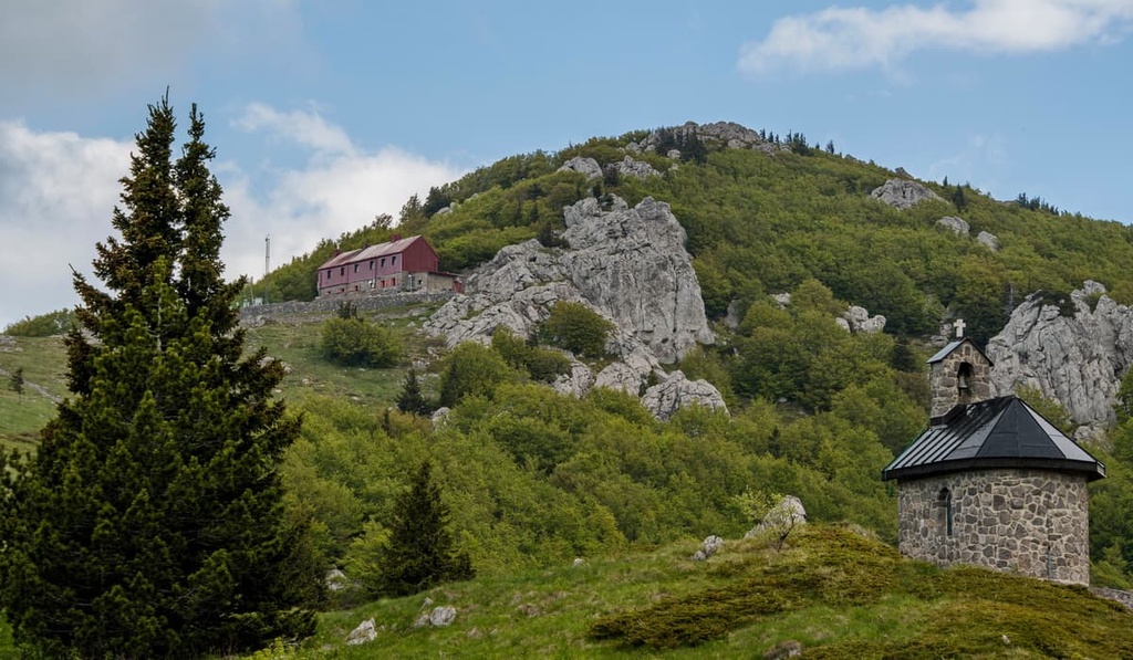
The Northern Velebit National Park’s main point of interest is Zavižan, where one can visit the Velebit House, Velebit Botanical Garden, and Zavižan hut (1,594 m/5,229 ft). The mountain hut with a meteorology station inside is occupied throughout the year, regardless of snowfall, wind, or storm.
Accommodation in the park is limited to only mountain huts, including these options:
One can reach these huts and shelters only by foot, with the exception of the Alan hut (1,340 m/4,396 ft) and Zavižan hut (1,594 m/5,229 ft), which are accessible with private vehicles through dirt roads.
These are all simple accommodation options, with phone reception and electricity. Note that water on Velebit is scarce, and during the summer months, is often not fit for drinking.
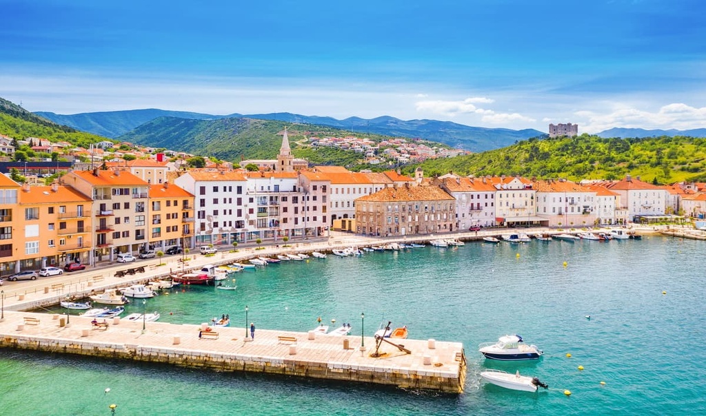
If you’re looking for more luxurious accommodation options, check out the apartments, cottages, holiday houses, campsites, and b&bs in the small coastal town of Senj. Senj is the closest town to the Velebit massif, and it is situated on the northern Adriatic Coast. It has 7,000 inhabitants, and good access by bus, road, and rail.
The town has a rich history that includes the Nehaj Fortress (63 m/206 ft). This fortress was a crucial element in the Uskok rebellion in the sixteenth century. The Uskoks were Catholics fleeing from Ottoman rule in Bosnia. Senj is a popular tourist destination today since it sits on the coast, and numerous hotels and campsites are to be found in the town and its surroundings.
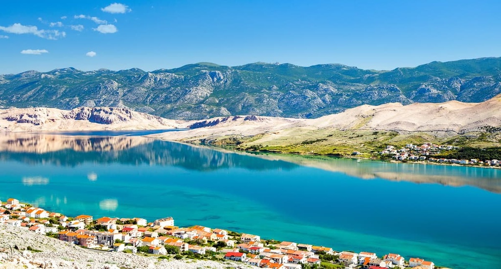
Pag is an island opposing the Velebit massif in the northern Adriatic Sea. The island has 9,000 inhabitants and two towns: Novalja and Pag.
One can reach the island by sea or road, and you can navigate the island ground via road and bus. Pag is a trendy tourist destination, where one can find luxurious hotels, restaurants, and clubs.
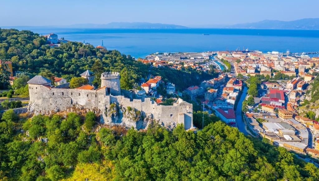
Rijeka is the third-largest city in Croatia, with 128,000 inhabitants and an important seaport. The city lies on the Kvarner Gulf, an Adriatic Sea inlet.
Its economy depends on transportation and shipbuilding. The city is rich in beautiful architecture and history since it was ruled by many governments over the centuries, including that of Yugoslavia, the Habsburgs, Italy, and Croatia.
The city of Rijeka has an airport, so outside of water, road, bus, and rail accessibility, one can also reach the region via air. Since it is a big city, it also has hostels, apartments, hotels, B&Bs, and other forms of accommodation for visitors to enjoy.


The highest peak in Northern Velebit National Park is Gromovača, at 1,676 m.
Notable peaks in Northern Velebit National Park include Gromovača, Veliki Pivčevac, Vratarski kuk, Veliki Zavižan and Krajačev kuk.


