Scan the QR code and open PeakVisor on your phone
Sutjeska National Park lies on the border between Bosnia and Herzegovina and Montenegro, also known as the Yosemite of the Balkans. This amazing area showcases numerous mountain peaks, rivers, lakes, and monuments. There are 50 named mountains in Sutjeska National Park. Maglić (2,386 m/ 7,828 ft) is the highest point. The most prominent mountain is Veliko pleće (1874 m/ 6,148 ft).
The largest and oldest national park in the Republic of Srpska and Bosnia and Herzegovina, Sutjeska, is 16,052.34 ha (39,665 ar). It was established in 1962 and covered the highest point of the Dinaric Alps in Bosnia and Herzegovina, peak Maglić (2,386 m/ 7,828 ft).
More than 66% of the park area is covered with trees, fields, and pastures. The park spreads out over a mountainous area on the border between Bosnia and Herzegovina and Montenegro. This is a beautiful place to visit since it has many rivers and mountains.
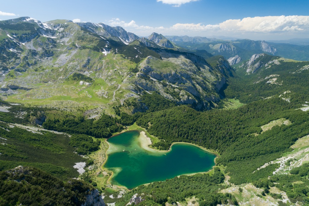
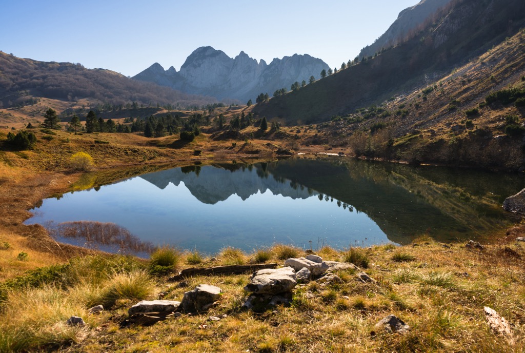
Apart from the country's highest peak being Maglić (2,386 m/ 7,828 ft), other mountains here include Bioč, Lebršnik, Volujak, Lelija, and Zelengora. The Montenegrin part of Maglić massif has a mountain and lake called Trnovački Durmitor and Trnovačko Jezero.
The Sutjeska National Park, also known as Национални парк Сутјеска or Nacionalni park Sutjeska is Bosnia and Herzegovina's oldest national park. The Strict Nature Reserve 'Peručica,' is one of the last primeval forests in Europe, is also a part of the park. The Battle of the Sutjeska took place on a hill inside the park in 1943 and took place during World War II.
This park lies in the area where Bosnia, Herzegovina, and Montenegro meet. It is a cosmopolitan and provincial area of original local architecture, combining both modernity and heritage.
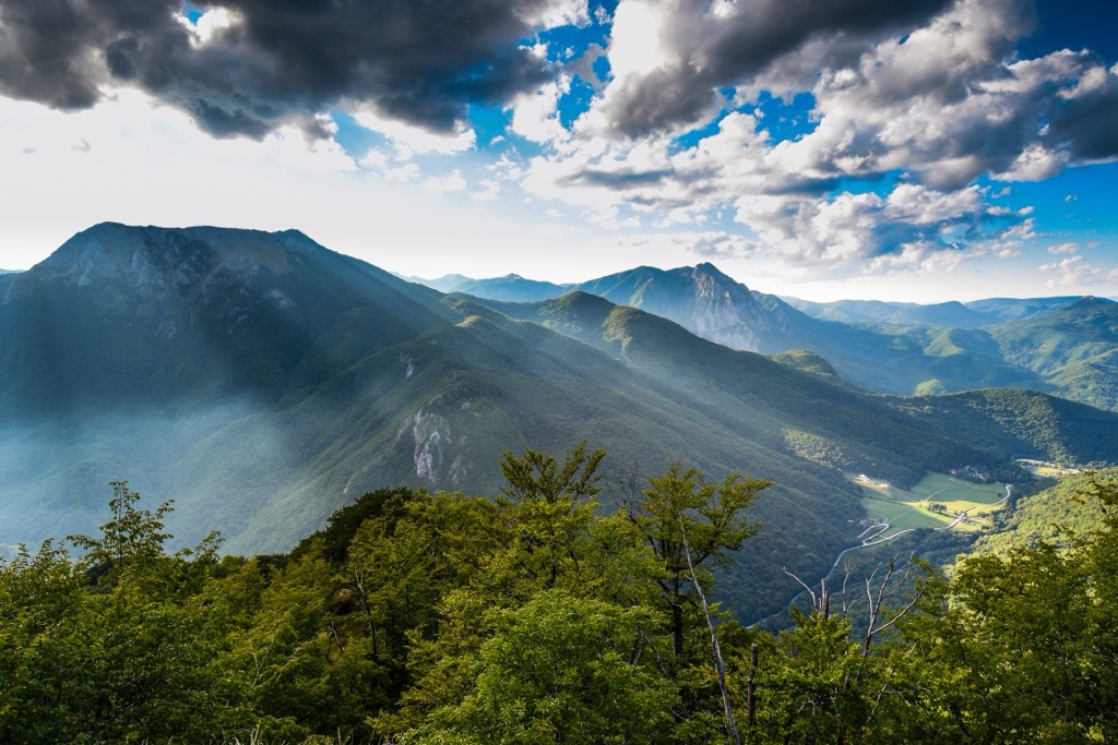
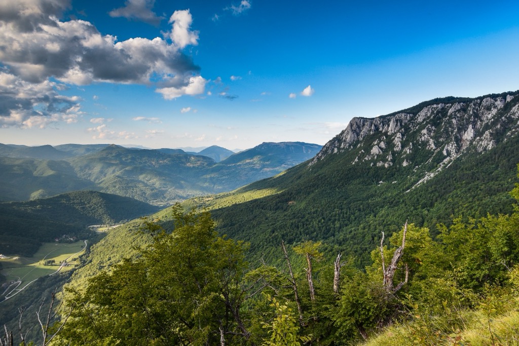
In fact, the park is in the middle of mountainous terrain, the heart of the Dinaric Alps. It is bordered by Pivska Mountain, Piva River, and Šćepan Polje up to the confluence of the Drina River. On the west, there is Zelengora mountain, connected with Lelija mountain, and on its southeast, Šćepan polje with a lowland area of the Drina River valley. Further, the mountains border the park with Maglić, Bioč, Volujak, Trnovački Durmitor, and Lebršnik.
Tara Canyon National Park is a Montenegrin national park that has been around for a long time but is currently considering expanding its boundaries to bring in an additional 3,500 ha (8,600 ar) to the area. The expansion plan would increase the park's size by 20% and make it even more capable of providing visitors with an experience they won't forget.
The expansion of the Sutjeska National Park and merger with three other parks in Montenegro will not only make it the biggest protected area in Bosnia and Herzegovina and Montenegro together but also offer wildlife a free place to roam.
Sutjeska National Park, Durmitor National Park, and Tara National Park in northwestern Montenegro are planned to form a transboundary protected area in the former Yugoslavia. This is because, at one point, they were all part of a single Yugoslavian state. Until then, you can enjoy these places worth visiting in Sutjeska National Park:
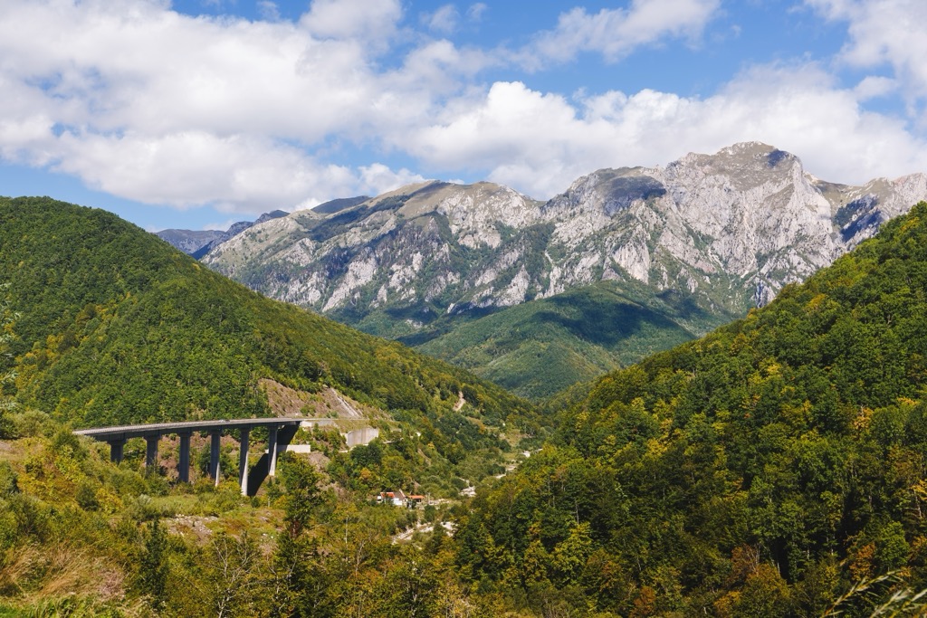
We can certainly reach the park from some convenient locations, but the only way to get there is by road. There are two routes: Sarajevo via 110 km (68 mi) and Dubrovnik via 142 km (88 mi).
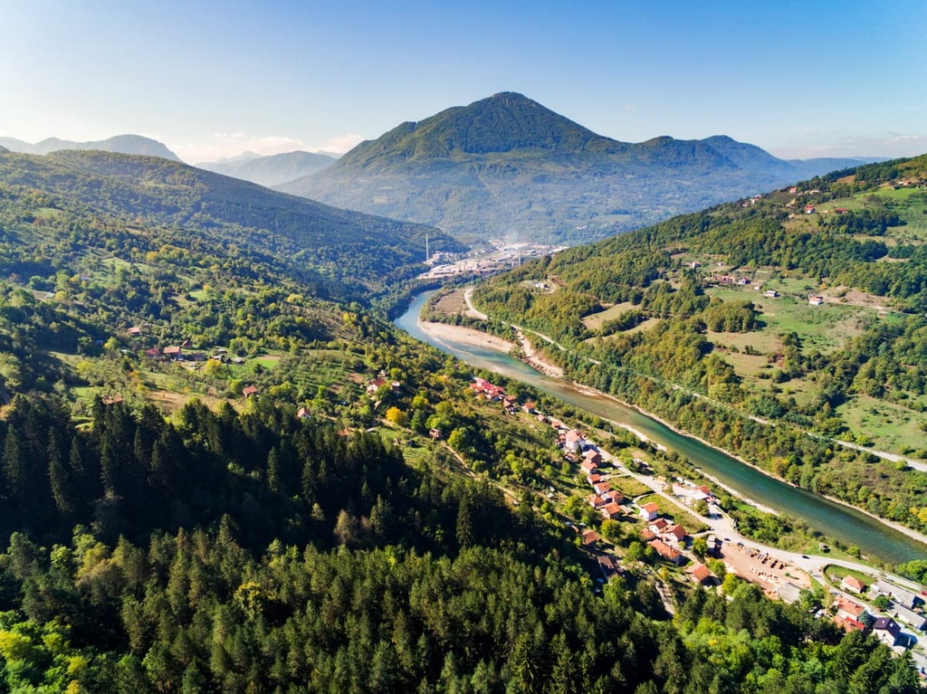
The Trebinje- Foca road passes through Sutjeska River’s beautiful canyon pass with thick forests and mountains on both sides. When visiting, you will also see the city of Foča, 20 km (12 mi) away from the park.
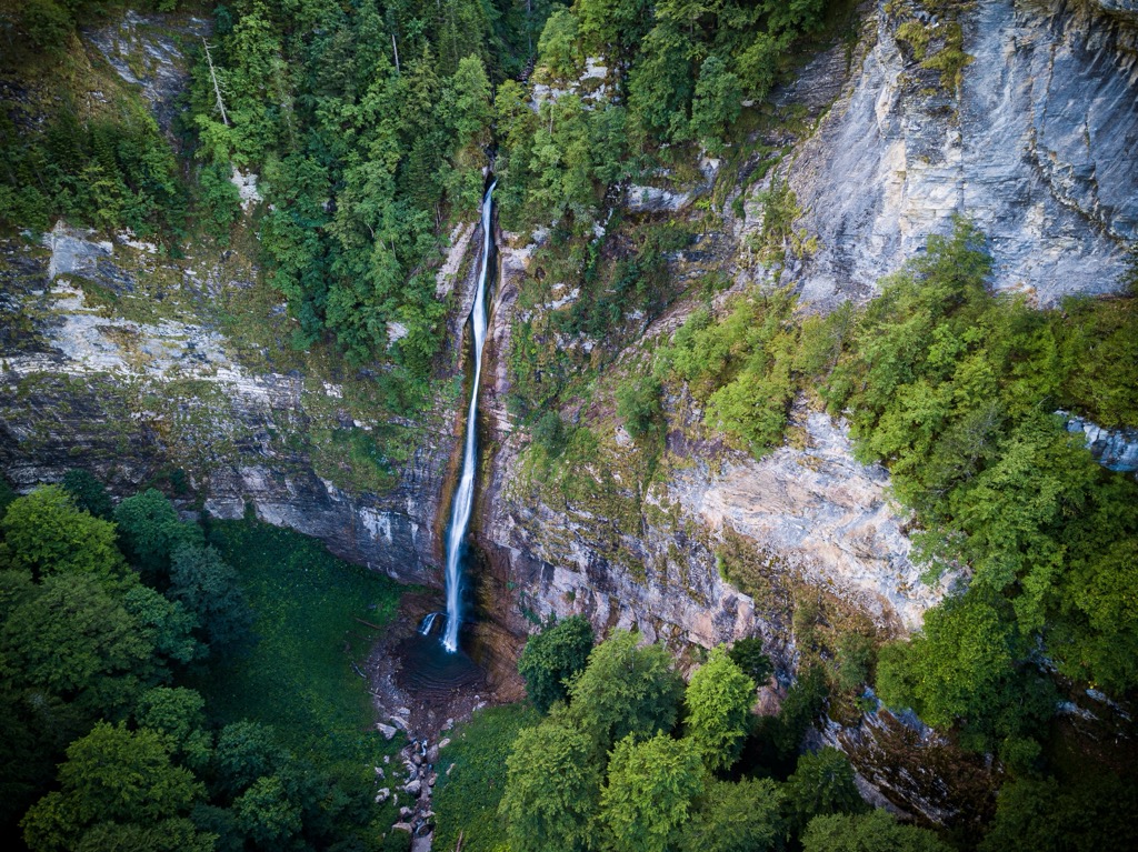
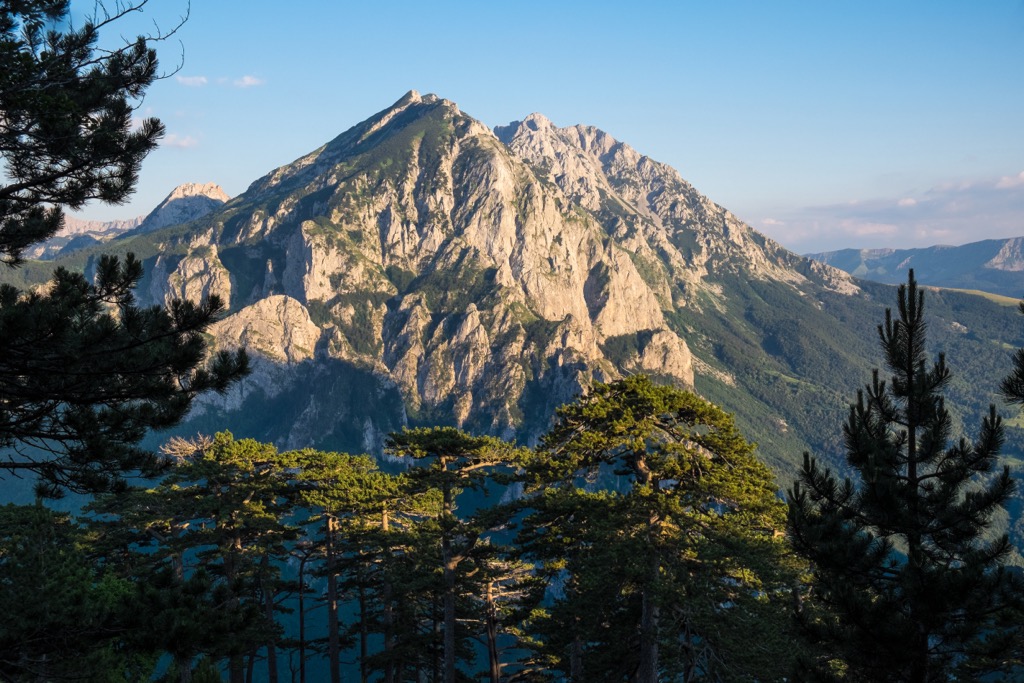
The Sutjeska River is 12 km (7 mi) long, dividing the park into two different areas with distinctly different terrain. On one side are the green slopes of Zelengora (lit. Green Hill), and on the other side is Maglić (lit. Foggy peak) with rocky terrain.
The very origin of the word "Sutjeska" refers to a straight line, which is cut into the rock and eroding it by water through its long geological history. One can see how the Sutjeska area has a lot of geological complexity due to its landforms, offering diversity in terrain, from both green pastures and lakes to rock faces and barren peaks.
The area of the park is fairly small, making it easy to get around, but large differences in height make mountain climbing exciting and unique. One can also see examples of geological processes like erosion, deposition, and formation that have created characteristic forms of relief over a specific time period during the geological past.
The park and its mountains are parallel to the Dinaric axis that runs through Western Herzegovina (or northwest-southeast). The Sutjeska River divides Zelengora from Maglić, together with Volujak and Bioč mountains on the other side, and Zelengora with its small counterpart Lelija.
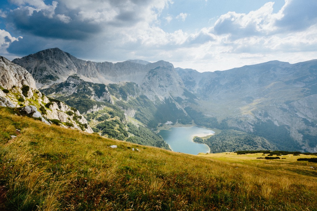
Tara River hosts also an impressive canyon with a 3,936 ft (1,200 m) deep drop, lying on the outer border of the park. The Tjentište valley in the heart of the park is a popular tourist destination where you can find various historical monuments.
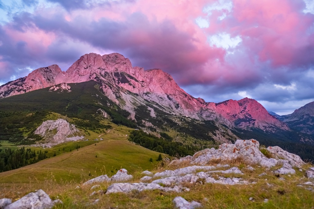
Sutjeska lies below Maglić, Volujak, with Bioč, Lebršnik, and Zelengora. These mountains are composed of limestone and dolomite as their main geological composition.
Needless to say, Sutjeska National Park is covered in karst forms and numerous rock faces. Karstification is the process of erosion and dissolution of soluble rocks, also found in Sutjeska National Park. Limestone, dolomite, and gypsum are dissolved by water, wind, and sun.
This process is most often seen in karst landscapes such as the Carpathian Mountains, the Piedmont region of Italy, or the Sutjeska as part of the Dinaric Alps. Karstification can be a natural process or an anthropogenic one.
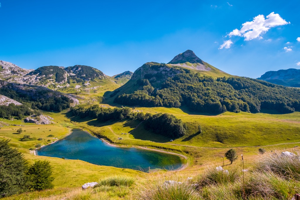
Of the four rivers in Sutjeska, the Piva and Drina Rivers form their northern border. The Zelengora mountain range is known for its forests, vast meadows, and 9 glacial lakes, often called "Gorske oči" or "Eyes of the Mountain." These lakes include Kladopoljsko Lake, Orlovačko Lake, Gornje Bare Lake, and other lakes. The highest peaks in the park include:
The park's climate is a transitional one. The moderate continental climate dominates from the north, and the southern Mediterranean climate has less of an effect on it. The typical mountain climate remains largely moderated by the Adriatic Sea near the park.
Plant and animal life diversity is one of the basic reasons for establishing this national park. There are over 2,600 vascular plant species in the Sutjeska Valley.
The Dinaric Alps are a mountainous region in Southeast Europe. Its biodiversity is outstanding and includes over 330 rare, endemic, and endangered plant species. This region has a high level of biological value because many of the plants have medicinal properties.
Many rivers with canyons are home to the so-called habitat refugia of the Serbian spruce (Picea omorika Pančić), a relic from the tertiary period. Mount Zelengora is one of them. The idea that this species is a living fossil was popularized by scientists here.
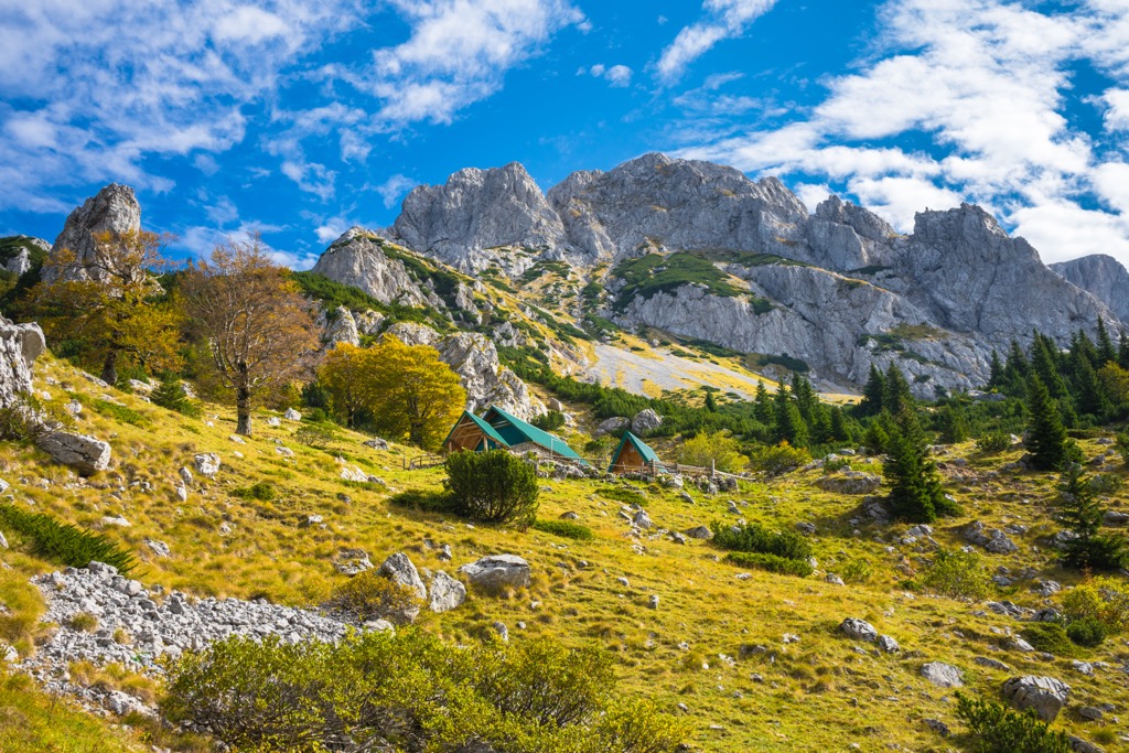
The park's vegetation is divided into a thick forest (66%), mountain pastures, meadows, and rocky ground at a higher elevation. The northwestern hill slopes are largely covered with coniferous and beech trees, which reach up to an elevation of 1,600 m (5,249 ft). This contrasts with the steep, barren, and rocky hill slopes in the other directions.
Pastures can be found at elevations above 1,600 m (5,249 ft) in the highland plateau. It contains about 2,600 species of plants and also about 100 species of edible mushrooms.
Perućica, a primeval forest inside the park, is home to large beech trees, often as tall as 60 m (200 ft), and black pines. The ancient forest is still preserved due to the blanket of trees that shield it from human contact. The Perućica primeval forest is a pristine nature reserve of extraordinary beauty. It's never been logged, and some of the trees are as old as 300 years.
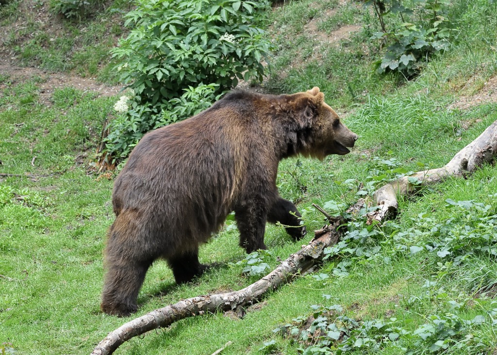
Hundreds of different animals have made their homes in this park. You might spot bears, chamois, boar, and wolves here. Pine martens, wild cats, and foxes also live in this area.
Balkan Chamois (Rupicapra rupicapra balcanica), a goat antelope cross-species native to the Dinaric mountains, has been successfully re-introduced into other parts of the park and country.
114 species of birds have been recorded so far, 61 of them live and nest in Sutjeska National Park. However, 16 of those can be classified as regular migrants who pass through Sutjeska, and around 50 only nest here.
There are many different types of birds in Perućica, including golden eagle, grouse, and peregrine falcon. The fauna that lives here includes roe deer, hare, fox, brown bear, gray wolf, and others.
The national park was established in 1962 and is the largest of its kind in Bosnia and Herzegovina. It was first included in the list of parks because of its historical significance rather than its importance as a conservation area.
Perućica is a forest where visitors can see the outstanding natural beauty. The wonders of this place are many, with one being its great diversity of plant species that spans 400-200 years of vegetation history.
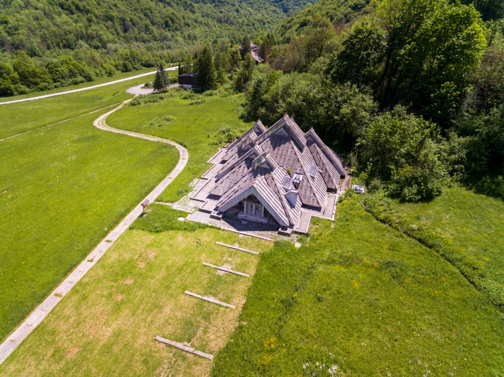
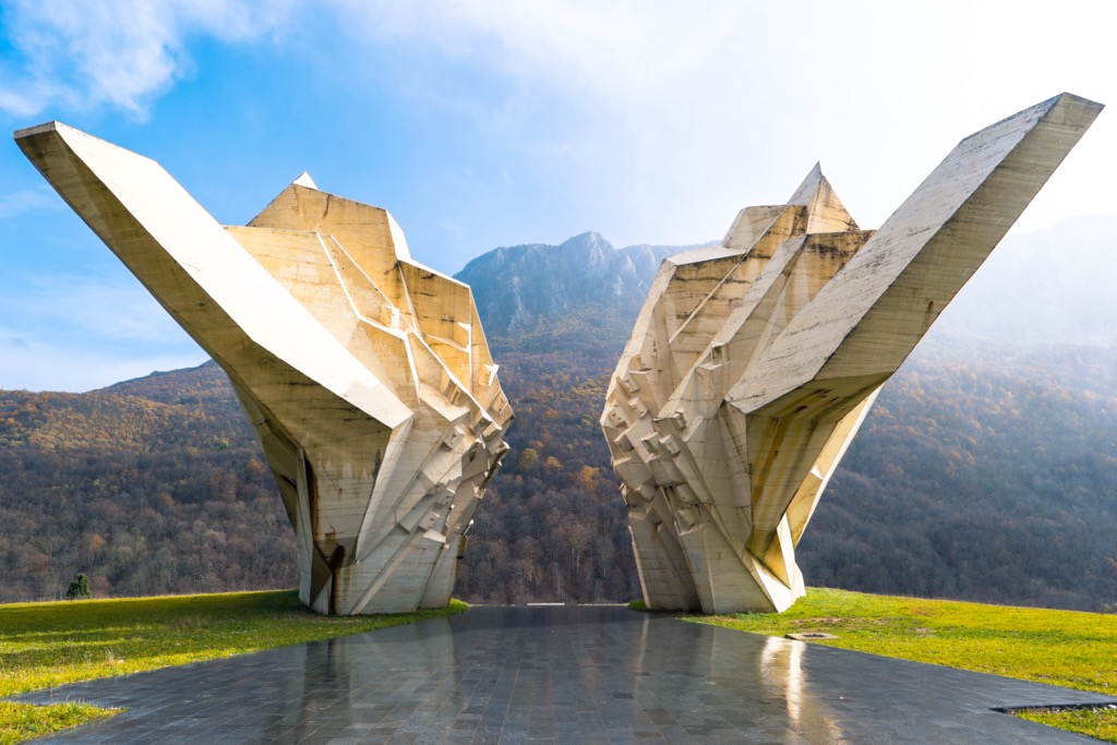
Several large memorials honor Partisan's Memorial at the northern edge of Tjentište. They lie on the Zelengora slopes along the way to the primeval Perucica forest reserve. They have a strong message which is worth getting to know while you’re visiting the area.
The Sutjeska Battle took place between the 15th of May and the 15th of June. It took place in Montenegro, Eastern Herzegovina, and Eastern Bosnia. The final and greatest battles for the local Partisan armies happened around the Sutjeska River.
Today the park is forever known as the location where, during World War II, Yugoslavian partisans were victorious over German forces. In memory of this great battle, locals built a memorial with Miodrag Živković's monument as its central part. There is also a Sutjeska Battle Memorial House, an architectural masterpiece that Ranko Radović created in 1972.
The Partisans led by Marshal Josip Broz Tito were most successful in the battles here. Despite losing a third of their men during the breakout, they eventually broke out of the encirclement under German forces and won the battle.
The protection of the natural features and rarities of Sutjeska Park dates back to the end of the nineteenth century. The first concrete evidence proves that this area was already protected in 1893, only to protect the wildlife here.
Protection activities remained relevant during and after the Second World War. After socialism began, locals did work on protecting the park from illegal logging and deforestation. At the beginning of the 1950s, intense work was carried out in this sphere and protected first the Perućica Forest. After that followed, the area of Sutjeska was declared a National Park on January 13th, 1962.
The 60th anniversary of heritage preservation in the NP Sutjeska (1962-2022) has had a large impact. The park’s duty is to work hard to preserve and protect the natural environment and cultural heritage here.
The Yosemite of the Balkans has numerous hikes to offer to visitors, and here are some of them.
The peak of Maglić (2,386 m/ 7,828 ft) is a popular tourist destination in Bosnia and Herzegovina. It is located in the Sutjeska National Park, which is one of the most beautiful national parks in Europe. The hike to Maglić (2,386 m/ 7,828 ft) starts from the village of Prevoj and takes about 3 hours to complete.
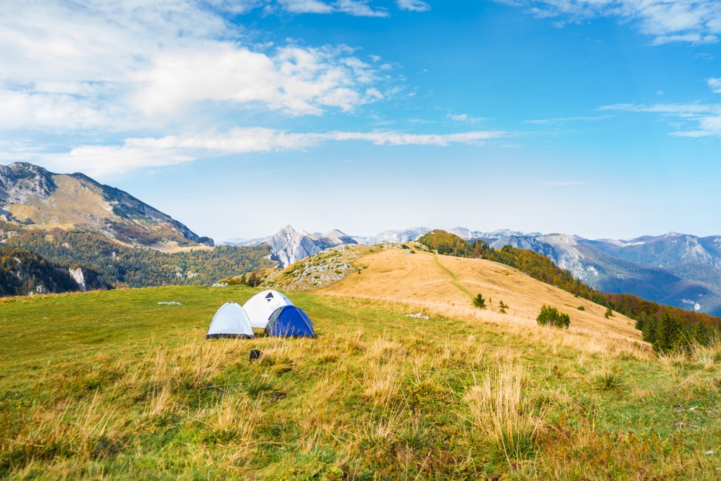
In other words, you will be able to hike and camp at Prevoj and then head out to Maglić (2,386 m/ 7,828 ft) peak. You can reach the peak via Ferrata, which will take 3 hours in total, or via Postman’s route, which also has some rocky and elevated areas but is much safer and easier, but will take longer. This can be a circular route with a visit to the Trnovačko Jezero and back to Prevoj with more than 20 km (12 mi) in length.
Another not-so-popular route but extremely beautiful is hiking to the peak of Volujak or Velika Vlasulja (2,336 m/ 7,664 ft), which is outside the Sutjeska National Park, but still needs to be mentioned. You can camp at the trailhead at Papin Do below Volujak.
The hike to Volujak is a popular tourist attraction in Bosnia and Herzegovina. It is located in the Dinaric Alps, near the border with Montenegro. The hike takes 18 km (11 mi) in total and can be combined with hiking to nearby peaks inside Montenegro.
Sutjeska National Park lies between Zelengora and Maglić, so hiking either of these mountains is a must. The hike to Zelengora starts from the Orlovačko Jezero, one of many lakes you can see here.
Most people hike to the highest peak of Zelengora or Bregoč (2,014 m/ 6,607 ft). The trail is easy and perfect even for beginners, with a length of only 8 km (5 mi). The trail leads through fields and then up to a ridge that offers views of the surrounding mountains and valleys.
Near Sutjeska National Park are three small towns that will offer tourists numerous accommodation options. Here they are:
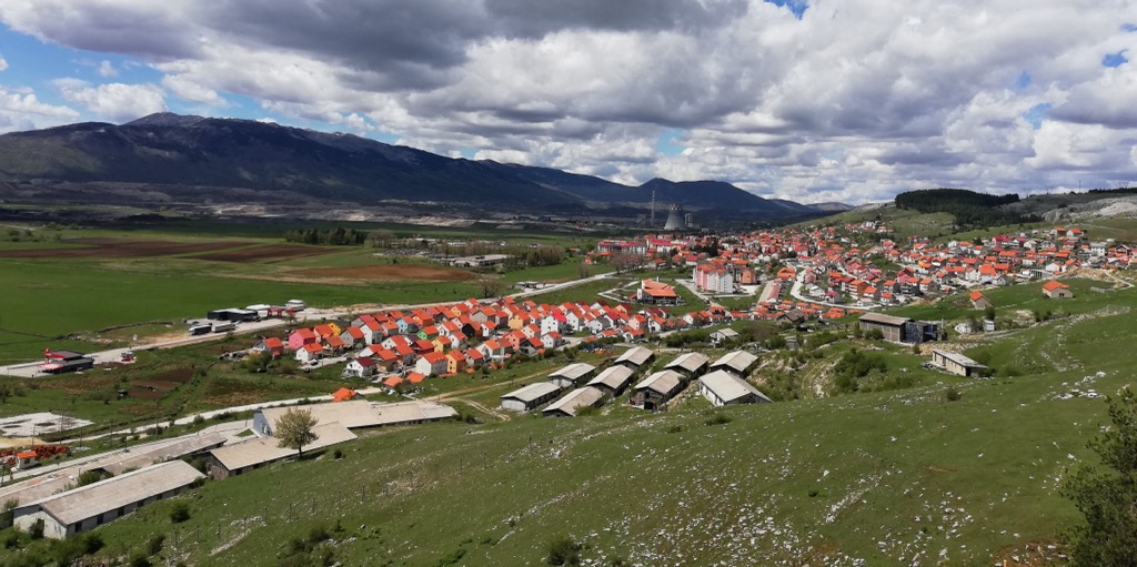
Foča is a town in the southeastern part of Bosnia and Herzegovina. It is located on the banks of the Drina River, near its confluence with the Tara River. The town has a population of around 10,000 people. Bosnian King Stephen Tomašević founded it in 1482.
You will be able to reach Foča only by road, be it by car or bus, but there are numerous accommodation options here. A few of the most popular ones include campsites and bungalows along the Tara River.
Gacko is a small town in Bosnia and Herzegovina, the nearest town to Volujak and Lebršnik mountains. The town has a population of about 3,000 people, which you will be able to reach via road. The accommodation options here are limited, but the local hiking club has a mountain hut on Papin Dol.
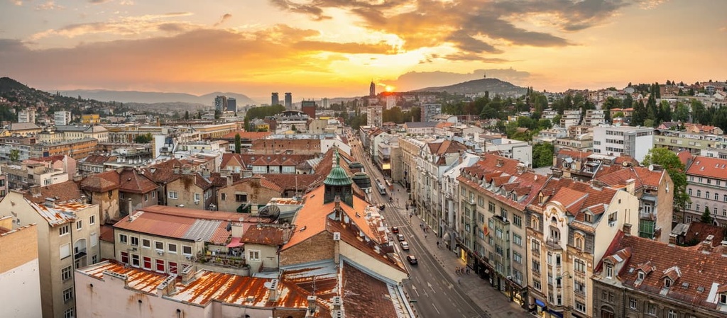
If you are reaching Sutjeska National Park from the north, this is a must-see. Sarajevo is the capital and largest city of Bosnia and Herzegovina. It is situated on the River Miljacka in the center of the country.
The city has a rich history, dating back to Roman times. It was also a major center for Bosnian culture during Ottoman rule. The city has many landmarks, including its old town, which is one of UNESCO's World Heritage Sites.
One can reach Sarajevo by air, rail, and road, and since it’s a tourist city, all types of accommodation options are available. It is situated near the River Bosna in the heart of the Balkans, surrounded by mountains and hills. The city has a long tradition of being multicultural and tolerant of other cultures.