Scan the QR code and open PeakVisor on your phone
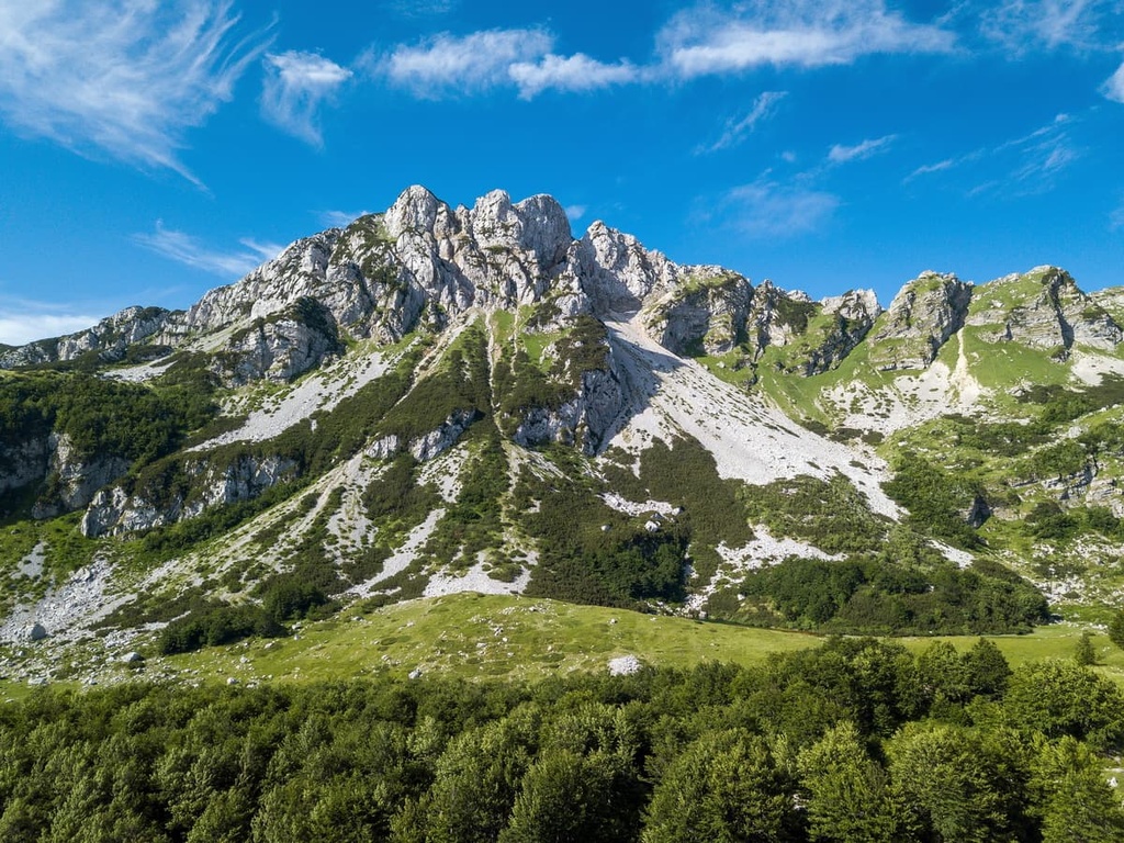
Durmitor National Park is a protected area that’s located in northern Montenegro on the country’s border with Bosnia and Herzegovina. The park is full of beautiful lakes and lush forests, making it one of the numerous masterpieces of mother nature found in Montenegro. There are 181 named mountains in Durmitor National Park, 48 of which are above 2,000 m (6,561 ft). The highest and the most prominent mountain in the park is Bobotov Kuk (2,523 m/ 8,277 ft).
Durmitor National Park is located in the northwestern part of Montenegro. The park lies on the country’s border with Bosnia and Herzegovina. It is a large protected area with a surface area of 390 sq. km (242 sq. mi). Durmitor National Park was established in 1952.
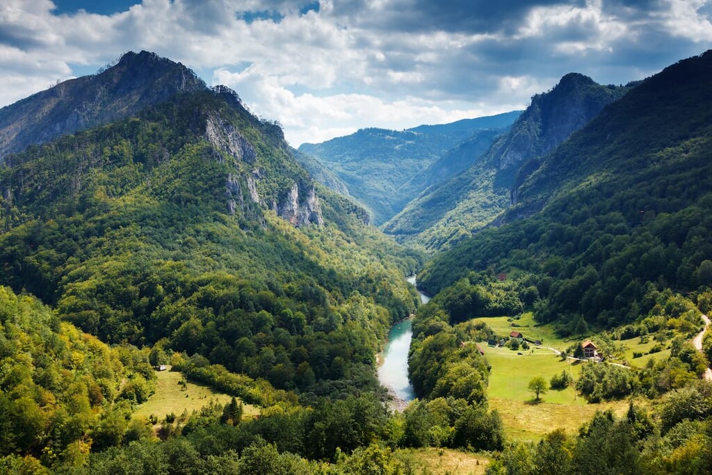
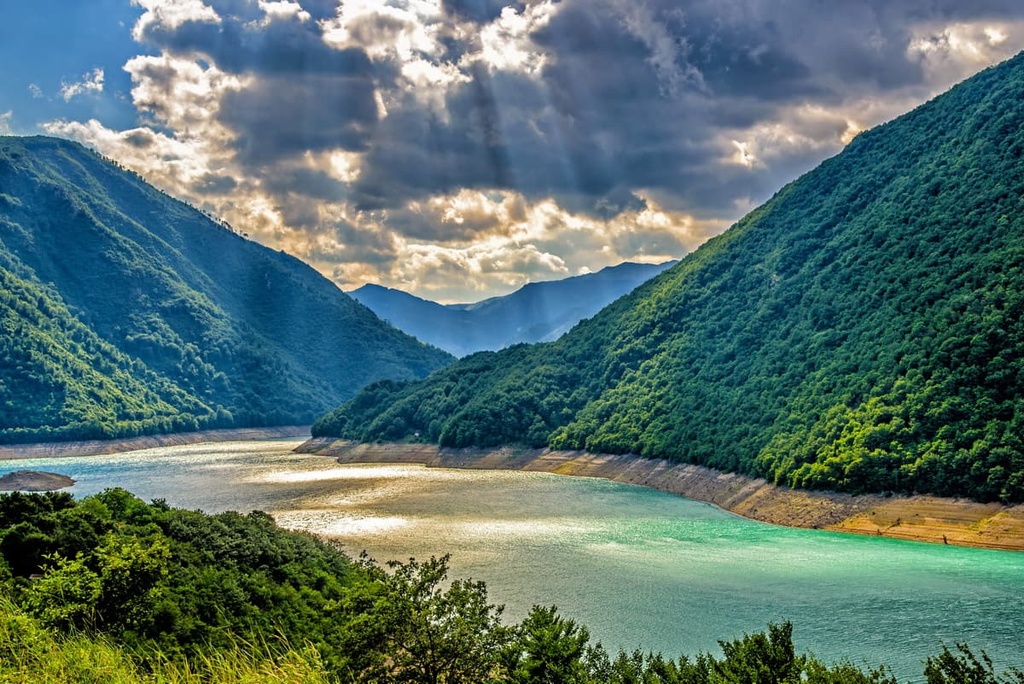
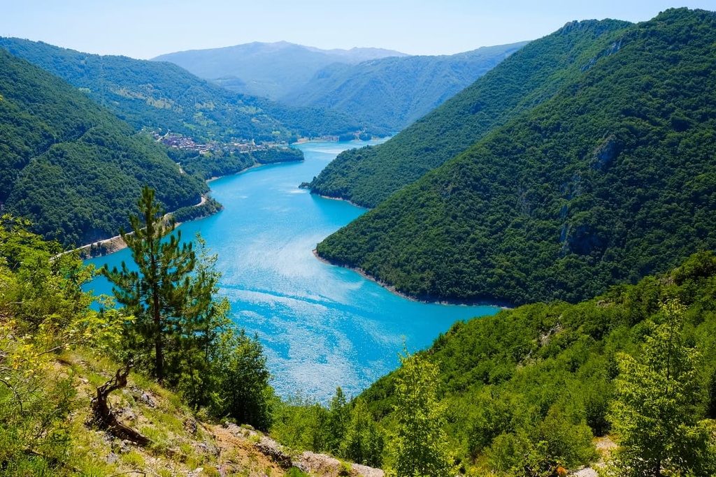
Three local municipalities govern the park: Žabljak, Plužine, and Pljevlja. The park includes Piva River in the west, the Tara River and Canyon to the north, and the Komarnica River and Canyon to the south.
As its name suggests, the park protects the Durmitor massif. The massif is part of the Dinaric Alps, and it is located roughly in the center of the range. The highest point of the Durmitor massif is Bobotov Kuk, which has an elevation of 2,523 m (8,277 ft).
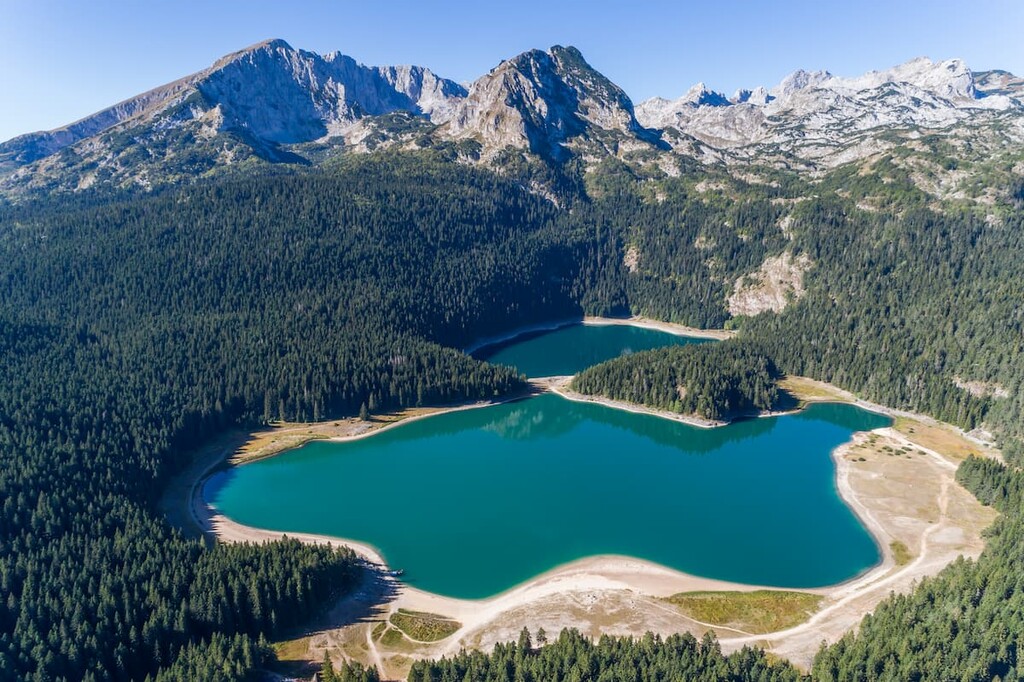
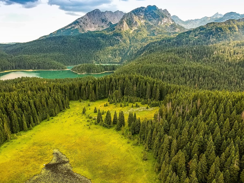
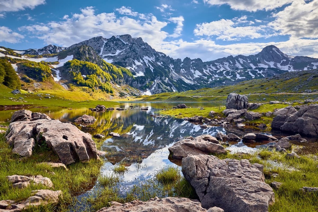
Surrounding Durmitor is the Sinjajevina massif, and between them lies Jezerska Površ (whose name translates to ‘Lake Plateau’). However, Durmitor isn’t just known for its beautiful rocky peaks and green grasslands; the mountains are also full of lakes.
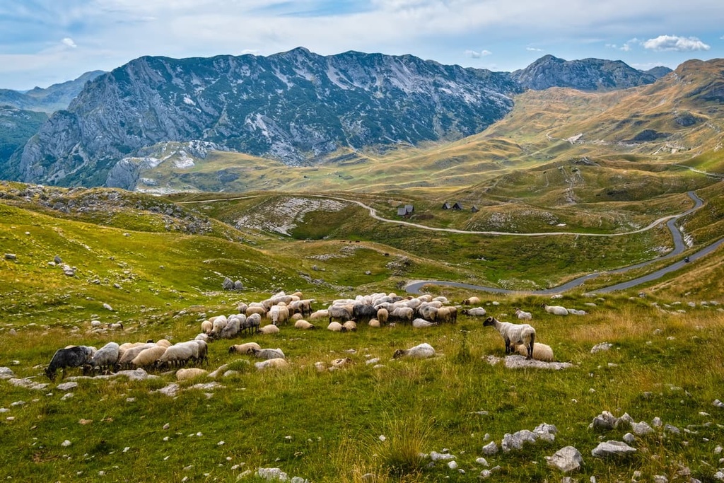
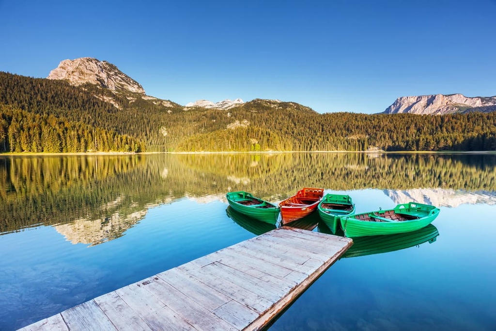
The locals call these lakes gorske oči, which translates literally as ‘eyes of the mountains.’ You can find 18 mountain lakes that are permanent and many others that appear only as a result of seasonal snowmelt.
Another thing you will notice when visiting the park are its numerous water sources. You will see signs for water and springs along the roads and trails wherever you go.
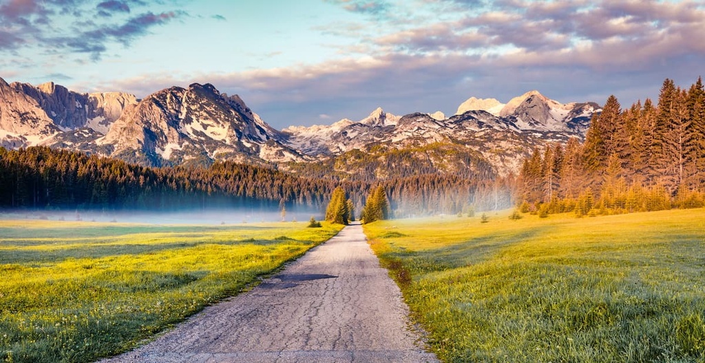
The immense beauty of the area in the current park has long been known to locals and to the global community. In 1980, UNESCO named Durmitor a World Heritage Site for its breathtaking natural beauty. The road from Žabljak to Jezerska Površ is called Durmitor Ring, and it is also considered to be one of the most scenic roads on the planet, thanks to its beautiful views of the surrounding mountains.
According to park officials, there are seven different zones of Durmitor National Park. These zones include:
One theory for where the name ‘Durmitor’ came from is that it is a remnant of the Balkan Vlach language. In this language, the word ‘Dumitor’ means 'sleeping place.’ This could be a reference to the fact that the peaks in the region are normally snow covered throughout the year.
Another theory is that the mountain’s name was given to it by the Celts or Illyrians. The meaning of ‘Dumitor’ in this case could be anything from “water mountain” to “ridged mountain.” This is the most likely possibility from an etymological standpoint because the Tara River and other locations surrounding this massif also have names of Celtic origin.
Durmitor Mountain Massif is the largest mountain massif in the country of Montenegro. It is also the most rugged of the country’s massifs and it contains a variety of terrain from forests to canyons. Of course, this makes Bobotov Kuk (2,523 m/ 8,277 ft) the highest peak of Montenegro, too.
This park has so much to offer to visitors. Here are some of the must-see locations in Durmitor National Park:
Honestly, saying that Durmitor National Park is ‘beautiful’ would not do it justice. The peaks in the park are rocky and barren while the grasslands below them offer rich pastures. The abundance of lakes, rivers and creeks in Durmitor is astounding, and that is why this park is so popular with tourists and locals alike.
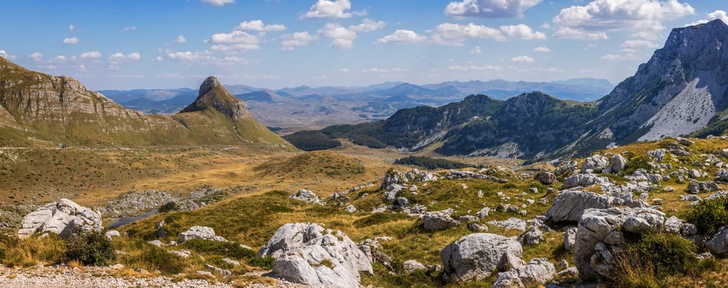
Durmitor National Park is a protected area in the Dinaric Alps. It encompasses the Durmitor massif and its surroundings. The park includes incredible geomorphological formations, rugged alpine relief, and numerous karst features.
Geologically, the Durmitor massif formed alongside the rest of the Dinaric Alps. This happened during the early Cenozoic era when the European Plate collided with the Adriatic Microplate. The Dinaric Alps rose 43 to 66 million years ago and are still growing to this day.
In fact, the Durmitor massif has the same geological origin as the Volujak mountain in Bosnia and Herzegovina and the Piva River. This is why we can consider these two mountains to be part of a single geological unit.
Northern Montenegro and southeastern Bosnia and Herzegovina are both known for their lush grassland mountains. They possess rocky terrain with steep relief that’s perfect for alpinism and mountaineering. Additionally, the peaks in both countries offer lush forests and grasslands to please both wildlife and hikers.
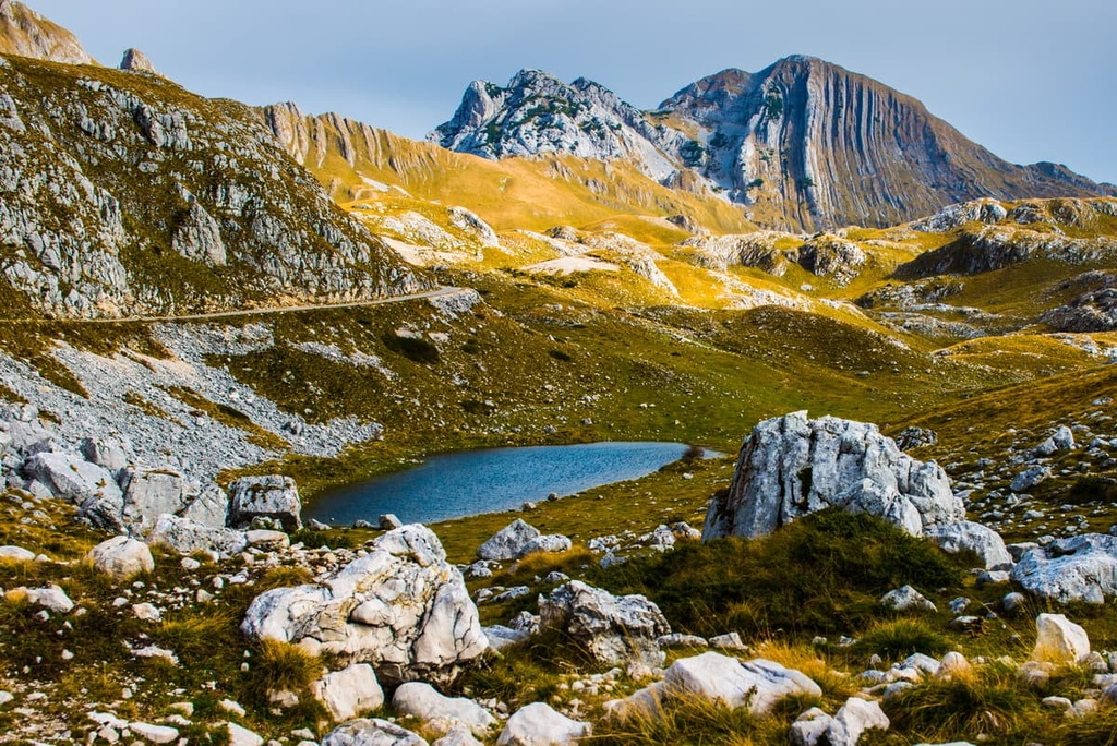
The most well-known feature in the Durmitor massif is its rugged limestone. The rocks in the region originated during the Middle and Upper Triassic, Upper Jurassic, and Upper Cretaceous periods.
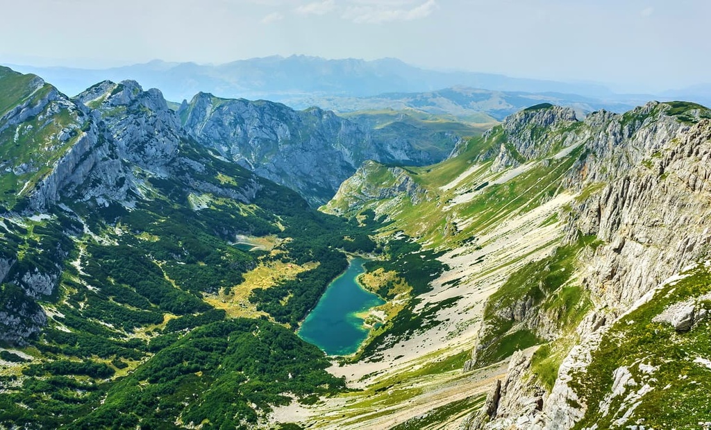
Karst topography forms when water dissolves limestone rock. The Dinaric Alps contain some of the most well-known karst formations in Europe. Of course, Durmitor has its fair share of karst landscapes as well. Take the Jezerska Površ, for instance, it is a karst field covered with numerous glacial lakes. All of these lakes come from karst waterways and they flow back into them.
The mountain's numerous springs and water sources are all part of a greater karst labyrinth. We can conclude that the underground tunnels form an intricate web of subterranean pathways from the number of caves and springs that are seen on the surface.
The park includes Montenegro's deepest caves and numerous underground water flows that drain some of the glacial lakes on the Jezerska Površ. In particular, the Ledena Pećina or Ice Cave, a deep and long cave system, is an important geological phenomenon in Montenegro. In fact, it is a relic of the last major glaciation.
Durmitor flysch, which is one of the main rock formations in the region, has been the focus of a number of studies and surveys in recent years. The rock formations are unique because they are composed of layers inclined at an angle of 90 degrees. They also have a unique color pattern, which is how Šareni Pasovi (literally ‘Colorful Belts’) also called Štit, got its name from.
Durmitor National Park is mainly known for the steep canyons of the Draga, Sušica, Komarnica, and Tara Rivers. The Tara River Gorge or Canyon is the deepest canyon in Europe, with a height of 1,300 m (4,265 ft).
The region has a high elevation, and around 50 peaks in the park reaching a height of at least 2,000 m (6,561 ft). Here are some of the highest peaks in Durmitor National Park:
Durmitor National Park is home to many different species of flora and fauna. With its beautiful pastures, wild lakes, and rocky cliffs, it’s no wonder that the park is a true hotspot for biodiversity.
Thanks to the elevation differences between the lowest elevations of the park and the highest peaks there are both alpine and Mediterranean climates in the park.
This makes the region prone to precipitation. In winter, there is always snowfall. In fact, on the highest peaks, you can expect it even in July. This is why we would recommend bringing rain gear and extra insulating layers when visiting the park. One can also visit Žabljak to go alpine skiing, since the area is known as a ski resort in the winter months.
The best time to visit Durmitor is in summer, when most of the snow thaws and mild temperatures are likely. Remember, the peaks are not covered with trees in the park, so they are exposed to the sun’s rays. As a result, you should always bring sun protection with you when hiking.
Another thing to know about the park is how low the temperatures get at night. In the morning, the creek and lake valleys are extremely cold because the sun rarely reaches them. Here, a microclimate forms, and snow can persist throughout the year.
This diversity in climate is why there are over 1,600 species of vascular plants on the Durmitor massif. One example of this is the park’s rare old-growth forest of European black pine. Durmitor National Park is home to 37 plant species that one can find only in the Balkans, as well as 6 endemic plants that are only found in the park.
The most commonly seen animals in the park are livestock like sheep, cows, and goats. Local farmers live here throughout the summer season to offer their animals better and more versatile pastures to graze.
Large mammals present in the park include brown bears, gray wolves, chamois, and lynx. Also worthy of a mention are 130 recorded bird species in the park, which include species such as the golden eagle and peregrine falcon.
While one might not suspect this, the park has a rich population of fish species, too. In particular, Durmitor is home to the endangered Danube salmon (Hucho hucho).
The Durmitor massif’s wild ecosystems have thrived in its wilderness and untouched landscapes. There are five primary ecosystems in the park:
Traces of human life in the Durmitor region date back to Paleolithic times. The main evidence we have today of the region’s first human inhabitants can be found in caves. Later, humans found temporary or permanent habitats for themselves and their livestock in the fields of the Durmitor massif.
When the Neolithic period started, about 10,000 years ago, humans started to settle around the base of the peaks of the Durmitor massif. This was due to the fact that the massif is home to many arable grasslands. Soon, the local residents learned how to harness the power of metallic ores and they started to mine these ores throughout the massif.
One of the first documented settlements in the region was established during the Bronze Age in Leveri on the River Tara where remains from an ancient hillfort still stand. Also, archeologists have found numerous tumuli sites in the national park as well. These were metal age necropolises where the settlers would bury their deceased under small hills of rock and dirt.
The first recorded inhabitants of the Durmitor arae were Celts and Illyrians. We only know the names of the Illyrian tribes that inhabited the area. They were called Pirusti and Autariati, and they settled in the valley of Tara. The Celts or Autariati were most likely responsible for naming the Tara River.
In the Roman period, when the Roman Empire invaded the area of Montenegro, Durmitor was part of the province of Prevalis. In Preslica, an archeological site inside the national park, there is an inscribed rock that is carved with an inscription dedicated to the god Mirtas. This was a Roman cult that was brought to Durmitor by their army. The cult reached its highest popularity in the second and third centuries.
In the seventh century CE, Slavic peoples inhabited the valleys of the rivers Piva and Tara. The new settlers imposed their belief system and spoke a Slavic language, both of which are still in use today.
Durmitor was part of the Duklja and Nemanjić states from the tenth to the fifteenth century. This was a time of great prosperity when mining developed in the region and brought monasteries and fortified towns with it.
The park's surrounding area features a number of medieval stećak necropolises, which hold many medieval tombstones. At the end of the fifteenth century, the Ottomans took over the Balkans, including the area of Durmitor.
Ottoman rule of the region continued until 1878, despite frequent resistance and revolts on behalf of the locals. Residents of Durmitor played an important role in the Balkan Wars and the First World War.
They helped Montenegro achieve its independence. The same thing happened during the Second World War. This area was also a place of great importance during the Yugolasvian revolution of 1941–1945 because of the numerous battles fought on Durmitor.
The Durmitor Partisan Republic, which existed from October 1941 to June 1942, was the most prominent revolutionary government in the liberated territory. Žabljak still pays tribute to many battles fought by the Partizani in the area of Durmitor, and a dozen socialist monuments are still visible there to this day.
Even in medieval times, the area surrounding Durmitor was known for its natural beauty. The Tara River was under the king's ownership during the medieval period. Even then, locals prized it for the diversity and wealth it brought to Montenegro.
A few centuries later, the first hikers climbed Durmitor. It soon became one of the most popular mountains in the Dinaric Alps, again for its beauty and diversity. What most people found interesting was the amount of water that came from the mountain.
One of the first protected areas of Yugoslavia was Durmitor National Park, which was established in 1952. The area was also named a UNESCO World Heritage Site in 1980.
As one might expect from this beautiful landscape, hiking trails are everywhere you look. Durmitor National Park offers many hiking trails for tourists to explore the region's natural beauty. Almost every peak has a marked trail leading to its summit.
There are also many opportunities for camping, swimming, fishing, and rafting on the Tara River within the park. Here are some of our favorite hikes in Durmitor National Park that are worth checking out during your next trip to the region.
The most popular hiking trail in Durmitor National Park is the hike to Bobotov Kuk (2,523 m/ 8,277 ft). The peak got its name from that of a local shepherd that lived below the peak. Translated from the local dialect, it means ‘Bobo’s Peak.’
One can reach the peak from Žabljak or from the north. This is the longer route, and it takes you from Crno Lake to the Peak of Bobotov Kuk. This hike is strenuous and takes a whole day to complete as it has 1,000 m (3,280 ft) of ascent.
The easiest way to reach Bobotov Kuk (2,523 m/ 8,277 ft) is from the southern side or Prevoj Pass, which has an elevation of 1,900 m (6,233 ft). This route too, requires a whole day to pull off. In any case, this is an amazing and scenic hike that’s perfect for those looking for an adventure.
Bobotov Kuk (2,523 m/ 8,277 ft), Đevojka (2,440 m/8,005 ft), and Bezimeni Vrh (2,487 m/ 8,159 ft) form a rock face called the Soa Nebeska. This rock face oversees the Skrcka Lakes, and it offers hikers a beautiful and scenic view from the top.
Those not afraid of heights can take the tour from Bobotov Kuk or Bezimeni Vrh and walk along the Soa Nebeska. This hike is a great addition to your adventures if you’re looking to take in some fantastic views.
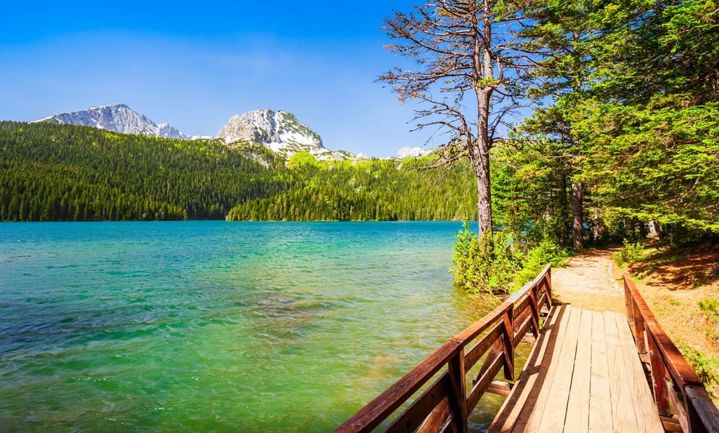
Located right above Crno Lake and the entrance at Crno Lake, Medjed is a short hike in Durmitor. The trail starts at Crno Lake and takes hikers through an ancient forest of European black pine. This forest is where the Crno Lake got its name from, as Crno jezero literally means Black Lake.
The hike takes up to 4 hours to complete, regardless of the route you take. Once there, you can enjoy the region’s incredible vistas.
One can reach Durmitor National Park from three countries: Bosnia and Herzegovina, Serbia, and, of course, Montenegro.
If you’re coming from the Adriatic seaside, you can get to the park via Podgorica. Or, if you’re coming from the north, you can travel through Sarajevo and Belgrade. When you get to the park, look for the small town of Žabljak, which is home to the official entrance.
Here are some of the cities you can check out during your visit to Durmitor National Park.
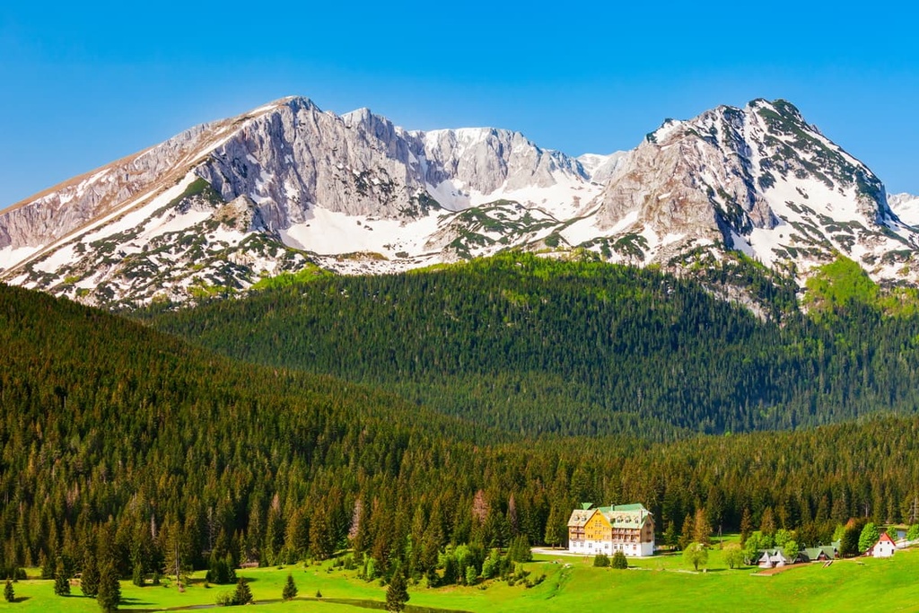
Žabljak is a small town in Montenegro. It lies on the slopes of Mount Durmitor at an elevation of 1,450 m (4,757 ft). It is the highest elevation year-round populated town in the Balkans.
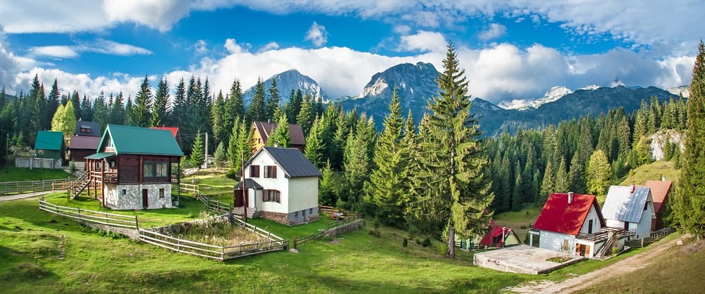
Žabljak is a popular tourist destination, and it is home to many hotels, campsites, and restaurants. The town has a rich natural heritage and offers many opportunities for hiking, skiing, rafting, and other outdoor activities.
It is also known for its traditional cuisine, which includes dishes such as ćevapi (a type of kebab), pljeskavica (a type of hamburger), and burek (a pastry). One can reach the town via rail and road.
Podgorica is the capital and largest city of Montenegro. It is a vibrant, modern city with a population of around 150,000 people. It is the cultural, economic, and academic center of Montenegro.
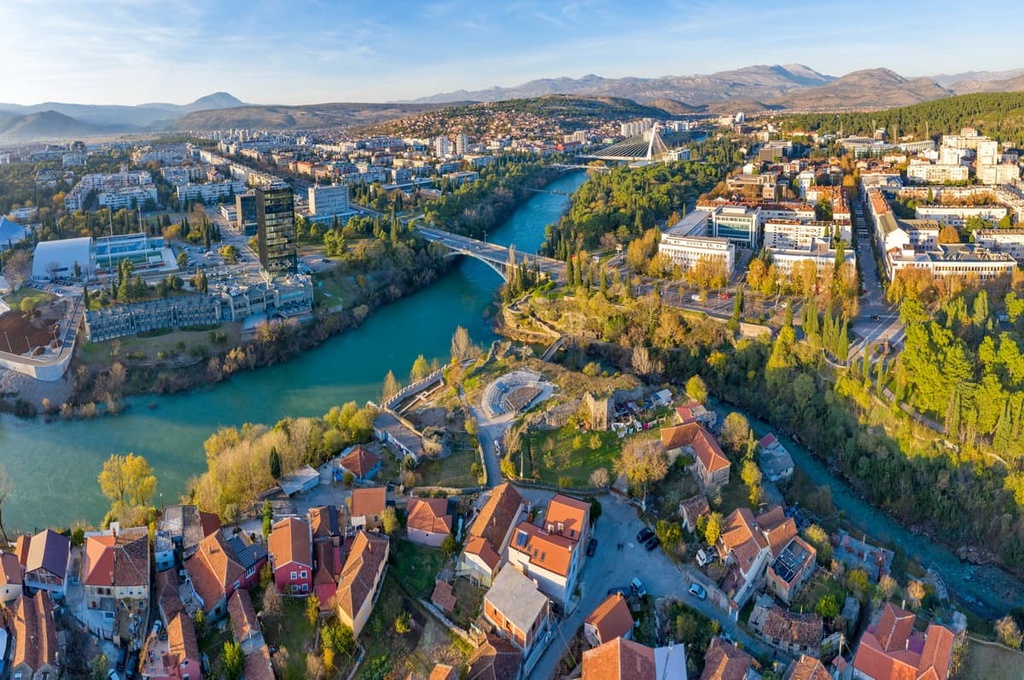
Podgorica has a Mediterranean climate with mild winters and hot summers. If you’re looking for a relaxing and modern getaway after visiting Durmitor National Park, Podgorica is your best bet because it offers all kinds of accommodations. In addition, you can reach it by air, rail, and road.
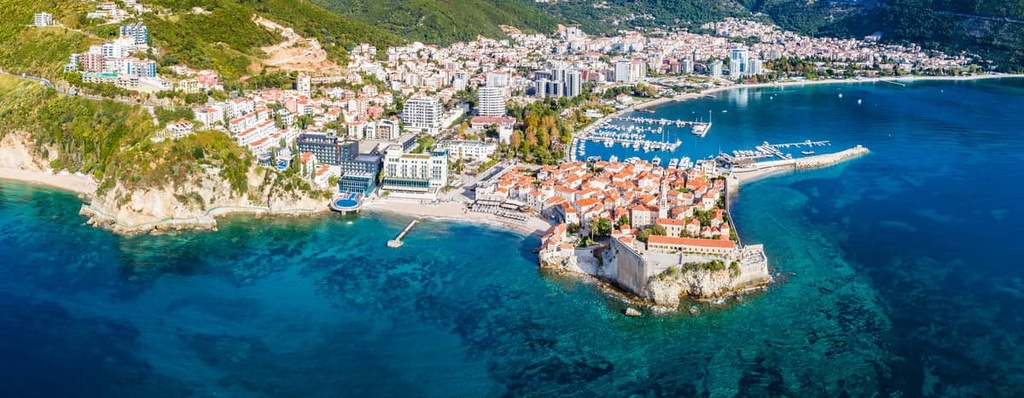
Budva is a coastal town in Montenegro. It is located on the Adriatic Sea and has a population of about 14,000 people. The town is known for its sandy beaches, which are popular among tourists.
Since ancient times, the town has been inhabited and was first mentioned in written documents from the twelfth century CE. It was known as Budua or Budua Castrum in those days. Budva is also home to many historical sites, such as the Church of St. John.
Today, you can enjoy beaches and a vibrant nightlife in Budva. The town also features numerous luxury hotels and accommodation options to suit all your needs. One can reach Budva by car, bus, and rail.