Scan the QR code and open PeakVisor on your phone
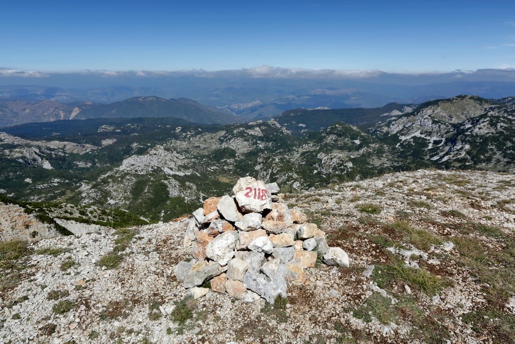
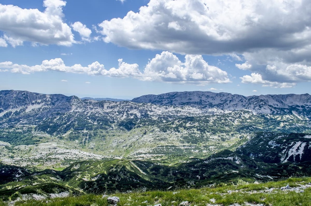
Nature Park Blidinje is a protected area in west-central Bosnia and Herzegovina that boasts lush grasslands, a long-standing cultural heritage, calm lakes, and wild mountain peaks. The park features a plateau with an average elevation of 1,300 m (4,265 ft) and three mountain ranges: Čabulja, Čvrsnica, and Vran. Blidinje has 170 named peaks, the highest and most prominent of which is Pločno (2,228 m/7,309 ft).
Nature Park Blidinje is located in northern Herzegovina within the country of Bosnia and Herzegovina, where the climate is more amicable. It is located to the northwest of the nearest city, Mostar. The park itself is significant in size by the country’s standards, with a total land area of 358 sq. km (138 sq. mi).
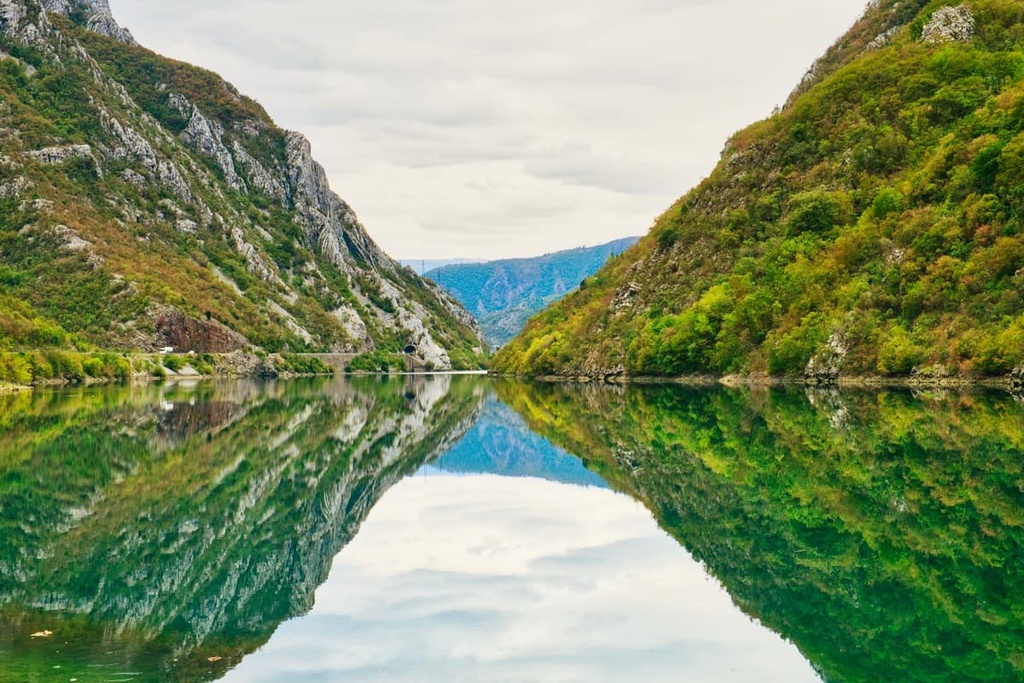
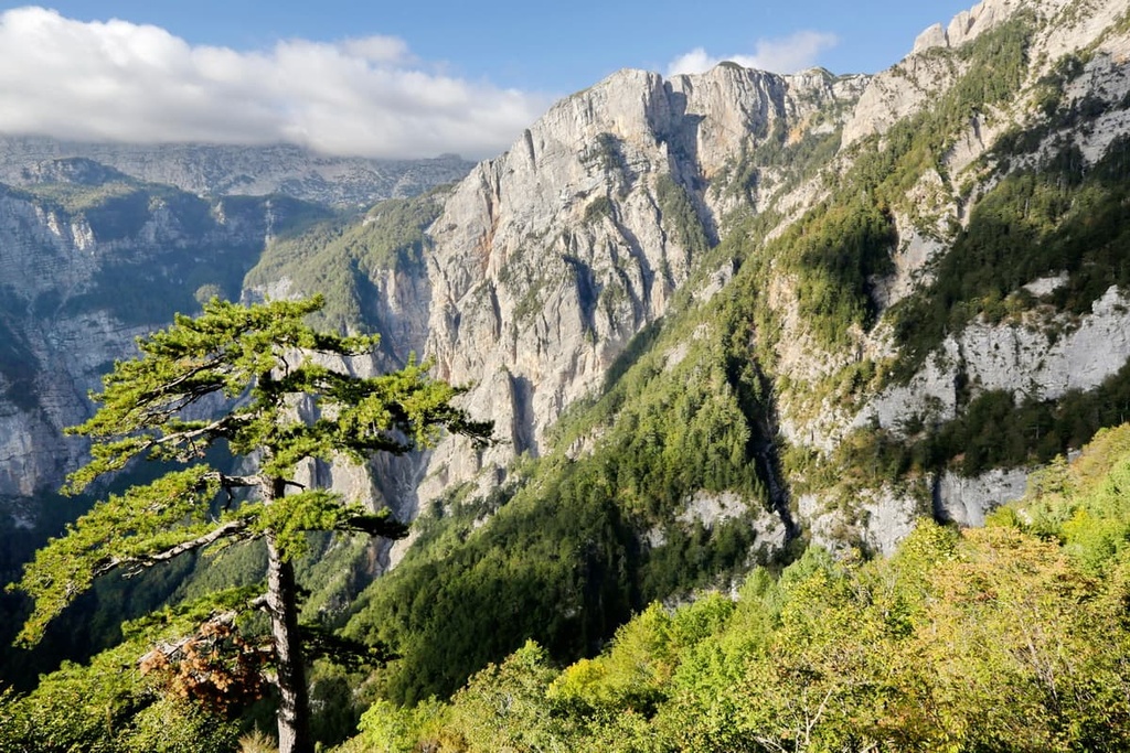
The park’s borders are defined by three gorges. To the east is Neretva Canyon, to the north is Doljanka Canyon, and to the south is Drežanka Canyon. Parts of the national park belong to three different municipalities and one city: Mostar, Jablanica, Posušje, and Tomislavgrad.
The mountains surrounding the park are part of the Dinarides, which are also called the Dinaric Alps. While the park itself is located in the northern part of the range, one can say it is still in the heart of the Dinarides. This is because of its position between the following three massifs:
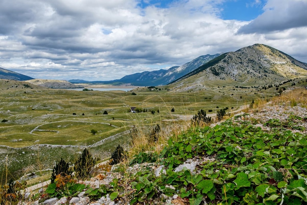
Dugo Polje (literally long field) is a major feature that lies in the center of the park. It is a calm grassland that’s perfect for raising livestock. This field is quite long, just like its name suggests, and it is 12 km (7.4 mi) in length and 2 to 3 km (1.2 to 1.8 mi) in width. The plateau has a typical valley shape that’s characteristic of the Dinaric Alps.
Geologically, the Blidinje Plateau and the mountain massifs surrounding it share a similar history. The region that is now part of the nature park primarily formed during the Mesozoic some 180 million years ago. That is when most of the rock formations, including various dolomites, and limestones, in the region formed.
Hercegovina is also particularly well known for its unique rock formations, which are also called Dinaric karst. This type of karst is found throughout the Balkan Peninsula. Blidinje shows features of the classic highland mountainous and inland karst fields.
The Dinaric Alps, including Blidinje’s mountains Čvrsnica, Vran, and Čabulja, formed between 50 and 100 million years ago. The geological structural unit of the Blidinje Nature Park, which is located in the Vran-Čvrsnica-Prenj region, consists primarily of limestone that formed during the Jurassic and Cretaceous periods.
The park is rich in mineral resources, and people have been extracting them since the dawn of time. The earliest settlements in the park are mining settlements that extracted iron and copper ores, often of poor quality. Blidinje has gypsum, coal, and lignite mines, which are still being used to this day. Today, there are companies that extract gravel from many locations in the park, too.
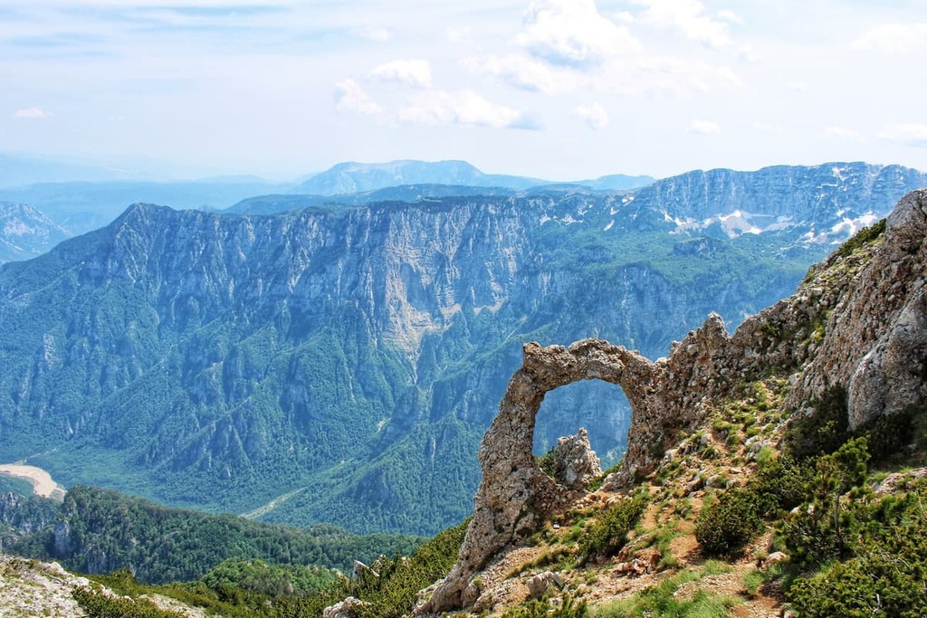
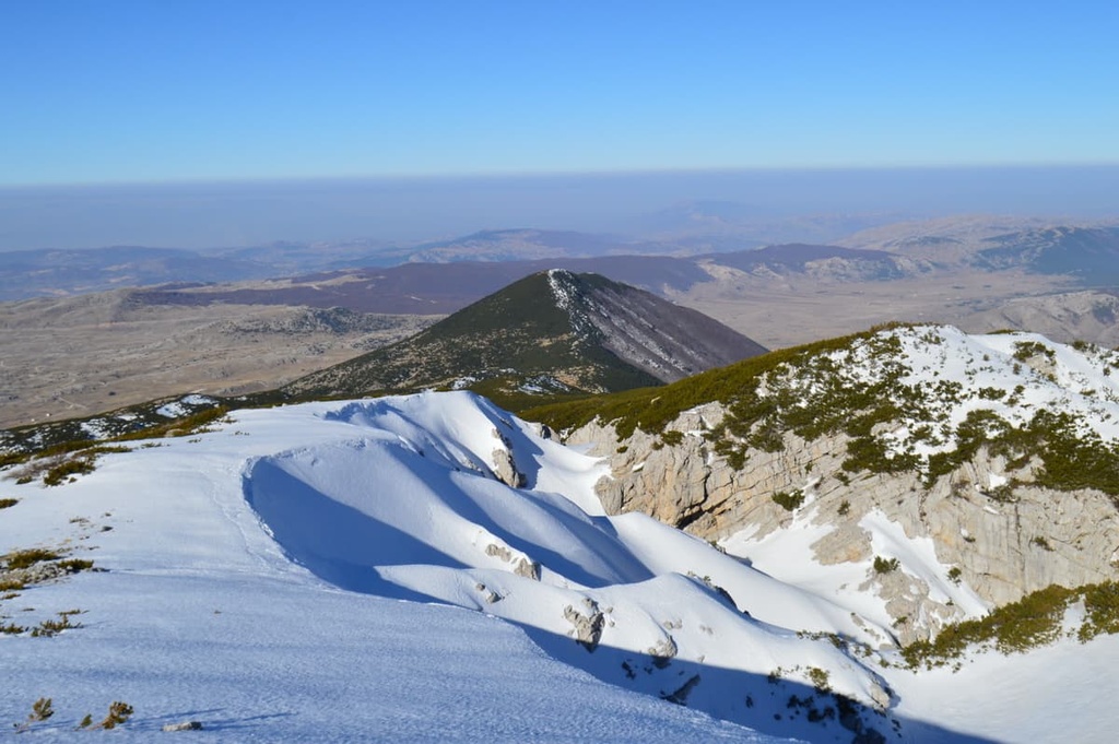
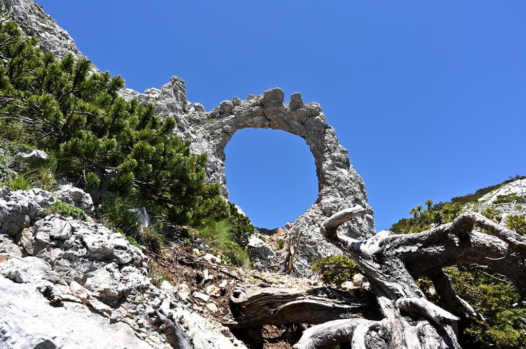
The Čvrsnica mountain massif is the highest and largest in the nature park. The most notable geomorphological feature in the region is located on the mountain’s eastern side above Grabovica Canyon.
This feature is a stone arch that looks a lot like a large door or circle called Hajdučka vrata (literally Haiduk Door). This is a protected natural feature in the park. Countless hikers and nature enthusiasts come to see it every year.
We divide the Čvrsnica massif into two sections. The first one, also called Muharnica, is located in the northeast section of the park and consists primarily of dolomite rocks. Veliki Vilinac is the highest peak in the massif with an elevation of 2,116 m (6,942 ft).
The second part of the massif, which is located opposite to Veliki Vilina on the southwestern ridge, is Velika Čvrsnica. The highest peak in this part of the massif is Pločno, which is mostly made of limestone.
The highest peaks of the Blidinje Nature Park are situated in the Čvrsnica massif. They include:
During the most recent glacial period, the peaks of the Vran massif as well as those on Čvrsnica were covered in glaciers. Slowly, these glaciers started to retreat, leaving behind the Blidinje Plateau (Dugo polje). The biggest glacier of Bosnia and Herzegovina was once located there. There is no trace of it today, only geological evidence that it once stood there.
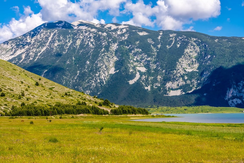
The Vran massif has two prominent peaks: Mali Vran and Veliki Vran, and three peaks above 2,000 m (6,561 ft). Veliki Vran (2,074 m/6804 ft) is the highest peak of the massif.
However, we cannot call the Čabulja mountain region a massif. It is rather an area of karst hills or perhaps a mountain ridge. The highest peak of Čabulja is Velika Vlajna, which is located at the top of this rocky and wavy tableland. It primarily consists of dolomite and limestone.
Like many other parks and ranges in the region, Blidinje Nature Park features an abundance of water. The fact that three major rivers surround the park is enough evidence for its abundance of waterways.
In fact, approximately 50 percent of all precipitation in the park is snowfall. This snowfall keeps the park’s creeks and rivers running throughout the year thanks to all of the seasonal snowmelt in the region.
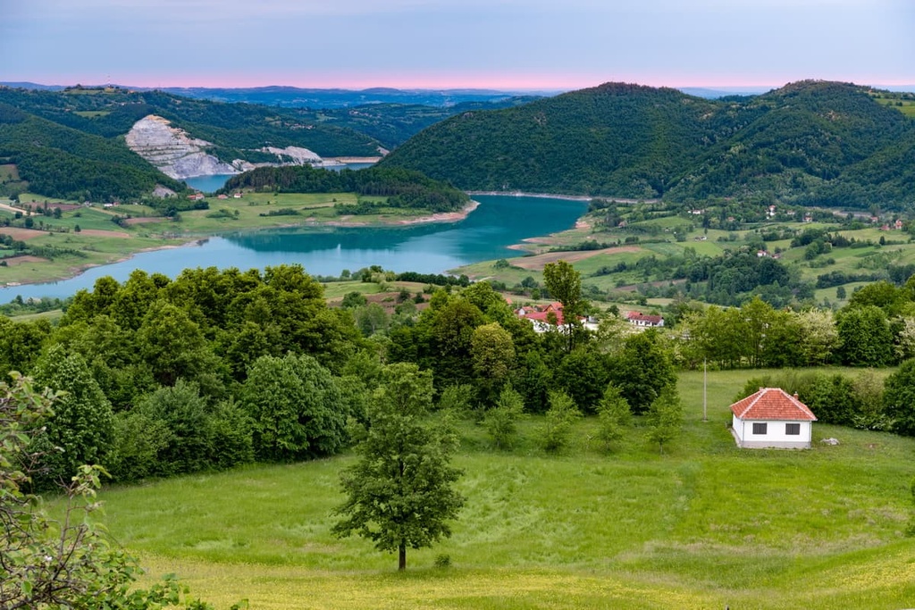
On the southern part of the Blidinje plateau is an artificial lake called Blidinje Lake. The lake is very shallow, and its banks are constantly changing. This is due to the lake accumulating through rainwater and snow thawing. The lake is smaller and more shallow in the summer but during the winter, it tends to get much deeper.
During the nineteenth century, local livestock herders even sealed water passages with clay and branches so the water accumulating in the valley would not sink into sinkholes and crevasses. They succeeded in their task, which is how the shallow lake formed. Its average area is quite small at just 32 sq. m (344 sq. ft), but it is still the largest alpine lake in Bosnia and Herzegovina.
The park also is home to the Grabovica Valley, which features the small creek of Grabovica. The source of the creek is located on the mountain Čvrsnica. This mountain range also has four other lakes (Čvrsničko, Crepulja, Ledeno, and Črljenak).
Geomorphologically, we can divide the Blidinje Nature Park into four ecoregions. These include:
Approximately two-thirds of the park is covered by forest. The rest of the park features grasslands, meadows, and mountainous terrain. An endemic species of tree, the Bosnian pine (Pinus leucodermis) is a type of coniferous tree that you can find on the slopes of the mountains in Blidinje Nature Park.
Bosnian pine is a relatively rare tree that’s only found on the Balkan Peninsula and in parts of southern Italy. Also, there are numerous wildflowers and herbs found in the park. Researchers believe there are around 200 endemic species found in Blidinje Nature Park. Masna Luka is one of the biggest nature reserves in the park and it’s tasked with protecting the region’s native species.
The Čvrsnica massif is also one of the few locations in the region where you can see wild chamois roaming freely. Other species you can see in the park include brown bears, foxes, and deer. The park has a protected bird life sanctuary around Blidinje Lake, too, where you can go bird watching. However, Blidinje Nature Park is a protected nature reserve for wildlife, so hunting is forbidden.
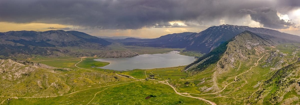
The central valley in the Blidinje Nature Park, Dugo Polje is a flat and peaceful landscape. This grass-covered valley has a low elevation when compared to the two massifs that surround it. Dugo Polje has the driest climate and the lowest temperatures in the park.
Locals grow vegetables, raise livestock in this valley, as they have for centuries. Sharing this living space with humans are multiple endemic fish species in Blidinje Lake and birds like eagles, pheasants, and vultures.
Čabulja is located in the southeastern part of Blidinje. It is a transition zone between green pastures and mountainous terrain. This area is full of hills and it is home to foxes, wolves, and wild boars, among other species.
The final two ecosystems in the park are the massifs of Vran and Čvrsnica. Pastures and forests cover this region, making it a perfect location for deer, brown bears, boars, and chamois. Masna Luka Nature Reserve is a part of Čvrsnica, and it serves as a natural monument that’s home to the highest concentration of Bosnian Pine in the region.
Nature Park Blidinje once was a vast pasture for local cattle herders. Blidinje was heaven on Earth for these farmers because it offers seemingly unlimited grasslands for grazing livestock.
Humans saw the potential of this field thousands of years ago when the first settlements occurred on Dugo Polje and in the surrounding valleys. The first signs of settlement in the park include numerous Illyrian graves and Roman roads. Other artifact finds suggest that ancient settlers mined, smithed, and kept livestock here.
The most popular historic landmark is the medieval necropolis on Dugo Polje, where one can see the local tombstone design called stećak. These stećak monuments are tombstones that were made of cubical rock slabs and decorated in a traditional fashion.
These tombstones still stand in Dugo Polje and other parts of the park. In the necropolis at Dugo Polje, there are approximately 150 stećak tombstones. The location is a national monument of Bosnia and Herzegovina and a UNESCO World Heritage Site.
The inaccessibility of Blidinje has long been known to local settlers, so haiduk groups (outlaws) and road robbers often chose to live on Dugo Polje. A haiduk republic, called The Haiduk Republic of Miat Tomić, still exists on the park’s premises. This is a fictional micro-nation with a president that takes care of the whole park.
A relic of this time is the Mijatova pećina or Mijatova Cave, which is located on the Vran massif. The cave had two entrances by legend, one in Dugo Polje and the other in Rama or across the Vran massif. It is said that local haiduk legend Mijat Tomić lived here during the seventeenth century.
Local legends and myths still live on in the region, and one such legend is the story of Diva Grabovica. A long time ago, a young maiden, the daughter of a shepherd from Grabovica, declined a proposal for marriage from a local nobleman. However, the nobleman loved her and he was so angry that he killed her and justified it by not wanting anyone else to have her hand in marriage.
Even at the start of the twentieth century, the Austro-Hungarian government in Bosnia and Herzegovina had already designated Blidinje as a protected wildlife area. But, throughout the existence of the country of Yugoslavia, the park was not cared for and it fell into a state of disrepair.
Only in the 1980s did local institutions proclaim Masna Luka a natural preserve. Then, they also decided to name Blidinje lake, Hajdučka vrata, and Mijatova cave as natural monuments. On April 30, 1995, local authorities established Blidinje as a nature park.
During the Bosnian War (1992–1995), the park was the site of much fighting. Luckily, the area of the park is free of mines and artillery. However, it is still best to stick to marked trails while traveling in the park.
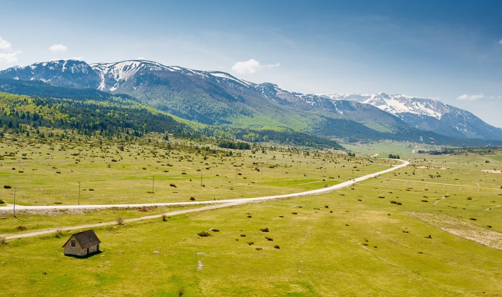
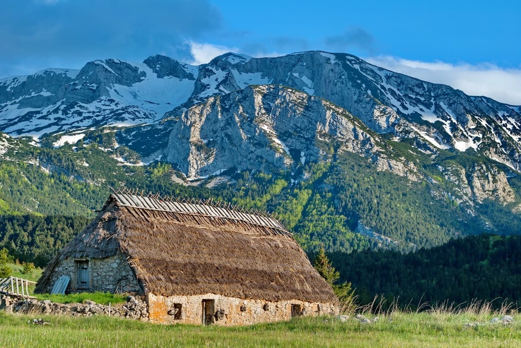
Today, Dugo Polje in Nature Park Blidinje is mostly a rental cottage resort that also features hotels and a ski slope. But life continues to thrive here, and while there are no year-round residents in the region’s villages, there is a Franciscan monastery in Masna Luka.
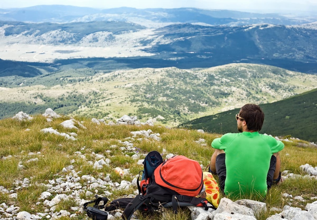
Hiking isn’t the only way to enjoy Blidinje Nature Park. The park also offers mountain biking, horseback riding, paragliding, skiing, birdwatching, fishing, ski mountaineering, and snowshoeing.
However, if you want to enjoy the serenity of a hiking trail, this nature park has so much to offer. You can choose between casual hikes that are suitable for the whole family as well as demanding thru-hiking routes. The park’s hiking trails are marked with red circles that feature a white dot in the middle.
Blidinje is one stop on the Via Dinarica. Thru-hikers get to pass through the valley of Dugo Polje and over the massifs of Vran and Čvrsnica when trekking the entire route.
Hikers can spend the night in the valley or mountain shelters, and they’ll get to enjoy the beautiful landscapes and wildlife in the park. It generally takes hikers between two and three days to hike from one side of the park to the other along the Via Dinarica.
Hajdučka Vrata is a large natural rock arch located in the eastern part of Čvrsnica in the outskirts of the Blidinje Nature Park. The arch was created as a result of differential erosion of the park’s rock layers.
The monument is located at around 2,000 m (6,561 ft) in elevation, making it a perfect place for taking pictures. When hiking up to the monument, one can choose a more casual route from Dugo polje or Vitlenica, or a more demanding route from Diva Grabovica.
Either way, you will see the canyon of Grabovica, the Prenj massif, parts of Čvrsnica, and Čabulja ridge.
The trail to Vran is steep, but the trail itself is well kept and maintained. Most hikers set out to climb Veliki Vran, the highest location on the massif.
The trail starts in a dense pine forest and then moves across grasslands. The peak is broad and prominent, so finding your way up and down will not be a problem.
One can start this trail on Dugo Polje, next to the Hajdučke Vrleti Hotel. You’ll immediately get to make an 800 m (2624 ft) ascent up the first part of the trail.
Your hard work will all pay off once you see the views that you get of the entirety of Blidinje Nature Park alongside Čvrsnica and Prenj. What most hikers love about this viewpoint is that one can see three bodies of water from its top: Blidinje, Rama, and Buško lakes.
Pločno is the highest point in the Blidinje Nature Park and this trail is one of the most popular hikes for visitors. You can start your route from Masna Luka reserve and go from there to the top of the ridge at 1,600 m (5,249 ft). This hike is strenuous and it can take up to 7 hours as it has an elevation gain of about 1,050 m (3,444 ft).
Once on the top of Čvrsnica, you will see a meteorological station on Pločno. Be sure to ask for permission to enter the station. Once there, you will see a fantastic view of Veliki Vilinac, Veliki Vran, Dugo polje, and Prenj.
The second most prominent peak on the Čvrsnica massif is Veliki Vilinac. This peak is accessible from Vitlenica and is only 1 hour away from Hajdučka vrata. Most hikers combine the Hajdučka Vrata Trail with the Veliki Vilinac Trail.
Two mountain huts are available along the hike for taking breaks, too. This is a moderately difficult hike with 800 m (2,624 ft) of ascent. When on the top, you will enjoy a scenic view of Hajdučka vrata, the rest of Čvrsnica, and Čabulja ridge.
The Blidinje Nature Park has numerous accommodation options. On the Dugo Polje, there are two hotels and two mountain cabins, as well as numerous rental cottages open to hikers from around the world.
The roads leading to Blidinje go from Jablanica, Mostar, Tomislavgrad, Posušje, Rama and Široki Brijeg. During the wintertime, there are roads through Doljani in Jablanica, Rakitno in Posušje, and Lipa in Tomislavgrad. One can take a rental car or find a local bus line to reach the center of the park.
If you’re visiting Herzegovina, here are some great cities and towns to visit:
Tomislavgrad is located just around the corner from Nature Park Blidinje. It’s a relatively small city with 33,000 inhabitants. One can reach Blidinje over the village Lipa by private car, cab, or bus. You can also find many hotels and B&Bs in Tomislavgrad.
Note that Tomislavgrad was formerly known as Duvno, which is where the name Duvanjsko polje comes from. In prehistory, Delminuim was the capital of the Illyrian tribe of Delmati. Today, it is a historic town looking over the Duvno field in Tomislavgrad.
Jablanica is another small town located very close to Blidinje Nature Park. You can reach the park from Jablanica through the village of Doljani, by car, taxi, or bus. With an elevation of 202 m (662 ft), it’s quite a climb from Jablanica to Blidinje. Here, you can find a number of hotels, hostels, guest houses, and rental cottages.
When in Jablanica, one surely needs to see Jablanica Lake, Neretva River, and Tito’s Bunker. The bunker is a national top-secret facility in Jablanica that tourists have been allowed to visit since the fall of Yugoslavia.
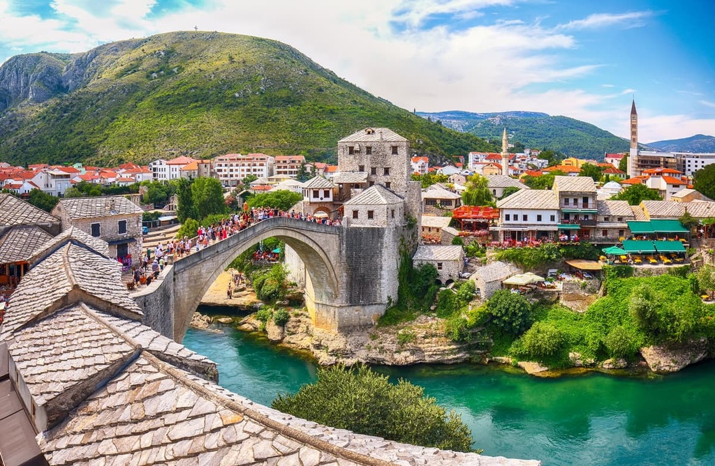
A true gem of Hercegovina is Mostar, which is home to all kinds of accommodations and tourist attractions.
With a population of 101.000 people, it is the fifth-largest city in Bosnia and Herzegovina and the biggest city in the region of Herzegovina. Mostar is a tourist city, and an array of hotels, hostels, camping locations, glamping, B&B, rental houses, and cottages are at your disposal during your visit.
Mostar also has an airport, so one can reach it by plane too. Or, you can take the scenic Herzegovina railroad. The train does not have a direct road line to Blidinje, but one can reach the park by car, cab, or bus through Jablanica. When there, you shouldn’t miss the Mostar Old Bridge, which is a UNESCO World Heritage Site.
If you’re looking for natural wonders, you can visit the beautiful river Neretva, which runs through Mostar. Also, the amazing Buna Canals are a wonder to behold. Near Mostar is another lovely national monument, the Blagaj tekke.