Scan the QR code and open PeakVisor on your phone
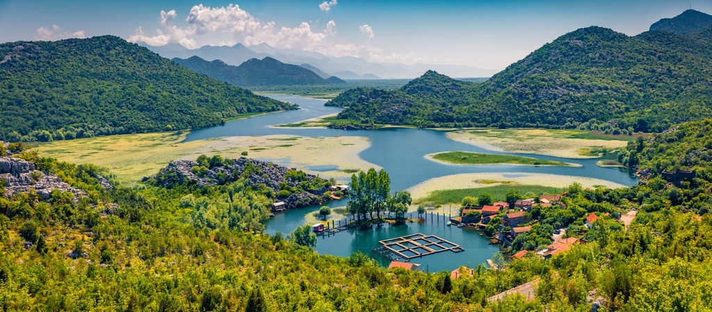
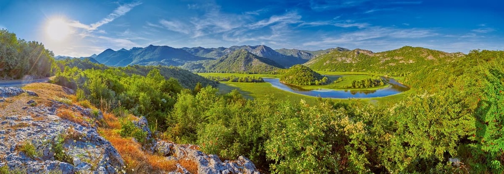
Lake Skadar National Park is a small protected area located in the southeastern part of Montenegro. It features Skadar Lake, a beautiful oasis situated between the mountains and the sea. The lake is primarily located in Montenegro though it also extends into Albania where it is called Shkodra Lake. There are 68 named mountains in the park, the highest of which is Komaraštik (420 m/1,377 ft) and the most prominent of which is Vranjina (303 m/ 994 ft).
Lake Skadar National Park is located in the Skadar Valley of southeastern Montenegro, approximately 7 km (4.2 mi) away from the Adriatic Sea.
Approximately two-thirds of the park’s namesake lake, Lake Skadar, is located in Montenegro, and one-third of it is in Albania. It is one of the few national parks in Montenegro, and it includes most of Lake Skadar, which is on the Ramsar list of wetlands of international importance. Locals initially created the park to protect the biodiversity of this region and all its natural wonders.
The lake got its name from the city of Shkodër in northern Albania, which lies on its banks. The park has been known by different names over history. For example, it was called Lake Shkodër during the Ottoman Empire and Lake Scutari during the time of Venetian rule in Albania.
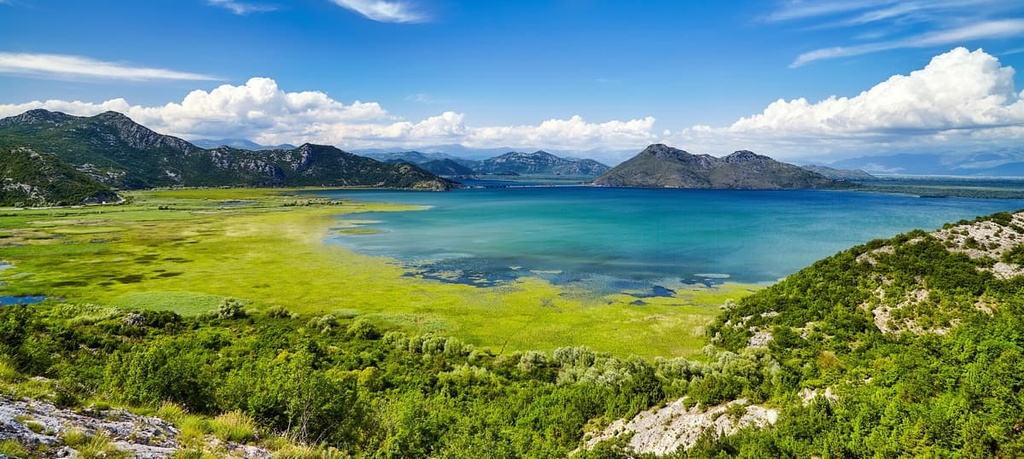
Lake Skadar is a freshwater lake in the heart of the Balkans. It lies on the border between Montenegro and Albania. It is the biggest lake on the Balkan Peninsula. Lake Skadar has a surface area of 530 sq. km (329 sq. mi), a maximum length of 44 km (27 mi), and a maximum width of 14 km (8.6 mi). It is one of the deepest lakes in Europe, with a maximum depth of 8 m (26 ft).
The national park, just like its namesake lake, lies in southeastern Montenegro, on the border with Albania. The park covers an area of 40,000 ha (98,842 acres), making it one of the biggest national parks in Montenegro. Unlike most national parks in the area, this one is home primarily to marshlands and lakes, not mountains. The park was proclaimed a protected zone in 1983.
The lake is surrounded by karst topography and is very close to the Adriatic Sea. It extends from the northwest to the southeast. Regionally, this is also called the Dinaric orientation, since the Dinaric Alps and its hinterlands are oriented in the same way.
There are also two small islands in the park: Beška and Grmožur. Both islands are fortified and each of them is home to a church or monastery.
Into the lake flow two rivers: the Drin and the Morača. The Drin River connects Skadar with Ohrid Lake on the other side of Montenegro. Meanwhile, the Morača River provides around 60 percent of the lake’s water inflow, making it the most important water source for the national park.
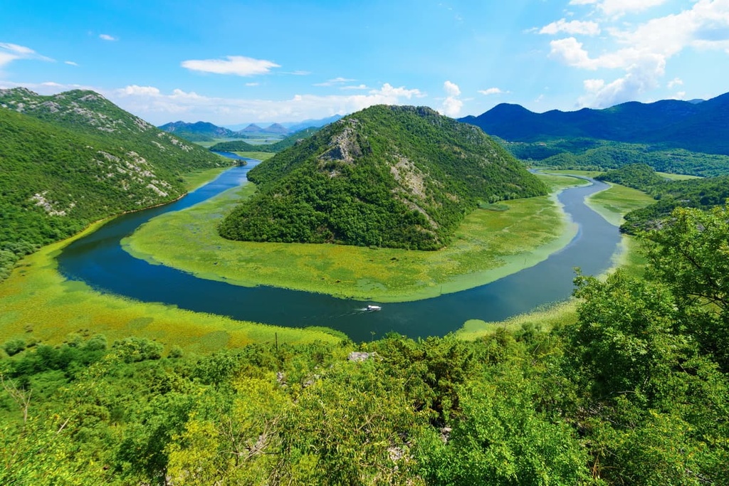
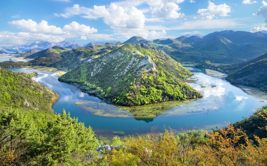
The Bojana River connects Skadar Lake with the Adriatic Sea. In fact, this river forms a natural border between Albania and Montenegro. It is 41 km (25 mi) long and it meanders so much that it creates beautiful horseshoe-shaped bends that all visitors can enjoy.
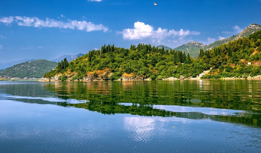
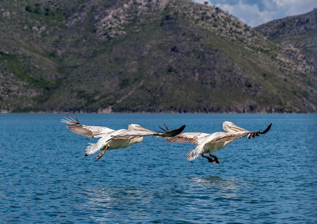
The park features a variety of landscapes, habitats, flora, and fauna. The flora consists mainly of trees such as oaks, maples, and pines, while the fauna includes birds like herons and pelicans and mammals such as wild boars and deer. The shores of the lake are mostly rocky, barren, and steep.
When visiting, we recommend seeing these sites:
Lake Skadar is the largest lake on the Balkan Peninsula, and it formed as a result of the region’s karst topography. Therefore, we can say this is a karst lake. It has a surface area of 530 sq. km (329 sq. mi) at its highest water levels. The smallest surface area ever recorded at the lake was 370 sq. km (229 sq. mi).
Lake Skadar is an ancient lake that has been important to humans since time immemorial. However, it is still quite young, geologically speaking as the lake itself formed during the Neogene and Paleogene periods.
The lake started forming alongside the karst topography of what is now Montenegro in the Cenozoic era. In fact, its basin is of tectonic origin and started developing together with the Dinaric Alps. Specifically, this section of Montenegro formed together with the Prokletije mountains.
Once, this area was covered by a sea in the Pliocene Era. The saltwater reached much further north than it does today, and this is when it wiped out almost all the freshwater in the Lake Skadar National Park area. Only later in the Pliocene did Skadar Lake become a separate body of water from the Adriatic Sea.
Today, the lake is located at a higher elevation than the Adriatic Saa, but the difference in elevation is only 9 m (29 ft). The water in the lake has come from the water flowing through the region’s karst landscapes, making it a haven of life in what is sometimes an inhospitable environment.
Just like the rest of the area surrounding it, the region of Lake Skadar National Park mostly consists of rocks like limestone and dolomite. This means that the area surrounding the lake and its basin are all of the same karstic origins and are continuously undergoing karstification.
Karst formations are the result of the dissolution of rocks such as limestone and dolomite in water. As rainwater falls on the limestone and dissolves it, it creates a network of streams, rivers, and underground caves. In this case, these water sources form a lake.
This terrain has been shaped by the action of water over a long period of time. The process starts with rainwater seeping through small cracks in the rock surface to form underground streams. This erosion process is called karstification.
These streams then carry away dissolved minerals to lower areas where they can accumulate as lakes or other bodies of water. This is how karstification helped form Skadar Lake and ultimately Lake Skadar National Park.
While the park doesn’t have any notable massifs located inside of it, there are still some peaks to be found in the park. The highest peaks of Lake Skadar National Park include:
Lake Skadar is a biodiverse lake that’s home to a collection of interesting ecosystems. It's situated on the border of Montenegro and Albania, and the park is famous for having saved numerous local plant and animal species from extinction. The park’s namesake, Lake Skadar, is one of the largest lakes in Southern Europe.
Lake Skadar is classified as an ecoregion under the European Union’s Natura 2000 program as well as a proclaimed Ramsar wetland site. It was also designated as part of a national park in Albania in 2008 and in Montenegro in 1983.
Lake Skadar's climate is influenced by different factors such as elevation, latitude, and proximity to the sea. The climate of Lake Skadar has a Mediterranean influence, with mild summers and cold winters. Since the lake is located close to the Adriatic Sea, the summers tend to be quite hot. That said, in winter, one can expect heavy rainfall and the occasional snowfall.
Lake Skadar National Park is home to five types of ecosystems, including

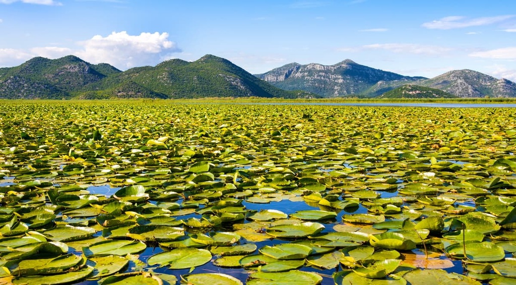
Wetland vegetation occupies a large area of the park along the lake’s northern coast and bays. These ecosystems consist of communities of floating, yellow, and white water lilies, cassowaries, and emergent aquatic plants, such as reeds, rushes, sedges, beetles, and more.
On the northern coast of the lake, in the floodplain forests, one can find different types of willow trees. Willow trees grow in dense forests with deep roots. The Morača River has a lot of lush green forests on its banks that provide excellent shade for the summer months.
Currently, the lake and park are home to a huge number of amphibians, including Skadar green frogs, which is a wide zone of aquatic vegetation and floodplain meadows. This environment usually features streams and forest areas, too, which only adds to the overall diversity.
Algae can only grow if the right conditions are in place, including the right amount of light, oxygen, and food. As a result, there are various types of algae in the park, including different ones in terrestrial and aquatic environments.
There are 48 known species of fish at Skadar Lake. The most populous species is bleak, followed by carp and crucian carp. Additionally, there are squid, bream, chub, and eel in the lake.
Skadar Lake also provides a home for 280 different bird species, which is why it is such an essential part of the local ecosystems. Thanks to Skadar Lake, which is surrounded by wetlands that support a wide variety of birds, the park is home to one of Europe's most well-preserved ecosystems. The most important birds found at the lake are Dalmatian pelicans, woodpeckers, swans, and crows.
Skadar Lake is also home to a number of endangered and near-threatened species, like the Dalmatian pelican. It's a bird that is found only in Montenegro, Greece, and Albania.
Out of the 50 types of mammals known to live in Skadar Lake, four are aquatic animals, and the other 46 are terrestrial. Some of the mammal inhabitants of the area around the lake include moles, otters, squirrels, water voles, wolves, foxes, wild boars, and skunks.
There are also many different species of reptiles that live around Skadar Lake, such as various types of lizards, snakes, and turtles. Various types of colorful salamanders also live in the area.
According to many archaeologists, the seat of the great Illyrian state was most likely in the area of Skadar Lake between the fourth and the second centuries BCE. The Illyrians were among the first recorded people to settle widely around the area that is now Skadar Lake.
At the time, the lake was likely called Lakus Labeatis, which derives from the name of the Labeatae, who were the Illyirna people that lived in the area. The Labeate tribe built city walls and harbors, developed metal and ceramic industries, and worked with stone in carving statues and building temples.
However, the Roman Empire eventually defeated the Illyrians. Although the Romans ruled the Illyrians in the middle of the second century BCE, they built settlements and quality infrastructure that's still around to this day. In the sixth century, the Slavs started to inhabit the Balkan Peninsula, and they've been living there up until today.
Skadar Lake was later the center of a medieval state ruled by Vojislav of Duklja. Vojislav fought wars from the ninth century to the twelfth century CE and had capitals in Duklja, Krajina, Papratna, Skadar, and Žabljak.
With the rise of the Nemanjić dynasty of Serbia from the twelfth to the fourteenth century, Catholicism began to give way to Eastern Orthodoxy in the area. With the new Balšić dynasty appearing around 1360 and taking control of Zeta as an independent region, this marked a major change in Serbian history. Zeta was located on the lands that would eventually become Montenegro.
The Kingdom of Montenegro was established in the fourteenth century in the area of Gornja Zeta, after one of the Crnojević lords defeated and killed others to take power. Montenegro was a part of the Kingdom of Serbia until 1396. It was soon annexed by Ahmed-beg. Then, it became part of the Ottoman Empire and remained under Turkish rule until 1878, when Montenegro became independent.
The history of Montenegro is a long and turbulent one, from Serbian invasions through Ottoman ones, but the locals still stood tall. Initially called "The State of Zeta," what is now Montenegro was, at different times, part of Serbia; the Kingdom of Serbs, Croats, and Slovenes; and eventually the Kingdom of Yugoslavia until 1918 when it declared its independence.
During the modern period, Skadar Lake has often been used as an official demarcation zone, as was seen in the Congress of Berlin in 1878. At the time, Montenegro claimed half of the lake, while the Ottomans claimed the other half. After conquering Shkodra, Montenegrins united their land into a single country and then conquered the entirety of Albania.
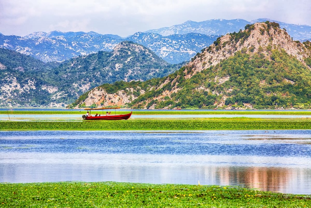
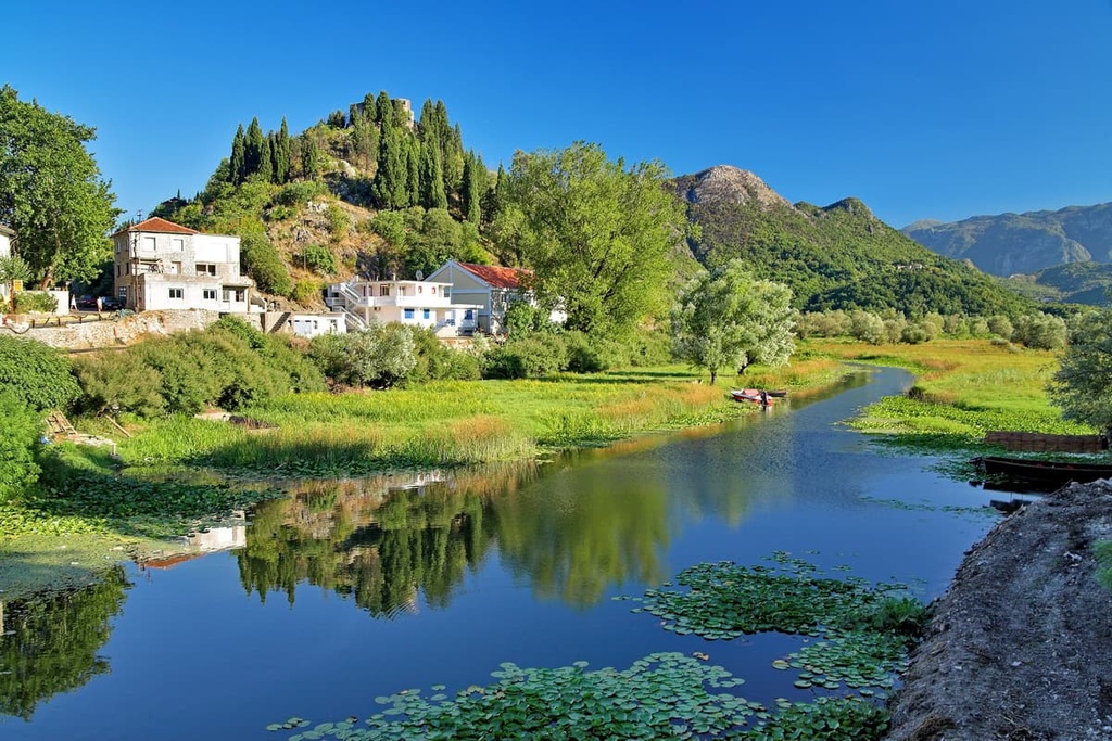
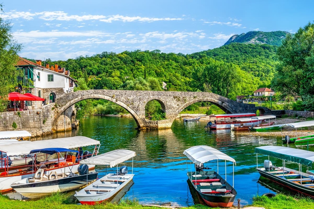
Although it changed hands many times over the centuries, local life never stopped on the lake. Many of the boats that you see on the lake are made by local craftsmen using materials like wood from the region's chestnut, mulberry, and oak trees. These boats were originally designed to transport goods and people. Fishing villages on the outskirts of Jezera sit right along the lake's shores and provide excellent views of the water.
Houses that were used to store fishing gear or salt the day’s catch are still in existence and have been restored to their original state. Mills, bridges, and pathways lie along the lake, too, and many individual examples of traditional architecture dating back more than a hundred years can be seen in the region to this day.
You can also see a number of unique pieces of architecture in the area that were built by the Crnojević family during the second half of the fifteenth century, including at the fortified towns of Žabljak Crnojevića, Kom Monastery, and Obod.
Given the region’s geographical and historical connections, it is also worth mentioning the three Crmnica monasteries located on the lake’s islands and in the surrounding region Orahovo, Donji Brceli, and Gornji Brceli. These monasteries all began between the fifteenth and eighteenth centuries.
Lake Skadar National Park was established in Montenegro in 1983 when this part of the world was still considered Yugoslavia. The Albanian part of the lake was proclaimed a nature reserve around the same time. Soon afterward, in 1996, the lake and park were all added to the Ramsar list of wetlands of international importance.
Skadar Lake is a beautiful place for a hike. The park contains nine hiking trails and two interpretive trails that you can choose from, along with five bike trails and two mountain biking trails. All the routes in the park are well-marked, too.
Around the lake, you can find a number of hidden beaches and swimming holes, which are an integral part of the fun in the summer months. During the summer, you can also take a ride on traditional wooden boats or go fishing at the lake.
And for birdwatching enthusiasts, Skadar Lake offers a variety of birding activities. Winter and autumn are generally considered optimal bird-watching times in the area because that's when visitors are most likely to spot migratory birds that are huge in numbers.
With that in mind, here are some of the main attractions and hiking areas in Lake Skadar National Park.
Kom Monastery is a Serbian Orthodox monastery in Montenegro. It is located on the biggest half-island on Skadar Lake, which gives it great views of the surrounding area.
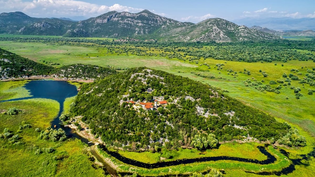
Monks have been living at the monastery since the fifteenth century and they still live their traditional way of life. They also offer hospitality to visitors and tourists who come to the monastery by bus or car.
The monastery is located close to Žabljak Crnojevića, where the Crnojević River flows into the western section of Lake Skadar. This is the starting location for a nice 3 km (1.8 mi) hike that visitors can enjoy during their trip to the monastery, too.
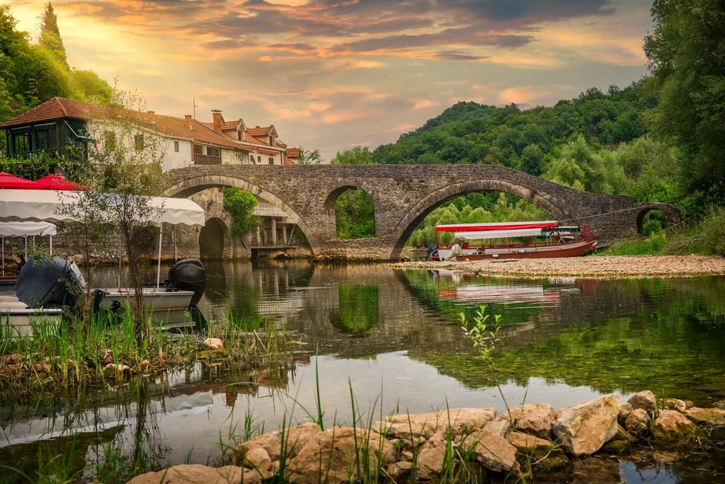
Rijeka Crnojevica is located near the most beautiful part of Lake Skadar, and it offers an unbeatable outdoor experience in central Montenegro. It is a popular tourist destination due to its natural beauty and cultural heritage.
You can reach this beautiful old town by walking along an old caravan trading route from Komarno to Rijeka Crnojevića. The trail is straightforward and well-marked, so most people can make the journey in less than 2 hours.
Pavlova Strana is a scenic viewpoint that overlooks one of the river bends above Skadar Lake. It is located near Gazivoda, to the northeast of Šanik.
A lot of tourists visit this viewpoint to bask in the scenic beauty of the lake. When visiting the viewpoint, you can also enjoy the scenery of Rijeka Crnojevica, which is located nearby.
Lake Skadar is located on the main roads that connect Podgorica and Bar in Montenegro. You can get there either by road or train. Most journeys to the lake pass through Jezera and take you to Virpazar, where you’ll find the park entrance.
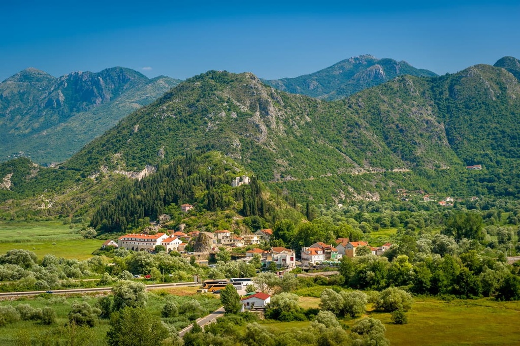
The small city of Virpazar is located in between the two main roads that lead from the capital Podgorica to the park, and, as such, it is reachable by road or rail. One of these roads goes to Bar while the other goes to Podgorica. The town was established in 1878, and it is located approximately 30 km (18 mi) away from the port of Bar.
Visitors to Virpazar will enjoy scenic views of the lake. For your stay in the town, you can book a camping spot or get a room in one of the many hotels in the area.
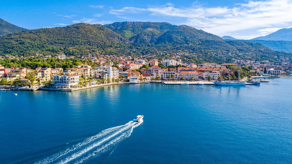
Tivat is a small town in Montenegro that features everything from beaches and forests to a gorgeous coastline. The region has also been home to some important historical artifacts as it was one of the first cities in the area to be established by the Romans.
You can reach Tivat by air, rail, road, and water. Once here, you can book a stay in a luxurious hotel or at a campground. Since Tivat is a popular tourist destination, you can enjoy good dining at one of the town’s many restaurants.
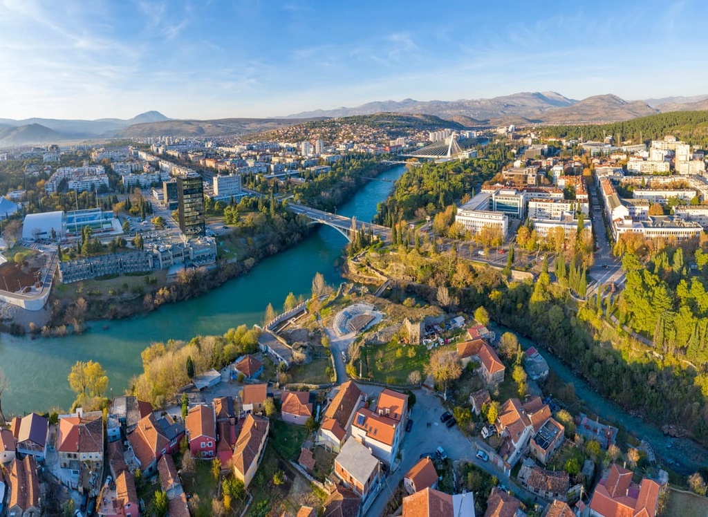
Podgorica is the capital of Montenegro and its largest city. It is also the administrative center of Montenegro. Podgorica is an old city that dates back to the seventh century. Podgorica became part of Serbia in 1346 before becoming a part of the Ottoman Empire.
Today, Podgorica is a modern city worth visiting since it is home to numerous galleries, restaurants, monuments, parks, and museums. Also, the city offers its visitors all kinds of accommodation options, and it is reachable by air, rail, and road.