Scan the QR code and open PeakVisor on your phone
If you are looking for breathtaking waterways near the sea, filled with meandering waterfalls, lavender fields, and green forests, then National Park Krka is the best choice. It lies in the Central Dalmatia region of Croatia, near the city of Šibenik and on the Krka River. There are 10 named mountains in Krka National Park. Kosa (244 m/ 800 ft) is the highest point, and the most prominent mountain is Veliki Debeljak (238 m/ 780 ft).
Krka National Park is a beautiful part of the Krka River's lower course. It stretches for 109 sq. km over 4 municipalities in Croatia in the Šibenik-Knin County.
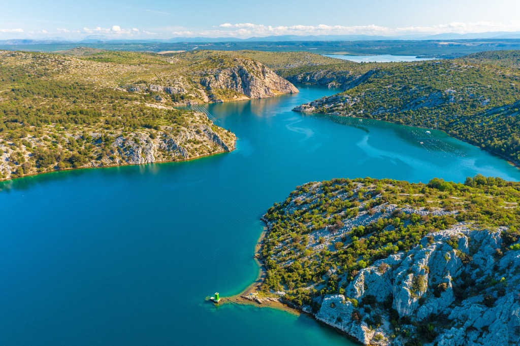
It's located in the middle of Croatia, between Knin and Šibenik, in the center of Dalmatia, and near the border with Bosnia and Herzegovina. The park lies on the Krka River, which flows through a 75 km (46 mi) long canyon before flowing into Prokljansko Lake.
The water eventually enters Šibenik Bay, where it forms an estuary. Krka River covers 25.6 sq. km (15 sq. mi) which is included in the 109 sq. km (67 sq. mi) of the national park’s surface.
All of Krka National Park is found within the territory of Šibenik-Knin County and occupies roughly the area between the downriver from Knin to Skradin. In fact, the park lies 2 km (1.2 mi) downstream from Knin and features forests, natural monuments, and waterfalls.
Krka National Park has very little if any, development and remains largely untouched. It is a great place for those wanting to rediscover the natural environment of Croatia.
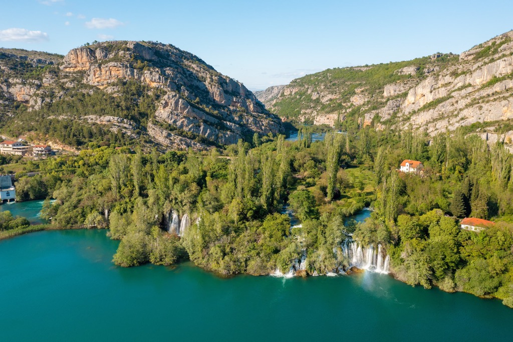
The Krka River springs just below the mountain Dinara and near Knin. The park and Krka River have 7 travertine waterfalls, which form a natural karst phenomenon due to its many underground springs, together with their channels that converge into it. The Čikola River and its canals also cross into the park's territory.
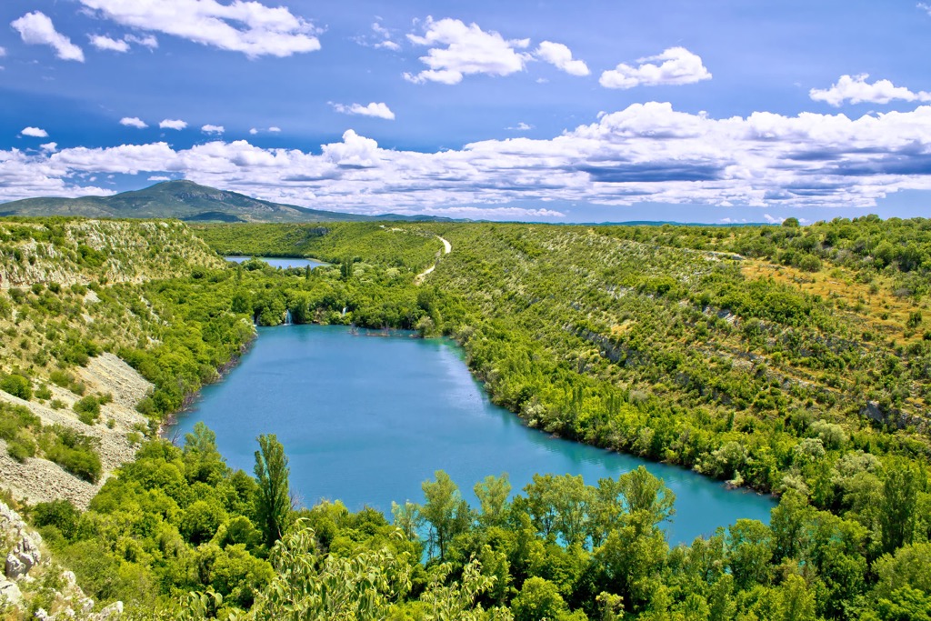
The Krka estuary is particularly attractive as it is a submerged river mouth. Brackish water forms here since the river's freshwater gets mixed with salty sea water in this small body of water. The estuary is quite long, too, about 23.5 km (14.6 mi) in length. It's interesting how the estuary water reaches all the way to Skradinski Lake inside the park.
This park works to protect crucial ecosystems here that make up one of the last true wildernesses in Croatia and is of the utmost importance for wildlife survival. Krka National Park is a natural jewel worth exploring.
When visiting, you pass through many different habitats and see viewpoints on your way to the beautiful waterfalls. You can see the famous iris flower all around and see other splendid plant species like lavender, lilies, and wild violets as well.
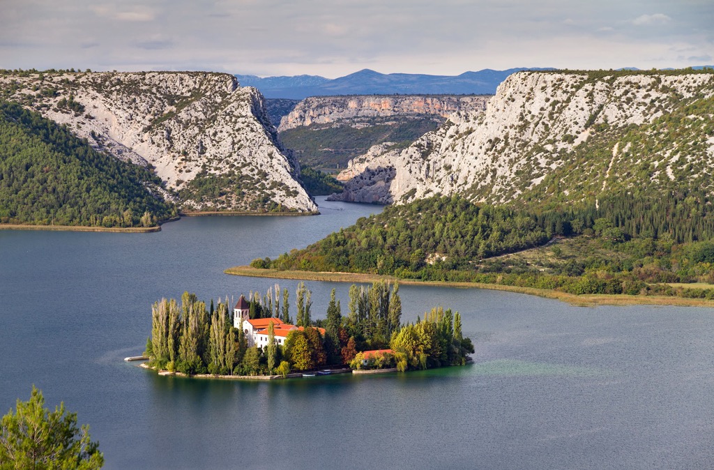
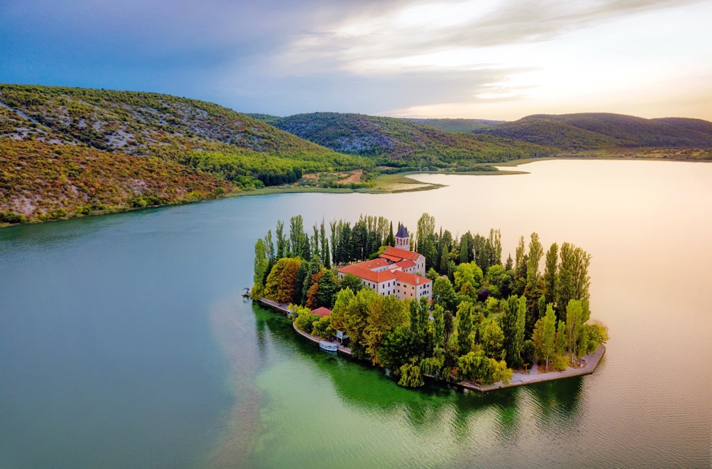
One could recommend stopping at Visovac before continuing down the scenic path. Visovac is a small island inside Visovačko Lake, one of Krka’s stillwaters. It is known as the Mother of God or Visovac Monastery.
The Franciscans have handled the island for centuries and also maintain a large museum with many cultural artifacts inside, together with a collection of 80 plants on the island. The Franciscans founded this island town during the reign of Louis I of Hungary in 1445.
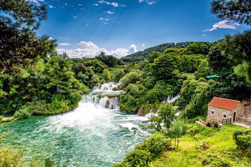
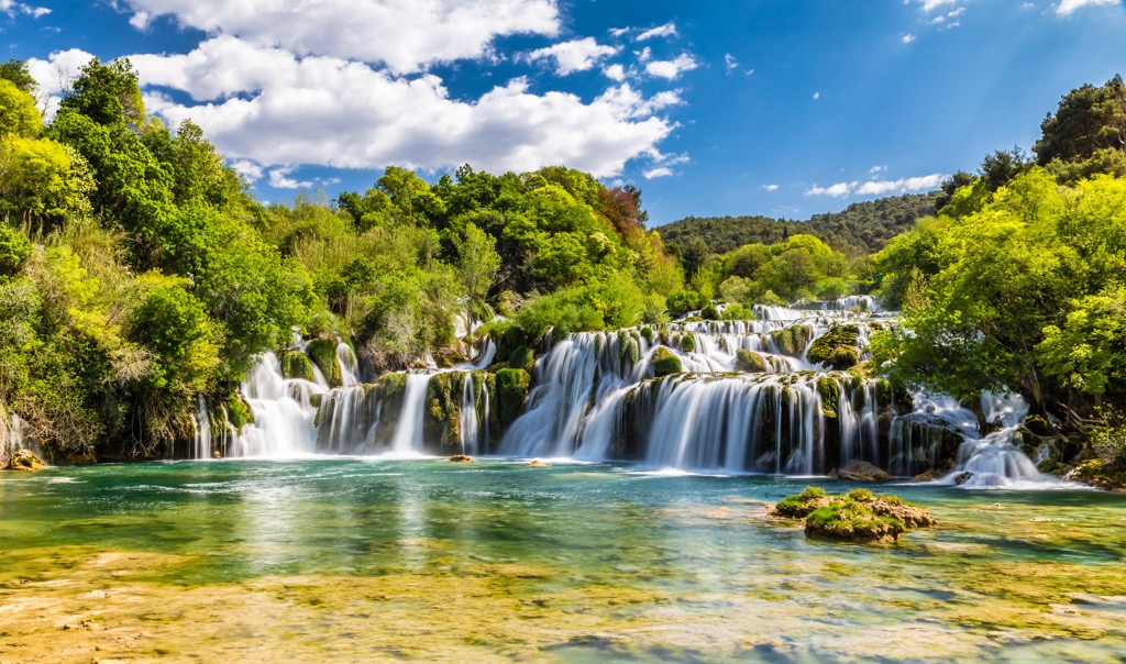
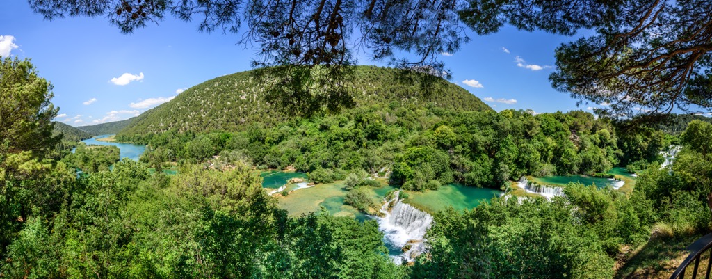
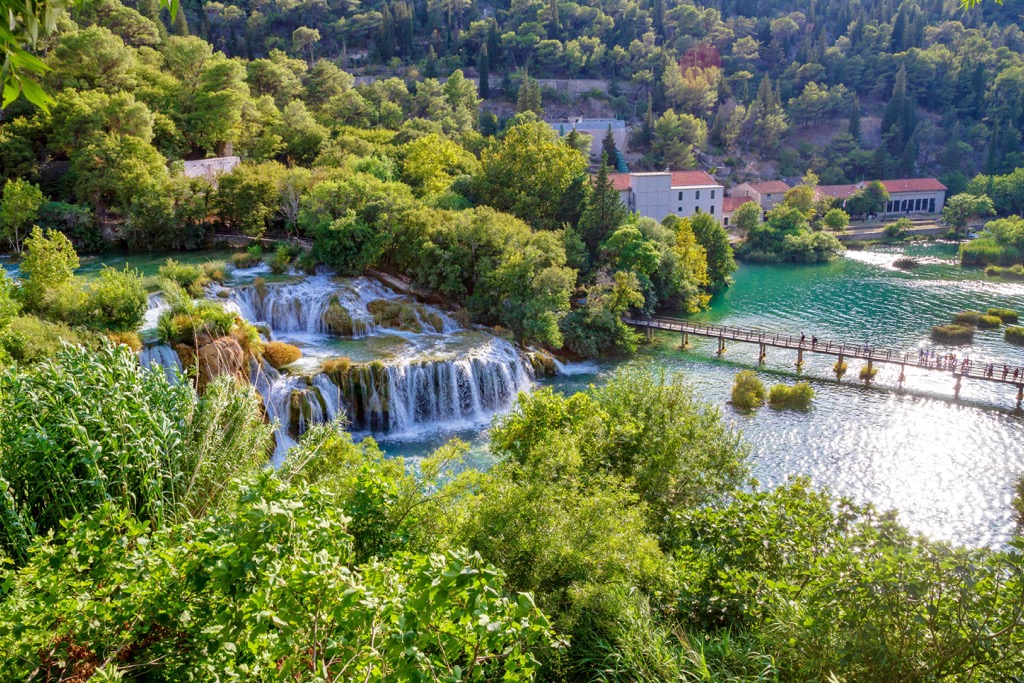
Krka National Park is many people’s favorite destination, and the most visited area here include the Skradinski Buk waterfall and Roški Slap waterfalls. The waterfalls here are easily accessible and great for all tourists, whether they love nature or are interested in the culture and hospitality offered here.
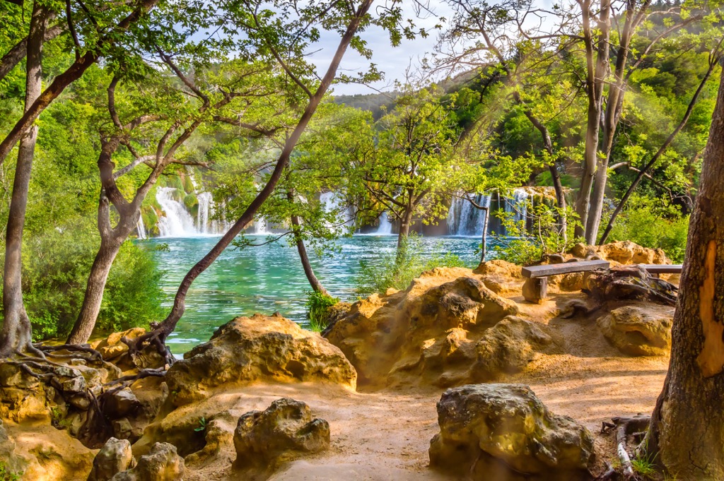
The Roški Slap waterfall is located near Miljevci, and it has a walking trail taking you there. Skradinski Buk is the most well-known and popular tourist destination here, for sure. It's a massive, clear, natural pool with high waterfalls at one end and cascades at the other.
Seventeen waterfalls range in height, with a length of 800 m (2,624 ft) in total and a height difference of 50 m (164 ft) between the highest waterfall and the lowest fall. Skradinski Buk is the rolling landscape that stretches out in front of you, with a beauty you have never seen before.
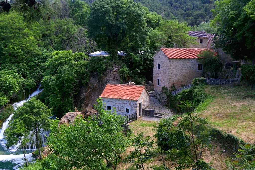
Here, the past is still alive since you can see the ethnographic collection and dozens of old watermills, which are all still operating. There are so many unique places to explore while in Krka National Park.
The Dinaric Alps have a northwest to southeast orientation, which has often been called the Dinaric orientation. This is the orientation in which Krka National Park's mountains have formed. The Krka River, on the other hand, flows to the southwest.
These mountains, which belong to the Dinaric Alps, were created some 20 to 30 million years ago. They were formed during a process where the Adriatic microplate was subducted under the Eurasian plate. This is when the rocks in which the Krka River cuts its bed formed. These are sedimentary and carbonate rocks from the Jurassic, Cretaceous, and Tertiary ages.
After looking at the relief around the Krka River, you'll notice that it's very dramatic. There are a lot of higher elevations in the north and southeast, along with various plateaus near the river. To the north lies Velebit, also surrounding it are Dinara and Ujlica and the canyons of both Krka and Čikola Rivers.
This is why one can distinguish three parts in the morphological sense in the Krka River basin. The mountainous region is in its northeastern part, and finally, it turns into a prairie to its south, but the river widens and forms a plain in the central part. The source of the Krka begins at the foot of Dinara, goes through Topoljski Buk waterfalls, and creates a barrier along the tributary of Krčić River.
Two types of type of rock formation or geomorphological forms are visible in the park. One type of rock is called tufa, and its formation results from calcium carbonate being deposited on different surfaces by water.
The oldest tufa in Krka River, also known as paleotufa, originates from the Pleistocene. Active barriers formed about 8,000 - 8,500 years ago, but the paleofluvial deposit is estimated to be over 20,000 years old, formed during the Riss-Würm interglacial.
Another geomorphological formation here is karst. Karst is basically a formation that develops on a rock that is soluble, and it has special morphological, hydrological, and hydrogeological properties. The creation process processes are called karstification.
The Dinaric karst is a huge limestone formation in the Dinaric Alps in southeastern Europe. It includes the border between Croatia and Bosnia and Herzegovina, where Krka National Park lies.
The Krka River has an orographic river basin in Dalmatia and is a large karst river, cutting its 75 km (46 mi) long way to the Adriatic Sea. While there are no mountains in the park, it is still a hilly landscape full of rocks. Here are the highest peaks in the park:
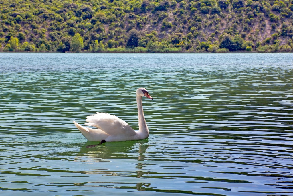
Krka National Park boasts a highly diverse mix of flora and fauna of its location and the mixture of habitats. Thanks to the Krka River basin, each area of this park has endless and beautiful natural landscapes.
Every habitat, therefore, has differing plant species, which create a variety of landscapes and provide a natural flow of wildlife throughout the region. Due to this, the Krka River basin has 1,197 different plant species.
The river is also home to 18 fish species, ten of which are endemic. Among those ten, the brown trout and Dalmatian barbelgudgeon can be found here.
The nesting sites for over 222 different species of birds make the region more diverse. The entire park is deemed one of the "Ornithologically most valuable areas in Europe." You'll find numerous birds of prey, including osprey, golden eagle, and the peregrine falcon.
Though the boundaries of the park are too low in elevation for these species, occasional chamois and roe deer sightings can sometimes happen in the vicinity. Other mammals present include otters and bats.
Krka National Park has five different types of habitats, which include:
There are a lot of important archeological sites near the Krka River and inside Krka National Park. This river basin is filled with natural settings that allowed humans to settle and live in the area long before today.
Remains of the oldest traces of human settlement in this area can be found in inaccessible cave sites, such as Jaznika and Ozidana caves, inhabited from as early as the Neolithic. Hillfort settlements were common during prehistory, especially during the Late Bronze Age and the Iron Age. This was when the local Illyrian tribes tried to unsuccessfully defend their land against the Romans.
The Roman settlers lived in the city of Burnum, a Roman military camp in what is today Krka National Park. Its remains were located on the right bank of the Krka River and can be found near Ivoševci today. Archaeologists also found the remnants of an amphitheater and a campus here. It was part of the Roman province Dalmatia.
Later, locals built fortifications above Krka to protect their trading routes in the middle ages. The fortresses included Trošenj, Ključica, Uzdah-kula, and Kamičak.
The two most important spiritual centers in the park are Visovac and Krka monastery. The spiritual center of the Orthodox faith in Dalmatia, the Krka monastery of the Holy Archangel, lies in Carigradska Draga, on the right bank of the Krka River.
The Island of Visovac is inhabited by Franciscans who built the Mother of Mercy Monastery on it in 1576. People have always used the Krka River’s power for their mills. This is why we still have numerous working watermills visible in the park.
In the early 1900s, the Krka River became useful for industrial-scale adoption. The local government constructed a series of 4 hydroelectric power plants here from 1895 to 1911. These included HPP Krka in 1895, HPP Jaruga in 1904, HPP Miljacka in 1907, and HPP Roški slap in 1911. HPP Krka is an industrial plant from the early 1900s, which is listed as a cultural asset of Croatia.
The Krka River was already recognized as a natural treasure by locals in the mid-twentieth century, which was why they included it in Croatia's national park system. In 1971, they passed a law designating it as a national park and drafted a more comprehensive plan for its protection.
In January of 1985, the Yugoslavian government declared that this area would be set aside from the Trošenju and Nečven territories and Šibenik. This territory included 3.5 km (2 mi) along the Čikola River, together with the territory around Nečven. This area was therefore protected as Krka National Park. Today, it consists of 109 sq. km (67 sq. mi) of land and welcomes numerous tourists.
While Krka National Park might not be the most mountainous terrain, there are still numerous hikes to try out here.
Skradinski Buk is the longest, best-known, and most visited waterfall in Krka. The famous travertine barriers, islands, and lakes are breathtaking. You can see the falls thanks to an extensive network of trails and bridges that traverse this area.
This trail takes 2 km (1.2 mi) in one way, and you will surely enjoy the fantastic views, even though you will cover 200 steps and an elevation difference of 50 m (164 ft). If you’re looking for an alternative route, reach the waterfall via Skradin bridge, 3.5 km (2 mi) away.
It's hard not to stop and take in the beauty of the Krka River. On its banks are scattered a row of travertine cascades that locals call Necklaces. This path leads you by a ball bridge over the Necklaces.
The hike takes off from the Roški Slap panorama, rises above it, and reaches the Kristijan watermill, together with the Roški Slap itself. It’s a great afternoon option, or in combination with another trail, since this tour only takes 3 km (1.8 mi) in both ways.
The longest trail in the National Park Krka is this one. You will see: Visovac, Šuplja Peć Cave, Kamićak Fortress, Roški Slap Waterfall, Ozidana Pećina Cave, and finally, reach Bogatić village. From here, you can take the same trail back or follow the road to Visovac.
This trail is 8.5 km (5 mi) long, and it offers hikers amazing views of the Krka River, its waterfalls, and other surroundings. Perfect for getting to know the national park!
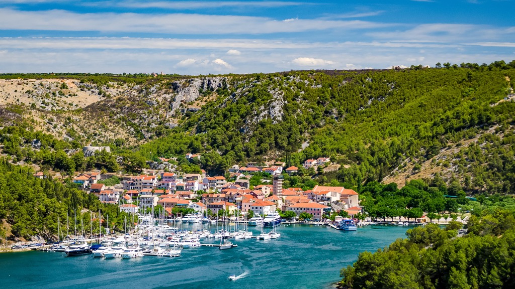
Here are the most beautiful seaside cities of Croatia you need to visit when in Krka National Park.
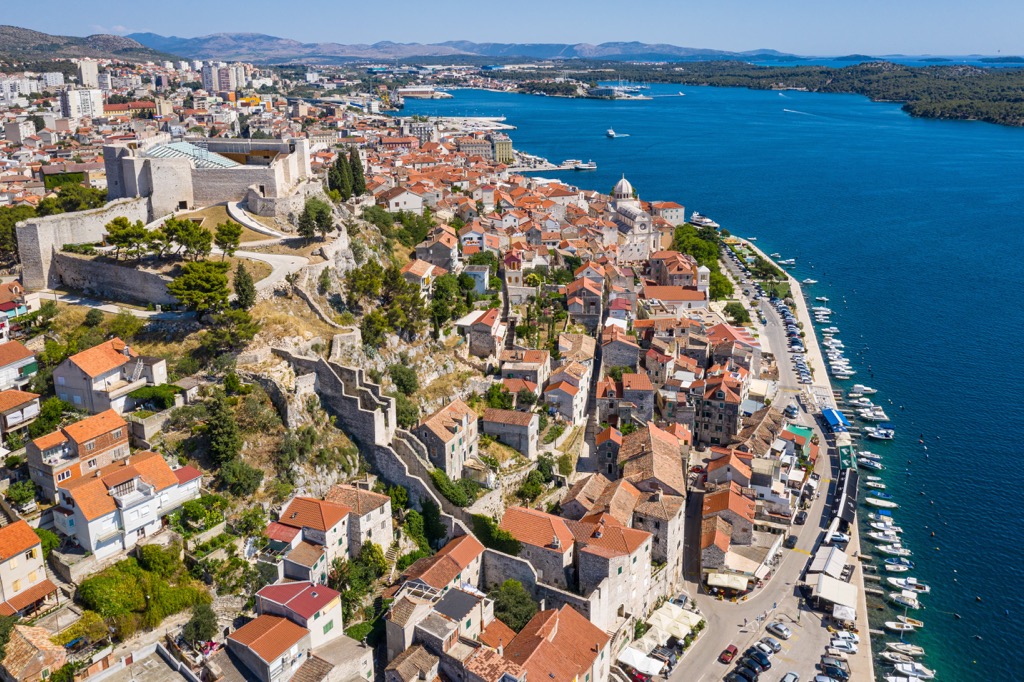
Šibenik has a population of about 34,000 people. It is a beautiful city with many attractions to offer. It has an old town with cobblestone streets, medieval architecture, and beaches and islands nearby.
Šibenik is also known for its rich cultural heritage, which includes the famous Cathedral of St. James from the fifteenth century. Krka’s estuary lies in Šibenik. You can reach Šibenik by air, sea, rail, and road, and stay here in all kinds of accommodations since it is a touristy city.
Zadar lies to the north of Krka National Park. It has been inhabited since prehistory, with evidence of human settlement dating back to the Stone Age. It is known for its walkway along the Adriatic Sea in the center of the town.
Zadar’s main attraction is its beautiful beaches which are a great place to relax or enjoy some water sports such as windsurfing or sailing. This city has all kinds of accommodation options, and you can reach it via air, rail, sea, and road.

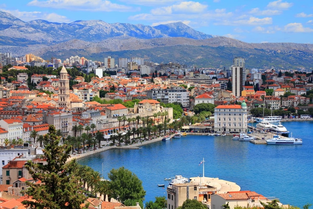
Split is a city located on the Dalmatian coast. It is one of the region's most popular tourist destinations and has a rich history. Greek colonists founded the split, but Roman Emperor Dioclesian made it famous by building his palace here. It is known as the Dioclesian’s Palace, the most important monument of Split.
Split is known as a trading center because boats from Italy and across the Mediterranean sail here, meaning that you can reach it by air, road, rail, and sea.