
Scan the QR code and open PeakVisor on your phone
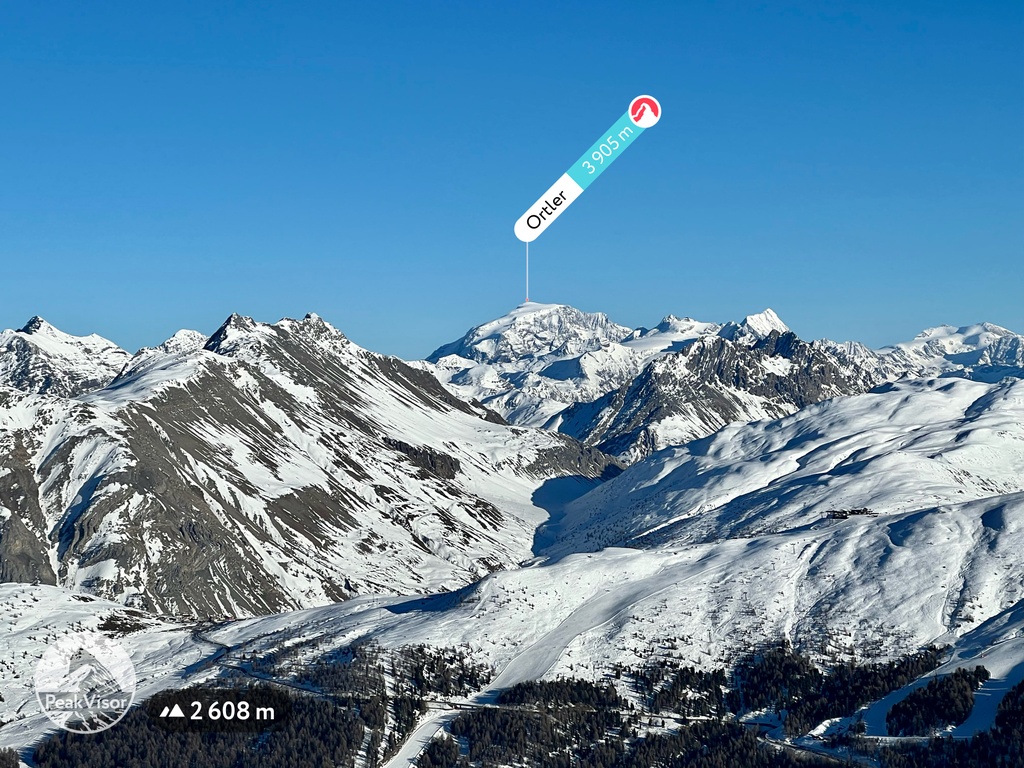
South Tyrol is home to 2,220 named mountains. The highest is Ortler at 3,905 m.
The province of Bolzano, which is also commonly known as South Tyrol, is one of the two administrative divisions of the Trentino-South Tyrol region in northern Italy. The main feature of the province are the Dolomites. However, the highest and the most prominent mountain, Ortler / Ortles (3,905 m / 12,812 ft), is located in the Southern Rhaetian Alps. In total, there are six large mountain ranges and 2220 named peaks in South Tyrol.
The name of the province of Bolzano or South Tyrol (Sud Tigolo in Italian, Südtirol in German and Ladin) comes from the fact that it belongs to a large geographical and cultural region Tyrol in Austria, which it borders to the north.
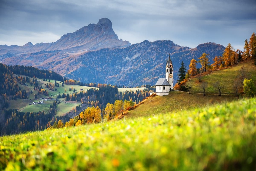
In the province, you can also find a small town with the same name, Tirol, which gave it its name. It is known, among other things, for the incredibly picturesque Tyrol Castle (Castel Tirolo/Schloss Tirol), which was built in the early Middle Ages before 1100 and is located on a high cliff.
The word Tyrol or Tirol itself most likely means simply ‘terrain,’ ‘land,’ or something similar. Words with similar meanings and spellings can be found in Latin (terra), Old Irish (tir), and other languages.
South Tyrol, meanwhile, is the unofficial name of the province. The full name of the province in Italian is Provincia autonoma di Bolzano-Alto Adige and in German it is Autonome Provinz Bozen-Südtirol)
Alto Adige is also the Italian name that is used instead of Bolzano and Sud Tirolo, which indicates that the region is located in the upper reaches of the Adige River.
The province of Bolzano or South Tyrol, despite the word "southern" in the name, is actually located in the very north of Italy on the border with Austria in the Alps. The two countries, in particular, are separated by the famous Brenner Pass (1,370 m / 4,494 ft). The total area of the province is 7,399 sq. km (2,857 sq. mi).
From the west, South Tyrol borders the province of Sondrio in the region of Lombardy in Italy and Engiadina Bassa / Val Müstair region in the canton of Graubünden in Switzerland. To the south, it borders the province of Trentino, with which South Tyrol forms the region of Trentino-Alto Adige/Südtirol. Finally, to the east, South Tyrol borders the province of Belluno in the Veneto region.
Internally, South Tyrol is divided into eight districts—Bolzano, Burgraviato, Val Pusteria, Oltradige-Bassa Atesina, Valle Isarco and Alta Valle Isarco, Salto-Sciliar, and Val Venosta— and 116 municipalities.
The provincial capital, Bolzano, can be reached from Trento and Verona (154 km / 95.6 mi, 1:35 h by car) in the south and from Innsbruck and Munich (262 km / 162.7 mi, 3:15 h by car) in the north.
If you are in Lombardy to the west, the nearest major resort is Livigno (139 km / 86.3 mi, 2:30 h by car). Alternatively, to the east in Belluno, the nearest town is Cortina d'Ampezzo (99 km / 61.5 mi, 2:20 h by car).
For public transport use Trenitalia trains and buses from companies like Trentino Trasporti, ATV Verona, Südtirol Mobil, and Dolomiti Bus. There are also international bus routes from Flixbus, which takes you between Italy and Austria/Germany.
The nearest international airports to the province of South Tyrol are located in Verona, Innsbruck, and Munich, all of which offer connections with many large cities in Europe and the world.
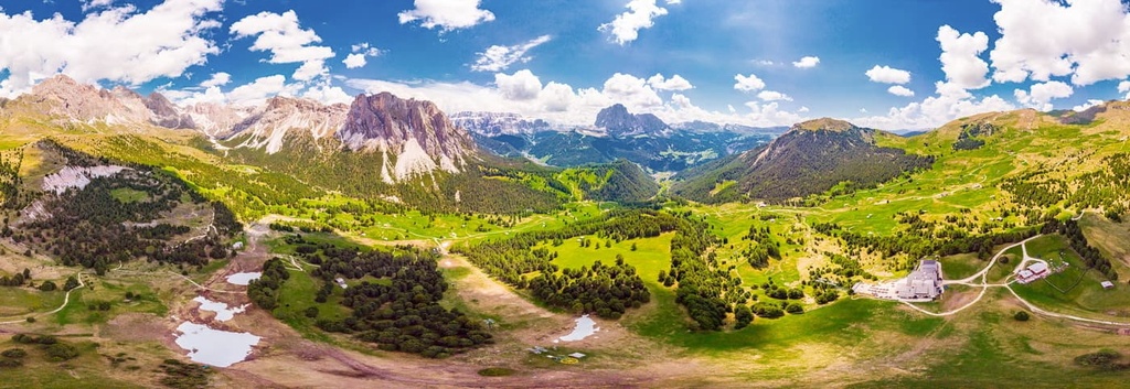
The landscape of South Tyrol is very diverse, and it includes everything except the sea. However, Tyrolians themselves believe that the culture of the sea permeates here in some way, too, as they call the climate of the province Mediterranean. Indeed, the province does get 300 days a year of sunshine, which allows it to grow grapes and other heat-loving crops.
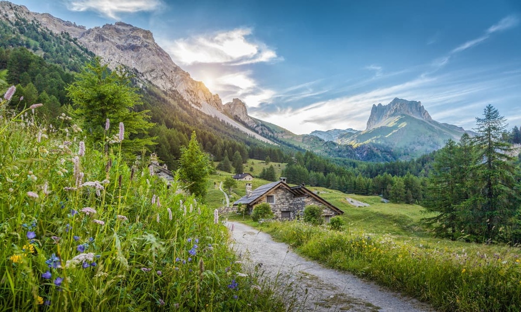
But of course, the province is located in the mountains at the intersection of several large mountain ranges, each of which consists of smaller mountain groups. This includes the region’s two most famous ranges: the Ortler Alps and the Dolomites. The mountains cover about 34 percent of the province.
Additionally, the Bolzano province is firmly associated with several large mountain valleys separating these mountain groups:
The province is also home to two of the five Ladin valleys in the center of the Dolomites: Val Gardena and Val Badia.
These and other valleys were formed by glaciers and rivers. The largest rivers in the province include Etsch / Adige River, Etsack / Sacro River, and Rienz / Rienza River in Val Pusteria.
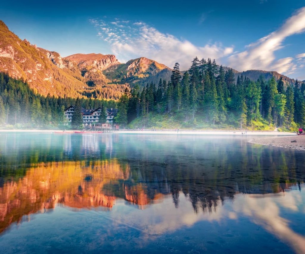
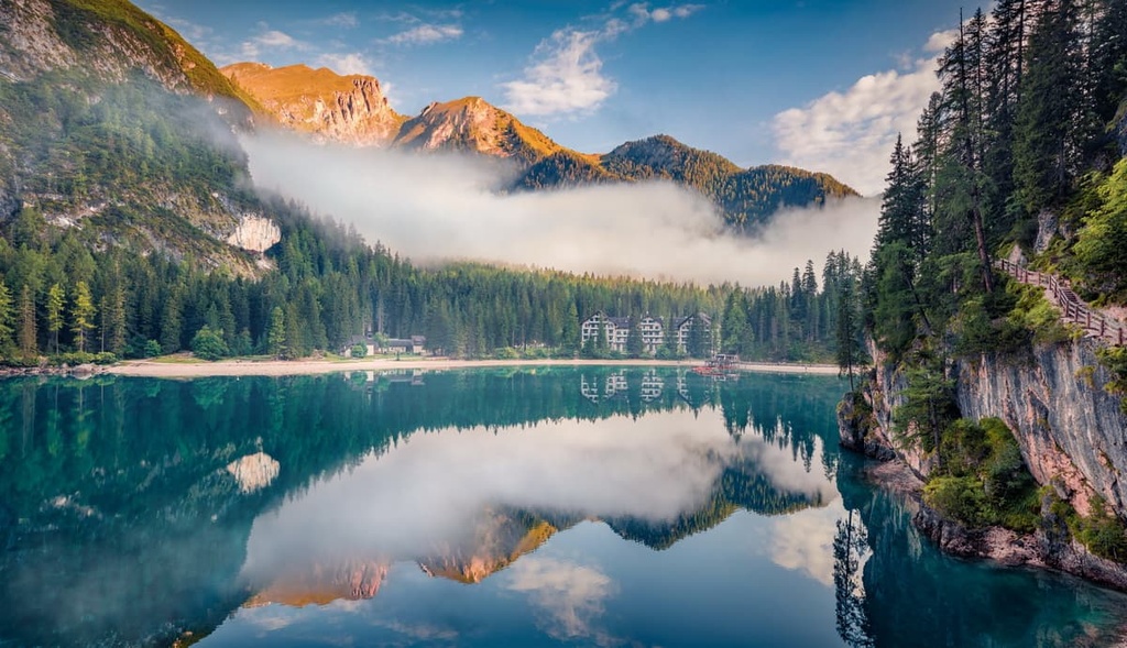
The most famous lake of South Tyrol is Braies Lake / Pragser Wildsee. Probably, it is its main attraction of all the natural wonders of South Tyrol, as it is known far beyond the borders of the province and even Italy. But in South Tyrol there are many other famous lakes of equal beauty such as Carezza, Dobbiaco, Caldaro, Vergago, and Resia, among others.
The province of Bolzano is also impossible to imagine without Seiser Alm / Alpe di Siusi, a Dolomite plateau and one of the largest high-elevation Alpine meadows in Europe with an area of 57 sq. km (22 sq. mi). It is the alpine meadows that also occupy most of the 34 percent of the mountainous areas of the province.
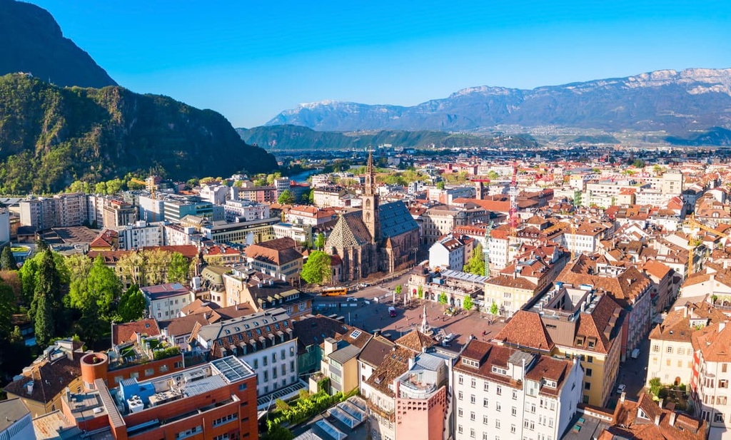
Finally, the city of Bolzano itself is an integral part of the landscape of South Tyrol. It is conveniently located almost in its geographical center. As in the case of the town of Tyrol, one of the main features of Bolzano itself is its many castles, which include Sigmundskron Castle, Runkelstein Castle, and Maretsch Castle.
In total, there are almost 100 castles in the province, the largest and most famous of which are Brunnenburg Castle, Festenstein Castle, Juval Castle, Karneid Castle, Marienburg Castle, Nussegg Castle, Trauttmansdorff Castle.
The province of Bolzano / South Tyrol is one of the most mountainous in northern Italy, along with the neighboring Trentino, Lombardy, and Aosta Valley. The mountains in its territory belong to two large ridges in the Eastern Alps. Within each of them, they are divided into 13 “smaller” ranges.. Some of them, in turn, are also divided into mountain groups.
The exact classification of mountain ranges and groups in South Tyrol varies slightly depending on which of the two common systems of mountain classification you’re referring to: the German-Austrian Club (AVE) and the Italian SOIUSA.
But in general, they are very similar with respect to the peaks of South Tyrol. Here’s a quick overview of how the peaks in the province are classified according to these two different systems.
AVE
SOIUSA
It is important to note that of all the groups listed above, only the Sarntal Alps are located entirely within the province of South Tyrol. The other groups partially belong to neighboring provinces, regions, and even countries.
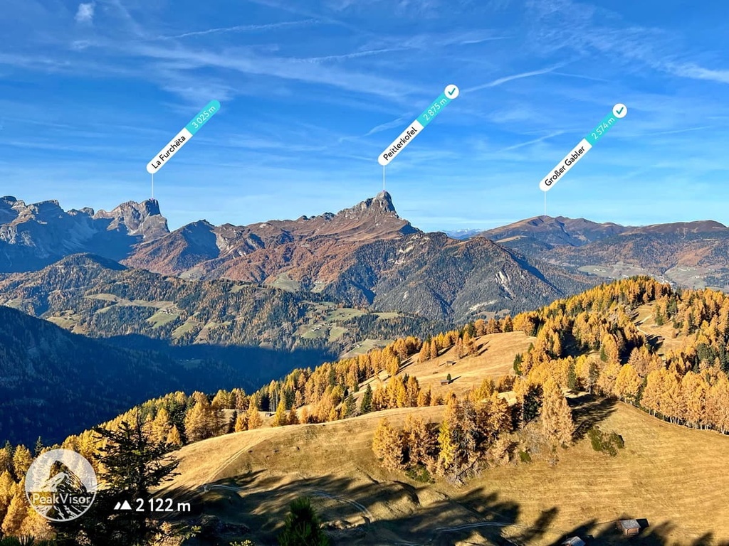
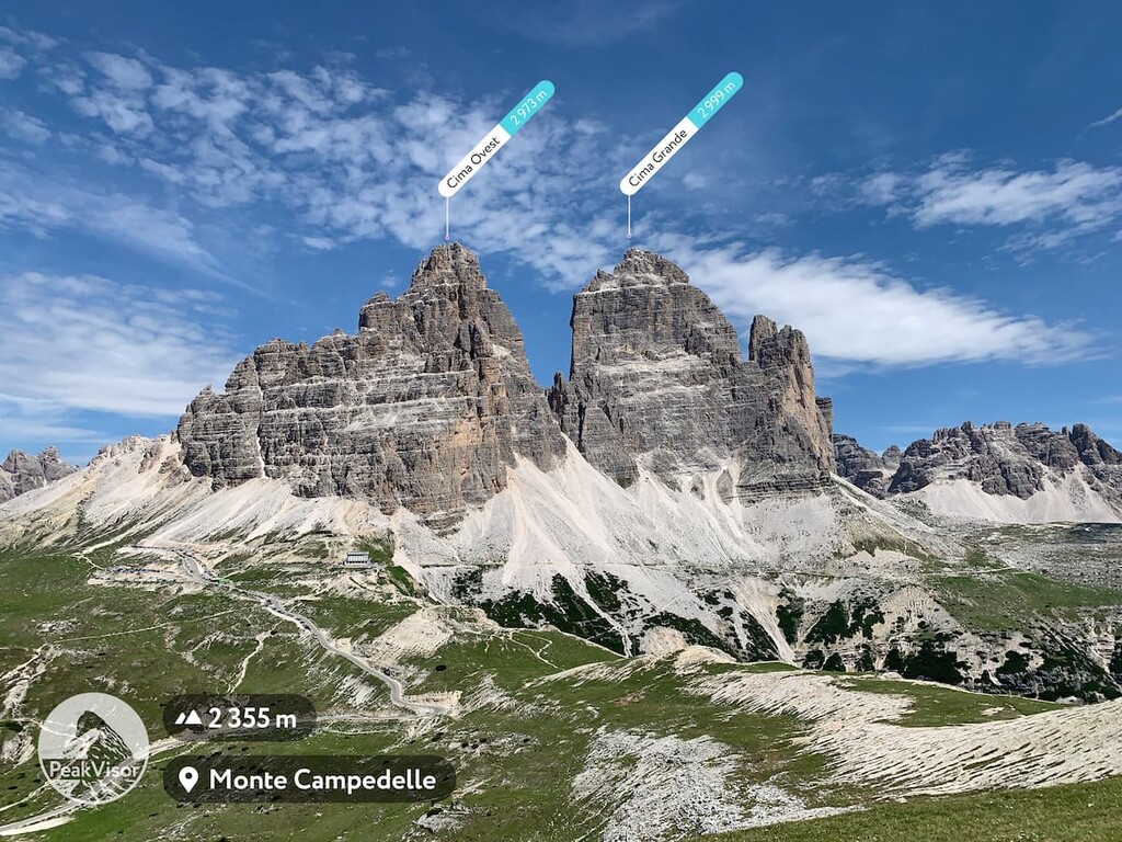
Among the 1,598 named mountains in the Bolzano province, the top include Ortler / Ortles, the many peaks of the Schlern / Sciliar and Rosengarten / Catinaccio groups, and Große Zinne / Cima Grande of the Drei Zinnen / Tre Cime di Lavaredo.
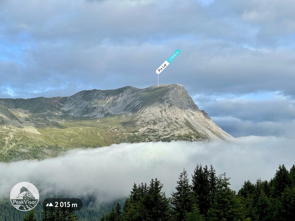
Among the also famous but somehow less-known and popular mountains, I would mention, for example, Piz Lad / Piz Lat (2,808 m / 9,212 ft) in the very northwest of the province. On the northern slope of this mountain, there is a so-called “tripoint” or the crossing point of the three borders of Italy, Austria, and Switzerland.
But there are plenty of other beautiful and lesser-known mountains in the province for those willing to travel off the beaten path.
The main hiking and recreational areas in the province of Bolzano are Stelvio National Park, which is the largest such park in Italy, and the eight regional nature parks that are part of the South Tyrol system of protected areas, namely:
Short and long multi-day hiking trails are located respectively in each of these parks. You can learn more about the specific trails in each park by clicking on the links above.
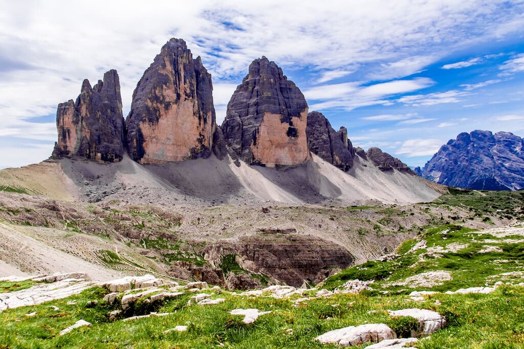
Perhaps the most famous day or two day long trail in the province is the Tre Cime di Lavaredo Loop (10 km / miles). It goes around one of the most famous peaks in the province and all the Dolomites. The views on the trail are absolutely sublime.
With respect to Stelvio National Park, I’ll highlight one of the park’s main long trails, the Ortler High Mountain Trail. It is a 119.5 km (74.3 mi) long route that takes about seven days to complete. It travels through the middle of the park and around the Ortler / Ortles Group.
The route runs from South Tyrol to Lombardy through Stelvio Pass, the town of Stilfs / Stelvio, the mountain huts of Düsseldorfer, Zufall and Pizzini, as well as the towns of Sant’Antonio and Bormio. It also takes you to Cancano Lake and to the many peaks in this mountain group. The total elevation gain on the trail is 8,126 m (26,660 ft).
Another very famous long hiking route in Bolzano province is the Alta Via 1 from Braies Lake. It is one of the two most famous multi-day routes in the Dolomites on par with the Alta Via 2.
To traverse the whole Alta Via 1, you have to walk 125 km (77.6 miles) in 12 stages with overnight stops in huts and sometimes bivouacs until you reach the city of Belluno.
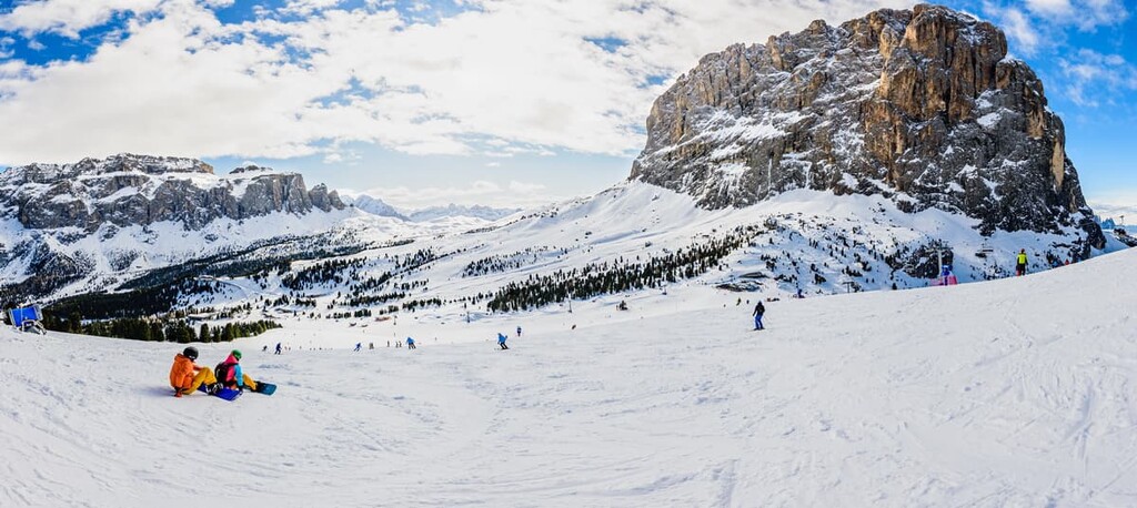
In short, the province of South Tyrol is one of the best places in Italy, Europe, and the world for skiing. In total, 46 different world-class ski resorts are located throughout the province. Some are world famous mega resorts while others are smaller local hills.
The closest and largest ski area to Bolzano is Rittner Horn / Corno del Renon in the Sarntal Alps. It has 13 km (8 mi) of slopes of all levels of difficulty, 3 ski lifts, 3.5 km (2.1 mi) of cross-country skiing trails, and a 3.7 km (2.2 mi) long sled run.
Other major resorts in the province include:
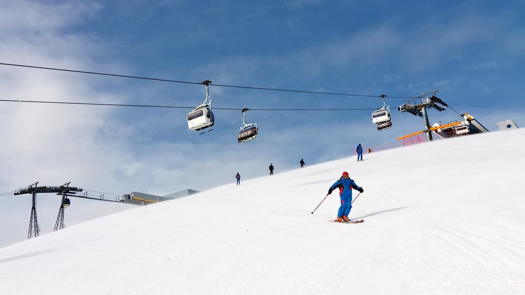
However, the most famous resorts in the province are the ones that belong to the even larger Dolomiti Superski system. A total of 8 of the system’s 12 resorts are located at least partially in the province, including:
Another example of a local resort that is not part of this system is the Plose Ski Resort in the Lüsener Berge mountains. At the resort, you will find 42.5 km (26.4 mi) of ski trails of varying difficulty, including the longest run in South Tyrol called Trametsch. It is 8.2 km (5 mi) long and has a vert of 1,400 m (4,593 ft). Trametsch is an advanced ski trail that’s legendary in the region.
To find out about the province’s open slopes in real-time, visit the Trentino-Alto Adige / Südtirol region page in the World Mountain Lifts section of the PeakVisor website.
For more information about the province, visit the official tourist center of South Tyrol, which is located at:
Via Alto Adige, 60
39100, Bolzano, BZ, Italy
You can contact the tourist office at +390471307000 or email them at info@bolzano-bozen.it. Similar tourist offices are also located in all major cities and resorts in the province.
For more information, you can also visit the official tourism website of South Tyrol: Suedtirol.info.
The province of South Tyrol offers an incredible variety of accommodation types from Airbnb apartments in Bolzano to spa hotels in the Alpine meadows. But even if we focus on mountain huts as the main type of accommodation during high-elevation hikes, there are still too many to list here.
For example, in the vicinity of the highest peak of the Bolzano province alone, Ortler / Ortles, there are at least a dozen such huts: Payer Hütte, Tabarettahütte, Hintergrathütte, Rifugio Borletti, Lodge V Alpini Bertarelli G., Zufallhütte, and Düsseldorfer Hütte, among others.
Much better known, however, are the huts near Tre Cime di Lavaredo, namely rifugio Locatelli, rifugio Lavaredo, and rifugio Auronzo.
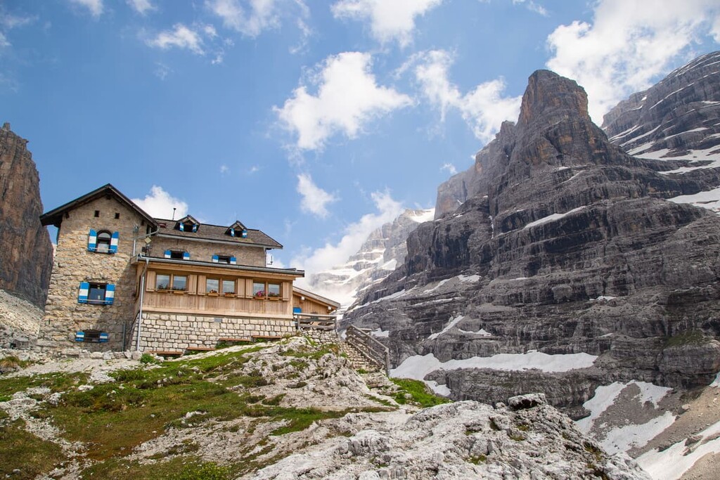
But be careful looking for a place to sleep: There are many huts in the province that operate as restaurants without providing accommodation, although they may be called the same—hut / hütte or rifugio in Italian. But, of course, you can visit them for lunch.
Some of them are incredibly interesting in terms of building architecture, like the Oberholz, at the foot of the Latemar. The futuristic building, which looks like three industrial containers, is, according to the founder of PeakVisor, his favorite of all the huts he has visited (and there are dozens if not hundreds that he has been to so far).
I assume you are also interested in an overnight stay at Braies Lake. There are no huts on its shores, but you can stay there at the historic hotel of the same name, Hotel Pragser Wildsee.
There, you can rent a single, double, or a family room, as well as a suite with a balcony and lake view starting from €96 a night per person. So, the price for two people will be around €150. However, if you visit during the off-season, the rooms tend to be more affordable.
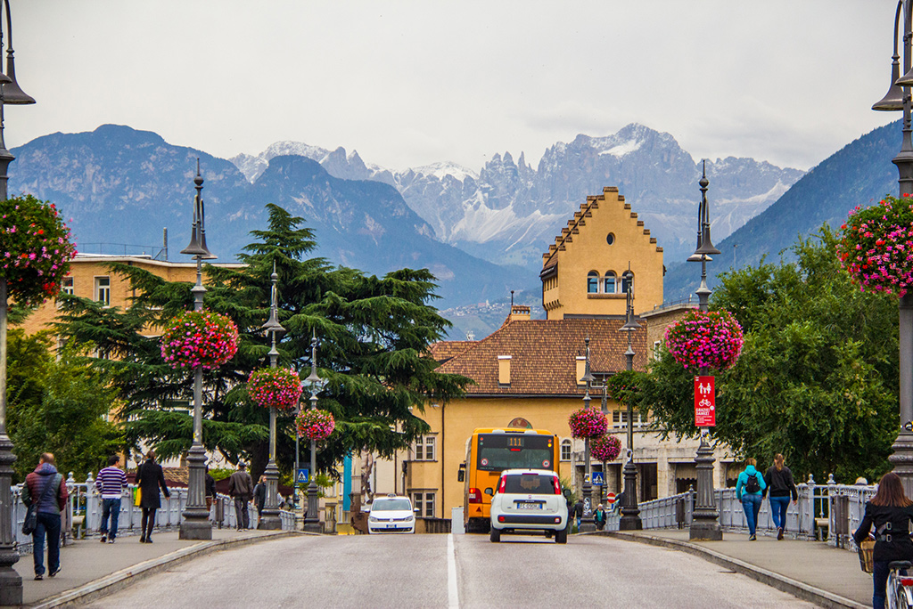
Bolzano is undoubtedly the center of the life of the province. It is a predominantly German-speaking city with a population of 536,000 people. It lies 262 m (860 ft) above sea level and is surrounded on all sides by mountains.
In addition to its several castles, the main architectural and cultural attractions of Bolzano are:
The other nine largest towns in South Tyrol, which can be considered as an alternative to the capital are Merano, Bressanone, Laives, Brunico, Appiano sulla Strada del Vino, Lana, Caldaro sulla Strada del Vino, Renon, and Sarentino.
South Tyrol also has many small and quiet resorts, which are popular places to visit, even though they are known only to locals. If Bolzano seems to be too big and noisy for your liking, head to Lüsen, Urtijëi / Ortisei, Toblach / Dobbiaco, Nova Ponente / Deutschnofen or Nova Levante / Welschnofen to the east of the capital or Reschen am See / Resia to the west.


top50
ultra
glacier
italy-ultras
top50
ultra
glacier
italy-ultras
Yes. South Tyrol has 2,220 named mountains. The highest is Ortler at 3,905 m.
The highest mountain in South Tyrol is Ortler, at 3,905 m.
South Tyrol has 2,220 named mountains.


