
Scan the QR code and open PeakVisor on your phone
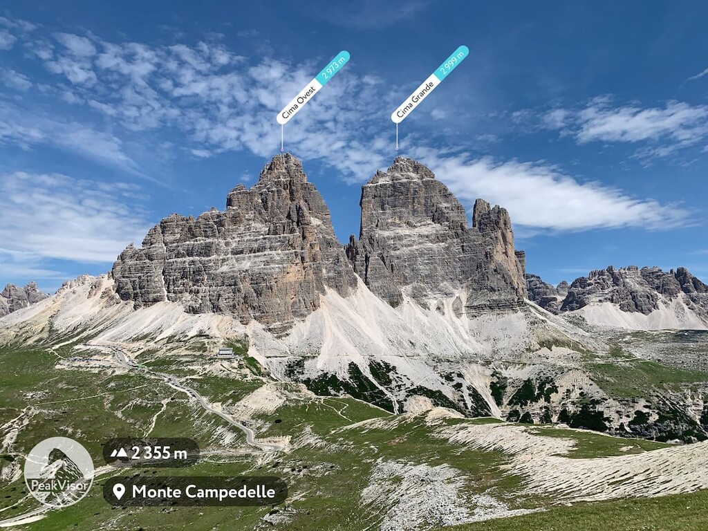
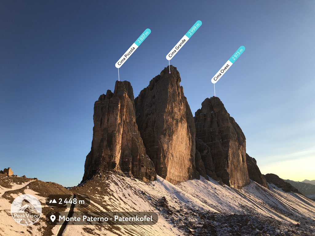
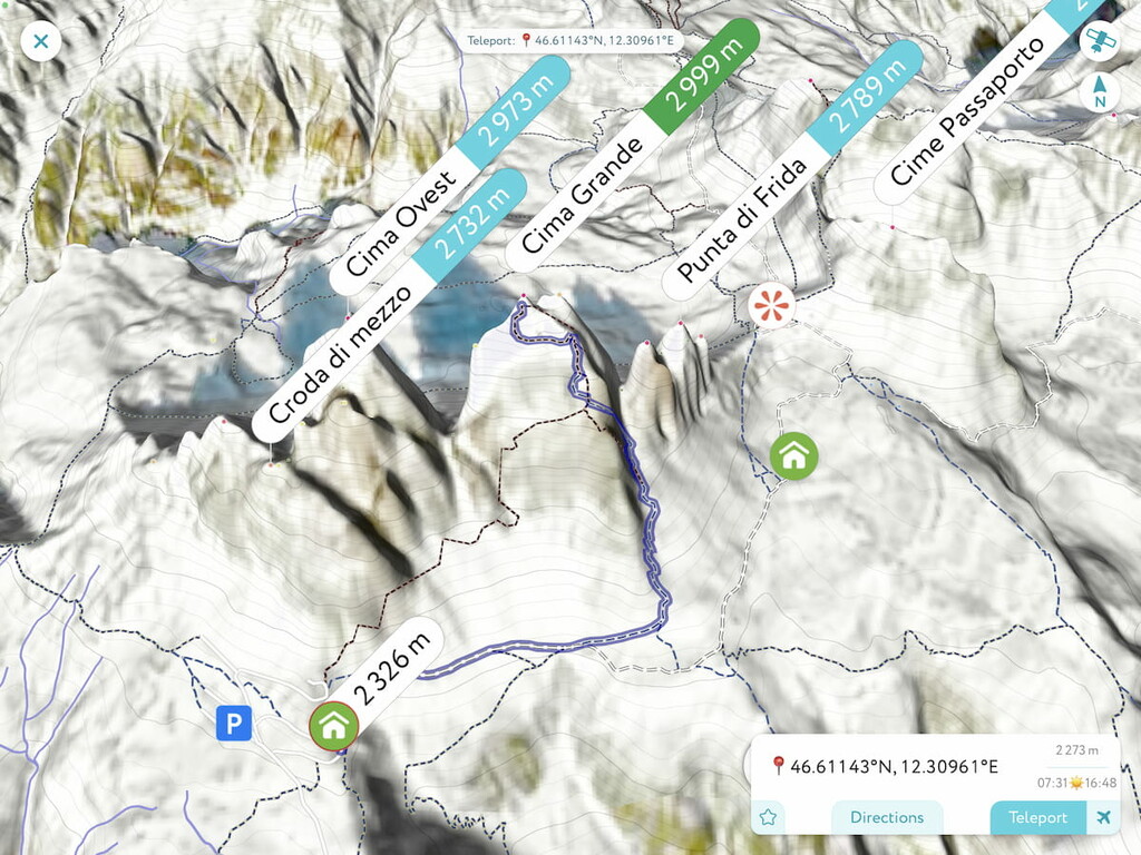
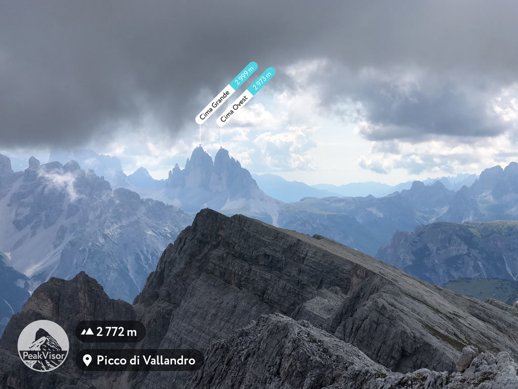
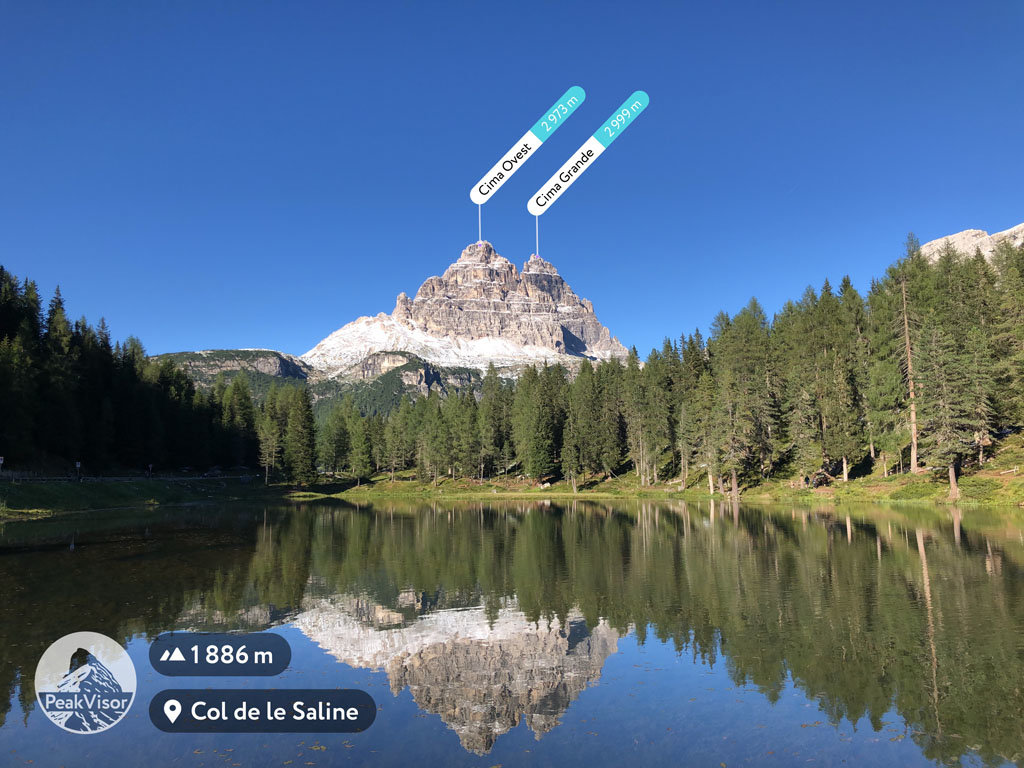
The Tre Cime di Lavaredo include 15 named peaks. The highest is Große Zinne - Cima Grande at 2,999 m. Other notable peaks include Cima Ovest - Westliche Zinne, Croda degli Alpini and Cima Piccola - Kleine Zinne.
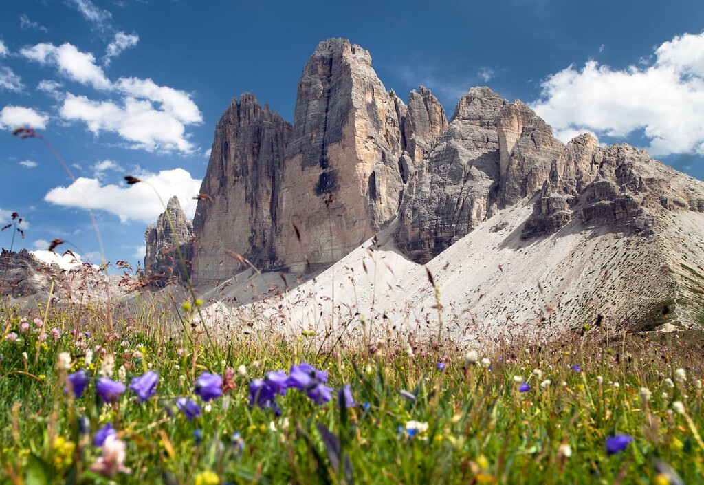
The Tre Cime di Lavaredo is the most unusual-looking and therefore the most popular and recognizable mountain group in the Dolomites. It is also the symbol of the Italian Alps. It is the Tre Cime that is printed on most of the postcards, calendars, posters, book covers and souvenirs. Local companies and different projects located in the Dolomites and the Alps often choose the silhouette of the mountains as their logo (but not the PeakVisor, where you see Matterhorn).
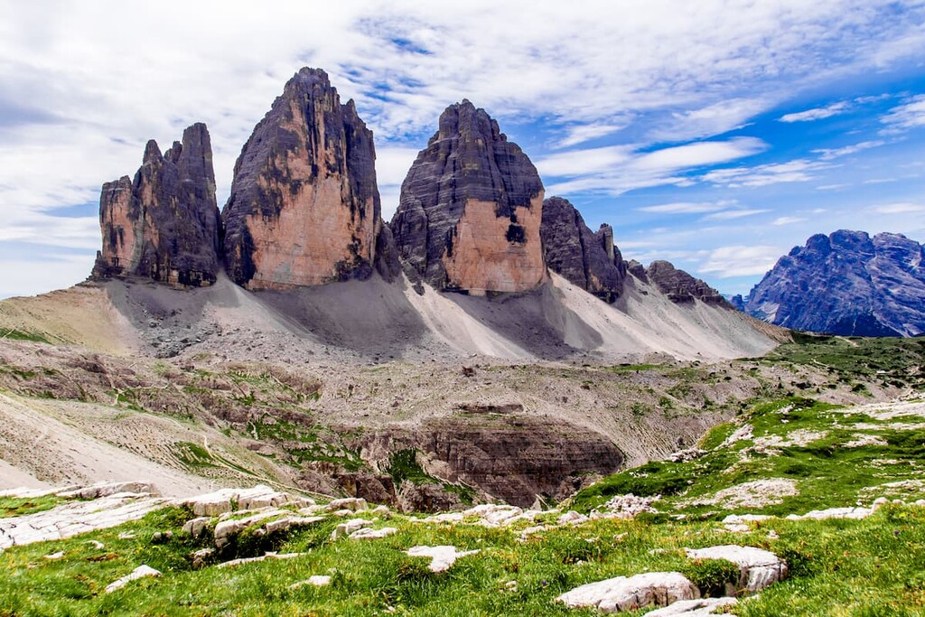
The mountains look like three sharp teeth of identical shape. The locals also call them "towers". This is why the name Tre Cime translates as The Three Peaks of Lavaredo from the Italian language.
The Tre Cime is located on the border between the autonomous province of South Tyrol in the Trentino—Alto Adige region and the province of Belluno in the Veneto region. The border between the provinces and regions runs straight through the Tre Cime mountain range. Until 1919, the border between Italy and Austria passed here, so the mountains have the second name in German — die Drei Zinnen. The same applies to the names of rifugios and other sites in the vicinity of the mountain group.
In reality, there are 15 named mountains in the Tre Cime di Lavaredo. The highest and the most prominent mountain is Cima Grande aka Große Zinne aka Big Peak (2,999m or 9,839ft). The two other equally famous peaks are Cima Ovest aka Westliche Zinne or Western Peak (2,973m or 9,754ft), and Cima Piccola aka Kleine Zinne or Little Peak (2,857m or 9,373ft).
Before 2010, the area of the current park had a different name — the Sexten Dolomites (Dolomiti di Sesto in Italian language) because it featured six peaks of over 2000m, viz. Punta Tre Scarperi / Dreischusterspitze (3,152 m) - the highest of the group, the name can be loosely translated as Peak of Three Shoemakers, Zwoelferkofel aka Peak No.12 (3,094m), Elferkofel aka Peak No.11 (3,092m), the Tre Cime di Lavaredo (2,999m, counted as one entity), Sextener Rotwand (2,965m), Birkenkofel aka Peak of Birches (2,922m) and Monte Piana (2,324). In addition, there are smaller peaks in the massif: Punta di Frida (2,792 m), Torre Minor aka Allerkleinste Zinne, Torre Preuss aka Preußturm, Cima Piccolissima aka Kleinste Zinne (2,700 m) and others.
Today, you can still hear the old name - the Sexten Dolomites - which is still used in different sources of information and some people just keep using both names.
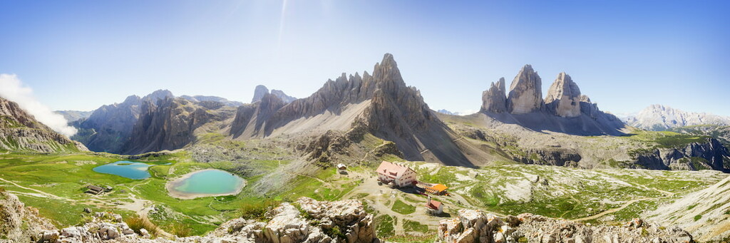
The area around the Tre Cime is a natural park with the same name — the Tre Cime Natural Park (Parco naturale Tre Cime). It is one of the nine natural parks in the Dolomites.
A mountain group as unusual as the Tre Cime di Lavaredo has proven to be a luring temptation since time immemorial.
The first attempt to climb Cima Grande was made by the climber Paul Grohmann with the guides Franz Innerkofler and Peter Salcher on August 21, 1869. All three were Austrians. Their attempt was successful. Paul Grohmann was also the first alpinist to climb such mountains in the Dolomites as Tre Scarperi, Croda dei Baranci, Cristallo, Sorapiss, and Antelao.
Cima Ovest was conquered by mountaineers exactly ten years later, on August 21, 1879. It was done by a farmer and mountain guide from the Sexten Dolomites Michael Innerkofler and a tourist named Georg Ploner. Two years later, the mountaineers conquered the last third peak of the Tre Cime — Cima Piccola. On July 25, 1881, the same Michael Innerkofler took his brother Hans Innerkofler to the peak to complete the ‘been there, done that, got the T-shirt’ quest.
All of these routes to the peaks of Tre Cime, on which the first alpinists climbed the mountain, are still considered relevant — they can be used for climbing today. At the same time, the third route to Cima Piccola is considered the most difficult.
The Italian climber Emilio Comici was the first to climb the north face of Cima Grande. He did so in 1933 in a group of three people. This north face is considered by climbers to be one of the six Great North Faces of the Alps, also called the six Classic North Faces, which are known for their difficulty and great height. Along with the Tre Cime, these are:
In addition to all these routes, there are tens of other routes of various categories of complexity. The normal routes on Cima Grande and Cima Piccola attract the most climbers because of the easy access and relatively low complexity routes.
In the vicinity of the Tre Cime di Lavaredo, there are two other notable mountain peaks: Monte Paterno aka Petenkofel (2,774 m) and Torre di Toblin aka Toblinger Knoten (1,617 m). You can climb both of them if you decide to spend more than one day here and look at the Tre Cime from a higher point and at an unusual angle which is rarely seen in photos.
On the way to the summits of both mountains, there are via ferratas, so you will need special gear consisting of a helmet, harness, gloves, and a lanyard.
The via ferrata to Torre di Toblin has the same name, and via ferrata to the summit of Monte Moterno is called a bit differently — via ferrata De Luca / Innerkofler.
Both via ferratas are good for beginners, so you don't need to be a climber with many years of experience. In both cases, you will need around 5-6 hours to climb these mountains and come back, including the time for hiking to and from rifugio Locatelli or Lavaredo.
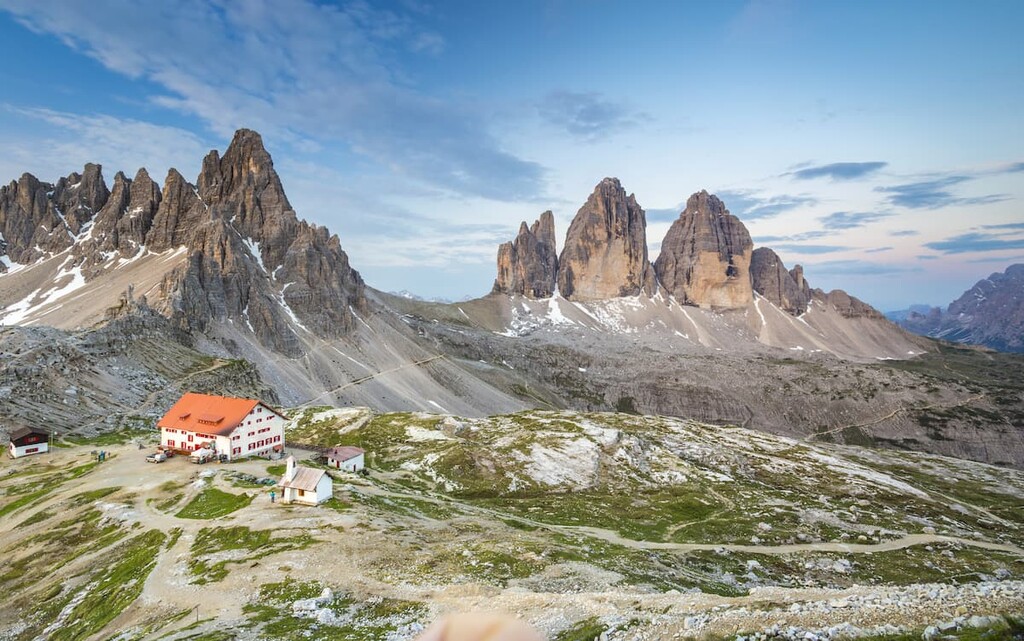
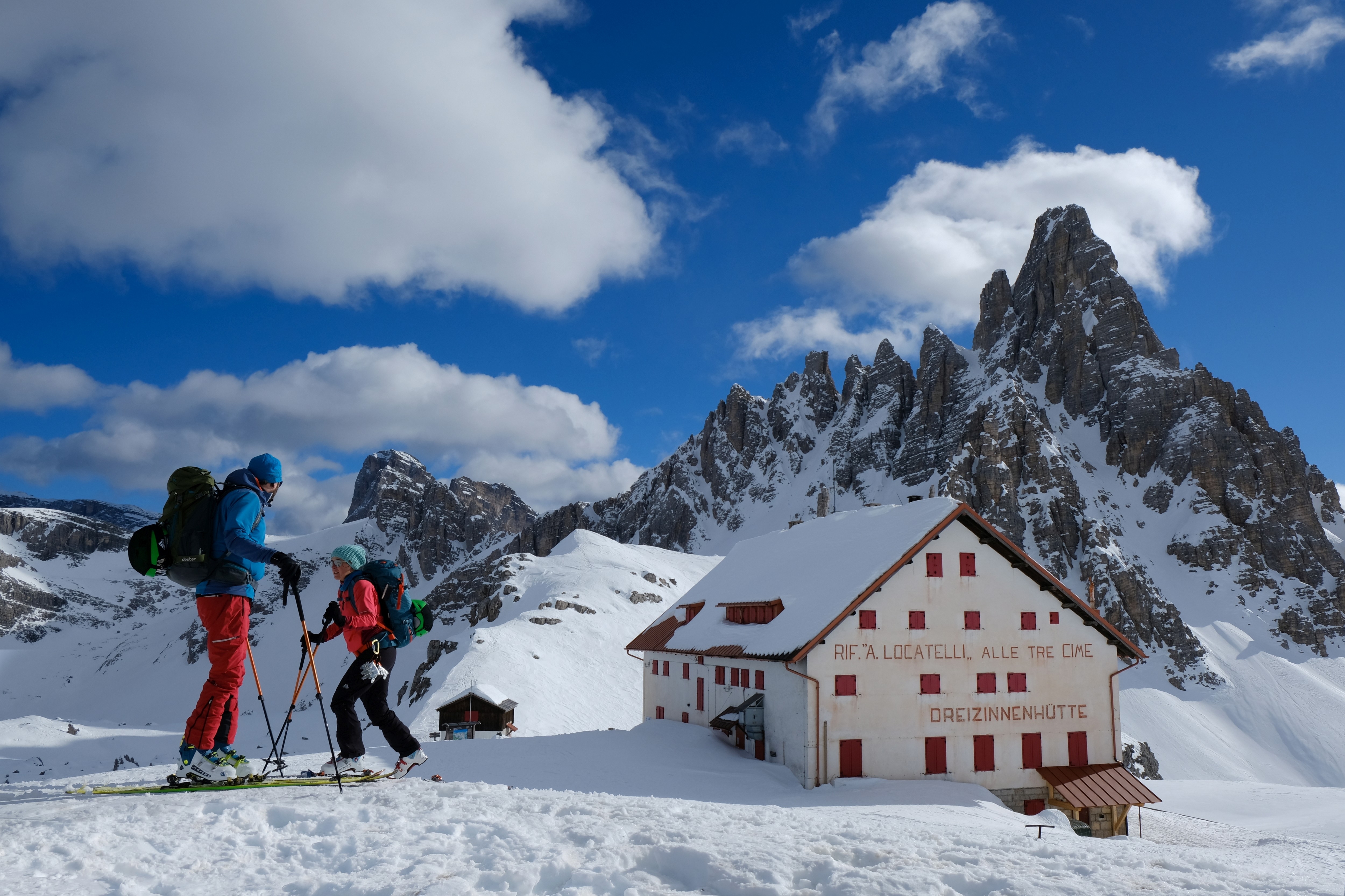
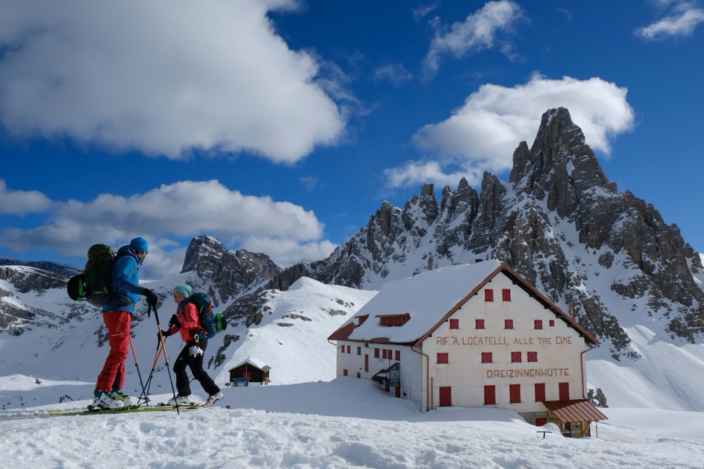
You can spend the night at the foot of the Tre Cime di Lavaredo in one of the mountain huts. In the immediate vicinity of the Tre Cime di Lavaredo, there are three of them:
It is very important to know and remember that during the summer season, from June 21 to September 21 exactly, when the mountain huts, cable cars, and most of the bus lines in the Dolomites are open, all three mountain huts are usually quite crowded. Especially Locatelli may have very few vacancies left. It's so popular that there is another big barn-like house for 8-10 people that you can stay at if the managers don't have room in the main house.
So it is better to book a place in the common room in advance by email or phone — better at least a month or two before the planned visit. Paying for the reservation is not necessary if you're traveling alone or in a small group, but for a group of more than 5-6 people, you may need to pay upfront about 15-20% of the cost. In this case, it is better to make a reservation even earlier.
Nevertheless, of all three huts, I recommend choosing Locatelli for the overnight stay because of the really beautiful view of the Tre Cime. If you want fewer people around, go hiking to the Tre Cime at the very beginning of the season, or choose the Lavaredo Hut, which is smaller and freer usually. Because of the parking lot right nearby, Auronzo seems the least preferable choice as it enjoys the biggest tourist flow. People also go to this hut even if they don't sleep in it.
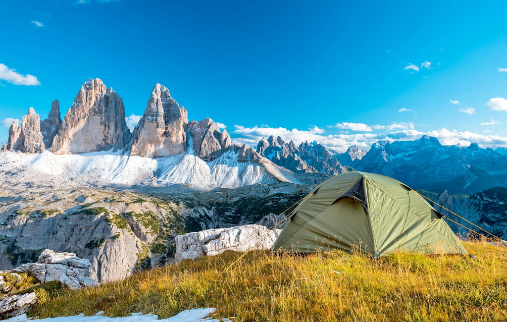
Another option to have a sleepover with a view of the Tre Cime di Lavaredo is pitching a tent. Many people do so near Locatelli hut. When I saw it for the first time, I was very surprised. Is it really allowed? Officially it is forbidden in the Dolomites and the rest of Italy, but if you can't find any other accommodation, you can pitch a tent as the last resort. Learn more about the rules of wild camping in the Dolomites.
There is also a camping site on Misurina Lake from where you can go hiking to the Tre Cime di Lavaredo. It is called "Camping Alla Baita Misurina". At the campsite, you’ll find 25 lots for cars and caravans and a big grass area to pitch a tent. There is a bathroom area with sinks to wash the dishes, a dump station and water filling for camping cars, electric outlets, showers with hot water, a restaurant/bar, and other services.
There is also another camping area just nearby the parking lot on Lake Misurina called Area Sosta Camper Misurina where you can park your caravan.
There are several hotels near the Tre Cime di Lavaredo, on Lake Musirina from where you can hike to the mountain. You can stay at Misurina, Miralago, Lavaredo, Sorapis, Sport hotel. There are many more hotels in the nearest towns of Sesto, San Candido, and others.
This mountain group is unusual not only for its shape but also for the fact that Auronzo mountain hut can be reached by shuttle bus from Lake Misurina, which, in turn, is accessible from Cortina d'Ampezzo, Belluno, and more distant towns by regular buses. For example, Belluno bus leaves every day early in the morning. The timetable can be found on Dolomitibus.it.
The parking lot is right by the hut. It's pretty big, approximately for a couple of dozen cars. It even accommodates huge buses and caravans. By the way, it is one of the highest parking lots in Italy.
Access to the Tre Cime by car is paid. There is a barrier at the beginning of the serpentine leading to the mountain. In 2020, the toll was €30.00 for a car, €20.00 for a motorcycle, €45.00 for a camper, €60.00 for a bus with a capacity of up to 30 people. To park overnight at the Tre Cime, you'll have to pay another €5,00 to €60,00 depending on the size of the vehicle. Learn more about parking on the official Tre Cime website.
Parking is open from 06:00 am to 20:00 pm.
You can also leave the car in the parking lot at Lake Misurina and continue to the Tre Cime by shuttle bus or on foot.

Unlike some other mountain groups in the Dolomites, which can be quite large in sizes — such as the Pale di San Martino or even the Marmolada, the Tre Cime di Lavaredo is a relatively small and compact mountain group consisting of only three big peaks and a few smaller ones. Therefore, there is only one trail on the Tre Cime di Lavaredo. It is a circular trail called the Trek around the Tre Cime di Lavaredo or Tre Cime di Lavaredo Loop.
The route begins at the parking near Auronzo Hut. From there, it's up to you where to go: you can turn left (counterclockwise) to Locatelli hut, or right (clockwise) to Lavaredo hut. In the beginning, the trail goes right around the Tre Cime so you don't see the whole mountain, but then it goes around the mountain at some distance and that is the lapse where you can see the whole mountain group.
Some more important information about the trail:
A tip: if you want to spend the night in Locatelli hut, you can go from either side. If your stay is at Lavaredo, go around the mountain on the left, but allow an extra hour to get to your sleeping spot. It gets dark quickly in the mountains after sunset, but there should be enough time if you walk fast. In any case, it is better to have a flashlight with you.
On the reverse side of the Tre Cime, when you look from Misurina Lake, there are three small lakes and a former farm. Another small lake, Lago di Piani Superiore, is located near Locatelli Hut.
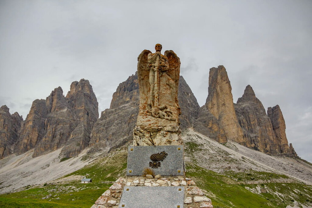
There are many fortifications, tunnels, iron ladders, and other things in the area because the front line between Italy and Austria during World War I ran through the Tre Cime peaks. There was intense fighting between 1915 and 1917 there.
It's also interesting that the Tre Cime di Lavaredo looks completely different from different angles. This is a very clear example of how the view of the same mountains changes when you move a couple of hundred meters away from them.
The trek around the Tre Cime is part of one of the eight long hiking trails in the Dolomites called Alta Via (High Route), the most famous of which are 1 and 2. The Tre Cime lies on the path of Alta Via 4, the less popular one. It runs from San Candido in Val Pusteria, BZ, to Pieve di Cadore, BL. Its total length is 85 km.
In winter, the Tre Cime Group turns into a ski resort with the same name Tre Cime Dolomites (3 Zinnen Dolomiten), which is simultaneously one of the 12 major ski areas in the Dolomiti Superski system, covering the whole region. The resort's slopes, as well as cross-country trails and snowshoeing routes, are located in the vast Tre Cime Nature Park to the north of the main Tre Cime massif. Learn more about them in the park guide.
Check the Tre Cime ski resort map on the larger Veneto ski map of Italy in the World Mountain Lifts section of the site. It includes information about open ski lifts / slopes in the Tre Cime Dolomites in real-time with opening dates and hours. There are also year-round cable cars, funiculars, cog railways, aerial tramways, and all other types of mountain lifts.
Both times I went up to the Tre Cime by bus, but next time I will definitely take one of the trails leading directly to the foot of the mountains as it usually happens in the Dolomites with other mountain peaks that cannot be reached by bus. In my opinion, the view of the beautiful mountains is a kind of reward, which must still be earned by hard work — that is, by walking for many hours.
There are six main routes to reach the Tre Cime on foot in less than a day from the following valleys:
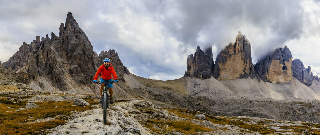
The Tre Cime di Lavaredo is a popular place not only for climbing, via ferrata and hiking, but also for cycling. Auronzo Hut has hosted several times the finishes of the decisive mountain stages of the Giro d'Italia — the main Italian multi-day bicycle race.
The first finish was in 1967 when the Italian cyclist Felice Gimondi won. The last finish was in 2013, when another Italian, Vincenzo Nibali, won. In between, there were five more finishes in the Tre Cime di Lavaredo: in 1968, 1974, 1981, 1989, and 2007.
As well as with climbing, after the first stages with a finish at the Tre Cime di Lavaredo, amateur cyclists come here to repeat the route of the famous cyclists.
The ascent is quite difficult. From Lake Misurina at an altitude of 1,760 m, cyclists need to climb to 2,333 m (573 m height difference). The length of the mountain serpentine, which winds up literally like a snake, is 7 km. Even the bus ride up the serpentine takes your breath away — it feels like you're trying to fly rather than ride.
The most difficult part of the ascent is the last 4 km with a 477m difference in elevation and an average gradient of 12% with sections going steep up to 19%.
If you decide to climb the Tre Chime di Lavaredo by bike, remember that during the summer season there will be many other cyclists on the mountain serpentine besides you, as well as cars and buses, and the desired descent from the serpentine is unlikely to be quick — not only because of traffic but due to the many turns.
To ride a bike up the Tre Cime di Lavaredo is more a kind of showing respect for the victories of cyclists and the cycling community, and a kind of “to-do-thing” on a bucket list of any amateur cyclist. Well, and some kind of personal achievement, of course.


The highest peak in the Tre Cime di Lavaredo is Große Zinne - Cima Grande, at 2,999 m.
The Tre Cime di Lavaredo have 15 named peaks.


