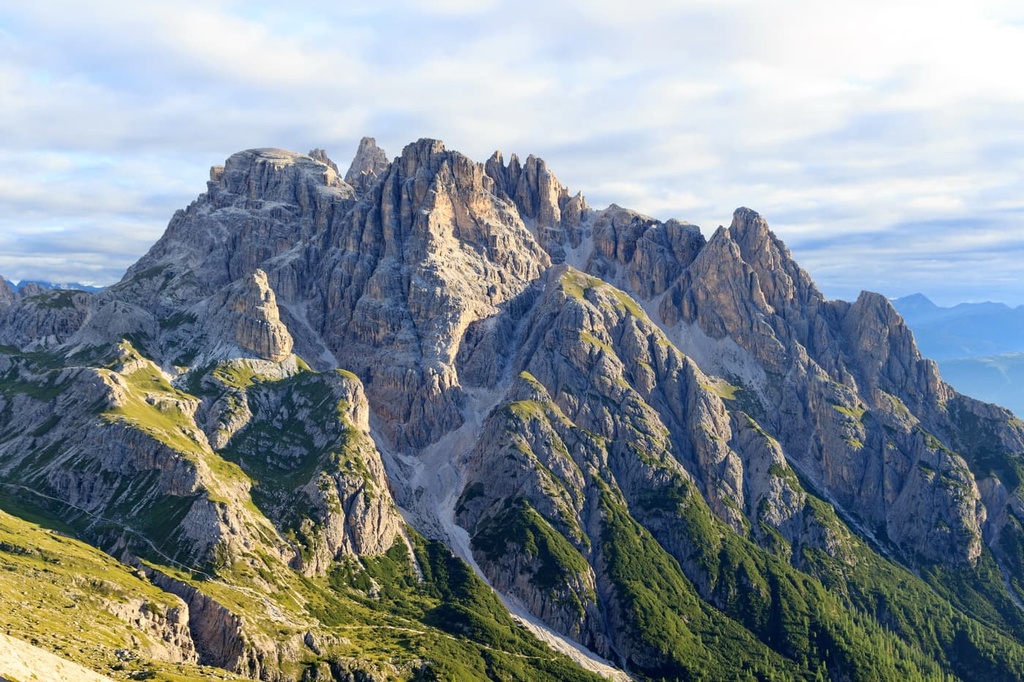
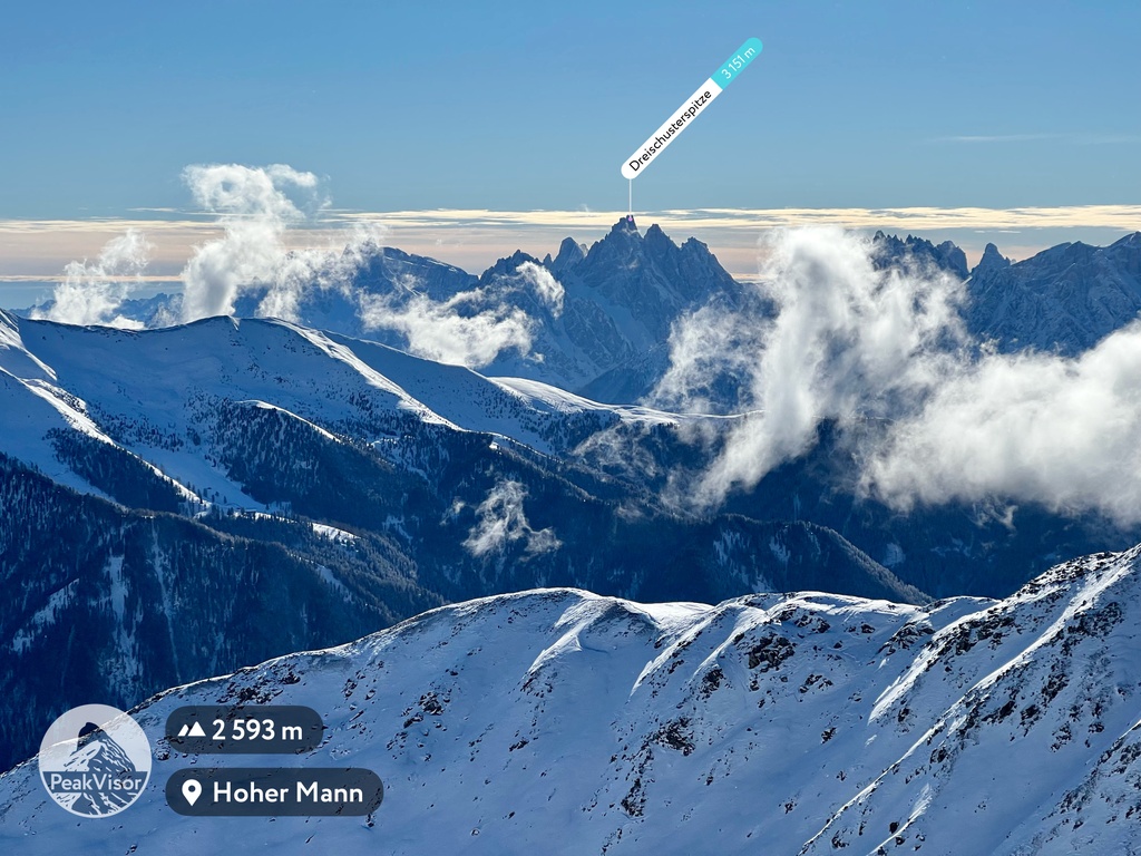
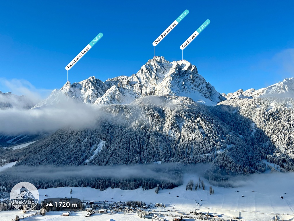
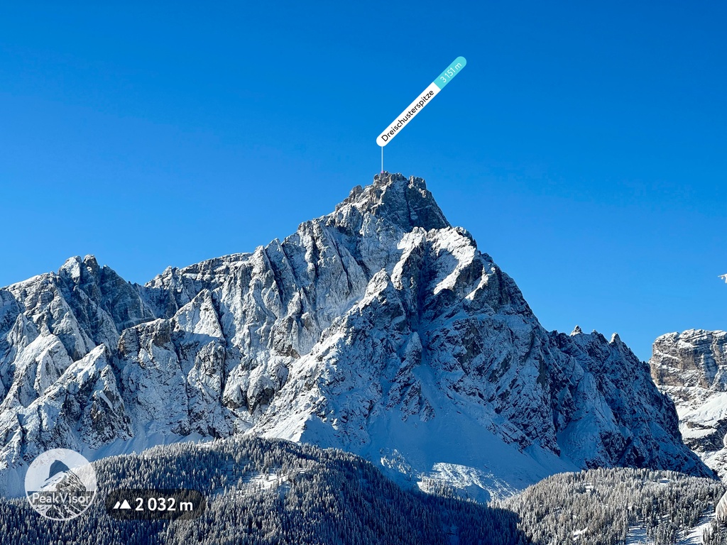
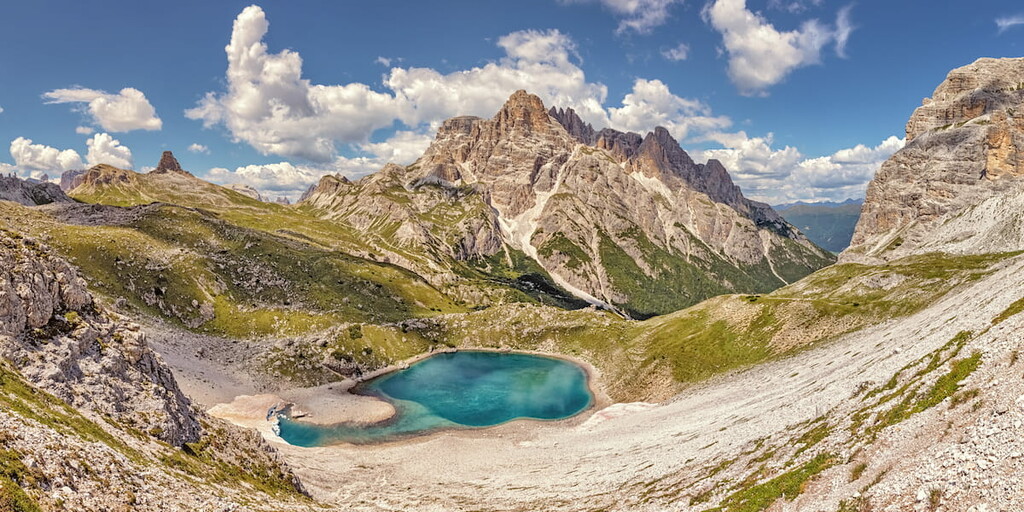
The Dreischusterspitze (Italian: Punta dei Tre Scarperi) is a mountain of the Dolomites in South Tyrol, Italy. It is the highest peak of the Sexten Dolomites and the most northerly 3,000m peak of the range. From the north it resembles a majestic pyramid, while from the east and west it resembles a jagged ridge. The mountain is located above the village of Sexten. It was first climbed in 1869 by Paul Grohmann, Franz Innerkofler and Peter Salcher.
Huts in the area are the Dreischusterhütte (Rifugio Tre Scarperi, 1653 m) in the Innerfeldtal as well as the Talschlusshütte (Rifugio al Fondo Valle, 1548 m) in the Fischlein Valley and the Dreizinnenhütte (Rifugio Locatelli, 2405 m) in the south of the Schusterplatte.
The nearest mountain hut is Dreischusterhütte - Rifugio Tre Scarperi located 1 719m/5 641ft WNW of the summit.
By elevation Dreischusterspitze - Punta dei Tre Scarperi is
# 21 out of 2113 in the Dolomites # 1 out of 71 in Naturpark Drei Zinnen - Parco Naturale Tre Cime # 1 out of 141 in the Sexten Dolomites # 13 out of 810 in the East Dolomites
By prominence Dreischusterspitze - Punta dei Tre Scarperi is
# 5 out of 2113 in the Dolomites # 59 out of 60693 in the Alps # 36 out of 42694 in Italy # 9 out of 3872 in Trentino-Alto Adige/Südtirol # 2 out of 2178 in South Tyrol # 1 out of 71 in Naturpark Drei Zinnen - Parco Naturale Tre Cime # 1 out of 141 in the Sexten Dolomites # 4 out of 810 in the East Dolomites
We use GPS information embedded into the photo when it is available.
3D mountains overlay
Adjust mountain panorama to perfectly match your photos because recorded by camera photo position might be imprecise.
Move tool
Rotate tool
Zoom
More customization
Choose which peak labels should make into the final photo and what photo title should be.
Next
Photo Location
Satellitte
Flat map
Relief map
Latitude
Longitude
Altitude
OR
Latitude
°'''
Longitude
°'''
Apply
Register Peak
Peak Name
Latitude
Longitude
Altitude
Register
Teleport
PeakVisor
This 3D model of Sagarmatha National Park in Nepal was made using the PeakVisor app topographic data. The mobile app features higher precision models worldwide, more topographic details, and works offline. Download PeakVisor maps today.
Download OBJ model
PeakVisor
The download should start shortly. If you find it useful please consider supporting the PeakVisor app.
PeakVisor for iOS and Android
Be a superhero of outdoor navigation with state-of-the-art 3D maps and mountain identification in the palm of your hand!