
Scan the QR code and open PeakVisor on your phone
Munich is home to 7 named mountains. The highest is Baldehöhe at 586 m.
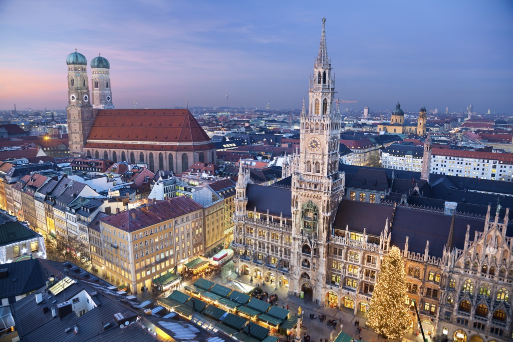
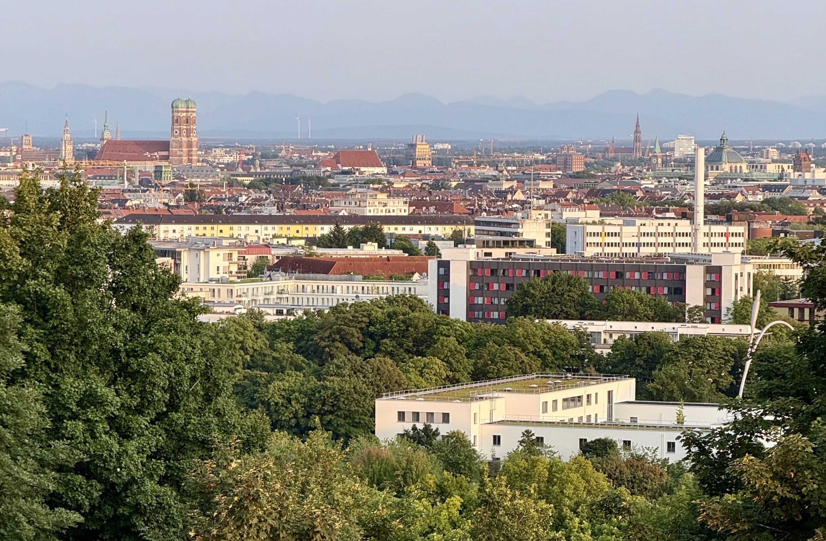
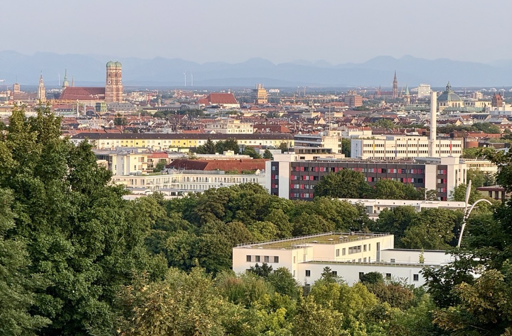
Munich is the capital of Bavaria and Germany’s third-largest city, but it’s also the best city for German outdoor enthusiasts, due to its urban hiking and proximity to the Alps. PeakVisor took a trip here in August 2025, and we spent the week exploring the city’s natural spaces and viewpoints (in addition to a work conference). Munich is also a historic city; as a result of the destruction of WWII, German cities aren’t known for their beauty, but Munich is the most visually appealing, worthy of a visit alongside other European capitals. Believe it or not, there are 7 named mountains within Munich city limits, mostly buried rubble piles from WWII. Baldehöhe (585 m / 1,921 ft) is the highest, while he most prominent is Fröttmaninger Berg (562 m / 1,843 ft). Take those elevations with a grain of salt, however; Munich itself sits on a plain at about 520 meters.
Munich lies in southern Germany, about 50 kilometers north of the northern edge of the Alps. The Isar River, a tributary of the Danube, flows through the city.
Munich covers an area of approximately 310 square kilometers and has a metro population of about 6 million (only Hamburg and Berlin are larger in Germany).
Climatically, Munich is a mixed bag. At 48°08′N and 520 meters above sea level, winters are cold, with some snow (less now than there once was). Meanwhile, summers are relatively warm and prone to thunderstorms. Long summer nights offer residents a chance to relax at restaurants and cafes until late, one of those everlasting European traditions. On the other hand, winter days are short and harsh.
The Föhn, a warm, dry downslope wind from the Alps, can bring sudden clear weather and a view of the mountains to the south (especially during spring). In addition to the short days, winters can be dreary, like other cities in northern Europe.
Munich’s geology is pretty straightforward. The city stands on sediments deposited by glacial and fluvial processes during the last several Ice Ages. During the Pleistocene, glaciers from the Alps carried vast amounts of gravel, sand, and clay, which were deposited in a fan-like spread northward. As a result, Munich rests upon a thick layer of gravel.
These gravel deposits provide excellent natural drainage, which explains why Munich historically faced fewer flooding problems than many river cities. They also supply quality groundwater, making Munich’s drinking water supply one of the purest in Europe.
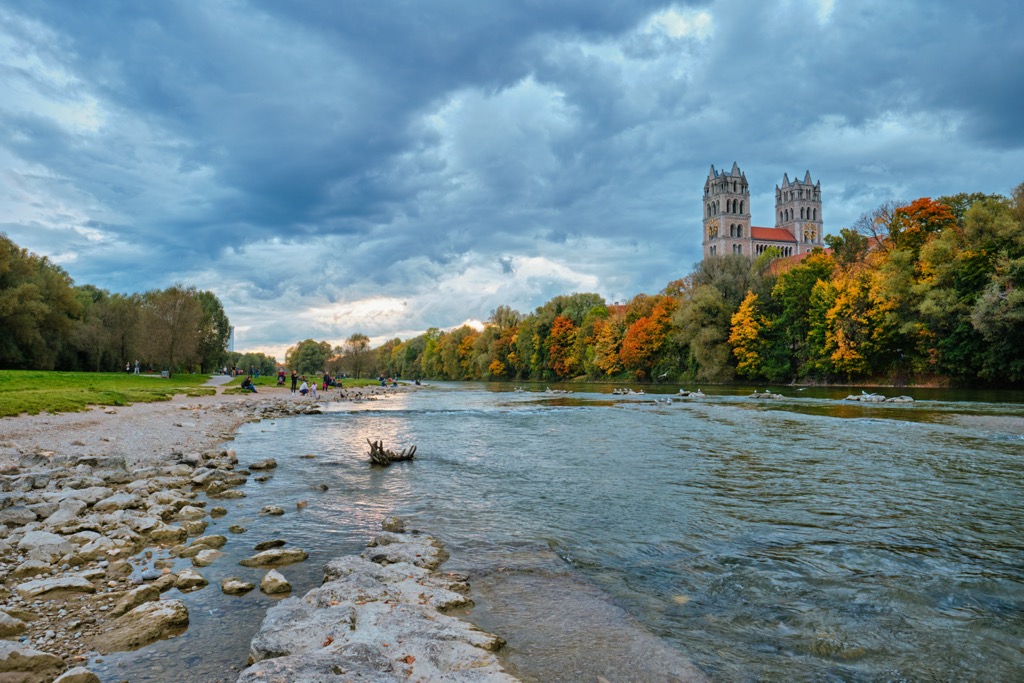
Munich has cultivated a reputation as a “green city,” both figuratively and literally. Figuratively, the hydroelectric capacity of the Isar River has given Munich a chance to become completely powered by renewable energy as early as 2025. Literally, the city is covered with parks and green spaces, as well as riparian zones around the renaturalized Isar River.
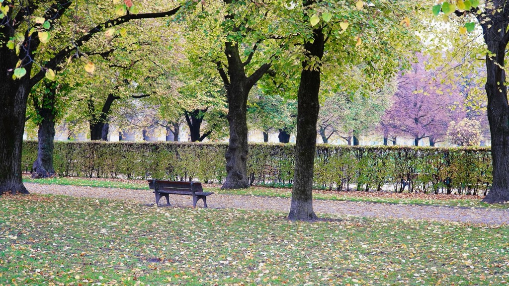
The Englischer Garten is one of the largest urban parks in the world, at 375 hectares, larger than New York’s Central Park. While you won’t see any chamois or eagles here, you might spot species such as tawny owls (Strix aluco), European green woodpeckers (Picus viridis), and red squirrels (Sciurus vulgaris). In the park’s meadows, keep an eye out for butterflies like the meadow brown (Maniola jurtina) and small tortoiseshell (Aglais urticae).
Meanwhile, the old-growth trees and canals of Nymphenburg Palace Park provide habitat for bats, including the common pipistrelle (Pipistrellus pipistrellus), and breeding sites for mallards (Anas platyrhynchos) and mute swans (Cygnus olor).
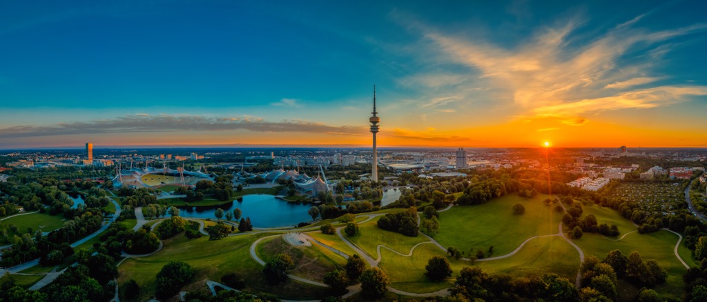
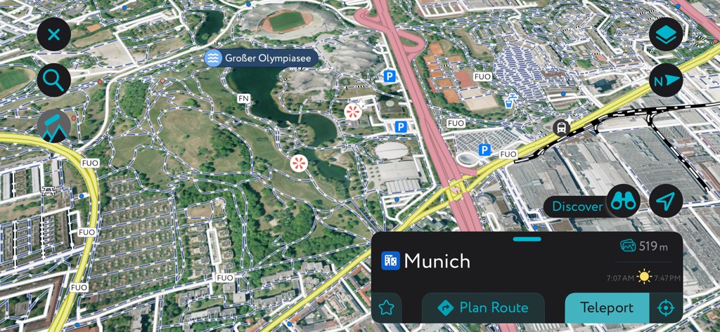
Olympiapark was built on rubble mounds from WWII and has become a refuge for kestrels (Falco tinnunculus) and urban foxes (Vulpes vulpes).
One of the most charismatic and well-adapted urban species is the adorable European hedgehog, which loves to shuffle around lawns, gardens, and other green spaces throughout the city.
Munich’s documented history begins in 1158, when Henry the Lion, Duke of Bavaria, granted rights for a settlement near a Benedictine monastery. The name “Munich” (German: München) derives from “bei den Mönchen,” meaning “by the monks.”
The 18th and 19th centuries transformed Munich into a cultural and industrial capital. Under King Ludwig I, the city underwent massive architectural expansion. Ludwig commissioned monuments such as Königsplatz and the Ludwigstraße. The brewing tradition also started during this time, and continues to this day with the annual Oktoberfest (though many locals detest this outrageous spectacle of drunken reverie).

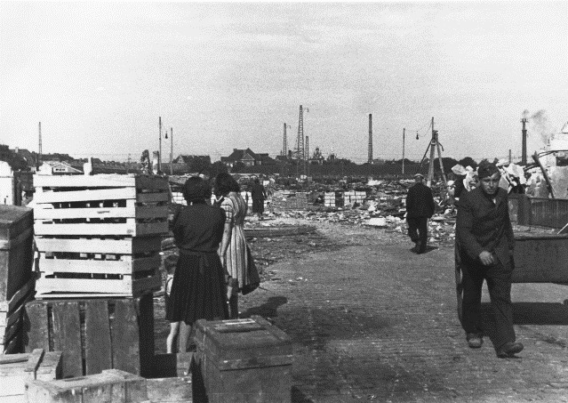
During World War II, Munich was heavily bombed, destroying about 90% its historical core. Postwar reconstruction focused on rebuilding and the restoration of the city’s numerous historic monuments, such as the Frauenkirche and Residenz. As a result, Munich is more pleasing to the eye than, say, Berlin.
Munich has now reinvented itself as Germany’s wealthiest major city, due in no small part to its access to the tactful restoration and the nearby mountains.
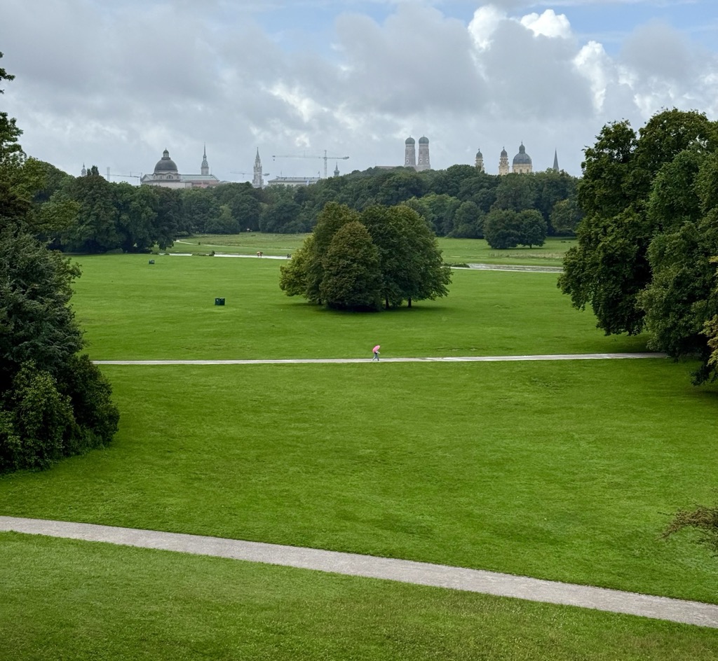
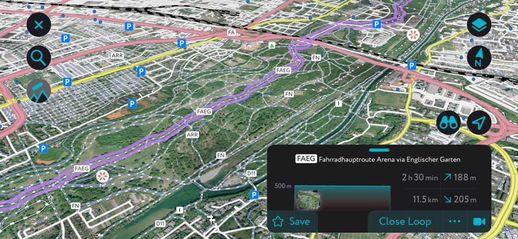
The Englischer Garten is one of the largest urban parks in the world, stretching from the city center to the suburbs. You could legitimately train for long-distance hikes here without crossing the same trail twice. We visited this place in the summer of 2025 and absolutely loved it.
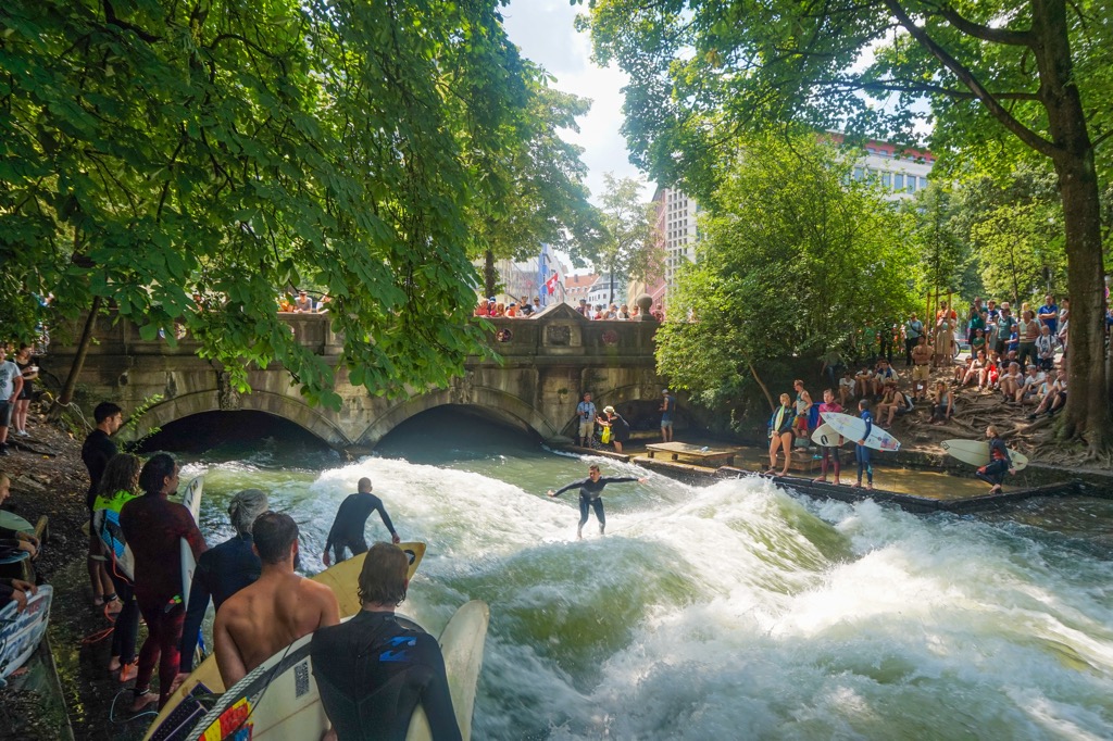
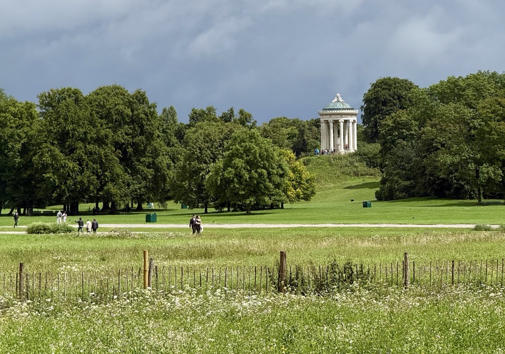
The main hiking routes follow the Isar River and the Eisbach, an artificial stream famous for its year-round surf wave. Being alongside these waterways, there isn’t much in the way of hills and viewpoints. One exception is the Monopteros, a Greek-style temple that offers views over Munich’s skyline.
The Japanese Teahouse, given as a gift during the 1972 Olympics, is another tourist hotspot. Beer gardens, like the one at the Chinese Tower, appeal to tourists and locals alike. Hikers can kick back in Bavarian fashion, under chestnut trees with a beer and a pretzel.
In spring, cherry blossoms line the southern sections; in autumn, golden leaves carpet the forested paths; in winter, the park sometimes transforms into a snowy landscape where hikers can share trails with cross-country skiers.
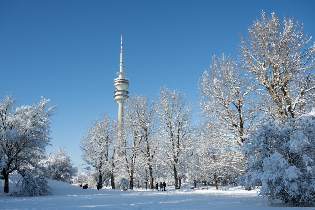
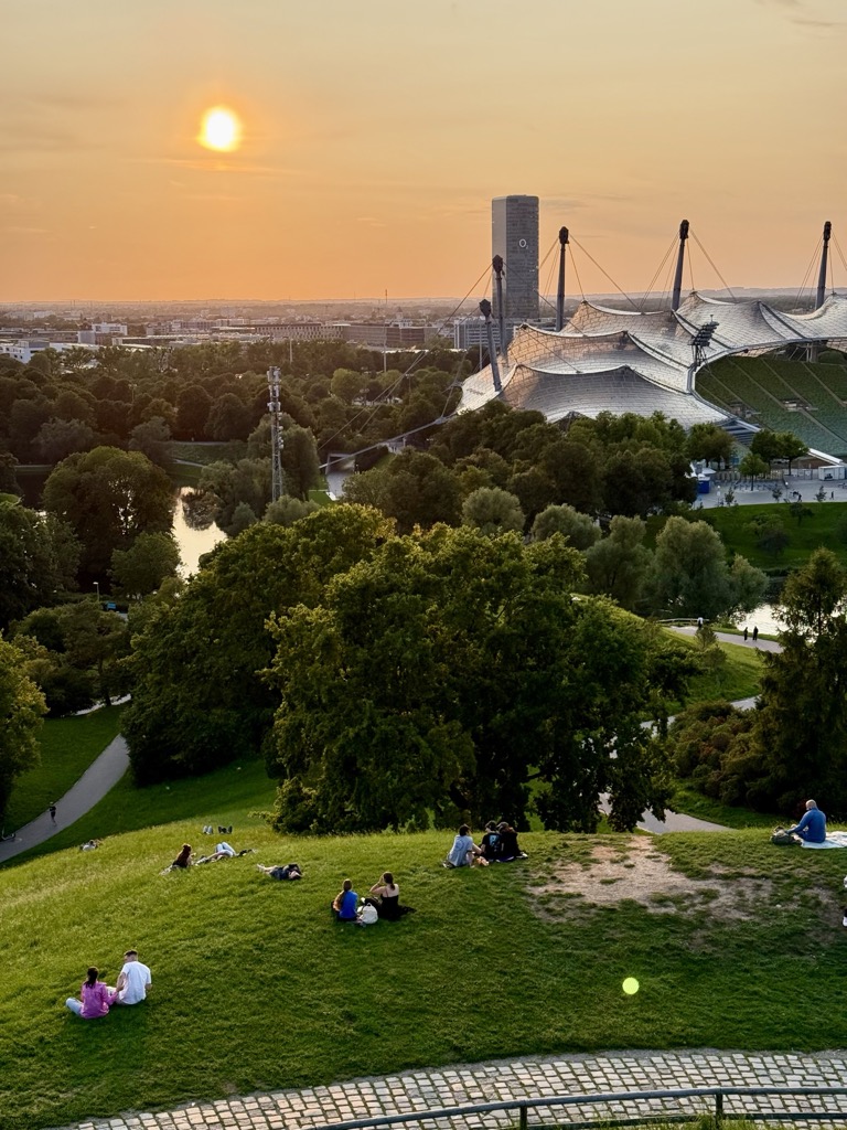
Munich’s Olympiapark was created for the 1972 Summer Olympics. Its elevation is derived from rubble mounds left from World War II bombings. Today, it covers about 85 hectares, about a quarter of the size of the Englischer Garten.
The 60-meter climb up the Olympiaberg (comprised of war debris) offers panoramic views over Munich and, on clear days, the Alps to the south. If you’re lucky, you’ll spot foxes and hedgehogs in the park’s quieter corners.
In spring, wildflowers and ornamental plantings brighten the slopes. Summer features concerts and festivals like the Sommerfest, while fall lends the hillsides a fiery palette of red and orange. Best of all, winter transforms Olympiaberg into a sledding hill if conditions line up.

Luitpoldpark’s centerpiece is the 37-meter Luitpoldhügel, another rubble hill constructed from war debris with a commanding view over Munich. At the heart of the park, the Obelisk Memorial commemorates the destruction of Munich during WWII and the subsequent rebuilding.
Westpark is the local favorite, as the least well-known of the large Munich parks. It’s split into an eastern and western section.
One of the main attractions is the park’s two lakes, the Ostsee and Westsee. Additionally, the park’s eastern section features the East Asian Ensemble, with a Thai Sala (pavilion), a Nepalese pagoda, and a Chinese garden with a water lily pond.
Hiking routes range from short 30-minute loops around the lakes to longer circuits connecting the eastern and western halves.

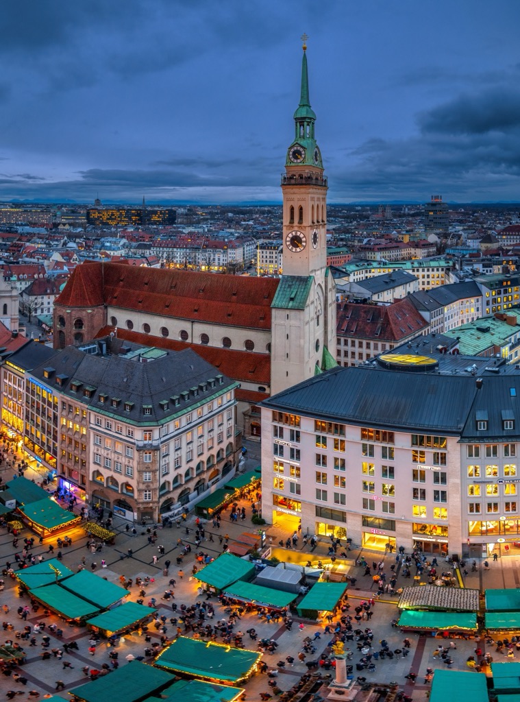
The Alter Peter Tower is one of Munich’s most iconic landmarks, totally worth a visit for the city views you’ll get from the top, as well as the beautiful Marienplatz. You’ll climb 306 wooden steps to reach the observation platform, which rises about 56 meters. That’s almost as high as the Olympiaberg rubble hill.
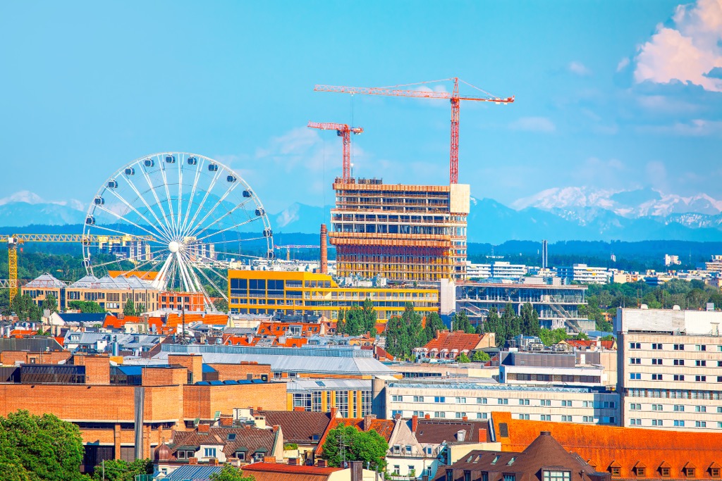
The 78-meter Umadum Ferris Wheel is in the revitalized Werksviertel-Mitte district near Ostbahnhof and is the world’s largest mobile Ferris wheel. Higher than any of the surrounding hills, it’s one of the best ways to look out over the cityscape, especially for families.
At PeakVisor, we love information. That’s why we write articles like this one.
Check out the PeakVisor app for even more information on thousands of hikes, ski tours, and ski resorts across the world. In fact, we’ve compiled information on all publicly maintained walking tracks worldwide, formatted onto our 3D maps.

PeakVisor started as a peak identification tool—you’ll have noticed the photos throughout this article—but we’ve evolved into purveyors of the finest 3D maps available. We continue to expand our offerings. You can track your hikes directly on the app, upload pictures for other users, and keep a diary of all your outdoor adventures.
Most recently, the PeakVisor App has included up-to-date weather reports, including snow depths, at any destination. We've also been hard at work adding the details of hundreds of mountain huts, including information on overnight accommodation, dining options, and opening hours. You can also use our Hiking Map on your desktop to create GPX files for routes to follow later on the app.
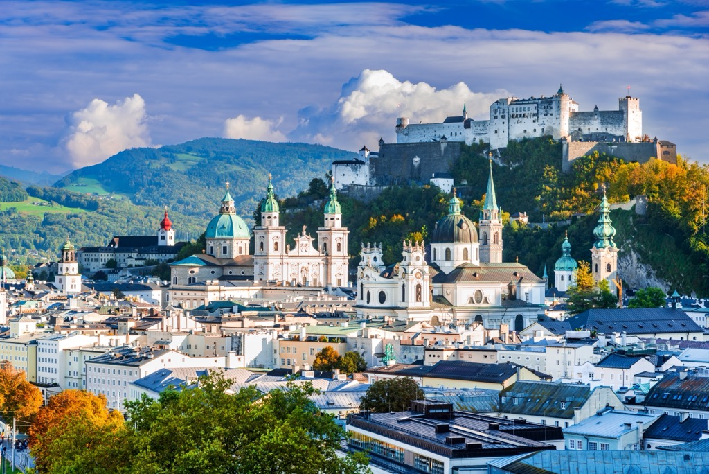
If you’re headed to Munich, don’t miss the mountain city of Salzburg, framed by the Northern Limestone Alps of Austria. Spared the destruction of WWII, Salzburg is one of Central Europe’s most picturesque cities. It’s just 90 minutes by train from Munich.
The baroque old town features the Hohensalzburg Fortress, perched high above on the Festungsberg. The city’s historical wealth was built on salt trade profits, hence the name “Salzburg,” meaning “Salt Fortress.” Check out PeakVisor’s article on mountain opportunities in the State of Salzburg (rather than just the city) for more information.
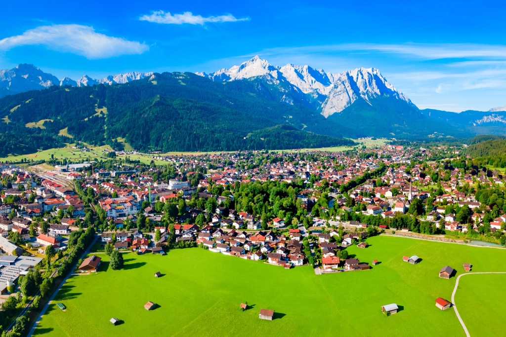
Garmisch-Partenkirchen is located at the foot of the Zugspitze, the highest peak in Germany at 2,962 meters (9,718 ft). In addition to the Zugspitze, the town is a gateway to the Partnach Gorge (Partnachklamm) and home to Germany’s 3rd largest ski resort, by kilometers of piste (60 km). Partenkirchen dates back to Roman times and retains some traditional Bavarian character, with frescoed houses and narrow streets, while Garmisch was developed for the ‘35 Olympics. It’s just a bit over an hour by car or train to Garmisch from Munich; just like that and you’re in the mountains.


Yes. Munich has 7 named mountains. The highest is Baldehöhe at 586 m.
The highest mountain in Munich is Baldehöhe, at 586 m.
Munich has 7 named mountains.


