
Scan the QR code and open PeakVisor on your phone
Free State of Bavaria is home to 8,541 named mountains. The highest is Zugspitze at 2,962 m.
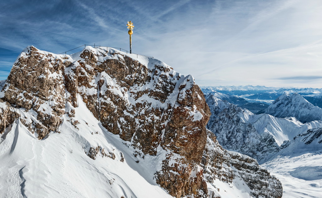
The Free State of Bavaria is an administrative region located in southeastern Germany. The state is home to both the cleanest lake and the tallest peak in the entire country. There are 8541 named mountains in Bavaria. The tallest and most prominent peak is Zugspitze, which straddles the border between Germany and Austria. The peak stands at 2,962 m (9,718 ft) in elevation with 1,758 m (5,768 ft) of prominence.
Bavaria (officially the Free State of Bavaria/Freistaat Bayern) is an administrative region that’s situated in southern Germany. It shares borders with three other countries: Czechia to the east, Austria to the south, and Switzerland to the west. Bavaria also borders four other German states: Baden-Württemberg, Hesse, Thuringia, and Saxony.
The state encompasses 70,550 sq. km (27,240 sq. miles) of land across southeastern Germany, making it the largest German state by area. It’s also the second most populous after North Rhine-Westphalia, though it’s among the least densely populated due to its large size. The two major rivers that run through the state are the Danube (Donau) and the Main, the latter of which is the river Rhine’s longest tributary.
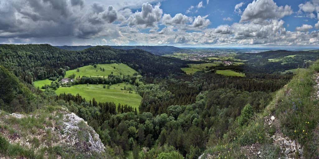
There are numerous parks and forests within the state of Bavaria. Some of the major protected areas include Bavarian Forest National Park, Berchtesgaden National Park, Östliche Chiemgauer Alpen, Karwendel und Karwendelvorgebirge, and Allgäuer Hochalpen.
Additionally, Bavaria can be broken down into four major geographical regions:
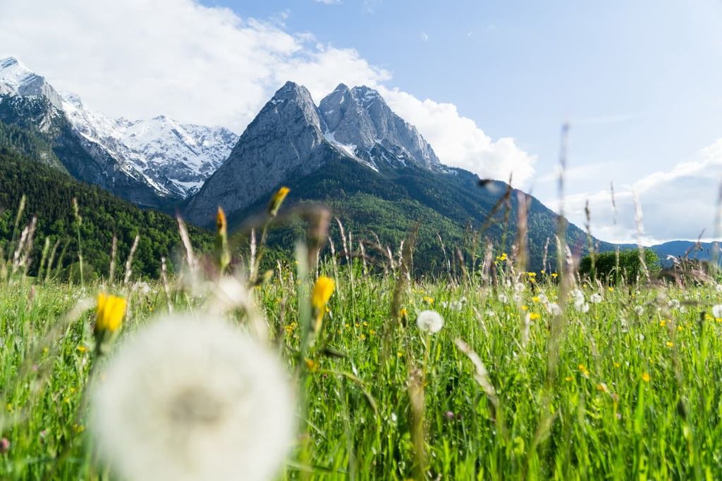
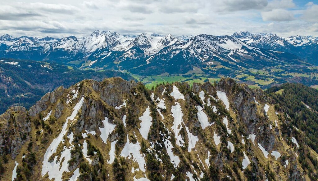
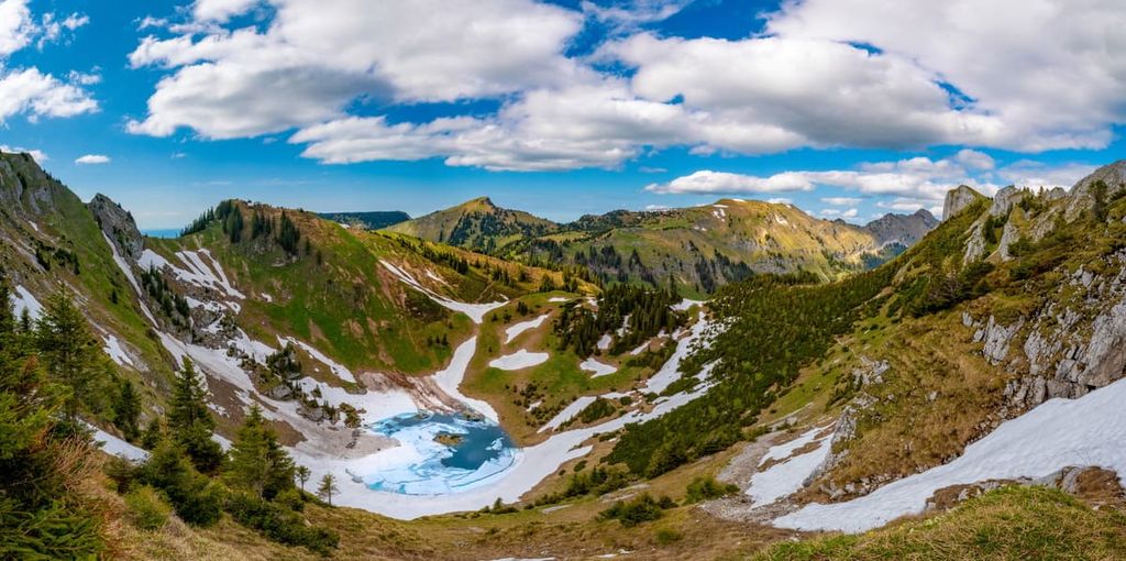
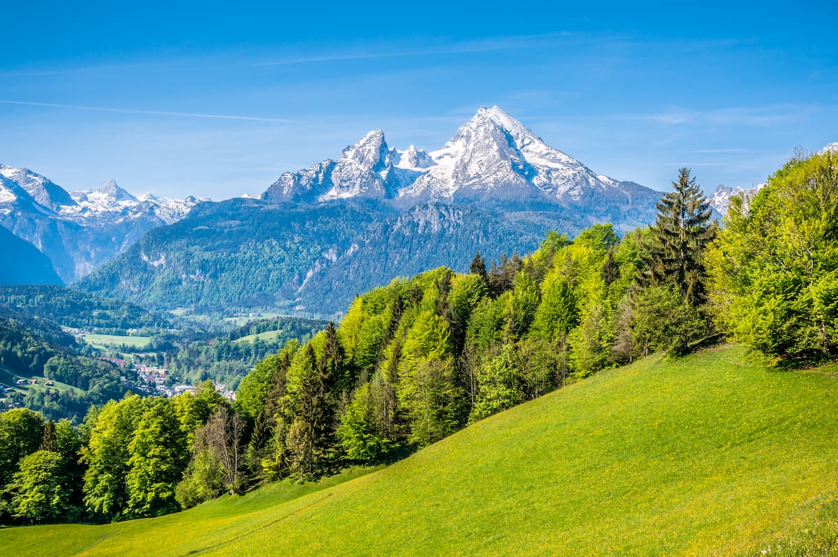
The Bavarian Alps are home to the tallest peaks in the entirety of Germany. As part of the larger Northeastern Alps, the peaks stretch across the southern border of Germany and into parts of extreme western Austria.
The Bavarian Alps lie within the Eastern Alps and their geography is similar to that of the rest of the range. Steep and rugged snow capped peaks create a natural barrier between Bavarian and Austria which lies to the south.
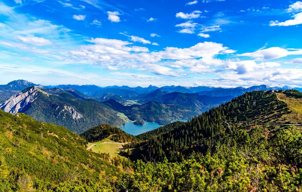
The range is met with deep river valleys, alpine lakes, and forested hillsides. Above the treeline, the peaks are home to minimal flora, allowing for hikes with panoramic views.
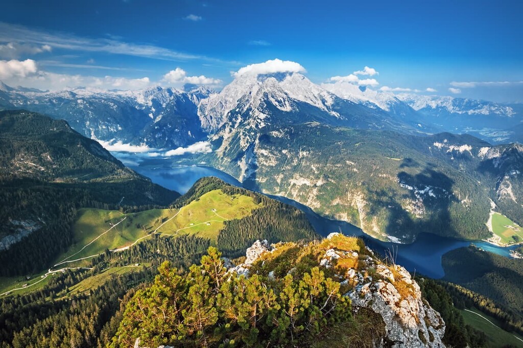
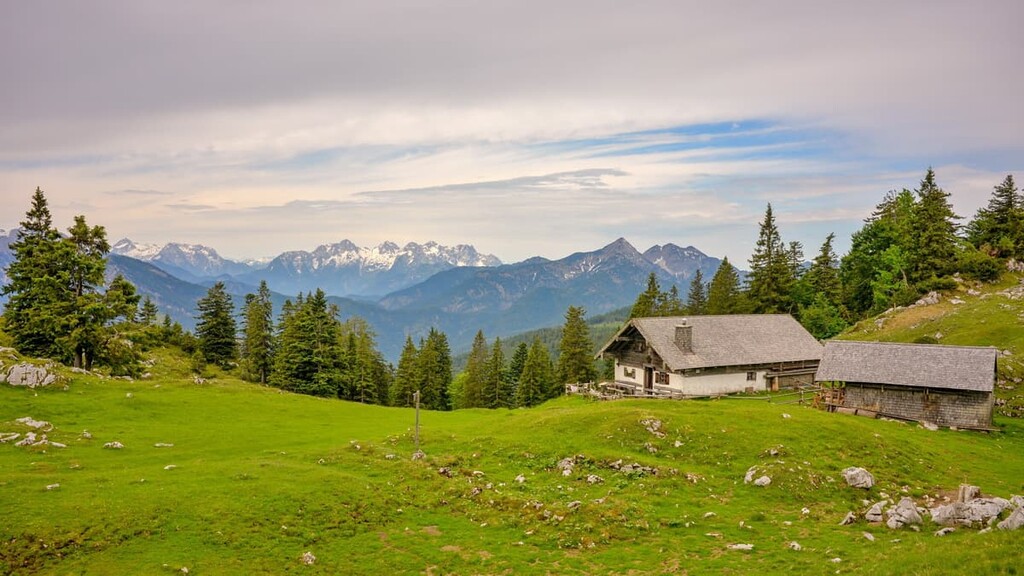
The most southeastern region of Germany, the Bavarian Alps are home to Berchtesgaden National Park. The park is home to what’s considered to be the cleanest lake in the country (Königssee), and it has long been a source of inspiration for painters and writers.
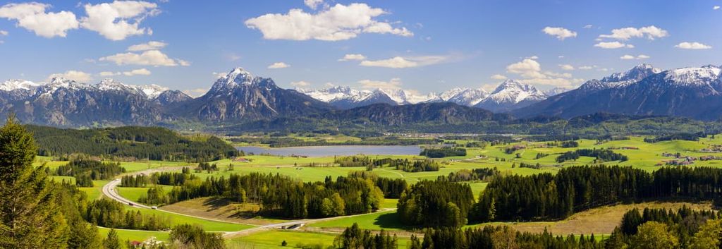
The Bavarian Alps slowly give way to alpine foothills, which extend northward from the peaks and are marked by lush rolling hills.
While the immediate foothills of the Alps are often heavily forested, fertile plateaus and farmlands can also be found throughout the region. Small settlements are scattered around the area while rivers and streams gently wind their way through the hills toward their outlets.
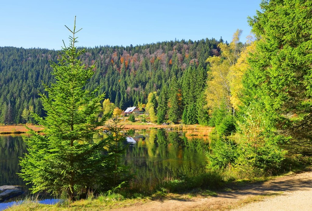
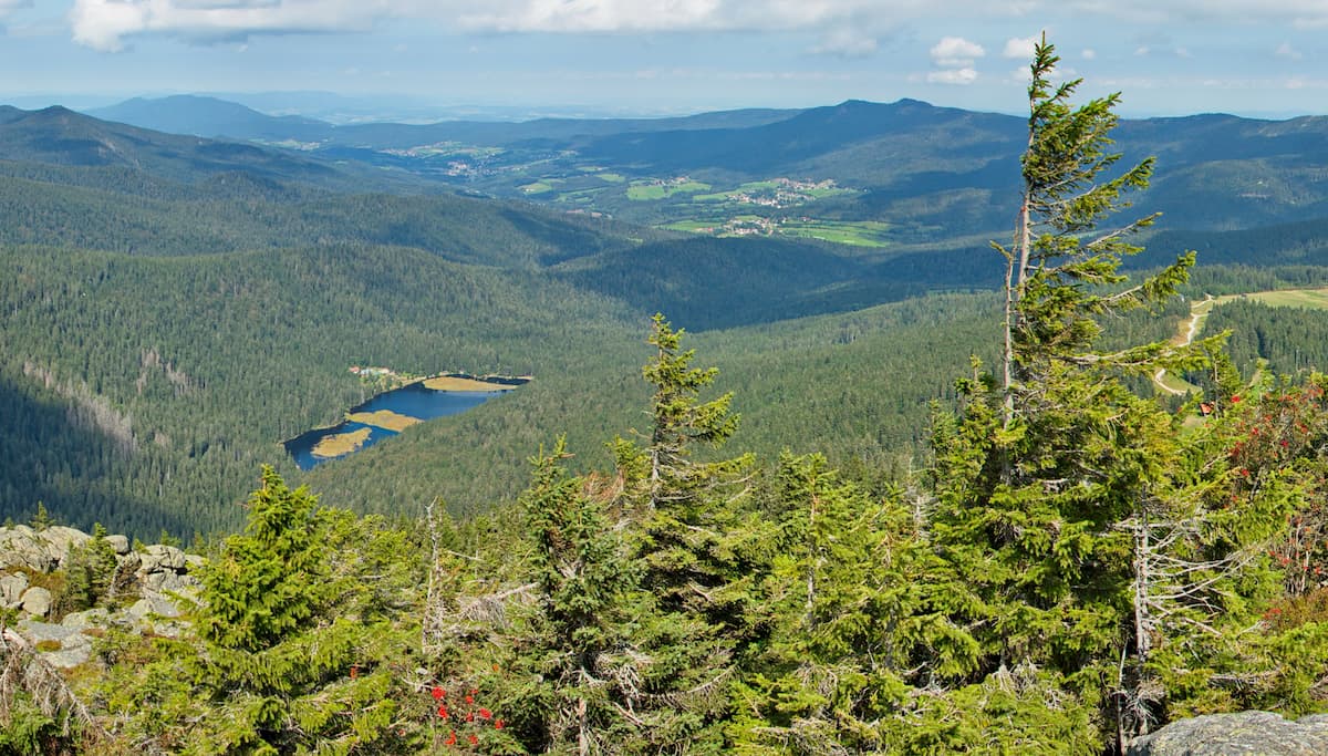
Eastern Bavaria is home to the Bavarian Forest National Park and the greater Bavarian Forest. This protected region extends into Czechia where it is known as Šumava National Park and the Bohemian Forest.
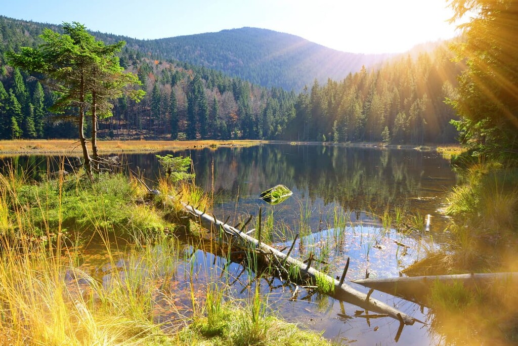
Together, the two national parks mark the largest continuous forest in central Europe. The region is marked by the Upper Palatinate-Bavaria Forest in the far east along the country’s border with Czechia.
Though much of the region is heavily forested, there are a number of towns located along the Danube River. Raised sections of peat bog are also common amidst the forested hills in this region.
The Swabian - Franconian region is dominated by the plateaus of western Bavaria. Here, the forested hillsides and vast fields are dotted with wineries while all of the region’s major rivers are home to various villages. Though not in Bavaria, the city of Frankfurt lies just west of the state’s boundary in the Swabian - Franconian region.
The most dominant geological feature of the park is the Bavarian Alps, which are a subrange of the Alps.
The Alps comprise the highest mountain range that is located wholly in Europe. The range began forming during the Alpine orogeny in the Late Mesozoic when the Eurasian plate collided with a number of other plates to the south, including that of the Indian subcontinent and northern Africa.
The range has experienced widespread erosion over the millennia. Continuous erosion and glacial retreat has left behind the towering peaks that mark the southern region of Bavaria. Nevertheless, the change in elevation is abrupt here as the region quickly transforms from alpine landscapes into rolling foothills.
The Alps are often broken down into three major regions: Western, Eastern and Southern Alps. The peaks within the Free State of Bavaria are part of the Eastern Alps (and, more specifically, the Northeastern Alps). Compared to other sections of the Alps, this subrange has a relatively small number of high peaked massifs.
Interestingly, Bavaria is home to a plethora of valuable minerals. Southeastern Bavaria, particularly in Berchtesgaden National Park, contains a high concentration of salt, which is why the region is known for its salt mines. In fact, nearby Salzburg (meaning Salt Castle in German) in Austria gets its name from this high concentration of salt.
Major peaks within the state include Zugspitze, Berchtesgadener Hochthron, and Ammergauer Kreuzspitz, Sonntagshorn, Krottenkopf.
The Free State of Bavaria is home to numerous ecological regions. The mountainous regions are home to vast areas of spruce trees.
Both beech and fir trees have been planted in the alpine regions in hope to restore the damage that widespread logging has caused over the centuries. Here, alpine lakes are surrounded by dense sections of forest along with vast pastures dotted with various species of grasses and wildflowers.
The foothills of Bavaria, along with certain regions in eastern Bavaria, are home to sections of raised bog. The bog landscapes are marked by rough patches of grasses and little to no trees.
Rare species of orchids can be found amidst the foothills of the state. Other common plants found in Bavaria include bluebills, primroses, cornflowers, daisies, as well as patches of wild berries, flap mushrooms, and chanterelles.
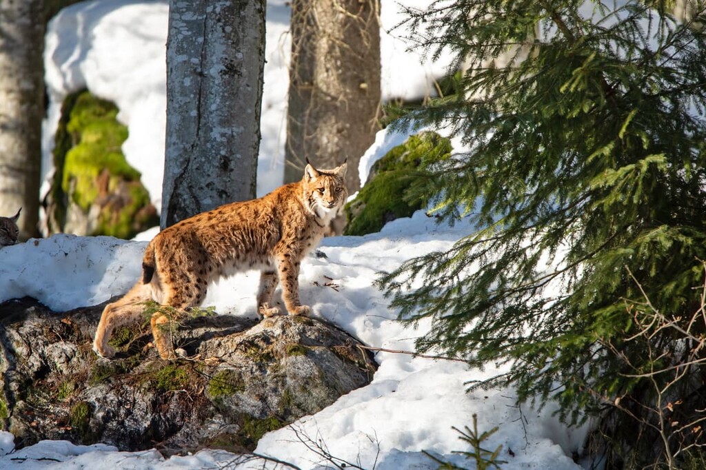
As far as wildlife goes, Bavaria is home to over 700 species of butterflies. Throughout the state, there are also large populations of ibex and red deer. Populations of marmots, chamois, beavers can be spotted in the state, as can moose, though the latter are often only seen in Bavarian Forest National Park. Within the park also exists a small population of the Eurasian lynx.
The sky within Bavaria is home to a variety of flying animals. Common species include golden eagles, black woodpeckers, black grouse, peregrine falcon, and the Eurasian pygmy owl.
However, though bears and wolves once thrived in the region, they became extirpated from Bavaria as human populations grew and ecological disturbances became more frequent.
The region of Bavaria has been inhabited by humans for thousands of years. The Celts inhabited the region prior to the arrival of the Bavarians, a Germanic people (also called the Baiuvarii). The Bavarians are often believed to be the ancestors of the contemporary Austrians and Bavarians.
Throughout the Middle Ages, the house of Agilolfing ruled over the Duchy of Bavaria, which included much of what is now the Free State of Bavaria. The house ruled from 554 to 788 CE until the leader of the house, Duke Tassilo III, was deposed by Charlemagne.
Throughout the next four centuries, the Duchy of Bavaria was ruled by a succession of different noble families. One notable event, however, was the founding of the Duchy of Ostarrichi in the twelfth century. This area, which was split off from the Duchy of Bavaria, eventually became what is now Austria.
The Duchy of Bavaria was further divided throughout the twelfth century. These divisions continued until about the fifteenth century until parts of Bavaria were reunited into one duchy with its capital at Munich.
In 1806 the Kingdom of Bavaria was formed by Napoleon after the abolition of the Holy Roman Empire. It was granted a constitution in 1818 and it became a center for culture and sciences throughout the nineteenth century. Bavaria even managed to preserve its independence in the face of an ever-expanding Kingdom of Prussia until it was defeated while fighting alongside the Austrians in the Austro-Prussian War of 1866.
In the 1870s, Bavaria eventually joined forces with Prussia to form the German Empire in 1871. Although Bavaria maintained its Kingdom and much of its autonomy after the establishment of the empire, King Ludwig III formally approved the formation of the Free State of Bavaria and its republican government in 1918. Soon thereafter, a communist government took control of the region, establishing the very short-lived Bavarian Socialist Republic.
Afterward, Bavaria became part of the Weimar Republic. Throughout the 1920s and 1930s, Bavaria played a central role in the development of the Nazi party. In particular, Munich was the site of the Beer Hall Putsch in 1923, a failed coup d’état led by Adolf Hitler.
Nuremberg, the state’s second-largest city, became a frequent location for Nazi propaganda events. It was also the site of the Reichstag’s passing of the Nuremberg Laws in 1935, which revoked rights and German citizenships for non-Aryans and all Jewish people.
Bavaria was the site of a number of infamous concentration camps during World War II. These include Dachau, where at least 41,000 people were murdered, and Flossenbürg, where at least 30,000 people were murdered by the Nazis. Bavaria was also a major manufacturing center during the war and, as such, it was heavily bombed by Allied forces.
After World War II, Bavaria was part of the American Zone of Allied-Occupied Germany. It then became part of Bizonia, which was occupied by both the British and American forces. Bavaria then became part of West Germany, however, the state notably didn’t sign the Founding Treaty ratifying the division of Germany into two countries in 1949, though the treaty was ratified anyway due to support from other states.
Since joining the Federal Republic of Germany and since the reunification of Germany in 1990, Bavarians have often sought to maintain and emphasize their national identity. Bavaria has a strong and rich cultural history. The state also has a strong and diverse economy as well as a burgeoning tourist industry.
The Free State of Bavaria is home to numerous protected regions and hiking trails. Here are some of the most popular spots in the state:
Berchtesgaden National Park is one of the most popular hiking regions in all of Bavaria. Located in southeastern Bavaria, the park is home to rugged peaks and the famous Lake Königssee, which is known for having some of the cleanest water in the entire country.
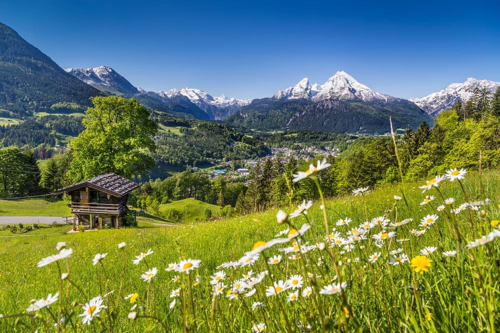
Easily accessible from major cities, Berchtesgaden National Park is home to a plethora of hikes of varying levels of difficulty. While some trails wind along the lake shores, others climb high into the Berchtesgaden Alps.
Popular trails include Das Kehlsteinhaus, Malerwinkel, Wimbachbrücke zum Watzmannhaus, and the Grünstein Loop. Visitors can also visit Jenner for cable car views or take a picturesque lake cruise.
Bavarian Forest National Park lies in the eastern region of Bavaria, sharing a border with Šumava National Park in the Czech Republic. Together these two parks form the largest continuous forest within central Europe.
Traditional Bavarian towns lie along the foothills of the forest park. Small lakes are scattered throughout the region along with vast sections of raised bog.
A few popular trails include those to Lusen Rundweg, Lusen ab Finsterau, and Rachelrundweg.
Along the southwestern border of Bavaria lies the Allgäuer Hochalpen Nature Reserve. By area, the reserve is larger than some of the national parks in Germany.
Rugged and barren peaks coupled with alpine lakes mark the southern region of the reserve while the northern section is dominated by lush vegetation on rolling foothills. Trails in the reserve include those to Rubihorn and Lower Gaisalpsee Loop, Zum Schrecksee, Von Reichenbach aufs Rubihorn, and Kemptner Hütte.
In the southwest of Bavaria lies Ammergau Alps Nature Park, which is known for its pristine and majestic forested landscape. Rare ferns and mosses are found along the forest floor while rugged cliffs line the sides of the valleys.
Common hiking routes include those to the Timberland Trail, Ludwigschlucht Gorge, Teufelstättkopf and Pürschling, Hörnle Loop, and Oberammergau Kolbensattel.
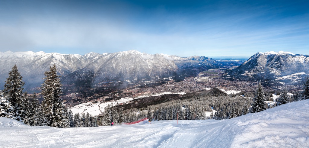
Situated at the base of the Zugspitze lies the town of Garmisch-Partenkirchen. During the winter, the town is immensely popular for both skiing and ice skating, however the summer months also provide some of the best hiking in the state.
Garmisch-Partenkirchen sits in a wide valley, and is surrounded by a plethora of hiking trails including numerous famous gorge hikes. Some of the most well-known trails in the region include those to Partnach Gorge Trail, On the Kramerspitz, Zugspitze via Ferrata, Höllental Loop, Wanderung auf den Wank, and Hoher Ziegspitz über die Stepbergalm.
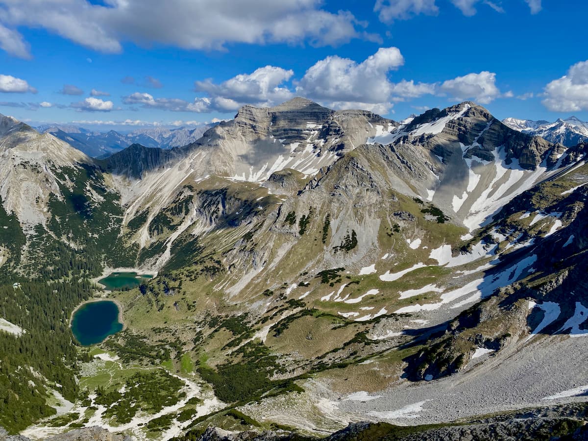
Located along the southern border of Bavaria lies the Karwendel und Karwendelvorgebirge Nature Reserve. Here, alpine lakes are scattered throughout the landscape amidst the snow capped peaks, meadows, and wide river valleys.
The reserve provides breathtaking views with far less crowds compared to some of the more well-known parks and reserves. Popular trails in the reserve include those to Wörnerkopf und Hochlandhütte von Mittenwald, Buckelwiesen und Isar-Natur-Erlebnisweg zwischen Mittenwald und Krün, Soiernrunde mit Schöttelkarspitze, and Zustieg Oberes Soiernhaus von Krün über Fischbach-Alm.
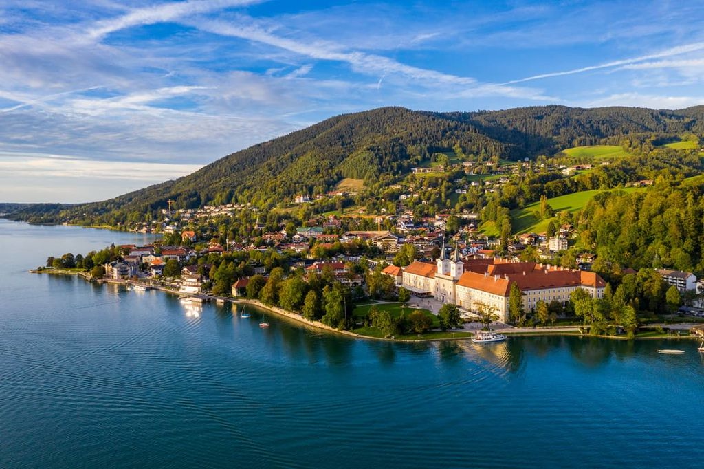
Tegernsee is a resort town located to the south of Munich that’s situated on the shores of Tegernsee Lake. The Tegernsee Valley extends past the lake shores with rolling forested hills towering on either side.
The city is popular throughout the year for hiking, and it also offers skiing, paved foot trails, and toboggan runs. Popular routes include those to the Alpbach and Riederstein Loop, Von Tegernsee zum Berggasthof Neureuth über Bayernweg, Von Tegernsee nach Hausham über die Grindelwald, and Von Tegernsee auf die Kreuzbergalm.
Located in southern Bavaria, Östliche Chiemgauer Alpen Nature Reserve is the fourth largest in the state by area. The Fischbachtal divides the reserve into two distinct regions.
The western region is marked by the Dürrnbachhorn massif while the eastern region extends along the Rauschberg massif. The reserve’s close proximity to Berchtesgaden National Park makes it easily accessible for those visiting the area.
Popular trails with the reserve include the SalzAlpenSteig (Fernwanderweg) thru hike, SalzalpenTour Rauschberg - Kienberg, Hörndlwand - Old Schmidkunzweg, and Rundwanderung Lödensee - Weitsee.
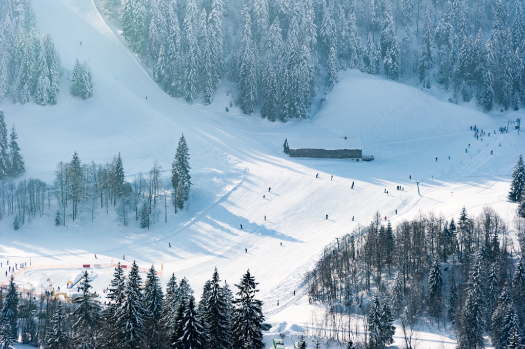
For skiing and snowboarding enthusiasts, there are more than 260 ski resorts in Bavaria. They are located throughout the state. However, the vast majority of them are very small resorts with a total length of slopes of just a few kilometers (miles). But there are quite a few large resorts too. These are areas for skiing in the Bavarian Alps along the southern border of the state with Tyrol in Austria and Switzerland.
The largest ski resort in Bavaria is Steinplatte/Winklmoosalm with more than 40 km (25 mi) of slopes and more than 10 ski lifts.
Other major areas for skiing in Bavaria with more than 20 km (mi) of slopes and more than 5 ski lifts each include the following in descending order of size:
The largest ski resort outside the Bavarian Alps is Arber on the eastern border of the state with more than 10 km (6 mi) of slopes and more than 5 ski lifts.
The main ski resort near Munich, the capital of Bavaria, is Kienader-Bergkirchen with 1 km (0.6 mi) of slopes and 3 ski lifts. The nearest major resort is Brauneck south of the city.
Check the Bavaria ski resorts map as well as the larger Germany ski resorts map in the World Mountain Lifts section of the site. It includes information about open ski lifts / slopes in Bavaria in real-time with opening dates and hours. There are also year-round cable cars, funiculars, cog railways, aerial tramways, and all other types of mountain lifts.
Looking for a place to stay in Bavaria? Here are some of the best cities and villages to check out in the state:
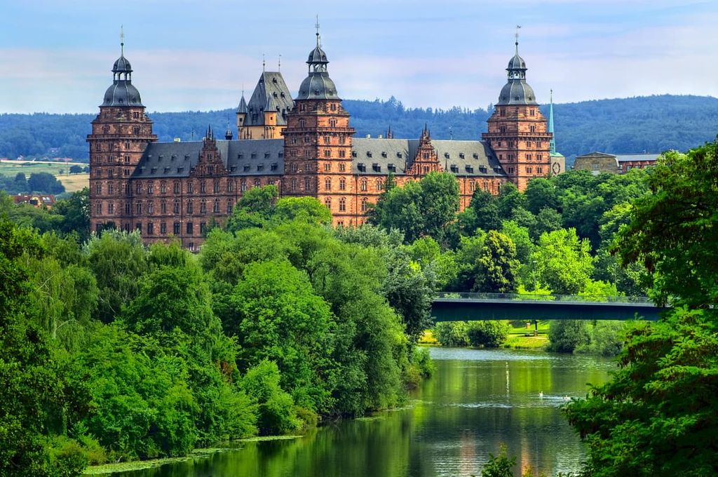
The largest and most populous city in all of Bavaria is Munich. Located in the southern part of the state, Munich is also the capital of Bavaria.
With a city population of nearly 1.5 million, Munich is the third largest city in the entire country. The river Isar, which is a tributary of the Danube, runs through the city after descending from the Bavarian Alps.
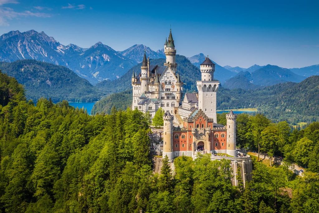
Today, Munich is home to the world’s largest beer garden, which is a popular site for both tourists and locals. As a major city within the country, Munich is home to over 80 museums. The south central location of the city allows for visitors to take day trips to nearby sites such as Neuschwanstein Castle.

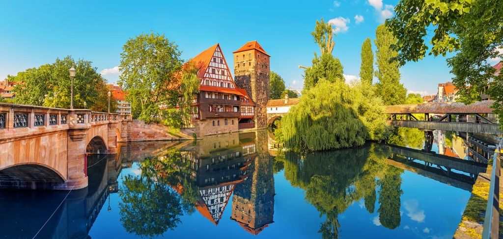
Nuremberg lies in northern Bavaria and has a population of around 515,000 people, making it the second most populous city in Bavaria. The city is also home to one of the biggest Christmas markets in Europe.
Nuremberg is one of the few cities in Europe that is still surrounded by a medieval wall with nearly 90 percent of it still intact. The Konigstrasse is another popular site and marks one of the main entrances into the city. Today it is lined with shops, restaurants, and local accommodations.
In the southeastern region of Bavaria, just outside of Bavarian Forest National Park, lies Zwiesel. The town of Zwiesel is situated at the fork of two rivers, Großer Regen and Kleiner Regen, with the summit of Großer Arber towering above.
The town is home to around 10,000 people. Today Zwiesel’s economy relies on brewing, glass making, and tourism for those visiting the surrounding nature. The river basin provides a quaint setting for the town, full of local shops and restaurants for those visiting the region.


Yes. Free State of Bavaria has 8,541 named mountains. The highest is Zugspitze at 2,962 m.
The highest mountain in Free State of Bavaria is Zugspitze, at 2,962 m.
Free State of Bavaria has 8,541 named mountains.


