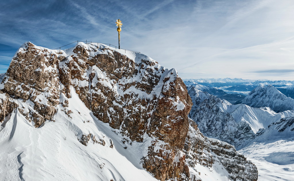
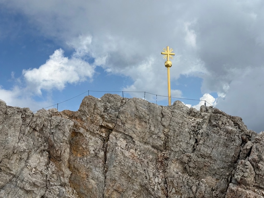
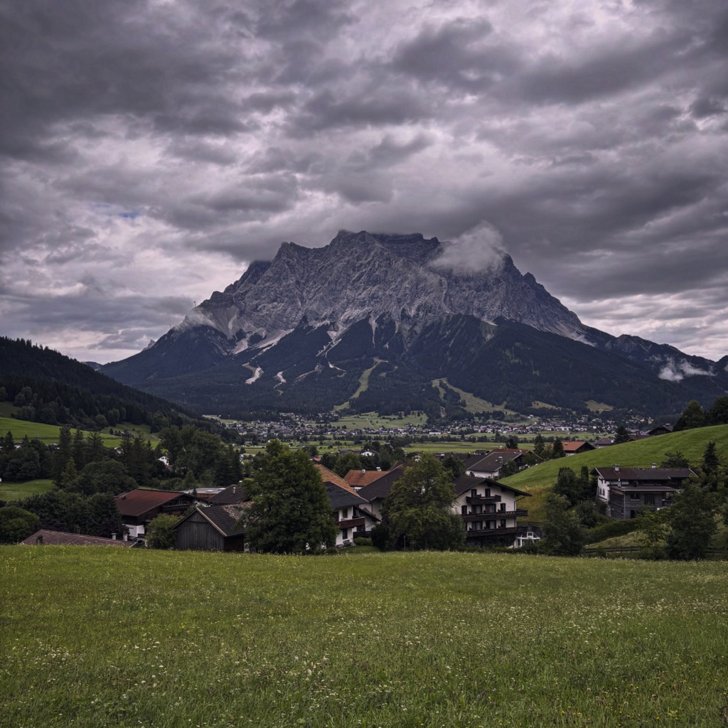
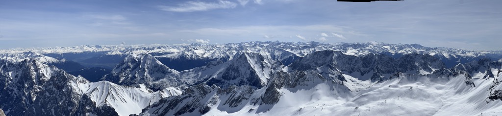
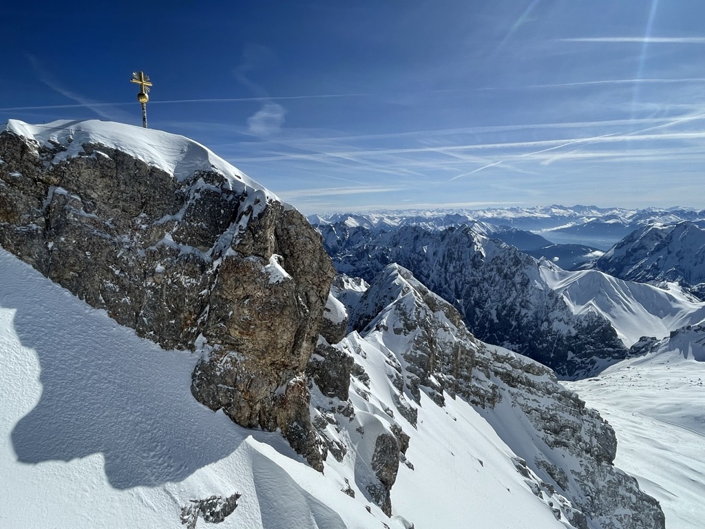
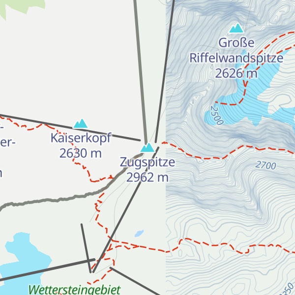
Zugspitze is a mountain on the border between Germany and Austria, the highest point (9,718 feet [2,962 meters]) in Germany. It is part of the Wetterstein Mountains in the Bavarian Alps. Zugspitze is home to one of Germany’s last glaciers. The mountain can be approached on the west by an aerial tramway from the village of Eibsee and on the northeast by a railway from the town of Garmisch-Partenkirchen.
The first people to ascend the Zugspitze on 27 August 1820 were Lieutenant Josef Naus, a 27-year-old engineer from the Royal Bavarian Army, his mountain guide Johann Georg Tauschl, and a military orderly named Maier. Lieutenant Naus was employed by the Royal Bavarian Topographic Bureau, putting together an Atlas of Bavaria.
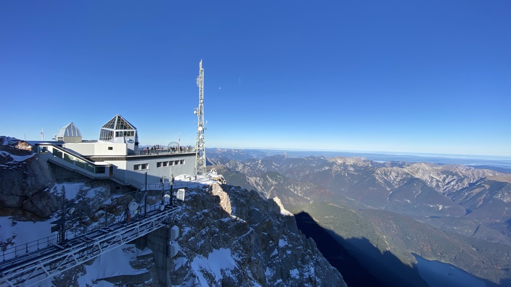
The peak is served by three cable cars, which between them carry an estimated half a million visitors to the summit each year. On the flanks of the Zugspitze are two glaciers, the largest in Germany: the Northern Schneeferner with an area of 30.7 hectares and the Höllentalferner with an area of 24.7 hectares2. But “eternal ice” on the Zugspitze is also acutely threatened by climate change. Accompanied by glacier guides, visitors can explore the ice worlds on the Zugspitze plateau. The trained staff provide background information on the glacier, give insights into the microcosm of the ice worlds and explain why this glacier is now threatened by climate change.
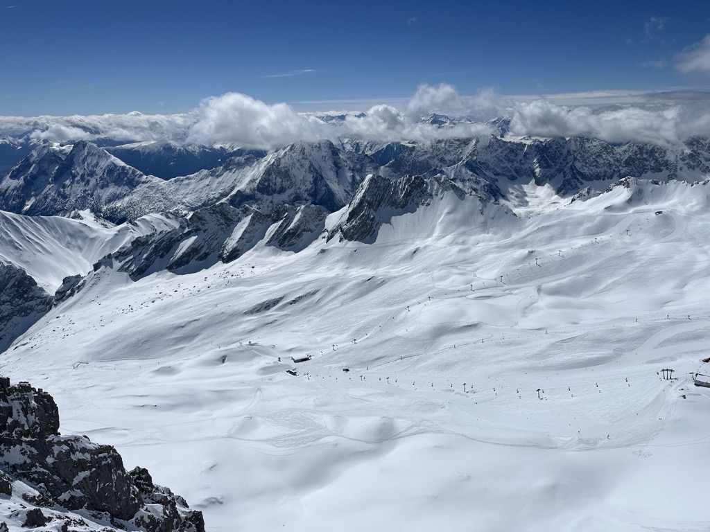
On Zugspitze lays Germany’s highest ski area with a total of 20 km of slopes with 9 ski lifts that can take you up to 2,720 meters above sea level. The ski area is suitable for both beginners and advanced skiers. The mountain also offers a variety of mountaineering routes such as the Reintal route which is the easiest route and the Höllental route which is considered the nicest one.
Zugspitze offers a several restaurants at the summit with breathtaking views and varied daily dishes.
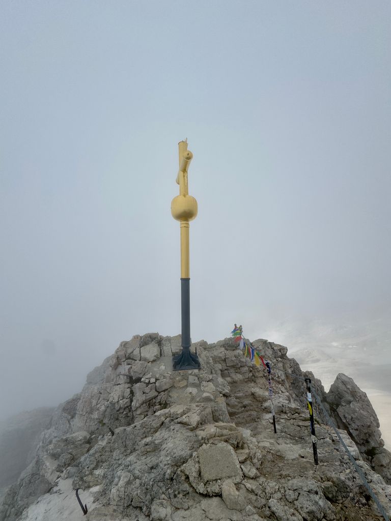
There's a trail leading to the summit.
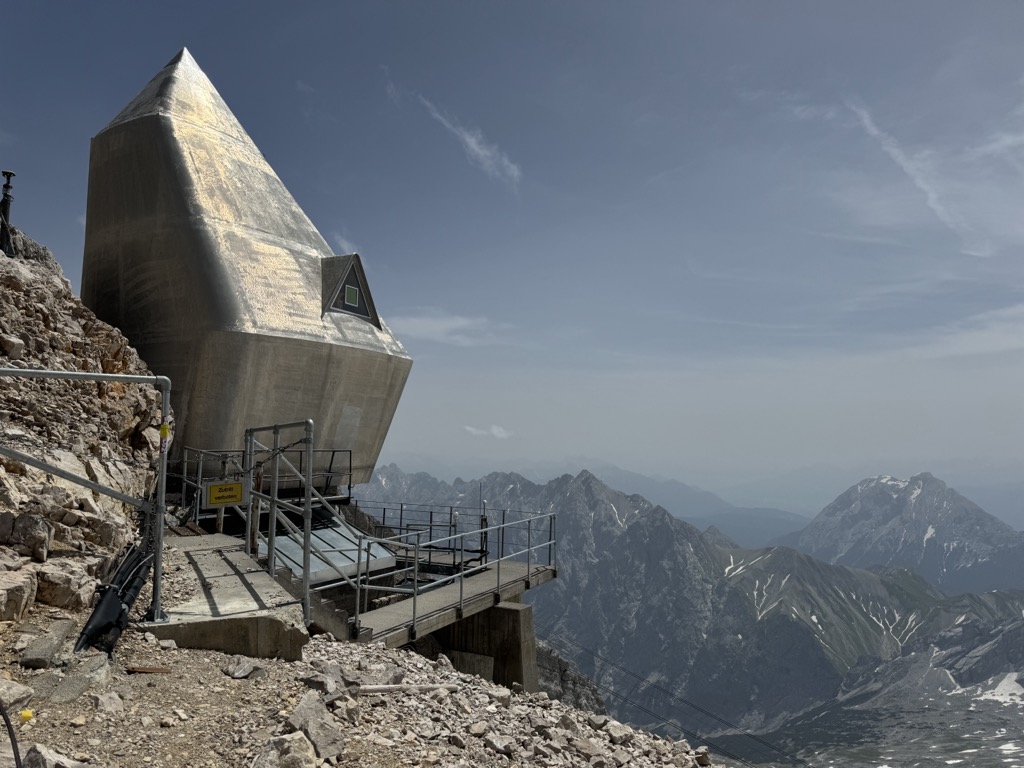
The nearest mountain hut is Münchner Haus located 18m/59ft ENE of the summit.
By elevation Zugspitze is
# 1 out of 182 in the Wetterstein # 1 out of 8134 in Bavaria # 1 out of 775 in Bezirk Reutte # 1 out of 37308 in Germany # 1 out of 442 in Landkreis Garmisch-Partenkirchen # 3 out of 1916 in the North Tyrol Limestone Alps
By prominence Zugspitze is
# 21 out of 60693 in the Alps # 1 out of 182 in the Wetterstein # 5 out of 23502 in Austria # 1 out of 8134 in Bavaria # 1 out of 775 in Bezirk Reutte # 1 out of 37308 in Germany # 3 out of 5947 in Tyrol # 1 out of 442 in Landkreis Garmisch-Partenkirchen # 1 out of 1916 in the North Tyrol Limestone Alps
We use GPS information embedded into the photo when it is available.
3D mountains overlay
Adjust mountain panorama to perfectly match your photos because recorded by camera photo position might be imprecise.
Move tool
Rotate tool
Zoom
More customization
Choose which peak labels should make into the final photo and what photo title should be.
Next
Photo Location
Satellitte
Flat map
Relief map
Latitude
Longitude
Altitude
OR
Latitude
°'''
Longitude
°'''
Apply
Register Peak
Peak Name
Latitude
Longitude
Altitude
Register
Teleport
PeakVisor
This 3D model of Sagarmatha National Park in Nepal was made using the PeakVisor app topographic data. The mobile app features higher precision models worldwide, more topographic details, and works offline. Download PeakVisor maps today.
Download OBJ model
PeakVisor
The download should start shortly. If you find it useful please consider supporting the PeakVisor app.
PeakVisor for iOS and Android
Be a superhero of outdoor navigation with state-of-the-art 3D maps and mountain identification in the palm of your hand!