Scan the QR code and open PeakVisor on your phone
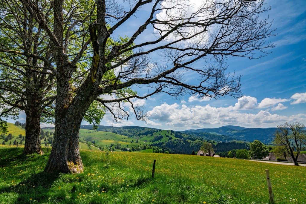
Baden-Württemberg is a German state situated in the southwestern portion of the country. The state features a wide variety of terrain and is home to the Black Forest (German: Schwarzwald), which marks the largest continuous forest in all of Germany. There are 3647 named mountains in Baden-Württemberg. The tallest and most prominent peak is Feldberg at 1,493 m (4,898 ft) tall with 923 m (3,028 ft) of prominence.
Baden-Württemberg lies in the southwestern region of Germany. It shares borders with the German states of Rhineland Palatinate, Bavaria, and Hesse. The state also shares borders with two countries: France to the west and Switzerland to the south.
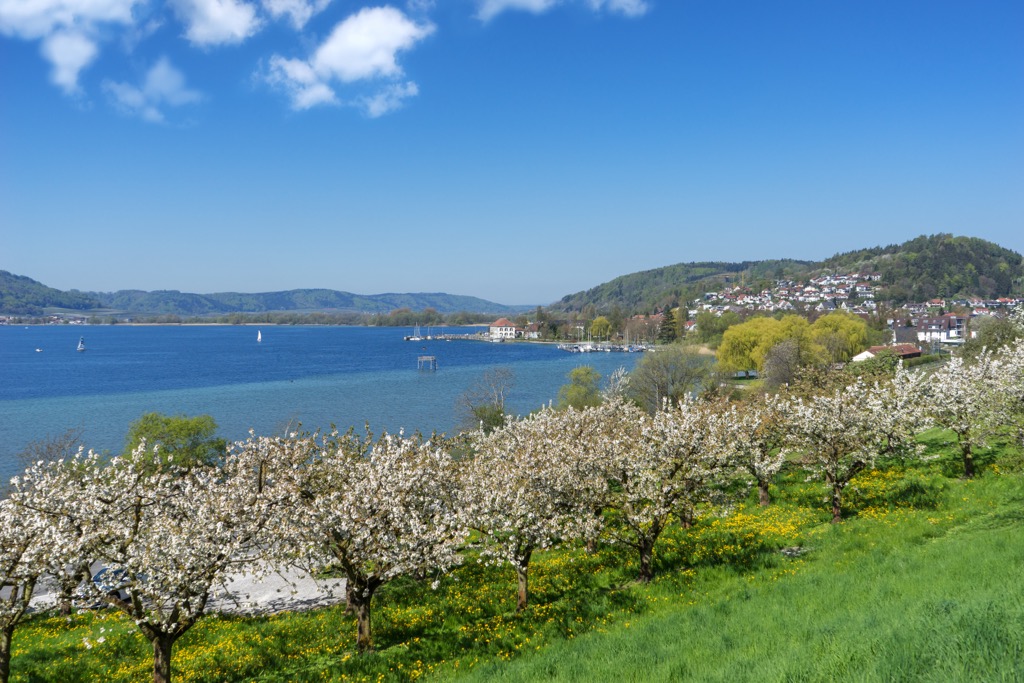
Though Baden-Württemberg does not share any land borders with Austria, both Germany and Austria border Lake Constance (also known as the Bodensee and Swabian Sea) along with Switzerland. The lake is situated along the southern border of Baden-Württemberg.
The state encompasses 35,751 sq. km (13,804 sq. miles) of land across southwestern Germany, making it the third largest German state by area. It’s also the third most populous state after North Rhine-Westphalia and Bavaria.
Baden-Württemberg marks one of the most geographically varied sections of terrain in the country. The state is bound by the Main River in the north, Lake Constance (Bodensee) and the upper Rhine in the south, the Iller River in the east, and the Rhine river and valley to the west. The Neckar River cuts through the central portion of the state, with multiple major cities in the state being situated along its banks. The headwaters for the Danube are located in the state, within the Black Forest.
There are numerous parks and forests within the state of Baden-Württemberg. Some of the major protected areas include Black Forest National Park, Southern Black Forest Nature Park, Black Forest Biosphere Reserve, Schönbuch Nature Reserve, and Wernau Quarry Ponds.
Additionally, Baden-Württemberg can be broken down into four major geographical regions:
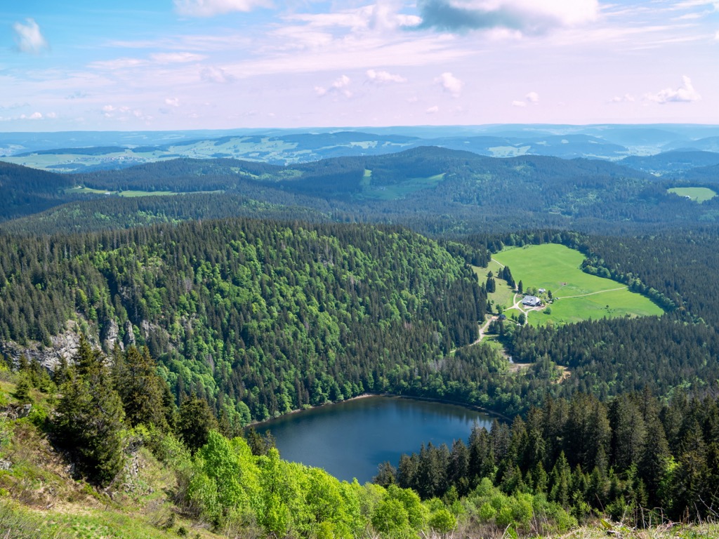
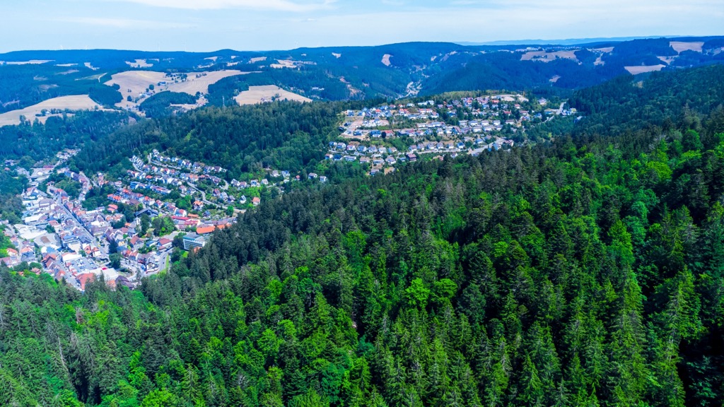
The Black Forest (Shcwarzwald) runs in a north to south direction near the southwestern border of the state. Feldberg, the highest peak within the entire state, lies in this mountainous region. The Black Forest marks the largest continuous forested section in the country.
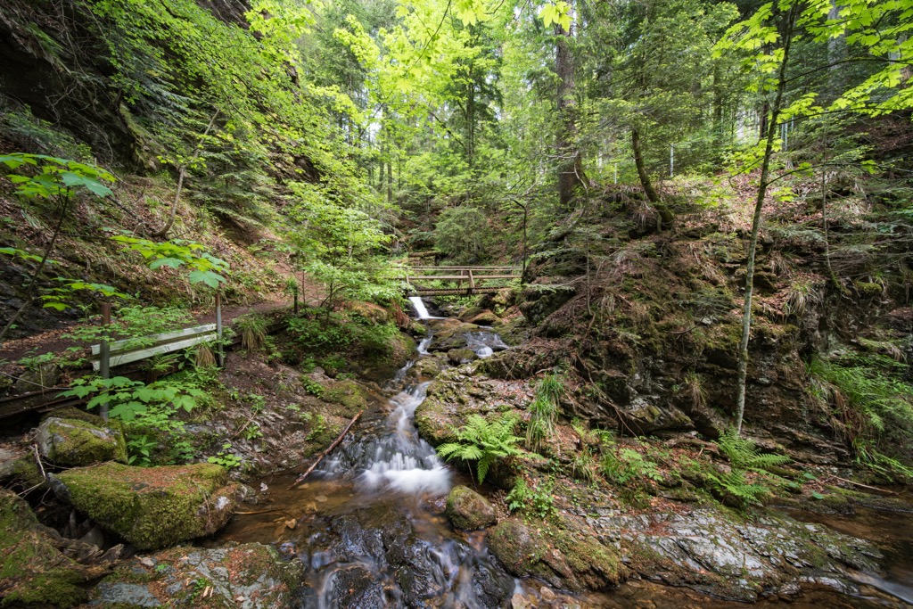
Covering roughly 6,000 square kilometers (2,300 sq miles), the Black Forest is bound by the Upper Rhine Plain in the west. The area features densely forested rolling hills and mountains along with numerous creeks, streams, and lakes. The Rhine River lies along the western edge of the forest. This region is often further divided into the Northern, Central, and Southern Black Forest and marks the central mountain range within the state.
The Upper Rhine marks a section of the Rhine which is surrounded by the Upper Rhine Plain. This river valley is situated along the western edge of Baden-Württemberg, forming a natural border with France.
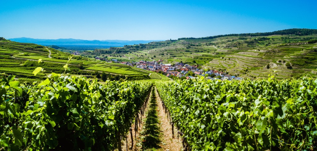
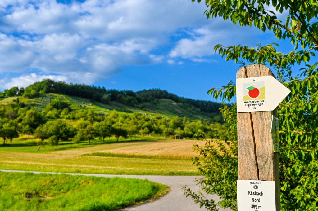
The Rhine Valley extends to the west, with the upper Rhine Valley marking an important agricultural region for the state. The lush terrain is able to support numerous vineyards and orchards, marking it as one of the best wine growing regions in the country.
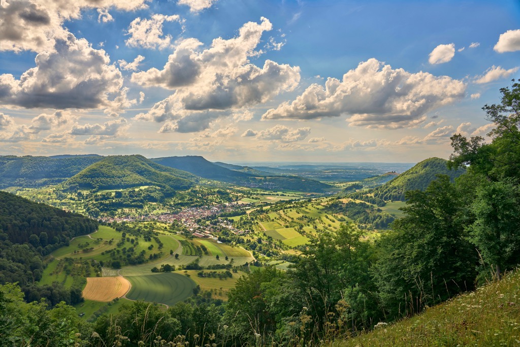
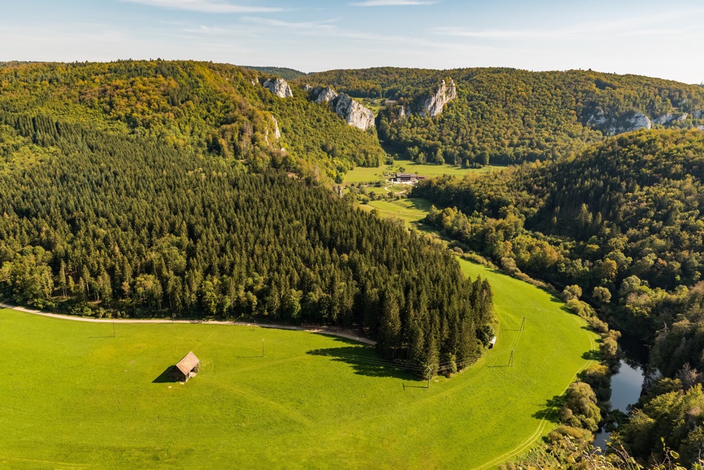
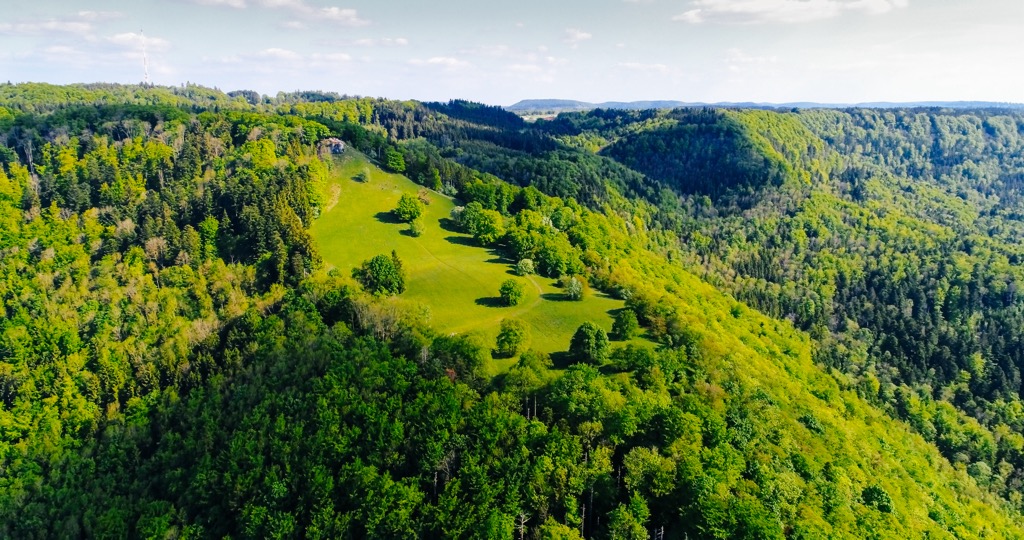
The Swabian Jura, also known as the Swabian Alps, is a mountain range situated east of the Black Forest. The range spans southwest to northeast, covering roughly 220 km (140 miles) in length and 40 to 70 km (25 to 43 miles) in width.
This range is classified as an upland plateau with forested hillsides. In the northern stretches of the range, elevations drop dramatically into the valley of the Neckar River. This valley region marks another important agricultural region in the state of Baden-Württemberg. Here the Neckar River, along with its tributaries, provide ideal conditions for growing a variety of crops.
The Alpine Foreland lies in the southern stretches of Baden-Württemberg, marking a deep trough near the foothills of the Alps. Terrain in this region features Lake Constance along with sections of rolling hills and marshes. There are numerous smaller lakes dotted throughout this geographic region.
Marshlands can be found amidst the varied terrain, which can be used for therapeutic baths. These unique marshlands, coupled with the natural beauty of the region, has led to numerous spas being established in the Alpine Foreland.
The two dominant geological features in the region are the Black Forest, located in the west, and the Swabian Jura, situated in the eastern stretches of the state.
Despite its name, the Black Forest is more than just a forest, but geologically a major mountain range in the region. This north to south trending range consists of crystalline bedrock from the Variscan orogeny. Outer layers of rock primarily consist of granite and gneiss.
During the Eocene epoch, downfaulting of Upper Rhine Plain resulted in the eastern and western sides of the valley to uplift. While the Black Forest marks the western side of the valley, the Vosges region is situated to the west. The Black Forest was heavily glaciated during the Riss and Würm glaciations. Glacial retreating further carved out the landscape, shaping the main ridgeline and leaving behind sweeping basins.
The Swabian Jura, or Swabian Alps, consist primarily of limestone, including three major layers classified as Black, Brown, and White Jurassic. The range originally laid along the bottom of a seabed which retreated roughly 50 million years ago.
The Alps range, which lies south of the Baden-Württemberg, were formed during the Alpine orogeny as the Eurasian plate collided with the African tectonic plate. As this major mountain range was thrust upwards, the land to the north formed a raised plateau.
Continual erosion slowly carved out the landscape, leaving behind the rolling hills, ridgelines, and buttes visible today. The Swabian Alps also feature a large system of caves with very few rivers or lakes amidst the plateau.
Major peaks within the state include Feldberg, Hornisgrinde, Belchen, Königstuhl, and Totenkopf.
Baden-Württemberg is home to numerous ecological regions ranging from forested mountain ranges to fertile river valleys.
Forested sections in the state are primarily populated by spruce, fir, and beech trees. The relatively acidic soil can make it difficult for some types of vegetation to survive. A variety of both mosses and ferns thrive in the forested hillsides of the Black Forest.
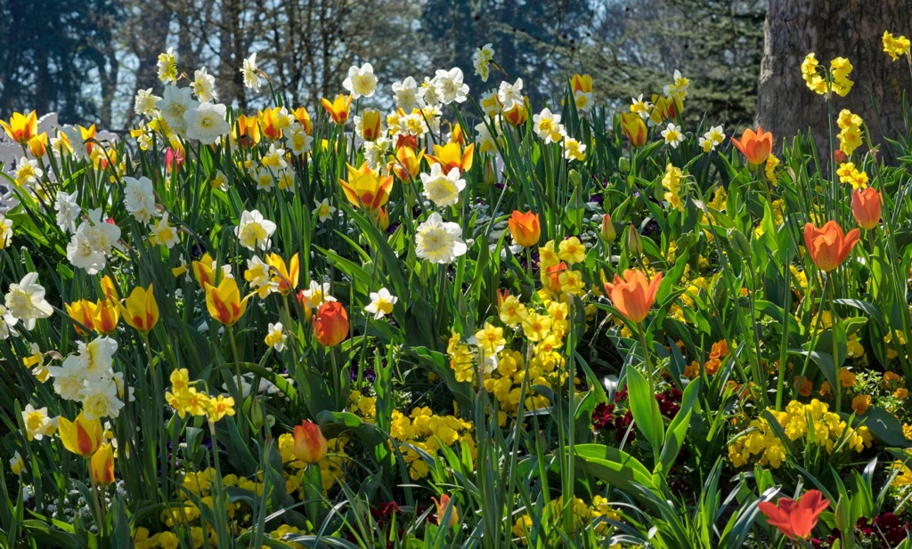
Other common plant species in the region include the common hazel, field maple, common dogwood, English ivy, common yarrow, and garlic mustard. Portions of the upper Rhine Valley are ideal for growing grapes, with numerous vineyards throughout the region. The Hotzen Forest (Hotzenwald) in the southern stretches of the state, supports a variety of fruit plants including grapes, plums, and cherries.
Sections of bog are present in the southern stretches of Baden-Württemberg. Here there are rough patches of grasses and little to no tree coverage.
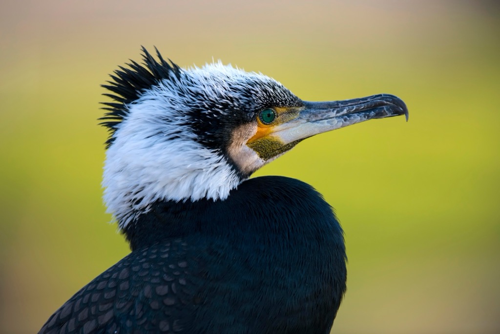
The varied landscape that defines Baden-Württemberg enables a wide variety of animal species to thrive. Some common bird species include the great tit, Eurasian blackbird, house sparrow, European starling, Eurasian kestrel, mallard duck, and grey heron.
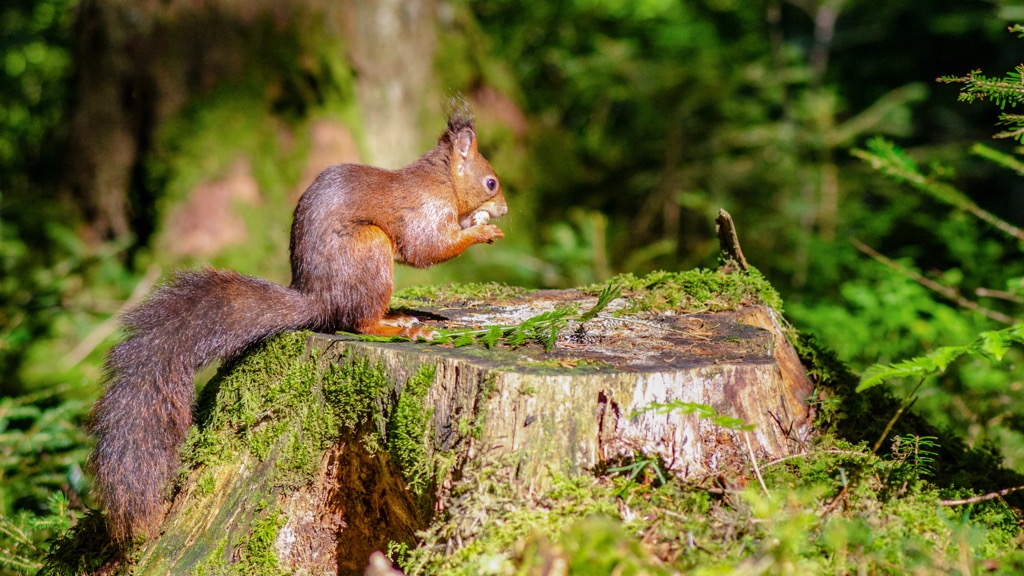
Large mammals that primarily live in the forested regions include the western roe deer, European fallow deer, red deer, wild boar and red fox. Smaller mammals that are often spotted include the Eurasian red squirrel, brown hare, Eurasian beaver, coypu, hedgehog, European badger, and various species of both bats and rodents.
The waterways throughout the state are populated by a variety of fish species including the European carp, brown trout, rudd, northern pike, rainbow trout, European perch, and European eel.
The region of Baden-Württemberg has been inhabited by humans for thousands of years. Over the previous centuries, the land has held numerous names depending on who was settled in the region at any given time.
Present-day Baden-Württemberg marks part of the traditional territories of Baden, Prussian Hohenzollern, and Württemberg. Around 100 CE, Württemberg was invaded and later occupied by the Roman Empire. During the third century, the Alemanni people were able to force the Romans to retreat past the Rhine and Danube rivers, towards present-day France.
The Alemanni were later defeated by the Franks in 496 CE. Shortly after this the Holy Roman Empire was established. Following the Protestant Reformation, a majority of the surrounding region remained Roman Catholics, which was less common throughout present-day northern Germany.
For the next four hundred years, the region was part of the Frankish empire. During the ninth century, the Duchy of Swabia took over the previously designated region of Alemania. The Duchy of Swabia was one of the five duchies of the Kingdom of the East Franks.
Military fortifications were built throughout the Black Forest during the seventeenth and eighteenth centuries, with remnants still visible today. Widespread deforestation occurred throughout the Black Forest during the nineteenth century, with the landscape eventually being replanted with spruce trees.
In 1806, under the rule of King Frederick I, the region became part of the Confederation of the Rhine. In 1815 the region then became part of the German Confederation, followed by the new German Empire in 1817.
Following the end of World War 1, Württemberg became an official state in the new Weimar Republic, classified as a “free popular state”. Baden had decided on ruling as a “democratic republic”.
After the end of World War II, present-day Baden-Württemberg was divided into three states by the Allies: Württemberg-Hohenzollern, Baden, and Württemberg-Baden. Both Württemberg-Hohenzollern, Baden were occupied by France during this time while Württemberg-Baden was occupied by US forces.
All three states were founding members of the Federal Republic of Germany in 1949. The three states voted to join together in 1952 to form Baden-Württemberg.
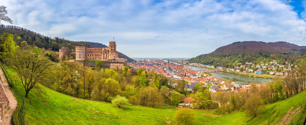
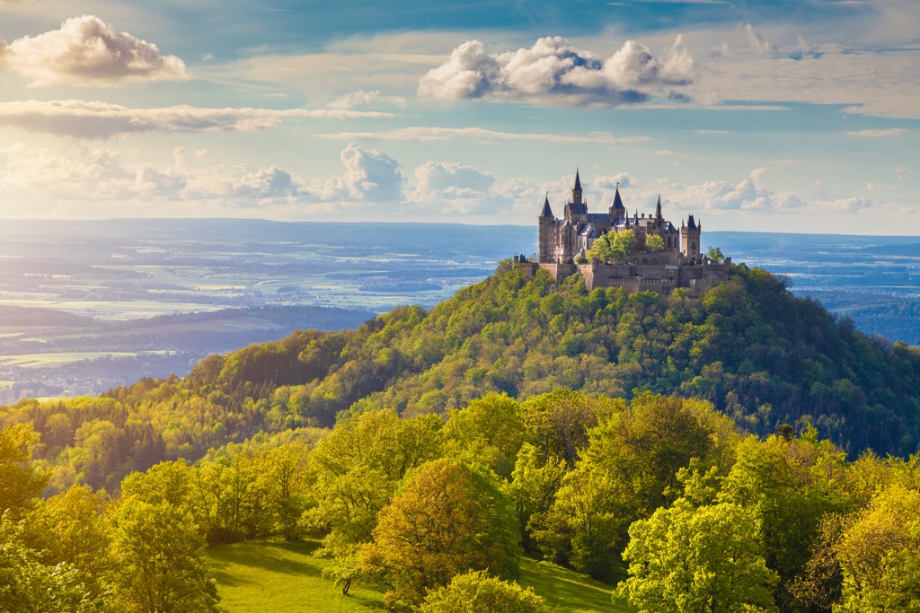
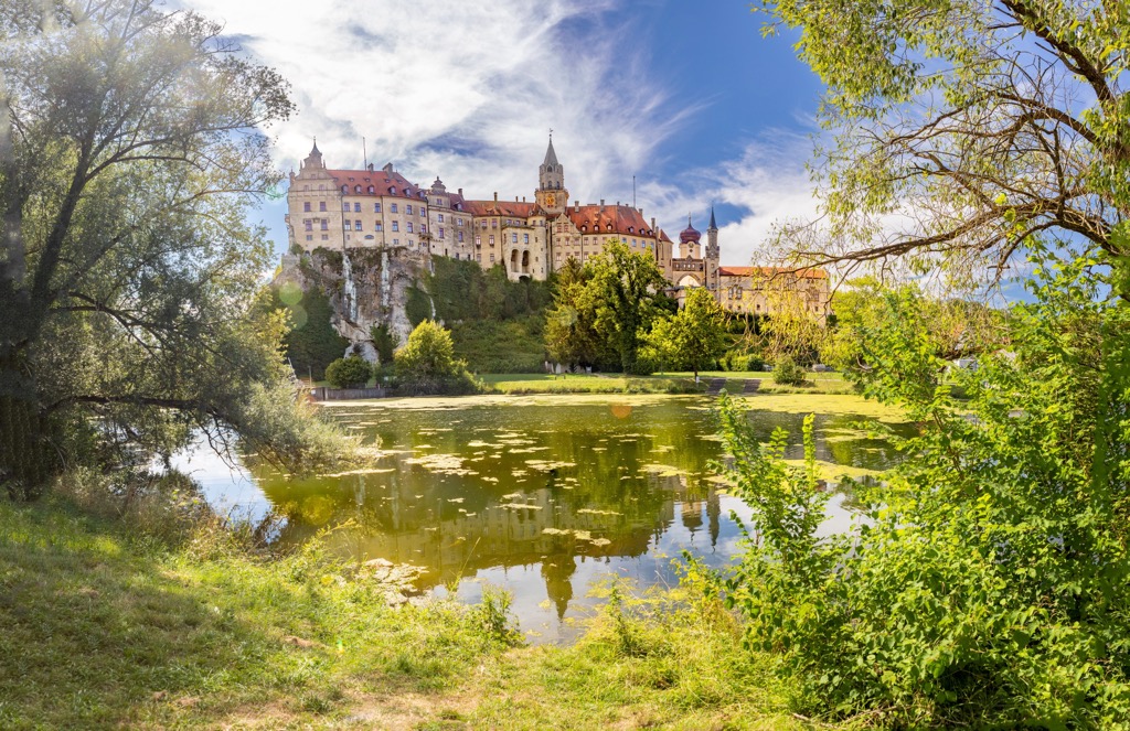
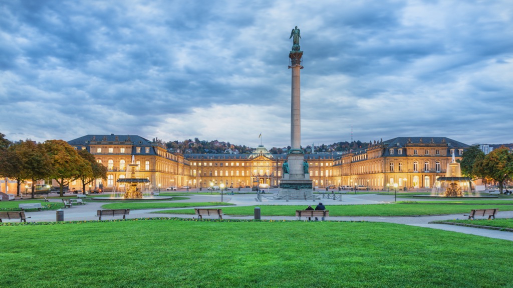
Today the state of Baden-Württemberg has a strong economy centered around electrical engineering, mechanical engineering, and car manufacturing. The stunning landscape has helped establish a tourist economy throughout much of Baden-Württemberg. Popular sites include the capital city of Stuttgart, Upper Rhine valley, and the Black Forest.
Baden-Württemberg is home to numerous protected regions and hiking trails. Here are some of the most popular spots in the state:
Black Forest National Park lies in the western region of Baden-Württemberg, marking the largest continuous forest in the country. Forested rolling hillsides and mountains dominate the region, which extends well beyond the boundaries of the national park.
Amidst the forested landscape lie numerous small lakes, creeks, and streams. Changes in elevation are more dramatic along the western edge of the park, with more gradual slopes to the east. Some popular hiking trails in the national park include All Saints Waterfall, Herrenwiesersee - Badener Höhe - Seekopf Rundweg Trail, and Schwarzenbachtalsperre.
True to its name, the Southern Black Forest Nature Park is situated in the southern stretches of the Black Forest mountain range. At 394,000 hectares (973,595 acres) it marks the largest nature park in the country.
From the summit of peaks in the park, hikers have sweeping views of the forested landscape as well as the traditional farmlands scattered throughout the hills. Feldberg, the tallest peak in the state of Baden-Württemberg, lies within the park. Popular sites include Feldberg, Schluchtensteig Trail, and Wutach Gorge.
Schönbuch Nature Reserve lies east of the Black Forest, and a short drive south of the capital city of Stuttgart. Established in 1972, it marks the first nature park in Baden-Württemberg and encompasses a primarily forested landscape.
Amidst the natural landscape, the park also features over 240 small monuments showcasing the history of the region. Popular hikes in the park include Panoramawanderung Mönchberg - Kayh, Herzog - Jäger - Pfad, and Museum Ritter - Faulbach Valley.
Looking for a place to stay in Baden-Württemberg? Here are some of the best cities and villages to check out in the state:
The city of Stuttgart lies near the geographic center of Baden-Württemberg, situated along the Neckar River. Stuttgart marks the capital city and the most populous city within the state. Home to 635,000 residents, it marks the sixth most populous city in Germany.
Stuttgart is spread out across the rolling hills that surround the city. Buildings are contrasted with lush hillsides and vineyards, all within close proximity of one another. Nicknamed the “cradle of the automobile”, Stuttgart features numerous museums and magazines centered around the automobile industry.
The surrounding terrain marks one of the largest wine growing regions in the country, making the city a popular spot for both local and international tourists. Some popular museums in the city include the State Museum of Natural History Stuttgart, Mercedes-Benz Museum, Porsche Museum, and the Stuttgart Art Museum.
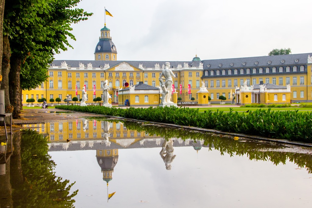
Karlsruhe is home to 308,000 residents, marking the third largest city in Baden-Württemberg. Named after the Hohenbaden Castle in the nearby city of Baden-Baden, Karlsruhe marks the former capital of Baden.

Popular sites in the city include the Karlsruhe Palace, Badisches Landes Museum, Center for Art and Media - ZKM, and the Palace Gardens. The city is situated along the east bank of the Rhine, amidst the Upper Rhine Plain. Karlsruhe is located just northwest of the Black Forest, providing visitors with easy access to the parks of the region.
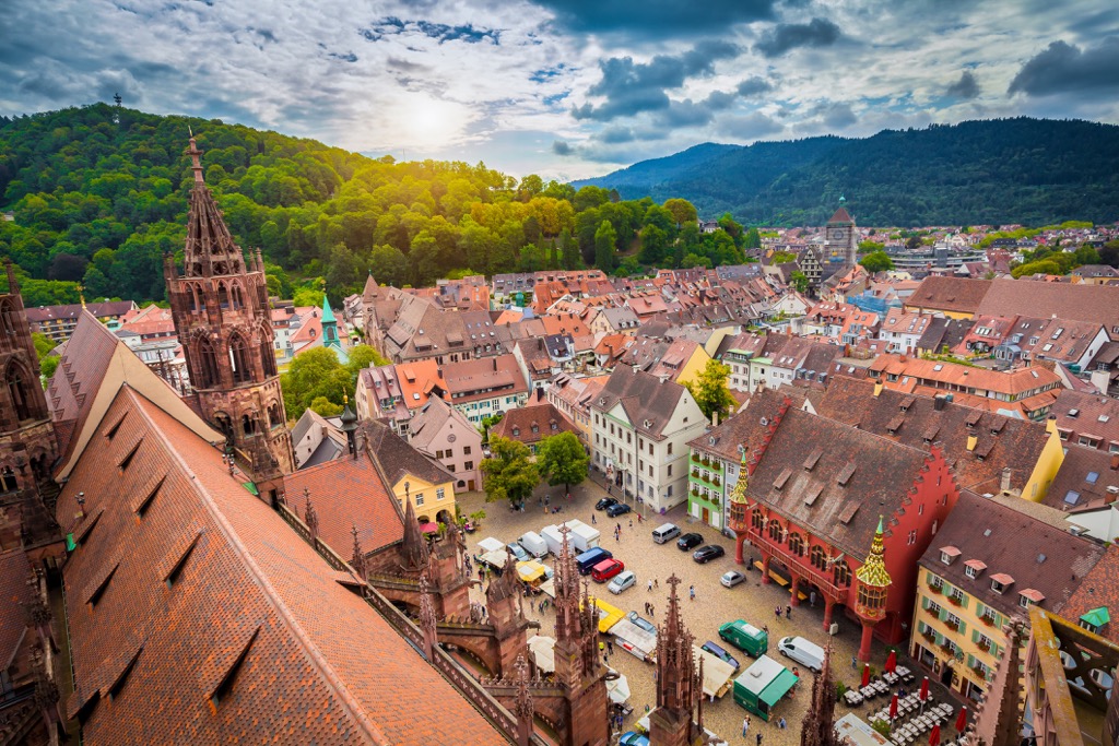
The university city of Freiburg im Breisgau is situated in the southwestern section of Baden-Württemberg. With a population of 230,000, it marks the fourth most populous city in the state. Situated along the Dreisam river, the city sits at the base of Schlossberg hill.
The temperature climate, close proximity to the Black Forest, and stunning medieval old town, make Freiburg im Breisgau a popular spot for local tourism. Those visiting should explore the Freiburg Minster towers or take a ride on the funicular that leads travelers up the hillsides and offers stunning views of the city.