
Scan the QR code and open PeakVisor on your phone
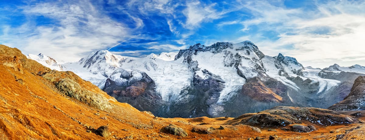
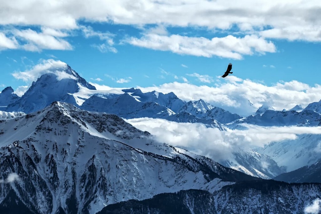
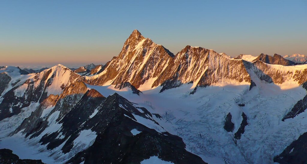
One of the world’s most mountainous countries, Switzerland is a land of staggering peaks, sprawling glaciers, vast alpine meadows, and a rich cultural heritage that dates back millennia. Switzerland is home to 10850 named mountains, the highest of which is Monte Rosa (4,633 m/15,200 ft) and the most prominent of which is the Finsteraarhorn (4,274 m/14,022 ft).
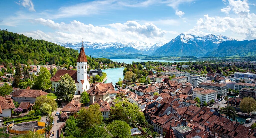
The country of Switzerland (officially the Swiss Confederation) is a small landlocked nation located in west-central Europe.
With a total area of some 41,285 square kilometers (15,940 square miles), Switzerland is the 132nd largest country on Earth after Estonia, Denmark, and the Netherlands, though it rivals Bhutan and Guinea-Bissau in terms of size.
However, with a total population of around 8.7 million people as of 2021, Switzerland is the world’s 99th most populous country after Tajikistan, Papua New Guinea, and Austria. This makes it the 48th most densely populated country after North Korea, Saint Kitts and Nevis, and The Gambia.
Switzerland's location at the heart of west-central Europe places it at a literal crossroads between Germanic-speaking Europe to the north, which includes countries like Germany, the Netherlands, Denmark, and the United Kingdom, and Romance language-speaking Europe to the south, which includes Italy and France.
Indeed, Switzerland itself is a land of linguistic diversity where German, French, and Italian are official languages. Meanwhile, the Romance language Romansh is a recognized national language, thanks to its prominence in the canton of Grisons (Graubünden/Grigioni).
As a land-locked country, Switzerland shares its borders with a number of other nations. This includes Italy to the south, France to the west, Germany to the north, and both Liechtenstein and Austria to the east.
Switzerland also contains two exclaves, Büsingen am Hochrhein of Germany and Campione d'Italia of Italy, which are small areas of foreign territory that are completely surrounded by Switzerland.
Despite being quite a small nation, Switzerland is home to a diversity of landscapes and cultures. Much of Switzerland’s geography can also be roughly grouped into seven regions called grossregions in German, as designated by the Federal Statistical Office (Bundesamt für Statistik).
Each of these regions is divided up into one or more cantons, which are the various member states of the Swiss Confederation. Interestingly, each canton in Switzerland has its own constitution, legislative system, judicial system, and executive government, much like a state or province in another country.
Although cantons are considered to be the first-level administrative subdivision of the Swiss Confederation, the country’s seven major regions offer a good glimpse into the diversity of Switzerland so we’ll take a closer look at them here.
Aptly named, the region of Northwestern Switzerland is located in the northwestern part of the country. It contains the cantons of Aargau, Basel-Landschaft, and Basel-Stadt, and it has a total population of approximately 1.2 million people.
Interestingly, even though Northwestern Switzerland contains Basel, the third-most populous city in the country, it is the third smallest region by total population.
Much of the cultural landscape of Northwestern Switzerland is dominated by the fact that Basel is located in this region. Indeed, Basel German (Baseldytsch) is the most common dialect of German spoken in Northwestern Switzerland. But, due to the region’s proximity to France, French is usually widely understood, too.
The major outdoor recreation area in this region is the Aargau Jurapark, which is a large region of rocky steppes, alpine meadows, and pine forests. Aargau Jurapark is one of the largest protected areas in northern Switzerland, so it’s a great place to hike if you’re looking to get outside.
Encompassing much of the west-central part of Switzerland, Espace Mittelland is a massive region of more than 10,062 square kilometers (3,885 sq. mi). It contains the cantons of Bern, Fribourg, Neuchâtel, Jura, and Solothurn.
The name “Espace Mittelland” derives from both French and German—the two languages most widely spoken in this region. In particular, the French “espace” means “space” while the German “Mittelland” is a name for the Swiss Plateau, which dominates the landscape.

Due to the region’s large size and the fact that it is home to the city of Bern, Espace Mittelland is the largest region by population in the country with a total of about 1.9 million residents. The region is topographically dominated by the Swiss Plateau, which makes it substantially less rugged than the Alps to the south or the Jura Mountains to the west.
Here, there are a number of popular outdoor recreation areas, including:
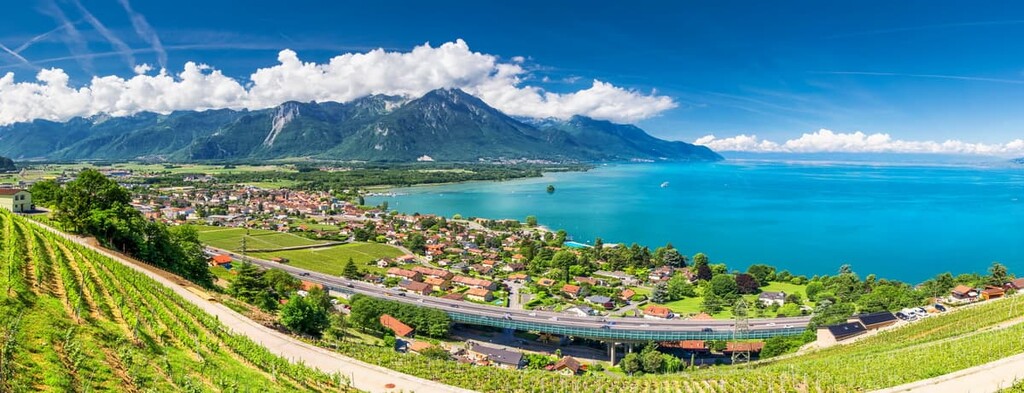
The Lake Geneva Region includes the bulk of the cantons located in the westernmost part of the country. It includes the cantons of Geneva, Valais, and Vaud which means that it enocmpasses much of French-speaking Switzerland as well as parts of German-speaking Switzerland.
This region is the second most populous of Switzerland’s major regions with a total population of about 1.7 million people. A substantial number of the people in this region are also immigrants to Switzerland, with approximately 30 percent of people claiming non-Swiss nationality.
In addition to the stunning Lake Geneva, for which the region gets its name, the Lake Geneva region also contains the westernmost part of the Swiss Alps in Valais. There are a number of popular alpine town destinations in the region, including Zermatt, Saas Fee, Crans-Montana, and Verbier. The famous Matterhorn is also located in this region.
Within the Lake Geneva region, there are plenty of fantastic parks to check out. Some of the most popular include:
Situated in the heart of the country, the Central Switzerland region is an area that’s known for its distinct history, culture, and topography. The region contains the cantons of:
Central Switzerland is particularly unique because it contains the three original forest cantons of the Old Swiss Confederacy—Uri, Schwyz, and Unterwalden, the latter of which is now Obwalden and Nidwalden. Furthermore, the Protestant Reformation never gained traction in this part of Switzerland so this region is still predominantly Catholic.
Finally, Central Switzerland long opposed the establishment of a federal state of Switzerland, particularly in the nineteenth century. While these sentiments have long since softened, Central Switzerland remains, in many places, one of the more conservative parts of the country.
Central Switzerland is the second smallest region in Switzerland in terms of population, leading only Ticino in terms of its total number of residents. There is one large nature severe in the region, however—UNESCO Biosphere Entlebuch—which is located in the canton of Lucerne.
Home to the bulk of the easternmost part of the country, Eastern Switzerland is a large area that contains the cantons of:
Unlike many of the other regions in Switzerland, Eastern Switzerland is decidedly heterogeneous. It contains predominantly German, Italian, and Romansh-speaking cantons as well as a diversity of stunning landscapes.
In particular, the canton of Grisons, which is the only trilingual canton of Switzerland and the only canton where Romansh has official status, is a fantastically geographically diverse place with hundreds of deep valleys and an abundance of alpine resorts, such as St. Moritz and Davos.
Eastern Switzerland, due to its large total land area, is the fourth largest region in the country in terms of population. It is also home to the country’s only national park—Swiss National Park—as well as a handful of other regional parks and reserves, such as:
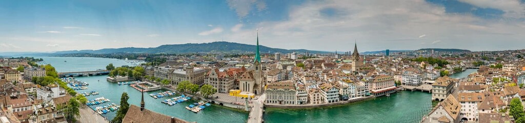
The region of Zürich contains only the canton of Zürich, which is the most populous canton in the country. It is located in the north-central part of Switzerland and it is home to about 1.5 million people, the bulk of whom live in the city of Zürich.
The official language of Zürich is German, though many people in the canton speak a local dialect called Zürich German (Zürichdeutsch/Züritüütsch).
Within Zürich, the topography is dominated by the drainage basin of the High Rhine and of Lake Zürich itself. There is one sizable park in Zürich called Wildnispark Zürich Sihlwald, which contains the Sihlwald forest. The Sihlwald forest is the largest deciduous and coniferous forest in the Mittelland and it is one of the country’s oldest wildlife parks.

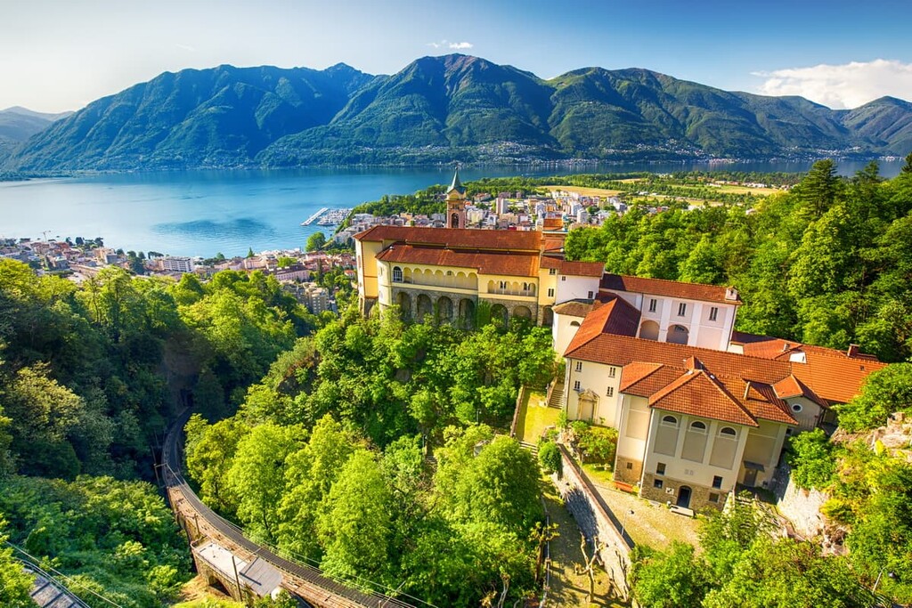
Located in the southernmost part of Switzerland, the region of Ticino is a highly mountainous area that contains only the canton of Ticino. It is by far the smallest of Switzerland’s regions in terms of population as it has a total population of just 350,000 people, despite being one of the largest cantons in the country in terms of total land area.
Ticino is particularly interesting because it is the only region where Italian is the only official language. The majority of Switzerland’s Italian-speaking population lives in Ticino, which is also located just to the south of the main crest of the Alps and is mostly surrounded by Italy along its western, eastern, and southern borders.
Interestingly, Ticino also contains a small Italian exclave called Campione d'Italia, which is located about 14 km (9 mi) by road to the next town in Italy.
Although some of the 26 Swiss cantons are more mountainous than others, each boasts its own collection of mountains and craggy peaks. Here are the highest and most prominent points in each of the Swiss cantons:
Switzerland has long held an important place in the world of mountaineering and outdoor adventure due to its plethora of mountains and rich geologic history. Interestingly, however, while the Alps do dominate much of southern Switzerland, the country itself consists of a number of major geologic features.
Indeed, Switzerland as we know it today is the result of hundreds of millions of years of geologic activity.
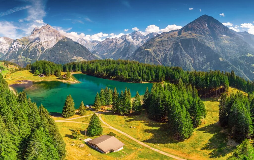
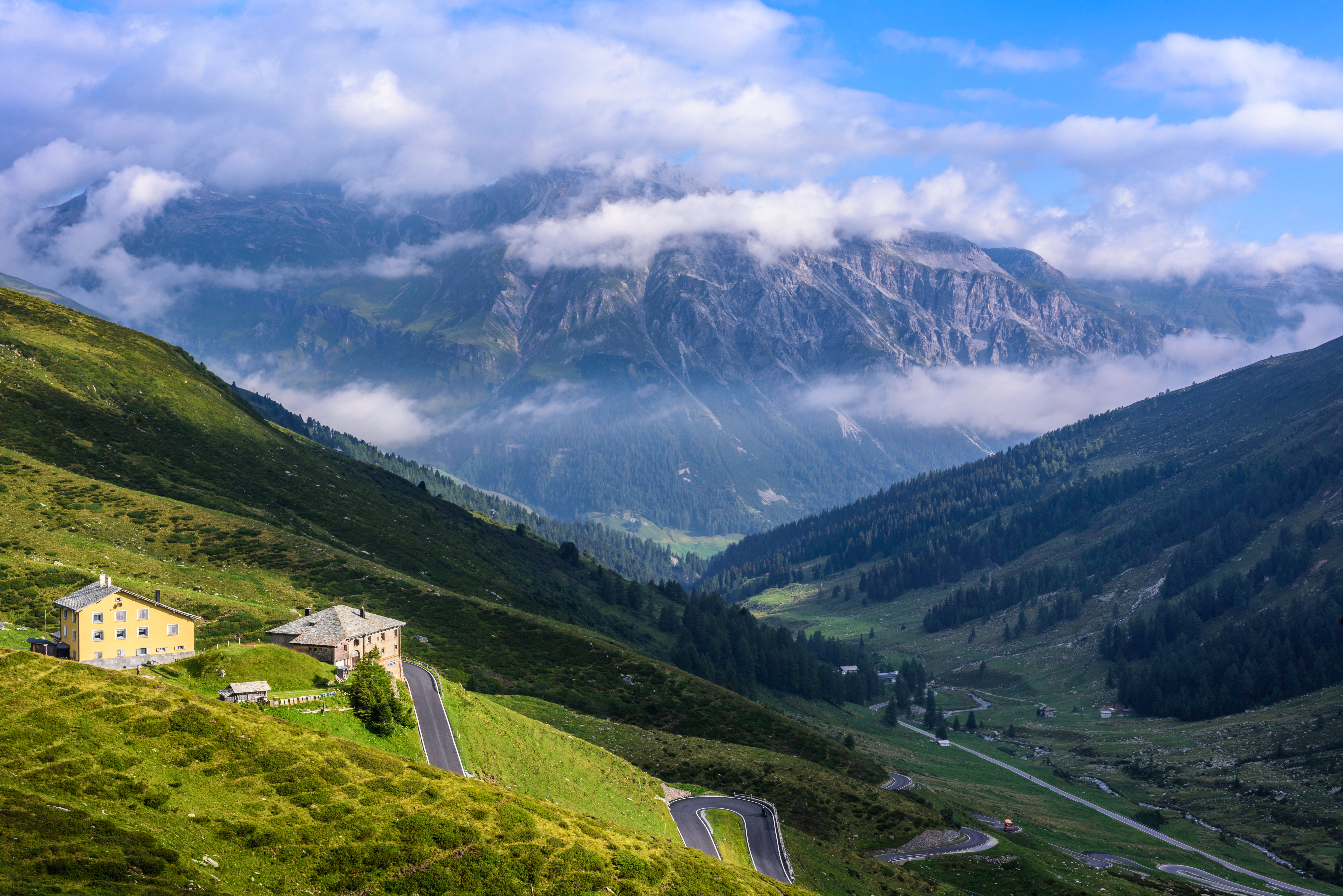
Nowadays, there are two main mountain ranges in Switzerland—the Jura Mountains and the Alps—the latter of which is divided up into a number of subranges. Furthermore, the central part of the country between these two ranges is home to the massive Swiss Plateau, which encompasses about 30% of the country’s total land area and houses much of its population.
Here’s a quick look at each of the primary mountain ranges in Switzerland:
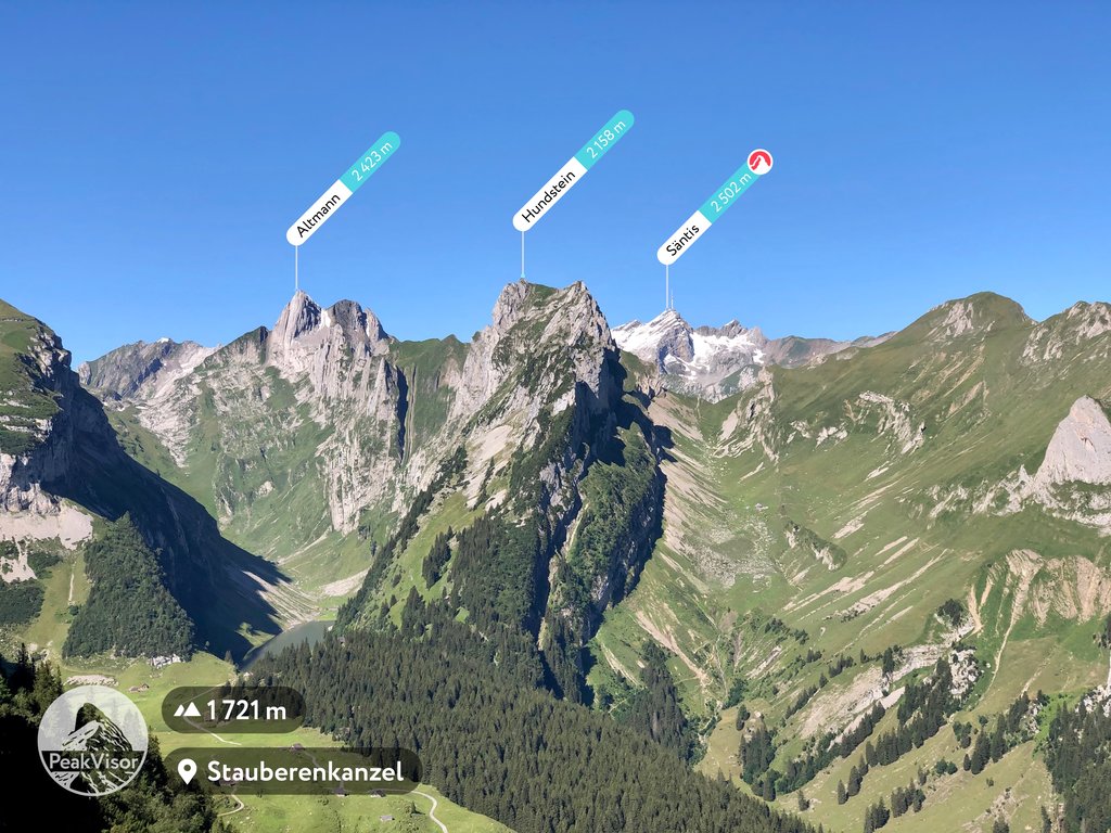
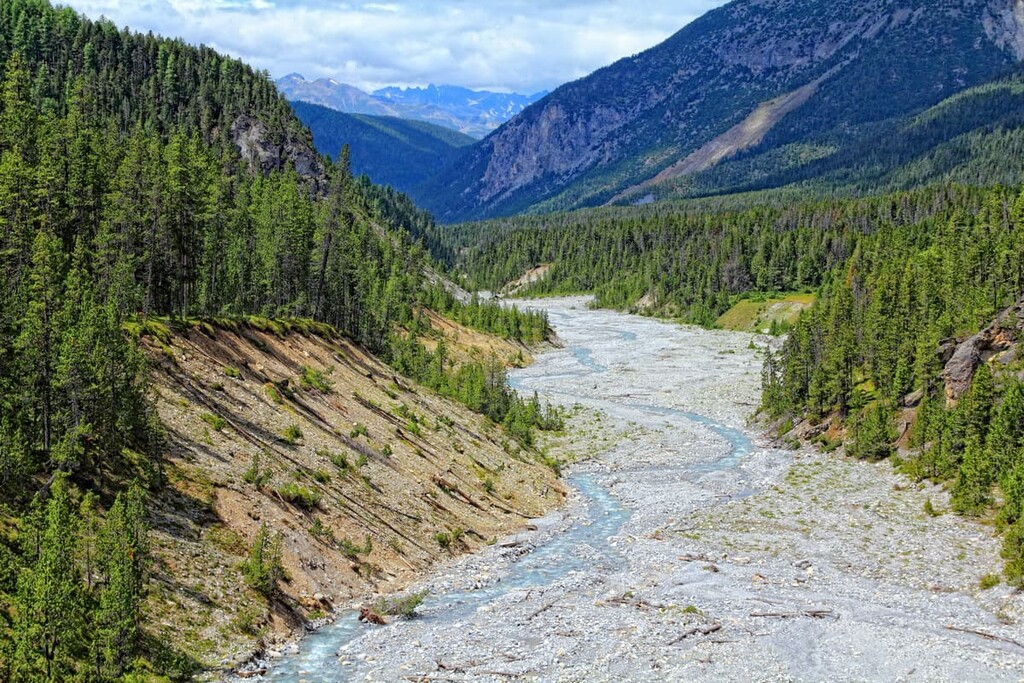
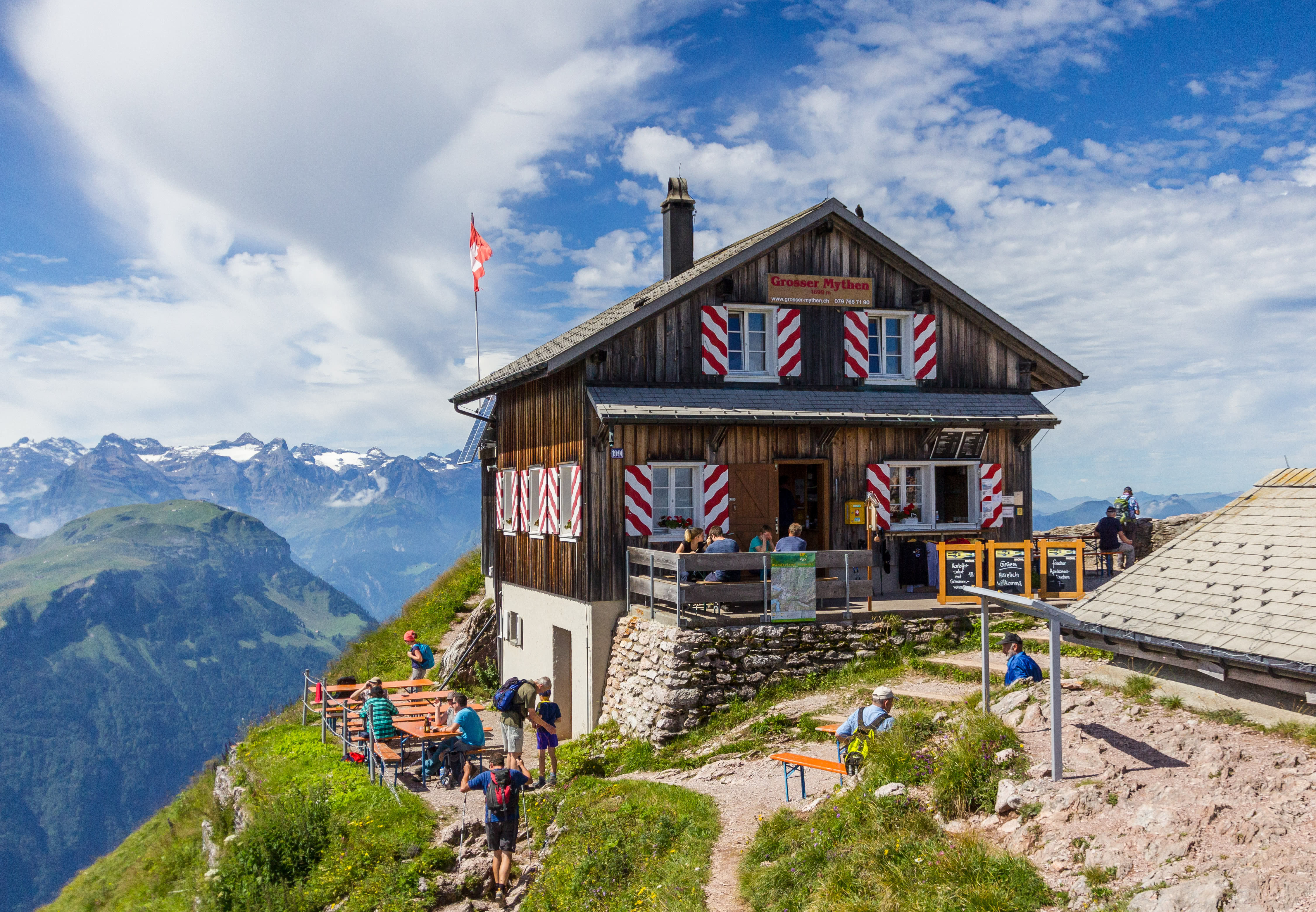
Aptly named, the Swiss Prealps are a collection of smaller peaks and foothills that extend from east to west throughout Switzerland. The range contains 1,882 named mountains, the highest of which is the Schilthorn and the most prominent of which is Säntis.
The Swiss Prealps form the border between the Swiss Plateau to the north and the main crest of the Alps to the south. Here, there are plenty of superb hiking paths, particularly in the UNESCO Biosphere Entlebuch. There are also fantastic cable cars for visitors to check out, as well as the historic town of Interlaken, which is situated between Brienz and Thun lakes.
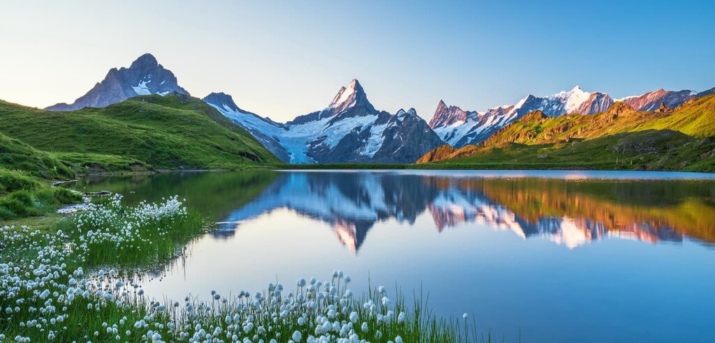
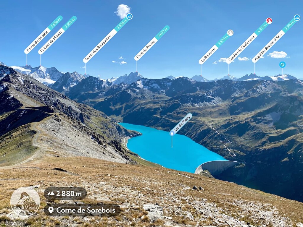
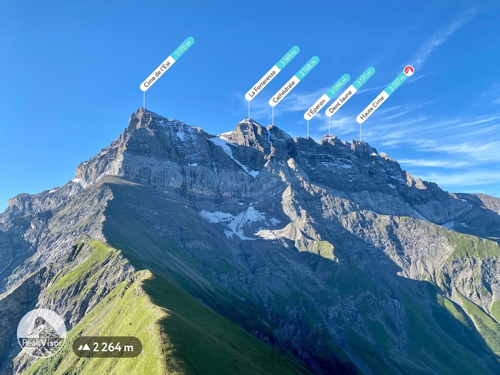
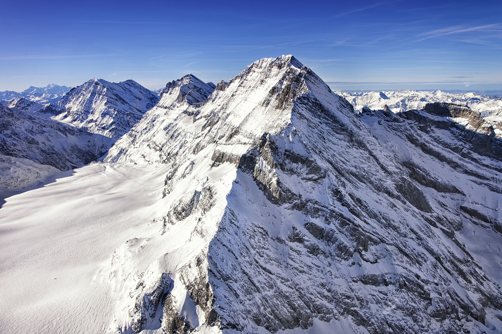
The Bernese Alps are a relatively small Alpine subrange that stretches from western to central Switzerland. It contains 1,128 named mountains, the highest and most prominent of which is the Finsteraarhorn, the most prominent peak in Switzerland.
Known for their jagged peaks, the Bernese Alps are found in the cantons of Valais, Vaud, and Fribourg, not in Bern, as the name of the range might suggest.
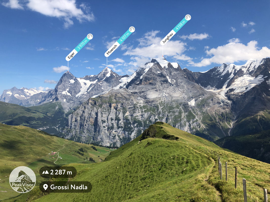
Here, mountaineers can find some of the most famous peaks in all of the Swiss Alps, including the Jungfrau, Eiger, and Mönch. There are also plenty of glaciers in the Bernese Alps, such as the Kander, Aletsch, Unteraar, and Lower Grindelwald glaciers.
Running along the border between Switzerland and Italy, the Pennine Alps are some of the most striking and visually appealing peaks in all of Switzerland. There are 2,009 total named peaks in the Pennine Alps, including those in Italy. The highest and most prominent peak in the Pennine Alps is Monte Rosa – Dufourspitze, which is the highest mountain in Switzerland.
The Pennine Alps are located predominantly in the Swiss canton of Valais and in the regions of Piedmont and Aosta Valley in Italy. Alongside the Bernese Alps, the peaks of the Pennine Alps are among the most famous in the entire Alps as they include the Matterhorn, the Weisshorn, and the Dom.
Dominating the south-central region of Switzerland, the Lepontine Alps are an Alps subrange that’s known for its gorgeous mountain scenery. There are 1,744 named mountains in both the Italian and Swiss Lepontine Alps, the highest of which is Monte Leone, and the most prominent of which in Switzerland is the Rheinwaldhorn.
The Lepontine Alps are found mostly in the Swiss cantons of Valais, Uri, Ticino, and Grisons, as well as the Italian regions of Lombardy and Piedmont. That being said, when compared to the Pennine Alps to the west, this region of Switzerland is less densely populated, so the mountains and their associated trails are often more rugged in character.
The Western Rhaetian Alps are the easternmost extent of the Alps in Switzerland, though they are also the westernmost extent of the Alps in neighboring Austria. The range contains 2,797 named mountains, the highest and most prominent of which is Piz Bernina.
Technically speaking, despite their name, the Western Rhaetian Alps are part of the central Alps. The range can be found in the Swiss canton of Grisons, the Italian region of Lombardy, and the Austrian states of Vorarlberg and Tyrol, as well as the country of Liechtenstein.
The Western Rhaetian Alps are particularly well known for their snow-capped peaks, which include famed summits likeLa Spedla, Pizzo Zupò, Piz Roseg, and Piz Palü.
The final major mountain range in Switzerland, the Jura Mountains are the only substantial range in the country that’s not part of the Alps.
In fact, the Jura Mountains are found along the border between France and Switzerland, particularly in France’s Franche-Comté and Rhône-Alpes regions and in the Swiss cantons of Bern, Jura, Solothum, Vaud, Neuchâtel, and Basel-Landschaft.
Due to the range’s proximity to some of the largest cities in Switzerland, including Basel and Bern, the Jura Mountains are a popular hiking and climbing destination for people in northern Switzerland and eastern France.
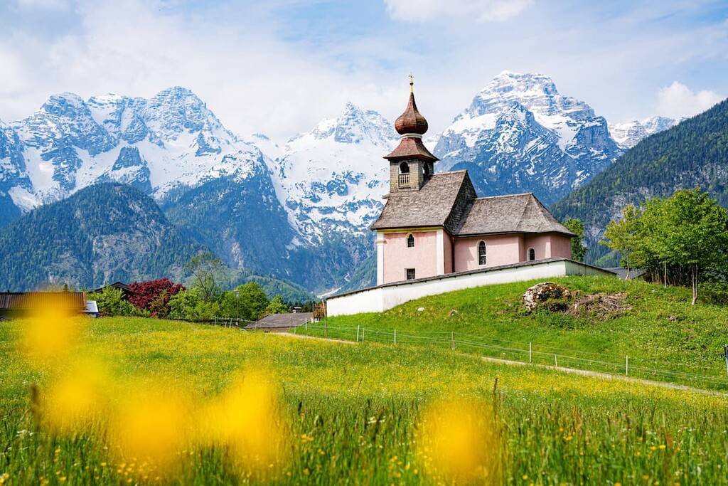
Switzerland is known for its stunning landscapes and fantastic biodiversity. The country is home to an array of flora and fauna that are found in two primary ecoregions and dozens of smaller plant communities.
There are two main ecoregions in Switzerland—the Western European broadleaf forests and the Alps conifer and mixed forests.
The Western European broadleaf forests ecoregion is found in Switzerland, as well as France, Germany, the Czech Republic, Poland, Belgium, Luxembourg, and Austria. It is characterized by a mixture of broadleaf trees, particularly beeches like the European beech.
Meanwhile, the Alps conifer and mixed forests are found just to the south of the Western European broadleaf forests. They include a large swath of land in Slovenia, Austria, Germany, Italy, France, Liechtenstein, and southern Switzerland. Here, the landscape is dominated by tree species like European oak, silver fir, mountain pine, Norway spruce, European larch, and European beech.
Due to the highly mountainous character of much of Switzerland, the country is home to an amazing assortment of unique wildlife species.
Some of the most notable species include European wildcat, Eurasian lynx, Eurasian wolf, Italian wolf, Eurasian brown bear (presence uncertain in Switzerland), European polecat, Alpine ibex, chamois, and wild boar.
Meanwhile, bird species that can sometimes be found in Switzerland include golden eagle, booted eagle, bearded vulture, hen harrier, Eurasian griffon, barn owl, boreal owl, and the Eurasian eagle-owl.
Despite its small size, Switzerland has a long and storied history of human inhabitation. In fact, archaeological evidence indicates that humans had lived in the region that is now called Switzerland some 150,000 years ago and, by about 3800 BCE, there were already small communities in the area.
By 1500 BCE, Celtic tribes from elsewhere in Europe arrived in what is now Switzerland. The Celtic tribe called Helvetti is known to have lived in the western part of the country while the Raetians lived more in the eastern regions.
More than one thousand years later, the Helvetti were defeated by Julius Caesar and his Roman army as they tried to escape the incoming Germanic tribes. After this defeat, the Roman Empire expanded into what is now Switzerland, eventually heralding in the first Christian bishoprics in the region during the fourth century.
Around this same time, the Western Roman Empire fell, paving the way for the Germanic tribes called the Burugundians and the Alamanni established themselves in what is now Switzerland. They were eventually partially pushed out by the Franks, at which point, Christianity was re-introduced to the region.
During the eighth century, the Frankish Caroligian dynasty established a feudal system in parts of what is now called Switzerland. The dynasty stayed in control of parts of the region until about the tenth century, at which point the Magyars (from what is now Hungary) sacked Basel and St. Gallen.
The rest of the early Middle Ages in the region were dominated by a succession of dynasties. The Zähringen claimed control of Burgundy in the twelfth century, though the Kyburg dynasty and, eventually, the Habsburgs later succeeded them.
By the thirteenth century, the three cantons of Unterwalden, Schwyz, and Uri had decided to unify and fight against the Habsburgs. This led to the establishment of what is now called the Old Swiss Confederacy on August 1, 1291.
These three cantons were later joined by the cantons and city states of Zürich, Lucerne, Bern, Zug, and Galrus to join what is now called the “Old Federation.” Eventually, this federation was able to defeat the Habsburgs at the Battle of Sempach.
In the sixteenth century, the Reformation came to Switzerland, leading to the establishment of the Protestant Church in parts of Switzerland. Interestingly enough, however, the Swiss Guard, which was established by Pope Julius II in 1506, just before the reformation, is still in existence to this day. All modern-day recruits to the Swiss Guards, which serve the Pope, are unmarried, young Swiss Catholic men.
During the seventeenth century, much of Europe was embroiled in the Thirty Years’ War. However, Switzerland as a confederation was relatively unscathed by the fighting as many mercenaries were enlisted to fight for other countries—not Switzerland itself.
Switzerland eventually gained legal independence from the Holy Roman Empire in 1648, after which there were a number of revolts in the region that led to the Swiss Peasant War.
In the late eighteenth century, the French invaded Switzerland and established the Helvetic Republic, which lasted until 1803. Afterward, the Act of Mediation under Napoleon restored some aspects of self-rule for the cantons of Switzerland, which also allowed the territories of Grisons, Vaud, Ticino, Aargau, Thurgau, and St. Gallen to become fully fledged cantons.
Switzerland gained internationally recognized independence with the Congress of Vienna in 1814–1815. This period also saw the cantons of Geneva, Valais, and Neuchâtel join the confederation, paving the way for the establishment of modern Switzerland.
After a brief civil war known as the Sonderbund War of 1847, Switzerland quickly became a unified and industrialized nation. Switzerland adopted a federal constitution the following year, which allowed it to establish which limited powers belonged to the federal government, leaving everything else for the cantons to decide on their own.
Since then, Switzerland has also maintained a period of military neutrality in all foreign wars, a principle that is one of the guiding features of the confederacy. In fact, Switzerland was not invaded during World War II, even though Nazi Germany had made plans to do so during Operation Tannenbaum.
Contemporary Switzerland is a member of the Council of Europe, the United Nations, the Schengen area, and the European Free Trade Association (EFTA). However, although Switzerland does participate in the European Single Market as part of the EFTA, it is not part of the European Union Customs Union nor the European Economic Area (EEA).
Nevertheless, Switzerland remains one of the world’s most prosperous countries. It ranks as second in terms of nominal per capita gross domestic product (GDP) after Luxembourg, and it ranks as second (tied with Ireland) in terms of its Human Development Index (HDI) after Norway.
It’s also a popular tourist destination and financial center for the world, to say nothing of the superb mountain landscapes and hiking opportunities that can be found in the Swiss Alps.
Switzerland is a true hiker’s paradise. Here are some of the best hiking and trekking areas to check out in the country:
Switzerland’s only national park, Swiss National Park is situated in the easternmost part of the country in the canton of Grisons near the country’s border with both Italy and Austria. The park contains 56 named mountains, the highest and most prominent of which is Piz Pisoc.
Swiss National Park is a federally protected area and UNESCO Biosphere Reserve that was founded in 1914, making it one of Europe’s oldest national parks.
As the country’s only national park, Swiss National Park has very strict rules governing land use and visitor access in the region. In particular, hikers are not allowed to depart from marked trails and they are not allowed to disturb wildlife or plantlife, so dogs are not permitted in the park. Furthermore, winter sports are not allowed in the park as the park is even closed during the winter months.
Nevertheless, there are plenty of excellent things to see and do in Swiss National Park. There are more than 100 km (160 mi) of hiking trails in the park with 21 different routes for visitors to enjoy.
Do keep in mind, however, that the park is located at a very high elevation. Furthermore, the only places to stay are at the Chamanna Cluozza mountain hut or the Hotel Parc Naziunal Il Fuorn. So, be sure to pack sufficient clothing, food, and drink to handle whatever weather comes your way and make sure that you arrange your accommodation well in advance.
Jura Vaudois Nature Park is one of the premier hiking areas in the northwestern part of Switzerland. It contains 57 named mountains, the highest and most prominent of which is Mont Tendre.
The park is located just to the west of Lausanne and Lake Geneva in the canton of Vaud along the country’s border with France. Having been established in 1973 and then reorganized to its current boundaries in 2010, Jura Vaudois Nature Park is one of the oldest protected areas in the region.
Here, the landscape is dominated by rolling hills and stunning woodlands. Additionally, the region in and around the park is famous for its production of regional delicacies, including Gruyère cheese, which is produced by dozens of dairies in the area.
If you’re looking to really do a deep dive into the local cuisine, you can also seek out Vacherin Mont d'Or, a rare, seasonal cheese that’s made only in this region from October to April each year.
Of course, there’s more to Jura Vaudois Nature Park than excellent cheese (but really, what else do you need?) There are plenty of hiking trails in the park, including hikes up La Dôle as well as a route that does a grand traverse of the entire park.
Located in the heart of the Swiss Alps, Binntal Nature Park is a land of alpine meadows, jagged peaks, and rich cultural heritage. It contains 78 named mountains, the highest of which is Helsenhorn and the most prominent of which is Monte Cervandone.
Binntal Nature Park was officially established in 2011 after years of work by the local community to help create the first regional nature park in the canton of Valais. The park is famous for its natural resources and excellent cuisine. It also offers unparalleled access to the gorgeous mountains of the Lepontine Alps.
Hiking is a time-honored tradition in the park as there is a large network of trails in the region. There are more than two dozen different routes for hikers to choose from that cater both to new and experienced hikers, alike.
The park is also a popular winter recreation destination. There are a number of winter hiking trails in Binntal Nature Park as well as cross country skiing, alpine skiing, ice skating, tobogganing, and snowshoeing opportunities.
Given the long border between Italy and Switzerland and the lack of border crossings under the Schengen Agreement, many outdoor enthusiasts travel to Switzerland from Italy by car, bus, or train. Another great option to cross the border in both directions is on foot while hiking, which can be an interesting experience, especially for those traveling to Europe from the U.S. and Canada, and Australia and New Zealand, so you can hike in two countries at once.
I asked Ivan Kuznetsov, a local outdoor writer from Dolomites in the Italian Alps, to talk about the main areas to hike this way:
"To be precise, the Italian-Swiss border is 744 km (462 mi) from Mont Dolent (3,823 m / 12,543 ft) on the French-Swiss-Italian tripoint in the west to Piz Lad (2,808 m / 9,213 ft) and Dreiländerecke (2,123 m / ft) mountains on the Austrian-Swiss-Italian tripoint in the east. Most of the border lies in the so-called High Alps with a maximum altitude of 4,634 m (15,203 ft) at Monte Rosa / Dufourspitze and a minimum of about 200 m (660 ft) at Maggiore Lake (Lago Maggiore).
The latter is one of the main and most accessible hiking areas that I would choose to cross the border between the two countries on foot, based on my own experience.
To get to Maggiore Lake from Milan, take the Trenord or Trenitalia train to the town of Luino on the eastern shore deep in the lake. It is already located almost on the border, which can be reached on foot during a 1–2 days hike on one of the marked trails leading to the border peaks. In particular, these are four summits: Monti di Caviano, Monte Pola (1,742 m / 5,715 ft), Monte Lema (1,619 m / 5,311 ft), and Moncucco (1,518 m / 4,980 ft). From the last two neighboring peaks, the trail leads to the town of Breno in Switzerland, where you can continue to Stagno Agra Nature Reserve (Riserva Naturale dello Stagno Agra) in the Italian-speaking Swiss canton of Ticino.
The other major hiking areas east of Como Lake, where you can cross the border between Italy and Switzerland while hiking, are as follows:
The main hiking areas on the border between Italy and Switzerland to the west of Como Lake are the three large nature parks:
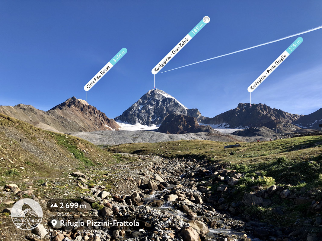
Another area worth mentioning is, of course, Cervino / Matterhorn (4,478 m / 14,692 ft), which you can see on the PeakVisor logo.
In total, there are 13 major hiking areas on the border between Italy and Switzerland.”
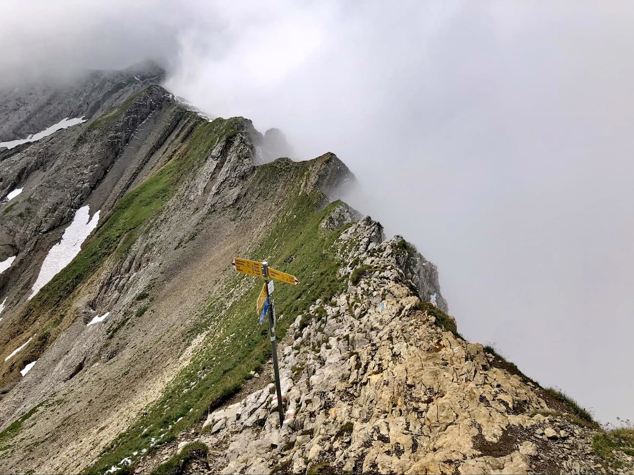
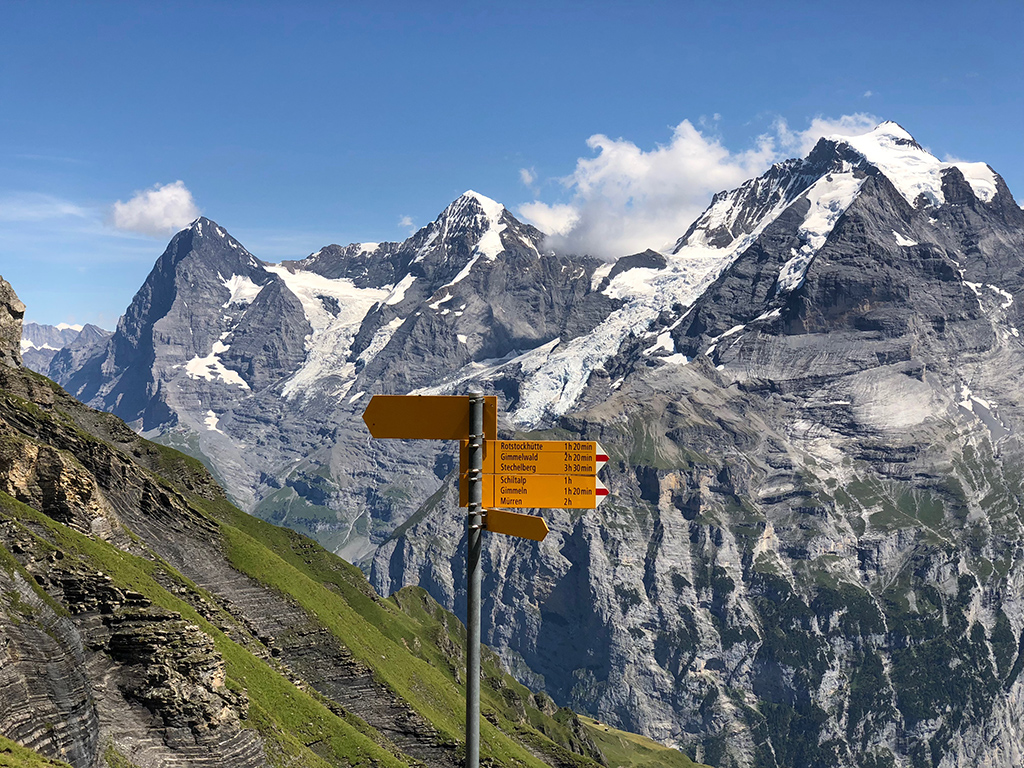
There are three types of hiking trail markers in Switzerland, each of which indicates a different type of trail. Here’s what you need to know:
On each of these signs, you may see a quoted “hiking time,” which indicates the estimated time to hike the trail in hours (abbreviated Std. for “stunden”). You may also see small symbols on hiking signs, such as a wine glass icon, which indicates a restaurant nearby, or other symbols that indicate different types of public transportation.
Do note that many trails have official names, numbers, and color codes. You can find more information about these official routes on the Switzerland Mobility website.
Finally, here are some useful facts about hiking in Switzerland:
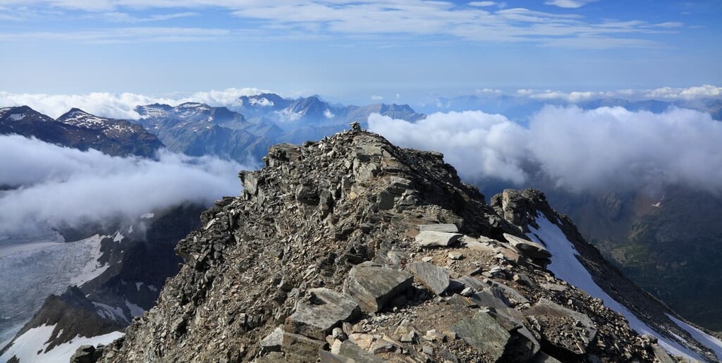
If there’s one thing that Switzerland is known for it’s the country’s mountains. In particular, Switzerland is known for being a central part of the history of mountaineering, least of all because it is home to some of the most famous peaks in the European Alps. Here’s a quick look at some of the country’s most notable climbing areas:
Out of all of the world’s mountains, few hold as much allure as the Matterhorn. Located along the border of Italy and Switzerland, the Matterhorn (Cervino/Cervin) is an iconic pyramidal peak situated in the Pennine Alps.
The peak itself rises up above the town of Zermatt where its steep faces and rugged ridges quietly beckon climbers toward the mountain. Indeed, Edward Whymper’s infamous and tragic first ascent of the Matterhorn in 1865 kick-started a period known as the golden age of alpinism where climbers tackled most of the Alps’ major peaks.
These days, the Matterhorn is considered to be one of the testpieces of the region as thousands of climbers flock to the peak in order to test their mettle and make it to the summit.
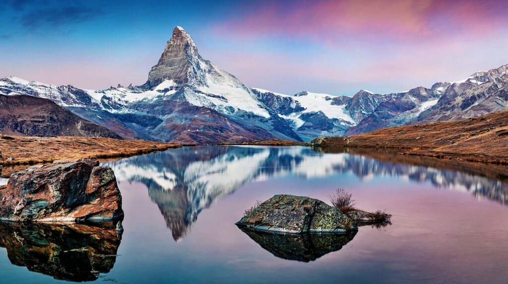
The most popular route on the Matterhorn is, by far, the route up the Hörnli Ridge to the Hörnli Hut. However, the route is very exposed and is not suitable unless you are a skilled alpinist or you have a trained guide with you on the mountain.
For those of us who aren’t interested in climbing the Matterhorn but still want to experience the mountain, there is a popular trekking circuit that takes you around the base of the peak.
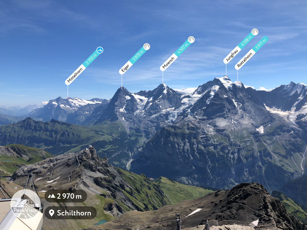
One of the most famous peaks of the Bernese Alps, the Jungfrau is a towering massif located along the border of the cantons of Valais and Bern. Alongside the Mönch and the Eiger, the Jungfrau creates one of the most iconic skylines in the Swiss Alps.
The Jungfrau was actually one of the earliest peaks to be climbed in the region. The first ascent of the peak was done by Johann Rudolf Meyer and Hieronymus Meyer, two sons of a rich merchant in Aarau.
By the twentieth century, however, the Jungfrau Railway (Jungfraubahn) had opened, connecting the Jungfraujoch saddle between the Jungfrau and the Mönch with the Kleine Scheidegg. This makes it one of the highest railways in the world and, as a result, the Jungfrau is more accessible than ever before.
Many climbers who attempt the summit start at the Jungfraujoch railway station and then climb up to the Mönchsjoch Hut, which is owned and operated by the Swiss Alpine Club. they then make their ascent to the summit, where the route is exposed, but not particularly difficult for an experienced climber.
Home to one of Europe’s most iconic climbs, the Eiger is a staggering summit that’s located in the heart of the Bernese Alps. The Eiger boasts one of the Great North Faces of the Alps thanks to its northern flank, which extends some 3,000 m (10,000 ft) above the valley below.
Due to its scenic beauty, the Eiger has long drawn alpinists to its slopes. The first ascent of the peak was completed by Charles Barrington, Peter Bohren, and Christian Almer in 1858 without much issue.
In 1871, a group of American climbers and Swiss guides make the first ascent of the peak’s southwest ridge while a group of Swiss and Japanese climbers made the first ascent of the peak’s Mittellegi Ridge in 1921 and a group of Swiss climbers made the first ascent of the northeast face in 1932.
By the mid 1930s, however, the climbing world had set its sights on the north face of the Eiger. However, this led to a series of tragedies when a German duo—Karl Mhringer and Max Sedlmeyer—froze to death on the peak in 1935. Just one year later, a group of four German and Austrian climbers also died on the north face of the Eiger.
The first ascent of the mountain’s famous north face was made by Fritz Kasparek, Ludwig Vörg, Anderl Heckmair, and Heinrich Harrer in 1938. It was swiftly repeated by the legendary climbers Lionel Terray and Louis Lachenal of France in 1947.
Since then, climbers have repeatedly pushed the limits as to what’s possible on the iconic Eiger. In the early to mid 2000s, the late Ueli Steck of Switzerland made a number of record-breaking speed attempts on the North Face, having climbed the mountain in just over 2 hours.
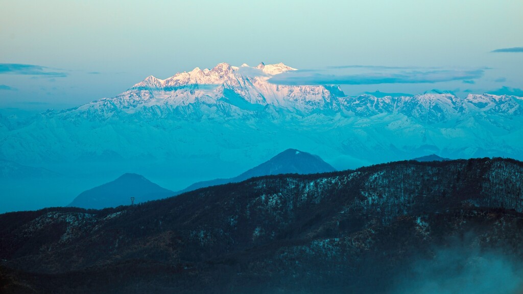
The highest peak in all of Switzerland, Monte Rosa is a large massif located along the border of Switzerland and Italy. With an elevation of 4,633 m (15,203 ft), Monte Rosa is the second highest mountain in all of the Alps after Mont Blanc.
Within the Monte Rosa Massif, there are actually multiple summits, the highest of which is the Dufourspitze. This summit is entirely located within Switzerland, though the massif is situated in both Switzerland and Italy.
The massif has long been a draw for climbers and non-climbers, alike. In fact, it’s believed that Leonardo da Vinci traveled near the mountain and used it as inspiration for his painting Madonna of the Rocks.
During the eighteenth century, a number of climbing parties attempted to ascend to the top of the Dufourspitze and other peaks on the Monte Rosa massif. However, the first serious attempt at the summit wasn’t made until about 1801 when Pietro Giordani climbed as high as the base of the Vincent Pyramid.
While a number of climbing parties had summited the other peaks of Monte Rosa during the early nineteenth century, the Dufourspitze wasn’t summited until a group of Swiss and English climbers reached the summit on August 1, 1855. Fittingly, August 1st is not only the day that the highest mountain in Switzerland saw its first ascent, but it is also the Swiss National Day, which celebrates the founding of the Swiss Confederation.
Nowadays, Monte Rosa is a popular climbing and trekking destination. There are a number of huts on the mountain that are owned by either the Swiss or the italian Alpine Clubs as well as a handful of routes that lead to the summit. If you’re not looking to climb at a high elevation, the famed Monte Rosa Tour is a trek that’s well worth considering for your adventure.
Switzerland’s most prominent peak, the Finsteraarhorn is a rugged mountain that’s located along the border of the cantons of Valais and Bern in the Bernese Alps. It is known for being surrounded by glaciers and it is also part of the Jungfrau-Aletsch UNESCO World Heritage Site.
Interestingly, the Finsteraarhorn is not nearly as popular of a climb as some of the other peaks in Switzerland, despite being the most prominent in the country. However, due to the relative remoteness of the peak and the difficult terrain that surrounds it, any climbing attempt on the Finsteraarhorn requires quite a bit of travel just to reach the base of the peak.
Furthermore, the mountaineering history of the Finsteraarhorn has long been a source of controversy. A climbing group led by Rudolph Meyer that made an attempt on the mountain in 1812 claims to have made the first ascent, but this has since been disputed.
Meanwhile, a group led by Franz Joseph Hugi made the first verifiable ascent of the mountain in 1829. While Hugi himself did not make it to the summit, two of his guides, Johann Währen and Jakob Leuthold did reach the top of Switzerland’s most prominent peak.
There are currently four standard climbing routes on the Finsteraarhorn, with the most popular starting at the Finsteraarhorn Hut and taking about 4 to 5 hours to complete. The so-called Normal Route is rated as a PD (peu difficile/slightly difficult) on the IFAS (International French Adjectival System), so it is a solid climb for intermediately experienced alpinists.
Looking for a place to stay during your next trip to Switzerland? Here are some of the best cities, towns, and alpine resort areas to check out in the country:
Switzerland’s largest city, Zürich is a major metropolitan area located in the north-central part of the country along the edge of Lake Zürich. Home to more than 430,000 people, Zürich is a hub for transportation and commerce in Switzerland.
The city has long been an important population center in the region, having first been permanently settled by the Romans in the year 15 BCE. Nowadays, Zürich is a particularly important center for global finance and it is a hub for the arts, thanks to its many museums and theaters.
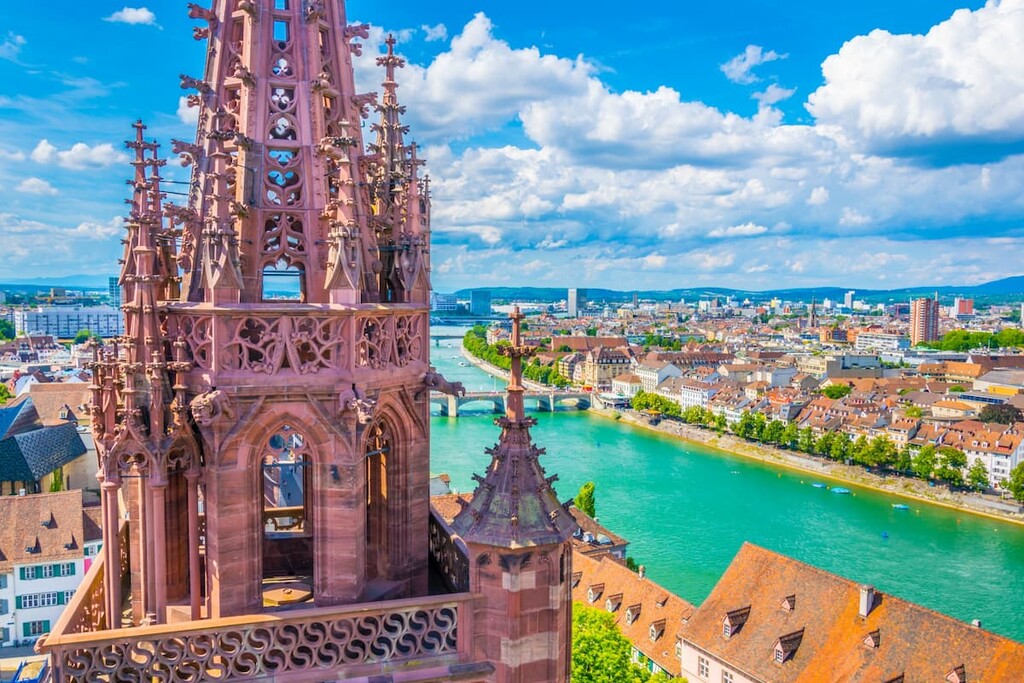
Located in northwestern Switzerland along the banks of the River Rhine, Basel is the cultural capital of the country and its third-most populous city with over 200,000 residents. Basel is often considered to be a center for the arts and education in Switzerland. In fact, the city is home to the University of Basel, which is the country’s oldest university, having been founded in 1460.
There are a number of important cultural sites and events in Basel, including a collection of churches, museums, and even a former Celtic settlement. Interestingly, the city also has an airport, EuroAirport Basel Mulhouse Freiburg, though it is located entirely on French soil in the Haut-Rhin department of Alsace.
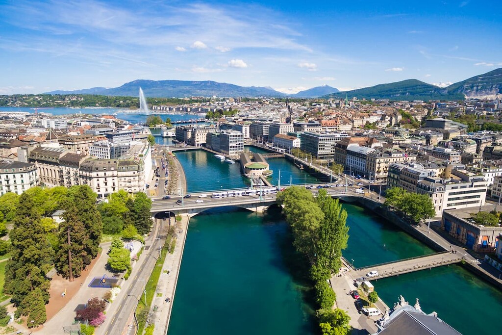
Home to more than 203,000 people, Geneva is Switzerland’s second-most populous city. The city is situated along the western edge of the country along the shores of Lake Geneva and near Switzerland’s border with France.
As the main population center in Romandy, the French-speaking region of Switzerland, Geneva is a major center for both finance and diplomacy. Geneva is often the host of major international diplomatic events and it is the headquarters of the Red Cross.
In addition to its status as a global city, Geneva is also home to more than 80 buildings and sites that are listed as heritage sites of national significance. These include dozens of churches, civic buildings, museums, theaters, and archeological sites.
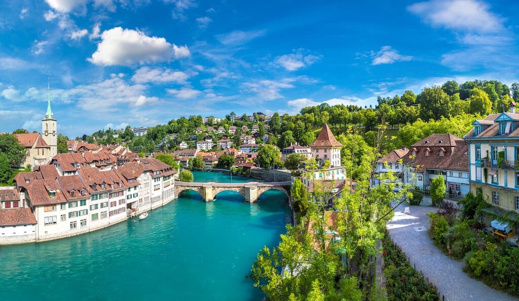
The federal city of Switzerland, Bern is a community of about 144,000 people located in the north-west part of the country. Bern’s city center is a UNESCO World Heritage Site, a testament to the wealth of history and culture found in the region.
Due to the fact that Bern is home to the Federal Palace of Switzerland, which is the seat of both the Swiss Federal Assembly and the Federal Council, Bern is the de facto seat of the country’s government.
Furthermore, much of the city’s central district retains its medieval charm, thanks to its many fifteenth and sixteenth century buildings. The city has also long been an important place for science and innovation and it was even the home of Albert Einstein when he wrote his four revolutionary papers during his ground-breaking Annus Mirabilis.
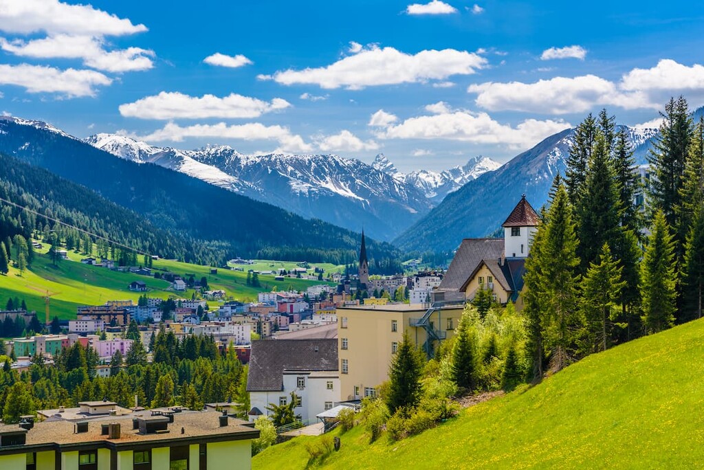
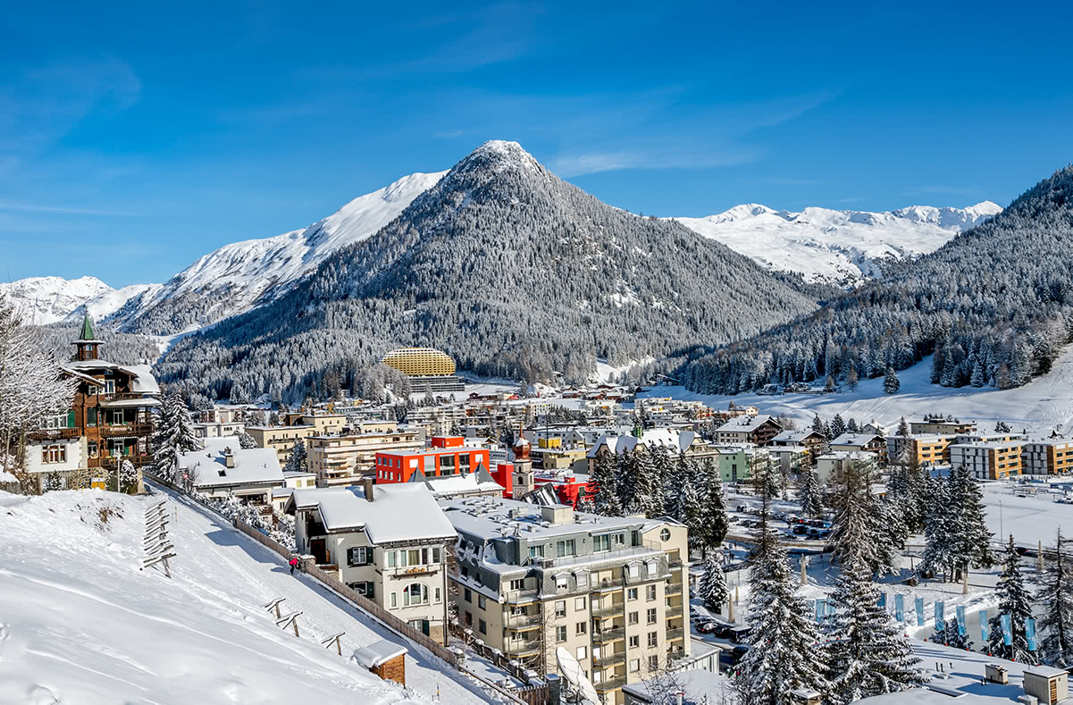
Famous for its alpine scenery and stunning vistas, Davos is a city of some 10,000 people located in the canton of Grisons. Davos rose to prominence in the nineteenth century as a popular health resort for wealthy Europeans looking to take in the region’s fresh, clean air.
These days, Davos is perhaps best known for its large ski resort and for its hosting of the World Economic Forum, which is an annual meeting of global leaders in both the economic and political spheres.
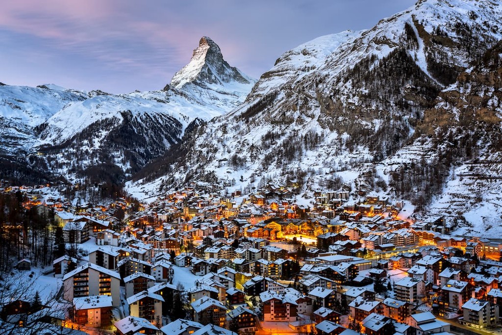
One of Switzerland’s most famous mountain towns, Zermatt is a town of some 5,800 residents located in the canton of Valais. The community has long been a major bastion for mountaineering and climbing, thanks, least of all, for its proximity to the great peak of the Matterhorn.
While Zermatt was a small agricultural community for much of its history, it has since transformed into an alpine and ski resort with a tourism-based economy.
Interestingly, Zermatt does not allow combustion-engine vehicles within its borders so electric vehicles are the primary mode of transport within the town. You can also reach Zermatt by train from Visp or Brig, where you can also get connections to Geneva, Bern, Zürich, and other major cities in Switzerland.


top10
ultra
glacier
europe-4500ers
alps-4000ers
italy-ultras
switzerland-ultras
top10
glacier
europe-4500ers
alps-4000ers
top10
glacier
europe-4500ers
alps-4000ers
top10
ultra
glacier
alps-4000ers
switzerland-ultras
top50
ultra
glacier
alps-4000ers
italy-ultras
switzerland-ultras
top10
ultra
glacier
europe-4500ers
alps-4000ers
italy-ultras
switzerland-ultras
top10
ultra
glacier
alps-4000ers
switzerland-ultras


