
Scan the QR code and open PeakVisor on your phone
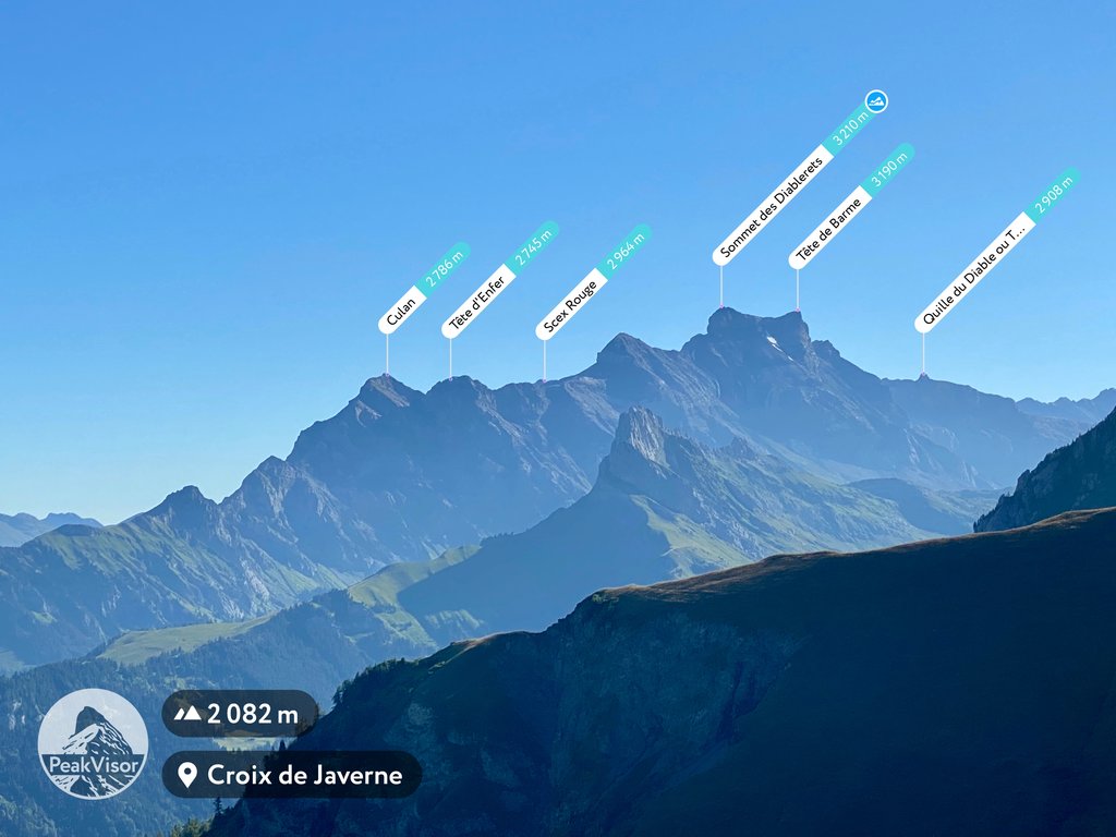
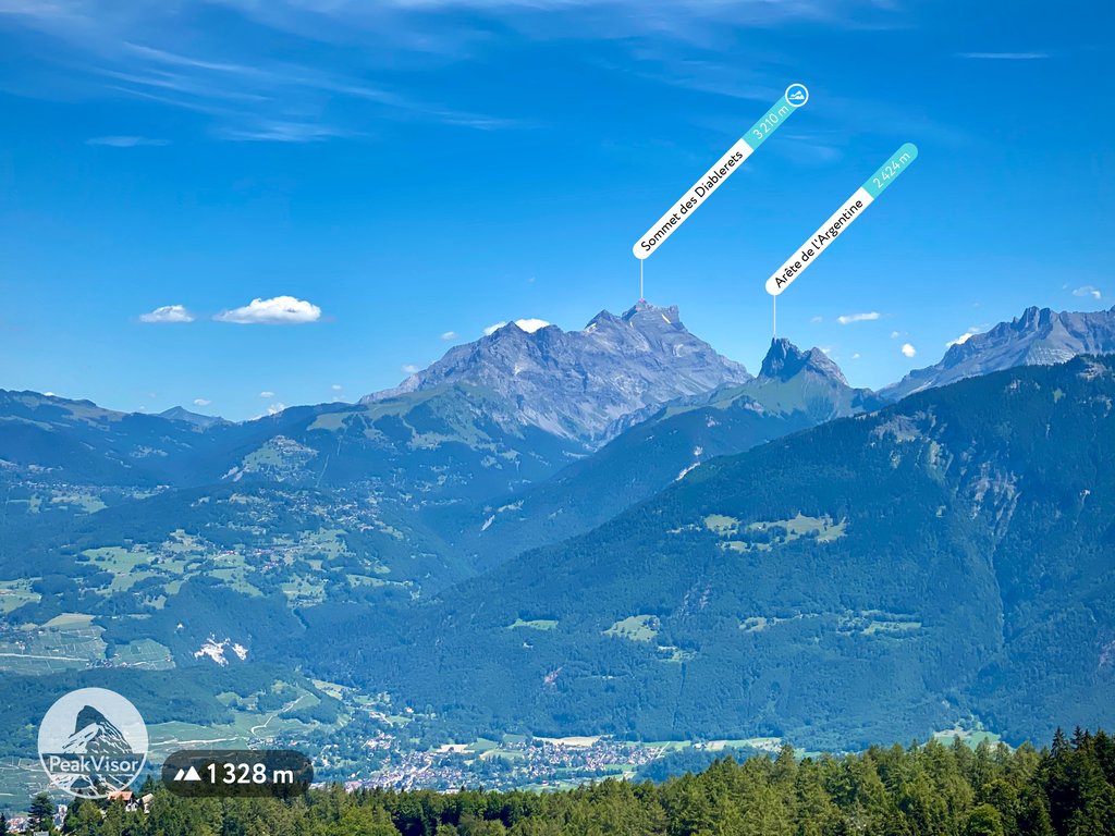
Vaud is home to 390 named mountains. The highest is Sommet des Diablerets at 3,216 m.
Vaud (Waadt) is a canton located in western Switzerland. The canton is the fourth largest in the country by area and it encompasses much of the northern shores of Lake Geneva. There are 390 named peaks in Vaud. Sommet des Diablerets is the highest peak in the canton at 3,216 m (10,551 ft) in elevation while Vanil Noir is the most prominent peak with 1,112 m (3,648 ft) of prominence.
Vaud is the fourth largest of the 26 cantons in Switzerland. Spanning to the western edge of the country, Vaud borders the cantons of Neuchâtel in the north, Geneva to the southwest, Fribourg and Bern to the east, and Valais to the south. France also lies to the west of the canton.
Vaud encompasses 3,212 square kilometers (1,240 square miles) of land and is divided into 10 districts. Along with the canton of Bern, Vaud is one of just two cantons in the country that include parts of the three major geographic regions within Switzerland: the Alps, the Swiss Plateau, and the Jura Mountains.
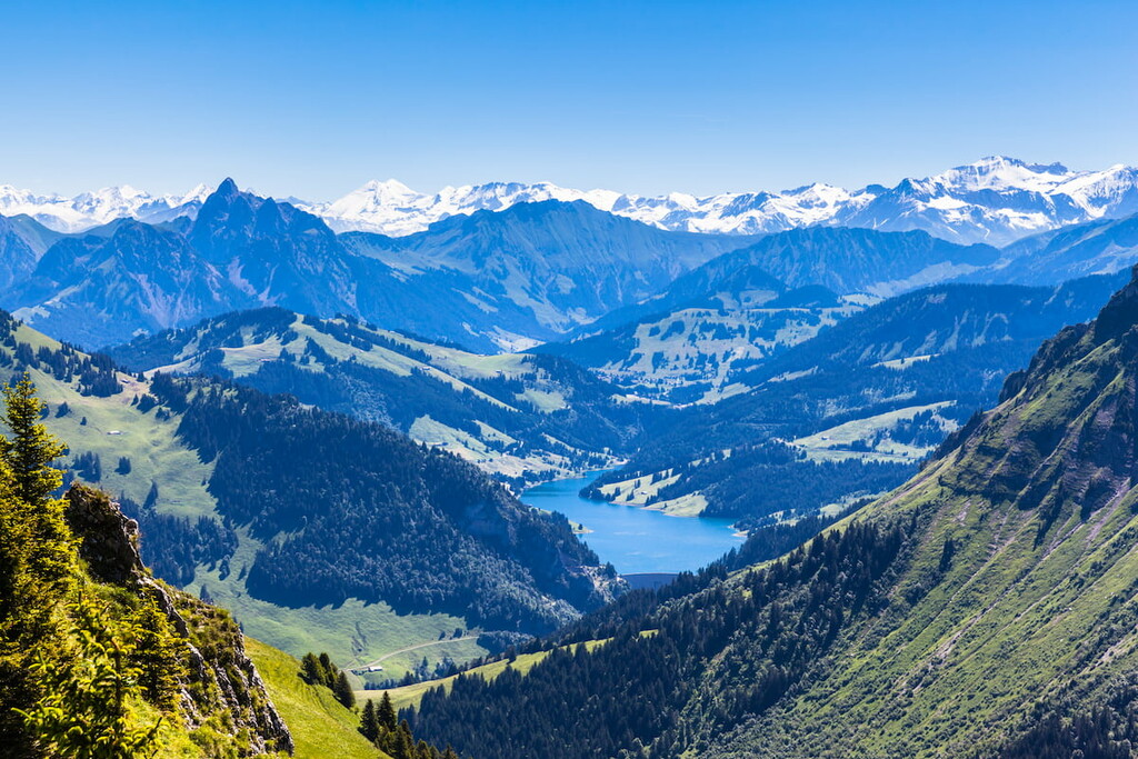
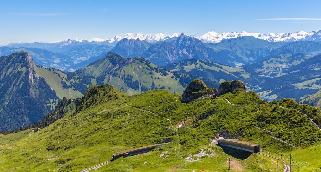
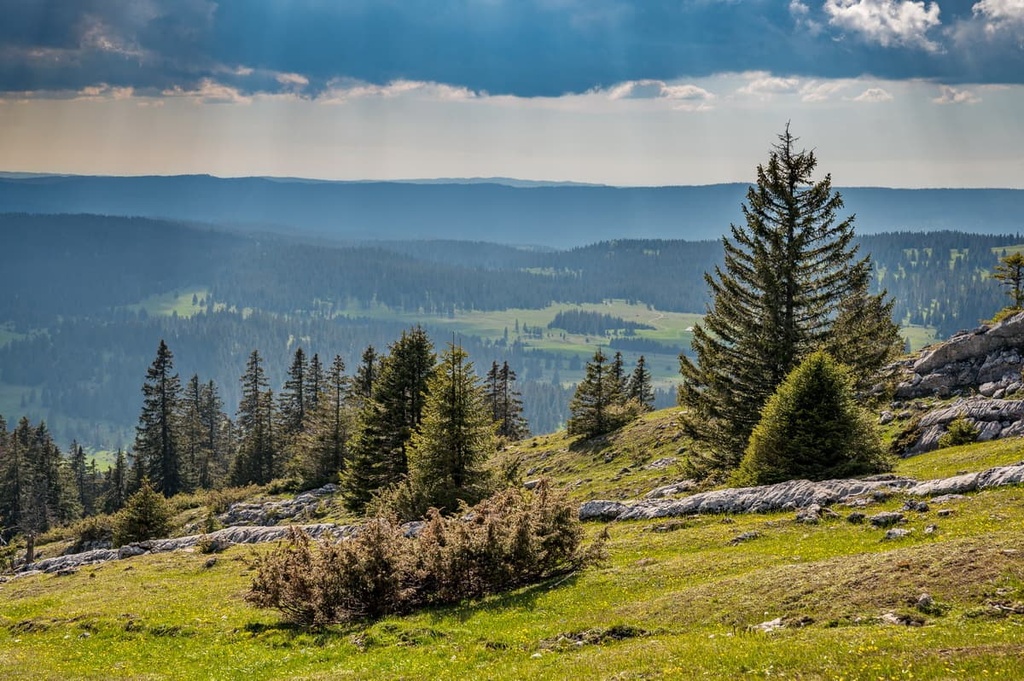
The southern portion of the canton extends into the Alps. The rugged peaks within Vaud mark the northern side of the Bernese Alps, which are also referred to as the Vaud Alps.
The tallest peaks within the canton can be found in the Vaud Alps, including the Diablerets massif, which is home to the tallest peak in Vaud. During the winter months, the landscape in the region supports a number of popular ski resorts, including Les Diablerets and Sainte-Croix/Les Rasses.
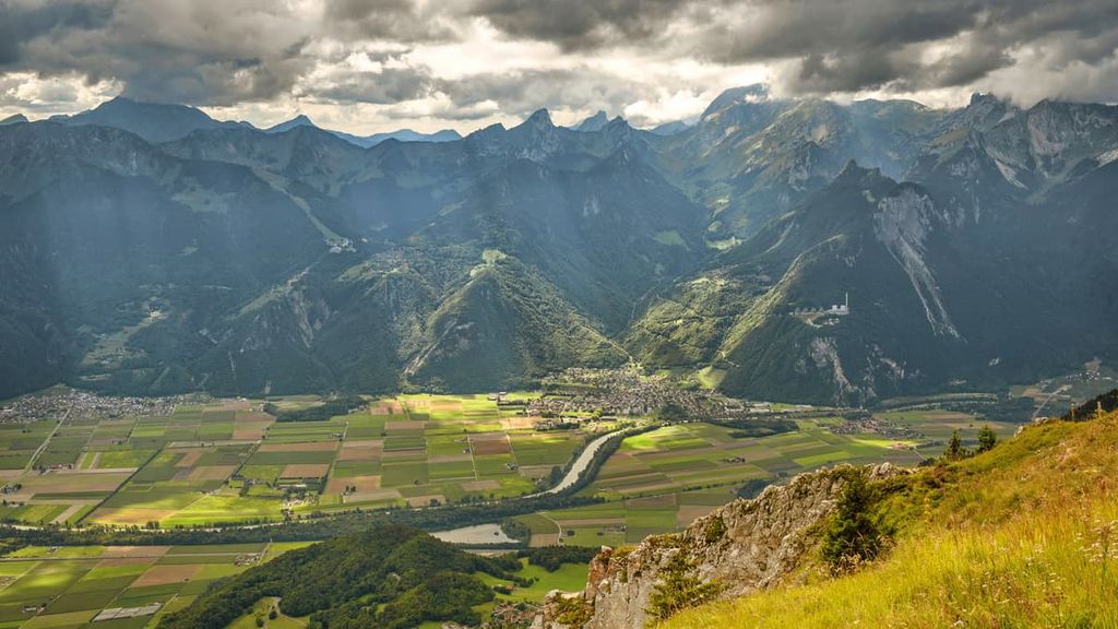
The central part of the canton lies within the Swiss Plateau. Rolling hills and plains mark the northern shores of Lake Geneva as do moraines. The relatively flat terrain in this region is home to the canton’s major cities, which are located in close proximity to the mountains to both the north and the south.
An exclave of the canton is surrounded by Fribourg while two enclaves in Vaud surround portions of the canton of Geneva. Parts of both Lake Geneva and Lake Neuchâtel lie within the canton.
The northwestern stretches of the canton are home to the Jura Mountains of Switzerland. Though more modest than the Alps, this subalpine region is home to forested hillsides, offering stunning views of the canton, Lake Geneva, the Swiss Plateau, and the Alps to the south. The Jura Mountains region is also home to the Vallée de Joux.
Additionally, Vaud is home to a number of parks and recreation areas. A few major parks in the canton include Gruyère Pays-d'Enhaut Regional Nature Park and Jura Vaudois Nature Park.
As a canton, Valais has a diverse geological history, due to its numerous major geological regions. Here’s a quick overview of the main geological regions in the canton.
The Alps found in the southern portion of the canton are part of the Bernese Alps. This rugged subrange is home to the tallest peaks within the canton.
The Alps are the tallest mountain range that lies entirely within Europe. The Alpine orogeny was a major mountain building event that helped form the range. It occurred between 65 million and 2 million years ago.
The Tethys Ocean, which once laid between Laurasia and Gondwana, began to recede as these continental plates drifted towards one another. Eventually the two plates collided with one another, resulting in immense pressure that formed a mountain chain known as the Alpide Belt.
The Alpide Belt extends from southern Europe and into south-central Asia, encompassing the Alps and various other mountain ranges. Metamorphism gave further rise to the peaks that are found in the southern portion of the canton. Recumbent folds and thrusting also transformed the marine sediment from the Tethys Ocean into the rocks that we see in the Alps to this day.
During the Quaternary period, the peaks were heavily glaciated. As the glaciers receded, their erosive forces carved out the distinct peaks of the limestone ranges that now exist in the canton of Vaud and the surrounding region.
The pressure caused by the formation of the Alps slowly gave rise to the Swiss Plateau. The many geological layers of the plateau are well documented, and the most important layer in the plateau is the thick molasse sequence that’s found near its border with the Alps.
This layer accumulated along the northern base of the Alps as the peaks rapidly eroded during their formation. Vast alpine rivers once ran down the northern side of the range, depositing sediment across the basin.
Throughout its geological history, the Swiss Plateau has been flooded twice by shallow seas, each leaving behind sediment that today form the many sedimentary rocks found in the region.
The Jura Mountains began forming during the Cenozoic era. A majority of the range was formed by two deformational thrust phases, one that formed the northern peaks and one that formed the southern peaks.
During the Pliocene epoch the main thrust occurred in the southeastern portion of the range. Lasting from around 5.3 million years to 2.6 million years ago, this thrust uplifted the range to its current height.
Major peaks within Vaud include Sommet des Diablerets, Vanil Noir, Grand Muveran, La Tarent, Dent de Savingy, and Chasseron.
The drastic changes in elevation throughout the canton allow for numerous ecosystems to thrive in Vaud.
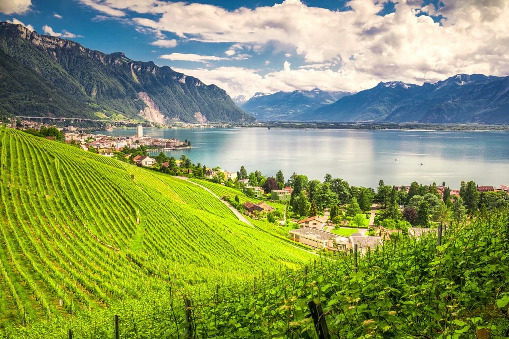
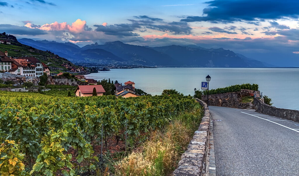
For example, the rolling hills near Lake Geneva are home to countless vineyards. In fact, Vaud is the second largest producer of wine in the country.
Meanwhile, the forests of Vaud are home to Norway spruce, European beech, silver fir, juniper, pine, larch, and alder trees. Lower elevations in the canton are often home to oak, maple and chestnut trees.
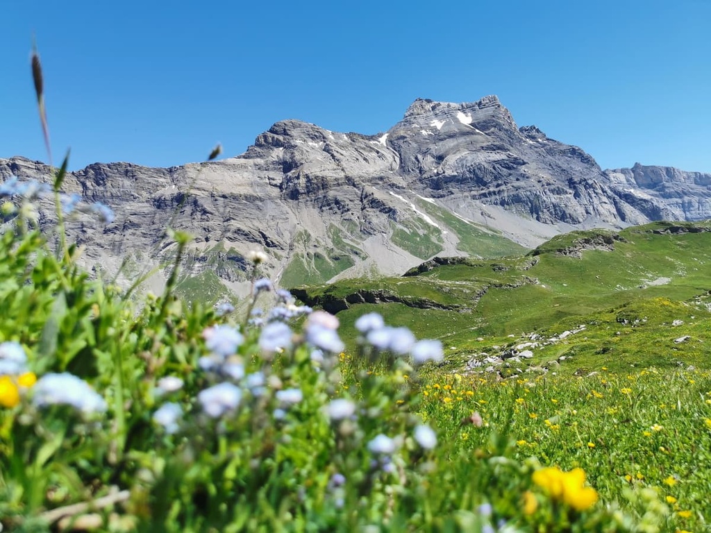
Higher elevations found throughout Gruyère Pays-d'Enhaut Regional Nature Park are home to a variety of wildflowers during the summer months. Common flowers include spotted deadnettle, Martagon lily, purple orchid, cornflower, and globeflower. Plant life is uncommon at the highest elevations in the canton.
Other flowers found in the canton include lilies, tulips, astragalus, forget-me-nots, germander speedwells, and primroses. Wool grasses are often spotted near alpine streams and lakes in Vaud.
A variety of fauna live amongst the various settings within Vaud. Some of the many mammals found in the canton include western roe deer, chamois, ibex, fox, marmot, wild boar, red deer, marmot, pine marten, and gray wolf, along with various species of bats and rodents.
Some birds found in the canton include the gray heron, black kite, red kite, great cormorant, golden eagle, and Eurasian eagle-owl.
The waterways in Vaud are home to many species of fish including the brown trout, northern pike, European perch, European carp, chub, Wels catfish, and burbot.
The human history of the canton dates back to prehistoric times when groups of people began inhabiting the land surrounding the various lakes of the region. Later on, the Celtic tribe known as the Helvetii lived in the region. They were defeated by the Romans during the last century BCE.

Many of the cities that are present today, such as Vevy and Lausanne, were established by the Romans during their occupation. Between the second and fourth centuries CE, Almannic tribes invaded the area in an effort to overthrow the Romans.
By 888 CE, the region of Vaud became part of the Carolingian Empire. The Zähringens of Germany later conquered the region in 1032, followed by the counts of Savoy in 1218. In the centuries that followed, troops from Bern began to occupy the area, though their presence was unwelcome from the residents of the region.
In protest of the Bernese occupation, Vaud nationalist drove out the Bernese governor in 1798, declaring the region as the Lemanic Republic. Under the Helvetic Republic, Vaud became known as the canton of Léman.
Following the fall of the Helvetic Republic in 1803, Vaud rejoined the Swiss Confederation and has been a sovereign canton ever since. During the nineteenth century, Vaud was a vocal opponent of the Sonderbund Catholic separatist movement. A new cantonal constitution was established in 2003, replacing the previous one, which dated back to 1885.
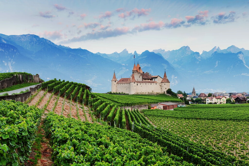
Currently, the only major city in the canton is the capital Lausanne. The canton is the second largest producer of wine in the country, and it is primarily known for its white wine. Other agricultural goods grown in Vaud include tobacco, sugar beet, and fruit. Cattle breeding is also common in the foothills of both the Jura Mountains and the Alps.
Besides Lausanne, one of the most popular tourist destinations in the canton is Vallée de Joux. Vallée de Joux is a valley in the Jura Mountains that’s home to a handful of ski areas as well as the factories for many famous Swiss watchmakers, such as Audemars Piguet and Vacheron Constantin.
Vaud is home to numerous trails for hiking and outdoor recreation. Here are some of the most popular trails and regions in the canton:
Gruyère Pays-d'Enhaut Regional Nature Park lies in the southern portion of Vaud within the Bernese Alps. The region is known for its tradition of Alpine dairy farming and its stunning mountain views. Vast valleys and forests can be found throughout the nature park.
In the park, lush alpine pastures are surrounded by rock fields and sheer cliffs. The park extends throughout the range, leading to the eastern shores of Lake Geneva.
Major hikes within the park include:
Jura Vaudois Nature Park lies in Vaud’s Jura Mountains. The park extends from the summit of La Dôle to the town of Romainmôtier, with Vallée de Joux to the north.
The park is home to a diverse range of landscapes. It features everything from limestone rocks, forests, marshlands, and glades. There are more than 523 km (325 miles) of trails in the park that offer hikers a variety of options for exploring the landscape.
Here are some of the major hikes within the park:
For skiing and snowboarding enthusiasts, there are more than 20 ski resorts in Vaud (Waadt), which are located throughout the canton. It is one of the main areas for skiing in the Swiss Alps.
The largest ski resort in Vaud (Waadt) is Villars/Gryon/Les Diablerets with more than 80 km (50 mi) of slopes and more than 25 ski lifts.
Other major areas for skiing in Vaud (Waadt) with more than 20 km (12 mi) of slopes and more than 10 ski lifts each include the following in descending order of size:

These are also the main ski resorts near Lausanne, the capital city of the canton.
Check the Vaud (Waadt) ski resorts map as well as the larger Switzerland ski resorts map in the World Mountain Lifts section of the site. It includes information about open ski lifts / slopes in Vaud (Waadt) in real-time with opening dates and hours. There are also year-round cable cars, funiculars, cog railways, aerial tramways, and all other types of mountain lifts.
Looking for a place to stay in Vaud? Here are some of the best cities and villages to check out in the canton:
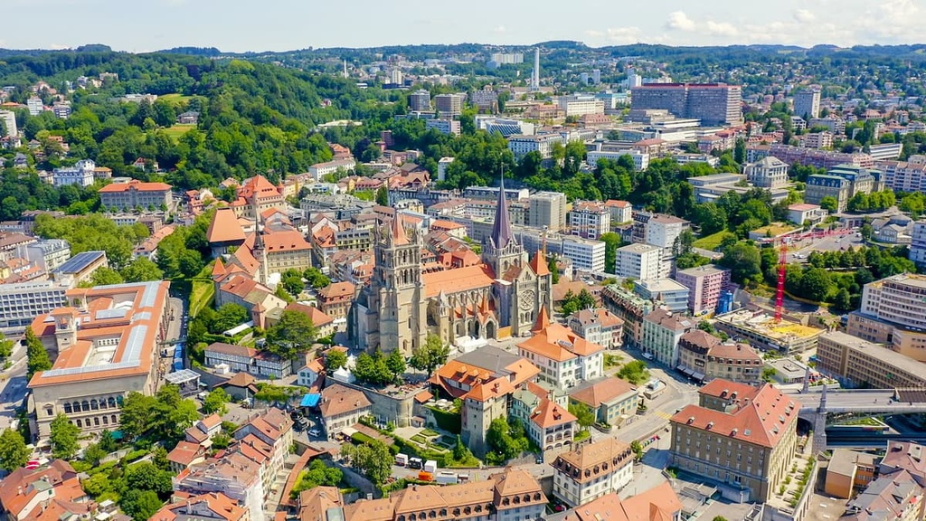
Lausanne is the capital city of Vaud and the most populated city in the canton. Situated on the northern shores of Lake Geneva, Lausanne is nestled between the lake to the south and the Jura Mountains to the north. Lausanne is home to 140,000 residents, making it the fourth most populous city in the country.
Known for being an old university city, today Lausanne is the world headquarters of the International Olympic Committee. The city is surrounded by vineyards while the old town district is primarily car-free. The medieval city center is lined with local shops and restaurants.
The Cathedral of Notre Dame of Lausanne is a focal point of the city. It is often revered as the country’s most impressive piece of gothic architecture.
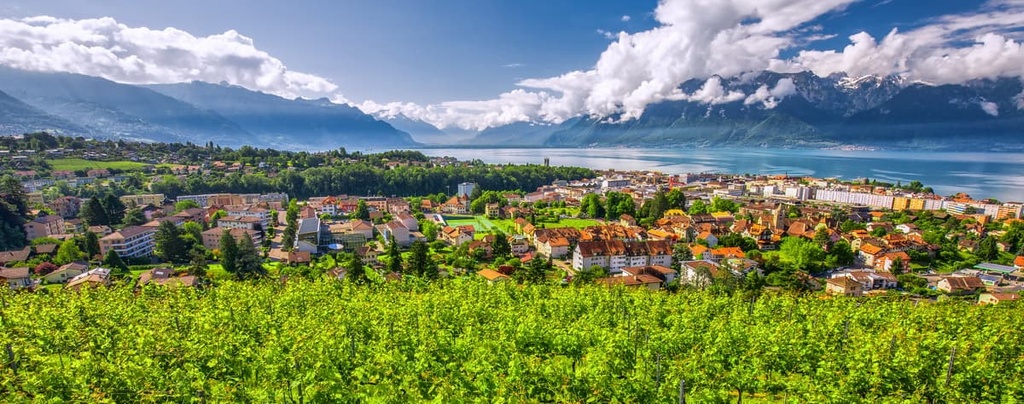
Montreux is a resort town that lies along the eastern shores of Lake Geneva, just outside of Gruyère Pays-d'Enhaut Regional Nature Park.
The resort town is home to around 26,000, and it is a popular tourist destination. Situated between Lake Geneva and the Alps, the town provides easy access for those wishing to relax and those headed into the Alps.
Known for its scenic promenade, Montreux is home to a microclimate similar to the Mediterranean. Popular museums in the town include Chaplin’s World and Chillon Castle. The town has historically been a place of inspiration for many artists of different mediums.


Yes. Vaud has 390 named mountains. The highest is Sommet des Diablerets at 3,216 m.
The highest mountain in Vaud is Sommet des Diablerets, at 3,216 m.
Vaud has 390 named mountains.


