
Scan the QR code and open PeakVisor on your phone
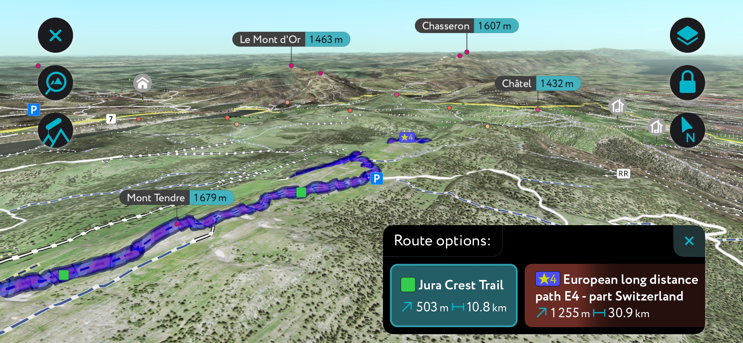
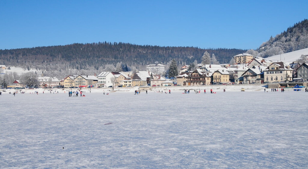
The Jura Vaudois Nature Park spans 56,800 ha (140,355 acres) in western Switzerland and encompasses 34 municipalities in the canton of Vaud. In addition to over 500 km (311 mi) of nature trails, the park preserves long traditions in dry stone wall building, cheese production, watchmaking, and woodworking. There are 58 mountains in the park; Mont Tendre is the highest (1,679 m / 5,509 ft) and most prominent, rising 453 m (1,486 ft) from its surroundings.
Established in 2013, the Jura Vaudois Nature Park lies in the canton of Vaud in western Switzerland. The peaks are part of the Jura Mountains, and the park features hundreds of kilometers of established trails for day hikes, biking, cross-country skiing, and multi-day routes such as the Jura Crest Trail.
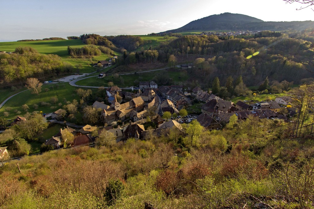
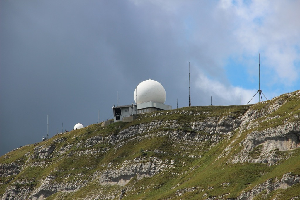
The park reaches from the summit of La Dôle (1,677 m / 5,502 ft), the park’s second tallest peak, to the town of Romainmôtier. Vallée de Joux lies to the north, and Lake Geneva neighbors the park to the south. Mont Tendre (1,679 m / 5,509 ft), the park’s tallest peak, is the highest summit in Switzerland outside of the Alps and one of 27 peaks along the Jura Crest Trail.
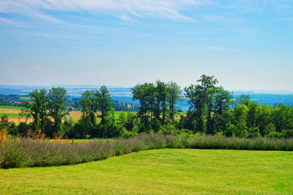
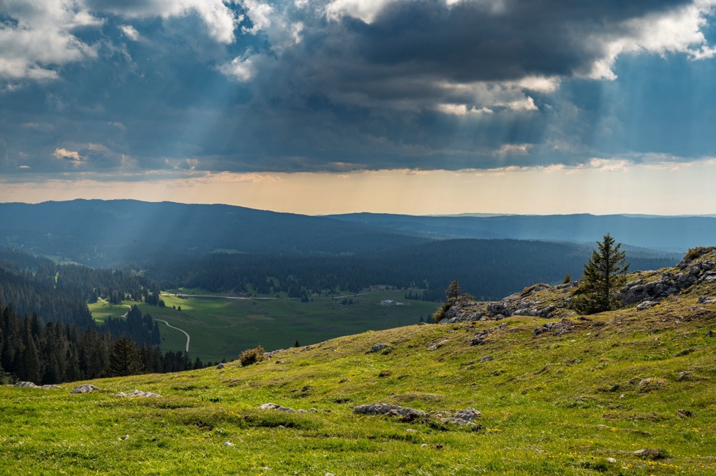
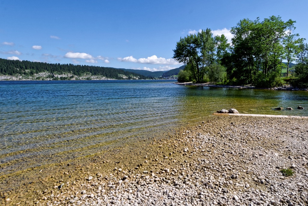
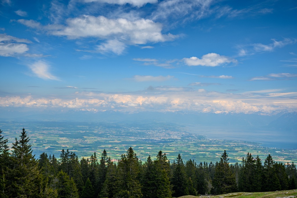
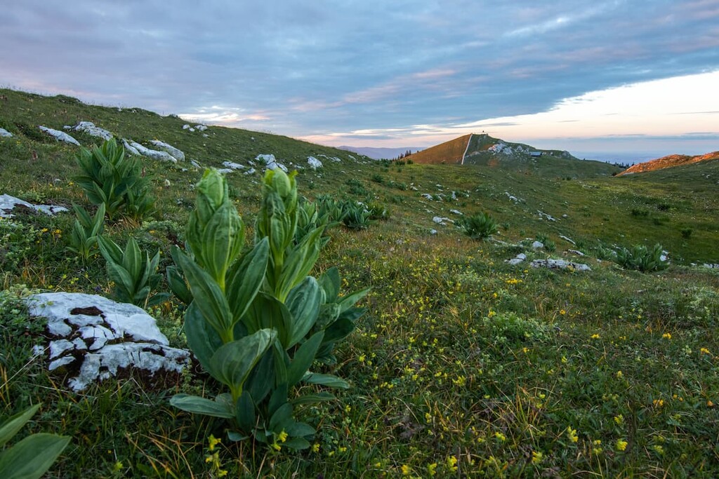
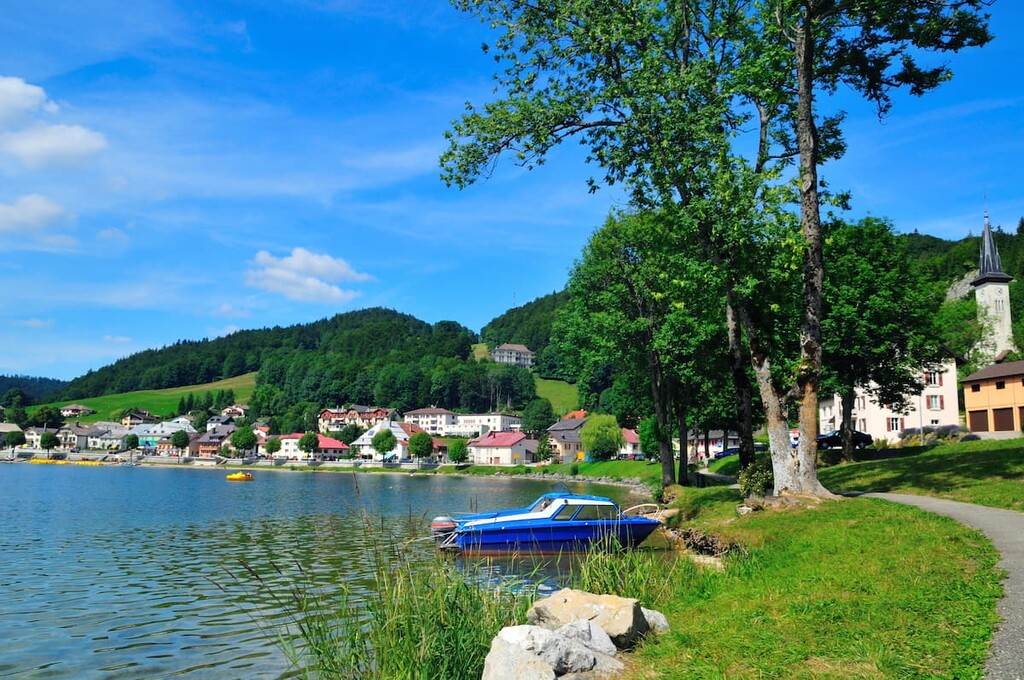
Features of the park include the gorges of the Orbe and Nozon Rivers, the Jura Ridge between Col de la Givrine and Col du Mollendruz/Dent de Vaulion, the Mont Risoux massif, and Lac de Joux – the largest lake in the Jura Mountains. The landscape is a mixture of forests, marshland, and pastureland overlying primarily limestone rock.
Peaks in the Jura Vaudois Nature Park belong to the Jura Mountains. The range spans 360 km (225 mi) across the French-Swiss border from the Rhône River to the Rhine. Most of the range lies in Switzerland with the tallest peaks in the south, near Geneva.
Jura limestone, rich with fossils, is the primary rock type. Its name references the Jurassic Era, as rocks formed during the same period from 200 to 145 million years ago.
The Jura Mountains began to form within the past 65 million years during the Cenozoic Era, triggered by the same events that raised the Alps. The main thrust occurred between 5.3 and 2.6 million years ago, with two phases forming the range. The first thrust phase formed the French ridges on the outer edge, and the second formed the higher inner ranges.
The rock composition, limestone alternating with layers of soft marl, is highly permeable. The porous layer leads to a shortage of surface water and formations characteristic of a karstic landscape, such as caves and chasms.
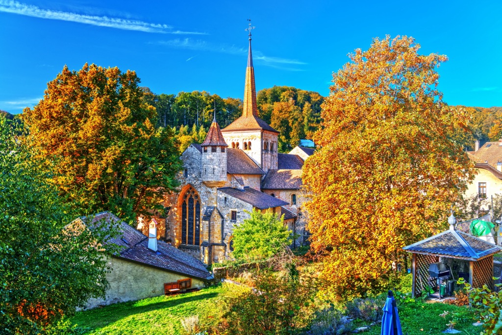
Jura Vaudois Nature Park’s landscape bears the transformation of centuries of human cohabitation. Since the 12th century, humans have logged and grazed the region, resulting in the wooded pastures common in the park today. There are 25 forest reserves in the park territory and one federal wildlife protection site, Le Noirmont.
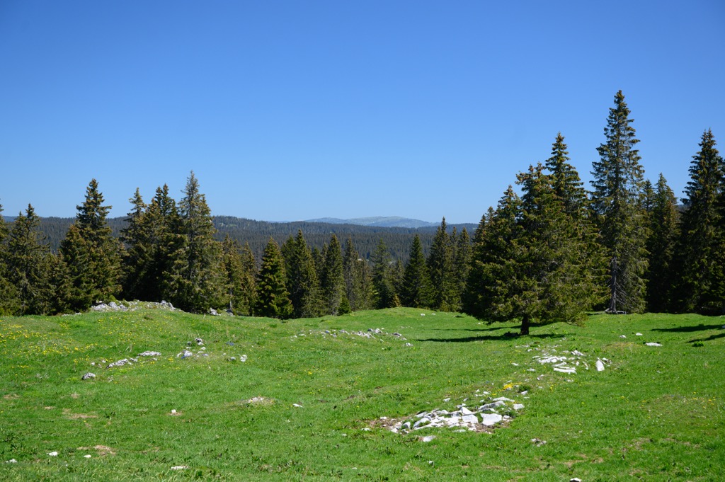
Forest cover accounts for nearly 60% of the park, or 32,000 hectares (79,075 acres). Around 40% of this is wooded pasture. Roughly two-thirds of trees are softwoods like spruce and fir, while the remaining third are hardwoods such as beech and oak. Historically, forest management systems replaced beech trees with spruce. Reforestation efforts in areas where agriculture has been abandoned are helping promote the regrowth of hardwood species.
Countless dry stone walls are another mark of civilization in the region. Hundreds of kilometers of stone walls crisscross the park, demonstrating an impressive regional tradition, and serving agricultural and ecological purposes.
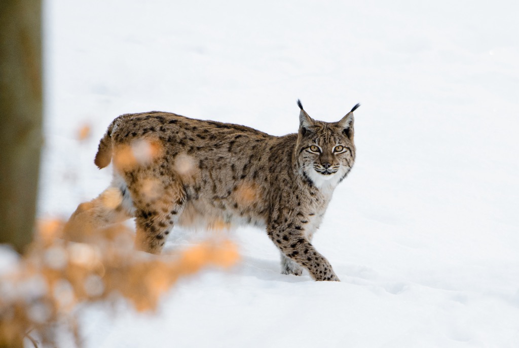
Lichen and moss on the stones create habitats for insects and reptiles, such as the midwife toad, the spotted salamander, and the wall lizard. The walls form long corridors that are a refuge for ermine and vipers. Other animals in the park include wood grouse, chamois, and the rarely-spotted lynx.
Apart from forests and wooded pastures, the region's karstic formations have created several marshes, caves, and chasms.
Jura Vaudois Nature Park was established in 2013. Humans have lived in the region for centuries, and visiting Jura Vaudois Nature Park is about more than just nature. Watchmaking, woodworking, the production of local cheeses, and the preservation of dry stone walls all represent long-standing regional traditions.
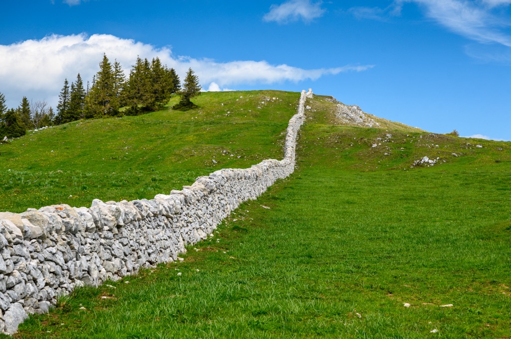
Dry stone walls have been constructed in the Vaudois Jura since the 1700s, marking mountain pastures, containing livestock, and securing wells. An early period of intense deforestation for sawmills, glasswork, forges, lime kilns, and charcoal production led to a shortage of wood, prompting farmers to build walls with stones they removed from pastures. Today, the Swiss Federation of Dry Stone Masons trains people to keep the knowledge alive.
More than 690 km (430 mi) of dry stone walls intersect the park. The park and its walls are on the UNESCO Representative List of the Intangible Cultural Heritage of Humanity. Preserving the walls is just one mission; another project is a conservation effort to create spaces for ermines within the walls. Ermines hunt voles, and maintaining healthy ermine populations helps farmers.
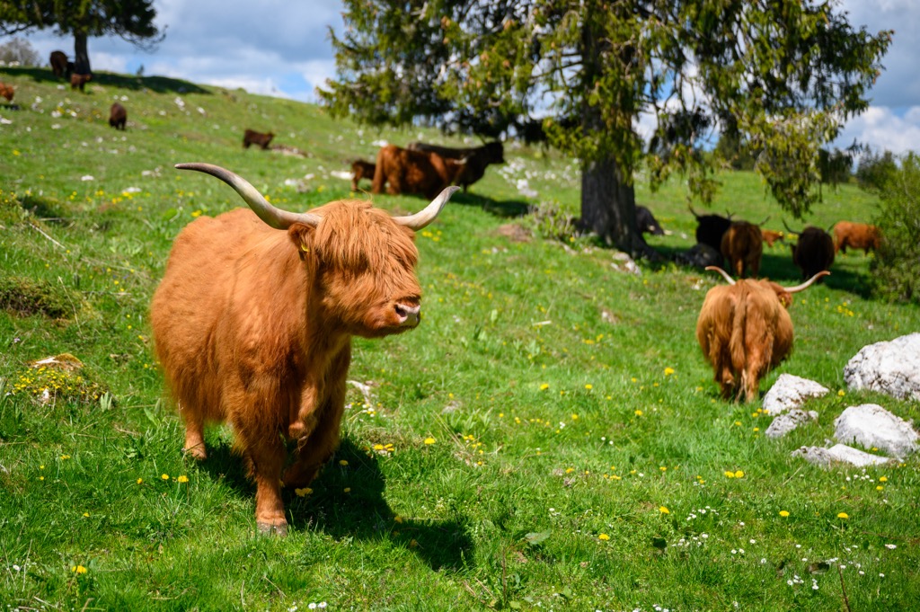
The area continues to support an agricultural economy, particularly with cattle and cheese production. Trails in the park pass by mountain huts and restaurants offering local products and regional cuisines.
Due to the permeable rock underlying the park, there tends to be little surface water. Farmers in the region historically collected their own cistern water, and today, water is often brought from the Doubs and other nearby rivers.
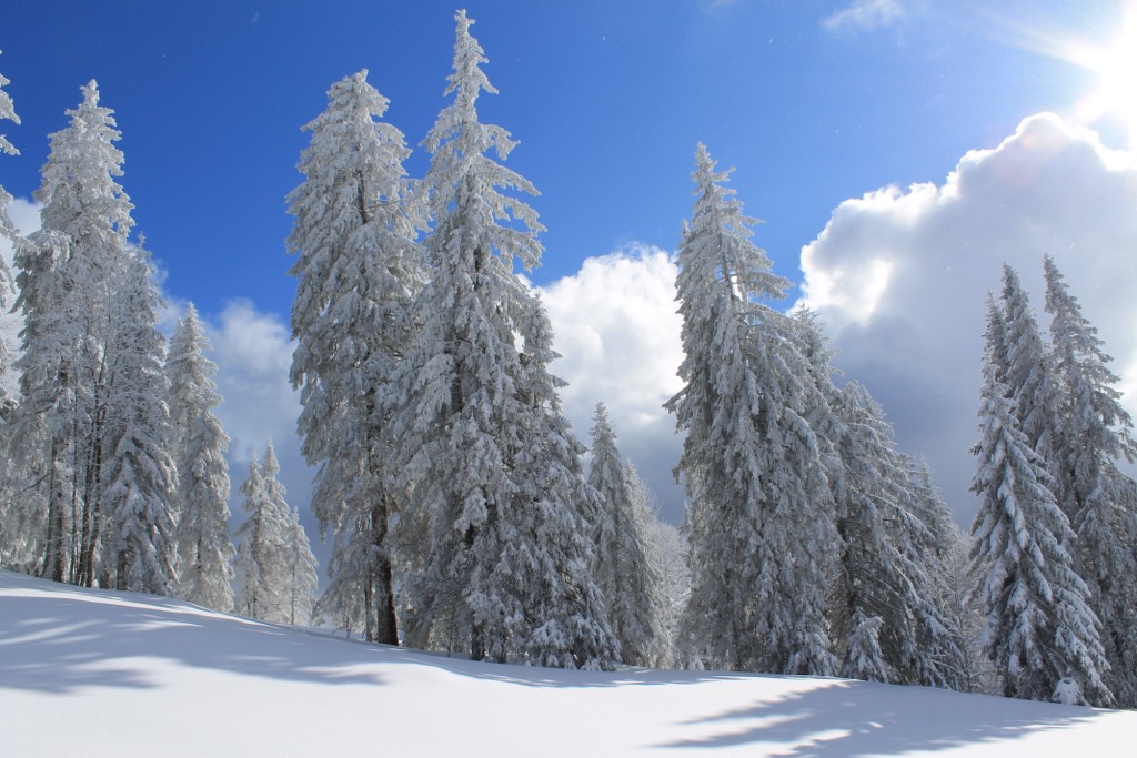
Jura Vaudois Nature Park contains the highest peak in Switzerland outside of the Alps and boasts 523 km (325 mi) of trails. It offers single and multi-day hiking and biking trails, as well as cross-country skiing and snowshoeing in winter. The Jura Crest Trail runs through the park, forming a 320 km (199 mi) arc along the Jura Mountains between Zurich and Geneva.
The Jura Crest Trail is Switzerland’s oldest long-distance trail, with its first signposts erected in 1905. The route is 320 km (199 mi) with 13,800 m (45,275 ft) of ascent as it arcs from Zurich to Geneva. It is easy to follow, and highlights include beautiful views of the Alps, the Black Forest, and the Vosges. The route passes cliffs, deep ravines, springs, lakes, forests, and sprawling meadows and crosses two linguistic zones, each with distinct architecture and local cuisine.
La Dôle (1,677 m) is the second tallest peak in the park. A perfect day hike is a 12 km (7.4 mi) loop trail with a 640 m (2,100 ft) elevation gain that passes Les Pralies and Col de Porte along the way. It’s a moderately challenging trail with some steep sections, but it is balanced by incredible views and several local restaurants along the way for a rest and recharge.
The trail system in Jura Vaudois Nature Park offers several great biking loops, mainly on paved surfaces. From short jaunts to multi-day routes, the bike trails range from easy to challenging. The Jura Route runs between Basel and Nyon, and part of the trail cuts through the nature park.
The Jura Trail is 280 km (175 mi) long and gains 5,300 m (17,390 ft) in elevation. It can be divided into six stages, with accommodation in villages and towns along the way. The trail winds through mountain meadows, forests, high moorland, and rolling pastures with cows and horses.
Jura Vaudois Nature Park sits on Lake Geneva's northern edge, approximately 45 minutes by car from Geneva to the west and Lausanne to the east. Those looking for accommodation in and around the park can choose from hotels, guest houses, and campsites.
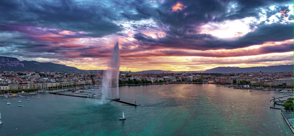
Geneva lies to the west and is home to nearly 200,000 people. The city is famous for its long history of watchmaking, luxury goods, and chocolatiers. It’s home to the United Nations European headquarters and the Red Cross. As an international hub, the city hosts trade fairs and exhibitions, offers shows at the Grand Théâtre and the Geneva Opera House, and boasts several museums such as the Musée International de l’Horlogerie (about watches) and the International Museum of the Red Cross.
A few well-known landmarks around Geneva include the Jet d’eau with its water jet spouting 140 m (460 ft) high on the banks of Lake Geneva, St. Peter’s Cathedral, and the historic street of Grand-Rue where the famous philosopher Jean-Jacques Rousseau was born.
A short trip from Geneva takes you to Mont Saléve, across the border in France. The cable car climbs to 1,100 m (3,610 ft) in less than five minutes, providing beautiful views of the city of Geneva, Lake Geneva, the Alps, the Jura Mountains, and Mont Blanc.
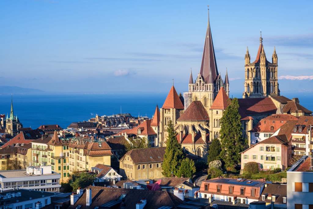
Slightly smaller than Geneva, Lausanne to the east has a population of 138,000 people. The lively university town with an air of holiday resorts serves as the capital of the canton of Vaud. It sits on the edge of Lake Geneva with views across the water of the Savoy Prealps on the French side.
The cathedral in the old town is an impressive example of early Gothic architecture and represents the influence of a diocese in the city for over a thousand years. If you’ve got a few days, there are many parks, grand palace hotels, and museums to explore. The city has been home to the International Olympic Committee since 1914, as well as the Olympic Museum.


