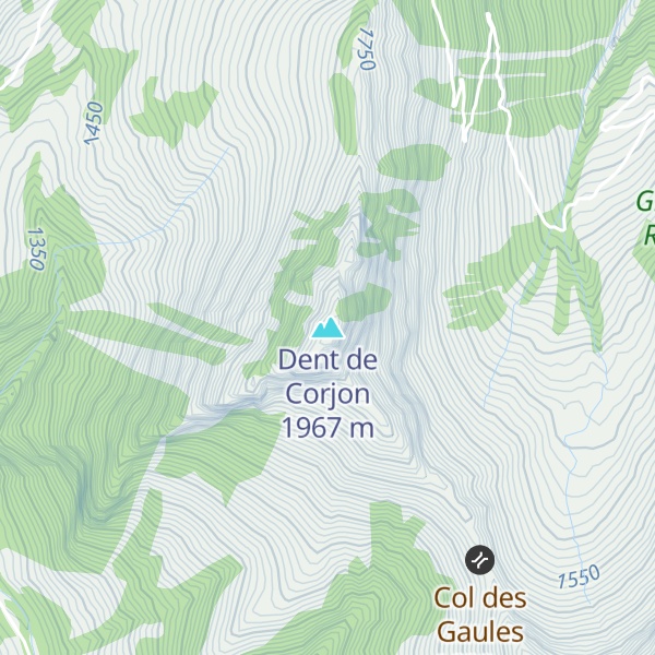
The Dent de Corjon (1,967 m) is a mountain of the Swiss Prealps, located west of Rossinière in the canton of Vaud. It is the culminating point of the small range lying between the valley of L'Hongrin and the Sarine, north of the Lac de l'Hongrin.
By elevation Dent de Corjon is
# 83 out of 172 in Gruyère Pays-d'Enhaut Regional Nature Park # 54 out of 95 in District de la Riviera-Pays-d’Enhaut
By prominence Dent de Corjon is
# 21 out of 1882 in the Swiss Prealps # 9 out of 387 in Vaud # 5 out of 172 in Gruyère Pays-d'Enhaut Regional Nature Park # 5 out of 95 in District de la Riviera-Pays-d’Enhaut
We use GPS information embedded into the photo when it is available.
3D mountains overlay
Adjust mountain panorama to perfectly match your photos because recorded by camera photo position might be imprecise.
Move tool
Rotate tool
Zoom
More customization
Choose which peak labels should make into the final photo and what photo title should be.
Next
Photo Location
Satellitte
Flat map
Relief map
Latitude
Longitude
Altitude
OR
Latitude
°'''
Longitude
°'''
Apply
Register Peak
Peak Name
Latitude
Longitude
Altitude
Register
Teleport
PeakVisor
This 3D model of Sagarmatha National Park in Nepal was made using the PeakVisor app topographic data. The mobile app features higher precision models worldwide, more topographic details, and works offline. Download PeakVisor maps today.
Download OBJ model
PeakVisor
The download should start shortly. If you find it useful please consider supporting the PeakVisor app.
PeakVisor for iOS and Android
Be a superhero of outdoor navigation with state-of-the-art 3D maps and mountain identification in the palm of your hand!