
Scan the QR code and open PeakVisor on your phone
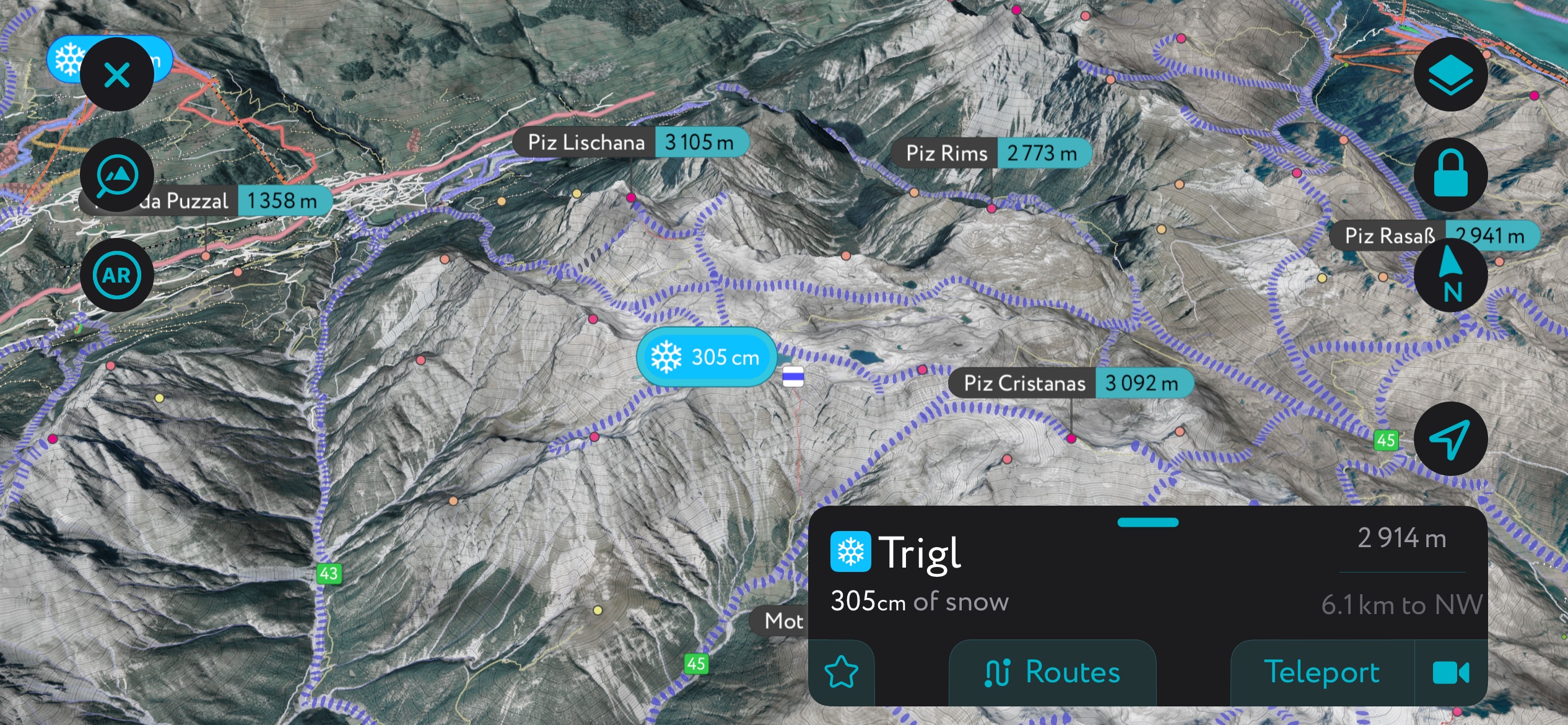
The Sesvenna Range include 175 named peaks. The highest is Piz Sesvenna at 3,204 m. Other notable peaks include Piz Pisoc, Piz Tavrü and Piz Plavna Dadaint.
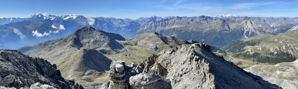
The Sesvenna Alps (Alpi della Val Müstair), also called the Sesvenna Range, are a mountain range straddling the border between northern Italy, eastern Switzerland, and western Austria. Dozens of 3,000ers dotted across this tri-border range make the Sesvenna Alps excellent for hikes and ski tours. There are 175 named mountains in the Sesvenna Alps. The highest and most prominent mountain is Piz Sesvenna (3,204 m / 10,511 ft).
The Sesvenna Alps are situated within the Central Eastern Alps and the Western Rhaetian Alps. The range is named after its highest summit, Piz Sesvenna (3,204 m / 10,511 ft).
Around 66% of the Sesvenna Alps fall within Switzerland's Grisons (Graubünden) canton, where they are commonly known as the Münstertal Alps. Just under 33% of the range belongs to Italy's South Tyrol, and the northeastern corner falls within Austria's Tyrol. None of the Sesvenna Alps' major summits are within Austria.
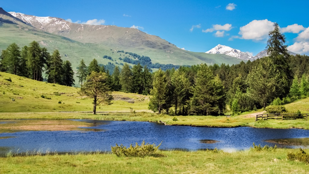
The Sesvenna Alps primarily overlook the Engadine Valley near Scuol in the Engiadina Bassa / Val Müstair Region of the Grisons. The Sesvenna Alps are triangular, stretching from Zernez in the west to Nauders in the north and Mals in the southeast.
The Sesvenna Alps are approximately 25 km (15.5 mi) long between its northernmost major summit, Piz Lad (Piz Lat) (2,808 m / 9,212 ft), and southernmost major summit, Piz Terza (Urtirolaspitz) (2,908 m / 9,540 ft).
Six other mountain groups surround the Sesvenna Alps. The Engadine Valley separates them from the Albula Alps, Samnaun Alps, and Silvretta Alps to the northwest. Across the Spöl Valley to the southwest are the Livigno Alps.
The Ortler Alps are beyond the Ofenpass (Pass dal Fuorn) (2,150 m / 7,053 ft) and Val Müstair to the south of the Sesvenna Alps. To the east, across one of the Alps' principal passes, the Reschenpass (1,507 m / 4,944 ft), are the Ötztal Alps.
Two rivers drain the Sesvenna Range: the Inn and the Adige. The Inn is the Danube's third-largest tributary, while the Adige is Italy's second-longest river.
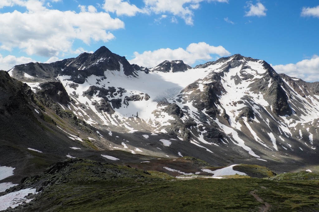
The Reschensee (Lago di Resia) (1,498 m / 4,914 ft) on the Sesvenna Alps' eastern boundary is the range's largest lake, with a surface area of 6.6 sq km (2.5 sq mi). The range's only significant glacier is Vadret da Sesvenna, located just north of Piz Sesvenna.
The Sesvenna Alps can be divided into nine subgroups. The Seeboden Group is unique as it's the only subgroup not reaching 3,000 m (9,842 ft) in elevation.
The groups at the three tips of the triangular Sesvenna Range are the Piz Macun Group to the west, the Rusenna Group to the north, and the Piz Starlex Group to the southeast.
Below is a list of each sub-group and their highest and most significant summits:
The Sesvenna Alps sit on the eastern edge of the Western Rhaetian Alps at the heart of the Central Alps. They formed along with the rest of the Alps during the Alpine Orogeny.
The Alpine Orogeny is an ongoing mountain-building event that commenced approximately 66 million years ago during the Late Mesozoic Era.
The key event in the Alpine Orogeny was the collision of the African, Arabian, Indian, and Cimmerian tectonic plates to the south with the Eurasian Plate to the north. Convergent movement between these plates helped form the Alps as they are today.
The Alpine Orogeny helped build many mountain ranges worldwide, ranging from the Atlas Mountains in North Africa to the Himalayas.
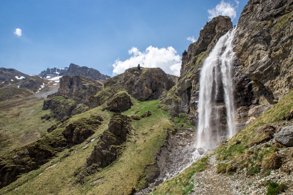
The Sesvenna Range's location on the edge of the Western Limestone Alps means it has a mixed geological structure. Limestone and dolomite are the dominant rock types in the Sesvenna Alps. The dolomitic layers across the Sesvenna Alps are up to 1,000 m (3,280 ft) thick and formed over 200 million years ago.
The Sesvenna Range’s dolomitic peaks and their position overlooking the lower Engadine Valley have earned them the nickname the "Engadine Dolomites."
Despite being overshadowed by higher neighboring mountain chains, the Sesvenna Alps are still home to 34 named 3,000ers. Aside from those previously mentioned, notable peaks in the Sesvenna Alps include Piz dals Vadès (3,139 m/10,299 ft), Piz Minger (3,113 m / 10,213 ft), and Foratrida (3,134 m / 10,282 ft).
The Sesvenna Range provides one of the best snapshots of flora and fauna within the Central Alps.
Common mammals that inhabit the Sesvenna Alps include chamois, red deer, Alpine ibex, Alpine marmots, foxes, mountain hares, and squirrels.
Brown bears and Eurasian lynxes have recently been reintroduced into the Swiss National Park. During the 19th and 20th centuries, they were hunted to extinction; however, protected parks, less livestock grazing, and a newfound acceptance among outdoor enthusiasts have enabled the reintroduction of these predators.
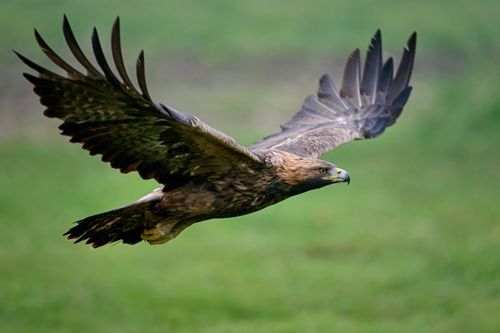
Golden eagles are one of the rarest birds of prey that nest in the Sesvenna Alps. Only six nesting pairs live partially within the Swiss National Park, which encompasses most of the range.
Other notable bird species that inhabit the Sesvenna Alps include bearded vultures, peregrine falcons, ptarmigans, nutcrackers, greater spotted woodpeckers, Eurasian jays, and black grouses.
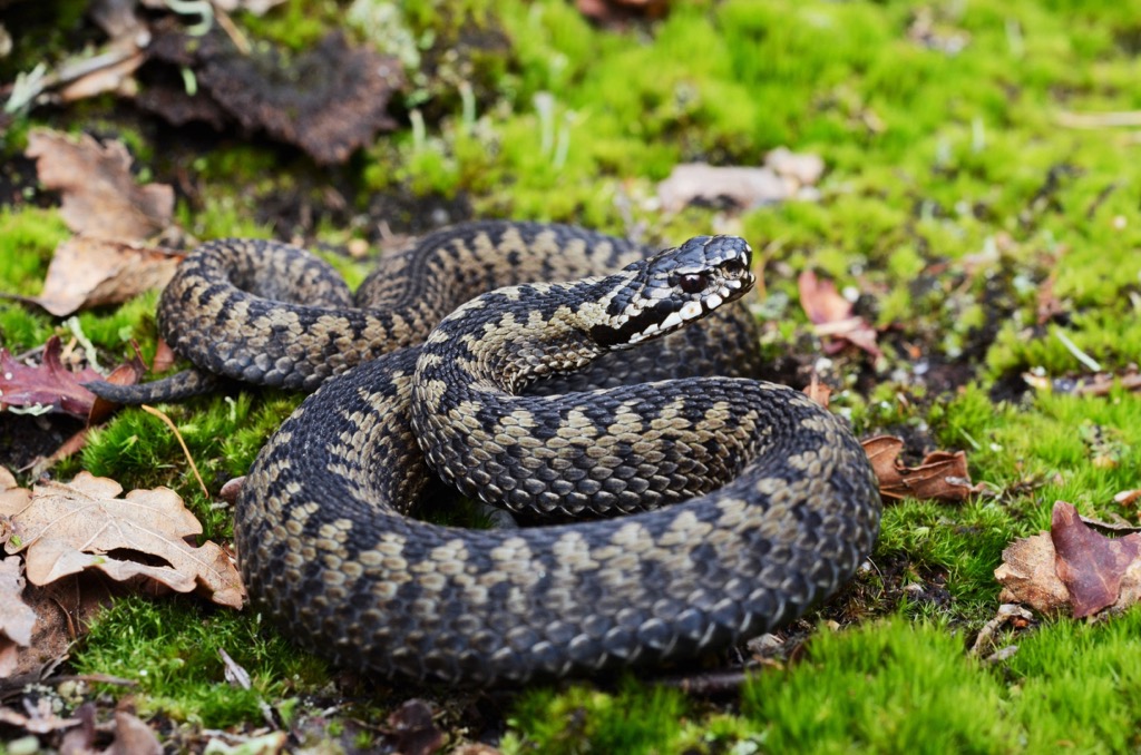
Northern vipers, also called common European adders, are the only snakes in the Sesvenna Alps. They're venomous to humans and can live in boulder fields at 3,000 m (9,842 ft) in elevation. Other notable reptile and amphibian species native to the Sesvenna Alps include grass frogs, common lizards, and Alpine salamanders.
Insects are often seen in the woodlands and alpine pastures of the Sesvenna Range, thousands of meters above sea level. These insects include butterflies like the mountain clouded yellow, mountain green-veined white, and small apollo.
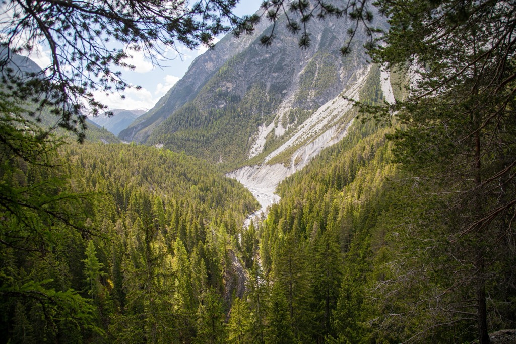
As with the rest of the Alps, the composition of forests in the Sesvenna Range changes with elevation. Up to 2,200 m (7,217 ft), coniferous forests consisting of larches and Norway spruces are prevalent.
At the edge of the treeline above 2,200 m (7,217 ft), Cembra pines, which can withstand temperatures as low as -40 ˚C (-40 ˚F), and mountain pines, which carpet the Ofenpass, dominate the landscape.
Higher up in the Sesvenna Range, the forests give way to alpine pastures and shrubland. Remarkably, many hardy flowering plants thrive in these harsh conditions.
Glacier crowfoots, or glacier buttercups, are the hardiest of these plants. They are the highest flowering plant in the Alps, having been spotted at over 4,000 m (13,123 ft) in elevation.
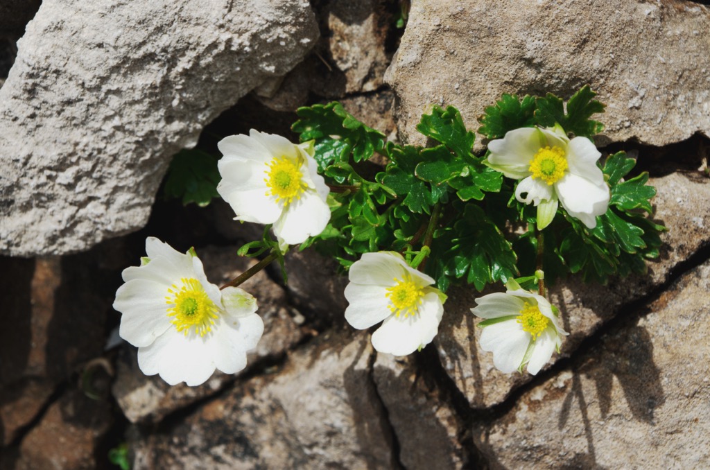
Other notable flowering plant species that grow across the Sesvenna Alps' pastures include edelweiss, Rhaetian poppies, Alpine toadflax, moss campion, vanilla orchids, and Alpine aster.
Europe's largest honey fungus was identified on the Ofenpass (Pass dal Fuorn) in 2007. It is thought to be over 1,000 years old and has an estimated diameter between 500 m (1,640 ft) and 800 m (2,624 ft).
The Sesvenna Alps are home to mountain passes that have been used for thousands of years. For example, the Reichenpass was a part of the Via Claudia Augusta, an ancient Roman road opened in 50 CE.
The range's central plateau, S-charl, takes its name from the Holy Roman Emperor Charlemagne, who traveled through the region on his way to Lombardia.
Many buildings and ruins across the Sesvenna Alps date back to the 8th century when Charlemagne frequented the area. The Benedictine Abbey of St. John at Müstair is a UNESCO World Heritage Site established in 780 CE and believed to have been founded by Charlemagne.
One of the most interesting cultural aspects of the Sesvenna Alps is the Romansh language, spoken by a minority across most of the Grisons canton.
At the start of the 19th century, around 50% of people in the Grisons spoke Romansh. Today, the language is spoken by less than 60,000 people. Romansh is the official language of Scuol, one of the principal settlements of the Sesvenna Alps.
The 270-bedroom Hotel Waldhaus Vulpera in Scuol is historic for being one of the first buildings in the Swiss Alps with an address. The Hotel Waldhaus Vulpera opened in 1897 and was a significant Belle Époque monument. It burned down in 1989.
It's worth noting that Switzerland's only national park, the Swiss National Park, encompasses most of the Sesvenna Alps. Within the park, leaving specified trails is prohibited, meaning hiking opportunities are limited.
Ensure you bring appropriate hiking equipment and plenty of food and water when hiking in the Sesvenna Alps. Check local weather forecasts, map out your route carefully, and inform others of your itinerary.
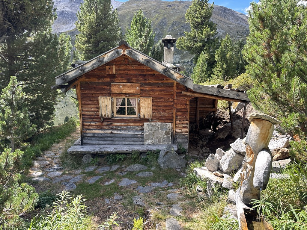
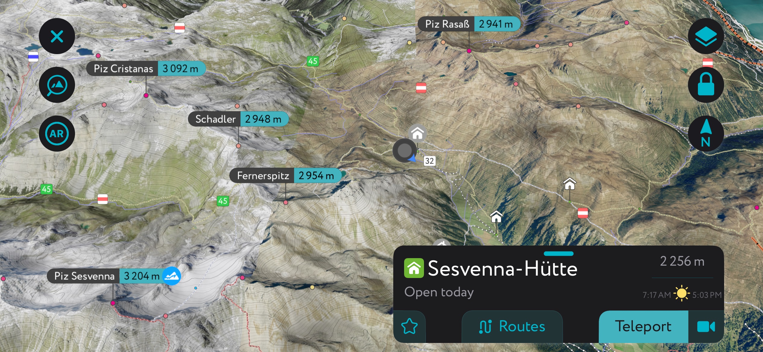
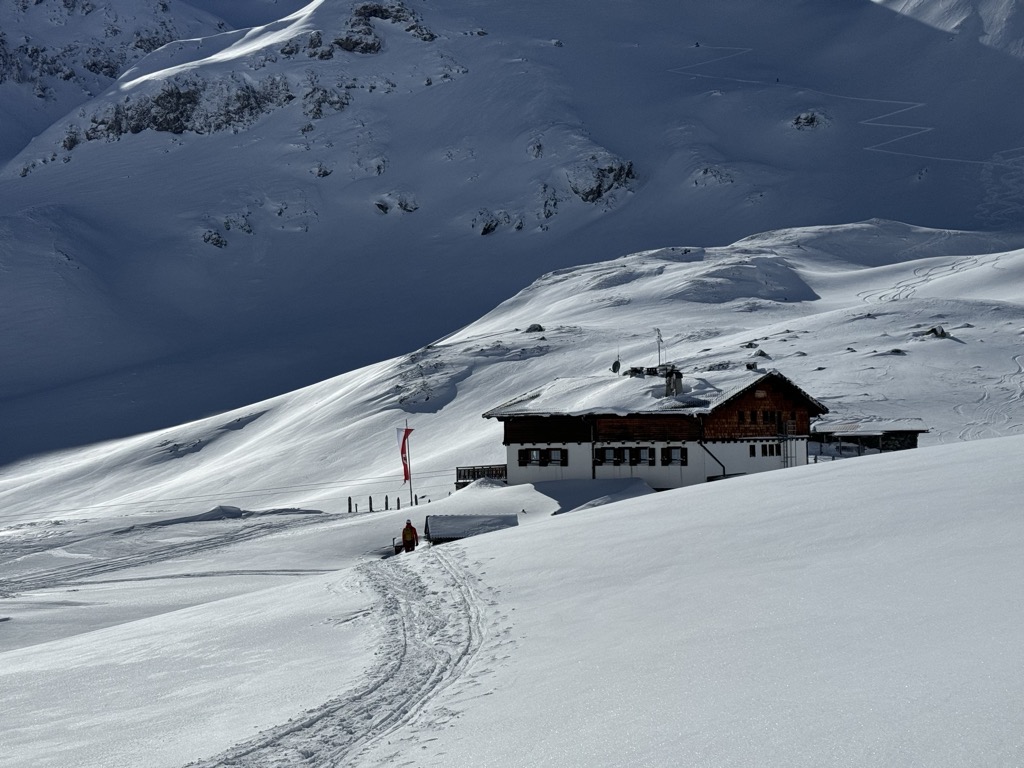
The Sesvenna Hütte is a legendary mountain refuge located at the foot Piz Sesvenna on the side, just northeast of the main peak. The hut sits in a valley at about 2,200 m (7,218 ft) and is open during summer and winter. It’s the perfect starting point for missions up to Piz Sesvenna and Schadler (two of the range’s finest peaks).
Nevertheless, this is Italy we’re talking about, so the food is bound to be even better. The hut offers its own homemade “Sesvenna” sausages, the perfect delicious fuel for your tours.
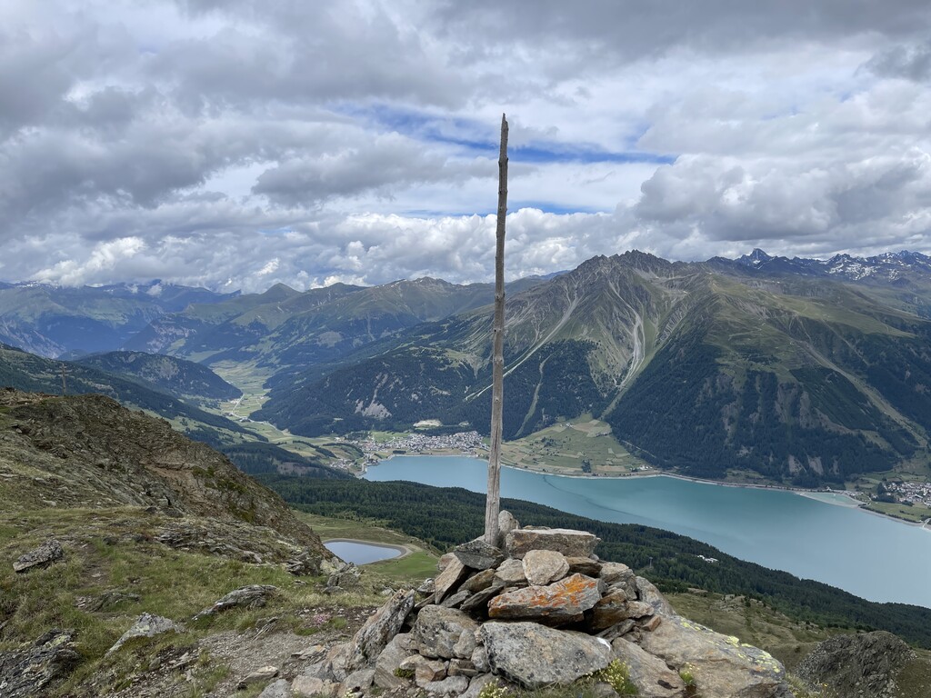
Perched on the Swiss-Italian border, Piz Sesvenna (3,204 m / 10,511 ft) is the Sesvenna Alps' highest mountain and namesake. With an isolation of 21.5 km (13.4 mi), Piz Sesvenna affords incredible panoramas of the surrounding ranges with the likes of Wildspitze (3,767 m / 12,362 ft) and Ortler (3,905 m / 12,812 ft) visible.
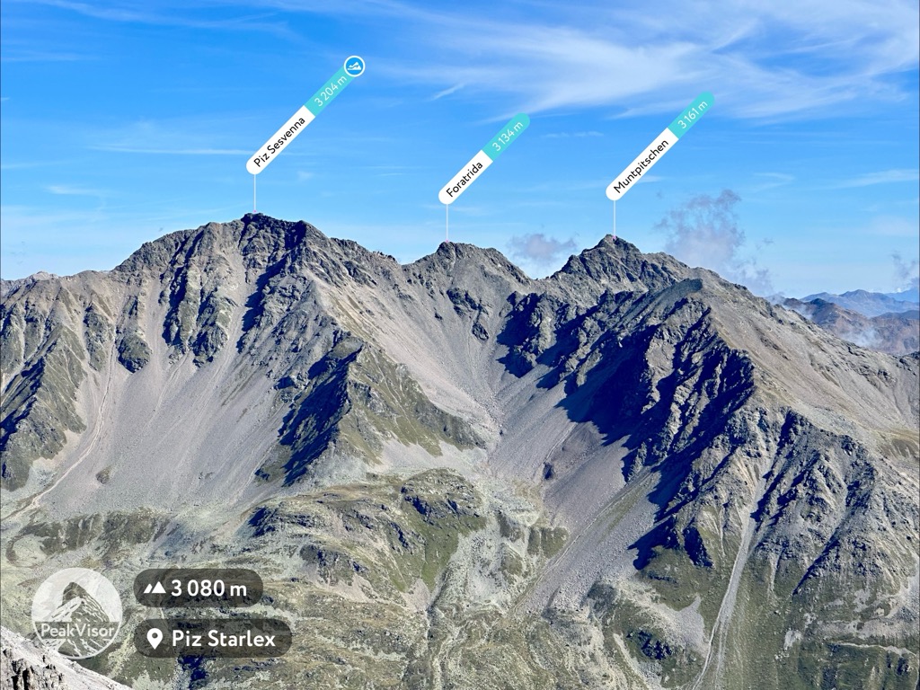
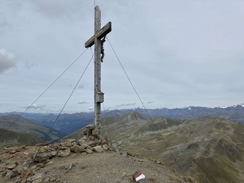
Piz Sesvenna is popular for hiking. The normal route for hikers leads along the mountain's eastern ridge from the saddle Foratrida's saddle. A large cross sits atop Piz Sesvenna's summit.
You can pick up this trail from the upper end of Schlinig. The hike is moderately strenuous and rated PD- on the Swiss Alpine Club (SAC) Mountaineering Scale. This out-and-back trail is approximately 21 km (13 mi) in length.
Piz Lat (2,808 m / 9,212 ft), also called Piz Lad, isn't among the highest mountains in the Sesvenna Aps, but its geographical position makes it a must for many hikers.
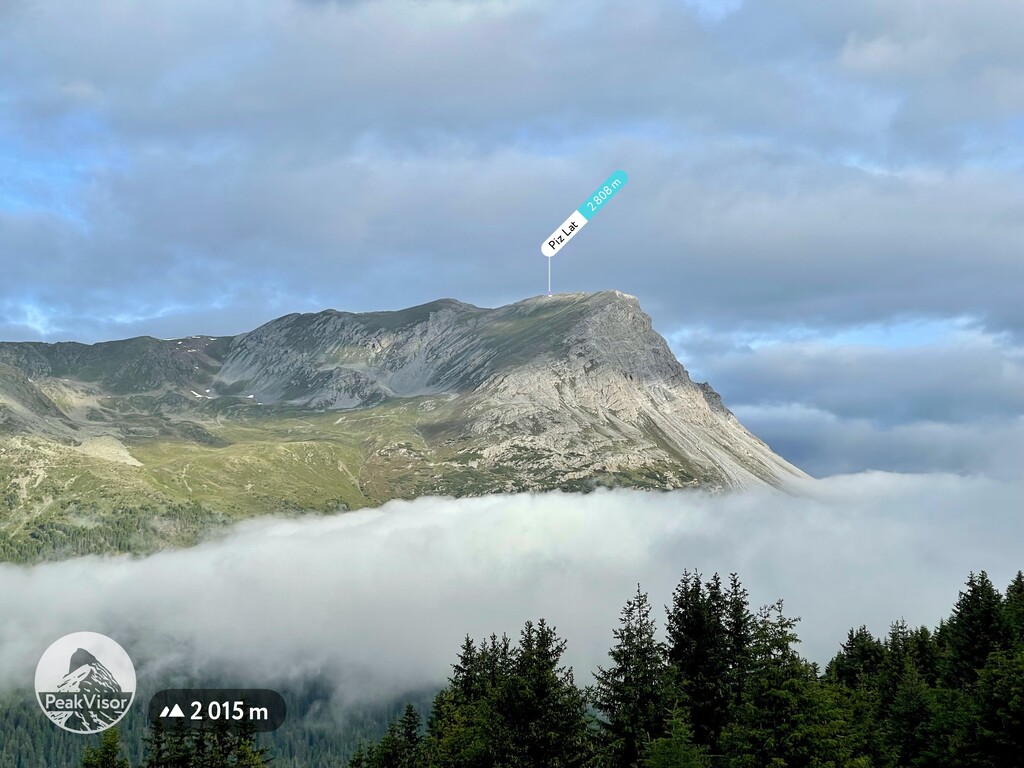
Piz Lat's summit is approximately 1 km (0.6 mi) south of the Dreilaendereck tri-border point between Italy, Switzerland, and Austria. It also overlooks the southwest shoreline of the serene Reschensee and is near the Rojen (Roia) ski resort.
The trail to Piz Lat's summit starts from the car park at Rescher Alm (2,009 m / 6,594 ft) in the Rojental, southeast of the mountain. This route follows the marked trails No. 4 and No. 5 to the summit. This out-and-back trail is approximately 14.5 km (9 mi) in length.
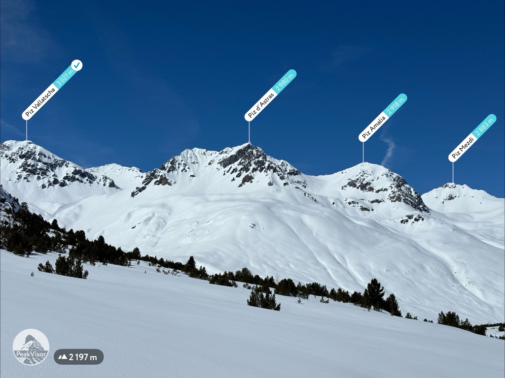
Piz Rasaß (3,152 m / 9,649 ft), sometimes called Rasaß Spitze, is part of the Seeboden Group on the eastern edge of the Sesvenna Alps.
It's the highest summit in the sub-group and offers a breathtaking view of the Ortler Alps, with Königsspitze (Gran Zebrù) (3,851 m / 12,635 ft) and Ortler visible. The Sesvenna Group and Piz Madlein Group are also visible to the south and west, respectively.
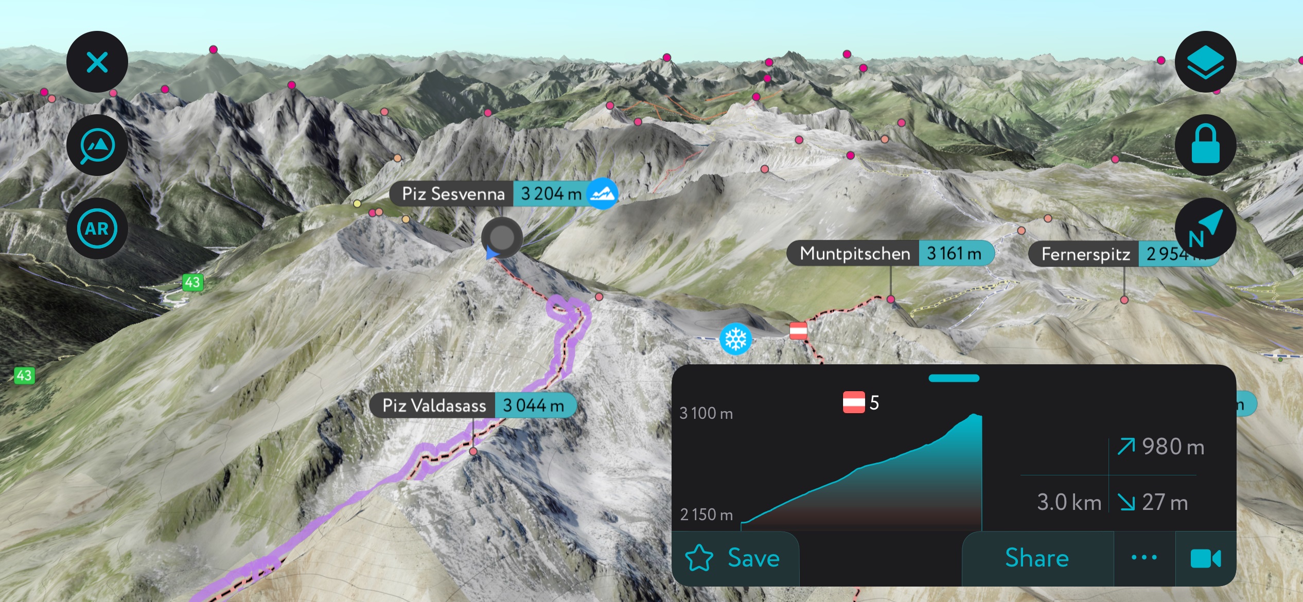
The most popular route up Piz Rasaß is from Schlinig to the mountain's west. The trail is well-signposted and leads to the Sesvenna-Hütte (Rifugio Sesvenna) (2,256 m / 7,401 ft) and towards the Schlinigpass (Passo di Slinga) (2,309 m / 7,575 ft). You'll also pass the picturesque Murmentensee (2,420 m / 7,939 ft). This out-and-back trail is approximately 17.5 km (10.8 mi) in length.
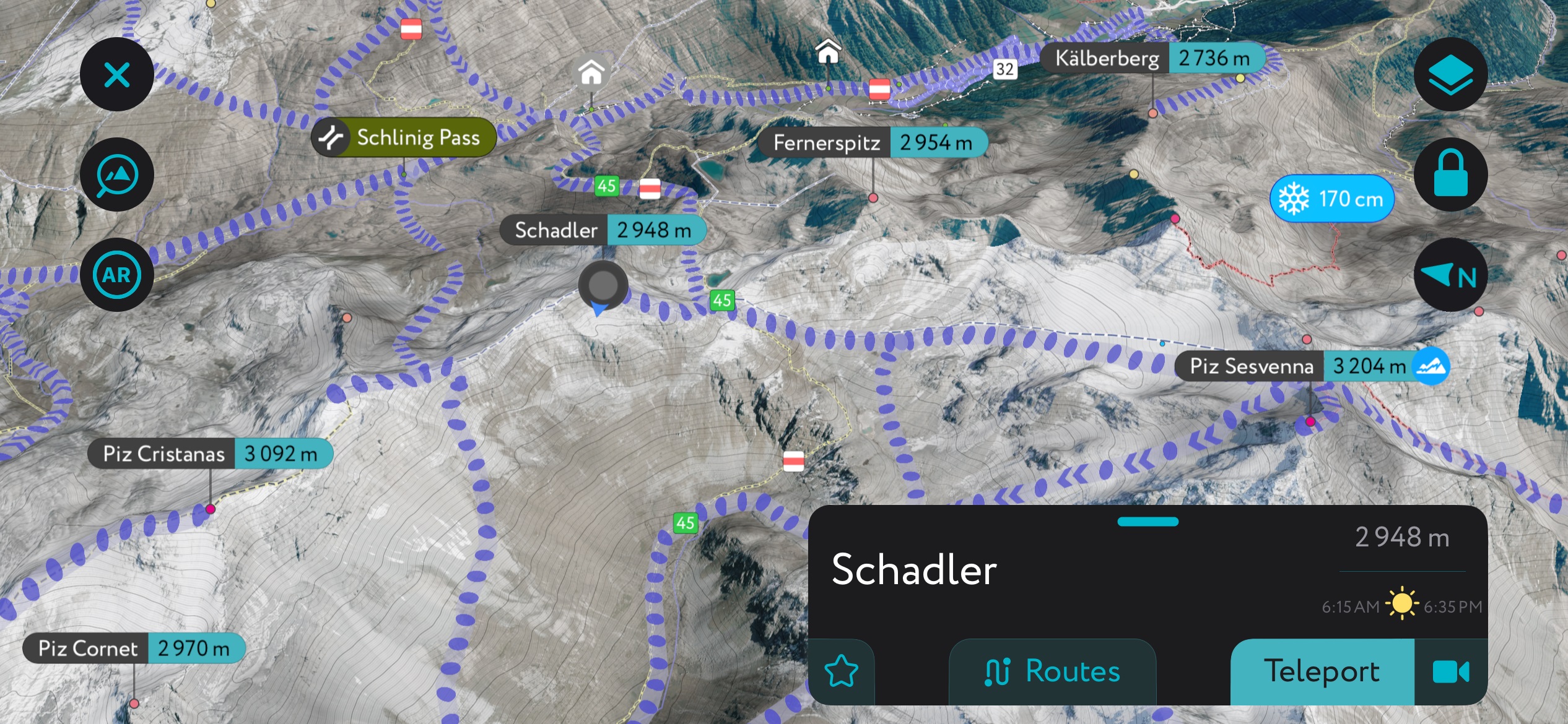
Schadler (2,948 m / 9,672 ft) is a relatively unassuming summit in the Sesvenna Range. It is opposite Piz Sesvenna and just above the Fuorcla Sesvenna (2,824 m / 9,265 ft). The Fuorcla Sesvenna saddle separates the Schlinig and Sesvenna valleys, making it popular with hikers and skiers.
When hiking up Schadler, you can also summit two relatively easy 3,000ers: Piz Rims (3,066 m / 10,059 ft) and Piz Cristanas (3,092 m / 10,144 ft). You can pick up this trail from the car park in S-charl village before following the signposts for Alp Sesvenna.
Highlights from this route include views of the Sesvennasee (Lago Sesvenna) (2,636 m / 8,648 ft), the Vadret da Sesvenna glacier, and Piz Sesvenna from atop Schadler. This looped trail is approximately 17.5 km (10.8 mi) in length.
Seebodenspitz (Cima Pian del Lago) (2,860 m / 9,383 ft) is the Seeboden Group's namesake summit on the Sesvenna Alps' eastern edge. It affords excellent views of the Haidersee (Lago della Muta) (1,449 m / 4,757 ft) and the upper upper Vinschgau valley.
Seebodenspitz is a popular summit, as you don't need to begin your ascent from the valley floor. Instead, you can pick up this trail from Haideralm (Malga San Valentino) (2,150 m / 7,057 ft), which you can reach by cable car from St. Valentin. This trail is approximately 6.8 km in length.
Zehner (Croda Rossa di Sesto) (2,965 m / 9,728 ft), Elferspitze (Cima Undici) (2,926 m/ 9,600 ft), and Zwölferkopf (Cimi Dodici) (2,783 m / 9,130 ft) are popular due to their accessibility and the views they offer of the Vinschgau Valley and Sesvenna Alps' largest lake, Reschensee (Lago di Resia) (1,498 m / 4,914 ft).
You can start your ascent of these tri-peaks by riding the cable from the Schöneben Valley Station. The trail leads to Zehner before following the No. 9b trail to Elferspitze.
It's also possible to skip Elferspitze and go straight to Zwölfer by following the No. 10 trail and then the No. 8 and 8b trails. Stop at the Schöneben Hütte Bergrestaurant for refreshments before catching a cable car and returning to your starting point. This out-and-back trail is approximately 9 km (5.6 mi).
Check out the Via Alpina Red Trail if you're searching for a long-distance hike that snakes through the Sesvenna Alps. The Via Alpina is a network of five hiking trails that traverse the Alps, with over 5,000 km (3,106 mi) of trails to explore.
Two legs of the Via Alpina Red Trail cross the Sesvenna Alps. R67 enters the Sesvenna Alps at Scuol on the range's northwestern boundary, heading south across the Inn River. Then, it passes over the Clemgia Gorge and across the Plan da Funtanas to S-charl at the heart of the range. The Via Alpina R67 is approximately 12.7 km (7.9 mi) long.
The second leg, R68, runs from S-charl to Taufers (Tubre) on the Sesvenna Range’s southeastern edge. The trail leads through the Plan d'Immez, which provides stunning views of surrounding mountains like Piz Madlain and Piz Cristanas.
Then, you'll pass over the Scharljoch (Passo della Cruschetta) (2,296 m / 7,533 ft) and into the Avignatal Valley, which provides extensive views of the Ortler Alps. The Via Alpina R68 is approximately 15 km (9.3 mi) long.
The Sesvenna Alps are home to several ski areas, including some of the finest ski resorts on the Swiss-Italian border.
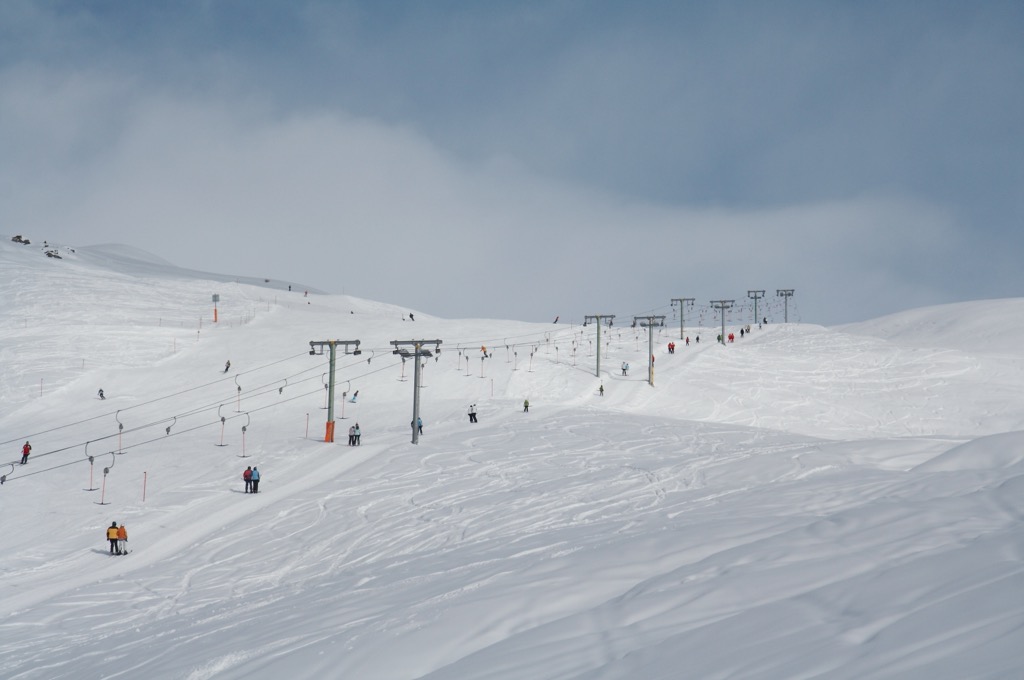
Popular ski resorts in the Sesvenna Alps include:
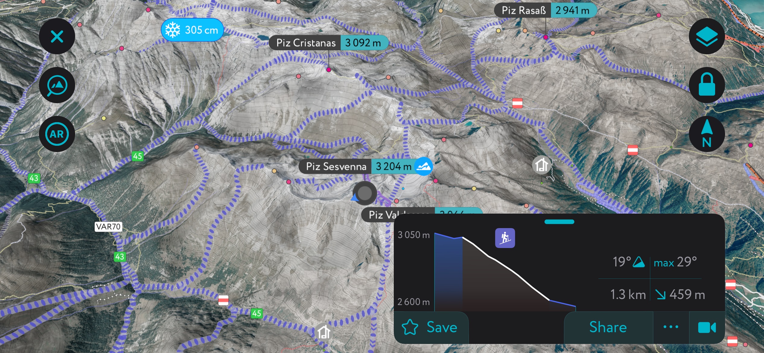
There are two normal ski tour routes to Piz Sesvenna's summit: from Schlinig (Slingia) on the Italian side and from S-charl on the Swiss side. You can see these approaches on the south and north sides, respectively. The Swiss approach, being north-facing and over 3,000 meters, involves a glacier crossing of the Vadret da Sesvenna. I highlighted one of the north-facing descent options from the summit to the skiers’ left of the Vadret.
Ski tours of Schadler are often a more accessible alternative to Piz Sesvenna. One of Schadler's most popular routes is from Schlinig via the Sesvennascharte on Fuorcla Sesvenna, which is about 16 km (10 mi) long. There are no glaciers, and Schadler is about 800 m (2,650 ft) of climbing from the Sesvennahütte; the approach is much more palatable than trekking out to Piz Sesvenna, which is well over 1,000 m of climbing.
You’re not committed to just the Piz Sesvenna zone, either. The entire Sesvenna range is peppered with ski tours; there are numerous options in every valley. Check out the mobile app for more ideas and inspiration!
With Romansh culture, premier ski areas, and exquisite surroundings, the towns and villages of the Sesvenna Alps are perfect for year-round getaways.
The Sesvenna Alps' nearest major international airports are Zurich Airport and Milan Bergamo Airport, which are both just over 200 km (124 mi) away.
The nearest regional airport to the Sesvenna Alps is Bolzano Airport, 135 km (89 mi) to the southeast. Samedan Airport near St. Moritz is a private airport for chartered flights, 54 km (33.5 mi) to the southwest.
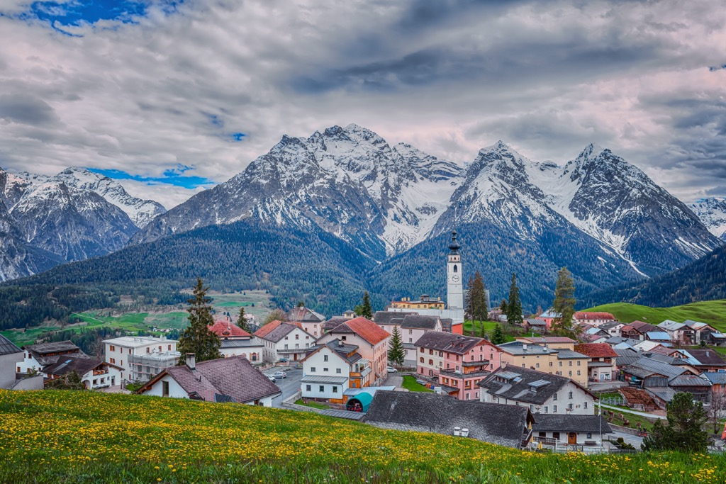
Scuol is the largest and principal town of the Sesvenna Alps. Scuol is a part of the Swiss Grisons canton located on the range's northwestern boundary. It has a population of over 4,500 people. Over 49% of Scuol's population speaks Romansh, making it the predominant language.
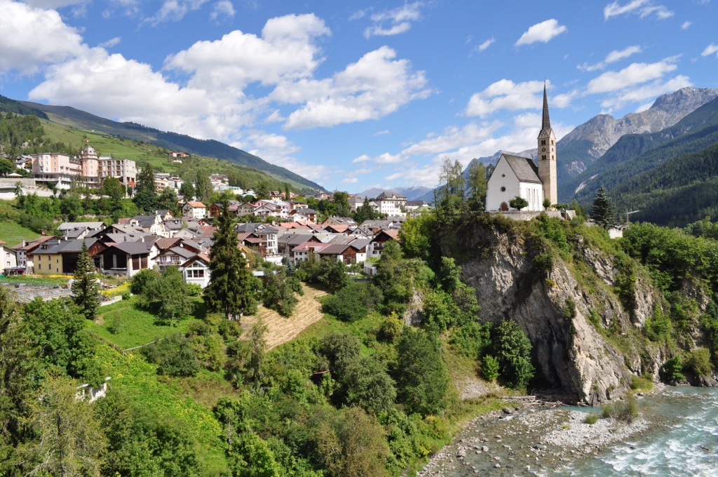
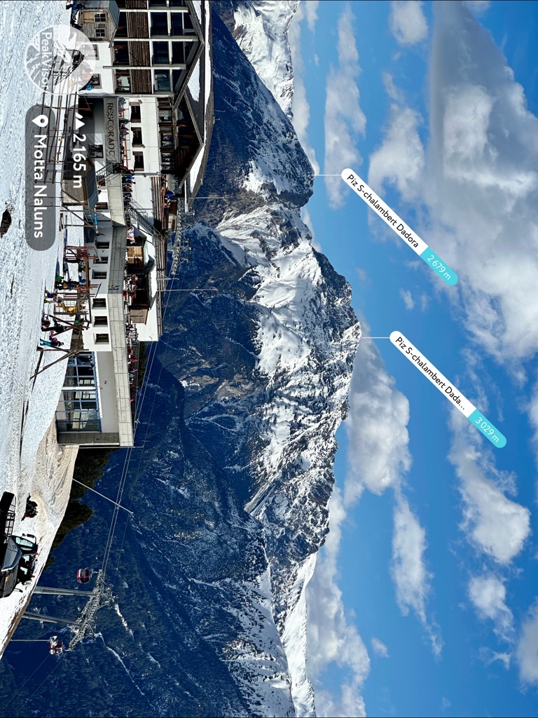
Scuol attracts visitors year-round because it's near popular mountains for hiking and skiing. Piz Champatsch's (2,920 m / 9,580 ft) southern face, which is adjacent to Scuol, is the location of the Motta Naluns ski area. Popular mountains like Piz Lad, Piz Sesvenna, and Piz Pisoc are within 15 km (9.3 mi) of Scuol.
Zernez is considered the gateway to the Swiss National Park and is among the most popular places for park visitors to stay. It's located on the western edge of the Sesvenna Alps within the Lower Engadine Valley near Ofenpass. Over 60% of Zernez's population speaks Romansh.
Zernez offers activities for outdoor adventurers, whether it’s winter or summer. Munt Baselgia (2,682 m / 8,799 ft) to the northeast features a toboggan run, and there's a 15 km (9.3 mi) wild cross-country ski track that runs through forests from S-chanf (yes, it’s a different municipality than S-Charl) to Zernez.
In the summer, you can scale the likes of Piz Nair, Piz Tavrü, and Piz Qattervals (3,165 m / 10,383 ft), all within 15 km (9.3 mi) of Zernez.
Graun im Vinschgau (Curon Venosta) is a village nestled along the eastern shores of the Rescehnsee, the Sesvenna Alps' largest lake. It's the largest of three lakeside villages in the vicinity, with a population of over 2,400 people.
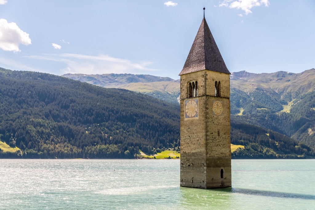
In 1950, the original Graun village was submerged by the expansion of the Reschensee when the valley was dammed to produce hydroelectricity. Graun was subsequently rebuilt on the shoreline. The old town's 14th-century bell tower rises from the Reschensee and is visible from Graun.
Schöneben ski area is located just across the Reschensee from Graun in Rojen (Roia). Popular mountains like Piz Lad, Seebodenspitz, Endkopf (Cima Termine) (2,649 m / 8,694 ft), and Klopaierspitze (2,922 m / 9,587 ft) are within 10 km (6.1 mi) of Graun.
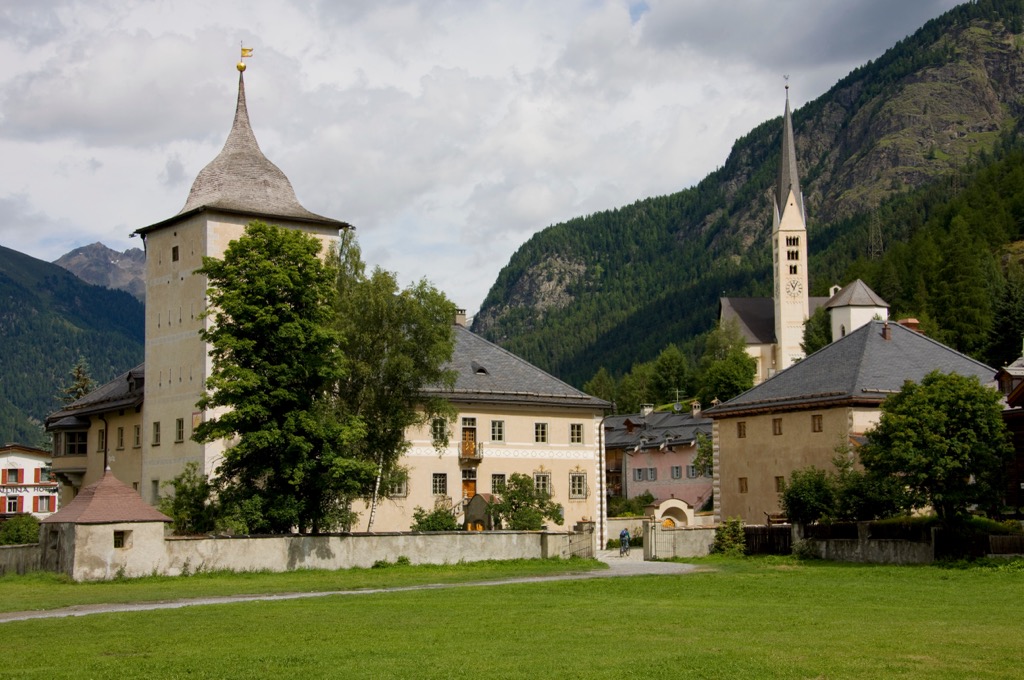
S-charl is a tiny village tucked away in the Val S-charl at the heart of the Sesvenna Alps. It's a picturesque, peaceful village — S-charl is traffic-free, with narrow winding streets to explore.
S-charl's position on the edge of Clemgia Gorge makes it the perfect base for exploring the Sesvenna Alps. Several famous mountains surround S-charl, including Piz Sesvenna, Piz Pisoc, and Piz Madlain.


The highest peak in the Sesvenna Range is Piz Sesvenna, at 3,204 m.
The Sesvenna Range have 175 named peaks.


