Get PeakVisor App
Sign In
Search by GPS coordinates
- Latitude
- ° ' ''
- Longitude
- ° ' ''
- Units of Length

Yes
Cancel
❤ Wishlist ×
Choose
Delete
The Ötztal Alps (German: Ötztaler Alpen, Italian: Alpi Venoste) are among the largest groups in the Eastern Alps, split between the Austrian state of Tyrol and the Italian province of South Tyrol. One of the most heavily glaciated areas of the Eastern Alps, with over 300 summits exceeding 3,000 m (9,842 ft) in elevation, the Ötztal Alps provide seemingly endless hiking and skiing opportunities. There are 969 named mountains in the Ötztal Alps. The highest and the most prominent mountain is Wildspitze (3,768 m / 12,362 ft).
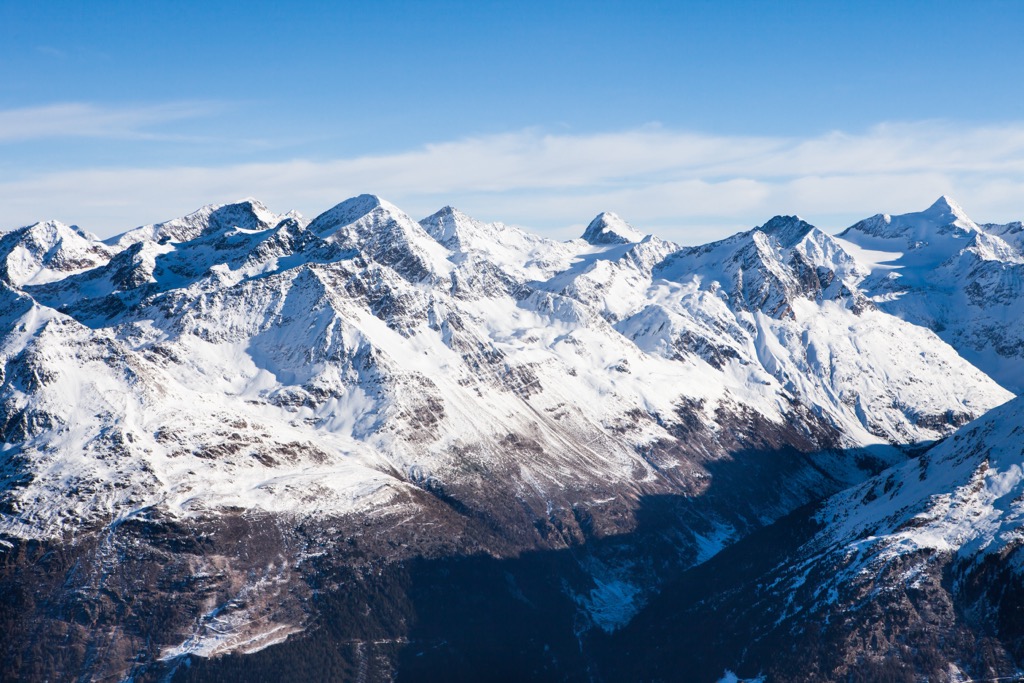
The Ötztal Alps span over 65 km (40 mi) from north to south, from the Upper Inntal Valley to the Upper Etsch Valley (Vinschgau). The Ötztaler Ache River bounds them to the east and the Reschenpass (Passo Resia) (1,507 m / 4,944 ft) to the west. Ötz, a village of the Ötztal Alps' northeastern boundary, is the range's namesake.
Seven other mountain ranges border the Ötztal Alps:
Of these groups, only the Ortler Alps are higher than the Ötztal Alps.
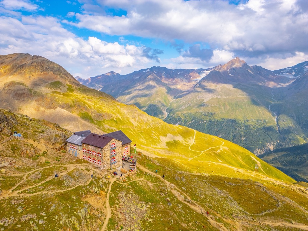
One of the Ötztal Alps' defining features is the Main Alpine Ridge (Alpenhauptkamm), which runs through the middle of the range from east to west, forming a natural border between Austria and Italy. It includes several significant ridges, including the Gurgler Kamm and the Schnalskamm.
At the heart of this section of the Main Alpine Ridge is Weißkugel (Palla Bianca) (3,738 m / 12,264 ft), the second-highest mountain in the Ötztal Alps. Its central location and elevation afford some of the finest views of the Alps, stretching from the Bernese Alps in the west to the Schober Group in the east.
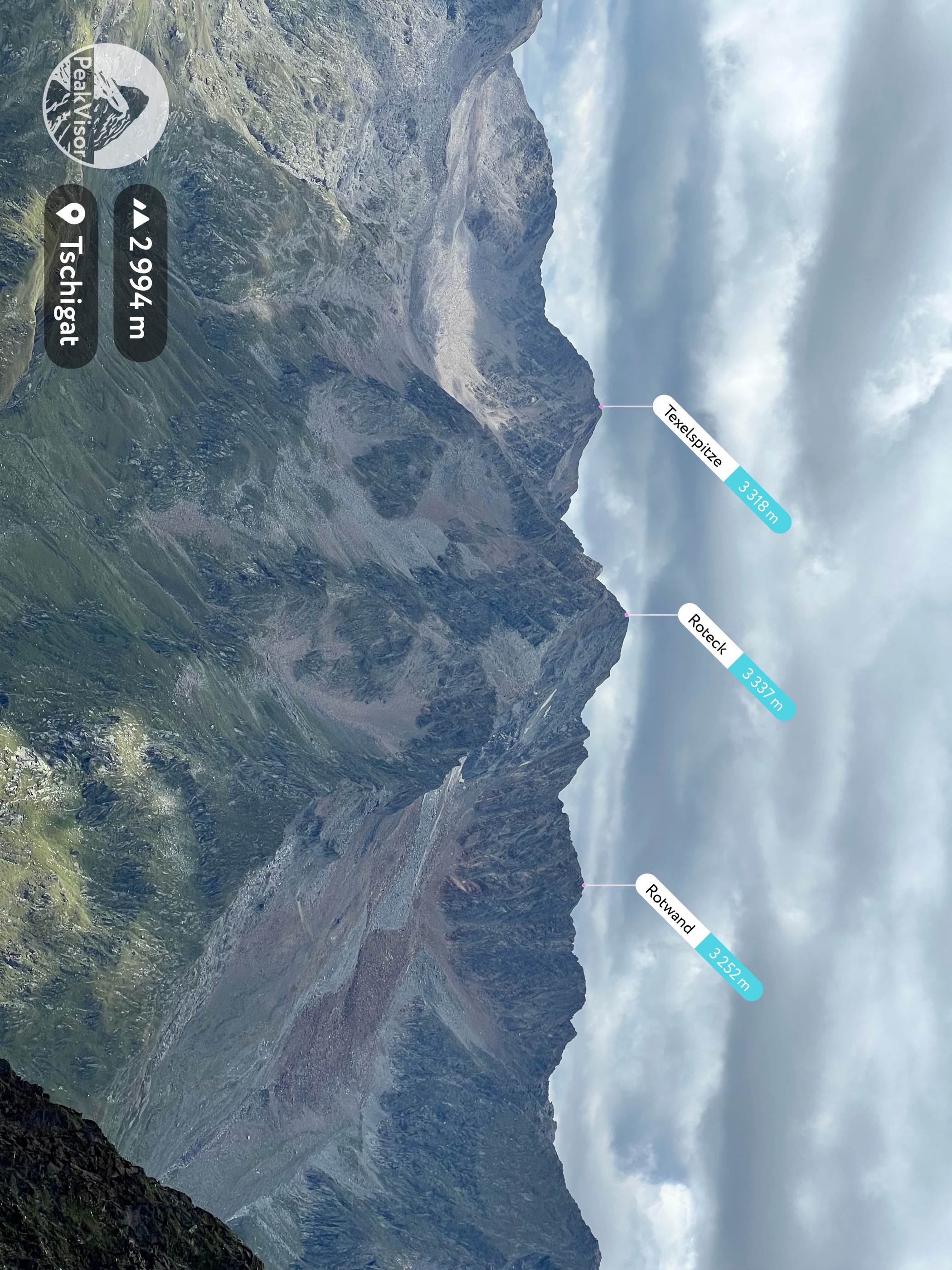
Several significant subgroups branch off from the Main Alpine Ridge. To the southeast is the Texel Group (Texelgruppe), which forms part of the Texelgruppe Nature Park (Naturpark Texelgruppe - Parco naturale Gruppo di Tessa), the largest regional park in South Tyrol.
To the northeast is the Weißkamm, home to Wildspitze, the highest mountain in South Tyrol and Tyrol and the second-highest mountain in Austria after Großglockner (3,798 m / 12,461 ft). From Weißkamm, two sub-groups diverge to the north: the Geigenkamm and the Kaunergrat.
The other sub-groups of the Ötztal Alps are the Nauderer Berge, the Saldurkamm (Monti di Saldura), the Planeiler Berge (Montagna di Planol), and Glockturmkamm.
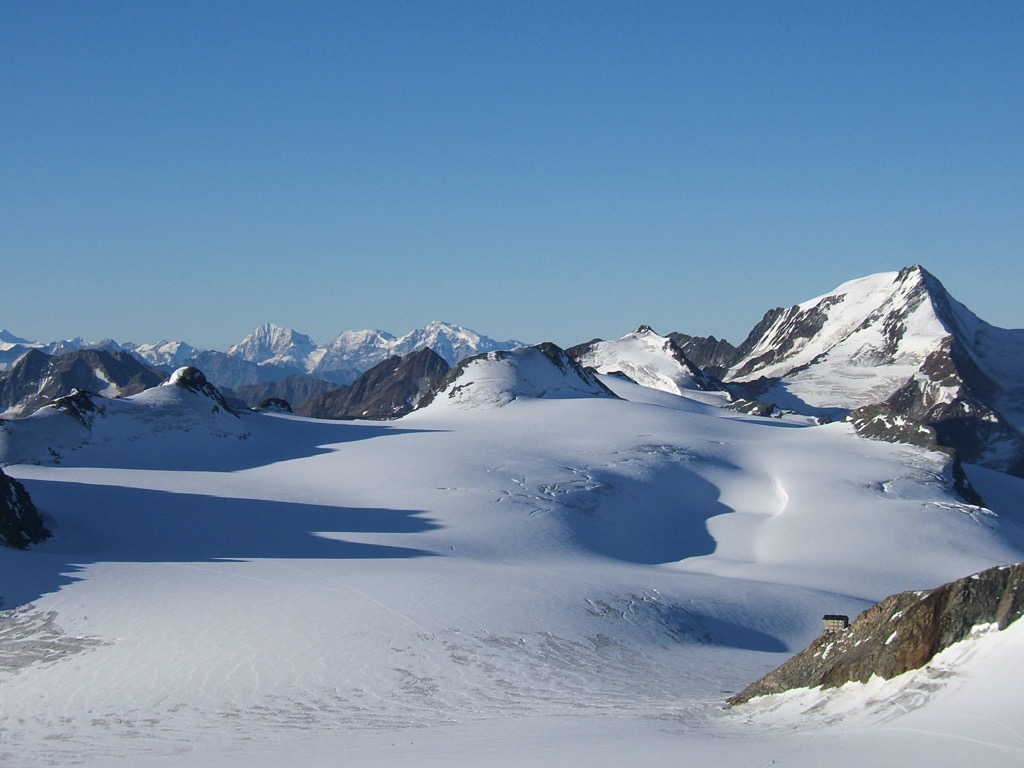
Over 200 glaciers blanket the Ötztal Alps, with the heaviest glaciation within its north-facing valleys. The most famous glacier in the Ötztal Alps is Gepatschferner (3,026 m / 9,928 ft), the second-largest glacier in Austria after the Pasterze (2,218 m / 7,277 ft), with an area of roughly 17 sq km (6.5 sq mi).
The Ötztal Alps' have a well-developed infrastructure for hikers and skiers with many famous ski and spa resorts, most notably Sölden, Maren, Obergurgl, Serfaus, and Ötz. In contrast, the northern side ridges and southwestern mountains are isolated and rarely visited.
The Ötztal Alps formed approximately 66 million years ago during the Alpine Orogeny. This mountain-building event occurred when the African, Arabian, and Indian tectonic plates collided with the Eurasian Plate.
Convergent movement between these plates helped create the Alps and many other mountain ranges worldwide, including the Himalayas, the Atlas Mountains, and the Pyrenees.
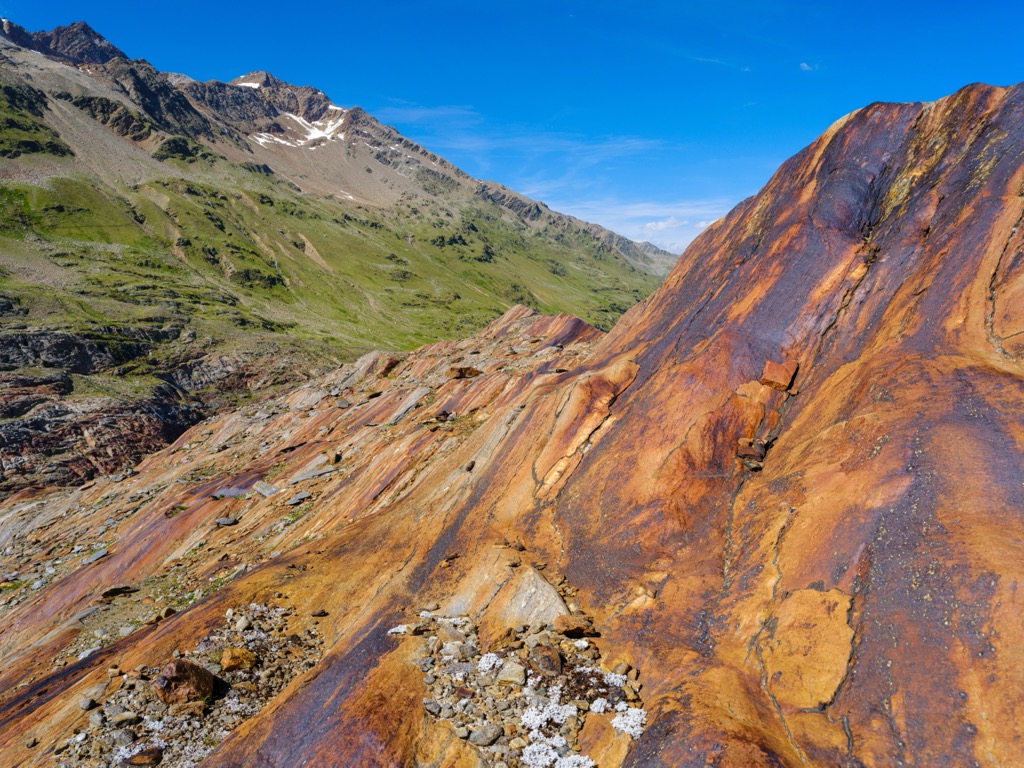
Most of the Ötztal Alps are part of the Ötz Valley-Stubai Complex geological system, composed mainly of gneiss with orthogneiss and amphibolite intrusions. Along with the rest of the Central Eastern Alps, the Ötztal Alps contain few crystalline rocks, which are confined to the Western Alps.
The Ötztal Alps' southern areas, especially around the Gaisbergtal and Rotmoostal valleys, are unique as they consist of limestone, marble, mica schist, and amphibolite. The mica here is mineral-rich, containing large hornblende crystals and garnets.
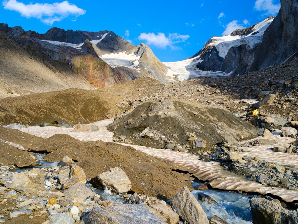
One of the most famous locations for finding garnets is Granatenkogel (Monte dei Granati) (3,318 m / 10,886 ft), within the Gurgler Kamm.
Granatenkogel (literally meaning "garnet mountain") is prone to rockslides due to its position at the end of the Gaisbergferner (3,172 m / 10,407 ft), revealing dazzling garnets up to a few centimeters long embedded in rock.
Nature watching is mandatory in the Ötztal Alps, with a wide variety of mammals, birds, and flowering plants on display throughout the range.
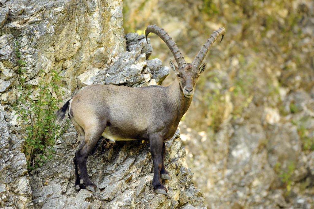
One of the famous residents of the Ötztal Alps are marmots, the heaviest members of the squirrel family known for their high-pitched whistling. Other notable mammals within the Ötztal Alps include red deer, roe deer, red foxes, chamois, Alpine ibex, and Alpine long-eared bats.
Golden eagles and bearded vultures are among the largest birds of prey to inhabit the Ötztal Alps. Bearded vultures rarely visit but are an impressive sight — their wingspans can exceed 2.8 m (9 ft) in diameter.
Northern nutcrackers can be found at and above the tree line, where they hide as many as 100,000 stone pine nuts during autumn. Another standout species is the Alpine chough, which can nest at up to 6,500 m (21,300 ft) in elevation — higher than any other bird species.
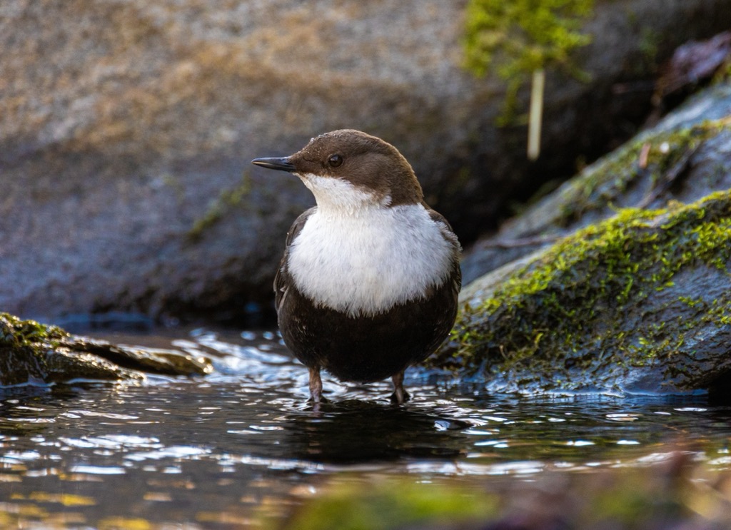
Other notable bird species include rock ptarmigans, white-throated dippers, snow finches, and capercaillies.
Common European adders are the only venomous snake species visitors are likely to encounter in the Ötztal Alps. Common European adders can live at elevations up to 3,000 m (9,842 ft). Aspic vipers are also present in Italy but are rare at high altitudes.
Austria is one of Europe's most heavily forested countries, with trees covering over 47% of the country. The Ötztal Alps' forests are extensive, reaching from the deep valley floors to nearly 2,000 m (6,561 ft) in elevation.
Coniferous trees, mainly larches, Swiss stone pines, and Scots pines, carpet the valley floors. At low elevations on mountain slopes, the Ötztal Alps' forests comprise primarily common spruces interspersed with firs and beeches.

Hardy Swiss stone pines dominate the forests at higher elevations between 1,700 m (5,577 ft) and 1,900 m (6,233 ft). In the undergrowth, frost-resistant shrubs thrive, including bilberries, wild blueberries, Alpine clematis, and snow roses.
Above the treeline, the forests give way to heathlands and alpine meadows. Dwarf willows, the smallest tree globally, are among the dwarf shrubs at this elevation. At their loftiest, dwarf willows are tiny — they grow to a maximum of 6 cm (2.3 in) tall.
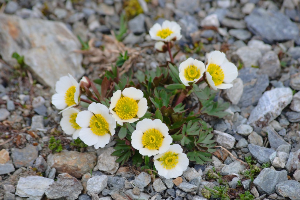
Other shrubs flowering plants found above the Ötztal Alps' treeline include Siberian junipers, sedges, edelweiss, glacier crowfoot, black vanilla orchids, globe orchids, and purple gentians.
As the home of Ötzi the Iceman, the Ötztal Alps have a prominent human history.
Archeologists have evidence humans have lived in the Ötztal Alps since the end of the last glacial period, approximately 11,700 years ago. Archeologists found the remnants of summer hunting camps around Obergurgl and Vent, dating back to 7,500 BCE.
The Ötztal Alps is the location of one of the most important archeological and anthropological discoveries in the Alps. In September 1991, hikers discovered a natural mummy, nicknamed Ötzi, on the eastern ridge of Fineilspitze (Punta di Finale) (3,514 m / 11,529 ft) near Similaun (3,606 m / 11,831 ft).

Archeologists believe Ötzi lived between 3,350 and 3,105 BCE and is Europe's oldest natural mummy. His discovery provided archeologists with rare insights into the life of Copper Age Europeans, including their diets, clothing, and tools.
Ötzi's body was so well-preserved that archeologists could identify he had at least 61 tattoos. To date, Ötzi is the oldest existing direct evidence of the practice of tattooing. However, archeologists have found tools and ancient art suggesting that the practice of tattooing dates to the Upper Paleolithic period (50,000 - 12,000 years ago) in Europe.
Local mountaineers and guides made the first ascents of the Ötztal Alps' highest summits between 1840 and 1850.
Leander Klotz from Rofen is credited with the first ascents of the three highest mountains in the Ötztal Alps. Klotz is a relatively unknown figure despite his mountaineering exploits. His ancestors still live within the Ötztal Alps, operating the Rofenhöfen farms, some of Austria's highest permanently inhabited farms.
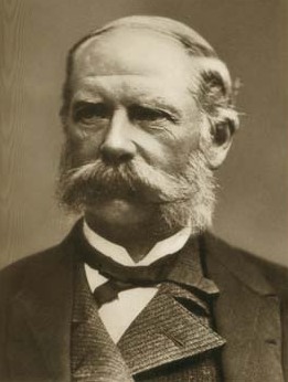
In 1848, Klotz and an unknown farmer became the first people to reach Wildspitze's south summit successfully.
In 1858, Klotz and tourist Albert Wachtler became the first to ascend Hinterer Brochkogel (3,635 m / 11,926 ft), the Ötztal Alps' third-highest mountain. Wachtler later became chairman of the Bozen chapter of the German and Austrian Alpine Club (DuÖAV).
In 1861, Leander and Nicodem Klotz guided Joseph Anton Specht from Vienna to the summit of Weißkugel (Palla Bianca), which many believe to be the mountain's first ascent. However, notes from Archduke John of Austria during a visit to Niederjoch (Giogo Basso) (2,993 m / 9,822 ft) imply his guides, Johann Gurschler and Josef Weitthalm, summited Weißkugel in 1846.
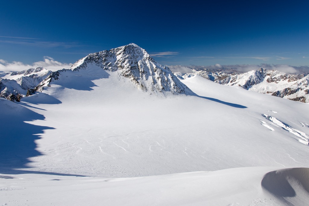
The construction of hiking infrastructure and ski resorts has helped the Ötztal Alps become one of the most popular ranges in the Eastern Alps.
Between 1880 and 1920, the German Alpine Association (DAV) built many mountain huts, such as the Braunschweiger Hütte (2,759 m / 9,052 ft) and the Brandenburger Haus (3,272 m / 10,735 ft), high in the Ötztal Alps. These huts provided refuge for early visitors and made exploration possible for amateur hikers and skiers.
Over 1,600 km (994 mi) of trails and hundreds of 3,000ers await hikers in the Ötztal Alps.
Ensure you bring plenty of provisions and the correct equipment when hiking in the Ötztal Alps. Check local weather forecasts, check local weather forecasts, and map your route carefully.
You can learn more about the hiking and mountaineering scales in this guide.
Wildspitze (3,768 m / 12,362 ft) is Austria's second-highest mountain and the fourth most prominent mountain in the Alps after Mont Blanc (4,810 m / 15,781 ft), Großglockner, and Finsteraarhorn (4,274 m / 14,022 ft).
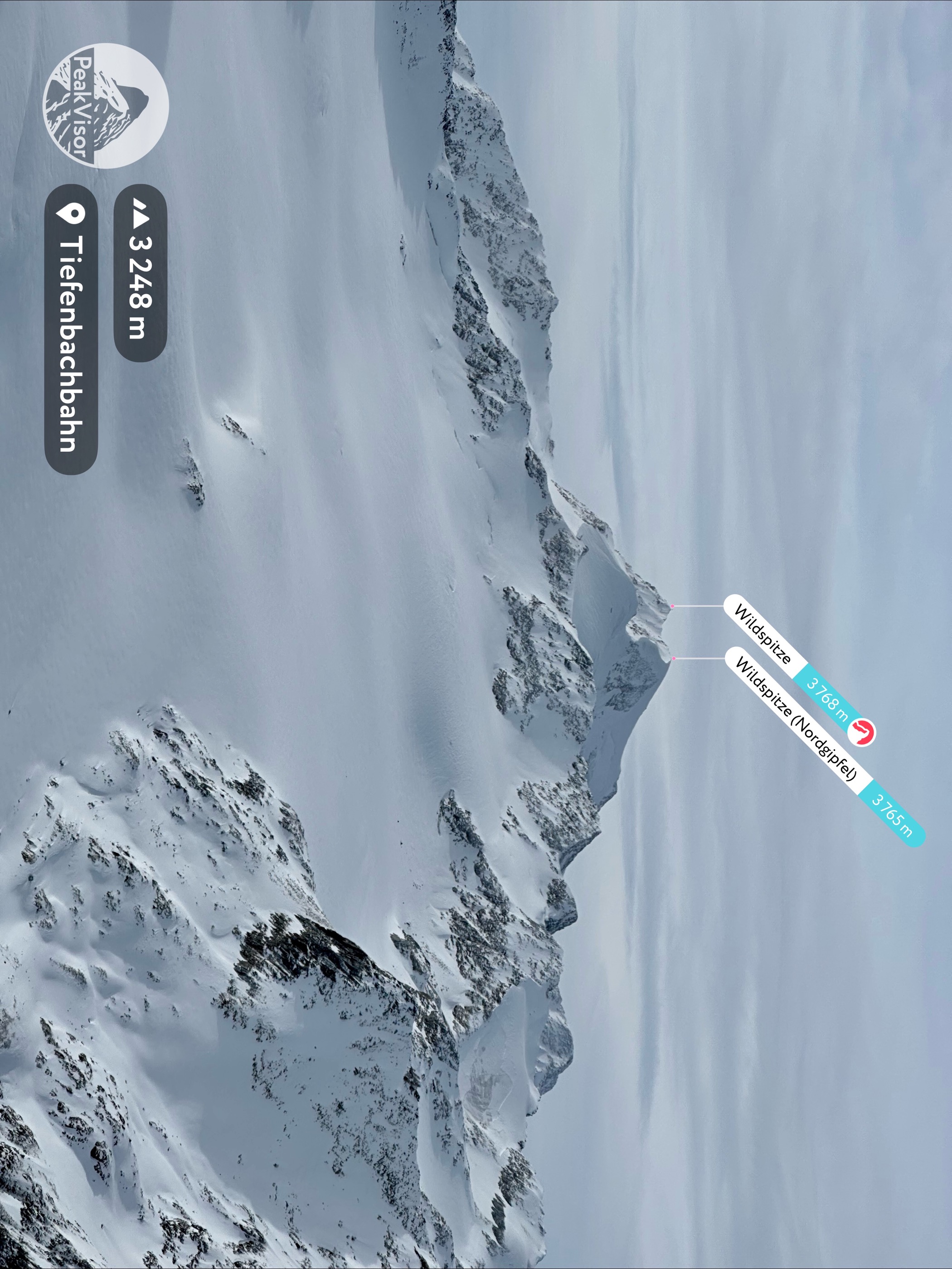
Wildspitze isn't to be underestimated. Its normal route is rated PD- on the Swiss mountaineering scale — crampons, an ice axe, and rope harnesses are essential gear. Inexperienced hikers should consider hiring a guide when climbing Wildspitze.
Despite the difficulties Wildspitze presents, dozens of climbers scale the mountain annually. On a clear day, its summit views are incredible due partly to its isolation — Ortler (3,905 m / 12,812 ft), located 48 km (30 mi) away, is the nearest higher mountain. You can see Großglockner, Finsteraarhorn, and the entire Ötztal Alps from Wildspitze's summit.
The normal route to Wildspitze leads from the Breslauer Hütte (2,844 m / 9,331 ft) over Mitterkarjoch (3,483m / 11,427 ft). Most hikers walk from Vent to the Breslauer Hütte and spend the night at the hut before climbing the mountain.
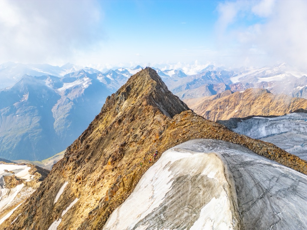
The Wildspitzlift, a two-person chairlift, takes you from Vent to the Panorama Restaurant Stablein atop Stablein (2,346 m / 7,697 ft), considerably shortening your ascent of Wildspitze.
The route is only signposted as far as the Mitterkarferner glacier, so map your route carefully. If conditions are good, hiking Wildspitze is a six or 7-hour round-up.
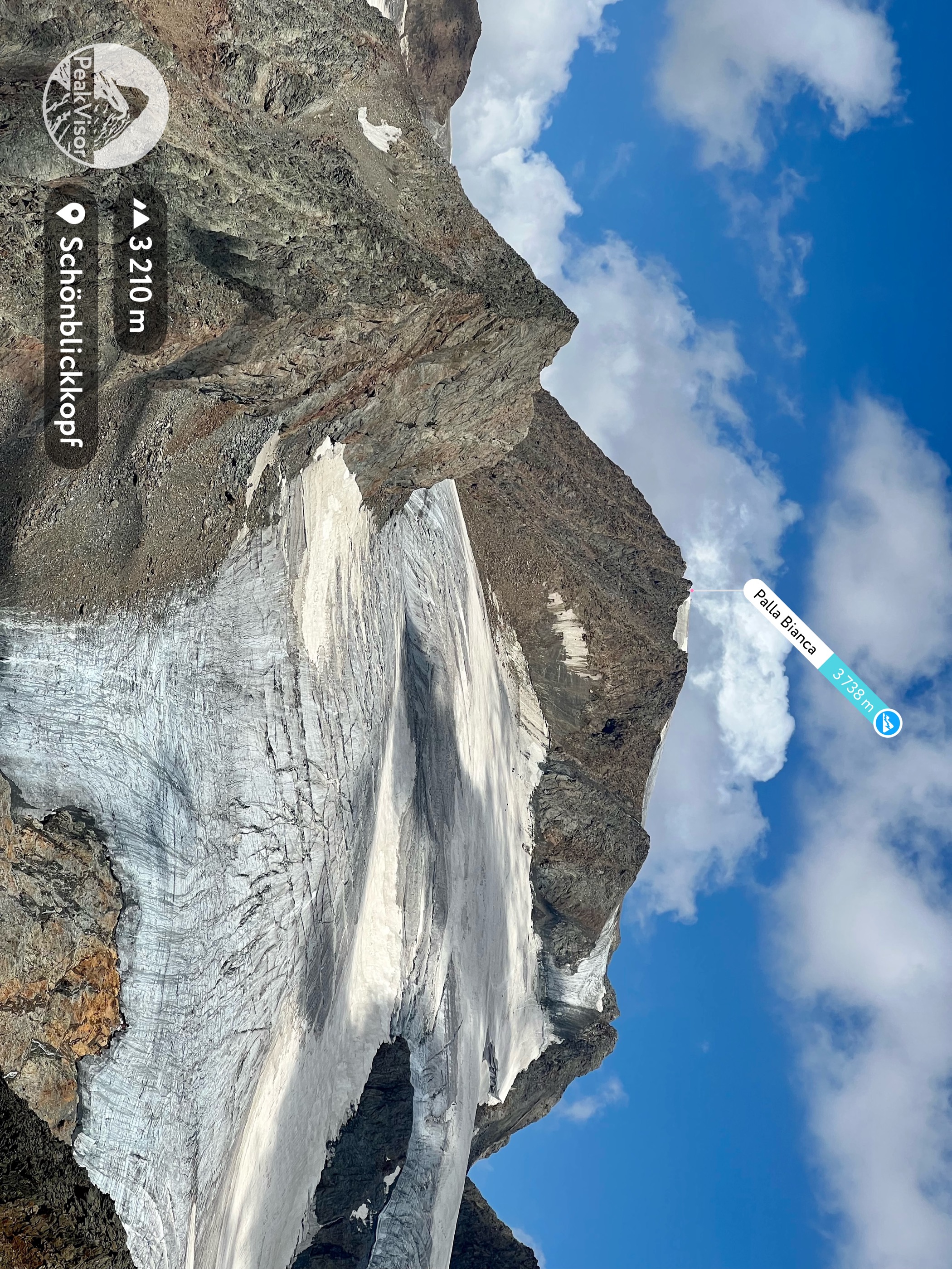
Weißkugel (Palla Bianca) (3,738 m / 12,264 ft) is the second-highest mountain in the Ötztal Alps, located at the heart of the range on the Austrian-Italian border. Views from this centrally located summit reach from the Bernese Alps in the west to the Schober Group in the east.
Flanked by four glaciers with its pyramidal shape, Weißkugel is an impressive mountain. It's most commonly climbed from the north, either from the Weißkugelhütte (Rifugio Pio XI) (2,541 m / 8,337 ft) or the Brandenburger Haus. Either way, Weißkugel is a challenging climb that should only be attempted by experienced mountaineers.
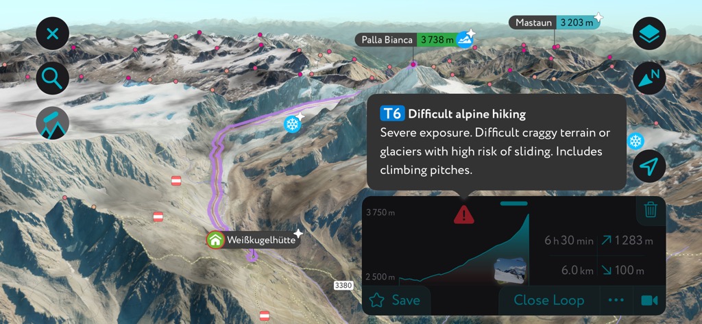
From the Weißkugelhütte, you'll walk across the Langtauferer Ferner (Vedretta di Vallelunga) (3,012 m / 9,882 ft) towards the Langtauferer Joch (Bocchetta di Vallelunga) (3,191 m / 10,469 ft), looping right around Langtauferer Spitze (Punta Vallelunga)(11,575 ft) to Weißkugeljoch (Forcella di Palla Bianca) (3,362 m / 11,030 ft).
The climb up Wildspitze's east flank is especially steep and potentially dangerous due to ice. The hike from Weißkugelhütte to Weißkugel is approximately 6.2 km (3.8 mi) long.
Hohe Mut (2,653 m / 8,704 ft) is a much easier mountain to climb than the likes of Wildspitze and Weißkugel and is perfect if you're searching for a family-friendly mountain hike in the Ötztal Alps.
Part of the Gurgl Ski Resort, Hohe Mut has a well-developed trail system. From its summit, you'll have spectacular views of 21 summits over 3,000 m (9,842 ft), including Granatenkogel (3,304 m/10,840 ft), Hinterer Seelenkogel (3,475 m/11,401 ft), and Schalfkogel (3,536 m/11,604 ft).
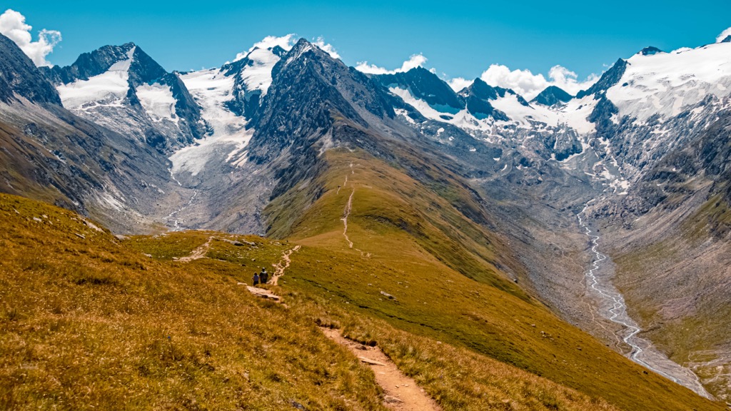
The hike to Hohe Mut starts from Obergurgl to the northeast. Follow the Gaisbergweg trail to Zirben Alm (1,953 m / 6,407 ft). Then, you'll cross the Gurgler Ache River and walk through forests before turning south into the Rotmoostal Valley.
One of the best places to stop for refreshments and a bite to eat is Schönwieshütte after exiting the forests. The walk is approximately 12.4 km (7.7 mi) long.
Wildes Mannle (3,019 m/9,905 ft) is one the most straightforward 3,000ers to scale in the Ötztal Alps. It's a more challenging climb than Hohe Mut and features some light scrambling, but it should be manageable for most hikers.
From Wildes Mannle's summit, you'll have breathtaking views across the Weißkamm, Weißkugel, and Hintere Schwärze (3,628 m / 11,903 ft). You can pick up the trail to Wildes Mannle from the Wildspitzlift.
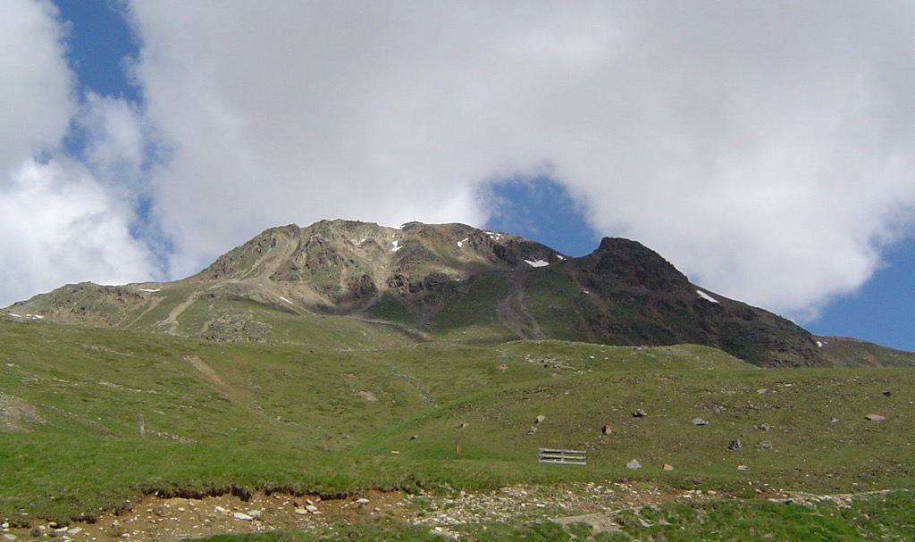
You'll start your hike by riding the Wildspitzlift 469 vertical meters (1,538 ft) to Stablein's summit. Then, you'll follow the 919 trail towards Breslauer Hütte before following signposts for "Breslauer Hütte – Wildes Mannle."
The hike up Wildes Mannle gets more difficult the higher you go — the final section is secured with steel ropes for safety. Descend Wildes Mannle to the north, turning left at signposts for "Rofenkar." You'll soon pass by the Breslauer Hütte and return to the ascent route. The hike up Wildes Mannle is approximately 7.8 km (4.8 mi) long.
The Via Alpina Yellow Trail is part of a network of five long-distance hiking trails spanning the breadth of western and central Europe. It extends 807 km (501 mi) from Muggia in Italy to Liechtenstein.
Nine stages of the Via Alpina Yellow Trail run through the Ötztal Alps and are one of the best ways to explore the range on a multi-day excursion. These nine stages have a total distance of 179.3 km (111.4 mi), with each stage usually taking a day to complete. The Via Alpina Yellow Trail is well-signposted with white-red-white waymarks and yellow metal signs.
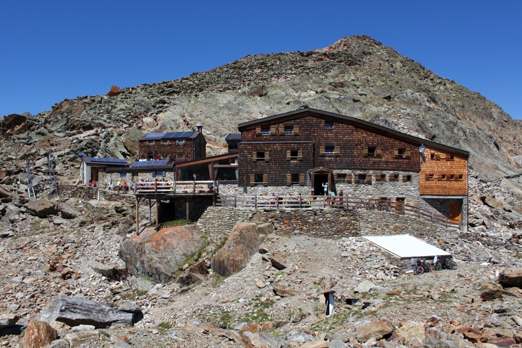
Along the way, you'll have the chance to enjoy many of the best mountain huts the Ötztal Alps have to offer. You'll also pass where Ötzi the Iceman was found on B32. The final stage includes two summit hikes: Glanderspitze (2,512 m / 8,241 ft) and Wannejöchl (2,497 m / 8,192 ft).
The nine stages of the Via Alpina Yellow Trail in the Ötztal Alps are:
The Ötztal Alps are a popular destination for winter sports, with over 300 km (186 mi) of manicured ski slopes for visitors to enjoy.
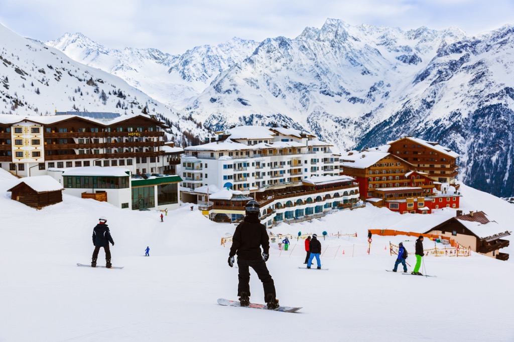
There are four ski resorts in the Ötztal Alps:
The Ötztal Alps are excellent for off-piste skiing, with hundreds of glaciers and sublime mountains to explore. The range is at the heart of one of our most thoroughly mapped areas in the Alps.
Let's look at a couple of the best ski tours in the Ötztal Alps and a few of the features that make the PeakVisor App a must-have when planning your next ski adventure.
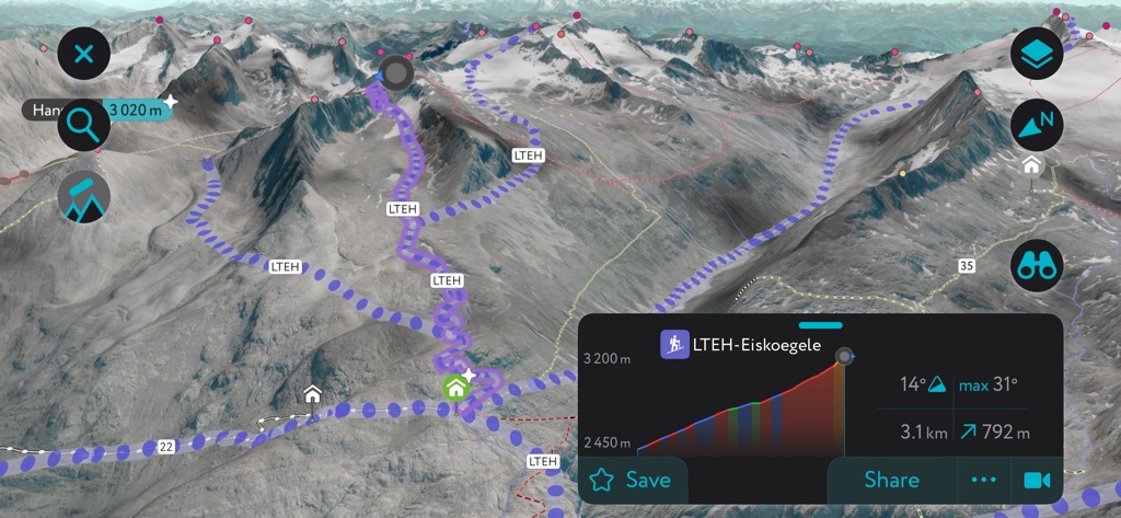
Eiskögele (3,228 m / 10,590 ft) is one of the classic ski tours near Obergurgl. Its summit offers panoramas of the Rotmoostal and the surrounding Gurgler Kamm. The best time to complete this ski tour is in spring when avalanches are less likely.
From the Obergurgl, you'll ski past the Nederhütte (2,098 m / 6,883 ft) and the Schönwieshütte (2,262 m / 7,421 ft) and cross the western slopes of Hohe Mut. This tour is approximately 11.6 km (7.2 mi) in length and is moderately difficult.
Similaun (3,606 m / 11,831 ft), Austria's sixth-highest mountain, is perched along the Main Alpine Ridge on the Austrian-Italian border. It's a classic hiking destination and offers one of the best - and most demanding - ski tours in the Ötztal Alps.
You can pick up this ski tour from the Martin-Busch-Hütte (2,501 m / 8,205 ft). This route leads over the Niederjoch (Giogo Basso) (2,993 m / 9,822 ft), which is less prone to avalanches than the northern route via Niederjochferner (Vedretta del Giogo Basso) (3,299 m / 10,823 ft). This ski tour is approximately 5.5 km (3.4 mi) long.
We've added several new features to the PeakVisor App to make it your go-to app for planning vacations in the Ötztal Alps.
Receive the latest weather reports from your location, including data on snow depths. You can also get up-to-date details on local mountain huts, including their opening hours, dining options, and overnight accommodation.
The new "Discover" feature on the PeskVisor App lets you quickly find and filter popular local hikes and ski tours, making it faster than ever to find your perfect outdoor adventure.
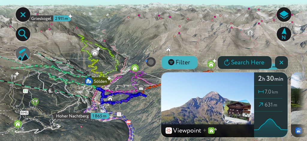
The Ötztal Alps are home to the most popular ski resort in the Tyrol and some major settlements on the Austrian-Italian border.
The nearest international airport to the Ötztal Alps is Innsbruck International Airport, located 100 km (62 mi) northeast of Vent.
Merano (Meran) is the largest city in the Ötztal Alps, with over 41,000 people. Merano is a famous spa resort known for its comfortable climate, attracting many famous visitors over the years, including Empress Elisabeth of Austria and Franz Kafka.
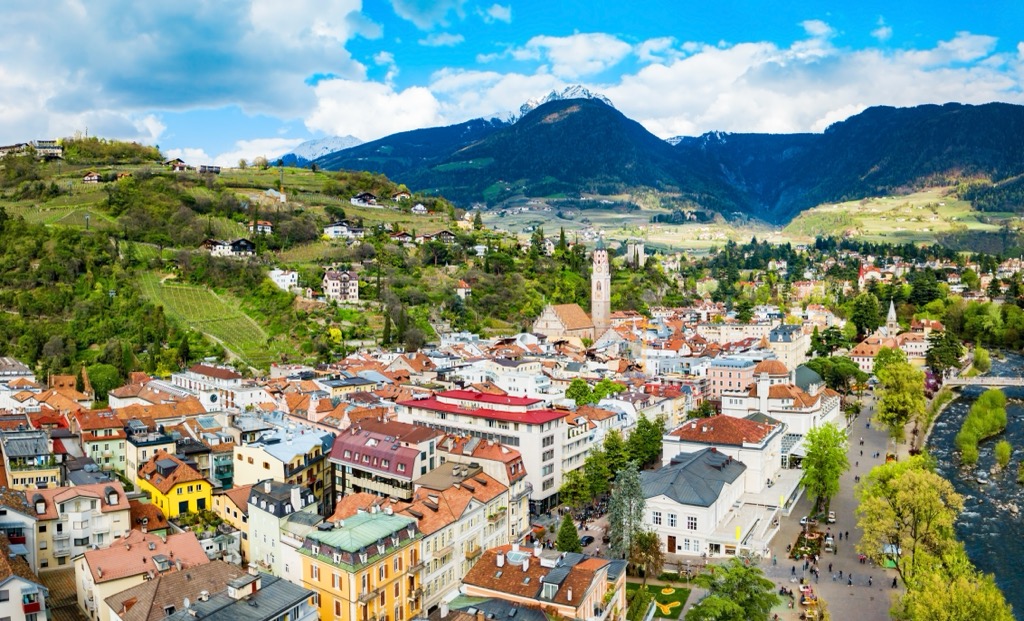
Situated on the Italian side of the Ötztal Alps, Merano offers easy access to the Naturpark Texelgruppe, the largest natural park in South Tyrol. Popular nearby mountains include Tschigat (2,999 m / 9,839 ft), Mutspitze (2,943 m / 9,656 ft), and Texelspitze (Cima Tessa) (3,318 m / 10,886 ft).
Merano-Maia Bassa/Meran-Untermais railway station connects Meran to Bolzano.
Landeck is the capital of the Landeck district and one of the largest settlements in the Ötztal Alps, with a population of over 7,700 people. It's on the northwestern edge of the range, at the confluence of the Sanna and Inn rivers.
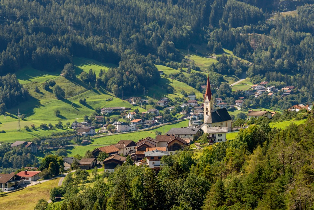
Landeck's position between the Lechtal Alps and the Ötztal Alps means it's within a stone’s throw of popular mountains like Parseierspitze (3,036 m / 9,961 ft), Dremelspitze (2,733 m / 8,967 ft), and Rotpleiskopf (2,894 m / 9,495 ft) The Serfaus-Fiss-Ladis ski area is 20 km (12.4 mi) south of Landeck.
The Landeck-Zams railway station is a major regional transport hub connecting the northern Ötztal Alps to Bludenz, Bregenz, and Innsbruck.
Sölden is among the most popular resorts in Tyrol, with over 2 million annual visitors. It's home to the largest ski resort in the Ötztal Alps and often hosts Alpine Ski World Cup races.
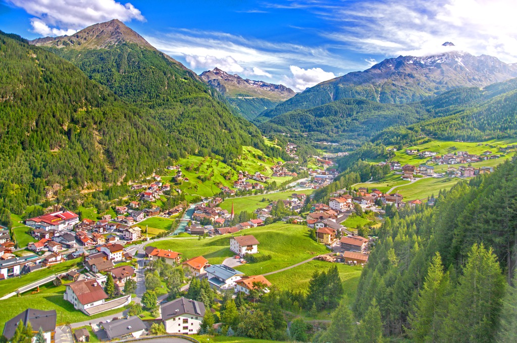
Sölden's location on the tip of the Weißkamm means it's an excellent base from which to scale some of the Ötztal Alps' highest and most famous mountains, like Wildspitze.
Sölden is accessible via the Ötztal Glacier Road, Europe's second-highest paved road. The nearest railway station to Sölden is the Ötztal Bahnhof, which offers services to Zürich, Basel, Vienna, and Innsbruck.
Explore Ötztal Alps with the PeakVisor 3D Map and identify its summits.


