
Scan the QR code and open PeakVisor on your phone
Saldurkamm - Monti di Saldura is the southernmost subgroup of the Ötztal Alps on the Italian side. The range contains 87 mountains; the tallest, Palla Bianca (Weißkugel in German), lies on the border of Tyrol, Austria, and Trentino-Alto Adige/Südtirol, Italy. The glacier-encrusted Palla Bianca measures in at 3,738 m (12,264 ft) and, with 571 m (1,873 ft) of prominence, has the greatest topographic prominence of the Saldurkamm subgroup.
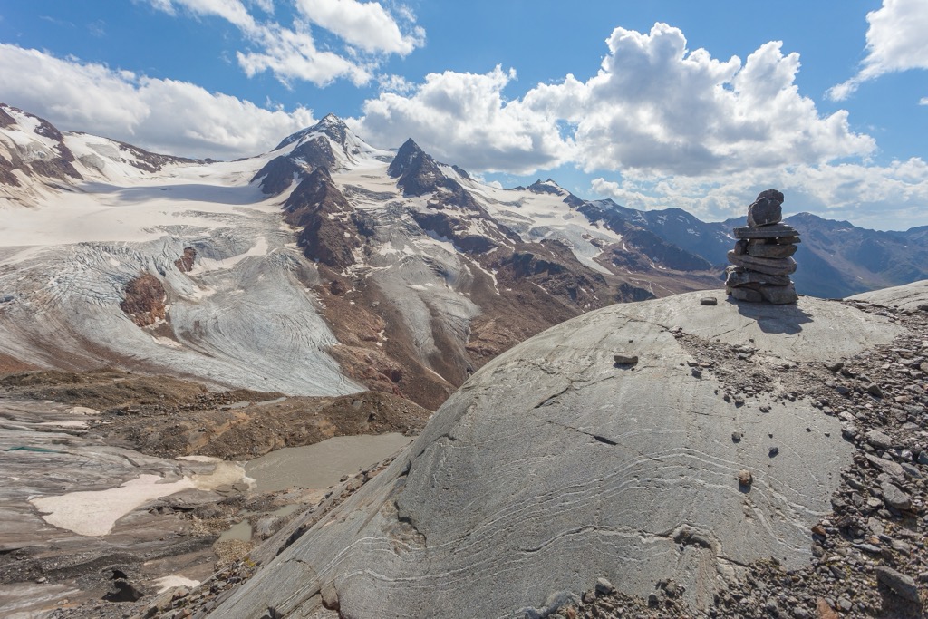
Saldurkamm - Monti di Saldura is a subgroup of the Ötztal Alps, located primarily in Trentino-Alto Adige/Südtirol, Italy, and bordering Tyrol, Austria. The tallest peak, Palla Bianca or “Weißkugel” in German, rises to 3,738 m (12,264 ft). It is the second-tallest mountain in the Ötztal Alps and the third-tallest mountain in Austria. The heavily glaciated massif lies within Naturpark Ötztal.
The Saldurkamm subgroup contains two main branches. The western ridge runs between Matscher Tal/Val di Mazia and Schlandrauntal/Val di Silandro, and the eastern ridge spans from Schlandrauntal/Val di Silandro to Schnalstal/Val di Senales. Steinschlagferner, a glacier between Innere Quellspitze and Äußere Quellspitze, connects Saldurkamm with the Weißkamm Ridge to the north.
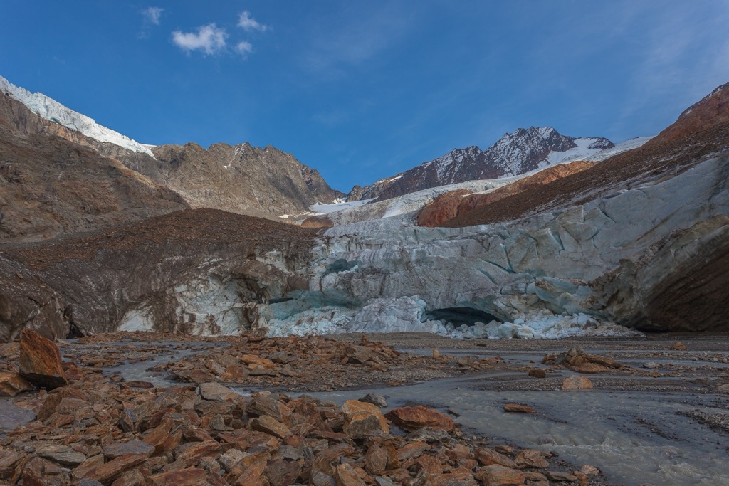
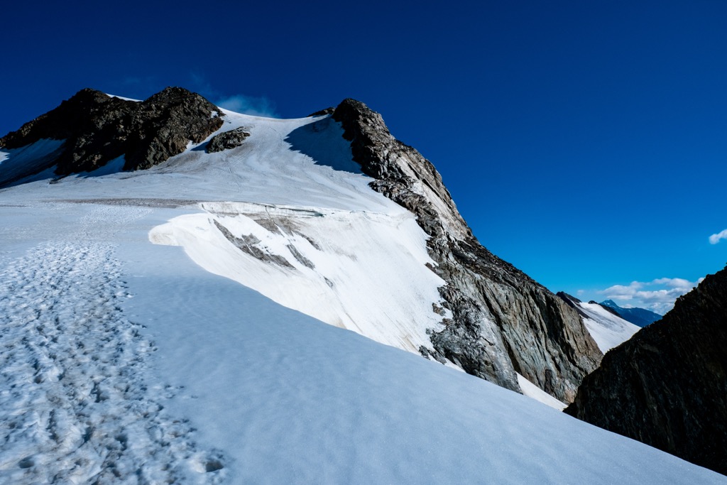
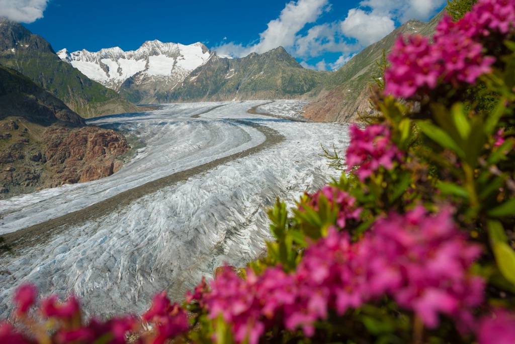
Extensive glaciation still exists on the north and west faces of the northern peaks. However, glaciers have largely receded on the south faces, although many glacial lakes remain.
Saldurkamm is a subgroup of the Ötztal Alps, which are part of the greater Eastern Rhaetian Alps and, ultimately, the European Alps.
The Öztzal Nappe is the primary geologic feature in the Ötztal Alps, consisting of a thrust sheet of pre-Mesozoic gneiss and schist basement rocks overlaid by Mesozoic sediment. The range has been shaped significantly by glaciers and ice sheets. Many lakes and carved-out valleys remain a testament to these once-great glaciers of yesteryear.
The Alps formed during the Alpine Orogeny, a mountain-building event that occurred as the African and Eurasian plates collided and which has been ongoing since the Cretaceous. Most mountain building occurred between 65 and 2.5 million years ago, although the mountains continue to slowly uplift. However, the uplift rate no longer outpaces erosion, and the Alps are not considered a growing range. Additionally, geologists have attributed the recent uplift to a rebounding effect as the Alps spring back after the weight of the last ice age’s ice sheet melts away.
Part of the Saldurkamm lies within Naturpark Ötztal. Common spruce grows abundantly in the montane zone, with silver fir and common beech appearing sporadically. Frost-resistant species like larch and Swiss pine grow well in the Ötz Valley.
Swiss pine also grows well in the sub-alpine, and dwarf-shrub heath thrives in the undergrowth. Other plants include blueberry and bilberry bushes, rusty-leaved alpenrose, and alpine clematis. In some areas, the alpine zone supports dwarf-shrub heath, rusty-leaved alpine rose, and Siberian juniper.
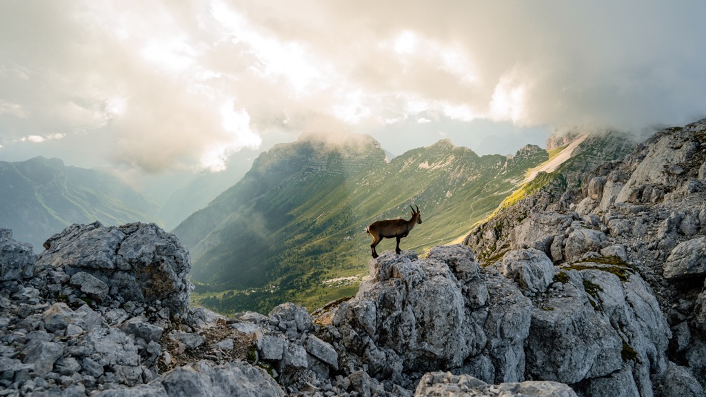
Marmots, red deer, roe deer, chamois, and ibex live in the forests and alpine zones. Birdlife includes golden eagles, bearded vultures, snow finches, spotted nutcrackers, white-throated dippers, capercaillies, and eagle owls. Several species of amphibians and reptiles are found here, including the alpine newt, the common frog, the dark brown common lizard, and the European viper.
The first summit of Palla Bianca is credited to either Joseph Anton Specht guided by Leander and Nicodem Klotz in 1861, or to the guides of Archduke John of Austria, Johann Gurschler and Josef Weitthalm. The Archduke’s personal notes suggest his guides had climbed the mountain in 1846.
Maso Corto, situated at the head of Val Senales Valley, was popular with skiing pioneers in the 1950s. The area began to expand in the 1970s as a winter sports destination. Each spring and fall, sheep are herded through the area on their way to and from the Austrian Ötztal Valley.
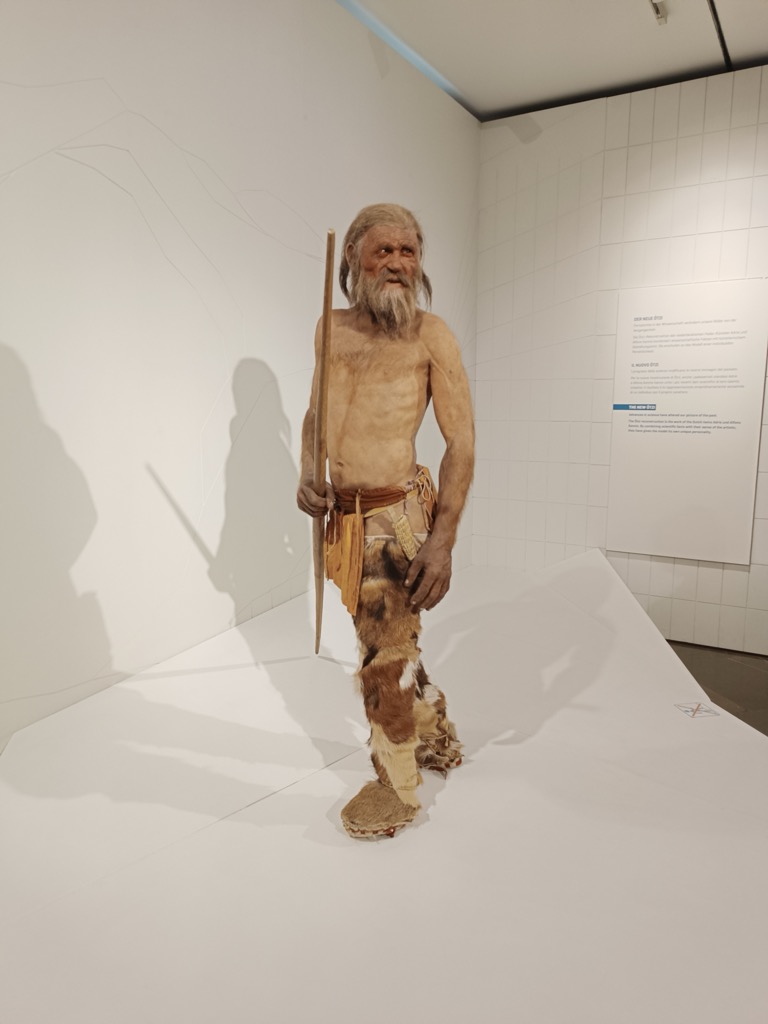
The region of South Tyrol was settled at least 5,300 years ago, as evidenced by Ötzi the Iceman, found preserved in receding glacial ice in the mountains nearby. Throughout history, the region shifted between ruling political parties. From 400 BC until the 5th century CE, the Romans and Rhaetians ruled South Tyrol. Starting in 1363, the region belonged to the Habsburg Empire and remained under Habsburg rule until Italy annexed it in 1919 at the end of World War I.
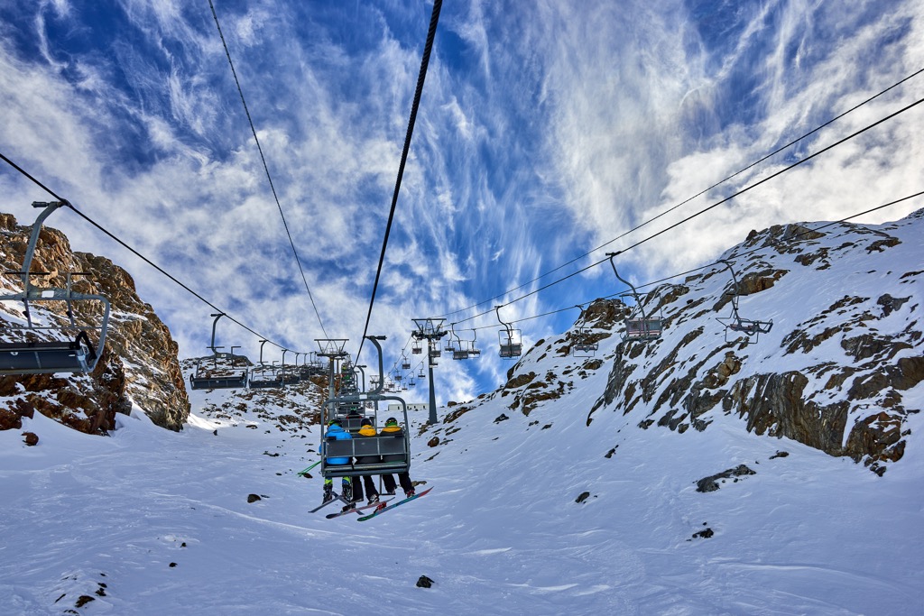
The towering peaks, glaciers, and alpine lakes of Saldurkamm draw visitors for summer hikes and winter ski touring. The ski resort Val Senales serves as an excellent base for skiing, as well as hiking and via ferratas in summer.
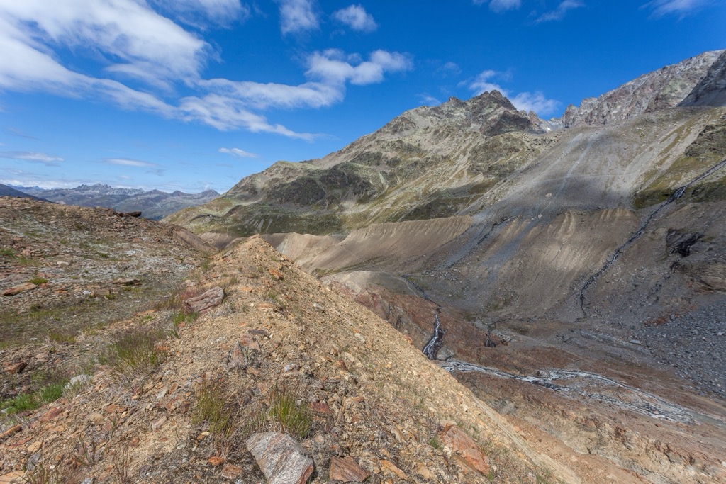
The southwest part of the range around Litzer Spitze/Punta d’Allitz and Hochal/Monte Alto has only a few summer trails leading to glacial lakes but offers good ski-touring up to some of the peaks over 3,000 m (9,840 ft) in winter. The southeast has a more extensive trail system. Its convenient location between Vinschgau/Val Venosta and Schnalstal/Val di Senales makes it easy to reach trailheads. Most summits in the area have trails leading to them, and many ski tours follow the summer hiking trails.
The most popular zone in the south is Vainschgauer Sonneenberg/Monte Sole. Panoramic hiking trails with views of the Ortler Group wrap around approximately 1000 m (3,280 ft) above the Vinschgau Valley. Trailheads are accessible by road or cable car. Be prepared for company on the trails here!
The tallest peak in the range, Palla Bianca, is easiest approached from the south side. There are two huts nearby – Lazaunhütte and Oberetteshütte.
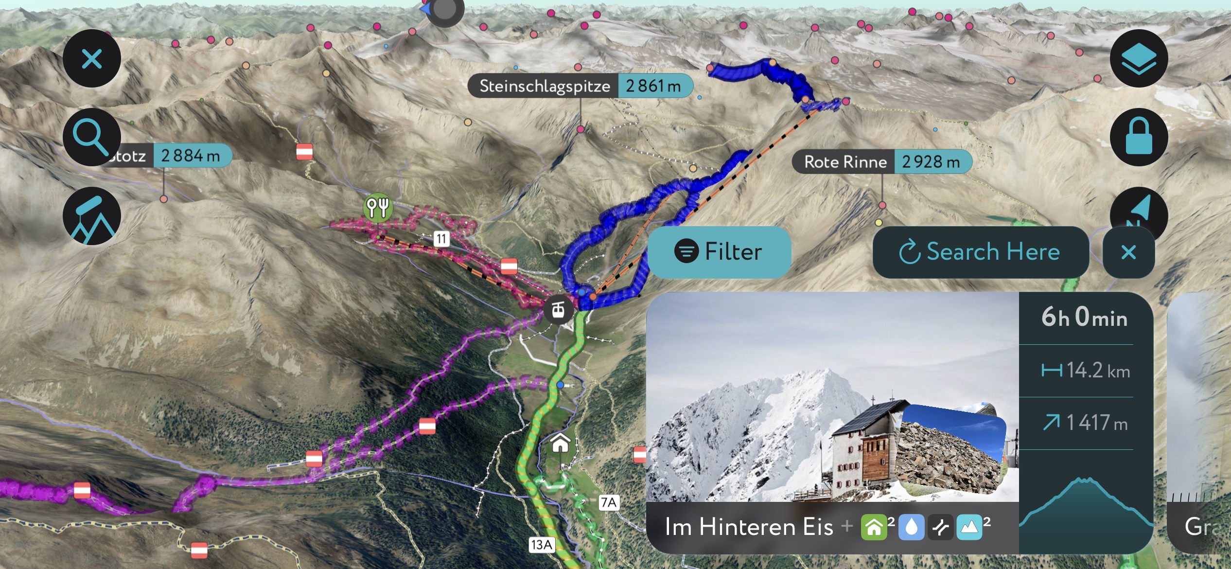
Check out our PeakVisor app for Peak Identification, 3D mapping, personalized route-finding, and adventure tracking, all with our Augmented Reality technology. The app is compatible with most smartphones and serves as your own mountain guide. Moreover, the “Discover” feature allows you to find the best trails in an area, whether planning a trip in advance or from the parking lot when you arrive.
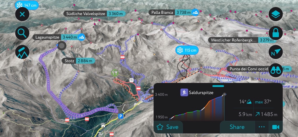
A challenging but rewarding ski touring route climbs nearly 1,500 m (4,920 ft) to Saldurspitze (3,433 m / 11,263 ft). There are two options for this climb. The first starts at Maso Corto/Kurzras around Koflhof Farm. It winds through the Lagauntal Valley and towards the Lagaun glacier before climbing north towards the summit. You can descend the same way or along the more challenging northeast wall by the Lazaun Mountain Hut.
The second option starts at the car park in Maso Corto and ascends about 1,425 m (4,675 ft), slightly less than the first option. The route departs from the Lazaun cable car station and travels to Lagauferner Glacier. Here, the trail passes over the north ridge to the summit. If conditions are reasonable, you can climb the steep north slope towards the summit before Saldurjoch Pass. It’s advised only to descend this way if weather conditions are optimal.

The 15.7 km (9.8 mi) day hike to the seven Saldur Lakes is challenging but beautiful. The hike starts at Glieshof and climbs 1,275 m (4,185 ft). It’s a strenuous climb but worth it for the blue lakes surrounded by a dramatic rocky mountainscape and sweeping views across the Ortler and Bernina Group at the top.
The Val Senales ski area sits in the Schnals Valley on the border between Italy and Austria. A cable car runs to the Schnals Glacier mountain station. From there, it’s easy access to slopes of all difficulty levels, from wide, gentle groomers to steep off-piste descents. The resort also features quite a bit of open glacier skiing.
Two incredible European cities, Bolzano and Innsbruck, are less than two hours by car from the Saldurkamm. Smaller towns, such as the mountain village Maso Corto/Kurzras, offer plenty of accommodation for those hoping to stay close to the slopes. From Maso Corto, a cable car travels to the Grawand mountain station, the starting point for many hiking trails and ski slopes.
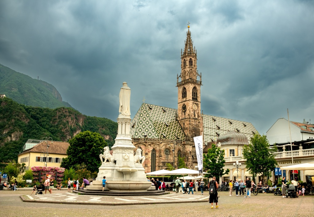
Bolzano is the largest city in South Tyrol, with a population just shy of 110,000. The city is sometimes called the gateway to the Dolomites and has lots to offer regarding access to the mountains and culture. Few cities of this size and cultural diversity have such excellent access. It is rich with German, Italian, and Austrian influences, making it culturally unique in Italy. For these reasons, along with Innsbruck, Austria, and Grenoble, France, Bolzano is one of the capitals of the Alps.
There’s impressive architecture, such as the largest Gothic church in South Tyrol and the Franciscan Friary. In winter, the city’s historic center houses Italy’s largest Christmas market. The Archeological Museum in town details the region's history dating back to the Stone Age.
Surrounded by mountains, you can take the Funivia Colle-Bolzano cable car up to Colle dei Contadini, a village about an hour’s walk from the city. The Dolomites are nearby, offering everything from easy hikes around Lake Garda to more challenging summit hikes.
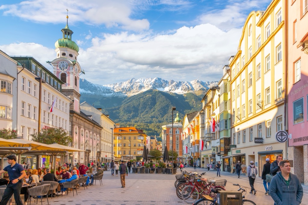
With a population of over 310,000, Innsbruck is an excellent destination for culture, nature, and proximity to mountain sports. It is the second-largest city in the Alps, after Grenoble, France, but arguably offers better mountain access. The city lies in a valley with steep mountains rising steeply around it; cable cars like the Nordkette and Patscherkofel provide quick access to the slopes for hiking, skiing, mountain biking, and paragliding.
Visitors can stroll through Old Town or pay a few Euros to climb the Town Tower. The Hofkirche church has 28 bronze statues, while the Cathedral of St. James exhibits Baroque architecture. The Schloss fortress, a medieval fortress turned Renaissance castle for Archduke Ferdinand II’s wife, displays armor and artwork. Innsbruck hosted the Winter Olympics in 1964 and 1976 and the 1984 and ‘88 Winter Paralympics; the stadiums still host sports events.
Purchasing an Innsbruck Card is a worthwhile investment if you want to go to multiple museums, ride some cable cars, and have free transport on buses, trams, and bikes. The passes can be purchased for 24, 48, or 72 hours.
Innsbruck is a 30-minute drive from both Italy and Germany. Trains arrive from Venice, Munich, Salzburg, and Zurich. The city also has a small but busy international airport and is a launching point for the famous Tyrolean ski resorts.


