Scan the QR code and open PeakVisor on your phone
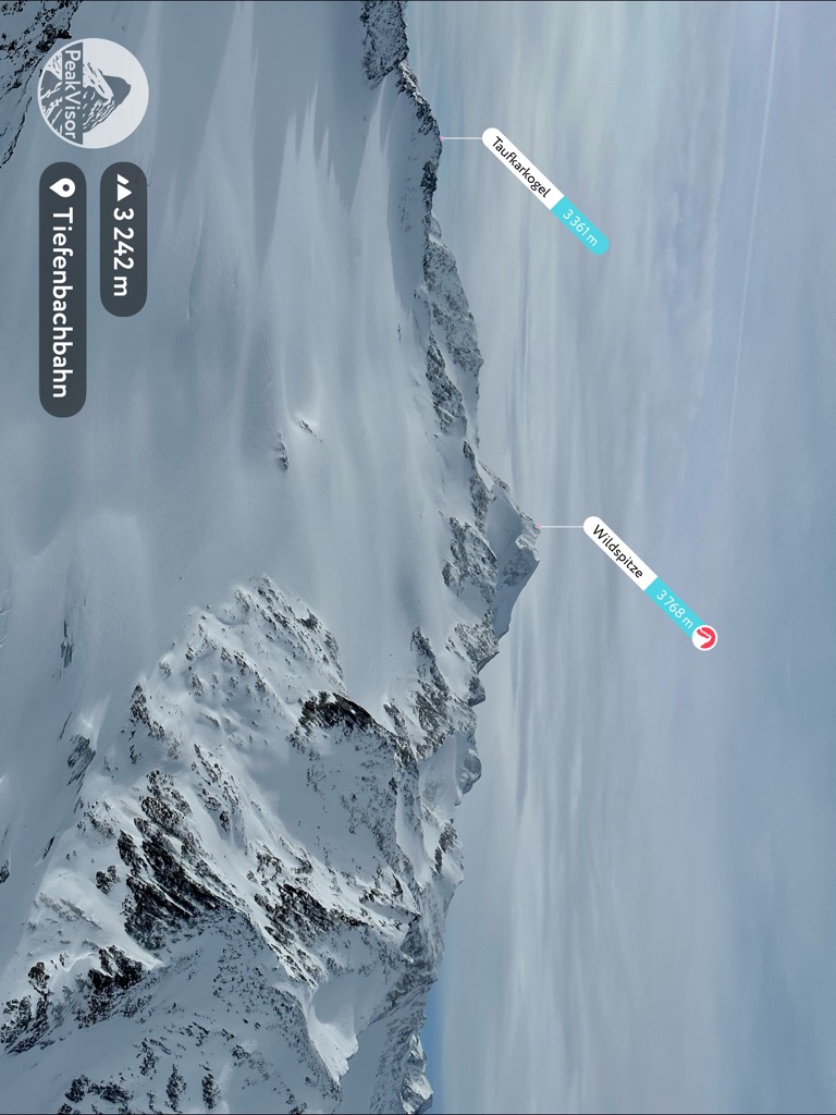
Scale the second-highest mountain in Austria and discover the majesty of the Ötztal Alps when you visit Ötztal Nature Park. There are 189 named mountains in Ötztal Nature Park. The highest and most prominent mountain is Wildspitze (3,768 m/12,362 ft).

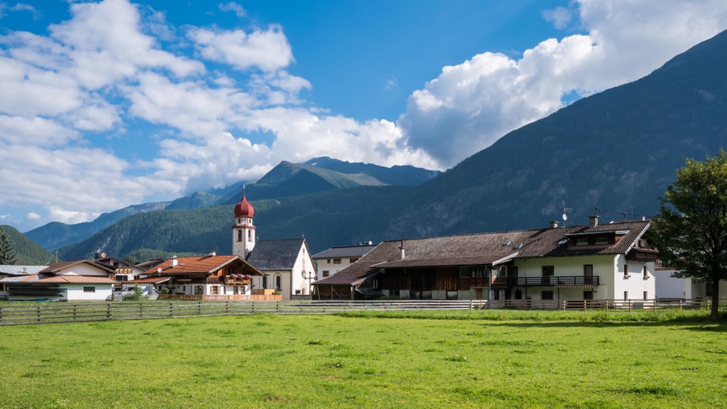
Ötztal Nature Park (Naturpark Ötztal) is a nature reserve located in Tyrol (Tirol), Austria. The park encompasses an area of approximately 508 sq km (196 sq mi). It's the second-largest nature park in Tyrol and the third-largest in Austria.
Ötztal Nature Park protects a series of areas stretching from the floor of the Ötztal valley to the highest summits of the Ötztal Alps. The park rests on the Austro-Italian border and is adjacent to Italy's Texelgruppe Nature Park (Naturpark Texelgruppe).
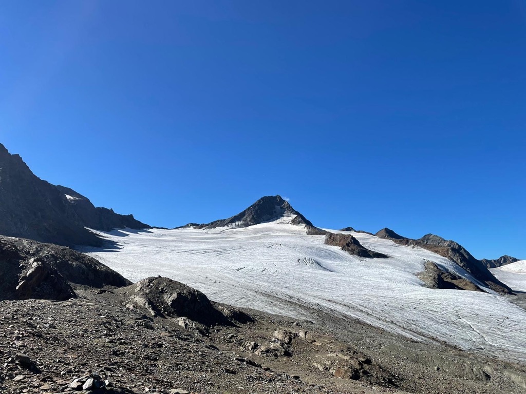
There are 152 mountains over 3,000 m (9,842 ft) in elevation in Ötztal Nature Park. The park is famed for containing Wildspitze, the highest mountain in the Ötztal Alps and the fourth most prominent summit in the entire Alpine range. It's also the second-highest mountain in Austria after Großglockner (3,798 m/12,461 ft).
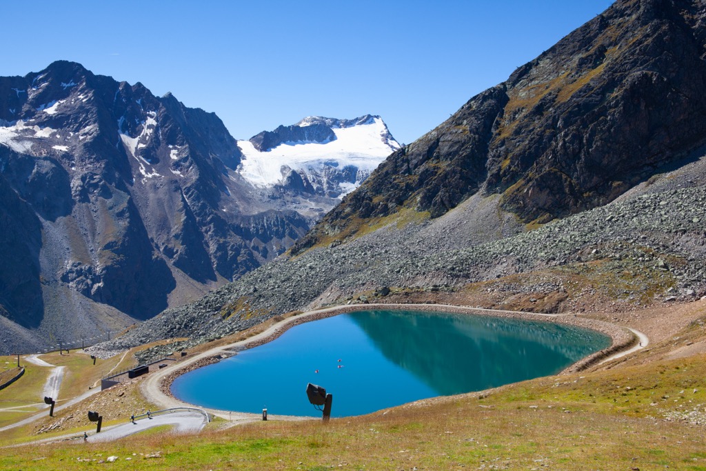
Ötztal Nature Park boasts several record-breaking features. It's home to 67 glaciers, including several of the largest and longest in the Eastern Alps: Hintereisferner, Vernagtferner, and Gurgler Ferner. The glaciers of Ötztal Nature Park have a total surface area of roughly 91 sq km (35 sq mi).
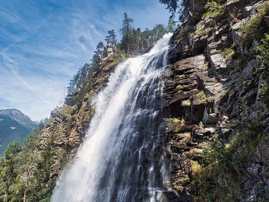
Additionally, within the park is Stuibenfall, the highest waterfall in Tyrol, which cascades for 159 m (521 ft). Lake Piburg (Piburger See) is the largest lake in Ötztal Nature Park and its lowest point at 774 m (2,539 ft) in elevation.
Ötztal Nature Park is a popular winter sports retreat with many popular ski areas and resorts like Vent, Obergurgl-Hochgurgl, and Sölden. Innsbruck, the capital of Tyrol, is located approximately 40 km (25 mi) northeast of Ötztal Nature Park.
The basis of the Ötztal Alps is the result of the Alpine orogeny, a mountain-building event that began between 65 and 2.5 million years ago and is still ongoing in parts of the Alps. The Alpine orogeny was caused by the African, Arabian, and Indian Plates in the south colliding with the Eurasian Plate to the north.
Over 20 mountain ranges worldwide were formed or affected by the Alpine orogeny. As well as forming the entirety of the Alps, the Alpine orogeny also created the Apennines, the Himalayas, the Atlas Mountains, and many others.
The Ötztal Alps are a part of the Ötztal-Stubai complex, one of three subunits of the Austro-Alpine basement. The unit is composed mainly of Ötztal Gneisses, which include mica slate and paragneiss, a type of gneiss originating from sedimentary rock. Orthogneiss, created by the metamorphism of igneous rocks, and amphibolites are also present but less prevalent.
Mica slate from the Ötztal Alps is famous for producing large garnets, which can sometimes be several centimeters wide. They are especially common on the south slope of Granatenkogel (3,304 m/10,840 ft) on the eastern side of Gaisberg valley.
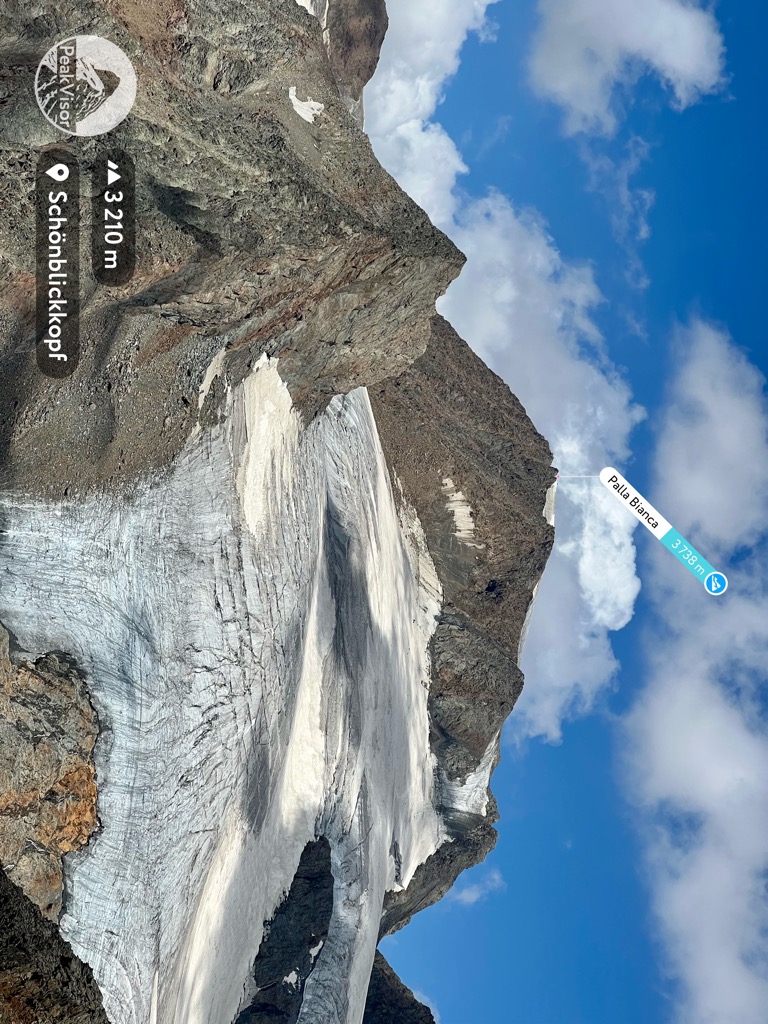
Today the Ötztal Alps is one of the major groups in the Eastern Alps, home to significant summits like Wildspitze. Notable mountains in the Ötztal Alps include Weißkugel (Palla Bianca) (3,738 m/12,264 ft), Kreuzerschneide (3 ,677 m/12,064 ft), and Similaun (3,606 m/11,831 ft).
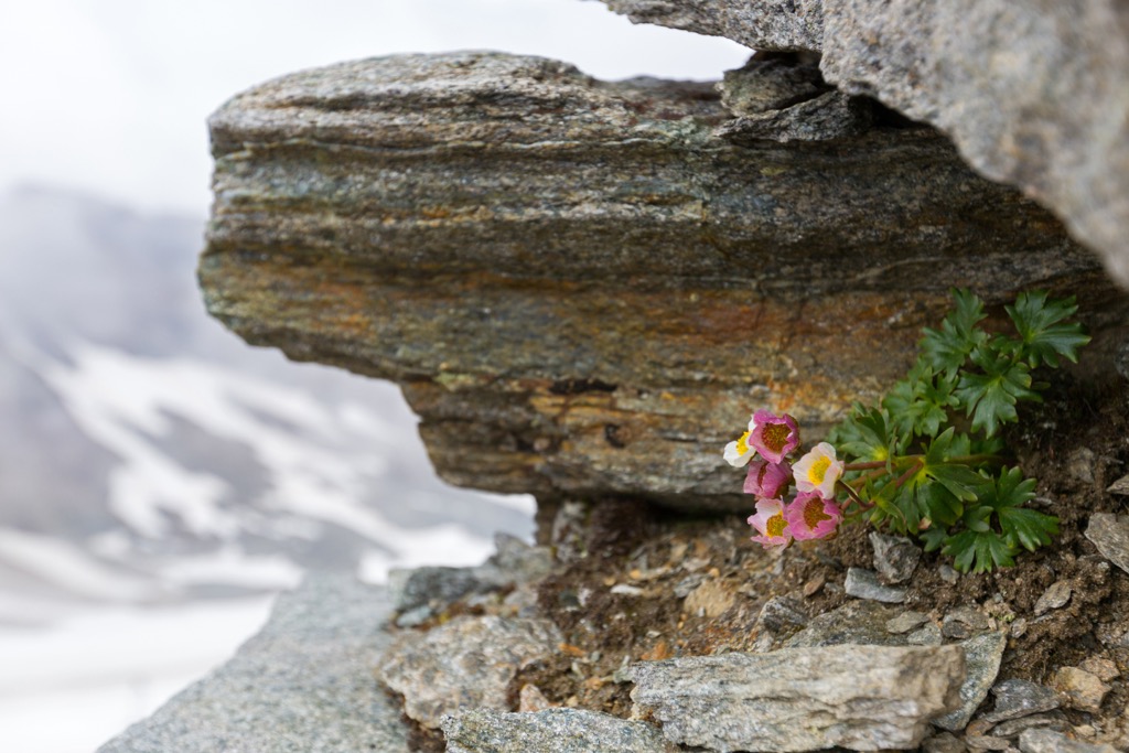
Home to lofty Alpine forests and lush valleys, Ötztal Nature Park boasts many rich environments where animals and plants thrive. Read on to learn about the wildlife in Ötztal Nature Park.
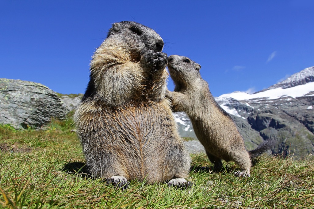
Mammals aren't a common sight within Ötztal Nature Park, as most species in the region are nocturnal or crepuscular. Some of the largest mammals inhabiting Ötztal Nature Park include chamois, roe deer, and red deer. Other notable mammal species in Ötztal Nature Park include marmots, Alpine ibex, and wild boar.
A wide variety of bird species can be seen in the skies above Ötztal Nature Park. Notable birds of prey which hunt in Ötztal Nature Park include eagle owls, golden eagles, and bearded vultures. Other distinctive bird species in Ötztal Nature Park include capercaillies, nutcrackers, snow finches, and dippers.
Several reptile and amphibian species are native to Ötztal Nature Park such as mountain lizards, common frogs, and mountain newts. The park is also home to one of only two venomous snakes in Austria, the common European adder.
Insects are the largest and most diverse animal group in Ötztal Nature Park, with over 1,900 species. Many of these species are rare and rarely found outside the Ötztal Alps, such as Matterhorn bear moths, Swedish notched ants, and the wolf spider species, Pardosa cincta.
One of Ötztal Nature Park's smallest but most interesting residents is the protected Hypsibius klebelsbergi, a species of tardigrades. These microscopic animals are among the hardiest on the planet, being able to withstand temperatures of 100°C (212 °F) to -272°C (-457 °F) and 1,000 atmospheres of pressure.
There are approximately 260 plant species within Ötztal Nature Park. As the elevation changes throughout the park, so does the makeup of its plant life.
Moorlands are common across Ötztal Nature Park, with a total of 17 forest and marshland moors. Ötztal Nature Park is also home to several bogs, which are remnants of the Ice Age.
Most of the forests here are coniferous, with larch pine and pine forests typical across the Central Alps. Spruces dominate the montane uplands of Ötztal Nature Park, while common beeches and silver firs are also present. Some deciduous trees, like silver birches, quaking aspens, and mountain ashes, are at the montane level.
More durable trees like stone pines take over at subalpine elevations between 1,700 m (5,577 ft) and 1,900 m (6,233 ft), as they're able to withstand harsh winter temperatures. In the undergrowth of these stone pine forests are lingonberries, alpine roses, blueberries, and bog bilberries.
Slightly higher up at the alpine level, the forests subside and make way for dwarf heathlands. Dwarf junipers and alpine roses constitute the majority of these dwarf heathlands. The hollows and meadows at the alpine level mostly feature crooked sedges. Least moonwort, which is extremely rare in Europe, is one of the most interesting plants found at this elevation.
The nival level above 3,000 m (9,842 ft) may seem barren and composed of rocks, but over 100 flowering plant species grow here. Glacier crowfoot is synonymous with the high mountains, while red algae dye the snow blood red in places. Protected plants found at alpine elevations and above include burnt-tip orchids, black vanilla orchids, and purple gentians.
Archeologists believe humans have been inhabiting the Ötztal Alps since approximately 7,500 BCE, after discovering the remnants of an ancient hunting camp near Vent.
Archeologists uncovered one of Central Europe's most important archeological finds on the east ridge of Fineilspitze, Ötzi the Iceman. Ötzi is a naturally preserved mummy which is thought to be from between 3,350 and 3,105 BCE, his body perfectly preserved by the Similaun glacier.
Europe's oldest natural human mummy, Ötzi has provided unique insights into the lives of Copper Age Europeans, including clothing, tools, and ancient warfare.
By 2,000 BCE, there was increased usage of high-elevation land for settlements and agriculture in the Ötztal Alps. However, by 800 BCE, land usage declined due to the harsh climate. By 500 BCE, there were settlements by the Rhaetians, a union of Alpine tribes similar to the Etruscans, strewn across the Ötztal Alps.
Following the Roman period, Germanic tribes settled in the Ötztal Alps. By 1,400 CE, the valleys of the Ötztal Alps were mainly settled.
In the mid-nineteenth century, the village of Vent was home to Franze Senn, a pastor who became one of the first to promote alpinism. He is considered one of the Alps' first mountain guides and an integral figure in the growth of mountaineering in Tyrol.
In 1931, while setting a record for the highest hydrogen balloon flight at 16,000 m (52,493 ft), Auguste Piccard made a dramatic emergency landing on the Gurgler Ferner glacier, with him needing to be rescued by mountain guides. This event caused a media storm and raised the profile of Obergurgl as a tourist destination.
Ötztal Nature Park was established on September 19, 2006, to preserve the local ecosystems and culture, as well as to aid research and promote tourism.
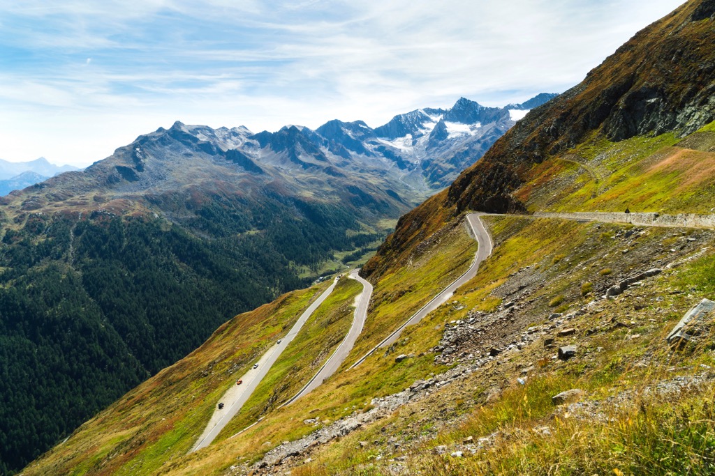
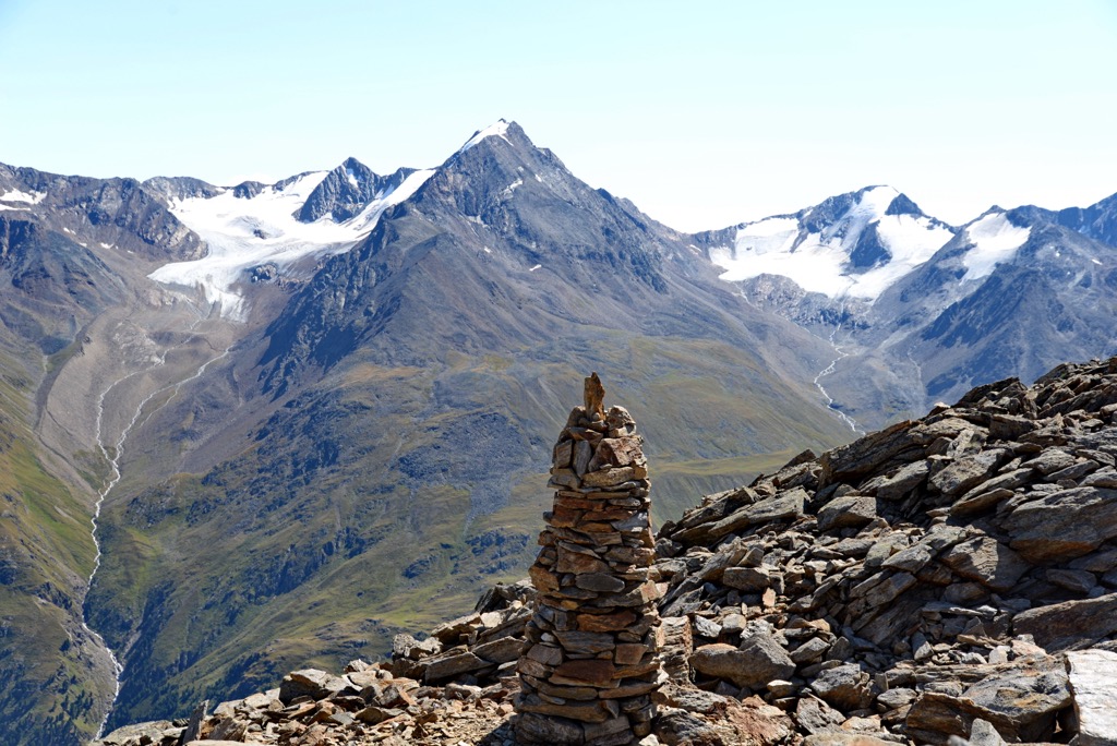
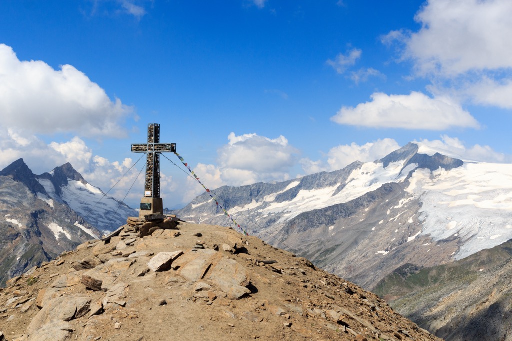
Ötztal Nature Park, the third-largest of its kind in Austria, has a network of roughly 1,600 km (994 mi) of high alpine paths. With dozens of mountains over 3,000 m (9,842 ft) in elevation, stunning glacial landscapes, and serene alpine lakes, Ötztal Nature Park is heaven for hikers.
The Ötztal Alps present plenty of potential dangers, so come well prepared. Bring appropriate hiking gear, topographic maps, and adequate food and water. Check local weather forecasts, identify mountain huts along your proposed route, and inform others of your itinerary.
Read on to learn about several of the best hikes in Ötztal Nature Park.
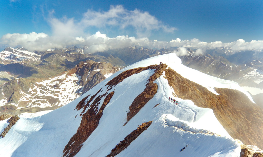
Austria's second-highest mountain, Wildspitze, isn't for the faint-hearted, ranked as the fourth most prominent summit in the Alps, only surpassed by Mont Blanc (4,810 m/15,781 ft), Großglockner, and Finsteraarhorn (4,274 m/14,022 ft). The mountain is sometimes called Oetztaler Wildspitze due to Stubaier Wildspitze being nearby.
Despite its difficulty Wildspitze is popular, with many experienced mountaineers attempting to reach one of Austria's highest points annually. Experience climbing glaciated mountains is a must for Widlspitze, and crampons, a harness, ropes, and ice axes are essential gear. Non-experienced climbers will need to hire a guide.
The normal route up Wildspitze is rated PD- on the Swiss Alpine Club's (SAC) mountaineering scale but should not be underestimated, especially in poor conditions.
The normal route is from the Breslauer Hütte over Mitterkarjoch (3,483m/11,427 ft). The Breslauer Hütte is reachable from Vent, with most hikers spending the night at the hut before ascending Wildspitze.
The Wildspitzlift, a two-person chairlift from Vent to the Panorama Restaurant Stablein atop Stablein (2,346 m/7,697 ft), significantly shortens the walk to the Breslauer Hütte to one or two hours. The Wildspitzlift is only open during summer and early autumn.
As long as there are no crowds and conditions are good, the round trip up Wildspitze from Breslauer Hütte takes around 6 or 7 hours to complete. Signposts only point the way until the Mitterkarferner glacier, so map your route carefully. The views from atop are among the finest in Austria, with Großglockner to the east and Finsteraarhorn to the west.
Hohe Mut (2,653 m/8,704 ft) is among the most visited mountains in Ötztal Nature Park, partly because its slopes are a section of the Gurgl ski resort. In the summer, Hohe Mut is a moderately challenging mountain suitable for families.
Hohe Mut's ridge and summit afford breathtaking views of 21 summits over 3,000 m (9,842 ft) high, including Granatenkogel (3,304 m/10,840 ft), Hinterer Seelenkogel (3,475 m/11,401 ft), and Schalfkogel (3,536 m/11,604 ft).
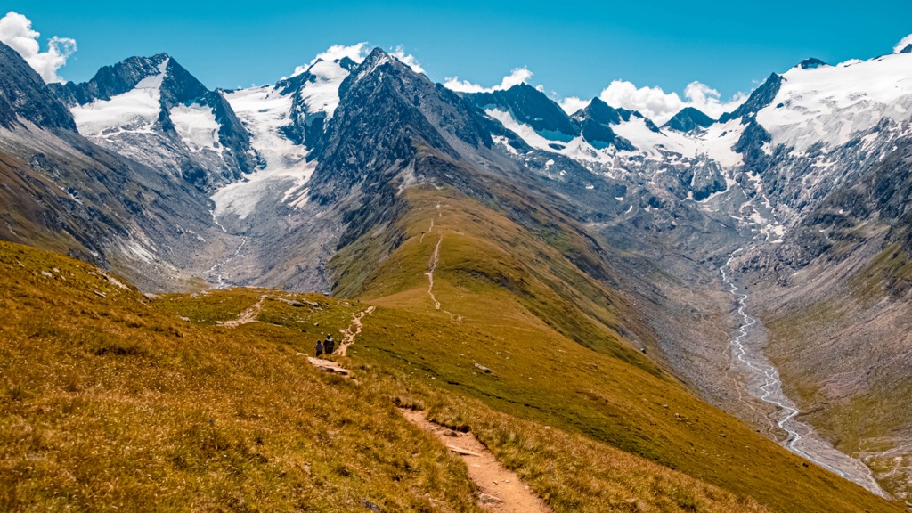
The hike up Hohe Mut starts in Obergurgl, following the Gaisbergweg trail to the Zirben-Alm hut. The trail then heads west through forests and across the Gurgler Ache River before turning south into the Rotmoostal valley.
You can stop for a drink and a bite to eat at the Schönwieshütte before continuing onto Hohe Mut's ridge. This walk is approximately 12.4 km (7.7 mi) in length.
Wildes Mannle (3,019 m/9,905 ft) is among the easiest 3,000ers to climb in the Ötztal Alps. It's very popular with hikers due to the views it affords of nearby Wildspitze.
Park at the Wildspitzlift in Vent, then take the chairlift up 469 vertical meters (1,538 ft) to the top of Stablein. From the starting point atop Stablein, follow the 919 trail to the Breslauer Hütte. Turn right at the "Breslauer Hütte – Wildes Mannle" signpost, approaching the mountain from the south.
Close to the summit is rocky and steep, with steel ropes anchored into the rocks for hikers to hold. The descent from Wildes Mannle is to the north, turning left at the marker for Rofenkar.
You'll reach a small glacial lake from which you can return to the Breslauer Hütte. From the mountain hut, you can return the way you came to the Wildspitzlift. This walk is approximately 7.8 km (4.8 mi) in length.
Hochwilde (3,482 m/11,424 ft), or Cima Altissima, is popular with hikers thanks to its spectacular views, with the Dolomites and the Bernina Range visible on a clear day. Views are incredible in every direction, with Hinterer Seelenkogel (3,475 m/11,401 ft) to the north, Hohe Weiße (3,276 m/10,751 ft) to the south, and Hintere Schwärze (3,624 m/11,890 ft) to the west.
One possible ascent of Hochwilde from within Ötztal Nature Park is from the Langtalereckhütte in the Langtal valley. This is a steep but relatively short walk up Hochwilde compared to other possible routes. The route zigzags up the Gurgler Ferner glacier through Annajoch.
You'll soon reach Hochwilde (Nordgipfel) (3,461 m/11,355 ft). From there, you continue along the mountain's east flank, crossing a very narrow ridge to Hochwilde's main summit. This walk is approximately 8 km (5 mi) in length.
Finailspitze (3,514 m/11,529 ft), or Punta di Finale, is a mountain straddling the Austro-Italian border. A part of the Schnalskamm group, Finailspitze is famous for being the closest summit to the discovery site of Ötzi the Iceman. Many hikers visit the area to walk in the footsteps of this 5,000-year-old mummy.
You can climb Finailspitze from either Ötztal Nature Park or Texelgruppe Nature Park. One of the most popular routes up Finailspitze from Ötztal Nature Park is from the Martin-Busch Hütte. The refuge is the focal point of the South Tyrolean sheep drive, where over 1,000 sheep are driven over the Ötztal main ridge.
Advanced climbing skills are necessary to navigate the exposed ridge of Finailspitze. A well-maintained trail leads toward Similaunhütte (3,019 m/9,905 ft). You'll need to turn right in the "Beim Bild" area at the last signpost for Similaunhütte.
Cross boulder fields to reach Tisenjoch, where Ötzi the Iceman was discovered. Past Hauslabjoch, you'll climb onto Finailspitze's exposed ridge where climbing skills are necessary. You'll pass Finailspitze's lower peak on the way to the main summit.
One of the highest mountains in its group, Finailspitze's views are stunning, with Wildspitze to the north, Similaun (3,606 m/11,831 ft) to the east, and Weißkugel (Palla Bianca) (3,738 m/12,264 ft) to the west. This walk is approximately 7.2 km (4.4 mi) in length.
Kreuzspitze (3,455 m/11,335 ft) is one of the tallest peaks in the Schnalskamm group and is popular with hikers due to the panoramas from its summit. From Kreuzspitze you can see every major peak in the Ötztal Alps, including Wildspitze, Hintere Schwärze, Weißkugel, Similaun, Schalfkogel (3,597 m/11,804 ft) and Ramolkogel (3,549 m/11,644 ft).
There's a moderately difficult ascent of Kreuzspitze starting from Vent. Due to the length of this trail, this walk takes two days to complete. You can spend the night at the Martin-Busch Hütte. An alternative is to stay at the Ramolhaus, but it's further away.
From Martin-Busch Hütte, there is a marked trail leading up Kreuzspitze. The trail is usually snow-free all summer. This walk is approximately 12 km (7.5 mi) in length.
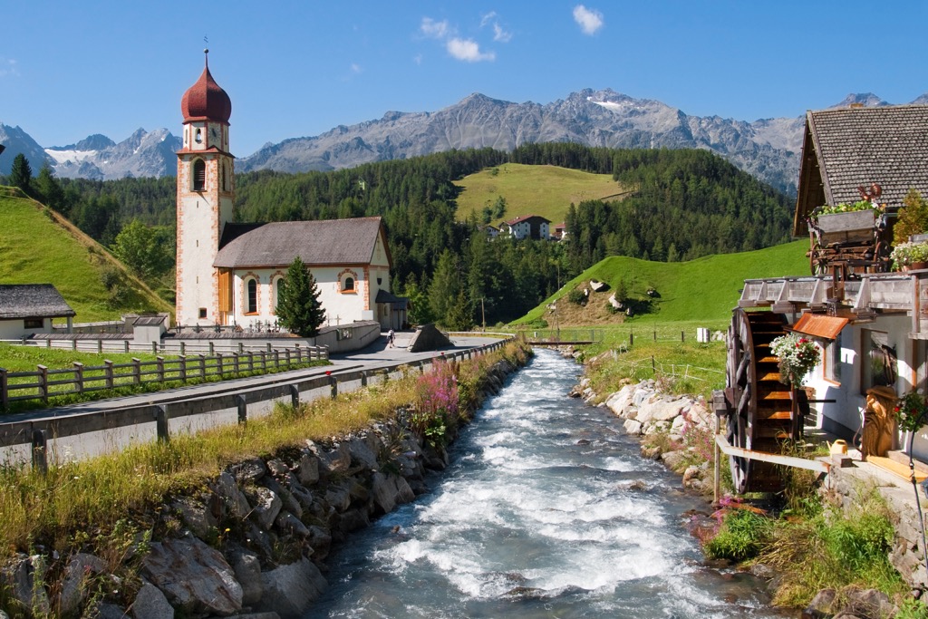
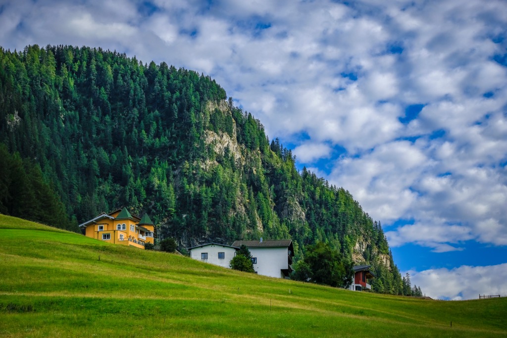
You'll find a wide range of accommodation options in and around Ötztal Nature Park, from picturesque villages in the Ötztal Valley to one of Austria's largest cities. Read on to learn about the main cities and towns near Ötztal Nature Park.
Innsbruck is Austria's fifth-largest city and the capital of Tyrol. It's a gorgeous city resting on the River Inn, with the Karwendel Alps providing a sublime backdrop. Contrasting bustling streets with traditional Alpine culture, Innsbruck is a truly one-of-a-kind city.
You'll find no shortage of attractions in Innsbruck. Take a tour of the sixteenth-century Gothic Court Church (Hofkirche), or admire the ornate and iconic Golden Roof (Goldenes Dachl) in Innsbruck's Old Town (Altstadt).
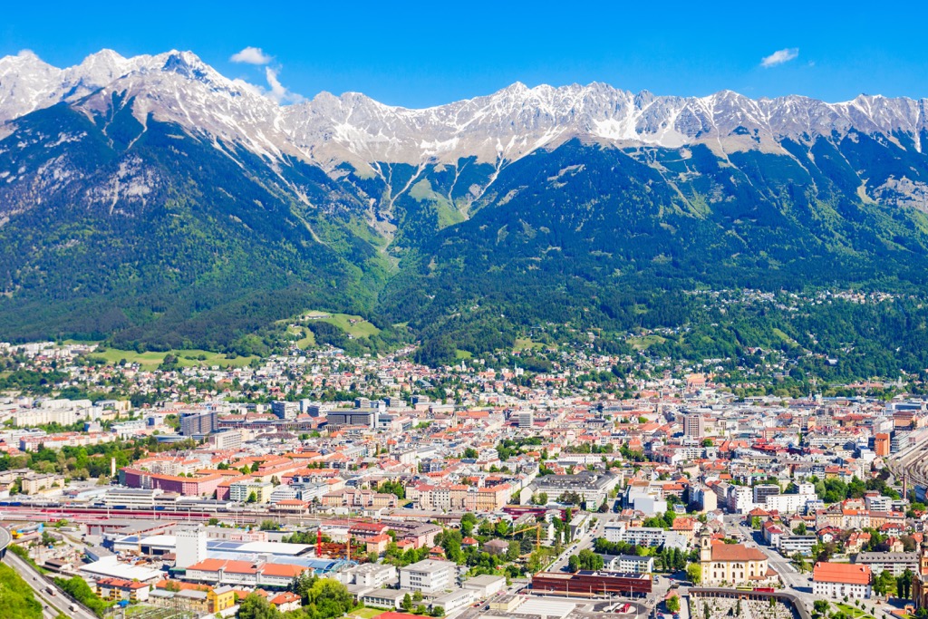
One excellent feature of Innsbruck is the Nordkette ski resort, which is located just north of the city. Nordkette ski resort contains 14 km (8.6 mi) of slopes and 6 lifts. Innsbruck is located approximately 40 km (25 mi) to the northeast of Ötztal Nature Park.
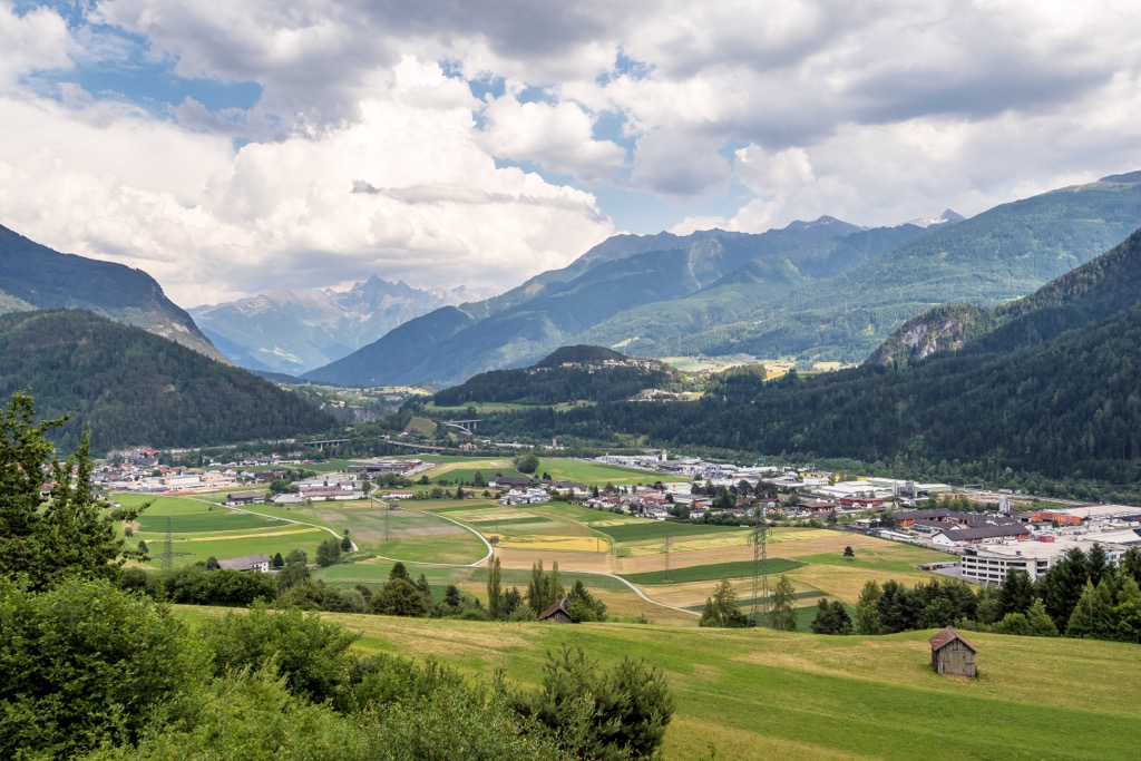
Imst is the capital of the Imst district and the largest towns close to Ötztal Nature Park. Despite being relatively small, Imst has plenty of amenities and attractions to keep you entertained during your downtime.
Thrillseekers will love the Alpine Coaster, a 3.5 km (2.1 mi) long summer toboggan run which is the longest Alpine roller coaster in the world. Another top attraction is the Rosengarten Gorge (Rosengartenschlucht), a series of cliffside trails above a scenic river in the town center.
Consider visiting Imst during Lent to try and catch Schemenlaufen, a UNESCO-protected carnival hosted every four years. Imst is located less than 30 km (18.5 mi) from Ötztal Nature Park.
Längenfeld is the largest village in the Ötztal Valley, with a population of roughly 4,600 people. It's a hub for tourism in the valley with dozens of accommodation options in Längenfeld and the surrounding area.
Längenfeld is a charming village with some interesting sights, including a thirteenth-century baroque church. One of the best attractions for hikers is the Nature Park House (Naturpark Haus), a purpose-built exhibition space for Ötztal Nature Park, filled with interactive exhibits, VR experiences, holograms, and more.
Längenfeld is close to some of the finest mountains in the Ötztal Alps, with Wildspitze located approximately 35 km (21.5 mi) to the south.
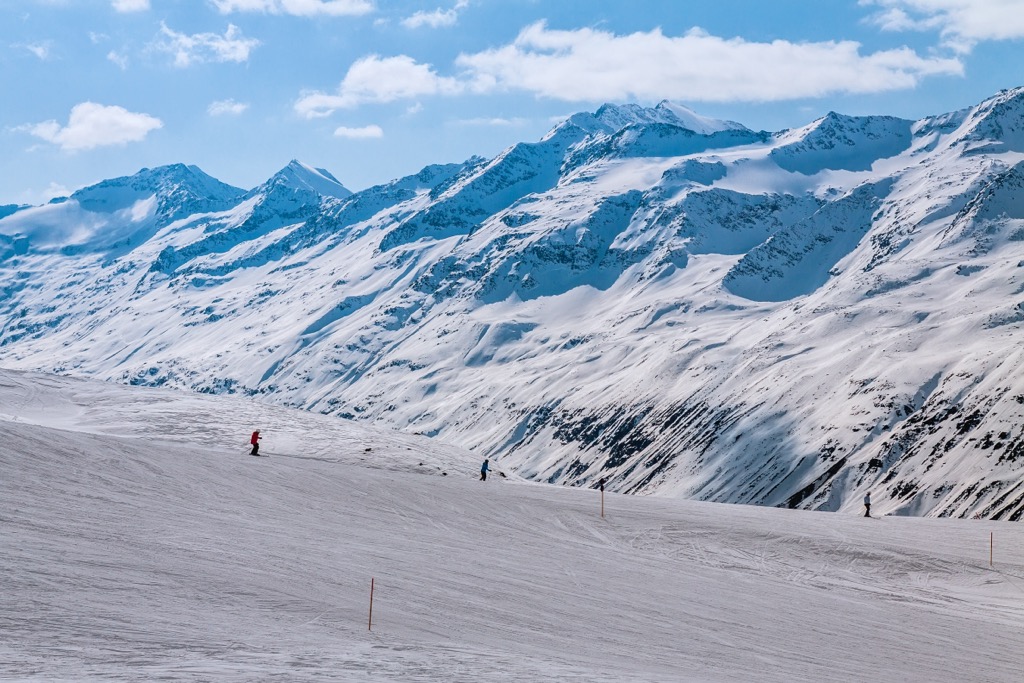
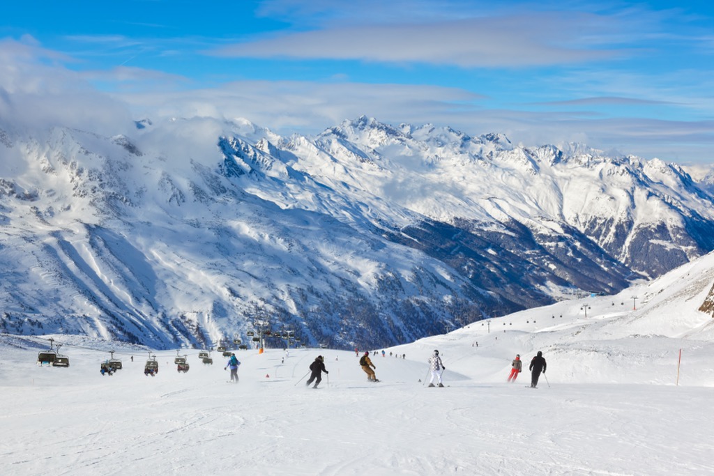
Tyrol is a hotspot for winter sports, with the highest concentration of ski resorts of any Austrian state. Read to learn about the best ski resorts in Ötztal Nature Park.
Located close to the Austro-Italian border, Obergurgl-Hochgurgl is home to one of the finest ski resorts in Ötztal Nature Park. With slopes at altitudes of over 3,000 m (9,842 ft), Obergurgl-Hochgurgl is one of the Alps' most reliable winter sports locations.
The Gurgl ski resort features 112 km (69.5 mi) of skiable terrain with 25 lifts and over 99 slopes.
Stubaier Gletscher is widely considered to be the best ski area in the Stubai valley. Covering an area of 14.5 sq km (9 sq mi), Stubaier Gletscher features 65 km (40 mi) of slopes and 26 lifts.
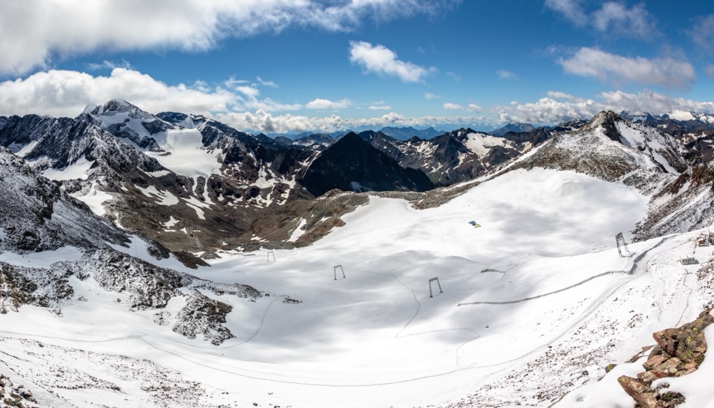
The highest elevation in the ski area is 3,212 m (10,538 ft), making this a very dependable ski area. Stubaier Gletscher is situated just east of Ötztal Nature Park and is approximately 44 km (27 mi) from Innsbruck.
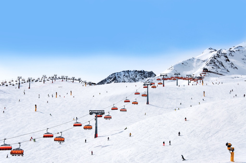
Sölden is one of Austria's most popular ski resorts, with over two million visitors to the municipality annually. It contains world-class pistes, with the resort regularly hosting Alpine Ski World Cup races.
With three accessible mountains over 3,000 m (9,842 ft) in elevation, there's enough snow in Sölden to make skiing possible from October and May. Sölden contains 144 km of slopes and 31 lifts.
Vent is among the smallest of the ski resorts around Ötztal Nature Park, but it still affords plenty of space to ski on the slopes of Wildspitze. It's an excellent destination for beginners with a mixture of easy and intermediate slopes. Vent ski resort contains 15 km (9.3 mi) of slopes and 4 lifts.
Other notable ski areas near Ötztal Nature Park include Serfaus-Fiss-Ladis, Pitztal, and Kühtai.